247
247
Jul 21, 2009
07/09
by
WUSA
tv
eye 247
favorite 0
quote 0
we hear you in calvert but we have your back. show you the time lapse tower cam from the netherlands and a view of the washington monday numb and murky weather forecast. you notice the humidity levels have changed since last week's spectacular weather with low humidity. 69% humidity. temperatures in the 70s across the board. 7 an drews air force base. today we will take a trip to the lower 8 -- 80s but feels like summer. we will have a stray shower probably this afternoon. >> good morning, kim. hey, everybody. we are still feeling the crunch as we get ready for this 9:00 a.m. hour. inner loop in virginia drivers are stacked from braddock road area up to 66. we are estimating the drive time 16 to 20 minutes. that's volume. no incidents or accidents there. check out 395. take it outside and show you how that translates. heavy all morning. things are breaking up a bit. below speed from duke to seminary and using the brakes across the 14th street bridge. moving along to the beltway and take you to the outer loop. we show you north of
we hear you in calvert but we have your back. show you the time lapse tower cam from the netherlands and a view of the washington monday numb and murky weather forecast. you notice the humidity levels have changed since last week's spectacular weather with low humidity. 69% humidity. temperatures in the 70s across the board. 7 an drews air force base. today we will take a trip to the lower 8 -- 80s but feels like summer. we will have a stray shower probably this afternoon. >> good...
315
315
Jul 21, 2009
07/09
by
WUSA
tv
eye 315
favorite 0
quote 0
east of ben dick here in calvert county. some heavy rain at times.k to the were computer and talk temperatures. 72 on the bay in on the bay. national officially 71. northeast winds at seven and the humidity is 73%. frontal boundary off shore focusing the rain there. for us the moisture is trying to move in. spotty showers here and as long as this is close to us the temperatures will be in check but a warmup is coming toward the end of the week. seven day looks like this. 83 today. mid 80s tomorrow and thursday with a couple of storms here and there. by friday, saturday and sunday near 90 if not above it with a better chance on sunday in to monday the way it looks now. it is 6:48. >>> angie? >> if you don't get the time i will take care of it. don't worry about it, howard. 270 slowing down from the montgomery village avenue to the capital beltway. no incidents or accidents at this time. moving right along to the outer loop we go. i like what i see. north of the district it is moving great from 95 to georgia. the inner loop, light traffic right now. sp
east of ben dick here in calvert county. some heavy rain at times.k to the were computer and talk temperatures. 72 on the bay in on the bay. national officially 71. northeast winds at seven and the humidity is 73%. frontal boundary off shore focusing the rain there. for us the moisture is trying to move in. spotty showers here and as long as this is close to us the temperatures will be in check but a warmup is coming toward the end of the week. seven day looks like this. 83 today. mid 80s...
453
453
Jul 21, 2009
07/09
by
WRC
tv
eye 453
favorite 0
quote 0
through central calvert county.ly drifting toward the southern prt of prince george's county, maybe drifting in anne arundel county in the next half hour to hour. slowly moving off to the north. temperatures are mild and a bit muggy in southern maryland, around the bay, the eastern shore but still not very humid around washington and points west where it's in the 60s. washington now 72 degrees. over the last six hours, watching some showers from the beaches, along the atlantic coast all the way up into new jersey, new york city and southern new england. but for us today, a partly sunny morning. by noon, near 80. during the afternoon, mid-80s. turning a little more humid. there's a small chance of late afternoon or evening passing thundershower. tomorrow, partly cloudy, more humid, highs in the mid-80s and a small chance of an afternoon thundershower. a look at the res of the week and the weekend in ten minutes. >> a live look along interstate 66 near manassas. this is the eastbound side. that rest area now closed. t
through central calvert county.ly drifting toward the southern prt of prince george's county, maybe drifting in anne arundel county in the next half hour to hour. slowly moving off to the north. temperatures are mild and a bit muggy in southern maryland, around the bay, the eastern shore but still not very humid around washington and points west where it's in the 60s. washington now 72 degrees. over the last six hours, watching some showers from the beaches, along the atlantic coast all the way...
431
431
Jul 29, 2009
07/09
by
WRC
tv
eye 431
favorite 0
quote 0
calvert county and anne arundel county. those cells have now dissipated. moving further to the east. there around st. mary's county, earlier that one cell possibly producing some hail. but further east of the area. here is the one cell i'm watching now because it is moving east-northeastward and into areas around orange county and perhaps southwestern spotsylvania county in the next few minutes. it could possibly, possibly, turn into some real rough weather here with possible rotation. we have wis out of the southwest and at the surface and winds out of the west alot of. a day with the possibility of location around the area. meanwhile, take a look at the high winds. norfolk, virginia, 54 miles per hour. half inch of rain there. temperature is 72. over a third of an inch of rain and huntingtown, maryland. with winds there just at 13 miles per hour. so for the next couple of hours here, up until at least about 8:00, 9:00 p.m., we could see high winds. and possible rotation still with some of the cells that come through here. today we stayed socked in with t
calvert county and anne arundel county. those cells have now dissipated. moving further to the east. there around st. mary's county, earlier that one cell possibly producing some hail. but further east of the area. here is the one cell i'm watching now because it is moving east-northeastward and into areas around orange county and perhaps southwestern spotsylvania county in the next few minutes. it could possibly, possibly, turn into some real rough weather here with possible rotation. we have...
357
357
Jul 21, 2009
07/09
by
WJLA
tv
eye 357
favorite 0
quote 0
there is a good soaker in calvert county. these storms are slowly pushing off to the northwest. andrews air force base is checking in at 64. we are mainly near 70 degrees across the area. showers and thunderstorms this afternoon. we cannot ruleut a brief severe thunderstorm out west of the metro. this afternoon. back to you with the traffic, lisa baden. >> a guy has broken down on 301. he is in the center of the roadway. we will show you some quiet traffic leaving 80 to 109. we are good on 395 northbound. the traffic flow is great at edsall road to the pentagon. >> thank you. >>> new research suggests that pollution may harm child brain development. they have linked this before birth to loweriq scores in child but -- before lower iq scores in childhood. the study's lead author says it is a big enough difference to affect performance in school. other scientists dispute the findings. >>>he u.s. is racing to develop a swine flu there have been one under thousand people affected. they are relying on five companies with track records of making vaccines. but one company has come up wi
there is a good soaker in calvert county. these storms are slowly pushing off to the northwest. andrews air force base is checking in at 64. we are mainly near 70 degrees across the area. showers and thunderstorms this afternoon. we cannot ruleut a brief severe thunderstorm out west of the metro. this afternoon. back to you with the traffic, lisa baden. >> a guy has broken down on 301. he is in the center of the roadway. we will show you some quiet traffic leaving 80 to 109. we are good...
225
225
Jul 23, 2009
07/09
by
WTTG
tv
eye 225
favorite 0
quote 0
this isoving south of you toward calvert county. we will deep a close eye on this and have another update and i'll let you know if we have to do this again tomorrow. that forecast in a few minutes. >> all right. >>> the president will not get his vote on health care before the august recess. the official word from senate majority leader harry reid. does this mean the plan is on life support? tom fitzgerald with the edge on this one. >> reporter: on the road to health reform in norheast ohio, he admitted that the road may be longer than expected. >> i want to get right but i want to get it done promptly. >> reporter: getting it down by august 7th, the day congress leavesor the summer recess has been the administration's deadline, a point the president made wednesday night. if you don't set deadlines in this town, things don't happen. >> what will not happen in the senate is a vote before the president's deadline. >> this is a complex difficult issue. >> reporter: senate majority leader harry reid said republicans asked for and he agr
this isoving south of you toward calvert county. we will deep a close eye on this and have another update and i'll let you know if we have to do this again tomorrow. that forecast in a few minutes. >> all right. >>> the president will not get his vote on health care before the august recess. the official word from senate majority leader harry reid. does this mean the plan is on life support? tom fitzgerald with the edge on this one. >> reporter: on the road to health reform...
515
515
Jul 24, 2009
07/09
by
WRC
tv
eye 515
favorite 0
quote 0
. >>> coming up, we'll tell you about a crash that involved a calvert county sheriffs deputy that left a young woman dead. >>> a man was sentenced today for his role in the heroin ring that rocked a virginia suburbs and resulted in four overdoses. >>> a search warrant confirms that michael jackson's personal doctor is at the center of an investigation into the singer's death. >>> coming up in sports, former redskins coach, steve spurrier makes a big mistake and the wizards add some quality depth as nlineup. as news4 at 6:00 conti (announcer) if you think all batteries are the same, consider this: when a tornado tore through holly, colorado, air life denver took to the air... their night-vision goggles keeping them safe on a perilous flight... and powering those precision goggles--- is the only battery air life trusts: duracell. trusted everywhere. look for new duracell ultra advanced now with even more power to protect. @@ the pontiac summer closeout is here; hurry to get the pontiac you want before they're gone. the price on the tag is the price you pay. get a 2009 pontiac vibe for $1
. >>> coming up, we'll tell you about a crash that involved a calvert county sheriffs deputy that left a young woman dead. >>> a man was sentenced today for his role in the heroin ring that rocked a virginia suburbs and resulted in four overdoses. >>> a search warrant confirms that michael jackson's personal doctor is at the center of an investigation into the singer's death. >>> coming up in sports, former redskins coach, steve spurrier makes a big mistake...
212
212
Jul 31, 2009
07/09
by
WTTG
tv
eye 212
favorite 0
quote 0
th dh maid thunderstorm e w have calvert and saint e mahave calvert and seint mary's out ofe tth, vere thunderstorm watch is in effect for the beaches and the 9:00 you c see, though, a lot of y e action, anwhich was rl 0,tween 2 and, t's:04 po4:00, pondug down especially hard in frederick and carol county and maryland. many reports of winds as high as 74 miles per hour in that region. now, for the rest of the evening, the strong storms will be to our east and maybe lingering showers behind them. tnd 7 is. 0th 70s. th 7is aersiftti aerit0 hng 9ti degrees earlier today. you can see ngdulles is 76 at 76 degrees. e titcatou yper ematpetisurr go tto o get edckckno . d.c. at 73 and the humidity is much more reasonable and we t were ira ir odsmfoay ts,, n hethat front started getting closer with an area of low pressure on it, the atmosphere was n absolutely ready and able to unload torrential rain and ngma ima windwe hae v wi winds gusting to 21 miles an ; ur in , cd.imba.orlt e,2 c.o anceity has a wind tiguans ng to 20 and dover at 37. dowedo have damage in the frederick area, in iamsville,
th dh maid thunderstorm e w have calvert and saint e mahave calvert and seint mary's out ofe tth, vere thunderstorm watch is in effect for the beaches and the 9:00 you c see, though, a lot of y e action, anwhich was rl 0,tween 2 and, t's:04 po4:00, pondug down especially hard in frederick and carol county and maryland. many reports of winds as high as 74 miles per hour in that region. now, for the rest of the evening, the strong storms will be to our east and maybe lingering showers behind...
302
302
Jul 30, 2009
07/09
by
WRC
tv
eye 302
favorite 0
quote 0
saint mary's county, boy, in charles calvert, calling again today. those are the areas that were under tornado warning. good news. no reports of any tornadoes or damn j. ov -- damage. tonight, the showers move off. we'll be back into the heat. and still seeing the humidity in on us. and go through tomorrow. and friday, a weak weather front coming our way. that could trigger showers and thundershowers by friday afternoon. temperatures tomorrow, they're back. into the 90s. so, for the remainder of the -- the evening. and for the remainder of the night. still a few lingering showers, thundershowers, can't rule out some rumbles. folks in charles county. southern maryland. saint mary's county. calvert county. tomorrow morning. we'll begin to get a westerly wind. hot, humid. high, tomorrow afternoon. i think possibly some spots may get up to 94, 95 degrees. uv index mighty high. taking the youngsters out to the pool lather up the sun block. and a slight risk. slight risk of a thundershower. but i think more than likely we'll be seeing a batch by friday aft
saint mary's county, boy, in charles calvert, calling again today. those are the areas that were under tornado warning. good news. no reports of any tornadoes or damn j. ov -- damage. tonight, the showers move off. we'll be back into the heat. and still seeing the humidity in on us. and go through tomorrow. and friday, a weak weather front coming our way. that could trigger showers and thundershowers by friday afternoon. temperatures tomorrow, they're back. into the 90s. so, for the remainder...
457
457
Jul 24, 2009
07/09
by
WRC
tv
eye 457
favorite 0
quote 0
sending the calvert county deputy's car tumbling, while the young victim's car burst into flames. this woman's office is right across the street. >> the sound -- it was like a sonic boom. >> i saw it was a sheriffs car just flipping and flipping. and a big, big engulf of flame. and i looked a i cross and you could see the car. >> reporter: a sheriffs department spokesman said the accident happened 11:00 a.m., deputy and another deputy in a second vehicle were traveling northbound on route 4 to a domestic disturbance. >> both deputies were responding to a domestic call, an in-progress call and they were running priority one, which is a lights and siren response. >> reporter: the victim, who was initially headed southbound, was attempting to turn left into a subdivision when her car was struck by the deputy. she and deputy wells were trapped in their vehicles. the deputy in the trailing car attempted to help. >> she immediately got out and went to the car. she couldn't get to the car in the flames. she went to check on the officer and knelt down and stuff. and the emergency crewings
sending the calvert county deputy's car tumbling, while the young victim's car burst into flames. this woman's office is right across the street. >> the sound -- it was like a sonic boom. >> i saw it was a sheriffs car just flipping and flipping. and a big, big engulf of flame. and i looked a i cross and you could see the car. >> reporter: a sheriffs department spokesman said the accident happened 11:00 a.m., deputy and another deputy in a second vehicle were traveling...
588
588
Jul 20, 2009
07/09
by
WJLA
tv
eye 588
favorite 0
quote 0
it could affect calvert counties over the next few hours or so. they are diminishing as they move towards the north. we are going to call for mostly cloudy skies with afternoon showers and thunderstorms. daytime high temperatures around 80 degrees. let's check the rush-hour commute. >> i have some good and some bad. south on 270 late-clearing construction is now gone. a fed -- a fender bender appeals to be the focal point of the backup. that is the wrong camera. this is the beltway at 50 in maryland. overnight construction is gone. this is the pace of traffic northbound 95 left side of your reen with plenty of headlights. good on 95 between washington and baltimore. nothing on the baltimore- washington parkway. route 5, route 4, 210 all good. >> thank you. >>> 6:13. 39 -- 69 degrees. when we continue -- and incredible look at one of the most dangerous places on earth. we will see the area called gecko: uh, you wanted to see me sir? boss: come on in, i had some other things you can tell people about geico - great claims service and a 97% customer s
it could affect calvert counties over the next few hours or so. they are diminishing as they move towards the north. we are going to call for mostly cloudy skies with afternoon showers and thunderstorms. daytime high temperatures around 80 degrees. let's check the rush-hour commute. >> i have some good and some bad. south on 270 late-clearing construction is now gone. a fed -- a fender bender appeals to be the focal point of the backup. that is the wrong camera. this is the beltway at 50...
337
337
Jul 23, 2009
07/09
by
WJLA
tv
eye 337
favorite 0
quote 0
mary's county, charles county, and calvert county. over towards annapolis.t will be off to our west. a cool front will drop across the. . is not bringing in the cool probably only in the low to mid 80's at best today. let's show you what is happening. a cold front will drop across the area. it should initiate some more widespread showers and storms this afternoon and into the evening. you can see the energy that has been bringing a lot of rain. heavy rains through the ohio valley. it has been basically hit or miss. we're hoping some of this energy comes our way. limited sunshine today. 81 to 85. tomorrow, partly cloudy. and i sedated storm. temperatures will be in the low to mid 80's. it will be down white hot for saturday. high pressure in charge. hot and sticky, 90 degrees. each and every day we get that chance for rain. let's take a look at the traffic. >> it is starting to slow now across the 14th street bridge. crash at 395 northbound on south capitol street and it has been there for two hours now. ddot is on the scene. we will take you to a live camera
mary's county, charles county, and calvert county. over towards annapolis.t will be off to our west. a cool front will drop across the. . is not bringing in the cool probably only in the low to mid 80's at best today. let's show you what is happening. a cold front will drop across the area. it should initiate some more widespread showers and storms this afternoon and into the evening. you can see the energy that has been bringing a lot of rain. heavy rains through the ohio valley. it has been...
422
422
Jul 17, 2009
07/09
by
WRC
tv
eye 422
favorite 0
quote 0
it iea nckror creek parkway in calvert street off connecticut. not far from the omni.ive at the scene. >> reporter: authorities got the call for a report stabbing around 3:30 this afternoon. the last hour ask a half there has been an intense search behind me and at the walter erce community park. it is at built more and calvert streets in northwest washington. d.c. police and u.s. park police have been working together in this investigation until about ten minutes ago and u.s. park police said that they realized that this was not their jurisdiction so it es
it iea nckror creek parkway in calvert street off connecticut. not far from the omni.ive at the scene. >> reporter: authorities got the call for a report stabbing around 3:30 this afternoon. the last hour ask a half there has been an intense search behind me and at the walter erce community park. it is at built more and calvert streets in northwest washington. d.c. police and u.s. park police have been working together in this investigation until about ten minutes ago and u.s. park police...
820
820
Jul 21, 2009
07/09
by
WJLA
tv
eye 820
favorite 0
quote 0
it has been hanging over calvert county all morning long.eeing those showers or just right there. the map shows a feature in the atmosphere that is funneling this into the atmosphere. >> a hyattsville nanny has been accused of showing pornographic web sites to children in her care and asking them to pose naked. the 22-year-old is charged with child abuse. > ifou ride metro, expect delays through thursdayon the bread line. aitrns are moving ow. er ma station will close e thko night for safety tests. we will have another news update for you at 8:25. for continuous news coverage, tune in to our sister station, news channel 8. sd >>> "good morning america" continues with hip-hop star chris brown's apology. why he says he's coming forward now. >>> toddlers in tiaras. is a 2-week-old infant too young to go for the crown? we talked to the parents behind baby beauty pageants. >>> and why the recession may be ruining your teeth. the five things your dentist wants you to know. >>> plus, katherine heigl live. we ask her about her hot, new movie. and "g
it has been hanging over calvert county all morning long.eeing those showers or just right there. the map shows a feature in the atmosphere that is funneling this into the atmosphere. >> a hyattsville nanny has been accused of showing pornographic web sites to children in her care and asking them to pose naked. the 22-year-old is charged with child abuse. > ifou ride metro, expect delays through thursdayon the bread line. aitrns are moving ow. er ma station will close e thko night for...
209
209
Jul 30, 2009
07/09
by
WBAL
tv
eye 209
favorite 0
quote 0
it happened in crossway and sussex courts, mayfair and calvert. splash pine and weeping cherry court. any unfamiliar or suspicious persons should be reported. >> a judge in washington, d.c. found a woman guilty of killing four daughters. bonita jackson was convicted on three counts of first degree murder but not a fourth. the girls from five to 16 were found in january of 2008 when marshals arrived to evict her. she could face a live sentence in the hearing scheduledor october 16. it is being called the beer summit or beer diplomacy. president barack obama invited two men over for beer. brooke hart has what they will talk about. >> before and after harvard professor gates was handcuffed many saw one questionable call after another. >> the cambridge police acted stupidly. >> president obama said later he didn't quite mean that. >> i could have calibrated the words differently. >> his reaction fired up right wing commentators who called him rash and racist. so tonight it is beer on a white house picnic table for the three involved. the president, pr
it happened in crossway and sussex courts, mayfair and calvert. splash pine and weeping cherry court. any unfamiliar or suspicious persons should be reported. >> a judge in washington, d.c. found a woman guilty of killing four daughters. bonita jackson was convicted on three counts of first degree murder but not a fourth. the girls from five to 16 were found in january of 2008 when marshals arrived to evict her. she could face a live sentence in the hearing scheduledor october 16. it is...
674
674
Jul 21, 2009
07/09
by
WMAR
tv
eye 674
favorite 0
quote 0
still looking at the calvert cliffs area with moderate rainfall.lowly try to extend to the north. and you see near severna park it looks like we have a little shower there over towards bowie. there are already showers in the atmosphere and there will be more this afternoon. our two-degree guarantee 77 because of a cool east wind off the water. take the umbrella because the showers could pop up any time. showers this evening could give way to fog and 68 overnight. tomorrow wee warm up to 86. more afternoon storms. >>> a check of the roads with kim. >>> traffic moving heavy and slow southbound on 95 from harford county through to about the whitemarsh area. down through the 695/895 split. traffic really slow on 83 southbound approaching padonia road from the earlier crash. it's been moved to the shoulder but traffic slows from shawan road, try york road as an alternate. 95 southbound at boston street, a report of tire tread in the right center lane. use caution. crash in reisterstown, falls road at knox avenue. in glen burnie, working an accident stew
still looking at the calvert cliffs area with moderate rainfall.lowly try to extend to the north. and you see near severna park it looks like we have a little shower there over towards bowie. there are already showers in the atmosphere and there will be more this afternoon. our two-degree guarantee 77 because of a cool east wind off the water. take the umbrella because the showers could pop up any time. showers this evening could give way to fog and 68 overnight. tomorrow wee warm up to 86....
272
272
Jul 21, 2009
07/09
by
WUSA
tv
eye 272
favorite 0
quote 0
yesterday in southern maryland they had 1 1/2 to two inches of rain in calvert and st. marys county and showers and thunderstorms that sat on them. this morning what do you see? you see the moisture along the coastal areas. not the greatest beach day and parts of new england, another batch in western pennsylvania. live hd, once again, southern maryland seeing showers. a couple of sprinkles to the cumberland area. here's saint leonards. north of you. benedict, mechanicsville, this is drifting in to eastern charles county at 20 miles an hour. here's hughsville, even plum point you might get in the activity in the next 20 to 30 minutes as this drifts to the north and west and then toward prince georges county. back to the weather computer and talk temperatures in the 60s and 70s. culpeper, you are dry and 3 for a cool spot. and thankfully saint indy goes you have the thermometer operational, 73. 72 cambridge and here in washington. the winds are northeast at seven. i expect them to be southerly later on today. and the relative humidity is 71%. we have showers off shore. in
yesterday in southern maryland they had 1 1/2 to two inches of rain in calvert and st. marys county and showers and thunderstorms that sat on them. this morning what do you see? you see the moisture along the coastal areas. not the greatest beach day and parts of new england, another batch in western pennsylvania. live hd, once again, southern maryland seeing showers. a couple of sprinkles to the cumberland area. here's saint leonards. north of you. benedict, mechanicsville, this is drifting in...
277
277
Jul 23, 2009
07/09
by
WJLA
tv
eye 277
favorite 0
quote 0
there is another one over in calvert and of to the west in the shenandoah valley. a little storm popping up out there throughout the day. you could be wet and a few houses down the street could be tried. hopefully everyone gets a shot for some showers today. we are in the low 80's right now. in the district is 78, but notice the rain we have seen across these areas. you can see over 1 inch in washington, the two inches downtown. -- but two inches downtown. there was no rain that fell yesterday at reagan national, but some better chances today. frederick right now is coming in at 82 degrees. the bigger picture shows a clear spell because of the moisture to the west. another band of the moisture to the south east. these will work in tandem to lift north and east, then they will bring a cool front that will bring us that story in this. 80 to 85 degrees today. partly cloudy skies and thunderstorms are possible through the evening, but less likely tomorrow. saturday will be hot and near 90 degrees, but it looks dry at this point. the weekend will be dry and next week th
there is another one over in calvert and of to the west in the shenandoah valley. a little storm popping up out there throughout the day. you could be wet and a few houses down the street could be tried. hopefully everyone gets a shot for some showers today. we are in the low 80's right now. in the district is 78, but notice the rain we have seen across these areas. you can see over 1 inch in washington, the two inches downtown. -- but two inches downtown. there was no rain that fell yesterday...
455
455
Jul 24, 2009
07/09
by
WRC
tv
eye 455
favorite 0
quote 0
. >>> there was a deadly crash today in calvert county, maryland, involving a sheriffs deputy, a teenager was killed. it happened around 11:00 a.m. this morning at the intersection of southern maryland boulevard and apple way in the town of dundalk. investigators tell us a sheriffs deputy was responding to a call when another vehicle turned left front of him. the impact caused the officer's cruiser to overturn. the other vehicle caught fire. the driver of the other vehicle was described as an 18-year-old woman, she died at the scene. her name hasn't been released yet. we're told she had just recently graduated from high school. the officer was transported to a hospital. >>> it's been warm and a bit breezy on and off today. is the rain all gone? veronica johnson has our forecast from the storm center. >> the rain is not all gone, pat, we have some thunderstorms out there west of the area this afternoon. and could see more as we go through the rest of the afternoon, into the evening hours. let's talk about jefferson county, i'll take you to the radar, because that's where there have been so
. >>> there was a deadly crash today in calvert county, maryland, involving a sheriffs deputy, a teenager was killed. it happened around 11:00 a.m. this morning at the intersection of southern maryland boulevard and apple way in the town of dundalk. investigators tell us a sheriffs deputy was responding to a call when another vehicle turned left front of him. the impact caused the officer's cruiser to overturn. the other vehicle caught fire. the driver of the other vehicle was...
244
244
Jul 21, 2009
07/09
by
WTTG
tv
eye 244
favorite 0
quote 0
we have this one area of persistent shower activity in calvert county. here in washington, i think we'll stay dry for the morning hours. by afternoon, we'll see the possibility of more scattered showers and thunderstorms. they will be hit and miss aroundhere. even off to the north and west, we could see afternoon showers. 71degrees at reagan national. you will notice the humidity. the dew point temperatures are at 61 degrees. hagerstown is 70 at this hour. afternoon high temperatures, we are in the middle 80s. we'll probably do that again today. i think low to mid-80s for afternoon high temperatures with a lot of clouds. check out the maps from last night and we did have scatter showers out there. we'll put the map in motion. you can see the motion here south to north. we are into a tropical air mass this week and that pat were will be very slow to break down so we'll be in and out of the clouds for much of the week with some scattered showers and thunderstorms each ternoon and evening as all we feed is a little lift in the atmosphere. atmosphere kind of
we have this one area of persistent shower activity in calvert county. here in washington, i think we'll stay dry for the morning hours. by afternoon, we'll see the possibility of more scattered showers and thunderstorms. they will be hit and miss aroundhere. even off to the north and west, we could see afternoon showers. 71degrees at reagan national. you will notice the humidity. the dew point temperatures are at 61 degrees. hagerstown is 70 at this hour. afternoon high temperatures, we are in...
317
317
Jul 29, 2009
07/09
by
WJLA
tv
eye 317
favorite 0
quote 0
live super doppler 7 radar, storms et city into charles county, a couple more cross calvert county, north of prince frederick, hunting town. e heavy storms moving toward the chesapeake bay. the storm scan shoav a light rain pattern in the media viewing area. to the west, it is quiet. maybe things will dry out, but we will keep on top of it. >>> abc world news is coming up next. >> have a good night. there are moments in time when the paths we take do determine our future. today we are communicating with each other as never before - and that requires a seamless network that is constantly growing better, smarter, and more secure. that's why our scientists and engineers in our labs, are taking the fastest technology in the world and making it mobile, better and faster - to keep pushing the internet further than anyone dreamed. last year alone we invested more in building america's future than any other company - improving and expandingour network, to keep you in control. and behind the scenes, that takes work by our employees, who pride themselves knowing, that because they do it right, you
live super doppler 7 radar, storms et city into charles county, a couple more cross calvert county, north of prince frederick, hunting town. e heavy storms moving toward the chesapeake bay. the storm scan shoav a light rain pattern in the media viewing area. to the west, it is quiet. maybe things will dry out, but we will keep on top of it. >>> abc world news is coming up next. >> have a good night. there are moments in time when the paths we take do determine our future. today...
401
401
Jul 8, 2009
07/09
by
WJLA
tv
eye 401
favorite 0
quote 0
the areas it will affect our along the patuxent river and eventually across the river into calvert county, sliding to the southeast. that is it and skies are beginning to clear. 72 degrees in laurel after a high of 85. 72 degrees reported in leesburg. currently 76 degrees in northwest washington at the studios of wtop radio. official numbers for washington today at reagan national airport, 85 and 63. we are going to see these temperatures go down the other way. the number of days we hit 90 degrees, it usually happens at 37 times on average. we have already had 12 days -- another difference today in the pollen count, mold spores back with a belong but grass pollen back into the moderate range. 76 in leesburg, 78 in fairfax. the cooler air is working in from the north and the west. 59 in syracuse right now, very cool weather. the real hot stuff is well to the southwest. we will get noticeable increases in temperature by the weekend. high pressure is building in. we will see clearing skies overnight. we will have an ice floe of dry air tomorrow. sunshine, lower humidity, the same story on th
the areas it will affect our along the patuxent river and eventually across the river into calvert county, sliding to the southeast. that is it and skies are beginning to clear. 72 degrees in laurel after a high of 85. 72 degrees reported in leesburg. currently 76 degrees in northwest washington at the studios of wtop radio. official numbers for washington today at reagan national airport, 85 and 63. we are going to see these temperatures go down the other way. the number of days we hit 90...
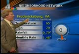
247
247
Jul 30, 2009
07/09
by
WJLA
tv
eye 247
favorite 0
quote 0
calvert county, a couple of places close to 2 inches, martinsburg over 1 inch, same with smithsburg.many areas saw less, quantico point to 5 inches. -- quantico point to 5 inches. at reagan national, 87 and 76 the actual high and low. those seventies across the board at this hour. as the line moves through, it will be partly, mostly cloudy, just muggy overnight. we will see a different weather pattern tomorrow. the moisture is moving through with the severe weather warnings and tornado warnings this afternoon, but none of that materialized, no reports of ground contact. just to the west, clearing. let me put this in motion. we have today's rain, then the high pressure that puts us between system. it will be 90 degrees. then another cold front, just enough to get a lift in the atmosphere. could give as widespread storms. toda's thunderstorm activity caused by a weak cold front. tomorrow, between systems, sunshine and hot weather, isolated thunderstorms the secondary front could cause widespread showers on friday. he expressed thursday, july 30, partly sunny, very warm and humid, close
calvert county, a couple of places close to 2 inches, martinsburg over 1 inch, same with smithsburg.many areas saw less, quantico point to 5 inches. -- quantico point to 5 inches. at reagan national, 87 and 76 the actual high and low. those seventies across the board at this hour. as the line moves through, it will be partly, mostly cloudy, just muggy overnight. we will see a different weather pattern tomorrow. the moisture is moving through with the severe weather warnings and tornado warnings...
346
346
Jul 5, 2009
07/09
by
WUSA
tv
eye 346
favorite 0
quote 0
but the calvert son station has little participation. >> how could you expect them to be -- >> they know that this particular station will not be staffed. >> reporter: that's why you will continue to see images like this one where the college park ambulance takes about an 9 minute run and passes the -- at a community just seconds away. >> reporter: were able to -- a number of volunteer chiefs say they don't know how long that can go on considering many of their firefighters have full time jobs during the day. would you like to know when the firefighters will be gone in your neighborhood? >>> having an easy pass will now cost you extra. this week the state started charging drivers $1.50 a month. right now virginia, west virginia and delaware do not have a monthly charge. but pennsylvania charges a 3 there 3-dollar maintenance fee a year. >>> when the county dumped its decal fee. but it may have to come back. peggy fox with that story. >> remember those car registration decals fair fax county used to require? the decals are gone for good but the fee may come back. >> i hate that idea. i mo
but the calvert son station has little participation. >> how could you expect them to be -- >> they know that this particular station will not be staffed. >> reporter: that's why you will continue to see images like this one where the college park ambulance takes about an 9 minute run and passes the -- at a community just seconds away. >> reporter: were able to -- a number of volunteer chiefs say they don't know how long that can go on considering many of their...
350
350
Jul 31, 2009
07/09
by
WTTG
tv
eye 350
favorite 0
quote 0
that is calvert county, charles county a ndsaint mary's county. you have the severe thunderstorm watch until 9:00. we don't see anything did. ky tell you it's gusty out there, seeing strong wds out of the northwest and the temperatures have been knocked back. in some cases, by 15 degrees. this evening, the strong tomorrows -- storms will push . the east and lingering possie possible. e're down to 7s deeegrin theee rict and fredericksburg is 82. winds gusting as high as 37 miles per hour and in dover and in d.c., gusting to 21. we have had a lot of straightline wind damage, potentially -- apparently, a tornado may have touched down in parts of frederick and carol county. they were warned that there was a rotating storm up there. we'll have more information on that with the full forecast. >> thank you so much. >>> cancun sounding good about now. but the beach outside of a resort there is now closed indefinitely because the hotel is accused of, get this, stealing the sand. no joke. yellow tape went up around the grand taribe hotel on wednesday. it's
that is calvert county, charles county a ndsaint mary's county. you have the severe thunderstorm watch until 9:00. we don't see anything did. ky tell you it's gusty out there, seeing strong wds out of the northwest and the temperatures have been knocked back. in some cases, by 15 degrees. this evening, the strong tomorrows -- storms will push . the east and lingering possie possible. e're down to 7s deeegrin theee rict and fredericksburg is 82. winds gusting as high as 37 miles per hour and in...
343
343
Jul 21, 2009
07/09
by
WTTG
tv
eye 343
favorite 0
quote 0
but off to the south and east down towards calvert county, charles county, we have some shower activity pushing north very slowly. most of the action right now is well off to the south and east down towards the beaches. down towards ocean shore here. it is there where we have the best chance of morning showers. real alita haytayaner this afternoon, just like yesterday, we'll see showers and thunderstorms fill in from the south. we can't rule out the possibility that you will get wet during the course of the afternoon. 72 at reagan national. 68 in fredericksburg. you will notice the humidity. our dew point temperatures are back up into the 60s, mid-60s at that. the air will get progressively more uncomfortable around here. with the flow in the atmosphere out of the south, it is amazing to see it pushing from south to north. we are going to stay in the tropical, warm, muggy air during much of the week. most the shower activity off to the east. we ha another little batch off to the north and west. i think the morning will be dry. we'll have high temperatures in the low80s. mostly cloudy ou
but off to the south and east down towards calvert county, charles county, we have some shower activity pushing north very slowly. most of the action right now is well off to the south and east down towards the beaches. down towards ocean shore here. it is there where we have the best chance of morning showers. real alita haytayaner this afternoon, just like yesterday, we'll see showers and thunderstorms fill in from the south. we can't rule out the possibility that you will get wet during the...
241
241
Jul 28, 2009
07/09
by
WUSA
tv
eye 241
favorite 0
quote 0
at station 41 in calvert on the, no re cealrsoran b s crewor balance crews --ulmb ace ancrews will be on duty s for the foreseeabl future. despite the lack of manpower, county officials say this does not mean the station is closed. >> isn't that in a sense closing the fire station there? >> no. >> reporter: why not? >> because the personnel from that station are moving down the street. >> reporter: there is a reduction of services at the station, is that correct. >> there will be no reduction in service. they will be covered by the surrounding companies. >> reporter: the crews, which once manned station 41 in caliverton will be base out of the beltsville station more than two miles away. some residents we spoke to said no personnel means the fire stations are closed. >>> and we're learning more about the drunk driving arrest of alexandria's police chief. david baker was arrested on saturday night in arlington. he rammed a city-owned vehicle in to another car. arlington county police say that baker failed several field sobriety tests. court documents say that he had a blood alcohol con
at station 41 in calvert on the, no re cealrsoran b s crewor balance crews --ulmb ace ancrews will be on duty s for the foreseeabl future. despite the lack of manpower, county officials say this does not mean the station is closed. >> isn't that in a sense closing the fire station there? >> no. >> reporter: why not? >> because the personnel from that station are moving down the street. >> reporter: there is a reduction of services at the station, is that correct....
212
212
Jul 24, 2009
07/09
by
WUSA
tv
eye 212
favorite 0
quote 0
b@ >>> we have breaking news now from calvert county. a collision has occurred between a sheriffs deputy and another vehicle sky 9 is over the scene as you can see. we are taking live pictures right now. we have been told that one person has died in the accident. it occurred at the intersection of route 4 and apple way in dunnkirk, maryland. we will have the latest information on you are website at wusa9.com. and of course on inevg ing newscast. >>> in our friends friday daton i'm so excited about saluting a local attorney. because she and her daughter decided to reach across the atlantic ocean to bring about change in africa. i'm talking about robin and her daughter montana stevenson. they sided decided to form an organization called the women's microfinance initiative which gives loans to african in small rural areas so they can start their own businesses, women in particular. where did you get the idea from. >> we were working on a project with our church, bradley hills presbyter yaian. we built a maze mill and the women said it is gr
b@ >>> we have breaking news now from calvert county. a collision has occurred between a sheriffs deputy and another vehicle sky 9 is over the scene as you can see. we are taking live pictures right now. we have been told that one person has died in the accident. it occurred at the intersection of route 4 and apple way in dunnkirk, maryland. we will have the latest information on you are website at wusa9.com. and of course on inevg ing newscast. >>> in our friends friday daton...
341
341
Jul 14, 2009
07/09
by
WBFF
tv
eye 341
favorite 0
quote 1
courthouse east on calvert street evacuated for a few hours around 9:00 this morning. employees smelled gas fumes and felt light-headed. fire department found carbon monoxide coming from a fork lift in the garage with low levels of the gas inside the building. everybody was okay. >> residents in baltimore county are also forced from their homes earlier today. police evacuated part of the 3900 block of red deer circle in randalls town after a call of a suspicious electronic device inside of a car. well, the bomb squad investigated and did not find anything dangerous. >> this just in tonight. southwest airlines flight headed for baltimore is forced to make an emergency land inning. 737 that left from nashville tennessee diverting to charleston south carolina before 6:30. officials decided to land the aircraft after a hole apparently appeared in the fuselage and depressurized quickly the passenger cabin. no one injured. and a replacement plane was expected to land in baltimore before 11:00. no word on what caused the damage. >> summer sun continues to work through the are
courthouse east on calvert street evacuated for a few hours around 9:00 this morning. employees smelled gas fumes and felt light-headed. fire department found carbon monoxide coming from a fork lift in the garage with low levels of the gas inside the building. everybody was okay. >> residents in baltimore county are also forced from their homes earlier today. police evacuated part of the 3900 block of red deer circle in randalls town after a call of a suspicious electronic device inside...
290
290
Jul 13, 2009
07/09
by
WBFF
tv
eye 290
favorite 0
quote 0
courthouse east on calvert street evacuated at 9:00 o'clock for a couple hours. employee smelled gas fume and felt light headed. fire department found carbon monoxide coming from a forklift in the garage area and they found low levels of carbon monoxide inside the building. no one was taken to the hospital. >>> baltimore couldn't police evacuated part of the 3900 block of red deer circle in randalls town today. they got a call about suspicious electronic device inside a car. bomb squad investigated but didn't find anything dangerous. >>> first on fox tonight. baltimore city councilman wants information on city vehicle crashes. councilman bill coal plans to ask for legislative hearing to get all the at that time a.city denied our request for accident reports involving city vehicle. this after we even filed a freedom of information request. the city we found out has spent 3.3 million dollars on repairs during the last two years alone. >> taxpayers of the city are funding this government and they have a right to know that their dollars are being spent efficiently an
courthouse east on calvert street evacuated at 9:00 o'clock for a couple hours. employee smelled gas fume and felt light headed. fire department found carbon monoxide coming from a forklift in the garage area and they found low levels of carbon monoxide inside the building. no one was taken to the hospital. >>> baltimore couldn't police evacuated part of the 3900 block of red deer circle in randalls town today. they got a call about suspicious electronic device inside a car. bomb squad...
229
229
Jul 24, 2009
07/09
by
WUSA
tv
eye 229
favorite 0
quote 0
. >>> a sheriffs deputy somehow survived this crash in calvert county but another driver was not so fortunate. that deputy was racing to an emergency when his patrol car collided with another vehicle. it happened this morning at route 4 in dunkirk. the other driver was killed. the deputies car flipped over and first responders had to free him from the wreckage. the sheriffs office said he had his lights and siren on at the time of the crash. >>> a man was struck by a metro train this afternoon. it happened at the red line and van ness station. according to metro, witnesses saw the 40-year-old man actual aget on the tracks. his injuries are life- threatening but he was conscious inside the ambulance. >> he has lacerations and lacerations and injuries compatible with being struck. he is being transported priority one to gw hospital. >> reporter: there were major delays on the ready line due though that incident. nearly two hours trains this that area shared a single track. >>> now to an active crime scene. a murder investigation. police say they found a woman dead inside of a bathroom. the kill
. >>> a sheriffs deputy somehow survived this crash in calvert county but another driver was not so fortunate. that deputy was racing to an emergency when his patrol car collided with another vehicle. it happened this morning at route 4 in dunkirk. the other driver was killed. the deputies car flipped over and first responders had to free him from the wreckage. the sheriffs office said he had his lights and siren on at the time of the crash. >>> a man was struck by a metro...
196
196
Jul 30, 2009
07/09
by
WTTG
tv
eye 196
favorite 0
quote 0
in fact north beach, cal verlt county -- calvert county they did have a tornado warning. there is that heavy rain t. looked ke about 10:00 at night at 4:00 this afternoon. we did not get any reports of tornadoes out of this but there were certainly at least a half dozen if not eight counties that were warned this afternoon for rotation in the thunderstorms. where is everything now? let's start withtueview because we have still a little bit of activity in montgomery county and just to the north. this continues moving east making good progress. it's just light stuff now. i really don't think you're going to have much more to deal with. you can see how it's been falling apart, heading toward cloverly and across the 270 corridor. most of this is staying in maryland. it will cross through baltimore and over the bay. let's talk about current temperatures. it has dropped temperatures quite a bit. we're at 76 degrees right now. frederick 72. winchester 70. baltimore 74 and patuxent naval air station 77. if will not be as busy tomorrow -- it will not be as busy tomorrow. we'll sta
in fact north beach, cal verlt county -- calvert county they did have a tornado warning. there is that heavy rain t. looked ke about 10:00 at night at 4:00 this afternoon. we did not get any reports of tornadoes out of this but there were certainly at least a half dozen if not eight counties that were warned this afternoon for rotation in the thunderstorms. where is everything now? let's start withtueview because we have still a little bit of activity in montgomery county and just to the north....
243
243
Jul 21, 2009
07/09
by
WUSA
tv
eye 243
favorite 0
quote 0
and down in calvert county, maryland a loan rain shower that seemed to rain itself out all morning. that is now done and temperatures with some steam in the atmosphere up to 79 degrees and again we will be working to the lower 80s. 81 frederick. 78 quantico and 75 annapolis. this stalled front will be lurking just off shore. it is providing just enough instable in the atmosphere and a southwesterly flow off the gulf of mexico where it is not going to be too hard to get showers to develop this week. in fact, right in to the weekend. so, i can't say any one day will be a washout, but it will be maybe kind of like a florida day where every day there is a chance of a couple of showers and thunderstorms. i want to give you a heads up about that. if you are flying to arkansas, louisiana, maybe new orleans later this afternoon, be prepared for some thunderstorms that might slow you down, might delay your flight. as for numbers around the rest of the country, how we compare in the lower 80s which is cool for our usual high this time of the year. minneapolis 75. 109 phoenix. today in boston,
and down in calvert county, maryland a loan rain shower that seemed to rain itself out all morning. that is now done and temperatures with some steam in the atmosphere up to 79 degrees and again we will be working to the lower 80s. 81 frederick. 78 quantico and 75 annapolis. this stalled front will be lurking just off shore. it is providing just enough instable in the atmosphere and a southwesterly flow off the gulf of mexico where it is not going to be too hard to get showers to develop this...
563
563
Jul 13, 2009
07/09
by
WUSA
tv
eye 563
favorite 0
quote 0
one of them just a lone cell crossing over the chesapeake bay from calvert county over towards eastton near root 50. if you're watching us around the shore line looking east you can see that thunderstorm sell. that should dissipate over the next couple of hours. there has been some activity across the northern neck but elsewhere, it is completely dry. just those couple of little isolated cells. let's switch it over take a wider view here. we can see a lot of activity again off to our south. pretty decent storm system off the carolina coast there. that will continue to pull away and take the cloud cover along with it. we will wind one a mostly clear sky tonight. with the air being -- so dry the temperatures will drop up pretty quickly. in the mid 80s right now. 86 downtown. 84 in hagerstown. but with dew points in the lower end of the 50s as soon as the sun goes down the temperature will fall fast. the dew point at national airport is 53 producing a relative humidity of only 30%. and the comfortable north wind at about 13 miles an hour. high pressure still in control tomorrow. begin --
one of them just a lone cell crossing over the chesapeake bay from calvert county over towards eastton near root 50. if you're watching us around the shore line looking east you can see that thunderstorm sell. that should dissipate over the next couple of hours. there has been some activity across the northern neck but elsewhere, it is completely dry. just those couple of little isolated cells. let's switch it over take a wider view here. we can see a lot of activity again off to our south....
274
274
Jul 9, 2009
07/09
by
CSPAN
tv
eye 274
favorite 0
quote 0
another declared that the calvert amendment was a, quote, wish amendment.wish is certainly the right word to use. my constituents wish that the democrats in this body would do their job. the same member went on to threaten members of the committee that if they supported the calvert amendment they would lose their earmarks. it's amazing what happens around this place when the clock strikes midnight and they think no one is watching what people will say. my message to you is we are watching. i put the entire hearing up on youtube for everyone in the world to see, the pathetic excuses that were made in that committee that night. my colleagues have complained that california farmers are pushing fishermen out of work but the truth is the federal government put the salmon fishermen out of work. in fact, the federal government paid $100 million for the salmon fishermen not to fish. it doesn't take $100 million to solve the crisis in california, madam speaker, mr. speaker. it doesn't even take a penny. just turn on the pumps and restore the flow of water is all we'
another declared that the calvert amendment was a, quote, wish amendment.wish is certainly the right word to use. my constituents wish that the democrats in this body would do their job. the same member went on to threaten members of the committee that if they supported the calvert amendment they would lose their earmarks. it's amazing what happens around this place when the clock strikes midnight and they think no one is watching what people will say. my message to you is we are watching. i...
230
230
Jul 21, 2009
07/09
by
WMAR
tv
eye 230
favorite 0
quote 0
looks like another short from calvert county, could be pushing to the west side of baltimore though focusingy on the east overall we have this tropical feed running up the coast. there's some moisture back there in through western pennsylvania. most of it off the coast. pull back a little wider, as you can generally see that is pretty much it. showers and storms along the shoreline from the outer banks through ocean city and up through long island and new england. we're going to be right on the fringe of that. the upper level cold core here, temperatures in the 50s and 60s versus our muggy 72. but this is another surge of upper level energy. there will be showers and storms to the west and east. we'll be caught in the squeeze play but there will be the chance of showers firing up back up late today and through the evening. there will be fog because of the evening showers. and then more showers will roll their way through into the afternoon and into the evening hours tomorrow. our two-degree guarantee gets us to 77 degrees. tonight we settle back to 68. the rest of the week -- 86 tomorrow, 85
looks like another short from calvert county, could be pushing to the west side of baltimore though focusingy on the east overall we have this tropical feed running up the coast. there's some moisture back there in through western pennsylvania. most of it off the coast. pull back a little wider, as you can generally see that is pretty much it. showers and storms along the shoreline from the outer banks through ocean city and up through long island and new england. we're going to be right on the...
744
744
Jul 8, 2009
07/09
by
WBFF
tv
eye 744
favorite 0
quote 0
mary's county will probably get rain and maybe calvert county.ut nothing in baltimore as we go through the overnight. timing this out on the future scan. looks like tomorrow morning's rush hour will involve plenty of sunshine. and we will have a decent day. into the afternoon hours. looks like relatively quiet conditions. plenty of sunshine. holding together as we get into the next day on thursday. and then into friday, a chance for moisture building back in. as you see pop up here in the region. as we see this stationary front continues to fluctuate off to the east. we have a trough that will develop over the mid-atlantic and gives us a chance for stray showers toward the weekend. and here is what it looks like on the five-day forecast. 83 degrees tomorrow. plenty of sunshine. 85 on thursday. and 85 on friday. and looks like we will see the chance for some showers possibly saturday and sunday. with temperatures topping out in the lower 90s. upper 80s. so on it will be a hot, humid weekend. remember sky watch weather is at your fingertips. i-rada
mary's county will probably get rain and maybe calvert county.ut nothing in baltimore as we go through the overnight. timing this out on the future scan. looks like tomorrow morning's rush hour will involve plenty of sunshine. and we will have a decent day. into the afternoon hours. looks like relatively quiet conditions. plenty of sunshine. holding together as we get into the next day on thursday. and then into friday, a chance for moisture building back in. as you see pop up here in the...
219
219
Jul 13, 2009
07/09
by
WMAR
tv
eye 219
favorite 0
quote 0
low levels of carbon dioxide and ordered the evacuation of the and the old post office building on calvert street. >> perform further monitoring and evaluation and determined that the odors came from a forklift. secondary, there was a battery that malfunctioned on the forklift that emitted some odors as well. >> the forklift was parked in a garage under the building. the building stayed closed until they were properly ventilated with large fans. some people received medical attention at the scene, but there were no injuries and no one was hospitalized. >>> a randlestown neighborhood is also back to normal after it was blocked off for a suspicious package. it started just before noon when police arrived in the 3900 block of red deer circle. someone had broken into a car and left an unknown electronic device on the seat. the neighborhood was sealed off while the bomb squad examined the box, which was not dangerous. the all clear was sounded around 1:30 this afternoon. police have not said what was inside that box. >>> the h1n1 virus continues to spread in maryland, and of course all around t
low levels of carbon dioxide and ordered the evacuation of the and the old post office building on calvert street. >> perform further monitoring and evaluation and determined that the odors came from a forklift. secondary, there was a battery that malfunctioned on the forklift that emitted some odors as well. >> the forklift was parked in a garage under the building. the building stayed closed until they were properly ventilated with large fans. some people received medical...
338
338
Jul 10, 2009
07/09
by
WUSA
tv
eye 338
favorite 0
quote 0
in calvert county, she faces trial in september on charges she abused a third daughter who slipped out of the family's home and ran for help. >>> moving to the international front. an historic meeting took place in vatican city load. president obama and pope benedict xvi meet face-to-face for the first time in private for a half an hour. the pontiff gave the president a document explaining the church's opposition to stem cell research and they discussed immigration, middle east peace and aid to developing nations. >>> the first lady and a handful of the top aides were there to meet the pontiff along with a gift exchange. the president gave the pope a letter from kennedy and asked him to pray for the senator. he ends the week overseas with a final stop in the african nation of ghana before heading home on saturday. >>> ahead we will have the latest on the hostage situation we have been talking about in leesburg. >>> plus, the new marijuana ad that some politicians call a smoke screen. >>> it was another beautiful day today but we have a little rain in the forecast for the weekend. we wi
in calvert county, she faces trial in september on charges she abused a third daughter who slipped out of the family's home and ran for help. >>> moving to the international front. an historic meeting took place in vatican city load. president obama and pope benedict xvi meet face-to-face for the first time in private for a half an hour. the pontiff gave the president a document explaining the church's opposition to stem cell research and they discussed immigration, middle east peace...
298
298
Jul 21, 2009
07/09
by
WRC
tv
eye 298
favorite 0
quote 0
you've got to water the garden, but on the other hands there calvert, luzby, half inch of rain for the nth. look at fredericksburg, folks said fine, had three quartz of an inch of rain. here in northwest washington, nada, nothing. so overnight, louds will move ought, but out to our east, as we go through tomorrow, maybe another scattered shower, eventually we're going to see some more humidity come in so as we get on into late wednesday and thursday. then there's another chance for more needed rain showers. our friend down in hollywood, over an inch of rain in st. mary's county today while here in washington, nothing. so for the remainder of the night, what's left of it, just cloudy skies. it will be cloudy, warm tomorrow. when you get up, temperatures in the mid to high 60s, a bit of humidity, nothing oppressive because of all the clouds, even though temperatures will get up into the 80s, woents feel too bad, just a chance, slight chance of a few showers. the air quality tomorrow, code yellow. a lot of clouds tomorrow evening, anything for showers will be hit and miss variety, just no
you've got to water the garden, but on the other hands there calvert, luzby, half inch of rain for the nth. look at fredericksburg, folks said fine, had three quartz of an inch of rain. here in northwest washington, nada, nothing. so overnight, louds will move ought, but out to our east, as we go through tomorrow, maybe another scattered shower, eventually we're going to see some more humidity come in so as we get on into late wednesday and thursday. then there's another chance for more needed...
173
173
Jul 24, 2009
07/09
by
WTTG
tv
eye 173
favorite 0
quote 0
this is all moving east so it will hit la plata into waldorf hit ntcao t lverio calvert coun hec oat thecrhe b achos athe bay toward oxford and cambridge. let's go up towards where that aclicoerid cist . ese storms aren't as strong but heavy downpours. o tinterstate 70 east of yernto biderick and ola.umc is olccbium this is all moving to the east at about 15 miles ur being pushedbiba pushed along by a f rontal system that's crossing the area squeezing out a lot of ntthat moisture but het lightning and heavy downpours e arincausg big problems on the roadways tonight. i can't imagine that didn't contribute to the accident but we'll leave that to the investigators to find out. >>> a close call for a golfer today during these storms. 42-year-old danny shantz, the golf pro at congressional country club was on the course when a lightning bolt was struck. he was not hit directly but was injured. he's in serious condition tonight. >>> a few hours after that a gaithersburg family also had a close call. their house struck by lightning caught on fire. the grandmother and her 8-year- old grandso
this is all moving east so it will hit la plata into waldorf hit ntcao t lverio calvert coun hec oat thecrhe b achos athe bay toward oxford and cambridge. let's go up towards where that aclicoerid cist . ese storms aren't as strong but heavy downpours. o tinterstate 70 east of yernto biderick and ola.umc is olccbium this is all moving to the east at about 15 miles ur being pushedbiba pushed along by a f rontal system that's crossing the area squeezing out a lot of ntthat moisture but het...
224
224
Jul 29, 2009
07/09
by
WTTG
tv
eye 224
favorite 0
quote 0
trong line where we had tornado warnings earlier this afternoon around 3:00 for anne arundel and calvert. that has all moved over to the east. it's moving away rapidly but heads up at the beaches because it will be heading in your direction as well. max hd trueview as we put this in motion, we're watching specifically out to our west where we have a frontal system that will still get a little bit closer tonight. we have our big batch now and a break. a little bit more activity. that means for us we can't really sound the all clear on this activity till after 9:00 or 10:00 and even at that point we could still see a little bit of activity. so our showers and storms will continue through the evening hours. some of those will be strong. temperatures in the 80s. max hd area, we'll show you the slight risk to much of the mid- atlantic is going to be watching this in the latter part of the afternoon. these storms have had some indication of rotation but that should also dissipate around 9:00 or so. temperature 82 degrees in the district. dulles has cooled a little bit to 78. we weren't nearly
trong line where we had tornado warnings earlier this afternoon around 3:00 for anne arundel and calvert. that has all moved over to the east. it's moving away rapidly but heads up at the beaches because it will be heading in your direction as well. max hd trueview as we put this in motion, we're watching specifically out to our west where we have a frontal system that will still get a little bit closer tonight. we have our big batch now and a break. a little bit more activity. that means for...
243
243
Jul 23, 2009
07/09
by
WMAR
tv
eye 243
favorite 0
quote 0
also watching it pushing its way on up from calvert county on in through anne arundel county.fact we can take you in a little closer, if you're watching us near shady side, it's heading up in your direction and probably passing to the west side of annapolis, maybe crofton and even bowie or laurel could be getting in on some of this action. while it's not quite there yet in easton and st. michaels it's getting close and we're watching the track of the heavy rain, extending towards cambridge, even lightning strikes there in portions of caroline county. it's good news because they need the rain. we all need it and it's pushing its way basically from the lower eastern shore and trying to head up in our direction. there's that cluster we were focused in on. looks like it's trying to close in on baltimore. over the morning commute we could get rain. as we're watching this semitropical system. i keep saying that because on the wide satellite picture we had outflow clouds last night. it looked like it was trying to take on a signature as it has a tropical feed extending all the way do
also watching it pushing its way on up from calvert county on in through anne arundel county.fact we can take you in a little closer, if you're watching us near shady side, it's heading up in your direction and probably passing to the west side of annapolis, maybe crofton and even bowie or laurel could be getting in on some of this action. while it's not quite there yet in easton and st. michaels it's getting close and we're watching the track of the heavy rain, extending towards cambridge,...
594
594
Jul 27, 2009
07/09
by
WRC
tv
eye 594
favorite 0
quote 0
far southern calvert county and portions of st. mary's county.ut most morning sprinkles are on their way out. temperatures on their way out the door, upper 60s in the western suburbs, to low 70s around town. up near 90 earlier today, before another chance for thunderstorms rolls in late this afternoon. tomorr, i think will be our hottest and driest day of the week. tomorrow's high up near 92 degrees. >> chuck, thanks for the warning. let's head to virginia. 95 northbound loaded up out of triangle, checking reports of an accident on the ramp from 234 to go north on to 95. so heads up. if you're continuing your trip elsewhere this morning out at the woodrow wilson bridge, no worries. i-270 reported to be incident free. earlier had report of an accident, inner loop of the beltway, one of the extra ramps to georgia avenue, police are headed over to check on that. >>> how you can own the vacation home of one of d.c.'s most notoous criminals. and going the wrong way and out of control. the horrific crash that killed eight people including a number of c
far southern calvert county and portions of st. mary's county.ut most morning sprinkles are on their way out. temperatures on their way out the door, upper 60s in the western suburbs, to low 70s around town. up near 90 earlier today, before another chance for thunderstorms rolls in late this afternoon. tomorr, i think will be our hottest and driest day of the week. tomorrow's high up near 92 degrees. >> chuck, thanks for the warning. let's head to virginia. 95 northbound loaded up out of...
185
185
Jul 14, 2009
07/09
by
WMAR
tv
eye 185
favorite 0
quote 0
>> there's a woman in calvert counties who has disabled pets and they all are pets that are on wheels. >> with carts? >> yes. incredible. >> way to go. great story. >>> coming up next on "good morning maryland" - >> a suspect is on the loose this morning. >> one man is dead, police are searching for the gunman after a four-hour standoff. i'm sherrie johnson. i'll have the latest on this search.
>> there's a woman in calvert counties who has disabled pets and they all are pets that are on wheels. >> with carts? >> yes. incredible. >> way to go. great story. >>> coming up next on "good morning maryland" - >> a suspect is on the loose this morning. >> one man is dead, police are searching for the gunman after a four-hour standoff. i'm sherrie johnson. i'll have the latest on this search.
242
242
Jul 13, 2009
07/09
by
WUSA
tv
eye 242
favorite 0
quote 0
but so -- if you're watching near the coast line there around annapolis down towards calvert county you're looking eastbound you will see some of those storm tops there but there is nothing around the metro area and it should stay dry for the rest of tonight. let's switch it over, take a wider view on the radar. you will see a more significant system moving off the carolina coast. this is the one i thought perhaps would clip us during the day today. and keep the temperatures down a little bit. but it stayed far enough south that we didn't get in on the main activity, with this storm. so behind it the air will be coming out of the north and that is usually a dry wind for us. and i think that will be the case during the day tomorrow and tonight. 86 degrees downtown. 84 in hagers town. 82 in winchester. the air is really dry. relative humidity is only 29%. so as soon as the sun goes down, the temperatures will fall very quickly. so that is why i think it will drop into the 50s in the suburbs by tomorrow morning. and during the day tomorrow, high pressure will be in control. and that means qui
but so -- if you're watching near the coast line there around annapolis down towards calvert county you're looking eastbound you will see some of those storm tops there but there is nothing around the metro area and it should stay dry for the rest of tonight. let's switch it over, take a wider view on the radar. you will see a more significant system moving off the carolina coast. this is the one i thought perhaps would clip us during the day today. and keep the temperatures down a little bit....
327
327
Jul 22, 2009
07/09
by
WJLA
tv
eye 327
favorite 0
quote 0
hewwe don't wanthe it, it is ever e one storm over calvert county yesterday. itaterh te and didn'ht go anywhere. heres a storm west of the 95 corridor. we will keep an eye on that. temperature range, upper 60's to low 70's. we will be in the mid to upper mid 80's when all is said and done. i think today it will be a lot like yesterday. tomorrow, a better chance of rain. saturday could be dry, albeit hot and sticky. let's check in on traffic. >> we have a lighter volume than we are used to. no problems in and out of baltimore. we have long term construction beginning tonight at 7:30 tonight. but everything is good this morning on the baltimore- washington parkway. there is a crash in virginia on 66. only one lane is getting by. that is out of tyson's out to the toll road. we will go to the camera and there we are at 210. everything seems to be moving smoothly to the bridge. alison and doug. >> thank you. >>> the president goes prime time tonight and talks about his health care reform plan. >> republicans in congress are saying it is now time to go back to squar
hewwe don't wanthe it, it is ever e one storm over calvert county yesterday. itaterh te and didn'ht go anywhere. heres a storm west of the 95 corridor. we will keep an eye on that. temperature range, upper 60's to low 70's. we will be in the mid to upper mid 80's when all is said and done. i think today it will be a lot like yesterday. tomorrow, a better chance of rain. saturday could be dry, albeit hot and sticky. let's check in on traffic. >> we have a lighter volume than we are used...
340
340
Jul 23, 2009
07/09
by
WJLA
tv
eye 340
favorite 0
quote 0
to r rsoheasutt, calvert county, charles county, that hottle blob ofweho srs is shgin off thpoe int of the activitypo isown to our southeast. it is north east of newburg. limited sunshine with cooler temperatures. sunshine returns on saturday. saturday should be a dry day. >> a crash on 95 virginia northbound in triangle is blocking the left lanes. stay to the right. you are right in the date of it. i am sorry. 66, you are good. crashed at the main toll plaza out of the spurt. live picture of traffic in maryland. not that along 270. gorges in jueous in both direct. >> thank you. >>> the house will be taking up a crucial vote on metro funding. " the first payment in federal cash is up for debate. it could not come soon enough. courtney robinson is live with more on this. >> they will be talking about $150 million in federal funding for metro. is slated to go for needed improvements and could not come at a better time. metro has discovered more safety concerns. as the investigation into last month's continue, mr. is discovering more problems with the circuitry system that keeps trains a
to r rsoheasutt, calvert county, charles county, that hottle blob ofweho srs is shgin off thpoe int of the activitypo isown to our southeast. it is north east of newburg. limited sunshine with cooler temperatures. sunshine returns on saturday. saturday should be a dry day. >> a crash on 95 virginia northbound in triangle is blocking the left lanes. stay to the right. you are right in the date of it. i am sorry. 66, you are good. crashed at the main toll plaza out of the spurt. live...
286
286
Jul 20, 2009
07/09
by
WJLA
tv
eye 286
favorite 0
quote 0
it will affect charles and calvert counties. >> i have a dramatic change from the last time we met. traffic southbound on 270. before, we could not even see the pavement. you could now see plenty of pavement to get down into germantown. ♪ what a difference a day makes ♪ nothing to report on the greenway. even 28 between sterling and 606, nothing to report across the wilson bridge. back to you. >> thank you. >>> when it's hot outside, we turn up the air-conditioning. but in spain, it gets wet and wild. people in this madrid neighborhood had a water fight. they made sure nobody left witht getting wet. the local council frowns on this because of all of the wasted water. it does get hot in spain. it is a tradition. it had been a while since the last harry potter film came out. they were wondering the wizard would hold aspell over movies. "harry potter and the half-blood prince had made nearly $160 million disappeared from audience wallets domestically. the success continues. to see the biggest cupcake, take a look. it was unveiled on saturday at the mall of america. it weighs about 150
it will affect charles and calvert counties. >> i have a dramatic change from the last time we met. traffic southbound on 270. before, we could not even see the pavement. you could now see plenty of pavement to get down into germantown. ♪ what a difference a day makes ♪ nothing to report on the greenway. even 28 between sterling and 606, nothing to report across the wilson bridge. back to you. >> thank you. >>> when it's hot outside, we turn up the air-conditioning. but...
303
303
Jul 23, 2009
07/09
by
WJLA
tv
eye 303
favorite 0
quote 0
north of the dunkirk heading into calvert county. a letter shower out near reston. -- eight lighter showers out near reston -- aa lighter shower out near reston. in an hour or two, most of this will be out of here. we have two four-packs. here is a look at a few of them. they are receiving half feet -- healthy rainfall amounts. temperatures around the area are warm, and it is muggy out there. with some of the rain, things have cooled off. 79 in hagerstown, 80 and marshall, 83 in fairfax. plenty of warm weather and hot and humid stop for the mid atlantic and southward but we maintain this school regime all across the northeast. 72 degrees reported right now at wilkes-barre. you get far enough to the south and west, it looks like summertime but you have to go pretty far south and west. new orleans is at 90 degrees right now. phoenix is over 100 degrees. it looks like we will get a little more heat. it is going to feel more like august around here. the storm system developing off the coast. it is going to develop into a pretty sizable,
north of the dunkirk heading into calvert county. a letter shower out near reston. -- eight lighter showers out near reston -- aa lighter shower out near reston. in an hour or two, most of this will be out of here. we have two four-packs. here is a look at a few of them. they are receiving half feet -- healthy rainfall amounts. temperatures around the area are warm, and it is muggy out there. with some of the rain, things have cooled off. 79 in hagerstown, 80 and marshall, 83 in fairfax. plenty...
 Live Music Archive
 Librivox Free Audio
 Metropolitan Museum
 Cleveland Museum of Art
 Internet Arcade
 Console Living Room
 Open Library
 American Libraries
 TV News
 Understanding 9/11