186
186
Oct 3, 2011
10/11
by
WMAR
tv
eye 186
favorite 0
quote 0
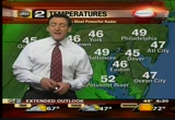
shadyside wet weather off the edge of easton.king maryland's most powerful doppler radar. sprinkles near and alleys and more rain back in -- annapolis and more rain back in western maryland. >> reporter: stop and go track on the northwest side of the beltway. i will tell you more when "good morning maryland" continues. @póo >>> this is your abc2 news to go i am charley crowson. let's check your forecast and say hello, to meteorologistjustin gerk. >> 6:-- berk. >>> 6:45 a lot of people are in a good mood because of the ravens victory. some of you love this and some not. this is snowshoe west virginia. the cute little snow resort that 4800 feet in west virginia is not so little and they have is 6 inches of brand new snow that's what's on the ground this morning. this is from saturday when it was first starting out there. good stuff. let's go back home. we have rain showers highlighting maryland's most powerful doppler radar coming up. we start off in the low to mid- 40s. and pushing to 55 and after this chilly damp start to the wee
shadyside wet weather off the edge of easton.king maryland's most powerful doppler radar. sprinkles near and alleys and more rain back in -- annapolis and more rain back in western maryland. >> reporter: stop and go track on the northwest side of the beltway. i will tell you more when "good morning maryland" continues. @póo >>> this is your abc2 news to go i am charley crowson. let's check your forecast and say hello, to meteorologistjustin gerk. >> 6:-- berk....
154
154
Oct 20, 2011
10/11
by
WUSA
tv
eye 154
favorite 0
quote 0
still 60 in annapolis. 59 in easton and then washington eight now we are in the upper 50s with winds gusting to 21 in town and 29 in easton but i think later today, that's when we're going to see the winds pick up gusting 30, 35, maybe even 40 miles an hour. right now 58. partly cloudy conditions. a south-southwest wind came down a little bit at 11 and the dew point at 52. the barometer is rising very quickly. 66 in new york but to the west look at all the 40s. in fact lexington is only 40 and the colder air will be coming in behind the storm system. westerly winds will drive it will cold from kentucky toward us. and we will be on the chilly side although mainly dry over the next few days. 62 this afternoon. but winds could gust 30, 35, 40. tonight we're not 40s. -- in the 40s. tomorrow still breezy to windy, 62. not as windy. saturday cool day but nice, 63. you folks in the diabetes walk and autism and howard university homecoming looking good. maybe a passing sprinkle on monday but still highs in the mid 60s. monika samtani has an update on the timesaver traffic. >>> here's a live
still 60 in annapolis. 59 in easton and then washington eight now we are in the upper 50s with winds gusting to 21 in town and 29 in easton but i think later today, that's when we're going to see the winds pick up gusting 30, 35, maybe even 40 miles an hour. right now 58. partly cloudy conditions. a south-southwest wind came down a little bit at 11 and the dew point at 52. the barometer is rising very quickly. 66 in new york but to the west look at all the 40s. in fact lexington is only 40 and...
166
166
Oct 7, 2011
10/11
by
WMAR
tv
eye 166
favorite 0
quote 0
check out some of the numbers in the 40s in frederick, york, low 50s, baltimore, easton, again, it's a crisp chilly night on the way but a nice rebound tomorrow. we are back into the mid70's late in the afternoon and this set the estimate for a much more dramatic warm up in to the weekend. >> thank you. your 7th grader says i don't want to go to school tomorrow. you ask why and they say they are being picked on or bullied. today they were tackling the issue. we went to a high school to talk to students and parents, the governor and first lady e even the president of the cartoon network were all there stressing the importance of national bullying prevention month, starring facebook. >> the pledge is a public statement to your friends, family and the community around you that you are going to take action when you see bullying happen. the idea is to inspire the great majority of people online and elsewhere who aren't bullying to come together as a community and take the steps to help someone in need and to create a culture that says it's not cool. >> you are encouraged to sign up on fac
check out some of the numbers in the 40s in frederick, york, low 50s, baltimore, easton, again, it's a crisp chilly night on the way but a nice rebound tomorrow. we are back into the mid70's late in the afternoon and this set the estimate for a much more dramatic warm up in to the weekend. >> thank you. your 7th grader says i don't want to go to school tomorrow. you ask why and they say they are being picked on or bullied. today they were tackling the issue. we went to a high school to...
144
144
Oct 1, 2011
10/11
by
WMAR
tv
eye 144
favorite 0
quote 0
right now temperatures coming in, right around 61 into baltimore, 59 easton, check out the real cold air into oakland, temperature in at 39 degrees west virginia you could see snow across the appalachian's. we will get wet rain across the area for tomorrow and sunday. the highs made it up to 81 degrees, 75 in culpepper. for tomorrow, no 70s, no 60's, the 50s into federal hill a round 58, more of that as we go into fell's point. again you do have the chance for showers in the forecast and actually the showers are likely into tomorrow. more of a chance into sunday. we can see that countser clockwise spin on the satellite and radar and it's another upper level low that's dropped in to the area and that is why we will be seeing the chance for the showers as we go throughout the weekend. cooler air will be invading us through tomorrow. tropical satellite picking up on felippe and ophelia is a hurricane. the future trend bringing the rain in here. through the overnight and by saturday morning and then we will see more into the saturday afternoon but we will get breaks in between. it won't
right now temperatures coming in, right around 61 into baltimore, 59 easton, check out the real cold air into oakland, temperature in at 39 degrees west virginia you could see snow across the appalachian's. we will get wet rain across the area for tomorrow and sunday. the highs made it up to 81 degrees, 75 in culpepper. for tomorrow, no 70s, no 60's, the 50s into federal hill a round 58, more of that as we go into fell's point. again you do have the chance for showers in the forecast and...
371
371
Oct 20, 2011
10/11
by
WJZ
tv
eye 371
favorite 0
quote 0
still some of the readings are in the 20-mile-an-hour range. 25-mile-an-hour winds around easton. we expect them to ease. the direction of the winds still keeping water bottled up in the bay. we have coastal flood advisories. expect tide to be a foot and a half to two feet above the average tide stage and all the areas until about 6 p.m. this evening. it was in effect until 2 a.m. so with the low pressure now that's responsible for all the winds starting to move, it's wrapping and bringing the wind across the region. it will move farther and farther up towards canada. as it does, it will bring the winds in from the inust. our temperatures go from the mid-60s to the upper 50s over the next few days. the wind also calm down. the -- we're going with a sun set of 6:20. we fall back on november the 6th. southwest wind on the bay at 20 to 25 knots, so today 69 partly sunny and breezy. overnight lows right on target. tomorrow cooler, 62 degrees. sunshine with patchy clouds. the five-day forecast will show a pretty nice stretch of weather. >>> still to come on wjz eyewitness news at noon,
still some of the readings are in the 20-mile-an-hour range. 25-mile-an-hour winds around easton. we expect them to ease. the direction of the winds still keeping water bottled up in the bay. we have coastal flood advisories. expect tide to be a foot and a half to two feet above the average tide stage and all the areas until about 6 p.m. this evening. it was in effect until 2 a.m. so with the low pressure now that's responsible for all the winds starting to move, it's wrapping and bringing the...
314
314
tv
eye 314
favorite 0
quote 0
easton 50. 55 packs river. 56 ocean city. 39 degrees right now in elkton. 45 cumberland, westminster, bel air. low 50s rock hall annapolis and kent island. 3 degrees warmer than yesterday. living big. there is that low again. it's high pressure that's going to force its will on the system. look at the low, south shows it, that's one, you saw the swirl, one heavy duty rip until the atmosphere if you will. enough of it. it's gone. we will call for rape this afternoon with high of 55. wait until you see the five day forecast off the charts. take it away, guys. >>> we have breaking news out of baltimore involving the subway system, o dor of natural gas tings entire system has been shutdown. stations are being evacuated. crews are monitoring the situation. a bus bridge set up from hopkins to cold spring. we have crews on the way and we will update you on this breaking story. >>> remember, wjz is always on, here are the stories we are following on our website. for updates of all the news and first warning weather forecast, go to wjz.com. ,,,,,,,,,,,,,,,,,, >>> in health watch, some parents
easton 50. 55 packs river. 56 ocean city. 39 degrees right now in elkton. 45 cumberland, westminster, bel air. low 50s rock hall annapolis and kent island. 3 degrees warmer than yesterday. living big. there is that low again. it's high pressure that's going to force its will on the system. look at the low, south shows it, that's one, you saw the swirl, one heavy duty rip until the atmosphere if you will. enough of it. it's gone. we will call for rape this afternoon with high of 55. wait until...
192
192
Oct 1, 2011
10/11
by
WTTG
tv
eye 192
favorite 0
quote 0
easton still getting some rain, cambridge and annapolis, finally light rain moved through there and back up from the metro to the northwest it's dry. temperatures right now sitting at 63 degrees in washington, but check out gaithersburg down to 55. our communities along i-81, winchester, martinsburg, hagerstown mid-50s, definitely colder air coming in. detroit now 42. so the colder air continues to come down from canada. it's part of a larger storm, okay? there's an upper level storm system component to this. so it's going to get over us this weekend and sit, spin and make it chilly. we'll deal with some rain showers, too. show you where i think we'll have the rain and how long it will stick around and how chilly it will be tomorrow, full forecast coming up. >> welcome fall. >>> starting tomorrow morning watch out for a big traffic shift. the left lane from the inner loop onto i-66 will close permanently, part of the work to create an access ramp for h.o.t. lanes under construction. traffic will shift to the right to go from the inner loop onto 66. if all goes well, the left exit will sh
easton still getting some rain, cambridge and annapolis, finally light rain moved through there and back up from the metro to the northwest it's dry. temperatures right now sitting at 63 degrees in washington, but check out gaithersburg down to 55. our communities along i-81, winchester, martinsburg, hagerstown mid-50s, definitely colder air coming in. detroit now 42. so the colder air continues to come down from canada. it's part of a larger storm, okay? there's an upper level storm system...
264
264
Oct 20, 2011
10/11
by
WJLA
tv
eye 264
favorite 0
quote 1
in the 50's most spots, 60 quantico 59 gaithersburg and easton. these temperatures are about eight degrees cooler than yesterday. tonight, at 11:00 after the skies cleared and the winds diminished we will have better departures. the cool dry air is rushing in, cold air to the west. 43 pittsburgh 52 indianapolis. it is a miserable day for parts of the ohio valley and portions of the midwest. we are fortunate to be on the southwest side of the circulation. we are getting the dry air despite the cloud deck. really warm temperatures, limited across the country. the circulation around the system, rain falling over chicago and indiana ohio, and that moves to the northeast. we get more dry air increasing sunshine tomorrow, lots of sunshine tomorrow. the skies clear, high pressure moves in, and we will be in fine shape friday through sunday. tomorrow, 56 midday, six to two in the afternoon. the next seven days, looks really nice. especially if you are thinking about looking at the leaves, skyline drive will be terrific, middle sixties. warming trend monda
in the 50's most spots, 60 quantico 59 gaithersburg and easton. these temperatures are about eight degrees cooler than yesterday. tonight, at 11:00 after the skies cleared and the winds diminished we will have better departures. the cool dry air is rushing in, cold air to the west. 43 pittsburgh 52 indianapolis. it is a miserable day for parts of the ohio valley and portions of the midwest. we are fortunate to be on the southwest side of the circulation. we are getting the dry air despite the...
173
173
Oct 24, 2011
10/11
by
WMAR
tv
eye 173
favorite 0
quote 0
atlantic city matching the mark. 45 easton. 50 back towards hagerstown. winds direction from the south. behind the front, a north westerly breeze, up and down little pattern as we head through the first couple of days. clouds on back towards the west. bands of clouds, clearing behind it midday. the showers will hang by this evening. a cloudy morning and afternoon, sun in between and high of 67. >>> 95 north, tightings bridge in the right lane ax broken down car. be careful. stay to the left if you can. a live look at the traffic camera, 95, 175, no issues reported between elk ridge, dorcey and laurel. 95 at the fort mc henry, doing fine as well. southbound with on coming traffic. northbound is flowing freely. earlier incident, 95 north is clearing out of the way. >>> texas rangers evened the world series. fall classic ties two games apiece. hamilton put the rangers ahead. texas a little bit of breathing room. . for moms pregnancy can be an exciting time and fightening. what megan pringle has been going through and doing to make things better. . new change
atlantic city matching the mark. 45 easton. 50 back towards hagerstown. winds direction from the south. behind the front, a north westerly breeze, up and down little pattern as we head through the first couple of days. clouds on back towards the west. bands of clouds, clearing behind it midday. the showers will hang by this evening. a cloudy morning and afternoon, sun in between and high of 67. >>> 95 north, tightings bridge in the right lane ax broken down car. be careful. stay to the...
145
145
Oct 17, 2011
10/11
by
WMAR
tv
eye 145
favorite 0
quote 0
we're still holding at 60 in baltimore and 63 in easton. if you're planning ahead for the kids going to school, they may want to wear shorts today. by the afternoon, we'll get mild. the 30s in the mountains that is a hint of cooler air. but it will be a few days from reaching us. we'll be in the low 60s this morning and mostly sunny and breezy afternoon. we'll get up to 74. we're almost on par with the week weather. but we have a mid-week storm coming up that we'll talk about next. here's your traffic now. >>> earlier accident in the city of south highland and dylan is in the clearing stages right now. on the interstates, we're doing well light traffic. this is the southwest side of the beltway going through katetonsville. 395 looking north, we have light traffic building both directions, no issues or incidents to report. just a pretty shot. drive time are doing well. 95 southbound from white marsh to the beltway, 9 minutes. >>> police continue gathering clues in the disappearance of 11-year-old william mcquain. he is the missing germantown
we're still holding at 60 in baltimore and 63 in easton. if you're planning ahead for the kids going to school, they may want to wear shorts today. by the afternoon, we'll get mild. the 30s in the mountains that is a hint of cooler air. but it will be a few days from reaching us. we'll be in the low 60s this morning and mostly sunny and breezy afternoon. we'll get up to 74. we're almost on par with the week weather. but we have a mid-week storm coming up that we'll talk about next. here's your...
207
207
Oct 13, 2011
10/11
by
WMAR
tv
eye 207
favorite 0
quote 0
we had a high near 80 in easton today. is the warm front boundary draped over the state that is createing that focusing area for potential storms and isolated strong ones. the humidity helps fuel the storms and as we look to the west, more heavy weather out in west virginia, extreme western pennsylvania and there's a cluster here down on the lower part of the eastern shore of virginia that may pack quite punch as well. so more storms and more moisture feeding up out of south. and we have to keep the watch for some of these to become fairly intense over the next few hours. and a very messy setup across the east right now. warm air surging in and the warm front staying in october and fall sometimes. you never trust a warm front. they don't cause the widespread storms that cold fronts do, they do often trigger the isolated rotating storms. and the second front to the west, this is the one that will bring in another round of showers and maybe storms tomorrow afternoon. but also clear us out into friday night and into saturday.
we had a high near 80 in easton today. is the warm front boundary draped over the state that is createing that focusing area for potential storms and isolated strong ones. the humidity helps fuel the storms and as we look to the west, more heavy weather out in west virginia, extreme western pennsylvania and there's a cluster here down on the lower part of the eastern shore of virginia that may pack quite punch as well. so more storms and more moisture feeding up out of south. and we have to...
192
192
Oct 10, 2011
10/11
by
WMAR
tv
eye 192
favorite 0
quote 0
eventually evolve and impact us as we head through the rest of this week. 46 york pa. 58 baltimore. 54 in easton. we are looking at high thin clouds building in across the area. i want to pull this back wider and show you this system here. high pressure is in control, we are actually watching a circulation across florida. that, if it were sitting over the tropical waters, had a very good chance of turning tropical. it may reemerge across the gulf of mexico. we are going to watch that storm as if it appears it is spreading rain on south carolina and georgia. some of the heavy rainfall could be coming in tomorrow night. wednesday is going to be the wettest day of the week. we will talk about how that storm will impact us with the forecast in a moment. >>> 95 southbound at the beltway, we have some road work, should be wrapped up in the next 15-20 minutes. no major accidents on tinner states. you are looking at the jfx from the overpass. moving south to north avenue, see how dark it is. we have lights out. be careful if you are heading downtown or through this area. there are no incidents in your w
eventually evolve and impact us as we head through the rest of this week. 46 york pa. 58 baltimore. 54 in easton. we are looking at high thin clouds building in across the area. i want to pull this back wider and show you this system here. high pressure is in control, we are actually watching a circulation across florida. that, if it were sitting over the tropical waters, had a very good chance of turning tropical. it may reemerge across the gulf of mexico. we are going to watch that storm as...
277
277
Oct 12, 2011
10/11
by
WUSA
tv
eye 277
favorite 0
quote 0
computers trying to generate heavier between annapolis and easton by then. andrea?y a quarter of a way through their season but they're already honoring some all-stars. tight end chris cooley hosted the 4th annual all-star survivor celebration for breast cancer patients at redskins park in ashburn, virginia. 20 area women battling breast canser were treated to a day of pampering which also included gifts, some brand new wigs, scarves, clothes and a custom redskins jersey. cooley's mother, nancy is a survivor as is owner dan snyder's wife, tanya. >> anything that we can do to touch people's lives, to get the message to women to take care of themselves, to make that appointment and to pay attention to anything different and unusual that's going on with their body, the earlier you catch it, the difference is tremendous. for the outcome. >> the redskins are sponsoring several events throughout this breast cancer awareness month as part of an effort around the national football league. you can join me in the fight against breast cancer by logging on to wusa9.com. click o
computers trying to generate heavier between annapolis and easton by then. andrea?y a quarter of a way through their season but they're already honoring some all-stars. tight end chris cooley hosted the 4th annual all-star survivor celebration for breast cancer patients at redskins park in ashburn, virginia. 20 area women battling breast canser were treated to a day of pampering which also included gifts, some brand new wigs, scarves, clothes and a custom redskins jersey. cooley's mother, nancy...
116
116
Oct 20, 2011
10/11
by
WUSA
tv
eye 116
favorite 0
quote 0
to noon, little recovery. 59 in town and 62 in easton and pax river. 58 for andrews and mid- afternoon, could be a few clouds just bubbling up in the daytime heating and instability. maybe a shower toward hagerstown. definitely need a jacket for the wind and the chill moving in. >>> thank you howard. game two of the world series tonight in st. louis after a close game one. >> plus, the redskins prepare to put a new starter against the panthers sunday at quarterback that is. kristen berset has the details in your morning sports. >>> good morning everyone. here's your first look at sports. the washington redskins have 11 turnovers all 11 of them are credited to rex grossman. this is been his m. o. and unfortunately it came to a head last sunday. so now the john beck era begins in ashburn. how long that will be is yet to be determined. mike shanahan announced yesterday that beck would be the starter sunday when the skins travel to face carolina. beck says he worked out this off-season with super bowl quarterbacks aaron rodgers and drew brees and hopes the time to lead the team could woman
to noon, little recovery. 59 in town and 62 in easton and pax river. 58 for andrews and mid- afternoon, could be a few clouds just bubbling up in the daytime heating and instability. maybe a shower toward hagerstown. definitely need a jacket for the wind and the chill moving in. >>> thank you howard. game two of the world series tonight in st. louis after a close game one. >> plus, the redskins prepare to put a new starter against the panthers sunday at quarterback that is....
213
213
Oct 24, 2011
10/11
by
WMAR
tv
eye 213
favorite 0
quote 0
a mix of clouds around the region and push of warmer air. 46 easton. a 1 hagerstown. -- 51 hagerstown. showers e mountains. there is a front that will swing through and nom date cloud cover. we get clearing, another band of showers to the northwest. an active week. today is going to be on the mild end on the first part of the week and a cool down. we will talk about that coming up. follow the details at the bottom of the screen. first check on traffic with tanya. >>> red pump road, an accident reported in bel air and harford county. looking outside, see how things are moving along. the beltway at old court in the north side, light traffic. nothing to worry about yet. 895 south, after the tunnel, the tow truck is on the scene. appears to be a bus, this is past shell road, should be cleared out of the way shortly. >>> engineering stranded make her way -- doctors believe she had a stroke and was stranded since august. linda so joins us live outside hopkins. this has been a story and a trip coming for sometime. >> reporter: yes. she has been anxious to mak
a mix of clouds around the region and push of warmer air. 46 easton. a 1 hagerstown. -- 51 hagerstown. showers e mountains. there is a front that will swing through and nom date cloud cover. we get clearing, another band of showers to the northwest. an active week. today is going to be on the mild end on the first part of the week and a cool down. we will talk about that coming up. follow the details at the bottom of the screen. first check on traffic with tanya. >>> red pump road, an...
222
222
Oct 24, 2011
10/11
by
WMAR
tv
eye 222
favorite 0
quote 0
. >> good morning, you got an iphone 4. 45 now in easton. 44 baltimore. 50 high spot in hagerstown. coldest spot, 48 ocean city. they are underneath clear skies. patchy fog, on the eastern show. couple of showers popping up in the mountains of west virginia. showers h be later on. bands of showers maybe maybe jove cast. clouds return with a chance of the shower towards evening. active for the middle of the week as well. more in just a moment. let's go to the roads with tonya. >>> road closure for you in the city, frank fort at sinclair lane, closed due to police activity. avoid the intersection. a live look at the traffic cameras, beltway, northwest, near 795, south at old court road. our traffic this morning, no issues to report in either direction. this is the jfx, light traffic, most cars are going southbound now. no issues southbound towards cold spring lane and downtown. you should be good to go. our drive times are doing just fine because we have the light traffic, 83 southbound, shawan to the beltway, five minutes. 95, white marsh 6 minutes. 7 between 795 and 70. >>> new info
. >> good morning, you got an iphone 4. 45 now in easton. 44 baltimore. 50 high spot in hagerstown. coldest spot, 48 ocean city. they are underneath clear skies. patchy fog, on the eastern show. couple of showers popping up in the mountains of west virginia. showers h be later on. bands of showers maybe maybe jove cast. clouds return with a chance of the shower towards evening. active for the middle of the week as well. more in just a moment. let's go to the roads with tonya. >>>...
180
180
Oct 10, 2011
10/11
by
WMAR
tv
eye 180
favorite 0
quote 0
arundel among the places that have it and valley areas across baltimore county. 54 easton to baltimore. 46 york. 50 hagerstown. we got high clouds starting to stream in. that will make for a milky cloud and dim sunshine, but we pump in more heat and how fitting on this columbus day. he thought he landed in india. they call it indian summer. there is different reasons and meanings. many think it's after the first killing frost. it was chilly a week ago and now we warm to 85. call it indian summer. we will talk about next. here is tanya rivero. >>> i like it. route 1 southbound, lorel at north lorel road. an incident. this the near the key bridge, we do have on tin i loop, -- the inner loop, stay to the left if you can. 695, liberty road, it is moving, more volume on the outer loop to the right. we are doing okay. drive times are our normal times, 83ing 95, no problems. outi loop 6 minutes. 7 minutes 795 to 70. >>> pledging to bring down corporate meek and calling for e quality. occupy wall street protest is going on. today could be a swing day of sports and linda so is here to explain.
arundel among the places that have it and valley areas across baltimore county. 54 easton to baltimore. 46 york. 50 hagerstown. we got high clouds starting to stream in. that will make for a milky cloud and dim sunshine, but we pump in more heat and how fitting on this columbus day. he thought he landed in india. they call it indian summer. there is different reasons and meanings. many think it's after the first killing frost. it was chilly a week ago and now we warm to 85. call it indian...
210
210
Oct 13, 2011
10/11
by
WMAR
tv
eye 210
favorite 0
quote 0
temperatures, what a contrast, 70 and near 80 in easton. but to the west, we got 50s and 60s. it's one of those days where a boundary is draped on top of the state and south that have boundary. that is where we have the brief tornado watch for the remainder of the evening anne arundel county south and high humidity. this warmth and humidity can help flare up a couple strong storm cells and we'll watch for that overnight. and same overall circulation that we've been watching for several days. it is still impacting things a a little bit. the cold front that is hoping to drive today's weather and will do so about this time tomorrow. front pushing in and warm front tonight with a few isolated strong storms and we got the cold front tomorrow that will bring in another round of showers and storms. we think it clears out by late tomorrow night and setting the stage for a clear and fall weekend. it will be breezy on saturday. and the round of showers tonight and another round blows through tomorrow afternoon. business friday, 6:00 to 8:00, we should see clearing and breezy and crystal
temperatures, what a contrast, 70 and near 80 in easton. but to the west, we got 50s and 60s. it's one of those days where a boundary is draped on top of the state and south that have boundary. that is where we have the brief tornado watch for the remainder of the evening anne arundel county south and high humidity. this warmth and humidity can help flare up a couple strong storm cells and we'll watch for that overnight. and same overall circulation that we've been watching for several days. it...
185
185
Oct 4, 2011
10/11
by
WMAR
tv
eye 185
favorite 0
quote 0
we are chilly this morning. 47 degrees the current temperature in baltimore. 45 easton, hagerstown and york pa, periphery. cloud cover is breaking up on the south and east end. cloud cover on the north side, lingering sprinkles. we are done with the rain. we will try to be optimistic, i adjusted for sun. the northwest winds helps out. a partly cloudy sky, towards the afternoon, we may bubble up clouds from time to time. we are under the influence of the storm that is departing. 67, marked improve. two degree guaranteed high. it gets better for the rest of the week. we will talk about that next. good morning to tanya. >>> 95 north, vehicle fire is gone. south of 32, a broken down car. let's look at the beltway, they are starting to get volume. frederick road, outer loop to the left, starting to get volume through kaytonsville, 695, liberty road, volume as well. that has volume from 795 to edmonton. drive times affect ad lib. 8395, outer loop, bel air to providence 7 minutes. 795 to 70, nine or ten minutes. >>> a battle brewing over a large sign sp you've got the water tower. why not a 1
we are chilly this morning. 47 degrees the current temperature in baltimore. 45 easton, hagerstown and york pa, periphery. cloud cover is breaking up on the south and east end. cloud cover on the north side, lingering sprinkles. we are done with the rain. we will try to be optimistic, i adjusted for sun. the northwest winds helps out. a partly cloudy sky, towards the afternoon, we may bubble up clouds from time to time. we are under the influence of the storm that is departing. 67, marked...
170
170
Oct 12, 2011
10/11
by
WMAR
tv
eye 170
favorite 0
quote 0
upper 50s to the west, midand upper 60s, easton, baltimore -- it just really depends where you are in the state but most spots a good five ten degrees cooler, winds will shift tomorrow. highs -- up in the upper 60s. 72 still the chance for showers on and off through the day. still looks like a agree day. 71 with the gray conditions, kind of holding, that ugly october weather you get for a couple days, throughout the month and we will have those another two days or so because the pattern not showing any kind of changing in the immediate future. big wave of rain this afternoon. pennsylvania and also up into new york but the south basically the main storm system over the carolina's. that will let moisture keep coming up and as this begins to move out thursday, evening, we have a new front that will push in out of the west and provide more rain in the early friday. the front will clear us, for saturday and into sunday and monday. there will be some improvement on the way. trend showing -- the hit and miss showers, chances for rain will persist and probably pick up again tomorrow afternoon
upper 50s to the west, midand upper 60s, easton, baltimore -- it just really depends where you are in the state but most spots a good five ten degrees cooler, winds will shift tomorrow. highs -- up in the upper 60s. 72 still the chance for showers on and off through the day. still looks like a agree day. 71 with the gray conditions, kind of holding, that ugly october weather you get for a couple days, throughout the month and we will have those another two days or so because the pattern not...
169
169
Oct 18, 2011
10/11
by
WMAR
tv
eye 169
favorite 0
quote 0
temperatures mid to upper 40s. 49 bel air and northeast. 55 by the water in edge mere. 52 centerville and easton. we have been watching clouds rolling back in overnight. after we had some nice moonlit sky. the clouds taking over. this is part of a larger storm. this storm system diving to the deep south is going to pick up this tropical moisture out of florida and gang up here in maryland. we will highlight the wind forecast coming up next. >>> if you are traveling 295 southbound at 197, there is an
temperatures mid to upper 40s. 49 bel air and northeast. 55 by the water in edge mere. 52 centerville and easton. we have been watching clouds rolling back in overnight. after we had some nice moonlit sky. the clouds taking over. this is part of a larger storm. this storm system diving to the deep south is going to pick up this tropical moisture out of florida and gang up here in maryland. we will highlight the wind forecast coming up next. >>> if you are traveling 295 southbound at...
172
172
Oct 20, 2011
10/11
by
WMAR
tv
eye 172
favorite 0
quote 0
could be see a patch many drizzle or two, yes but not much and the wind gusts 36 dover, gusting to 24 easton, 20 baltimore and temperatures falling off sharply, mid50s, 60s on the del marva and in western maryland at 36 degrees. so, humidity nice and dry. winds continue to howl. chapstick weather and as we zoom out across the east coast you can see the bigger picture. the storm finally starting to swirl further north. we are still catching the clouds and plenty of wind as this area of low pressure drifting off north and the high pressure south tries to fill in that sort of hole in the atmosphere you get the winds coming up big time and that's what we will continue to see tonight and tomorrow will be a breezy day. just mix of clouds, sun through the day, i think saturday we will see more sun around here. the last of that storm wind of fizzles out and pushing north and west. overnight 44, cloudy, breezy, the forecast tomorrow, 62, most of the day in the 50s. with the wind it's going to feel like 50s even late in the afternoon. tomorrow night less windy, down to 42, suburbs could hit the 30s. p
could be see a patch many drizzle or two, yes but not much and the wind gusts 36 dover, gusting to 24 easton, 20 baltimore and temperatures falling off sharply, mid50s, 60s on the del marva and in western maryland at 36 degrees. so, humidity nice and dry. winds continue to howl. chapstick weather and as we zoom out across the east coast you can see the bigger picture. the storm finally starting to swirl further north. we are still catching the clouds and plenty of wind as this area of low...
252
252
Oct 17, 2011
10/11
by
WUSA
tv
eye 252
favorite 0
quote 0
that is one of our warm spots. 66 in easton. 66 also in culpepper at this hour. they were in the 30s this morning. so the air is dry, the humidity 43%. everything is low on the allergy count example mold spores, they are moderate. the system in the rockies is moving off to the east and southeast. and then in the gulf of mexico, potentially this might be trying to develop. even if it doesn't, there is a lot of tropical moisture coming into florida and that is going to be lifted north as the system moves toward us over the next couple of dies. the futurecast shows that front nice afternoon around here. partly cloudy skies tonight into tuesday morning. then as this system from the west comes toward us the moisture is going to come in from the south, we have a nor'easter here and some of the rain could be locally heavy. looking fine, real nice, temperatures in the low 70s. 40s and 50s tonight. again low 70s tomorrow. wednesday cooler, windy and wet, temperatures holding in the 60s to make an early shower. look at the cool down for friday and saturday. 30 in the subur
that is one of our warm spots. 66 in easton. 66 also in culpepper at this hour. they were in the 30s this morning. so the air is dry, the humidity 43%. everything is low on the allergy count example mold spores, they are moderate. the system in the rockies is moving off to the east and southeast. and then in the gulf of mexico, potentially this might be trying to develop. even if it doesn't, there is a lot of tropical moisture coming into florida and that is going to be lifted north as the...
207
207
Oct 18, 2011
10/11
by
WMAR
tv
eye 207
favorite 0
quote 0
we've got ourselves and look here. 50 degrees in baltimore, 52 easton.fog, temperatures allowed to drop a little bit overnight, through 40s, north and west of baltimore and reach the dew point. clouds trying to roll in for the last couple of hours, showers to the north. we stay dry today and intermittent clouds this morning, any little bit of morning sun peaking out, we will lose out to the advancing crowds ahead of the storm system. a little peak on the edge of the screen. it looks well organized. extended front across the eastern edge. it's going to tap in to tropical moisture near florida and all get drawn you have the eastern sea board locking in on us. today a dry day, thickening clouds. 71 this afternoon. we will talk about that storm in just a moment. now it's 5:29. back to the roads. >>> baltimore drive at windsor milks an accident reported in baltimore county. so far accident free in the city, let's
we've got ourselves and look here. 50 degrees in baltimore, 52 easton.fog, temperatures allowed to drop a little bit overnight, through 40s, north and west of baltimore and reach the dew point. clouds trying to roll in for the last couple of hours, showers to the north. we stay dry today and intermittent clouds this morning, any little bit of morning sun peaking out, we will lose out to the advancing crowds ahead of the storm system. a little peak on the edge of the screen. it looks well...
159
159
Oct 28, 2011
10/11
by
WMAR
tv
eye 159
favorite 0
quote 0
easton 39 degrees, ocean city at 45. we are dealing with the cold air moving in throughout the day. picking up a few clouds out there, but that cold front has pushed through the area. behind it we will start to see high pressure building in. we will get a little bit of sunshine going throughout the day. let's talk about what's going on with tropical storm rina as of now. it is weakening. big changes here at the national hurricane center. moving north northeast at 4 miles per hour. it is just brushing up against cancun, as of now it is moving to the west of it. with this definitely weakening, not touching cuba at all. we saw this track changing, that is what we like to see. as we are looking at a storm moving into our area as we go through tomorrow, we have the rain yesterday, we are going to dry out for some time today. by the evening, that is when we'll have a chance for rain to work its way in here. but by tomorrow morning, we can see the rain works its way in. we can see more of that snow back off toward the west. by lunch time we can start to see the rain snow mix as we go throu
easton 39 degrees, ocean city at 45. we are dealing with the cold air moving in throughout the day. picking up a few clouds out there, but that cold front has pushed through the area. behind it we will start to see high pressure building in. we will get a little bit of sunshine going throughout the day. let's talk about what's going on with tropical storm rina as of now. it is weakening. big changes here at the national hurricane center. moving north northeast at 4 miles per hour. it is just...
187
187
Oct 18, 2011
10/11
by
WMAR
tv
eye 187
favorite 0
quote 0
the boundary push through that cleared us out with the sun. 48 is where we sit now in baltimore. 52 easton. 50s southern maryland. 50s and 40s to the north. skies will give way from early morning sunshine, increasing clouds, a bit breezy this afternoon. aiming for 71 degrees. we will talk about the storm coming up. let's go to the roads. traffic with tanya. >>> a broken down car, 50 west at the bay bridge. downtown, an accident in the clean up stages, sarah to ga at charles street. this is 795, light traffic in both directions. no incidents. things are running smoothly. 93, 395, south, overnight construction between russ spell the beltway. they will clean that up before 5:00 a.m. >>> it happened in march of 2010, day the trial will begin for the suspect accused in the shooting of a gas station owner. the long awaited trial will start in harford this morning. linda so joints us now in towson. >> reporter: this gas station is where ray porter was shot and killed. he owned the place and working here the morning where he was murdered. the man accused will go on trial today. jury selection will
the boundary push through that cleared us out with the sun. 48 is where we sit now in baltimore. 52 easton. 50s southern maryland. 50s and 40s to the north. skies will give way from early morning sunshine, increasing clouds, a bit breezy this afternoon. aiming for 71 degrees. we will talk about the storm coming up. let's go to the roads. traffic with tanya. >>> a broken down car, 50 west at the bay bridge. downtown, an accident in the clean up stages, sarah to ga at charles street....
220
220
Oct 17, 2011
10/11
by
WMAR
tv
eye 220
favorite 0
quote 0
this is 57 in bel air. 55 in westminster but holding at edgemere and centerville, 63 in easton. we had some cloudiness overnight. the clouds seem to hold tight over the eastern shore, breaking up in annapolis and baltimore. and the showers in the northwest falling apart overnight that was expected. the front itself is anything that will help kick up the winds today. but we stay mild on par with what the weekend is like. and we'll talk about that running festival. but 74 will do it this afternoon with gusty winds. 6:01, we'll see what is happening with your morning commute on this monday. >>> we had an earlier accident on 70 eastbound. the two left lanes are still blocked. you can only get by to the right. take a look at the beltway. a live look of south frederick road. north pear pier, that may slow done. we'll call the drive times okay so far because it has not backed up too much. 83 to the beltway still five minutes. and the -- and we're traveling fine on the outter loop till you get to the liberty road. >>> an 11-year-old boy is still missing after his mother was found dead l
this is 57 in bel air. 55 in westminster but holding at edgemere and centerville, 63 in easton. we had some cloudiness overnight. the clouds seem to hold tight over the eastern shore, breaking up in annapolis and baltimore. and the showers in the northwest falling apart overnight that was expected. the front itself is anything that will help kick up the winds today. but we stay mild on par with what the weekend is like. and we'll talk about that running festival. but 74 will do it this...
231
231
Oct 4, 2011
10/11
by
WMAR
tv
eye 231
favorite 0
quote 0
cloudy skies, 49 baltimore, 49 easton. notice we've had a couple of sprinkles, underneath the influence of clouds and showers to the west. sprinkles possible this morning. as we work in to the afternoon we develop sun, a little cooler than normal at 67. it gets better, for the rest of the week. we will talk about that coming up. first look at traffic with tanya. >>> good morning, a accident in harford, 95 north, mountain road. also in the city, 33rd and alameda, there is a tow truck on the way. let's look at the traffic camera, 695, old court, near 795, light traffic. nothing to worry about on the northwest side. topside, extremely light traffic as well. this is at harford. no issues on either loop. starting out well charlie. >>> after four years in an italian prison she got her first taste of freedom. a italian court overturned her murder conviction. knox and family in hand. linda so joining us now with what both families had to say. >> reporter: the sister says the family is thankful the nightmare is over. now they are l
cloudy skies, 49 baltimore, 49 easton. notice we've had a couple of sprinkles, underneath the influence of clouds and showers to the west. sprinkles possible this morning. as we work in to the afternoon we develop sun, a little cooler than normal at 67. it gets better, for the rest of the week. we will talk about that coming up. first look at traffic with tanya. >>> good morning, a accident in harford, 95 north, mountain road. also in the city, 33rd and alameda, there is a tow truck on...
149
149
Oct 14, 2011
10/11
by
WMAR
tv
eye 149
favorite 0
quote 0
up with wet weather in the next couple hours and a tropical feel out there. 67 in baltimore, 66 in easton and in central virginia where the tornado outbreak was, six tornadoes reported in virginia yesterday. and we'll talk about that college park issue in a minute. we'll have temperatures back up to 72 and maybe some more turbulent weather. here's a look at the roads with tonya. >>> if you're commuting towards washington d.c., we have all lanes shut down on i-95. that serious accident is on the live shoulder. this is a live look at baltimore belt way. in problems to report. 695 and the key bridge, all is quiet here. all is well. back to you. >>> williams mcquane was last seen in germantown in september and wednesday his mother was found dead in her apartment. new details on "good morning maryland." and we've got the latest. >> reporter: they discovered his mother dead in her apartment wednesday night after a missingperson's report. on thursday, they arrested jane mcquane's ex-husband, curtis lopez. lopez was recently seen removing property from the home and placeing it inside her car. det
up with wet weather in the next couple hours and a tropical feel out there. 67 in baltimore, 66 in easton and in central virginia where the tornado outbreak was, six tornadoes reported in virginia yesterday. and we'll talk about that college park issue in a minute. we'll have temperatures back up to 72 and maybe some more turbulent weather. here's a look at the roads with tonya. >>> if you're commuting towards washington d.c., we have all lanes shut down on i-95. that serious accident...
238
238
Oct 7, 2011
10/11
by
WUSA
tv
eye 238
favorite 0
quote 0
easton it's 68. out to the west we're still in the low- to mid-60s there at oakland, 72 in culpepper, just absolutely gorgeous. and that 66, it actually feels warmer because the winds are reported now at calm. so you got the sun out, no wind and a dewpoint in the 50s. it's just beautiful outside and likely to stay that way for several more days. the jet stream taking a big dip out west, big rise in the east. look how high it's going up into canada. when you get a ridge underneath it, you get high pressure as well. but in the troughy area, you get storminess and unsettled weather. snow in the mountains, cold rains here in eastern montana, heavy snow in the high country in the rockies east of salt lake city. 20 to 30 inches around alta, but with the high pressure with us, it's down towards binghamton and scranton, it'll be sagging south, so plenty of sunshine for the rest of the day. a nice clear, cool crisp night tonight, back into the 40s and 50s. tomorrow high pressure to our east, looking good, we
easton it's 68. out to the west we're still in the low- to mid-60s there at oakland, 72 in culpepper, just absolutely gorgeous. and that 66, it actually feels warmer because the winds are reported now at calm. so you got the sun out, no wind and a dewpoint in the 50s. it's just beautiful outside and likely to stay that way for several more days. the jet stream taking a big dip out west, big rise in the east. look how high it's going up into canada. when you get a ridge underneath it, you get...
228
228
Oct 20, 2011
10/11
by
WUSA
tv
eye 228
favorite 0
quote 0
but easton gusting to 35 miles per hour and andrews and tappahannock gusting just 31. so windy and chilly afternoon, relatively speaking. we're in the mid-50s and with the clouds moving in from the mountains, don't expect to get warm in the shenandoah valley. we're 159 in town and 61 in fredericksberg. 60 on bay in annapolis. it's mostly cloudy at reagan national. high clouds as well with the south, southwesterly wind sustained at 32, gusting to 31. the monster storm still spinning on the great lakes. the rain around it and the big chill tonight in st. louis for game two of the world series and it's driving the clouds toward us for a little while today. but we'll stay dry. to the mountains, don't be surprised if you see some rain showers there in places like snow shoe, and they are seeing wet snowflakes. the next three days, 62 today and windy. probably a few more clouds than i'm showing here. breezy tomorrow and 62 with partly sunny skies. saturday 63 but a willie morning. got the autism walk. sunday looks nice at 64. and money chance of a sprinkle with temperatures i
but easton gusting to 35 miles per hour and andrews and tappahannock gusting just 31. so windy and chilly afternoon, relatively speaking. we're in the mid-50s and with the clouds moving in from the mountains, don't expect to get warm in the shenandoah valley. we're 159 in town and 61 in fredericksberg. 60 on bay in annapolis. it's mostly cloudy at reagan national. high clouds as well with the south, southwesterly wind sustained at 32, gusting to 31. the monster storm still spinning on the great...
266
266
Oct 21, 2011
10/11
by
WRC
tv
eye 266
favorite 0
quote 0
. ♪ >>> turns out the man who owned all those wild animals in easton, ohio was deep in debt.e is terry thompson. he killed himself after he released more than 50 of his exotic pets, which included lions and tigers and bears and wolves. court records show he's had money problems since the 90s. he and his wife owed at least $68,0 in income and property taxes. thompson also was just released from prison after serving a year on an unregistered gun charge. >> a fairfax man who is registered as a sex offender in virginia is in trouble with the law given. 20-year-oldio 20 yus yef josie is in the fairfax county jail held without bond. >> a new study shows using your cell phone regularly does not increase your risk of brain cancer. researchers in denmark examined 350,000 people over 17 years. it is the largest study on cell phone risks ever done. back in may the world health organization put cell phones in the same carcinogenic category as dd it. and gas exhaust. medical experts say any potential cell phone risk can be reduced by using an ear piece. >> still ahead on "news4 at 11," hu
. ♪ >>> turns out the man who owned all those wild animals in easton, ohio was deep in debt.e is terry thompson. he killed himself after he released more than 50 of his exotic pets, which included lions and tigers and bears and wolves. court records show he's had money problems since the 90s. he and his wife owed at least $68,0 in income and property taxes. thompson also was just released from prison after serving a year on an unregistered gun charge. >> a fairfax man who is...
234
234
Oct 25, 2011
10/11
by
WMAR
tv
eye 234
favorite 0
quote 0
clearing out of cambridge and easton, it's a good shower there earlier tonight. ocean city getting set for rain, the beach here getting wet weather in but that is about it. you see clearing to the west, that will be in a sunnier day tomorrow. i think a good warm up in baltimore tonight. had a couple showers earlier, 52 right now, humidity higher in the wake of the showers, winds west at six. sunshine to finish the day after times a relatively cloudy afternoon, this is just before sunset and then into the night a couple showers came in early and then now the sky is starting to clear out, much the same in annapolis. temperature 51 baltimore, 47 at the beach. cooler and winds light behind that boundary sneaking through. i hesitate to call it a cold front because it won't drop the air temperatures. coolest air will stay bolted up to the north and the dry, clear situation that we are seeing in the midwest, that will settle in for about another day, day and a half. by wednesday night things change again. weather pattern speeding up. mild air in place up and down the ea
clearing out of cambridge and easton, it's a good shower there earlier tonight. ocean city getting set for rain, the beach here getting wet weather in but that is about it. you see clearing to the west, that will be in a sunnier day tomorrow. i think a good warm up in baltimore tonight. had a couple showers earlier, 52 right now, humidity higher in the wake of the showers, winds west at six. sunshine to finish the day after times a relatively cloudy afternoon, this is just before sunset and...
263
263
Oct 18, 2011
10/11
by
WUSA
tv
eye 263
favorite 0
quote 0
a sunny day, at least partly to mostly sunny. 75 in easton.ning, monika samtani, tell me it's better than yesterday morning. >>> it is better, but this time everything is happening north of town. i just got off the phone with montgomery county police, an off-duty police officer was heading home on georgia avenue. let's go there live right now and he saw live wires across the roadway on georgia avenue. closed between bachelor's forest forest road and emery lane in both directions. live wires across the roadway in both directions on georgia avenue. this is at the swim center. what you want to do if you're heading out right now is go ahead and take route 108 to 28 and back over to georgia avenue. to virginia, no problems to report here on 395 north of duke street to the 14th street bridge. coming up i will update you on the situation in alno. back to you guys. >>> president obama will continue pushing his jobs plan in north carolina this morning. it's day two of his three day bus tour. >> and yesterday, in ashville he told the crowd that congress
a sunny day, at least partly to mostly sunny. 75 in easton.ning, monika samtani, tell me it's better than yesterday morning. >>> it is better, but this time everything is happening north of town. i just got off the phone with montgomery county police, an off-duty police officer was heading home on georgia avenue. let's go there live right now and he saw live wires across the roadway on georgia avenue. closed between bachelor's forest forest road and emery lane in both directions. live...
312
312
Oct 21, 2011
10/11
by
WBAL
tv
eye 312
favorite 0
quote 0
up to the north and west of us and the winds are beginning to diminish. 24 mile an hour gusts in easton, 16 in frostburg, 19 in oakland. only 36 that opened in garrett county right now. they may have some wet snow mixed in with the rain showers tonight and tomorrow. for western maryland, skies should continue to clear east of the mountains and it will be a chilly fall morning. a big storm is pulling away, the last of a cloud the beginning to fall apart. the clouds covering all of the great lakes and the northeast will continue working up into eastern canada. high pressure schedule to get in here with perfect timing for friday, saturday, and all of sunday as well. maybe a little cloud cover late in the weekend out west, but mostly sunny days and clear nights. breezy tomorrow but not quite as windy as today. pda-63 degrees, temperatures a little below normal. a small craft advisory on the bay tomorrow with winds gusting to 20 knots. look at those chilly temperatures, highs in the 40's in western maryland throughout the weekend. sunshine returns to the eastern shore and on the lower easter
up to the north and west of us and the winds are beginning to diminish. 24 mile an hour gusts in easton, 16 in frostburg, 19 in oakland. only 36 that opened in garrett county right now. they may have some wet snow mixed in with the rain showers tonight and tomorrow. for western maryland, skies should continue to clear east of the mountains and it will be a chilly fall morning. a big storm is pulling away, the last of a cloud the beginning to fall apart. the clouds covering all of the great...
197
197
Oct 28, 2011
10/11
by
WUSA
tv
eye 197
favorite 0
quote 0
culpepper is 50. 50 in fredrick, 48 for easton, 48 in fredricksburg, and here in washington a very pleasant degrees. i know it's chilly. we stay mostly cloudy. these are high thin ones, but the thicker clouds will be moving in over the next couple of hours. dry air as the dewpoints are 41 and the humidity at 50%. this storm system hit colorado, hit texas with snow. it's going to hit our area all the way to the northeast and some of this snow could be heavy, it could be historic for october and with leaves still -- still many of the trees having leaves on them, they could catch that snow and you could have snapping branches, trees coming down and there's a lot of moisture here and we're going to get a coastal storm to develop as well. our futurecast, we'll put it in motion. here comes the rain this evening. by 7:00 snowing in the mountains of western virginia and west virginia out toward areas west of the valley. that will be moving up towards western maryland tonight. one thing i think this model is not doing too well, i think the cold is a little bit deeper, this blue could be here, this p
culpepper is 50. 50 in fredrick, 48 for easton, 48 in fredricksburg, and here in washington a very pleasant degrees. i know it's chilly. we stay mostly cloudy. these are high thin ones, but the thicker clouds will be moving in over the next couple of hours. dry air as the dewpoints are 41 and the humidity at 50%. this storm system hit colorado, hit texas with snow. it's going to hit our area all the way to the northeast and some of this snow could be heavy, it could be historic for october and...
159
159
Oct 12, 2011
10/11
by
WRC
tv
eye 159
favorite 0
quote 0
and across the bay in annapolis towards easton and central delaware, light to moderate showers. temperatures in low to mid-60s throughout most of the region. right now 65 at reagan national. we'll hold steady in the 60s throughout much of the day. there's the cloud cover over washington. sunrise at 7:14. it's back passing showers throughout the day. highs only reaching upper 60s to around 70 by early afternoon. grab the umbrella before you head off to work and school. a look at your evening planner in ten minutes. here's a look at evening traffic. good morning, danella. >> good morning. >>> if you're taking the bay bridge westbound, an accident here. multi-vehicle crash, but one lane will get you by heading west across the bridge. other areas are wet. i want to caution you. local roadways. see leaves on the roadway, and it's going to make for a slippery commute. let's take a look at the american legion bridge. inner loop and outer loop is clear, slick roadways. this is the bridge as well. southeast bridges not seeing any problems, but some slick roadway. if you're making the com
and across the bay in annapolis towards easton and central delaware, light to moderate showers. temperatures in low to mid-60s throughout most of the region. right now 65 at reagan national. we'll hold steady in the 60s throughout much of the day. there's the cloud cover over washington. sunrise at 7:14. it's back passing showers throughout the day. highs only reaching upper 60s to around 70 by early afternoon. grab the umbrella before you head off to work and school. a look at your evening...
362
362
Oct 31, 2011
10/11
by
WBAL
tv
eye 362
favorite 0
quote 0
easton is 34. ocean city is at freezing. same at parkton, westminster -- frederick is in the 20's. notice, there in the 30's fras frederick is in the 20's. we can see the chilly air, dark blue shade from new england to our area. there's snow pack on the ground. parts of pennsylvania, northern new jersey, up into new york and england they had considerable snows. the lighter blues and green shades to the west where temperatures are running 10 degrees warmer than our part of the world. generally clear skies overhead but wispy clouds to the west and here's the disturbance in the midwest, in slightly warmer air with the colder air pushed further east. high pressure has given us clear skies and dry atmosphere right now. combination of this low, kind of a clip are, and disturbance developing down to the south, will come together off shore morning. we will see a change in the weather start to move into the picture during the day tomorrow. generally clear tonight, a few high, thin, wispy clouds, unseasonably cold temperatures. a few upper 20's, like frederick is 28. 35 for the low. winds wi
easton is 34. ocean city is at freezing. same at parkton, westminster -- frederick is in the 20's. notice, there in the 30's fras frederick is in the 20's. we can see the chilly air, dark blue shade from new england to our area. there's snow pack on the ground. parts of pennsylvania, northern new jersey, up into new york and england they had considerable snows. the lighter blues and green shades to the west where temperatures are running 10 degrees warmer than our part of the world. generally...
269
269
Oct 31, 2011
10/11
by
WMAR
tv
eye 269
favorite 0
quote 0
first temperatures here as you will see 32 degrees in easton. 30 in baltimore and 24 up towards yorkwhere there's 3 to 5 i been. -- inches of snow he left on the ground that exacted and melted. by the way heavy -- the man lives up
first temperatures here as you will see 32 degrees in easton. 30 in baltimore and 24 up towards yorkwhere there's 3 to 5 i been. -- inches of snow he left on the ground that exacted and melted. by the way heavy -- the man lives up
226
226
Oct 24, 2011
10/11
by
WMAR
tv
eye 226
favorite 0
quote 0
we got a lot of action this morning. 44 baltimore. 48 hagerstown. 45 easton. cloudiness this morning. intermittent fog. we will have variable clouds. it could be mostly cloudy, or partly cloudy or clear. that's what the picture shows us now. band of cloudsness, you will see the winds south and that helps to boost temperatures through 5:00 this afternoon. watch the winds shift. that's when we clear out behind this front. surge of winds. temperatures tank towards the end of the week. this morning no action locally. a dry sweep, and we will look at clouds this morning, and a break midday through a good chunk of the afternoon, we will see sunshine and a nice day stacking up. late afternoon and evening, a chance of a shower, a high of 67 degrees. we talked about action, a new tropical storm. the latest on the earthquake in turkey and baseball sized hail. wait until you see that video i get to show you in just a bit. >>> harrisburg, southbound, at york road, report of a broken down car in the right lane. stay to the left if you can. i'm not seeing problems in the ca
we got a lot of action this morning. 44 baltimore. 48 hagerstown. 45 easton. cloudiness this morning. intermittent fog. we will have variable clouds. it could be mostly cloudy, or partly cloudy or clear. that's what the picture shows us now. band of cloudsness, you will see the winds south and that helps to boost temperatures through 5:00 this afternoon. watch the winds shift. that's when we clear out behind this front. surge of winds. temperatures tank towards the end of the week. this morning...
217
217
Oct 11, 2011
10/11
by
WMAR
tv
eye 217
favorite 0
quote 0
clouds will take over today. 61 in easton but with cooler temperatures, 50s and 40s to the north. and there's areas of patchy thick fog. let's go back towards south. there's our storm circulating acruets panhandle of florida and -- circulating across the panhandle of florida and heading into the carolinas and virginia this morning. the high pressure is departing and that in between hour storm is a crawler. but it's pulling in that moisture and there's nothing to avoid it to get it from pushing in our direction. there's going to be two storms. the first one storm and a second late on thursday. this morning the rain in through central virginia and future radar is the adoneis model one of many indicating the rain coming in through the afternoon and evening. plan for things to be wet later on in the day. heavy band of moisture this shows in the delmarva but uppedcations we node to have it on and off throughout the day -- need to have it on and off throughout the day as a second wave pushes through wednesday evening. a more heading in through thursday evening and getting out of here. 7
clouds will take over today. 61 in easton but with cooler temperatures, 50s and 40s to the north. and there's areas of patchy thick fog. let's go back towards south. there's our storm circulating acruets panhandle of florida and -- circulating across the panhandle of florida and heading into the carolinas and virginia this morning. the high pressure is departing and that in between hour storm is a crawler. but it's pulling in that moisture and there's nothing to avoid it to get it from pushing...
185
185
Oct 11, 2011
10/11
by
WMAR
tv
eye 185
favorite 0
quote 0
we are mild out there. 61 in baltimore and easton -- and cool pockets to the north. york, p.a. at 48. notice the light cloud cover. we have been up in the evening overnight or early this morning and had a chance to see the moonshine through and there's some areas of patchy dense fog and moisture building in. 55 to # 0 for most -- 60 for most of us. there could be afternoon showers and rain arriving tonight through tomorrow. a high today of 74. above normal but not the 80s charley might like. it will get cooler tomorrow. we will talk more about that coming up but here's tanya. >> reporter: roadwork is clean 95 northbound at the beltway in arbutus. 259 northbound between 195 and the beltway there's still roadwork. 59 north of i-95 traffic running southbound with the oncoming traffic -- 95 northbound at i-95 traffic rung southbound with the oncoming traffic. traffic building in both directions but no incidents and that's always good news. if you headed into locust point, you may want to think twice. main drag has been closed for the last month after residents lobbied for years to
we are mild out there. 61 in baltimore and easton -- and cool pockets to the north. york, p.a. at 48. notice the light cloud cover. we have been up in the evening overnight or early this morning and had a chance to see the moonshine through and there's some areas of patchy dense fog and moisture building in. 55 to # 0 for most -- 60 for most of us. there could be afternoon showers and rain arriving tonight through tomorrow. a high today of 74. above normal but not the 80s charley might like. it...
245
245
Oct 12, 2011
10/11
by
WMAR
tv
eye 245
favorite 0
quote 0
looks like it's not going to be the full hit that it initially looked like at 63 right now in easton and baltimore. we have had rain and we have had bands of rain pushing their way to the east and north of baltimore. this one making roads wet baltimore county up 95 through harford and cecil a break in the action near annapolis through southern maryland and picks up around southern calvert and st. mary's county and down 95. that's a solid wet trip from d.c. through central virginia. so overall, we have got wet weather here. most of the heavy stuff back into the mountains and see a little circulation and upper- level low but there's a band of rain that extends down to the south and we have got a few days of a wet pattern. we will get back to 66 and maybe afternoon storms. at 5:31 roads are wet. rain or no rain let's see what's happening with tanya. >> reporter: be careful out there in aberdeen harford county work an accident on pulaski highway. so be careful. if you are up near pulaski and route 22. this is a live look at 95 at 175. you can see the shiny roads there i like to call them
looks like it's not going to be the full hit that it initially looked like at 63 right now in easton and baltimore. we have had rain and we have had bands of rain pushing their way to the east and north of baltimore. this one making roads wet baltimore county up 95 through harford and cecil a break in the action near annapolis through southern maryland and picks up around southern calvert and st. mary's county and down 95. that's a solid wet trip from d.c. through central virginia. so overall,...
141
141
Oct 11, 2011
10/11
by
WUSA
tv
eye 141
favorite 0
quote 0
easton and cambridge at 61. winchester is 54. we're at 63 degrees.at the visibilities, a little bit of fog. martinsburg, cumberland, petersburg even up toward frederick, patchy dense fog. not nearly as warp as yesterday. with highs mainly in the low 70s. few spots west and southwest. clouds, may stay in the upper 60s. >> good morning, everybody. we've still got the green light. as howard said, you may encounter some fog. here's what it looks like in the beltway on college park. toward 95 and over toward silver spring where you'll find the construction. both loops of the beltway should be being picked up shortly between new hampshire and georgia and between connecticut and georgia on the inner loop as well. both loops of the beltway. let's go to springfield on the northbound side of i-95. no problems from fredericksburg up to this point and up to 395, i checked it out. it is doing fine. 66 to george mason drive toward the roosevelt bridge, nice and quiet. north side of town, 95 at route 198 looks like this from baltimore to laurel and the beltway. we'
easton and cambridge at 61. winchester is 54. we're at 63 degrees.at the visibilities, a little bit of fog. martinsburg, cumberland, petersburg even up toward frederick, patchy dense fog. not nearly as warp as yesterday. with highs mainly in the low 70s. few spots west and southwest. clouds, may stay in the upper 60s. >> good morning, everybody. we've still got the green light. as howard said, you may encounter some fog. here's what it looks like in the beltway on college park. toward 95...
153
153
Oct 18, 2011
10/11
by
WUSA
tv
eye 153
favorite 0
quote 0
easton is 52 while gaithersburg is 49. here in d. c. we sit at 55 right now. dew point 53 and the humidity high at 93% and reporting clouds at reagan national this morning at a north wind at 6 miles an hour. storm system actually two pieces of the storm system yesterday was in the rockies. today it's coming through areas in the mississippi valley. yesterday, this thing came through lubbock and winds other 70 miles an hour. quite a -- over 70 miles an hour. quite a dust event for them. east texas, louisiana through little rock now coming to memphis and st. louis. we're -- we've got to get this out of here because tomorrow the wild card is hosting the world series can you believe it there with the rangers? tropical moisture though down in the southeast gulf of mexico. trying to develop. this may not happen but regardless the moisture is going to start moving northward in response to the storm out west. for us that means we're going to turn wet and breezy tomorrow. looking at the futurecast put it in motion, a few clouds around this morning and then we get into p
easton is 52 while gaithersburg is 49. here in d. c. we sit at 55 right now. dew point 53 and the humidity high at 93% and reporting clouds at reagan national this morning at a north wind at 6 miles an hour. storm system actually two pieces of the storm system yesterday was in the rockies. today it's coming through areas in the mississippi valley. yesterday, this thing came through lubbock and winds other 70 miles an hour. quite a -- over 70 miles an hour. quite a dust event for them. east...
186
186
Oct 25, 2011
10/11
by
WMAR
tv
eye 186
favorite 0
quote 0
pennsylvania coming in the 30s. 44 in baltimore and 50s at patuxent river on the eastern shore and eastonin around 50. highs yesterday made it up to 67 in baltimore and that's what i am forecasting for today. satellite and radar is not picking up on anything and we are not dealing with clouds. the front passed through the area and it's gone being replaced with high pressure. that's some good news. it means we will get lots of sunshine. but going to the tropics, we are tracking hurricane rina a category 2 hurricane as of now. winds sustained at 100 miles per hour moving to the west northwest at 3 miles an hour. and it could be impacting the resorts, cancun, cozumel bringing heavy rain across the area. very gusty winds. but the good news is it stays away from us. as we check out what's going on in the future, future radar picking up on not a lot for today but we could be seeing rain in the forecast as we go into thursday as a disturbance moves in. for today, temperatures at 67 degrees. mostly sunny and nice and mild. by tonight, that temperature will be right around 45 degrees and a few clo
pennsylvania coming in the 30s. 44 in baltimore and 50s at patuxent river on the eastern shore and eastonin around 50. highs yesterday made it up to 67 in baltimore and that's what i am forecasting for today. satellite and radar is not picking up on anything and we are not dealing with clouds. the front passed through the area and it's gone being replaced with high pressure. that's some good news. it means we will get lots of sunshine. but going to the tropics, we are tracking hurricane rina a...
161
161
Oct 27, 2011
10/11
by
WUSA
tv
eye 161
favorite 0
quote 0
in fact it's 64 in petersburg, west virginia. 65 in southern maryland. 16 in easton. again anywhere from around 60 north to 70 south. much colder air moving in by tomorrow. >> thank so you much, howard. >>> if you're an early bird and know about construction, i just highlighted the hot spots this morning. you've always got that construction overnight right here at 66. basically both directions between 123, vienna and the beltway down in annandale, newspaper tysons, 395 in springfield. it's the ramp to get southbound into springfield and of course on the north side of the beltway here as well, connecticut avenue. let's take a live look. on the inner loop of connecticut i saw crews picking this up at 4:10 this morning. on the outer loop you may still find construction as you leave new hampshire avenue. let's take you over to virginia on the northbound side of i-95. everything is fine. up to the beltway and to to 395 to the 14-g9 street -- 14th street bridge. coming up in our next report, we'll go into the district. thank you. >>> the european union has agreed to bail ou
in fact it's 64 in petersburg, west virginia. 65 in southern maryland. 16 in easton. again anywhere from around 60 north to 70 south. much colder air moving in by tomorrow. >> thank so you much, howard. >>> if you're an early bird and know about construction, i just highlighted the hot spots this morning. you've always got that construction overnight right here at 66. basically both directions between 123, vienna and the beltway down in annandale, newspaper tysons, 395 in...
292
292
Oct 31, 2011
10/11
by
WMAR
tv
eye 292
favorite 0
quote 0
feel your pain and it's not fun. 32 in easton and 30 in baltimore. 24 you will towards york, p.a. someplace that had snow and the snow melt, ice which spots is the main issues. temperatures about 54 and we clouded up but stay dry for the trick or treaters. a chance of rain tonight we will talk about in a moment. 4:32. good morning to tanya and see what he's happening on the roads. >> reporter: good -- what's happening on the roads. >> reporter: good morning. it's to go hunting for my scraper but found it. look live at the live traffic at the live traffic cameras a few cars out there. mostly on outer loop to the right of the screen. but nothing in your way. no incidents to report. 95 at the fort mchenry tunnel. we have all lanes open now in both directions. two lanes to the right have been closed in both directions overnight. but you are good to go with the lanes open in both directions. you can check the cameras at abc2news.com and click on traffic and you can follow us on twitter at maryland traffic. charley. >>> get ready to dig deeper into your pockets. the toll hikes we have b
feel your pain and it's not fun. 32 in easton and 30 in baltimore. 24 you will towards york, p.a. someplace that had snow and the snow melt, ice which spots is the main issues. temperatures about 54 and we clouded up but stay dry for the trick or treaters. a chance of rain tonight we will talk about in a moment. 4:32. good morning to tanya and see what he's happening on the roads. >> reporter: good -- what's happening on the roads. >> reporter: good morning. it's to go hunting for...
148
148
Oct 21, 2011
10/11
by
WMAR
tv
eye 148
favorite 0
quote 0
tomorrow another breezy day, not as gusty but even tonight we have a gust of 24 in easton, 22 at the naval air station, 18 york, 30 toward oakland and deer creek lake, just barely above freezing. mid50s across most of the state though. tomorrow we are right about 60 degrees or so. sunshine, mixed with clouds, again, breezy still but not as windy overall. and the overall picture here across the area, little bit of wet weather left from the storm that's been affecting us for a couple days but it's well north of maryland, it's western pennsylvania, central ohio, back up into eastern canada and this storm starting to wind itself out and bringing in dry, cool air and behind the system so that's what we are seeing. as we go into the day tomorrow the trend is for this thing to not just get weaker wind out but push further north and east so by saturday, should just be a few clouds left. tomorrow i think will be mostly cloudy at times, by saturday a good amount of sun and the winds will relent to. offer night 44, cloudy, the two degree guarantee for friday, how about 62 in still breezy but no
tomorrow another breezy day, not as gusty but even tonight we have a gust of 24 in easton, 22 at the naval air station, 18 york, 30 toward oakland and deer creek lake, just barely above freezing. mid50s across most of the state though. tomorrow we are right about 60 degrees or so. sunshine, mixed with clouds, again, breezy still but not as windy overall. and the overall picture here across the area, little bit of wet weather left from the storm that's been affecting us for a couple days but...
213
213
Oct 31, 2011
10/11
by
WMAR
tv
eye 213
favorite 0
quote 0
and 32 in easton. clouds coming ahead and they will increase throughout the day. but we start mostly clear and 25 to 35 the spread and chilly at bus stop. warm the car up and scrape the thick frost off 5 # and the trick or treeding forecast in moment. tanya. >> reporter: outer looed is slow from -- loop is slow from -- let's look live at frederick. it is moving well here even though there is volume in both directions. 95 south in white marsh is backed up due to an earlier accident that is now out of the way. that was at 895. >>> break news out of north baltimore war fire a two condition condition where a fire a. two -- a fire a. two alarm fire at at popular restaurant and pub. let's go to linda so. >> reporter: you can see firefighters are still here working on this fire at mount washington tavern. a popular tavern around here. kevin cart wright joins us you have a chance to see the building what does it lock like in. >> very heavy damage. when we arrived on the scene around 5 a.m., the building was nearly fully involved. heavy flames and heavy smoke conditions an
and 32 in easton. clouds coming ahead and they will increase throughout the day. but we start mostly clear and 25 to 35 the spread and chilly at bus stop. warm the car up and scrape the thick frost off 5 # and the trick or treeding forecast in moment. tanya. >> reporter: outer looed is slow from -- loop is slow from -- let's look live at frederick. it is moving well here even though there is volume in both directions. 95 south in white marsh is backed up due to an earlier accident that is...
 Live Music Archive
 Librivox Free Audio
 Metropolitan Museum
 Cleveland Museum of Art
 Internet Arcade
 Console Living Room
 Open Library
 American Libraries
 TV News
 Understanding 9/11