208
208
Sep 20, 2012
09/12
by
KGO
tv
eye 208
favorite 0
quote 0
mid 80s excuse me mid to upper 70s, morgan hill, gilroy hollister. sweep of the rockies magic number now five, 12:45 first pitch, 62, sun, breezy, 65 by the time the game ends. friday, saturday, warmer, two to six degrees cooler sunday before slow warming trend monday through wednesday. here's sue hall. >>> thank you. how about turn, turn, turn there's a season for everything. maybe it works, a little. golden gate bridge southbound no problems into san francisco, a little roadwork over the waldo grade due to be picked up. bright lights overnight, distracting give yourself extra time past any construction zone like that toll plaza moving nicely no metering lights, no delays upper deck into san francisco. accident -- pardon me roadwork eastbound 4 at elevator ridge should be picked up in 10 minutes -- at loveridge should be picked up in 10 minutes. earlier accident over the eastbound 24 near 680 is now out of lanes. here's roadwork i was talking about, northbound and southbound 101 over waldo many eastbound 24 past pleasant hill, traffic flowing nicely
mid 80s excuse me mid to upper 70s, morgan hill, gilroy hollister. sweep of the rockies magic number now five, 12:45 first pitch, 62, sun, breezy, 65 by the time the game ends. friday, saturday, warmer, two to six degrees cooler sunday before slow warming trend monday through wednesday. here's sue hall. >>> thank you. how about turn, turn, turn there's a season for everything. maybe it works, a little. golden gate bridge southbound no problems into san francisco, a little roadwork over...
288
288
Sep 20, 2012
09/12
by
KGO
tv
eye 288
favorite 0
quote 0
mid to upper 80s morgan hill, gilroy hollister.'t think it is going to warm up much more with that sea breeze 72, 93 fresno. 86 with sun in l.a., three degrees warmer than average. tonight at&t park. magic number is five. we win it goes down by one dodgers lose it goes down by one i'm a huge baseball fan you think i would have got that right yesterday but it is there. rockies and giants daytime take brooms, sunglasses and sunscreen, 6212:45 down to -- 62 at 12:45. sunday cooler air from canada temperature drop two to eight degrees sunday moderating temperatures next week. good luck tomorrow morning. >> you gotta listen to this next story. >> turn out that popnator that automatic popcorn device that has taken the internet by storm is a hoax. >> the popnator is a fully automated voice-activated popcorn launching machine that is triggered by the word pop. >> but that is not the case. it is a marketing campaign for a popcorn company. the co-founders deemed up a gadget which fires popcorn by remote control. catching the kernels required
mid to upper 80s morgan hill, gilroy hollister.'t think it is going to warm up much more with that sea breeze 72, 93 fresno. 86 with sun in l.a., three degrees warmer than average. tonight at&t park. magic number is five. we win it goes down by one dodgers lose it goes down by one i'm a huge baseball fan you think i would have got that right yesterday but it is there. rockies and giants daytime take brooms, sunglasses and sunscreen, 6212:45 down to -- 62 at 12:45. sunday cooler air from...
0
0.0
Sep 27, 2012
09/12
by
KGO
tv
eye 0
favorite 0
quote 1
east bay shore upper 80s to mid 90s developing in the east bay valleys mainly 80s morgan hill, gilroy hollisterore sun in monterey 65. regular season game couldn't be more beautiful, 12:45, 61°, sunshine, don't need a coat sunscreen. tonight partly cloudy fog north bay valleys temperatures in the 50s. area of high pressure starting to settle over the bay area winds starting to calm almost churn offshore which they will do tomorrow more so saturday, sunday. low to mid 70s at the coast this weekend, we could near 90 around the bay almost triple digits inland the difference between this and a fire event is winds won't be very fast. excited not only for the warm weather but also the october 18th 49ers game that's why we are giving away $49,000 we will announce the winner october 18th after the 49ers take on the seahawks. click the win $49,000 button on facebook.com/abc7 news. watch the game right here. >> we can't way for that. >>> still ahead, a look at what's hot this weekend. >> including a free >>> today on katie financial infidelity. >>> today on katie we are asking the question, do you hide p
east bay shore upper 80s to mid 90s developing in the east bay valleys mainly 80s morgan hill, gilroy hollisterore sun in monterey 65. regular season game couldn't be more beautiful, 12:45, 61°, sunshine, don't need a coat sunscreen. tonight partly cloudy fog north bay valleys temperatures in the 50s. area of high pressure starting to settle over the bay area winds starting to calm almost churn offshore which they will do tomorrow more so saturday, sunday. low to mid 70s at the coast this...
230
230
Sep 10, 2012
09/12
by
KGO
tv
eye 230
favorite 0
quote 0
71 to 77 fremont, 78 castro valley, warmer inland mid to upper 80s there, same morgan hill, gilroy hollister sun santa cruz and watsonville in the next hour mid to upper 70s northerly wind monterey, pacific grove carmel socked in with cloud cover, 10° cooler. tonight monday night football kicks off at the coliseum chargers and raiders 7:15, 64° dropping to 56 by the time the game ends 40s north bay valleys tonight the rest of us in the 50s mist possible along the coast, cloud cover as you move into the bay tomorrow morning. couple areas of low pressure move from us this high is going to move in, push the storm track to the north and keep it there for the next seven days. high temperatures by wednesday, back to 90 inland, low to mid 90s there through the weekend 80 wednesday around the bay low to mid 80s through the weekend mid 60s coast. wouldn't be surprised if we spike up to 70 thursday, friday at the coast. >>> federal government appears to be ready to admit that people working at ground zero might have been exposed to cancer-causing toxins after several agencies spent more than a decade
71 to 77 fremont, 78 castro valley, warmer inland mid to upper 80s there, same morgan hill, gilroy hollister sun santa cruz and watsonville in the next hour mid to upper 70s northerly wind monterey, pacific grove carmel socked in with cloud cover, 10° cooler. tonight monday night football kicks off at the coliseum chargers and raiders 7:15, 64° dropping to 56 by the time the game ends 40s north bay valleys tonight the rest of us in the 50s mist possible along the coast, cloud cover as you...
317
317
Sep 27, 2012
09/12
by
KOFY
tv
eye 317
favorite 0
quote 0
east bay shore upper 80s to mid 90s developing in the east bay valleys mainly 80s morgan hill, gilroy hollisterore sun in monterey 65. regular season game couldn't be more beautiful, 12:45, 61°, sunshine, don't need a coat sunscreen. tonight partly cloudy fog north bay valleys temperatures in the 50s. area of high pressure starting to settle over the bay area winds starting to calm almost churn offshore which they will do tomorrow more so saturday, sunday. low to mid 70s at the coast this weekend, we could near 90 around the bay almost triple digits inland the difference between this and a fire event is winds won't be very fast. excited not only for the warm weather but also the october 18th 49ers game that's why we are giving away $49,000 we will announce the winner october 18th after the 49ers take on the seahawks. click the win $49,000 button on facebook.com/abc7 news. watch the game right here. >> we can't way for that. >>> still ahead, a look at what >>> today on katie financial infidelity. >>> today on katie we are asking the question, do you hide purchases from your husband or wife? in f
east bay shore upper 80s to mid 90s developing in the east bay valleys mainly 80s morgan hill, gilroy hollisterore sun in monterey 65. regular season game couldn't be more beautiful, 12:45, 61°, sunshine, don't need a coat sunscreen. tonight partly cloudy fog north bay valleys temperatures in the 50s. area of high pressure starting to settle over the bay area winds starting to calm almost churn offshore which they will do tomorrow more so saturday, sunday. low to mid 70s at the coast this...
278
278
Sep 24, 2012
09/12
by
KGO
tv
eye 278
favorite 0
quote 0
bay valleys not as warm as yesterday close to 90 brentwood at 89 low to mid 80s morgan hill, gilroy, hollisterlouds and breeze will keep carmel, monterey, low to mid 60s. palm springs 102, san diego warm and dry about 80. 50s again tonight clouds along the coast some spilling late into the bay like this morning could have flight arrival delays into sfo like this morning those are over one of the weak cold phones to our east another up to the north, they just don't have much moisture. they are going to reinforce cooling trend for today through wednesday. temperatures drop one to two degrees tuesday and wednesday we reverse that thursday and friday, saturday, sunday near 80 around the bay, 90 inland, still cool at the coast temperatures in the mid to upper 60s there. >>> great question about peanut butter, you can bring it back to the store. >>> comedy takes hope the gold again. >> the list of -- >> today on katie actress talks about bulimia. here's a preview. >> when did you start to feel uncomfortable with your body and start to have body image issues? >> when i started to have body image issu
bay valleys not as warm as yesterday close to 90 brentwood at 89 low to mid 80s morgan hill, gilroy, hollisterlouds and breeze will keep carmel, monterey, low to mid 60s. palm springs 102, san diego warm and dry about 80. 50s again tonight clouds along the coast some spilling late into the bay like this morning could have flight arrival delays into sfo like this morning those are over one of the weak cold phones to our east another up to the north, they just don't have much moisture. they are...
416
416
Sep 11, 2012
09/12
by
KGO
tv
eye 416
favorite 0
quote 0
inland 80s from hollister, gilroy towards morgan hill. next three days the hottest. to four degrees warmer tomorrow, another couple degrees warmer thursday and then hold temperatures until at least friday that means upper 60s coast, upper 70s to low 80s bay and low to mid 90s inland. >>> good morning. if you are headed out southbound 101 towards millbrae, accident does not look like it is causing significant slowing past the scene, may be partially blocking or out of lanes south 101 past millbrae to vallejo west 37 past mare island accident right lane traffic slowing approaching the scene. north 101 south bay gilroy at hollister exit highway 25 accident blocking left lane. live look at san mateo bridge, brake lights westbound, up towards the highrise, we don't have problems there just a lot of company over towards foster city. bay bridge back-up beyond the west grand overcrossing, metering lights are on. >>> 6:40. >>> 9/11 anniversary coverage continues. we'll take you back to the pentagon in moments where you see live there defense secretary panetta addressing the c
inland 80s from hollister, gilroy towards morgan hill. next three days the hottest. to four degrees warmer tomorrow, another couple degrees warmer thursday and then hold temperatures until at least friday that means upper 60s coast, upper 70s to low 80s bay and low to mid 90s inland. >>> good morning. if you are headed out southbound 101 towards millbrae, accident does not look like it is causing significant slowing past the scene, may be partially blocking or out of lanes south 101...
175
175
Sep 20, 2012
09/12
by
KOFY
tv
eye 175
favorite 0
quote 0
mid to upper 80s morgan hill, gilroy hollister. think it is going to warm up much more with that sea breeze 72, 93 fresno. 86 with sun in l.a., three degrees warmer than average. tonight at&t park. magic number is five. we win it goes down by one dodgers lose it goes down by one i'm a huge baseball fan you think i would have got that right yesterday but it is there. rockies and giants daytime take brooms, sunglasses and sunscreen, 6212:45 down to -- 62 at 12:45. sunday cooler air from canada temperature drop two to eight degrees sunday moderating temperatures next week. good luck tomorrow morning. >> you gotta listen to this next story. >> turn out that popnator that automatic popcorn device that has taken the internet by storm is a hoax. >> the popnator is a fully automated voice-activated popcorn launching machine that is triggered by the word pop. >> but that is not the case. it is a marketing campaign for a popcorn company. the co-founders deemed up a gadget which fires popcorn by remote control. catching the kernels required r
mid to upper 80s morgan hill, gilroy hollister. think it is going to warm up much more with that sea breeze 72, 93 fresno. 86 with sun in l.a., three degrees warmer than average. tonight at&t park. magic number is five. we win it goes down by one dodgers lose it goes down by one i'm a huge baseball fan you think i would have got that right yesterday but it is there. rockies and giants daytime take brooms, sunglasses and sunscreen, 6212:45 down to -- 62 at 12:45. sunday cooler air from...
175
175
Sep 10, 2012
09/12
by
KOFY
tv
eye 175
favorite 0
quote 0
berkeley 71 to 7 fremont, 78 castro valley, warmer inland mid to upper 80s there, same morgan hill, gilroy hollisterun santa cruz and watsonville in the next hour mid to upper 70s northerly wind monterey, pacific grove carmel socked in with cloud cover, 10° cooler. tonight monday night football kicks off at the coliseum chargers and raiders 7:15, 64° dropping to 56 by the time the game ends 40s north bay valleys tonight the rest of us in the 50s mist possible along the coast, cloud cover as you move into the bay tomorrow morning. couple areas of low pressure move from us this high is going to move in, push the storm track to the north and keep it there for the next seven days. high temperatures by wednesday, back to 90 inland, low to mid 90s there through the weekend 80 wednesday around the bay low to mid 80s through the weekend mid 60s coast. wouldn't be surprised if we spike up to 70 thursday, friday at the coast. >>> federal government appears to be ready to admit that people working at ground zero might have been exposed to cancer-causing toxins after several agencies spent more than a decade sa
berkeley 71 to 7 fremont, 78 castro valley, warmer inland mid to upper 80s there, same morgan hill, gilroy hollisterun santa cruz and watsonville in the next hour mid to upper 70s northerly wind monterey, pacific grove carmel socked in with cloud cover, 10° cooler. tonight monday night football kicks off at the coliseum chargers and raiders 7:15, 64° dropping to 56 by the time the game ends 40s north bay valleys tonight the rest of us in the 50s mist possible along the coast, cloud cover as...
265
265
Sep 24, 2012
09/12
by
KOFY
tv
eye 265
favorite 0
quote 0
bay valleys not as warm as yesterday close to 90 brentwood at 89 low to mid 80s morgan hill, gilroy, hollisteruds and breeze will keep carmel, monterey, low to mid 60s. palm springs 102, san diego warm and dry about 80. 50s again tonight clouds along the coast some spilling late into the bay like this morning could have flight arrival delays into sfo like this morning those are over one of the weak cold phones to our east another up to the north, they just don't have much moisture. they are going to reinforce cooling trend for today through wednesday. temperatures drop one to two degrees tuesday and wednesday we reverse that thursday and friday, saturday, sunday near 80 around the bay, 90 inland, still cool at the coast temperatures in the mid to upper 60s there. >>> great question about peanut butter, you can bring it back to the store. >>> comedy takes hope the gold again. >> today on katie actress talks about bulimia. here's a preview. >> when did you start to feel uncomfortable with your body and start to have body image issues? >> when i started to have body image issues i remember being
bay valleys not as warm as yesterday close to 90 brentwood at 89 low to mid 80s morgan hill, gilroy, hollisteruds and breeze will keep carmel, monterey, low to mid 60s. palm springs 102, san diego warm and dry about 80. 50s again tonight clouds along the coast some spilling late into the bay like this morning could have flight arrival delays into sfo like this morning those are over one of the weak cold phones to our east another up to the north, they just don't have much moisture. they are...
241
241
Sep 26, 2012
09/12
by
KOFY
tv
eye 241
favorite 0
quote 0
valleys. 68 berkeley, 74 fremont, 82 dublin to 87 in brentwood. 70s to low 80s morgan hill, gilroy hollisterrom low to upper 70s around the monterey bay. tahoe about 73, 100 palm springs mid to upper 70s around san diego and los angeles. back home, game tonight dress warmly 59° at 7:15. cooling to 55 with increasing clouds during the game. clouds just about everywhere tonight except east bay valleys most of us in the 50s. stuck in the same pattern right now, you can see the next system diverted to the north the high pressure coming in will bring a warming trend to all neighborhoods and friday. you will notice it more friday afternoon, saturday and sunday, 70s at our beaches this weekend, mid 80s around bay, mid 90s inland. when it starts to taper a little monday, tuesday it will be warm inland to a lesser extent around the bay coolest at the coast. abc7 is about to make someone $49,000 richer. go to facebook.com/abc7news and like us then click the win $49,000 button to enter we'll announce the winner october 18th, after the 49ers take on the seahawks here on abc7. if you already like us you
valleys. 68 berkeley, 74 fremont, 82 dublin to 87 in brentwood. 70s to low 80s morgan hill, gilroy hollisterrom low to upper 70s around the monterey bay. tahoe about 73, 100 palm springs mid to upper 70s around san diego and los angeles. back home, game tonight dress warmly 59° at 7:15. cooling to 55 with increasing clouds during the game. clouds just about everywhere tonight except east bay valleys most of us in the 50s. stuck in the same pattern right now, you can see the next system...
433
433
Sep 26, 2012
09/12
by
KGO
tv
eye 433
favorite 0
quote 0
valleys. 68 berkeley, 74 fremont, 82 dublin to 87 in brentwood. 70s to low 80s morgan hill, gilroy hollisterrom low to upper 70s around the monterey bay. tahoe about 73, 100 palm springs mid to upper 70s around san diego and los angeles. back home, game tonight dress warmly 59° at 7:15. cooling to 55 with increasing clouds during the game. clouds just about everywhere tonight except east bay valleys most of us in the 50s. stuck in the same pattern right now, you can see the next system diverted to the north the high pressure coming in will bring a warming trend to all neighborhoods and friday. you will notice it more friday afternoon, saturday and sunday, 70s at our beaches this weekend, mid 80s around bay, mid 90s inland. when it starts to taper a little monday, tuesday it will be warm inland to a lesser extent around the bay coolest at the coast. abc7 is about to make someone $49,000 richer. go to facebook.com/abc7news and like us then click the win $49,000 button to enter we'll announce the winner october 18th, after the 49ers take on the seahawks here on abc7. if you already like us you
valleys. 68 berkeley, 74 fremont, 82 dublin to 87 in brentwood. 70s to low 80s morgan hill, gilroy hollisterrom low to upper 70s around the monterey bay. tahoe about 73, 100 palm springs mid to upper 70s around san diego and los angeles. back home, game tonight dress warmly 59° at 7:15. cooling to 55 with increasing clouds during the game. clouds just about everywhere tonight except east bay valleys most of us in the 50s. stuck in the same pattern right now, you can see the next system...
275
275
Sep 11, 2012
09/12
by
KGO
tv
eye 275
favorite 0
quote 0
mid to upper 70s east bay shore upper 80s to low 90s in the east bay valleys morgan hill, gilroy hollisterow to upper 80s. more cloud cover monterey 63. today thunderstorms near the sierra possibly as far north as tahoe and yosemite best chance palm springs towards las vegas. temperatures in the 90s through the central valley, 78 in big sur. two to tour degrees warmer tomorrow and -- two to four degrees warmer tomorrow and thursday cooling trend hits the coast friday moves into the bay saturday, never reaches inland until possibly monday back to 90° for a high. >>> if your drive takes from you vallejo westbound 80 into el cerrito, live look 80 westbound past golden gate fields into he emeryville berkeley and macarthur maze moving nicely smooth sailing into the macarthur maze bay bridge toll right now is very light, no problems here, nice traffic flow into san francisco on the upper deck incline section moving well as well drive out of central valley now looks good, speeds he 57 miles an hour towards tracy up and over the altamont pass. altamont to 680 under 15 minutes. elsewhere roadwork n
mid to upper 70s east bay shore upper 80s to low 90s in the east bay valleys morgan hill, gilroy hollisterow to upper 80s. more cloud cover monterey 63. today thunderstorms near the sierra possibly as far north as tahoe and yosemite best chance palm springs towards las vegas. temperatures in the 90s through the central valley, 78 in big sur. two to tour degrees warmer tomorrow and -- two to four degrees warmer tomorrow and thursday cooling trend hits the coast friday moves into the bay...
214
214
Sep 10, 2012
09/12
by
KGO
tv
eye 214
favorite 0
quote 0
mid to upper 80s throughout the east bay shore pretty close to temperatures in morgan hill, gilroy and hollistertonight expect 40s in the north bay valleys, mid to upper 40s the rest of us in the 50s any drizzle along the coast. temperatures by wednesday 90 inland, hang in the 90s through sunday, 80s starting wednesday through the weekend, 60s will dominate the coast everyday. here's sue. >>> good morning. traffic flowing nicely past golden gate fields in through berkeley, emeryville on 80 westbound a little crowded, we don't have problems to report. into the bay bridge toll the fastrak and commute lanes carpool lanes moving well, metering lights on and traffic is backed beyond the west grand overcrossing getting shrubbish on the incline section headed into san francisco. san mateo bridge, brake lights towards the highrise westbound towards foster city, 15 minute drive from hayward to foster city. traffic flowing nicely eastbound direction, if hayward is your destination. problems southbound 880 at andreotti accident blocking left lane through the sunol grade through the central valley to the al
mid to upper 80s throughout the east bay shore pretty close to temperatures in morgan hill, gilroy and hollistertonight expect 40s in the north bay valleys, mid to upper 40s the rest of us in the 50s any drizzle along the coast. temperatures by wednesday 90 inland, hang in the 90s through sunday, 80s starting wednesday through the weekend, 60s will dominate the coast everyday. here's sue. >>> good morning. traffic flowing nicely past golden gate fields in through berkeley, emeryville...
277
277
Sep 14, 2012
09/12
by
KGO
tv
eye 277
favorite 0
quote 0
bay valleys. >>> we have a serious accident with full road closure in the south bay between hollister and gilroy. 25 is closed between 101 and shell road. fatal accident. chp expects a closure for two hours, 101 southbound, off-ramp to highway 25 towards hollister is closed for the duration. that of westbound 580, an accident with an overturn blocking the left lane coming out of the central valley and live look at the toll plaza, metering lights are on. >> a string of suspicious fires overnight have arson investigators sifting for clues in antioch. amy hollyfield is live at a strip mall. >> reporter: at first they were concerned about losing this whole building. firefighters will tell you, shared space like this, tenant after tenant they were worried it was going to spread. take a look what they saw when they got here. there was a tree on fire, pretty big fire and starting to spread to the 99 cent store. that is when firefighters got nervous and brought in more help. they got the fire out. they saved the strip mall but then they started poking around and realized there is something suspicious go
bay valleys. >>> we have a serious accident with full road closure in the south bay between hollister and gilroy. 25 is closed between 101 and shell road. fatal accident. chp expects a closure for two hours, 101 southbound, off-ramp to highway 25 towards hollister is closed for the duration. that of westbound 580, an accident with an overturn blocking the left lane coming out of the central valley and live look at the toll plaza, metering lights are on. >> a string of suspicious...
429
429
Sep 12, 2012
09/12
by
KGO
tv
eye 429
favorite 0
quote 0
mid 80s to 90s east bay valleys around antioch and brentwood. 80s morgan hill, gilroy hollister.ow to mid 70s watsonville, santa cruz. most clouds at the coast tonight patchy fog in the north bay valleys temperatures in the 50s we wake up. jet stream north going to get a slight offshore wind developing tomorrow i think it will be warmest at the coast tomorrow with the most sunshine a run at 70s. warmest around the bay thursday, friday, mid 80s warmest inland thursday through saturday low to mid 90s temperatures slowly taper back into the 80s sunday inland, 70s bay, lower 60s coast. have a great day. >>> good morning. trouble spot in san francisco if you are traveling cesar chavez on-ramp northbound 101 covered in gravel that does not bode well especially for your windshield. northbound 880 alvarado may be cleared southbound 880 before 237 debris in lanes car hit a wooden pallet that debris is scattered in lanes southbound 880 chp and cleanup crews trying to get that out of lanes traffic low in the vicinity. walnut creek headed southbound from concord towards walnut creek brake li
mid 80s to 90s east bay valleys around antioch and brentwood. 80s morgan hill, gilroy hollister.ow to mid 70s watsonville, santa cruz. most clouds at the coast tonight patchy fog in the north bay valleys temperatures in the 50s we wake up. jet stream north going to get a slight offshore wind developing tomorrow i think it will be warmest at the coast tomorrow with the most sunshine a run at 70s. warmest around the bay thursday, friday, mid 80s warmest inland thursday through saturday low to mid...
277
277
Sep 11, 2012
09/12
by
KGO
tv
eye 277
favorite 0
quote 0
upper 80s to low 90s east bay valleys, first day to see 90s. 80s morgan hill, gilroy, hollister, upperw 70s most of the monterey bay. tonight clouds along the coast fog in the north bay with 48 in santa rosa, most temperatures in the 50s. two to four degrees warmer tomorrow, again thursday and the heat will peak thursday at the coast upper 60s to low 70s, heat will peak thursday, friday around the bay low 80s, heat peaks thursday through saturday inland with low to mid 90s cooler next week still a little above average for this time of the year. >>> live now to walnut creek southbound 680 past north main on towards highway 24 good shape this morning no delays all the way down to the san ramon valley southbound on 680, northbound too. toll plaza minor delay for cash paying folks headed into san francisco no -- no metering lights yet. good news 580 had an earlier accident now cleared. you will find a little ripple effect with slow traffic bagging past fast has slow from the central -- central valley up and over the altamont pass. very own terry mcsweeney in san jose tells me the almaden e
upper 80s to low 90s east bay valleys, first day to see 90s. 80s morgan hill, gilroy, hollister, upperw 70s most of the monterey bay. tonight clouds along the coast fog in the north bay with 48 in santa rosa, most temperatures in the 50s. two to four degrees warmer tomorrow, again thursday and the heat will peak thursday at the coast upper 60s to low 70s, heat will peak thursday, friday around the bay low 80s, heat peaks thursday through saturday inland with low to mid 90s cooler next week...
244
244
Sep 19, 2012
09/12
by
KGO
tv
eye 244
favorite 0
quote 0
monterey bay from 60, 67 watsonville, 70 santa cruz inland mid 70s morgan hill, gilroy and hollister.sday just as cool as today, coolest in the three-day forecast, slow and slight warming trend rolls in friday and saturday. fall arrives saturday into sunday. sue has traffic. >>> now to petaluma southbound 101 past cast teenia slow through to -- cast takenia, slow due to a truck accident, south 680 through walnut creek bumper-to-bumper brake lights past north main to highway 24. reports of a stall in the middle of caldecott tunnel now westbound 24, we'll follow that. southbound 101 from marin and i did want to show you your waze app, traffic reporters showing very slow traffic out of roanoke park due to ask southbound 101 bumper-to-bumper past the scene past san antonio road. >>> ahead, one big box retailer getting ready to hire just in time for the holidays and trading is underway on wall street. the dow off two points. >>> first and new, endeavour takes off from florida on its way to another cooler than average day, live doppler over the last three hours dry across state warmest in p
monterey bay from 60, 67 watsonville, 70 santa cruz inland mid 70s morgan hill, gilroy and hollister.sday just as cool as today, coolest in the three-day forecast, slow and slight warming trend rolls in friday and saturday. fall arrives saturday into sunday. sue has traffic. >>> now to petaluma southbound 101 past cast teenia slow through to -- cast takenia, slow due to a truck accident, south 680 through walnut creek bumper-to-bumper brake lights past north main to highway 24. reports...
203
203
Sep 20, 2012
09/12
by
KGO
tv
eye 203
favorite 0
quote 0
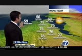
60s east bay shore. 70s, a few 80s into the east bay valleys, mid to upper 70s, morgan hill, gilroy, hollistereed sunglasses and also a broom if you are going to the game, fourth game we've won the first three, 12:45 first pitch, breezy up to 65° by the time the game ends. low pressure will start to move off to the north tonight sea breeze relaxes that's why tomorrow and saturday will be two to six degrees warmer maybe eight degrees inland that's why temperatures will be a little warmer. cooling trend sunday, slow warming for monday, tuesday and once day. here's sue. >>> good morning. -- bay bridge, 80 westbound past golden gate fields, estuary into the macarthur maze in sluggish traffic once you get to the bay bridge reports of a stall incline past metering lights blocking right lane so traffic there as well. elsewhere, southbound 101 through san rafael lucas valley road towards the civic center, traffic is a bit bumper-to-bumper towards the 580 into southern marin. problem on the peninsula north 101 near embarcadero road exit, overturn possible in one of the lanes, chp en route, slow residua
60s east bay shore. 70s, a few 80s into the east bay valleys, mid to upper 70s, morgan hill, gilroy, hollistereed sunglasses and also a broom if you are going to the game, fourth game we've won the first three, 12:45 first pitch, breezy up to 65° by the time the game ends. low pressure will start to move off to the north tonight sea breeze relaxes that's why tomorrow and saturday will be two to six degrees warmer maybe eight degrees inland that's why temperatures will be a little warmer....
209
209
Sep 10, 2012
09/12
by
KGO
tv
eye 209
favorite 0
quote 0
berkeley 71, 78 castro valley inland mid to upper 80s, 83 dublin, brentwood 88 morgan hill, gilroy hollister0s monterey bay clouds monterey carmel and pacific grove mid 60s cloud cover tonight along the coast drizzle possible around half moon bay and pacifica, around the bay, clear inland 4 4s r, 46 napa, 49 -- san rafael, cool start to tomorrow morning. dry air and sunshine tomorrow, temperatures a -- maybe one to two degrees warmer bay and coast, 90s inland wednesday through sunday low to mid 80s around the bay mid 60s coast. >>> good morning. back to the san mateo bridge westbound direction brake lights because on the highrise we have a stall lane number three beginning to slow now westbound. eastbound is fine from foster to hayward. macarthur maze flowing smoothly from 880, 580 and 80 into the bay bridge toll, no metering lights so far, you can see traffic flowing nicely as you head through metering lights up the incline section into san francisco. some areas of concern eastbound highway 4 loveridge lanes blocked due to roadwork detour in place that should be picked up in a couple of min
berkeley 71, 78 castro valley inland mid to upper 80s, 83 dublin, brentwood 88 morgan hill, gilroy hollister0s monterey bay clouds monterey carmel and pacific grove mid 60s cloud cover tonight along the coast drizzle possible around half moon bay and pacifica, around the bay, clear inland 4 4s r, 46 napa, 49 -- san rafael, cool start to tomorrow morning. dry air and sunshine tomorrow, temperatures a -- maybe one to two degrees warmer bay and coast, 90s inland wednesday through sunday low to mid...
238
238
tv
eye 238
favorite 0
quote 0
shore, from 70 berkeley, 81 fremont inland low to mid 90s here and mid to upper 80s morgan hill, gilroy, hollisterid 60s to 70 monterey bay. tonight cloud cover moisture keeping news the mid 50s to mid 60s. we have an upper level low developing to our west had been bringing us a very dry pattern now we have moisture starting to move in and because of that moisture, we are going to see scattered thunderstorms develop. the best chance during the morning is over the ocean i think that will dry up and during the afternoon we'll start to see more storms over land those will fade overnight with more storms developing over the ocean and then again tomorrow we'll repeat with more storms developing over land. after tomorrow temperatures close to average dry friday through tuesday. have a great day. >>> chp going to do a traffic break highway 80 near highway 12 because of hay in the lanes. drivers will be slowing there. accident first reported northbound 17 santa cruz at laurel so far doesn't show significant slowing we'll keep our eye on that. san mateo bridge westbound towards the highrise traffic getting
shore, from 70 berkeley, 81 fremont inland low to mid 90s here and mid to upper 80s morgan hill, gilroy, hollisterid 60s to 70 monterey bay. tonight cloud cover moisture keeping news the mid 50s to mid 60s. we have an upper level low developing to our west had been bringing us a very dry pattern now we have moisture starting to move in and because of that moisture, we are going to see scattered thunderstorms develop. the best chance during the morning is over the ocean i think that will dry up...
445
445
tv
eye 445
favorite 0
quote 0
beaches. 70 richmond, 78 fremont and castro valley inland mid to upper 80s, a few 80s morgan hill, gilroy hollister mid 60s to mid 70s monterey to santa cruz. tonight more clouds bay and coast 50s, santa rosa 48°. smooth sailing near normal inland and around the bay mid 80s to mid 70s slightly cooler than average along the coast with mid to upper 50s. >>> good morning many back to the santa cruz mountains hot spot, southbound 17 remains closed at bear creek road overnight big rig tanker fire and accident has lanes still closed southbound. northbound is getting through. southbound alternate would be old santa cruz highway or highway 92 from san mateo up and over to half moon bay highway 1 towards santa cruz. terry mcsweeney is there on the scene we'll get an update from him in a little bit. he's telling us the chp are hoping to have the southbound lanes open before 6:00 this morning, certainly by 6:00 is the hope. elsewhere issue in oakland with "sig alert" by the chp 580 east the macarthur off-ramp closed due to police activity west macarthur closed between market and san pablo they are asking folk
beaches. 70 richmond, 78 fremont and castro valley inland mid to upper 80s, a few 80s morgan hill, gilroy hollister mid 60s to mid 70s monterey to santa cruz. tonight more clouds bay and coast 50s, santa rosa 48°. smooth sailing near normal inland and around the bay mid 80s to mid 70s slightly cooler than average along the coast with mid to upper 50s. >>> good morning many back to the santa cruz mountains hot spot, southbound 17 remains closed at bear creek road overnight big rig...
211
211
Sep 18, 2012
09/12
by
KGO
tv
eye 211
favorite 0
quote 0
up to mid 80s. 80 morgan hill, gilroy. 77 hollister. around the monterey bay. 85 l.a., 77 san diego. cooler weather moved into the central valley this morning will stay there mid to upper 80s. did you dress properly for the game last night? dress the same way tonight 57 dropping to 53 between 7:15 and 10:00 at at&t4 park. 50s with cloudy conditions upper 40s around santa rosa and napa. area of low pressure as long as it keeps this sea breeze coming the temperatures will be pushed below arm. we'll see a little warming trend thursday through saturday astronomical fall begins. sunday and monday are going to be cooler, temperatures below average everyday, possibly saturday. >>> right now, a new update from robin roberts. she wrote in her blog, she has her final chemo today. a rest day tomorrow and thursday she will have her transplant. this is a picture from last week when she threw a party for her gma family before checking into the hospital. she writes: the start of last week went well, chemo caught up to me by the weekend. my body is so
up to mid 80s. 80 morgan hill, gilroy. 77 hollister. around the monterey bay. 85 l.a., 77 san diego. cooler weather moved into the central valley this morning will stay there mid to upper 80s. did you dress properly for the game last night? dress the same way tonight 57 dropping to 53 between 7:15 and 10:00 at at&t4 park. 50s with cloudy conditions upper 40s around santa rosa and napa. area of low pressure as long as it keeps this sea breeze coming the temperatures will be pushed below...
228
228
Sep 11, 2012
09/12
by
KGO
tv
eye 228
favorite 0
quote 0
more sunshine santa cruz 72, still stuck with clouds monterey and 63 inland 80s morgan hill, gilroy and hollisteround the state later today, watch out for thunderstorms upon in the sierra more likely down south, two days in a row record rains in southern california mainly clear through the central valley, 90s. tonight cooler , temperatures in the 50s, cloud cover, more so around the bay than this morning, definitely out to the coast fog north bay valleys santa cruz 48° cooler nights are getting loner 40s becoming more dominant north bay valleys. high pressure to our west small branch will break off this tonight today clouds clinging to the coast during the afternoon evening hours and overnight when the high develops starts to dip down a little closer to us by noon tomorrow clouds start erasing from the coast then gone for the most part during the afternoon that land breeze going to scare away includes that's why we'll be warmest tomorrow, thursday and friday at the coast middle 60s to around 70° warmest thursday, friday bay, low 80s, warmest thursday through saturday inland mid 90s. >> late summe
more sunshine santa cruz 72, still stuck with clouds monterey and 63 inland 80s morgan hill, gilroy and hollisteround the state later today, watch out for thunderstorms upon in the sierra more likely down south, two days in a row record rains in southern california mainly clear through the central valley, 90s. tonight cooler , temperatures in the 50s, cloud cover, more so around the bay than this morning, definitely out to the coast fog north bay valleys santa cruz 48° cooler nights are...
235
235
Sep 11, 2012
09/12
by
KOFY
tv
eye 235
favorite 0
quote 0
more sunshine santa cruz 72, still stuck with clouds monterey and 63 inland 80s morgan hill, gilroy and hollisternd the state later today, watch out for thunderstorms upon in the sierra more likely down south, two days in a row record rains in southern california mainly clear through the central valley, 90s. tonight cooler , temperatures in the 50s, cloud cover, more so around the bay than this morning, definitely out to the coast fog north bay valleys santa cruz 48° cooler nights are getting loner 40s becoming more dominant north bay valleys. high pressure to our west small branch will break off this tonight today clouds clinging to the coast during the afternoon evening hours and overnight when the high develops starts to dip down a little closer to us by noon tomorrow clouds start erasing from the coast then gone for the most part during the afternoon that land breeze going to scare away includes that's why we'll be warmest tomorrow, thursday and friday at the coast middle 60s to around 70° warmest thursday, friday bay, low 80s, warmest thursday through saturday inland mid 90s. >> late summer
more sunshine santa cruz 72, still stuck with clouds monterey and 63 inland 80s morgan hill, gilroy and hollisternd the state later today, watch out for thunderstorms upon in the sierra more likely down south, two days in a row record rains in southern california mainly clear through the central valley, 90s. tonight cooler , temperatures in the 50s, cloud cover, more so around the bay than this morning, definitely out to the coast fog north bay valleys santa cruz 48° cooler nights are getting...
241
241
Sep 18, 2012
09/12
by
KOFY
tv
eye 241
favorite 0
quote 0
up to mid 80s. 80 morgan hill, gilroy. 77 hollister. around the monterey bay. 85 l.a., 77 san diego. cooler weather moved into the central valley this morning will stay there mid to upper 80s. did you dress properly for the game last night? dress the same way tonight 57 dropping to 53 between 7:15 and 10:00 at at&t4 park. 50s with cloudy conditions upper 40s around santa rosa and napa. area of low pressure as long as it keeps this sea breeze coming the temperatures will be pushed below arm. we'll see a little warming trend thursday through saturday astronomical fall begins. sunday and monday are going to be cooler, temperatures below average everyday, possibly saturday. >>> right now, a new update from robin roberts. she wrote in her blog, she has her final chemo today. a rest day tomorrow and thursday she will have her transplant. this is a picture from last week when she threw a party for her gma family before checking into the hospital. she writes: the start of last week went well, chemo caught up tome the weekend. my body is so wea
up to mid 80s. 80 morgan hill, gilroy. 77 hollister. around the monterey bay. 85 l.a., 77 san diego. cooler weather moved into the central valley this morning will stay there mid to upper 80s. did you dress properly for the game last night? dress the same way tonight 57 dropping to 53 between 7:15 and 10:00 at at&t4 park. 50s with cloudy conditions upper 40s around santa rosa and napa. area of low pressure as long as it keeps this sea breeze coming the temperatures will be pushed below...
207
207
Sep 10, 2012
09/12
by
KGO
tv
eye 207
favorite 0
quote 0
upper 80s east bay valleys, 66 monterey, 77 santa cruz and 80s inland around morgan hill, gilroy and hollisterid 80s temperatures keep getting warmer will hold on through saturday and sunday a lot of inthese inland, 80s bay, 60s coast. >>> good morning. back to hayward accident on 880 near davis industrial -- off to the shoulder good news hopefully getting that cleared out. eastbound 4 continuing with lanes blocked for roadwork, a few more minutes there. they have a detour in place, north 880 at high, more construction until 5:00. once again, hopefully that is on time many marin north 101 sir francis drake, i saw this coming in, lane blocked on the right, that should be picked up by 6:00 this morning hopefully on time. san mateo bridge a few taillights westbound towards the highrise and foster city no problems headlights in the eastbound direction towards hayward southbound 680 towards highway 24 on to the san ramon valley everything good into the dublin-pleasanton interchange. >>> excited to welcome a new show to our afternoon line-up today. katie premieres 3:00 right here on abc7. this after
upper 80s east bay valleys, 66 monterey, 77 santa cruz and 80s inland around morgan hill, gilroy and hollisterid 80s temperatures keep getting warmer will hold on through saturday and sunday a lot of inthese inland, 80s bay, 60s coast. >>> good morning. back to hayward accident on 880 near davis industrial -- off to the shoulder good news hopefully getting that cleared out. eastbound 4 continuing with lanes blocked for roadwork, a few more minutes there. they have a detour in place,...
323
323
Sep 28, 2012
09/12
by
KGO
tv
eye 323
favorite 0
quote 0
today, low to mid 70s most of the east bay shore, 80s and 90s like yesterday, low to mid 80s hollister, gilroymorgan hill, out to the coliseum arblg's take on mariners still in the wild card, -- 61 dropping to 56° if you are heading out of town we are going to start off tomorrow with a little fog low to mid 50s this is as cool as it gets overnight sunday night into monday morning saturday night into sunday morning not quite as comfortable. temperatures reach 80s, 90s southern california even 100s next week tahoe mid 70s, chance of thunderstorms today. pushing the 100s inland by sunday. how would you like to win $49,000? >> yes please. >> go to our facebook page and like us click the win $49,000 button to enter we'll announce the winner october 18th, after the game right here. if you already like us g to our page and click that $49,000 button that will take you to the page where you can fill out the entry form. >>> with when we come back, we have breaking news. >>> major car crash >>> a crash involving multiple cars sent five people to the hospital. >> this happened a short time ago at 14th and
today, low to mid 70s most of the east bay shore, 80s and 90s like yesterday, low to mid 80s hollister, gilroymorgan hill, out to the coliseum arblg's take on mariners still in the wild card, -- 61 dropping to 56° if you are heading out of town we are going to start off tomorrow with a little fog low to mid 50s this is as cool as it gets overnight sunday night into monday morning saturday night into sunday morning not quite as comfortable. temperatures reach 80s, 90s southern california even...
195
195
Sep 28, 2012
09/12
by
KOFY
tv
eye 195
favorite 0
quote 0
today, low to mid 70s most of the east bay shore, 80s and 90s like yesterday, low to mid 80s hollister, gilroy, morgan hill, out to the coliseum arblg's take on mariners still in the wild card, -- 61 dropping to 56° if you are heading out of town we are going to start off tomorrow with a little fog low to mid 50s this is as cool as it gets overnight sunday night into monday morning saturday night into sunday morning not quite as comfortable. temperatures reach 80s, 90s southern california even 100s next week tahoe mid 70s, chance of thunderstorms today. pushing the 100s inland by sunday. how would you like to win $49,000? >> yes please. >> go to our facebook page and like us click the win $49,000 button to enter we'll announce the winner october 18th, after the game right here. if you already like us g to our page and click that $49,000 button that will take you to the page where you can fill out the entry form. >>> with when we come back, we have breaking news. >>> a crash involving multiple cars sent five people to the hospital. >> this happened a short time ago at 14th and franklin near cit
today, low to mid 70s most of the east bay shore, 80s and 90s like yesterday, low to mid 80s hollister, gilroy, morgan hill, out to the coliseum arblg's take on mariners still in the wild card, -- 61 dropping to 56° if you are heading out of town we are going to start off tomorrow with a little fog low to mid 50s this is as cool as it gets overnight sunday night into monday morning saturday night into sunday morning not quite as comfortable. temperatures reach 80s, 90s southern california even...
0
0.0
Sep 28, 2012
09/12
by
KGO
tv
eye 0
favorite 0
quote 1
monterey bay mid to upper 60s inland 80s around morgan hill, gilroy and hollister. three hottest days tomorrow, sunday and monday many inlaid mid 90s to near 100 monday, mid 80s to near 90 bay, mid 70s coast, heat could be a little dangerous especially santa clara valley by sunday. >>> good morning. 80 berkeley east shore freeway beginning to up a little crowded speeds there, a little slow speeds i should say traffic moving as you need macarthur maze eastbound at carquinez bridge three place blocked with roadwork will not be picked up until 8:00 this morning eastbound. here's a look at toll plaza bumper-to-bumper metering lights on, sluggish traffic into san francisco, good news san jose southbound 880 to the alameda accident cleared, traffic getting by. mass transit everybody on time. critical mass at 6:00, you will find delays kicking off at justin herman plaza we have a great way for to you get around some of these delays this weekend with the waze app this is san jose now it is a free app you can communicate with other traffic spotters and download it at abc7new
monterey bay mid to upper 60s inland 80s around morgan hill, gilroy and hollister. three hottest days tomorrow, sunday and monday many inlaid mid 90s to near 100 monday, mid 80s to near 90 bay, mid 70s coast, heat could be a little dangerous especially santa clara valley by sunday. >>> good morning. 80 berkeley east shore freeway beginning to up a little crowded speeds there, a little slow speeds i should say traffic moving as you need macarthur maze eastbound at carquinez bridge three...
426
426
Sep 27, 2012
09/12
by
KGO
tv
eye 426
favorite 0
quote 1
to upper 60s along the coast into san francisco, 65 monterey, 75 santa cruz mid to upper 80s hollister, gilroyorgan hill. hottest days tomorrow, saturday, sunday, mid to upper 90s inland near 90 bay sunday mid 70s at the coast. going to be a delightful weekend if you like the heat. here's sue. >>> good morning. nice ride as early as it is, live look at the macarthur maze, 80 westbound funneling in, 880, 580 coming in nicely. bay bridge toll virtually nobody coming into the city at this hour, very light as you head in no metering lights, light on the upper deck to southern is county west 152 at dinosaur point road an accident injury accident blocking left lane. west dumbarton continues roadwork, a little slow traffic headed from newark towards the menlo park area. eastbound san mateo bridge, foster city boulevard towards flat section roadwork there. giants game, ferry no delays now expect crowds on that 11:10 and 11:40 a.m. ferry even though they are going the giants ferry, these ferries otherwise sell-out. give yourself plenty of time. returning from the city 4:25 and 5:25 larkspur ferry tend
to upper 60s along the coast into san francisco, 65 monterey, 75 santa cruz mid to upper 80s hollister, gilroyorgan hill. hottest days tomorrow, saturday, sunday, mid to upper 90s inland near 90 bay sunday mid 70s at the coast. going to be a delightful weekend if you like the heat. here's sue. >>> good morning. nice ride as early as it is, live look at the macarthur maze, 80 westbound funneling in, 880, 580 coming in nicely. bay bridge toll virtually nobody coming into the city at this...
238
238
Sep 25, 2012
09/12
by
KGO
tv
eye 238
favorite 0
quote 0
fog this morning around watsonville, sun 67 this afternoon, 73 santa cruz upper 70s to mid 80s hollister, gilroy and morgan hill. tomorrow the coolest day. wind shift thursday, friday temperatures from 8 to 10° warmer. that does stretch all the way out to the coast. warm coastal weekend may have it in the forecast. here's sue with traffic. >>> good morning. san mateo bridge we have overnight roadwork in lanes. traffic flowing nicely from the hayward side towards foster city roadwork picked up in a few minutes many eastbound looking good, no fog on the san mateo bridge. south 101 through san rafael past lucas valley road light towards the civic center. southern marin there is delays due to fog and roadwork in the northbound direction. not the commute direction near sir francis drake northbound. toll plaza light, metering lights off. roadwork northbound around greenbrae a little in cortamadera scheduled to pick up about 6:00 this morning northbound. nice commute out of the central valley up and over the altamont pass into the dublin-pleasanton area. looking good, no delays, no slow traffic at this
fog this morning around watsonville, sun 67 this afternoon, 73 santa cruz upper 70s to mid 80s hollister, gilroy and morgan hill. tomorrow the coolest day. wind shift thursday, friday temperatures from 8 to 10° warmer. that does stretch all the way out to the coast. warm coastal weekend may have it in the forecast. here's sue with traffic. >>> good morning. san mateo bridge we have overnight roadwork in lanes. traffic flowing nicely from the hayward side towards foster city roadwork...
198
198
Sep 17, 2012
09/12
by
KGO
tv
eye 198
favorite 0
quote 0
cooler air directions, so all of this will slowly move inland inland over toward gilroy and hollisters reporting overcast conditions and even throughout the salinas valley. keep that in mind if you have early-morning travel. here is current readings, 64 in antioch and 53 in san francisco. it is 50 already in santa rosa and getting ready for a chilly temperature or a chilly night there temperature wise and 57 in san jose. we will go with low clouds moving inland and the cooler trend will begin for the bay area tomorrow and linger through midweek. and then after that we will warm up slightly by the latter part of the workweek. this is 5:00 a.m. tomorrow morning and you will notice unlike today with the stronger westerly winds, the overcast, the marine layer is going to move further inland. concord, walnut creek and maybe as far east as danville, you will probably wake up to the overcast, looking for mist and drizzle near the coast. 8:00, 9:00 tomorrow most of this peels back to the coast. we will keep it foggy and temperatures in the 50s. 60s around the bay. 70s and things are cooling d
cooler air directions, so all of this will slowly move inland inland over toward gilroy and hollisters reporting overcast conditions and even throughout the salinas valley. keep that in mind if you have early-morning travel. here is current readings, 64 in antioch and 53 in san francisco. it is 50 already in santa rosa and getting ready for a chilly temperature or a chilly night there temperature wise and 57 in san jose. we will go with low clouds moving inland and the cooler trend will begin...
301
301
Sep 17, 2012
09/12
by
KGO
tv
eye 301
favorite 0
quote 0
over toward gilroy and hollister is reporting overcast conditions and even throughout the salinas valleykeep that in mind if you have early-morning travel. here is current readings, 64 in antioch and 53 in san francisco. it is 50 already in santa rosa and getting ready for a chilly temperature or a chilly night there temperature wise and 57 in san jose. we will go with low clouds moving inland and the cooler trend will begin for the bay area tomorrow and linger through midweek. and then after that we will warm up slightly by the latter part of the workweek. this is 5:00 a.m. tomorrow morning and you will notice unlike today with the stronger westerly winds, the overcast, the marine layer is going to move further inland. concord, walnut creek and maybe as far east as danville, you will probably wake up to the overcast, looking for mist and drizzle near the coast. 8:00, 9:00 tomorrow most of this peels back to the coast. we will keep it foggy and temperatures in the 50s. 60s around the bay. 70s and things are cooling down inland out tore -- out toward livermore and concord. and then we wil
over toward gilroy and hollister is reporting overcast conditions and even throughout the salinas valleykeep that in mind if you have early-morning travel. here is current readings, 64 in antioch and 53 in san francisco. it is 50 already in santa rosa and getting ready for a chilly temperature or a chilly night there temperature wise and 57 in san jose. we will go with low clouds moving inland and the cooler trend will begin for the bay area tomorrow and linger through midweek. and then after...
447
447
tv
eye 447
favorite 0
quote 0
tomorrow morning, followed by plenty of afternoon sunshine. 77-degreesdegrees there, monter, and hollister, gilroyen morgan hill, warming into the 80s. here's a look at my accuweather seven-day forecast. ament warmer on sunday, and then for our labor day we all will start to warm up. warm to mild temperatures, mid-90s inland, 80s around the bay. 60s at the coast. mild to warm again on tuesday, and then the coastal clouds will start to move in on wednesday and thursday, and notice temperatures slowly starting to come down. a great day tomorrow. >> alan: with labor day weekend kicking into high gear, beach goers in cape cod, massachusetts, are thinking twice about the free freshing body surf. a shark scare is heating up, forcing many beaches to close. here's us how swimmers are on alert and close to sure. >> oh, my god. >> it scenes like this, this youtube video of a great white shrk punching on -- shark munching on a seal that has beach officials kicking swimmers out of the water. >> the youtube video recall -- validated concerns. sharkness the 'er. >> thursday, seven grate white sitings in the sam
tomorrow morning, followed by plenty of afternoon sunshine. 77-degreesdegrees there, monter, and hollister, gilroyen morgan hill, warming into the 80s. here's a look at my accuweather seven-day forecast. ament warmer on sunday, and then for our labor day we all will start to warm up. warm to mild temperatures, mid-90s inland, 80s around the bay. 60s at the coast. mild to warm again on tuesday, and then the coastal clouds will start to move in on wednesday and thursday, and notice temperatures...
211
211
Sep 19, 2012
09/12
by
KGO
tv
eye 211
favorite 0
quote 0
inland mid 70s for hollister, morgan hill and gilroy.o upper 80s sacramento, chico feeling cooling effect of the sea breeze. 105 palm springs, 86 l.a.. back home rockies and giants tonight another cool breezy night 7:15, 58° dropping to 54. 40s north bay valleys tonight rest of us low to mid 50s with cloud cover low staying west and tomorrow start to move a little friday and saturday, brief warming trend before cooler weather rolls in for the first day of astronomical autumn sunday, monday, tuesday. >>> back to vallejo where the chp has issued a "sig alert" a chase this morning around 3 a.m., sheriff collided with a big rig that big rig remains in lane two eastbound 37 past wilson. slow traffic past the scene there. chp advising that you stay out of that area, if you can for now and expect delays. we will be following it throughout the morning. eastbound 4 with roadwork still happening at loveridge should be picked up by 5:30, detour in place. drive out of tracy from 205 looking good, no major delays up and over the altamont just 15 minu
inland mid 70s for hollister, morgan hill and gilroy.o upper 80s sacramento, chico feeling cooling effect of the sea breeze. 105 palm springs, 86 l.a.. back home rockies and giants tonight another cool breezy night 7:15, 58° dropping to 54. 40s north bay valleys tonight rest of us low to mid 50s with cloud cover low staying west and tomorrow start to move a little friday and saturday, brief warming trend before cooler weather rolls in for the first day of astronomical autumn sunday, monday,...
299
299
Sep 15, 2012
09/12
by
KGO
tv
eye 299
favorite 0
quote 0
mid-70s santa cruz and upper 80s in gilroy with 86 in hollister.veryone has been talking about the a's. and tonight, 6:05, 62 degrees with the fog beginning to creep back across the bay. upper 50s by about 10:00. and the cool down starts tomorrow. it's kind of been like this the past couple of weekend. we will see the cool weather leng are into the early part of the week. but it's really how long that fog lasts in the morning. today about 10:00, 11:00. >> lisa, thanks a lot. dan harris joins us now from new york to tell us what is coming up at 7:00 on "good morning america." good morning to you, dan. >> hey, terry, good morning to you. coming up, overnight, the man suspected of making that low budget anti-islam film that's set the muslim world on fire was picked up for police questioning. he wrapped a towel around his face as they put him in the car. as we are learning new details, we are also learning new details about the attack on an american base in afghanistan, which now appears to be part of the backlash that's spread to 31 countries. high te
mid-70s santa cruz and upper 80s in gilroy with 86 in hollister.veryone has been talking about the a's. and tonight, 6:05, 62 degrees with the fog beginning to creep back across the bay. upper 50s by about 10:00. and the cool down starts tomorrow. it's kind of been like this the past couple of weekend. we will see the cool weather leng are into the early part of the week. but it's really how long that fog lasts in the morning. today about 10:00, 11:00. >> lisa, thanks a lot. dan harris...
245
245
Sep 12, 2012
09/12
by
KGO
tv
eye 245
favorite 0
quote 1
near 80 east bay valleys me 80s dublin to near 90 antioch and brentwood low 80s around hollister mid to upper 80s gilroy morgan hill, mid 60s monterey, carmel and pacific grove few clouds in the afternoon high pressure compresses marine layer tonight best chance of clouds along the coast and fog north bay where santa cruz is the cool spot 49 most of us low to upper 50s area of high pressure while were you sleeping it expanded up to the north and down to the south moving into northern california right now the offshore flow is i think we'll have a better chance of seeing that offshore flow tomorrow today just squashing the marine layer that's why we'll see more sun at the coast. the warmest weather hits the coast tomorrow with light offshore wind still warm friday, saturday by sunday temperatures in the low 60s at coast upper 70s bay upper 80s inland where we'll hang out monday and tuesday of next week. >>> live now to walnut creek, from concord pleasant hill south on 680 just a few brake lights towards highway 24 traffic flowing nicely, no problems or delays through the rest of the san ramon valley to th
near 80 east bay valleys me 80s dublin to near 90 antioch and brentwood low 80s around hollister mid to upper 80s gilroy morgan hill, mid 60s monterey, carmel and pacific grove few clouds in the afternoon high pressure compresses marine layer tonight best chance of clouds along the coast and fog north bay where santa cruz is the cool spot 49 most of us low to upper 50s area of high pressure while were you sleeping it expanded up to the north and down to the south moving into northern california...
59
59
Sep 14, 2012
09/12
by
KNTV
tv
eye 59
favorite 0
quote 0
i have to take you down to gilroy because i just heard that highway 25, hollister road, it is closed for the time being after a deadly accident at bloomfield. that is south of 152. 152 is a good alternate and it takes you over toward high 5. if you're going to l.a., that is clear. now a look at the bay bridge toll plaza because it's friday but we still have your backups. here's the toll plaza, here are the low clouds but the east shore freeway, it's good. back to you. >> okay, thank you. >>> a southern california football powerhouse is coming to stanford this weekend. >> that is right. that means the fans are coming along and nobody is happier than our producer, caitlin. she's a big usc trojan. stanford and san francisco abrasion for the weekender. this is an annual usc tradition where all the fans caravan up to the bay area to watch the game. from past experience when they take on the stanford cardinal, yeah, the san francisco marina district and downtown palo alto will be the hot spots. tomorrow's kickoff if you plan on tuning in, kickoff is at 4:30. >> we've got college football a
i have to take you down to gilroy because i just heard that highway 25, hollister road, it is closed for the time being after a deadly accident at bloomfield. that is south of 152. 152 is a good alternate and it takes you over toward high 5. if you're going to l.a., that is clear. now a look at the bay bridge toll plaza because it's friday but we still have your backups. here's the toll plaza, here are the low clouds but the east shore freeway, it's good. back to you. >> okay, thank you....
103
103
Sep 27, 2012
09/12
by
KNTV
tv
eye 103
favorite 0
quote 0
gilroy recommendigistering i hundre of feet. the orange shows mist and low visibility affecting the speeds for your drive. 152 an 101 as well heading over towards hollister. live look over on the peninsula shows you quite the contrary, a clear view. just checking the volume. northbound with the taillights. no slowing up through san mateo but watch for fog along the coast as well. back to you. >> maybe watch out for some flooding too. >>> coming up, the south bay under water. it's an alarming risk that could submerge parts of santa clara county if the big one hits. >>> the actress in that controversial youtube video sues in court. we'll take a look at the case coming up. >>> right now a live look downtown san jose. the weather forecast going to get hot. the forecast for the sun, it should be coming up soon. we're back in a matter of minutes. i'm a professional stylist but styling my friend's is my favorite. they all love the latest trends but none of them want to pay full price. they each have their own unique style, so t.j.maxx is a great place because they have such an incredible mix of designers for so much less than the department stores. when my frie
gilroy recommendigistering i hundre of feet. the orange shows mist and low visibility affecting the speeds for your drive. 152 an 101 as well heading over towards hollister. live look over on the peninsula shows you quite the contrary, a clear view. just checking the volume. northbound with the taillights. no slowing up through san mateo but watch for fog along the coast as well. back to you. >> maybe watch out for some flooding too. >>> coming up, the south bay under water. it's...
206
206
Sep 24, 2012
09/12
by
KGO
tv
eye 206
favorite 0
quote 0
low to mid 80s morgan hill, gilroy and hollister. today is the beginning of the cooling trend. we drop one to two degrees tomorrow, minor cooling, likely coolest day wednesday we turn that around with a warming trend thursday. could see 90s back in the forecast for the weekend. first an update from sue. >>> back out to the pleasanton area. southbound 680 "sig alert" in effect all lanes shutdown due to fatal accident. with the waze app traffic bagging towards al costa standstill as you can see. the best way around is westbound 580 to foothill to stoneridge back on to southbound 680 beyond that scene if you want to avoid 680 coming from the pittsburg/ antioch area take eastbound 4 that will get you to basco road into livermore. this is earlier video from the scene southbound 680 shutdown at stoneridge until further notice. traffic light, intersection mission and tennison in hayward shutdown due to police activity. >> 5:08. >> want to correct ourselves with the giants' score last night 6-4, not 5-3. the difference is the same. >> like that it was a star-studded night at the emmys.
low to mid 80s morgan hill, gilroy and hollister. today is the beginning of the cooling trend. we drop one to two degrees tomorrow, minor cooling, likely coolest day wednesday we turn that around with a warming trend thursday. could see 90s back in the forecast for the weekend. first an update from sue. >>> back out to the pleasanton area. southbound 680 "sig alert" in effect all lanes shutdown due to fatal accident. with the waze app traffic bagging towards al costa...
 Live Music Archive
 Librivox Free Audio
 Metropolitan Museum
 Cleveland Museum of Art
 Internet Arcade
 Console Living Room
 Open Library
 American Libraries
 TV News
 Understanding 9/11