235
235
Sep 13, 2011
09/11
by
KNTV
tv
eye 235
favorite 0
quote 0
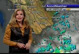
but look what's happening in the sierra, nonstop flood watches up and down the sierra. thunderstorms large thuf with strong updrafts to drop golf ball-sized hail north of i-80. hopefully that stays awayth fro ate.inter imagine driving freeway speed and hitting hail. areas south toward monterey along the coastal range, because there's a little less msture if some of those showers have fired up this afternoon. lightning bolts, that unfortunately can spark fires. we're watching that to our south. notice the movement on the moisture trying to creep toward the north bay. be watching this tonight. tomorrow morning, variable clouds, mainly drizzle from the low clouds we typically see. as we head toward the afternoon, not too bad. numbers in the mid 80s inland again for the tri-valley. 65 san francisco. temperatures the next few days not going to change a whole lot. the second half of the week, stronger sea breeze will also mean those thunderstorms in the sierra should move further east. >> is this normal for the end of summer? >> for this pattern, typically we might see this c
but look what's happening in the sierra, nonstop flood watches up and down the sierra. thunderstorms large thuf with strong updrafts to drop golf ball-sized hail north of i-80. hopefully that stays awayth fro ate.inter imagine driving freeway speed and hitting hail. areas south toward monterey along the coastal range, because there's a little less msture if some of those showers have fired up this afternoon. lightning bolts, that unfortunately can spark fires. we're watching that to our south....
293
293
Sep 12, 2011
09/11
by
KGO
tv
eye 293
favorite 0
quote 0
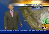
let's talk about the sierra.f you are headed that way, all areas are shaded in green, that a floor flood watch this afternoon into the evening hours because of the thunderstorms that will develop. the inch per hour could drop and mudslides and flash flooding that could develop. let's talk temperatures, here is how mild. we have 54 in mountain view and san jose. just about everybody else in upper 50s to low 60s. santa rosa, 56. monterey bay, inland, still everybody at 56 degrees. here at three things i want you to know. partially cloudy and warmer inland. the sierra storms and flooding for today, we'll have more storms in the sierra tomorrow. warmer everywhere as we head throughout tomorrow and wednesday. looks like inland we'll see the biggest jump. concord and santa rosa, 9 degrees warmer than yesterday. fremont about 3. oakland 1. one to two gris cooler in san jose and also into san francisco. let's take a look down in the south bay, we have temperatures near 80 in campbell. los gatos, 79. san jose, and everybo
let's talk about the sierra.f you are headed that way, all areas are shaded in green, that a floor flood watch this afternoon into the evening hours because of the thunderstorms that will develop. the inch per hour could drop and mudslides and flash flooding that could develop. let's talk temperatures, here is how mild. we have 54 in mountain view and san jose. just about everybody else in upper 50s to low 60s. santa rosa, 56. monterey bay, inland, still everybody at 56 degrees. here at three...
342
342
Sep 12, 2011
09/11
by
KRON
tv
eye 342
favorite 0
quote 0
the showers are beginning to die down for the sierra. the showers from that storm will be swimming across in the morning. in the afternoon sun was high, thin clouds. showers and thunderstorms are erupting for another day in the sierra. highs will be on the mild side. glow-mid '80s in the east bay. intel will be the norm spot. --antioch will be the morning spot. in san mateo in redwood city in the mid-70s. here is the seventh day around the state. more typical weather returns start and on tuesday. not much change in the temperatures. upper 60s and low '70's with low-mid '80s. >> at least 50 of fires across california. the fires have scorched more than 3 mi. and threatening it doesn't of homes. people are being told to be ready to leave quickly. the most highly anticipated android phone is finally here. and we will see if it is worth the hype. >> to the most highly anticipated android smart phone is finally here. this is detroit biotic. this is the new flagship android smart phones. it is made by motorola. it has a big touchscreen which is
the showers are beginning to die down for the sierra. the showers from that storm will be swimming across in the morning. in the afternoon sun was high, thin clouds. showers and thunderstorms are erupting for another day in the sierra. highs will be on the mild side. glow-mid '80s in the east bay. intel will be the norm spot. --antioch will be the morning spot. in san mateo in redwood city in the mid-70s. here is the seventh day around the state. more typical weather returns start and on...
133
133
Sep 13, 2011
09/11
by
KTVU
tv
eye 133
favorite 0
quote 0
sierra thunderstorms, high clouds occasionally. as you get some of the that tropical feel, morning clouds sin and clouds for inland temperatures, some are running very warm, clouds sun and warmth on the breezy side, antioch at 90 degrees. santa rosa 80 degrees, red wood city 77. the cooling trend comes in on saturday and with your weekend in view sunday does look warmer. >> 455 is the time for the first time the democratic district could vote republican. now they are facing off to fill the congressional seat by anthony weaner and he resigned after sending sexually explicit messages to women online. the numbers include alameda, san francisco and san mateo counties. the new report says there are 4200 fewer government jobs and that's the largest drop for any sector. the number of jobs is growing in san francisco. products include social gaming and organizers say participation has doubled from 2010. >> they are moving to much more high tech jobs and it creates much bigger companies where they can become bigger and it creates jumps as a
sierra thunderstorms, high clouds occasionally. as you get some of the that tropical feel, morning clouds sin and clouds for inland temperatures, some are running very warm, clouds sun and warmth on the breezy side, antioch at 90 degrees. santa rosa 80 degrees, red wood city 77. the cooling trend comes in on saturday and with your weekend in view sunday does look warmer. >> 455 is the time for the first time the democratic district could vote republican. now they are facing off to fill...
269
269
Sep 12, 2011
09/11
by
KGO
tv
eye 269
favorite 0
quote 0
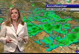
talk about thunderstorms in the sierra and a warming trend in our forecast. >>> good morning. sue hall, traffic center, live shot of the bay bridge, checking monday morning commute. i'll have the details in a few minutes. >>> it is a monday. thank you so much for starting our day with us. i'm kristen sze. >> union city woman accused of killing a former friend out of jealousy is set to try again to make a plea in court today. she will come face to face with the family of a victim nursing student michelle le. >>> family members say they will be here. family has been so dedicated to finding michelle le and so committed to this case even the lieutenant in the case called it one of the most impressive examples of mobilizing in a crisis. the family will be here to watch giselle esteban face the charge against her. there is a chance that she will enter a plea today. esteban told "abc 7 news" she openly hated michelle le but she did not want to have anything to do she did not have anything to do her disappearance. they may have dispute over a man. the father of giselle's five-year-old
talk about thunderstorms in the sierra and a warming trend in our forecast. >>> good morning. sue hall, traffic center, live shot of the bay bridge, checking monday morning commute. i'll have the details in a few minutes. >>> it is a monday. thank you so much for starting our day with us. i'm kristen sze. >> union city woman accused of killing a former friend out of jealousy is set to try again to make a plea in court today. she will come face to face with the family of...
251
251
tv
eye 251
favorite 0
quote 0
low pressure, thunderstorms there in sierras and secondary one will bring more storms to the sierra tomorrow. high fire danger because of the lightning if you are heading that way. back home, we saw fog, three-quarter of a mile, visibility in santa rosa, napa and novato and is on a for most of us. so very mild morning. temperatures close to air-conditioning, low to mid 90s in east bay valleys. parts of the santa clara valley will hit the upper 80s to near 90s. napa 83, santa rosa 87. mid to upper 60s along the coast into san francisco. heading down to the monterey bay not as much sunshine as yesterday. low to mid-70s. accu-weather seven-day forecast, we're up tomorrow by about 2-4 degrees and then we lose about 6 on saturday. another 6 on sunday for our coolest day sunday into monday. >> we have a large piece of metal blocking a couple lanes for commuters on the san mateo bridge, two right lanes blocked at eden landing road. live look in san jose, 280 at 17 overcrossing. problem free on the freeway through the san jose area but we do have a crash to be on the lookout and golden gate bridge,
low pressure, thunderstorms there in sierras and secondary one will bring more storms to the sierra tomorrow. high fire danger because of the lightning if you are heading that way. back home, we saw fog, three-quarter of a mile, visibility in santa rosa, napa and novato and is on a for most of us. so very mild morning. temperatures close to air-conditioning, low to mid 90s in east bay valleys. parts of the santa clara valley will hit the upper 80s to near 90s. napa 83, santa rosa 87. mid to...
279
279
Sep 10, 2011
09/11
by
KGO
tv
eye 279
favorite 0
quote 0
spine sierra, southern sierra, northern sierra, kern county, southern california, risk of showers anderstorms. we saw forward into sunday, not much has changed. back home, still kind of sticky in fresno. hot weather at 97. nice afternoon and few clouds, 80 in santa clara and on the peninsula look for the fog and afternoon sun, late morning sun with 78 in redwood city. in fact brightening up all around the city, 66 this afternoon. 80 in novato. 77 in vallejo. near east bay, 68 in berkeley. nice day as you head towards union city, 79 in fremont and more 90s will prevail, 92 in livermore. 87 in walnut creek. mid-level clouds and light rain, low clouds in terms of fog along the coast and then some decent temperatures, warm temperatures, 80s down around monterey. the coast will be in the mid-60s. as we look ahead, we'll notice the cooler weather will stay with us tomorrow into next week. a little unusual but definitely be careful if you are out there in the north bay and all around in the bay area with the high fire danger. >>> it was a pitching duel between the giants and dodgers at at&t.
spine sierra, southern sierra, northern sierra, kern county, southern california, risk of showers anderstorms. we saw forward into sunday, not much has changed. back home, still kind of sticky in fresno. hot weather at 97. nice afternoon and few clouds, 80 in santa clara and on the peninsula look for the fog and afternoon sun, late morning sun with 78 in redwood city. in fact brightening up all around the city, 66 this afternoon. 80 in novato. 77 in vallejo. near east bay, 68 in berkeley. nice...
434
434
Sep 24, 2011
09/11
by
KSTS
tv
eye 434
favorite 0
quote 0
en los deportes toda la accin de lo que viene con juan carlos sierra.en nuestra versin impresa el fin de semana y en nuestro sitio web elmensajero.c om las 24 horas del da. eso sera todo yo los veo la prxima semana. cu --nos vamos a la pausa, pero antes un adelanto de acceso total con maria cu --nos vamos a la pausa, pero antes un adelanto de acceso total con maria alejandra... take sot mas adelante les cuento con que duo reggaetonero esta grabando k-paz de la sierra y el nuevo escandalo en torno al matrimonio de jlo y ojani noa... segment ends cu --chismes, novedades y noticias del mundo de la farandula con maria alejandra prato esta noche en acceso total.... take pkg )) hola que tal!!! tras superar los problemas legales que tuvieron recientemente los chicos de k paz de la sierra se preparan para grabar nuevo disco...y cuentan con la participacion de un duo reggaetonero... )) se trata de los venezonales chino y nacho quienes se encuentran en la ciudad de monterrey grabando una version duranguense de su mas reciente tema "el poeta..." este tema sera el
en los deportes toda la accin de lo que viene con juan carlos sierra.en nuestra versin impresa el fin de semana y en nuestro sitio web elmensajero.c om las 24 horas del da. eso sera todo yo los veo la prxima semana. cu --nos vamos a la pausa, pero antes un adelanto de acceso total con maria cu --nos vamos a la pausa, pero antes un adelanto de acceso total con maria alejandra... take sot mas adelante les cuento con que duo reggaetonero esta grabando k-paz de la sierra y el nuevo escandalo en...
238
238
Sep 14, 2011
09/11
by
KNTV
tv
eye 238
favorite 0
quote 0
get the idea, the last six hours in the sierra, and along the coastal range. watching clothed building up mainly to the south and east of monterrey. no lightning with those cells in monterrey county to north bay, a few isolated thundershowers but sierras with flash flood watching and as the sun sets the atmosphere will stabilize and it will drift away except for remnant high clouds but another wild afternoon in the sierras. oakland, 66, sea breeze starting to pick up, spilling in low clouds in san francisco. 67 right now. at least temporarily, the marine layer is close to 1,000 feet, still compressed enough to get our inland spots climbing to the 80s. over the next few days, we see this thicken up, which means our temperatures drop off for the second half of the week. a very healthy sea breeze reaching livermore and fairfield and up to 80 miles an hour and some gusts to 75 and the delta cool air-conditioning turns on more strong the next couple of days. good news for air quality. we're back in the green and also a sign of strong onshore winds to keep the level
get the idea, the last six hours in the sierra, and along the coastal range. watching clothed building up mainly to the south and east of monterrey. no lightning with those cells in monterrey county to north bay, a few isolated thundershowers but sierras with flash flood watching and as the sun sets the atmosphere will stabilize and it will drift away except for remnant high clouds but another wild afternoon in the sierras. oakland, 66, sea breeze starting to pick up, spilling in low clouds in...
355
355
Sep 9, 2011
09/11
by
KTVU
tv
eye 355
favorite 0
quote 0
really it's a bigger deal up in the sierra, nevada. not only for the rain but thunderstorm activity up there. for us thick fog and then sunny. a little warmer. there is a westerly breeze. i don't see the northerly wind. if it's a northerly wind i would say it's a lot warmer. it's not happening. 50s to 90s. for some yeah if you get that north wind it will rock it up. for others it will be slightly warmer. high clouds over the weekend. and then sunday mostly cloudy and a big cool down sunday into monday. >> thank you. >>> 4:57. the san bruno pipeline disaster remembered. the events planned today. >>> vandals hit a bart station. we are live at the scene to show you the damage left behind after another long day of protests.
really it's a bigger deal up in the sierra, nevada. not only for the rain but thunderstorm activity up there. for us thick fog and then sunny. a little warmer. there is a westerly breeze. i don't see the northerly wind. if it's a northerly wind i would say it's a lot warmer. it's not happening. 50s to 90s. for some yeah if you get that north wind it will rock it up. for others it will be slightly warmer. high clouds over the weekend. and then sunday mostly cloudy and a big cool down sunday into...
261
261
Sep 12, 2011
09/11
by
KTVU
tv
eye 261
favorite 0
quote 0
today we have a lot of cloud cover just feeling off from the sierra nevada.ost of it is on the north bay, a little bit on the east bay heading to san francisco and south. but it's more low clouds and fog. 63, hayward, mountain view. livermore is 59. 56 napa. 56 san rafael. so temperatures and you can see why, that cloud cover drifting back from east to west -- to west right to us. and then you can see underneath that, there's more low clouds towards the south bay. sun, cloud, possible showers. maybe like we had on friday night. partly cloudy, a thunderstorm threat is there today. more of the same on thursday. and then that low in the gulf of mexico inches closer, bumps it out of here and we'll go into a decent threat. 80s now in lake county, not knows 90s or 100s. same for ukiah. 74 novato. napa 76. walnut creek, 78. antioch, 84 but again a lot of -- a lot of cloud cover will start to drift in. low 80s for the santa clara valley. 60s, 70s along the coast. maybe some 70s towards santa cruz. redwood city, 76. we do have a kim been -- combination of more of the
today we have a lot of cloud cover just feeling off from the sierra nevada.ost of it is on the north bay, a little bit on the east bay heading to san francisco and south. but it's more low clouds and fog. 63, hayward, mountain view. livermore is 59. 56 napa. 56 san rafael. so temperatures and you can see why, that cloud cover drifting back from east to west -- to west right to us. and then you can see underneath that, there's more low clouds towards the south bay. sun, cloud, possible showers....
250
250
tv
eye 250
favorite 0
quote 0
it will be active in sierra with the dry thunderstorms. near hundred around fresno, 108 in palm springs, 84 in l.a. heading to the sierras, chance of thunderstorms about every day. tahoe mid to upper 70s. heading down to southern california, it's going to be rather quiet. temperatures cooling in los angeles in the upper 70s and even some upper 50s in san diego. >>> the nation is on high alert this morning with word of a new al-qaeda not attack new york or washington just two days before the tenth anniversary of the 9/11 terrorist attacks. they say the threat is credible but unconfirmed. now live from washington with the very latest. scott? >> u.s. officials have been bracing for this kind of plot ever since they discovered documents mention ago possible september 11th anniversary attack in osama bin laden's hideout. they are sorting through information the c.i.a. came across in the last two days. >> in the hearts of new york city where police were already on alert. think know are adding extra hours on their shifts. in the capital they are
it will be active in sierra with the dry thunderstorms. near hundred around fresno, 108 in palm springs, 84 in l.a. heading to the sierras, chance of thunderstorms about every day. tahoe mid to upper 70s. heading down to southern california, it's going to be rather quiet. temperatures cooling in los angeles in the upper 70s and even some upper 50s in san diego. >>> the nation is on high alert this morning with word of a new al-qaeda not attack new york or washington just two days...
223
223
Sep 12, 2011
09/11
by
KTVU
tv
eye 223
favorite 0
quote 0
most of us will be up in the sierra and sacramento valley. a very good amount of rainfall in a short amount of time. today again northbound, eastbound you are closer to the peninsula. not much change on tuesday as the low kicks in. the extended wednesday through friday increase in fog and cooler pattern. it's wrapping back around a lot of cloud cover now. they fall apart once you hit sunset. at night you just get the cloud cover. during the afternoon get a little heating. they will start to bubble up again. low responsible for it just sitting there hanging out. but the direction around that is counter clock wise so that takes a lot of the thunderstorms up in the sierra, nevada and drift back toward us. partly cloudy. possible showers and thundershowers slightly warmer for some but not for everybody. 50s and 60s due to the cloud cover be it low or high. we are much warmer than we have been. the live storm tracker two showing a lot of that cloud cover taking aim toward mendocino county and parts of solano and back over toward the city. there is
most of us will be up in the sierra and sacramento valley. a very good amount of rainfall in a short amount of time. today again northbound, eastbound you are closer to the peninsula. not much change on tuesday as the low kicks in. the extended wednesday through friday increase in fog and cooler pattern. it's wrapping back around a lot of cloud cover now. they fall apart once you hit sunset. at night you just get the cloud cover. during the afternoon get a little heating. they will start to...
274
274
Sep 13, 2011
09/11
by
KGO
tv
eye 274
favorite 0
quote 0
we had a muggy day because of the low to the south of us providing heavy rain in the sierra envied. southern california but once that moves out our next focus will be a cooler air mass coming our way. after that we're talking much warmer. 77 fremont. 80 in vallejo and san francisco not clearing all the way today. just sunshine in the financial district. cooler in the days ahead. we're talking a big warmup by the end of the weekend. >> good morning. we've got an issue still in tracy, actually out by the 205 and 580. some slowing from tracy to livermore. mountain parkway, emergency crews on site and sensors, traffic is slowing as you head up to altamont pass. out of antioch, fairly typical. here is a look at key drive times, also up the central valley. >>> just ahead, north bay city that may -- have a problem with dress codes. skirts for the cheerleaders. >> a san jose school and they are cracking down. what do you think? we'll have more. >> and why nobody will be walking across the golden gate bridge for months starting today. c [bell rings] welcome back! this is going to be a great
we had a muggy day because of the low to the south of us providing heavy rain in the sierra envied. southern california but once that moves out our next focus will be a cooler air mass coming our way. after that we're talking much warmer. 77 fremont. 80 in vallejo and san francisco not clearing all the way today. just sunshine in the financial district. cooler in the days ahead. we're talking a big warmup by the end of the weekend. >> good morning. we've got an issue still in tracy,...
196
196
Sep 12, 2011
09/11
by
KGO
tv
eye 196
favorite 0
quote 0
check out the live doppler 7 hd because in the sierra, some strong weather going on. oakland is 70. 73. 72 in antioch. and livermore right now, 74. here's a look at our highlights. i'm going to keep a slight chance, a slight chance of an isolated thunderstorm in our overnight forecast. mainly east bay and south bay locations. on radar you see them talking about it. look for afternoon sunshine tomorrow, and here's a look at live doppler 7 hd. earlier in the day a few cells just rotated back over the bay area. we reported in marin county sprinkles there. you can see where the action is. numerous, hundred opposite -- hundreds of lightning strikes in the sierra, and this is moving 'back towards the west. this is why i'm going to keep a slight chance of an isolated storm in the forecast. the low is going to move to the east and take a lot of it with us. kings beach, south lake tahoe, these thunderstorm cells moving toward rock linn and sacramento. here's a look at the coast. lower pressure just off the southern california coast. you can see the counterclockwise spin, and all of this mois
check out the live doppler 7 hd because in the sierra, some strong weather going on. oakland is 70. 73. 72 in antioch. and livermore right now, 74. here's a look at our highlights. i'm going to keep a slight chance, a slight chance of an isolated thunderstorm in our overnight forecast. mainly east bay and south bay locations. on radar you see them talking about it. look for afternoon sunshine tomorrow, and here's a look at live doppler 7 hd. earlier in the day a few cells just rotated back over...
331
331
Sep 10, 2011
09/11
by
KGO
tv
eye 331
favorite 0
quote 0
a chance of showers into the northern sierra, but a better chance in the southern sierra. the red flag warning is still in effect for the southern sierra. about 1500 feet we have the offshore winds. the next couple hours the chance exists for some dry lightning in the north bay. i said the chance of thunderstorms all weekend long as an area of low pressure continues to set up to the south of monterey county. and with it we are looking at the subtropical moisture being bumped up. a little lift from the low. look at all the activity from santa maria eastward right on through the mountains. we are looking at this wet weather to continue. in fact, rotate to the north. fresno should be getting wet throughout the day today. we will be looking at kind of a muggy day throughout much of the southern sierra, as well. so we will call it partly cloudy in the south bay, but elsewhere sunshine today. it looks like a nice afternoon throughout big sur, 72 there. hot in sacramento at 96. look for the upper 70s to the low 80s for campbell and sunyvale today. peninsula 77 with sunny skies. 7
a chance of showers into the northern sierra, but a better chance in the southern sierra. the red flag warning is still in effect for the southern sierra. about 1500 feet we have the offshore winds. the next couple hours the chance exists for some dry lightning in the north bay. i said the chance of thunderstorms all weekend long as an area of low pressure continues to set up to the south of monterey county. and with it we are looking at the subtropical moisture being bumped up. a little lift...
211
211
Sep 15, 2011
09/11
by
KTVU
tv
eye 211
favorite 0
quote 0
.$♪ slope of the sierra, -- west slope of the sierra, low clouds fog a decent sea breeze for many, itill be a cool blustery day. east southeast at 8:00 and livermore is calm and it is all being helped along curtsey of that front as it approaches us, it has definitely lifted the fog and it is cool aloft. fog sun cooler windy at times a lot of 70s an locations closer to 90s, 60s and 70s and a few 80s inland but not too many and thursday and friday cool but with your weekend always in view, it does look warmer to much warmer heading into saturday sunday and monday. >>> some important questions that still need to be answered, also... >> there is a huge price that was paid for it. >> a rare honor at the white house today for a brave marine but he talks about the tragedy that led up to his heroics. n? . >>> welcome back to the morning news time now 6:12 in just a few hours, president barack obama will present a metal of honor. he will become the first living marine to receive this metal since the vietnam war. he ran through enemy fire to recover the bodies of his fallen comrade two years ag
.$♪ slope of the sierra, -- west slope of the sierra, low clouds fog a decent sea breeze for many, itill be a cool blustery day. east southeast at 8:00 and livermore is calm and it is all being helped along curtsey of that front as it approaches us, it has definitely lifted the fog and it is cool aloft. fog sun cooler windy at times a lot of 70s an locations closer to 90s, 60s and 70s and a few 80s inland but not too many and thursday and friday cool but with your weekend always in view, it...
195
195
Sep 9, 2011
09/11
by
KTVU
tv
eye 195
favorite 0
quote 0
rosemary is watching a possibility of thunderstorms here and lightning strikes in the sierra, she will have the forecast next. >>> and it was an exciting morning at a local school. ahead how today's event is connected to the new remember them statute in oakland. >>> a settlement hearing is underway today on the tanker truck explosion there in 2007. it was so intense it brought down a section of the freeway, they sued the company and the driver, citing more than $17 million for repairs but the company is only able to pay 3 million, u.s. stocks have tumbled av the top german official at the central european bank resigned in protest in the bank bond buying program. taking live look at the big board stocks are down almost 3%, the dow down 325 at 10,971. >>> before the markets opened this morning traders at the new york stock exchange took time to remember the victims of the september 11th attacks. [ singing god bless america ] >> traders joined in to sing god bless america after they stood in silence for a minute. many people on the floor could be seen wiping tears from their eyes, hillary
rosemary is watching a possibility of thunderstorms here and lightning strikes in the sierra, she will have the forecast next. >>> and it was an exciting morning at a local school. ahead how today's event is connected to the new remember them statute in oakland. >>> a settlement hearing is underway today on the tanker truck explosion there in 2007. it was so intense it brought down a section of the freeway, they sued the company and the driver, citing more than $17 million for...
214
214
Sep 8, 2011
09/11
by
KPIX
tv
eye 214
favorite 0
quote 0
more subtropical moisture over the sierra nevada.going to visit us in the next couple of days. 90s inland, 60s at the coastline. cooler weather on the way. let's check traffic with elizabeth. >> thank you. bart is all running on time including those heading into the city. but be prepared. afternoon protest once again planned near the powell street station. they are planning to block the gates there around 5:00. so plan accordingly. and some people may be avoiding bart for that reason. we are expecting extra heavy traffic towards the bay bridge toll plaza. metering lights are off, traffic light heading into the city. be prepared commuting this afternoon. if you are in san francisco, san francisco symphony has various events kicked off last night, continues through friday so expect street closures around the civic center. back to you. >> thank you. >>> it is back on the campaign trail for republican presidential front-runner rick perry this just a day after taking part in his first debate. the texas governor locked horns with former ma
more subtropical moisture over the sierra nevada.going to visit us in the next couple of days. 90s inland, 60s at the coastline. cooler weather on the way. let's check traffic with elizabeth. >> thank you. bart is all running on time including those heading into the city. but be prepared. afternoon protest once again planned near the powell street station. they are planning to block the gates there around 5:00. so plan accordingly. and some people may be avoiding bart for that reason. we...
319
319
Sep 11, 2011
09/11
by
KTVU
tv
eye 319
favorite 0
quote 1
you can't see the live sweep, here is the bulk of the action, out to the sierra, yellows and reds showing, lightning strikes, with that, we would like to watch the fire danger, especially across the sierra, looks like we're getting downpours as well. and a look here at the coast, the fog showing up, with that we cooled off quite a bit today, about 5-10 degrees from yesterday's readings. here is a look at current numbers, 70s, 80s to report. oakland, 65. and mountain view at last check reporting 72 degrees. forecast headlines for tonight. we do have this, fog for the coast, for the bay, partly cloudy skies, tomorrow, a slight chance of thunderstorms tomorrow especially for the bay area hills. next week, temperatures coming up a bit, overnight lows tomorrow morning, muggy out there, humid with that moisture in place, so with that, temperatures in the 50s to right at about 60 degrees, it is a mild start for your sunday morning. san jose, a forecast low of 61 degrees. quite a bit of activity, especially towards southern california as we lost that satellite image. but we have clusters of showe
you can't see the live sweep, here is the bulk of the action, out to the sierra, yellows and reds showing, lightning strikes, with that, we would like to watch the fire danger, especially across the sierra, looks like we're getting downpours as well. and a look here at the coast, the fog showing up, with that we cooled off quite a bit today, about 5-10 degrees from yesterday's readings. here is a look at current numbers, 70s, 80s to report. oakland, 65. and mountain view at last check reporting...
537
537
Sep 11, 2011
09/11
by
KPIX
tv
eye 537
favorite 0
quote 0
they moved automatic us from the sierra, bringing it the afternoon thunderstorms. temperature wise, we were in the upper 80's to low 90s. mid to upper 70's across the north bay, the south bay, san jose got to 86, 66 downtown san francisco, cooler than this tomorrow -- low 60a expected at the beach. the overall pattern hasn't changed much. this system off southern california is generating all the thunderstorm activity that's been taking place across the foothills of the sierra and mainly to our south. we are just on the northern fringe of this, catching a few cells last night and again tonight. possibility with us for this type of development again tomorrow afternoon into tomorrow evening and then pretty well should be gone by the beginning the week as we see most of the clouds moving from east to west through the day tomorrow. clearing out the patchy low cloud cover again. early in the day and once again leaving us with that threat of thunderstorms moving out of the valley toward the bay by late tomorrow afternoon and into tomorrow evening as we will look for tempe
they moved automatic us from the sierra, bringing it the afternoon thunderstorms. temperature wise, we were in the upper 80's to low 90s. mid to upper 70's across the north bay, the south bay, san jose got to 86, 66 downtown san francisco, cooler than this tomorrow -- low 60a expected at the beach. the overall pattern hasn't changed much. this system off southern california is generating all the thunderstorm activity that's been taking place across the foothills of the sierra and mainly to our...
208
208
Sep 5, 2011
09/11
by
KTVU
tv
eye 208
favorite 0
quote 0
it is evaporating and reporting some rain in the sierra.o you see tropical moisture screaming into novato as well. it is a very pronounced sea breeze, gusts to 32 into travis and it tells me it will be hard pressed. 50 on these temperatures. northeast california up in yosemite keeping an eye on the sky and high pressure will build after tomorrow and that will allow warmer conditions but today low clouds local drizzle possible by the coast and the breeze should pick up anywhere from 50s and 60s on the coast and a few 90s. temperatures are held in check due to that fog bank. 86 morgan hill and santa clara as well. 72 san mateo and 74 mountain view and 60 in the city. tomorrow does look warmer away from the coast and about the same on wednesday. another low coming up and we could have partly cloudy skies over the weekend. >>> it is one of the biggest shopping days. anybody who opens a car from another auto maker get the $1,000 bonus. they are also offering more because they are trying to make room for new models. >>> there has been no challeng
it is evaporating and reporting some rain in the sierra.o you see tropical moisture screaming into novato as well. it is a very pronounced sea breeze, gusts to 32 into travis and it tells me it will be hard pressed. 50 on these temperatures. northeast california up in yosemite keeping an eye on the sky and high pressure will build after tomorrow and that will allow warmer conditions but today low clouds local drizzle possible by the coast and the breeze should pick up anywhere from 50s and 60s...
187
187
Sep 13, 2011
09/11
by
KRON
tv
eye 187
favorite 0
quote 0
more over nevada, california and the sierra. we did see one just last week and we could see one again tomorrow just be aware of it. but you will definitely see the fog into tomorrow morning. whites spread all the way through the bay area. we start scaling back to the bayshores by the 10:00 hour and hovering over the 101 as well and also still cooling toward the south bay. finally starting to move its way back to san francisco and the 1:00 hour. the fog is expected to be more dense out there to mark. will not declaring that to the coastline my today. it will also be returning to san francisco quite quickly. temperatures for tomorrow afternoon a very similar to what we saw today. one degree or two degrees warmer or cooler depending on where you are. 78 in san jose, 84 los gatos, '70s for the bayshores, 60s along the coastline, 80's for the inland valleys. 88 in antioch will be the warmest location for tomorrow afternoon. 83 in concord, '70s for the north bay. indicate your extended forecast, temperatures are not changing that much
more over nevada, california and the sierra. we did see one just last week and we could see one again tomorrow just be aware of it. but you will definitely see the fog into tomorrow morning. whites spread all the way through the bay area. we start scaling back to the bayshores by the 10:00 hour and hovering over the 101 as well and also still cooling toward the south bay. finally starting to move its way back to san francisco and the 1:00 hour. the fog is expected to be more dense out there to...
SFGTV: San Francisco Government Television
86
86
Sep 2, 2011
09/11
by
SFGTV
tv
eye 86
favorite 0
quote 0
>> good afternoon, commissioners jeremiah dean, sierra club. i don't have much more to add to what my fellow advocates have said today. they pretty much laid out the plan why it's beneficial to the community, to california, to sacramento, to san francisco. everyone needs to know that clean power is the way to go. we need to get to renewables. i would love to see san francisco get to 100% as soon as possible. and not 100% green to just 70,000 customers. i would like to see everybody in san francisco have the ability to have 100% clean renewable energy. and the way to get to that zpwole through this scope of work. we need that local buildout. it's going bring jobs. it's going to bring an amazing boom to green technology. we're going to see that if we get this scope to move forward. sierra club, san francisco would like to see the resolution today from ms. miller move forward. thank you. supervisor campos: thank you. is there any other member of the public that would like to speak? seeing nothing, public comment is closed? commissioner america rim
>> good afternoon, commissioners jeremiah dean, sierra club. i don't have much more to add to what my fellow advocates have said today. they pretty much laid out the plan why it's beneficial to the community, to california, to sacramento, to san francisco. everyone needs to know that clean power is the way to go. we need to get to renewables. i would love to see san francisco get to 100% as soon as possible. and not 100% green to just 70,000 customers. i would like to see everybody in san...
SFGTV2: San Francisco Government Television
70
70
Sep 23, 2011
09/11
by
SFGTV2
tv
eye 70
favorite 0
quote 0
i'm not going to go into heavy detail, i want to take you down here into the sierra madre. i was following routes all over for the house of rain, trying to figure out where the anastazi went when they left house of rain. many of them made the modern pueblos but other groups continued south. i followed pottery trails down into the sierra madre where my wife and two others went out and we came to these cliff dwellings. it seemed like every single cave we looked into had cliff dwellings. and this wasn't a place with trails. this wasn't a known location. many of these sites were pristine. they were just -- it looked as if people had just left suddenly, just like all the stories in here. little cliff dwellings, little granaries, little sites falling apart. larger sites. this site went actually 5 layers deep into this cave. very particular to this region were these shaped storage rooms. this one is about 10 feet high. often they would have door stones sealing them on the top. and they were of all kinds of shapes and sizes, but they specific to that area. that's the smallest one w
i'm not going to go into heavy detail, i want to take you down here into the sierra madre. i was following routes all over for the house of rain, trying to figure out where the anastazi went when they left house of rain. many of them made the modern pueblos but other groups continued south. i followed pottery trails down into the sierra madre where my wife and two others went out and we came to these cliff dwellings. it seemed like every single cave we looked into had cliff dwellings. and this...
280
280
tv
eye 280
favorite 0
quote 0
you, see tonight and tomorrow morning, best chance of thunderstorms, up in the sierra. look at tomorrow, as they spread through the central valley, these will be dry thunderstorms. a lot of lightning that could spark some fire. that is why we have the high fire danger today and tomorrow through the central valley into the sierra. tenancy for all of us will be about four to ten degrees by sunday. a slight warming trend next week. >>> good morning. a little bit of fog on the san mateo bridge. taillights headed into the westbound direction, headlights headed towards hayward. southbound 101 out of novato, a bit of bunch go as you head up the hill past civic center. no significant slowdowns, metering lights are on. traffic is back to the caltrans parking lot. we are getting first reports of an accident in hayward, southbound 880 before "a" street blocking the two left lanes. traffic sensors are not picking up significant slowing. i'll keep following that. two left lanes are blocked there. drive times slow out of concord, toward concord out of antioch. continuing slow out of
you, see tonight and tomorrow morning, best chance of thunderstorms, up in the sierra. look at tomorrow, as they spread through the central valley, these will be dry thunderstorms. a lot of lightning that could spark some fire. that is why we have the high fire danger today and tomorrow through the central valley into the sierra. tenancy for all of us will be about four to ten degrees by sunday. a slight warming trend next week. >>> good morning. a little bit of fog on the san mateo...
158
158
Sep 26, 2011
09/11
by
KPIX
tv
eye 158
favorite 0
quote 0
a second traffic alert lanes blocked northbound one at sierra point parkway.they were able to just reopen one lane so now just one lane is blocked northbound 101 but again consider using 280 instead. we'll have more traffic in a bit. in the meantime, let's get an update on your forecast with lawrence. >> all right, elizabeth, yeah, turned out to be a little wet over the weekend, but things shaping up very nicely outside today. couple of leftover clouds outside. some of that thick into santa rosa but we are going to clear things out nicely. temperatures mainly in the 50s now, although the napa valley still at 47 degrees. but as we head toward the afternoon, we are going to see plenty of fall sunshine. that will crank those temperatures up to the mid-80s in the hottest spots inland. you will see 70s inside the bay and 60s with a mix of sun and clouds at the coast. it's looking good now as high pressure starting to build into the bay area. still have a couple of leftover clouds but not a lot. toward the afternoon, becoming mostly sunny but boy, the pacific is get
a second traffic alert lanes blocked northbound one at sierra point parkway.they were able to just reopen one lane so now just one lane is blocked northbound 101 but again consider using 280 instead. we'll have more traffic in a bit. in the meantime, let's get an update on your forecast with lawrence. >> all right, elizabeth, yeah, turned out to be a little wet over the weekend, but things shaping up very nicely outside today. couple of leftover clouds outside. some of that thick into...
208
208
Sep 10, 2011
09/11
by
KGO
tv
eye 208
favorite 0
quote 0
the southern sierra, the sierra nevada they. the mountains and south. to be careful out there. relative humidity as you go up in elevation and decreases in the atmosphere. very dry above 1500 feet. monterey county, just south of you. you have some pretty big storm activity actually well south. north of santa barbara. also around santa maria. here sits an upper level low. with that we aren't only looking at the moisture, you need the moisture, the clouds and the lift. with this you are looking at quite an active weekend to the south of us. it's going to stay here. it's really not going to move right on through sunday, perhaps even monday it's still in place. so los angeles, san diego, the desert, the better chance of showers into the southern sierra. kern county and sneaking northward into the sierra nevada. sacramento still hot at 96. fresno 97. back home we are looking at a lot of sunshine today. pleasant afternoon. sunyvale 79. 83 campbell. 74 san mateo, so the fog early morning and then partly cloudy. san francisco 66. actually a pretty nice day arou
the southern sierra, the sierra nevada they. the mountains and south. to be careful out there. relative humidity as you go up in elevation and decreases in the atmosphere. very dry above 1500 feet. monterey county, just south of you. you have some pretty big storm activity actually well south. north of santa barbara. also around santa maria. here sits an upper level low. with that we aren't only looking at the moisture, you need the moisture, the clouds and the lift. with this you are looking...
216
216
tv
eye 216
favorite 0
quote 0
scattered thunderstorms and thunderstorms over the sierra.e will move on and increase in sunshine. bring it back here at home you can see the winds. they are pretty stout at fairfield. we have nice normal sea breeze, that is why most of us under cloud cover. winds down in the lower elevations are fairly quiet. oakland 4 degrees warmer. antioch, one degree warmer. everybody else one to about 4 degrees cooler. even though we're starting off cooler this morning, i think we'll see pretty warmer temperatures the farther away from the coast. east bay and south bay will start to clear out first, but most of us will be at 50s at 8:00 this morning. jump up to lunchtime, low to mid 50s around the bayshore. now let's head to 4:00, see the clouds firmly en entrenched around the coast. looking at santa cruz, 67 and sunshine low to mid-70s around the bayshore. south bay and north bay, mid to upper 70s. take a look at accu-weather seven-day forecast, get past today, and we have warmer weather on the way during the afternoon hours. we're talking about temper
scattered thunderstorms and thunderstorms over the sierra.e will move on and increase in sunshine. bring it back here at home you can see the winds. they are pretty stout at fairfield. we have nice normal sea breeze, that is why most of us under cloud cover. winds down in the lower elevations are fairly quiet. oakland 4 degrees warmer. antioch, one degree warmer. everybody else one to about 4 degrees cooler. even though we're starting off cooler this morning, i think we'll see pretty warmer...
226
226
Sep 12, 2011
09/11
by
KOFY
tv
eye 226
favorite 0
quote 0
but potential is some thunderstorms that are coming off the sierra. let's talk about that and the warming trend that is on the way. good morning everybody. 11:21 as we are looking from mount tamalpais. some of the mid-level moisture as the main storm has collapsed for today. as we look eastbound toward mount diablo. you see it's hazy but nothing to worry about any poor air quality. we do not have a spare-the-air day. you can see what is going on all levels of the atmosphere. here is the storms is what is left over. they are backing our way towards us but shrinking and even at the coast you can see it's pushing away some of the clouds there, too. i think today will be warmer. but these storms will regenerate tonight and everywhere you see in green, flash flood watch until 11:00 this evening. we could have mud slight and pretty healthy rain up there. temperatures in the 50s and 70s showing up around novato total south bay and to the east bay valleys. plenty of sunshine around the monterey bay. mid 50s for santa cruz. low to mid-70s for everyone else. th
but potential is some thunderstorms that are coming off the sierra. let's talk about that and the warming trend that is on the way. good morning everybody. 11:21 as we are looking from mount tamalpais. some of the mid-level moisture as the main storm has collapsed for today. as we look eastbound toward mount diablo. you see it's hazy but nothing to worry about any poor air quality. we do not have a spare-the-air day. you can see what is going on all levels of the atmosphere. here is the storms...
274
274
tv
eye 274
favorite 0
quote 0
there is a fire weather watch friday through saturday, up into northern sierra and beyond that, a red flag warning for high fire danger because of hot, dry winds in that area. coupled with the threat of dry lightning strikes. so we'll be on the lookout over the weekend. low temperatures tonight here in the bay area into mid-50s so another mild overnight period, then a warm day tomorrow. especially inland. and high temperatures will be soaring into mid to upper 90s inland and 102 possibly up in yuk kaia. 70s near the bay and 90s inland that. is our weather wrap up. >> thank you. >> and thanks for joining us this afternoon. and cheryl is here now about news at 5:00. >> the fbi raids fremont's bankrupt solar company. why agents are serving search warrants. >> regulateors say it must prove something important before increasing pressure in a pipeline. bart protesters plan a new tactic to keep the heat on bart. will it backfire? >> developing news right now, the u.s. government has received a credible terror threat. that threat is unconfirmed but according to abc news, counter terrorism sou
there is a fire weather watch friday through saturday, up into northern sierra and beyond that, a red flag warning for high fire danger because of hot, dry winds in that area. coupled with the threat of dry lightning strikes. so we'll be on the lookout over the weekend. low temperatures tonight here in the bay area into mid-50s so another mild overnight period, then a warm day tomorrow. especially inland. and high temperatures will be soaring into mid to upper 90s inland and 102 possibly up in...
322
322
Sep 13, 2011
09/11
by
KGO
tv
eye 322
favorite 0
quote 0
we have a flash flood watch for sierra nevada yesterday afternoon. today we could see heavy downpours once again, 80 in yosemite. look for the fog to stay put here. we're not looking at lot of sun but partly cloudy, south bay, upper 70s. you've been enjoying sunshine and 80 in campbell. peninsula, the fog getting hung up here ace the the am coming in at 72. 70 in millbrae. san francisco, big change with the low clouds and fog, it's back so temperatures will be much cooler, only in the mid-60s. 82 in novato. you are feeling the cooldown in near east bay talking breezy at times, 72 san leandro and still a warm afternoon here. last day of numbers in 80s, 85 in pleasanton. 86 in danville and fog moving back into monterey right now. it will push more after temperatures here just in the mid 60s. notice today where the numbers start to come down in most areas and then we really get another 4-5 degrees cooler tomorrow. coolest day of the week should be friday and then much warmer weather with highs well above normal. sunny beaches by then. >> part of a rolle
we have a flash flood watch for sierra nevada yesterday afternoon. today we could see heavy downpours once again, 80 in yosemite. look for the fog to stay put here. we're not looking at lot of sun but partly cloudy, south bay, upper 70s. you've been enjoying sunshine and 80 in campbell. peninsula, the fog getting hung up here ace the the am coming in at 72. 70 in millbrae. san francisco, big change with the low clouds and fog, it's back so temperatures will be much cooler, only in the mid-60s....
212
212
Sep 8, 2011
09/11
by
KOFY
tv
eye 212
favorite 0
quote 0
cooling trend will rolling rol in and so will storms into the sierra creating a high fire danger theresome of the storms may actually go backwards, moving east to west into our neighborhoods for saturday and sunday. let's go back today, 4 degrees cooler in concord, 5 in san francisco and santa rosa, san jose, 8. hayward, 10-12 degrees cooler than yesterday. it's still hot in the east bay valleys, low on to mid 90s. closer to average along the shores, 80 in fremont. south bay, low to mid-80s, campbell and los gatos, upper 80s to near 90 degrees. cooler than average on the peninsula with mid to upper 70s to near 80 in palo alto. low to mid-60s along the coast with upper 60s in downtown south san francisco to near 70 in sausalito. 80 in san rafael and mid to upper 80s in the north bay valleys. will there is more cloud cover around the beaches. 71 in monterey, mid-70s in santa cruz and salinas. around the state, most of the storms have moved into nevada. heat is big story in central valley. 112 in palm springs. for tonight we're going to have temperatures in the 50s once again. even a 60 n
cooling trend will rolling rol in and so will storms into the sierra creating a high fire danger theresome of the storms may actually go backwards, moving east to west into our neighborhoods for saturday and sunday. let's go back today, 4 degrees cooler in concord, 5 in san francisco and santa rosa, san jose, 8. hayward, 10-12 degrees cooler than yesterday. it's still hot in the east bay valleys, low on to mid 90s. closer to average along the shores, 80 in fremont. south bay, low to mid-80s,...
288
288
Sep 13, 2011
09/11
by
KNTV
tv
eye 288
favorite 0
quote 0
we have flash flood watches up r s ptoiearts of the sierra. some thundershowers trying to creep closer to the hill tops. we'll talk about that more in the forecast coming up. >>> students from across the state rallied in sacramento for the government to sign the dream act. it would allow undocumented immigrant students to receive that would allow immigrant students to get state aid like cal grants in addition to private scholarships. >>> we have the opportunity to have brown sign a piece of legislation that is not only critical to a few students in the university. it's critical to all students in the university. and it's evidenced by the fact that we have over 11,000 postcards signed hire. >> it's a big debate. critics of the dream act say undocumented students cannot legally be employed in the state. therefore the bill gives them false home. >>> same plant. same problem. for the second time in a month a minnesota company is recalling ground turkey products after tests show salmonella contamination. cargill is recalling an additional 185,000 p
we have flash flood watches up r s ptoiearts of the sierra. some thundershowers trying to creep closer to the hill tops. we'll talk about that more in the forecast coming up. >>> students from across the state rallied in sacramento for the government to sign the dream act. it would allow undocumented immigrant students to receive that would allow immigrant students to get state aid like cal grants in addition to private scholarships. >>> we have the opportunity to have brown...
231
231
Sep 13, 2011
09/11
by
KOFY
tv
eye 231
favorite 0
quote 0
we have a flash flood watch for sierra nevada yesterday afternoon. today we could see heavy downpours once again, 80 in yosemite. look for the fog to stay put here. we're not looking at lot of sun but partly cloudy, south bay, upper 70s. you've been enjoying sunshine and 80 in campbell. peninsula, the fog getting hung up here ace the the am coming in at 72. 70 in millbrae. san francisco, big change with the low clouds and fog, it's back so temperatures will be much cooler, only in the mid-60s. 82 in novato. you are feeling the cooldown in near east bay talking breezy at times, 72 san leandro and still a warm afternoon here. last day of numbers in 80s, 85 in pleasanton. 86 in danville and fog moving back into monterey right now. it will push more after temperatures here just in the mid 60s. notice today where the numbers start to come down in most areas and then we really get another 4-5 degrees cooler tomorrow. coolest day of the week should be friday and then much warmer weather with highs well above normal. sunny beaches by then. >> part of a rolle
we have a flash flood watch for sierra nevada yesterday afternoon. today we could see heavy downpours once again, 80 in yosemite. look for the fog to stay put here. we're not looking at lot of sun but partly cloudy, south bay, upper 70s. you've been enjoying sunshine and 80 in campbell. peninsula, the fog getting hung up here ace the the am coming in at 72. 70 in millbrae. san francisco, big change with the low clouds and fog, it's back so temperatures will be much cooler, only in the mid-60s....
226
226
Sep 12, 2011
09/11
by
KTVU
tv
eye 226
favorite 0
quote 0
wrapping back around from the sierra, nevada. things could get interesting this afternoon. 60s and 70s or low 80s. here is sal. >>> steve, good morning. as we look at the traffic pictures we are noticing definitely more people are on the road on interstate 880 and 80 pretty much all over the place. we do have one crash that is causing slow traffic and we will tell you about that. that is westbound 580 at grant line road. ly tell you about that in -- i will tell you about that in a moment. westbound bay bridge getting a little bit of a backup. westbound 580 two lanes blocked. people coming from tracy if that is your commute to livermore you need to give yourself extra time. let's go back to dave and pam. >>> thank you. 6:01. a disturbing story. two burned bodies were found inside of a suspicious apartment fire in oakland and may have been the victims of murder. ktvu kraig debro is in oakland right now where this is all being in facted by -- investigated by inside teams. good morning. >> reporter: good morning, dave. the fire happe
wrapping back around from the sierra, nevada. things could get interesting this afternoon. 60s and 70s or low 80s. here is sal. >>> steve, good morning. as we look at the traffic pictures we are noticing definitely more people are on the road on interstate 880 and 80 pretty much all over the place. we do have one crash that is causing slow traffic and we will tell you about that. that is westbound 580 at grant line road. ly tell you about that in -- i will tell you about that in a...
205
205
Sep 14, 2011
09/11
by
KTVU
tv
eye 205
favorite 0
quote 0
up in the sierra things a lot quieter today. a lot of the higher clouds which were flirting with us they made it one day and didn't after that. they will start to move off toward the east. 5050s -- 50s and 60s. west, southwest 23. flow master on that sea breeze right there. it's howling. it will continue all the way out to the delta. if you are up in high country you will have to deal with thunderstorms. but for us we are on the drier side, but we are also on the side of the increase in the fog bank. that will really get enhanced by that system move into the pacific northwest. fog, and sun cooler inland. it will be windy at times. but fog will be hanging out by the coast. 50s and 60s coast and bay. instead of 90s now it's a lot of upper 70 ann low 80s. on the extended outlook wednesday, thursday, and friday means of cooling trend in view. just a little bit warmer on sat. more so inland on sunday. >>> international markets are rebounding a bit this morning with the hope that a new bailout will come for greece. the leaders of gree
up in the sierra things a lot quieter today. a lot of the higher clouds which were flirting with us they made it one day and didn't after that. they will start to move off toward the east. 5050s -- 50s and 60s. west, southwest 23. flow master on that sea breeze right there. it's howling. it will continue all the way out to the delta. if you are up in high country you will have to deal with thunderstorms. but for us we are on the drier side, but we are also on the side of the increase in the fog...
186
186
Sep 12, 2011
09/11
by
KGO
tv
eye 186
favorite 0
quote 0
but potential is some thunderstorms that are coming off the sierra.at and the warming trend that is on the way. good morning everybody. 11:21 as we are looking from mount tamalpais. some of the mid-level moisture as the main storm has collapsed for today. as we look eastbound toward mount diablo. you see it's hazy but nothing to worry about any poor air quality. we do not have a spare-the-air day. you can see what is going on all levels of the atmosphere. here is the storms is what is left over. they are backing our way towards us but shrinking and even at the coast you can see it's pushing away some of the clouds there, too. i think today will be warmer. but these storms will regenerate tonight and everywhere you see in green, flash flood watch until 11:00 this evening. we could have mud slight and pretty healthy rain up there. temperatures in the 50s and 70s showing up around novato total south bay and to the east bay valleys. plenty of sunshine around the monterey bay. mid 50s for santa cruz. low to mid-70s for everyone else. three things i want yo
but potential is some thunderstorms that are coming off the sierra.at and the warming trend that is on the way. good morning everybody. 11:21 as we are looking from mount tamalpais. some of the mid-level moisture as the main storm has collapsed for today. as we look eastbound toward mount diablo. you see it's hazy but nothing to worry about any poor air quality. we do not have a spare-the-air day. you can see what is going on all levels of the atmosphere. here is the storms is what is left...
290
290
Sep 29, 2011
09/11
by
KSTS
tv
eye 290
favorite 0
quote 0
take pkg que tal como les va...pues les tengo una novedad con los chavos de kpaz de la sierra...ya estano.. )) pues nos enteramos que la agrupacion de kpaz de la sierra se reunio en un estudiod de monterrey nuevo leon con los reguetoneros chino y nacho para grabar una nueva version de su exito ...el poeta....asi que ahora estos chicos le estan entrando a la onda duranguense.. hoy no mas.... asi que va a estar interesante ver como se acoplan.. )) con este nuevo sencillo que anda promocionando shaila drcal....convenceme... quiere reflejar la cantante lo fuerte que pueden ser las mujeres al no querer payasos en sus vidas sino hombres y a su ves ser independiente s... en su quinto disco dice la cantante que encontraran temas ineditos que ya era algo que le hacia falta.. por ahora shaila prefiere dedicarse a su carrera y no tiene la intencion de tener bebes al menos por ahora.. )) la actriz y cantante jennifer hudson dice que jams soÑ con ver su nombre ligado a un centro de adelgazamient o y ya lo logro en su ciudad natal, chicago.... hudson ha perdido ya 80 libras y se ve espectacular.. ....
take pkg que tal como les va...pues les tengo una novedad con los chavos de kpaz de la sierra...ya estano.. )) pues nos enteramos que la agrupacion de kpaz de la sierra se reunio en un estudiod de monterrey nuevo leon con los reguetoneros chino y nacho para grabar una nueva version de su exito ...el poeta....asi que ahora estos chicos le estan entrando a la onda duranguense.. hoy no mas.... asi que va a estar interesante ver como se acoplan.. )) con este nuevo sencillo que anda promocionando...
276
276
Sep 11, 2011
09/11
by
KGO
tv
eye 276
favorite 0
quote 0
more shower and storms for the southern sierra. not as favorable for the northern sierra.heat in the valley here and along the coast. the fog really not going anywhere. so once again, we will see some cooler numbers in the south bay. 75 santa clara, 78 in campbell. with the fog at the coast, a cool and breezy afternoon. 58 pacifica, 74 redwood city. san francisco a little bit cooler today at 64 with that onshore push. in the north bay, low 70s should do it for petaluma with 72 va vallejo. near east bay, 60s. the inland east bay we will see some low 80s today. a break from the heat for sure but we could see the possibilities of other few raindrops in the higher elevations. down by the monterey bay we are talking 78 in hollister. here's the accuweather seven-day forecast. there's still unstable air around us. cloud cover. a cooler day today and that will also take us through tomorrow. we will try to bump back into the low 90s, but certainly no fog-free offshore flow that we expect in september. >> still below normal. >> a little bit. >> thank you, lisa. >>> on this historic
more shower and storms for the southern sierra. not as favorable for the northern sierra.heat in the valley here and along the coast. the fog really not going anywhere. so once again, we will see some cooler numbers in the south bay. 75 santa clara, 78 in campbell. with the fog at the coast, a cool and breezy afternoon. 58 pacifica, 74 redwood city. san francisco a little bit cooler today at 64 with that onshore push. in the north bay, low 70s should do it for petaluma with 72 va vallejo. near...
SFGTV: San Francisco Government Television
60
60
Sep 20, 2011
09/11
by
SFGTV
tv
eye 60
favorite 0
quote 0
this is along the regional water system that brings water from the sierra to the local customers and the city of san francisco. it is the red stripe on the third screen, along the blue line that traces the full route of the transmission system. the fourth screen shows you the affected communities which are tracie, manteca, modesto, oakdale, and river bank. most of the property through which the pipeline -- the right of way is agricultural. this is developed primarily through modesto but in terms of the uses, this is agriculture, most of the way. the fifth screen gives you an idea of the configuration of the system in the corridor and this varies from 100-200 feet wide, depending on whether we have power transmission facilities as well as the water drinking facility. and 50 miles of pipeline and the 3 miles of buried pipeline that underneath the surface in the yellow circle indicate the fourth pipeline, and the water system improvement program was installed. the last slide, this is the timeline for the review for this particular project. we published the project just last year for pub
this is along the regional water system that brings water from the sierra to the local customers and the city of san francisco. it is the red stripe on the third screen, along the blue line that traces the full route of the transmission system. the fourth screen shows you the affected communities which are tracie, manteca, modesto, oakdale, and river bank. most of the property through which the pipeline -- the right of way is agricultural. this is developed primarily through modesto but in...
261
261
Sep 10, 2011
09/11
by
KTVU
tv
eye 261
favorite 0
quote 0
the south sierra. tomorrow morning we wake up with the clouds and by the afternoon, it looks like perhaps inland east bay areas as well as the diablo range and monterey county the possibility. few thunderstorms into the evening hours. it doesn't look like a whole lot. that possibility is there. 20% gives us a really -- riding the fence on this one. giving you a look at what is going on temperature-wise, 79 in novato today. upper 70s in napa. widespread 70s for the east bay, and inland east bay upper 80s, row 90s. 89 expected for livermore today. 78 san jose. mid-70s redwood city. 70 degrees expected at san mateo for the afternoon. your extended forecast here, cooler for tomorrow, monday morning clouds, temperatures very similar. you see just a gradual warm-up as we slide away, closer to tuesday and wednesday. back to the desk. >>> a quick check on traffic right now. all lanes on highway 101 in san jose are back open after overnight construction there. the work is part of a big project to replace a 50-y
the south sierra. tomorrow morning we wake up with the clouds and by the afternoon, it looks like perhaps inland east bay areas as well as the diablo range and monterey county the possibility. few thunderstorms into the evening hours. it doesn't look like a whole lot. that possibility is there. 20% gives us a really -- riding the fence on this one. giving you a look at what is going on temperature-wise, 79 in novato today. upper 70s in napa. widespread 70s for the east bay, and inland east bay...
202
202
tv
eye 202
favorite 0
quote 0
cooling trend will rolling rol in and so will storms into the sierra creating a high fire danger there. some of the storms may actually go backwards, moving east to west into our neighborhoods for saturday and sunday. let's go back today, 4 degrees cooler in concord, 5 in san francisco and santa rosa, san jose, 8. hayward, 10-12 degrees cooler than yesterday. it's still hot in the east bay valleys, low on to mid 90s. closer to average along the shores, 80 in fremont. south bay, low to mid-80s, campbell and los gatos, upper 80s to near 90 degrees. cooler than average on the peninsula with mid to upper 70s to near 80 in palo alto. low to mid-60s along the coast with upper 60s in downtown south san francisco to near 70 in sausalito. 80 in san rafael and mid to upper 80s in the north bay valleys. will there is more cloud cover around the beaches. 71 in monterey, mid-70s in santa cruz and salinas. around the state, most of the storms have moved into nevada. heat is big story in central valley. 112 in palm springs. for tonight we're going to have temperatures in the 50s once again. even a 60
cooling trend will rolling rol in and so will storms into the sierra creating a high fire danger there. some of the storms may actually go backwards, moving east to west into our neighborhoods for saturday and sunday. let's go back today, 4 degrees cooler in concord, 5 in san francisco and santa rosa, san jose, 8. hayward, 10-12 degrees cooler than yesterday. it's still hot in the east bay valleys, low on to mid 90s. closer to average along the shores, 80 in fremont. south bay, low to mid-80s,...
254
254
Sep 9, 2011
09/11
by
KOFY
tv
eye 254
favorite 0
quote 0
with the counterclockwise flow it going to push those storms off the sierra. look how they go through the central valley during the afternoon hours on saturday and ride their way towards us. it will be most likely in the central valley. will less likely around us but close enough especially higher elevations and they lack moisture. that is why we call it dry lightning. thunderstorm where the rain evaporates but the lightning doesn't. lightning gets up to 50,000 degrees. that is what going to spark the fire. you see all the areas in the red flag warning, the sierra up to the northern sections of the central valley as close as the eastern sections, of alameda and contra costa county and including lake county. you can see how close the red flag warning is that is why i'm concerned with the possibility of us having higher fire danger. and heading to san diego or l.a. upper 70s around l.a. and san diego, near 70-degree temperatures. let's take a look seven-day forecast, most of us don't need to worry about the storms. just want to let you know they e t there but bi
with the counterclockwise flow it going to push those storms off the sierra. look how they go through the central valley during the afternoon hours on saturday and ride their way towards us. it will be most likely in the central valley. will less likely around us but close enough especially higher elevations and they lack moisture. that is why we call it dry lightning. thunderstorm where the rain evaporates but the lightning doesn't. lightning gets up to 50,000 degrees. that is what going to...
290
290
Sep 7, 2011
09/11
by
KTVU
tv
eye 290
favorite 0
quote 1
there will be rain up in the sierra nevada. thick fog.ittle bit kind of spilling over lake merritt. that fog and sun means big differences. anywhere from 60 to near 80. santa cruz did eek out an 80 the temperatures in the -- 80- degree -- eek out an 80-degree temperature. the lows are just incredible. all over the place. 40s, 50s to near 60 degrees. officially in san francisco, it's 51. but i've seen a lot of upper 40s. cole valley, all around twin peaks here. mill valley, outer sunset, 51. marina district 52. there's some cooler numbers around. high pressure will win out. you get up near 1500, 1600 feet on the altamont pass, it's already 80 degrees on the back side. this little low, it doesn't look like much there. but watch when i show you the water vapor. there it is. that's spinning in a few high clouds. it's also going to move in and backtrack by friday and saturday and settle off southern california. that's the one we need to keep an eye on for the weekend. today, under mostly sunny skies. it will be warm. this looks like the warmes
there will be rain up in the sierra nevada. thick fog.ittle bit kind of spilling over lake merritt. that fog and sun means big differences. anywhere from 60 to near 80. santa cruz did eek out an 80 the temperatures in the -- 80- degree -- eek out an 80-degree temperature. the lows are just incredible. all over the place. 40s, 50s to near 60 degrees. officially in san francisco, it's 51. but i've seen a lot of upper 40s. cole valley, all around twin peaks here. mill valley, outer sunset, 51....
248
248
Sep 9, 2011
09/11
by
KTVU
tv
eye 248
favorite 0
quote 0
for us all eyes are also on what is developing up in the sierra, nevada. a lot of that cloud cover will wrap back around. probably more likely on saturday and sunday. some high base thunderstorms out in the high country. anybody traveling up that way keep anoia on the sky. lightning possible. the forecast models never handle these things well. never. if the low goes down to l.a. it will miss us completely. today though it looks a little warmer. there is a north wind out in the valley. i don't see it here yet. in the higher elevations they are running a couple degrees cooler than 24 hours ago. the sea breeze has been cut by five or seven miles an hour. there is a few signs of -- 59 san jose. san ho is a overcast. you can see our low spinning right there as it starts to dive down southern nevada. eventually it will head back toward the west coast. we may drew draw in a few clouds. the authority wind looks to be in the northern sacramento valley. after that fog burns off it will be sunny to mostly sunny. i'm just warming things up a little bit. somes of the f
for us all eyes are also on what is developing up in the sierra, nevada. a lot of that cloud cover will wrap back around. probably more likely on saturday and sunday. some high base thunderstorms out in the high country. anybody traveling up that way keep anoia on the sky. lightning possible. the forecast models never handle these things well. never. if the low goes down to l.a. it will miss us completely. today though it looks a little warmer. there is a north wind out in the valley. i don't...
291
291
Sep 11, 2011
09/11
by
KGO
tv
eye 291
favorite 0
quote 0
chance of thunderstorms from the southern sierra. skies up through lake tahoe. so in terms of the numbers then, held on a little bit. 83 yosemite. 71 in big sur. sacramento 89. back home we will see more 70s here. 77 san jose under partly cloudy skies. slight chance of a thunderstorm there. 72 in san mateo. san francisco, a couple degrees cooler for you at 64. in the north bay we are looking at 72. petaluma, and a mixture of clouds and sun. 68 oakland with mid-70s in fremont and up out over the hills. about a 20% chance of a thunderstorm from antioch. 84 livermore. and down by the monterey bay, the best instability remains here with 63 in monterey. after today we get back into a more stable pattern with some upper 80s, low 90s in the inland valley. pretty typical for mid-september coming up. >> looks good. thank you, lisa. next at 8:30, shanksville, pennsylvania has a new memorial. you are looking at live pictures there. bay area families remembering lost loved ones who died aboard united flight 93. we will take a look at how the att
chance of thunderstorms from the southern sierra. skies up through lake tahoe. so in terms of the numbers then, held on a little bit. 83 yosemite. 71 in big sur. sacramento 89. back home we will see more 70s here. 77 san jose under partly cloudy skies. slight chance of a thunderstorm there. 72 in san mateo. san francisco, a couple degrees cooler for you at 64. in the north bay we are looking at 72. petaluma, and a mixture of clouds and sun. 68 oakland with mid-70s in fremont and up out over the...
 Live Music Archive
 Librivox Free Audio
 Metropolitan Museum
 Cleveland Museum of Art
 Internet Arcade
 Console Living Room
 Open Library
 American Libraries
 TV News
 Understanding 9/11