201
201
Oct 28, 2012
10/12
by
WRC
tv
eye 201
favorite 0
quote 0
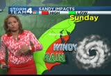
yes, that rain stretches all of the way up into southeastern virginia, virginia tidewater, farther northo the northern neck and on the eastern shore. and it has been deepening. in fact, the pressures dropped ten mil. bars in the last ten hours. it remains a hurricane with winds at 75, 80 miles an hour. tonight it takes a turn to the north and tomorrow taking a sharp left turn and heading inland and coming ashore tomorrow evening. timing on that does look like it will be coming ashore anywhere between assateague to long island. coming ashore perhaps around 8:00 p.m., 9:00 p.m. monday is the latest timing on that. as we get into monday afternoon and evening, into tuesday morning it does move inland, after that, after midnight tuesday, that's when we'll have the strongest winds and heaviest rains. here's a close-up view of that first heavy rain banned from sandy. it is producing really heavy rain right now from the eastern northern neck just about to come in to southern maryland in st. mary's county. it's been raining pretty heavy up toward kent county. that is gradually tracking its way fa
yes, that rain stretches all of the way up into southeastern virginia, virginia tidewater, farther northo the northern neck and on the eastern shore. and it has been deepening. in fact, the pressures dropped ten mil. bars in the last ten hours. it remains a hurricane with winds at 75, 80 miles an hour. tonight it takes a turn to the north and tomorrow taking a sharp left turn and heading inland and coming ashore tomorrow evening. timing on that does look like it will be coming ashore anywhere...
221
221
Oct 27, 2012
10/12
by
WTTG
tv
eye 221
favorite 0
quote 0
. >> we're all at hook anywhere from southeastern virginia up to new england. this was updated at 11:00, too and you can see our category 1 storm still spinning down there, but watch the area in yellow. let's give you an idea when we can expect the worst of these winds. we'll be okay tomorrow, might be breezy, most of sunday okay, but in terms of the wind we'll really start to see it ticking up along the coastline monday and as we go through the day monday that starts moving into our area. our landfalling system will be sometime monday night into tuesday and those big winds will continue and you can see those really stronger gusts in the orange along the coast. it will be really rough at the beaches. in terms of rain looks like most of the day tomorrow will be dry. we could pick up a spotty shower, but if you want to do some traveling, you'll be okay most of saturday. outer banks might be a different story, southeastern virginia might be a different story. we get into norfolk sunday, 8 a.m., it's starting to rain there. we will likely see our rain picking up in
. >> we're all at hook anywhere from southeastern virginia up to new england. this was updated at 11:00, too and you can see our category 1 storm still spinning down there, but watch the area in yellow. let's give you an idea when we can expect the worst of these winds. we'll be okay tomorrow, might be breezy, most of sunday okay, but in terms of the wind we'll really start to see it ticking up along the coastline monday and as we go through the day monday that starts moving into our...
221
221
Oct 8, 2012
10/12
by
WUSA
tv
eye 221
favorite 0
quote 0
we are seeing other showers developing, south carolina, north carolina toward southeastern virginia, kind of two areas we are going to watch for the afternoon. i think the futurecast is a little bit underdone with some of the rain here west of us. scattered showers and light rain, the good news is, other than an early shower tomorrow, we are going to be dry for the most part for the rest of the week. today yellow alert for the showers, later tonight, 53. tonight back in the mid-40s in town, upper 30s in the cold spots with light rain and showers. tomorrow 60, wednesday 70, looking nice for the rest of the week, in fact by sunday, we could be back in the mid-70s. we'll be back with more 9news now at noon, right after this. >>> i have breaking news from wheaton, maryland. connecticut avenue is closed. sky 9 was over the scene not too long ago, where a tree has fallen on a car. isn't that incredible? no one was in the car at the time but we need to tell that you connecticut avenue is closed between randolph road and dale wood road. and that is in wheaton, maryland. we don't know how lon
we are seeing other showers developing, south carolina, north carolina toward southeastern virginia, kind of two areas we are going to watch for the afternoon. i think the futurecast is a little bit underdone with some of the rain here west of us. scattered showers and light rain, the good news is, other than an early shower tomorrow, we are going to be dry for the most part for the rest of the week. today yellow alert for the showers, later tonight, 53. tonight back in the mid-40s in town,...
148
148
Oct 18, 2012
10/12
by
WUSA
tv
eye 148
favorite 0
quote 0
we've got some showers potentially developing southeastern virginia headed this way with the front comingn from the west. then we get into tonight. midnight. showers and thunderstorms scattered about with us overnight. by tomorrow morning, potentially this will all be east of us with some luck. we'll get through both rush hours late tonight and tonight -- late tonight and tomorrow morning i should say dry with the rain in between. tomorrow turns out to be a decent day. could be a lingering shower south and east but all in all not a bad friday out there. then the weekend, that looks pretty good, too. here's a look at the forecast. we've got the threat for a shower late, 72. storms tonight. temperatures falling back into the 50s in town. some 40s north and west. tomorrow mainly an early shower with the best chance east, mild, 73. but the weekend cooler, dry both days. mid-60s both days. look at mild temperatures headed our way. the warm-up monday, tuesday, wednesday. temperatures mid- to upper 70s. it is 4:48. good morning, monika. >>> good morning, howard. very some generally speaking good
we've got some showers potentially developing southeastern virginia headed this way with the front comingn from the west. then we get into tonight. midnight. showers and thunderstorms scattered about with us overnight. by tomorrow morning, potentially this will all be east of us with some luck. we'll get through both rush hours late tonight and tonight -- late tonight and tomorrow morning i should say dry with the rain in between. tomorrow turns out to be a decent day. could be a lingering...
247
247
Oct 29, 2012
10/12
by
WRC
tv
eye 247
favorite 0
quote 0
it is swinging in heavy rains into the eastern shore, southeastern virginia, eastern north carolina. this has been going on the last couple of hours. we've seen the rain really picking up in intensity. here's the latest track. track does still look like it's going to be bringing it inland somewhere between the maryland and delaware to new jersey around sunset tonight. but the big story now is the heavy rain already moving inland, already now many parts of the eastern shore have had three to five inches of rain, and it's just now getting started. here's washington. we're beginning to see the rain closing in on us. right now heavy rain is falling in anne arundel county, calvert, charles, st. mary's, and about to move into prince george's county. going to move in the metro area the next couple of hours. the flooding rain is going to cause issues quickly as we get into the afternoon. five to ten inches of rain, maybe three to six inches around washington, but higher amounts on the eastern shore. right now frederick county has a flood warning for the monochasee river. there's going to be
it is swinging in heavy rains into the eastern shore, southeastern virginia, eastern north carolina. this has been going on the last couple of hours. we've seen the rain really picking up in intensity. here's the latest track. track does still look like it's going to be bringing it inland somewhere between the maryland and delaware to new jersey around sunset tonight. but the big story now is the heavy rain already moving inland, already now many parts of the eastern shore have had three to...
135
135
Oct 29, 2012
10/12
by
FOXNEWSW
tv
eye 135
favorite 0
quote 0
we are seen with tropical storm like conditions in southeastern virginia and even across the state of maryland. we are talking about rainfall situation that could receive 10 inches. now again the outer rain bands already producing heavy rains on the order of half an inch of rin fer hour. already picking up through wind gusts 30 miles per hour easily. parts of new york city as we head southward across new jersey. they have been dealing with wind gusts in the 30 mile per hour range and also had reports of wind gusts exceeding 30 miles an hour. baltimore over 20 mile per hour winds. land fall through the state of new jersey as we head into later tonight. it is forecast to make a transition from a tropical system to hurricane to more of a nor' easter regardless of what the classification of sandy is 111 coastal flooding and heavy snow on the back end of this system. we are dealing with sandy for days. take a look at the forecast track. tuesday 8:00 a.m. a little further inland and forecast recur back out into portions of new england over the next several days. the center of it moving over
we are seen with tropical storm like conditions in southeastern virginia and even across the state of maryland. we are talking about rainfall situation that could receive 10 inches. now again the outer rain bands already producing heavy rains on the order of half an inch of rin fer hour. already picking up through wind gusts 30 miles per hour easily. parts of new york city as we head southward across new jersey. they have been dealing with wind gusts in the 30 mile per hour range and also had...
242
242
Oct 26, 2012
10/12
by
WJLA
tv
eye 242
favorite 0
quote 0
think that will be forced back and the centerline and possibilities between long island and southeastern virginiaind and rain with it. we're thinking 80% odds of heavy rain and high wind, 60% probability of wind damage and flooding. 20% chance of historic flooding or damage, and only a small chance it will not do much of anything. the marine corps marathon sunday, 54 degrees, cloudy skies. the next seven days, and only goes downhill. we will have a lot more at 6:00. >> speaking of getting nasty talking about baseball. >> the detroit tigers' story is kind of like the nationals maybe too much rest was not good. the starting pitcher doug fister had an unusual big play in the second inning. by that i mean it was scary. the line drive up the middle, hitting his head. he barely had enough time to put his glove off, turning his head. he did not sustain injury. he lasted six innings. tough guy. football is not only gaining more of the female audience in america, it is acquiring more female participants. there are four girls kicking for varsity squads in prince william county, and we caught up with victor
think that will be forced back and the centerline and possibilities between long island and southeastern virginiaind and rain with it. we're thinking 80% odds of heavy rain and high wind, 60% probability of wind damage and flooding. 20% chance of historic flooding or damage, and only a small chance it will not do much of anything. the marine corps marathon sunday, 54 degrees, cloudy skies. the next seven days, and only goes downhill. we will have a lot more at 6:00. >> speaking of getting...
241
241
tv
eye 241
favorite 0
quote 0
widespread rains come through and then by late in the day, southern maryland and areas down through southeastern virginiaut sunday looks as though we're going to get quite a bit of rain in here. it's going to be a bet one through the day. about a quarter to maybe half inch of rain and a gray day and, again, a mighty chilly day. we'll go from 78 degrees on saturday with just a 30% chance of showers to a 60% chance of showers all through the day on sunday. the high just 55. and then look at what happens as we go into monday. the first time we'll see highs in the 30s to around 41 degrees. we've got sunshine on tap first part of next week, but, still, we're camped out in the 60s for quite some time. say bye-bye to the 80s and how nice it felt today. >> all right, veronica, i did it. >> he did it. >> i got glitter on my hands now. i knew she was setting me up for something. >> yes, i was. >> but he won't be needing these. >> no, it's yours, pat. >> thanks. >>> now, to a story for anyone who has struggled to find the perfect fit. it's a body scanner that helps take all the guess work out of shopping for clothe
widespread rains come through and then by late in the day, southern maryland and areas down through southeastern virginiaut sunday looks as though we're going to get quite a bit of rain in here. it's going to be a bet one through the day. about a quarter to maybe half inch of rain and a gray day and, again, a mighty chilly day. we'll go from 78 degrees on saturday with just a 30% chance of showers to a 60% chance of showers all through the day on sunday. the high just 55. and then look at what...
527
527
tv
eye 527
favorite 0
quote 0
right now it's in the 70s southern matter land around the bay, eastern shore, much of southeastern virginia, areas in green 60s west of i-95. and by 8:00 this morning, still a little patchy fog around. temperatures upper 60s and low 70s. maybe a little bit of drizzle, too. then by noontime, sunshine breaking out, upper 70s to near 80 and hitting the mid-80s. we'll call it aug-tober. feeling more like august. low humidity and gorgeous weather for thursday, friday and moth of saturd most of saturday. a front coming in late saturday might trigger showers sunday morning. after that, drying out and feeling like autumn again monday and tuesday. >>> we're jammed on 395 closer to the 14th street bridge. northbound you'll see the left center lane blocked at boundary channel drive. westbound route 50 past string sdlt fellow road, center lane still blocked by an accident there. 66 slow jammed as you make your way from the by pass.blocked by. 66 slow jammed as you make your way from the by pass.still bloc there. 66 slow jammed as you make your way from the by pass. fairfax county parkway, under speed,
right now it's in the 70s southern matter land around the bay, eastern shore, much of southeastern virginia, areas in green 60s west of i-95. and by 8:00 this morning, still a little patchy fog around. temperatures upper 60s and low 70s. maybe a little bit of drizzle, too. then by noontime, sunshine breaking out, upper 70s to near 80 and hitting the mid-80s. we'll call it aug-tober. feeling more like august. low humidity and gorgeous weather for thursday, friday and moth of saturd most of...
390
390
Oct 3, 2012
10/12
by
WUSA
tv
eye 390
favorite 0
quote 0
this looks like it may bring some showers to southeastern virginia, more so than here but some of the cloudiness with that certainly will be with us on and off throughout the day. future cast is fairly quiet thankfully this morning. we do see a spotty shower. for the afternoon, though, we may see some sunny breaks but also the spotty shower here and there. not exacting all that much to go o. quiet tonight with the clouds. then tomorrow we start cloudy, maybe a shower south and east and in the afternoon looks like we're going to turn somewhat sunny and pleasant with highs tomorrow again above the 80- degree mark. today 85. isolated shower this afternoon. tonight 60s to near 70 for the low with partly to mostly cloudy skies. 82 tomorrow. it will be a warm one after some morning clouds. friday looks beautiful, 82. over the weekend here comes a cold front so there could be a shower. saturday afternoon 76. sunday afternoon 67. look how cool monday s. you'll need a sweater, maybe a twin set for mike hydeck. high temperature monday 61 degrees. let's check in with beverly farmer. >>> out ther
this looks like it may bring some showers to southeastern virginia, more so than here but some of the cloudiness with that certainly will be with us on and off throughout the day. future cast is fairly quiet thankfully this morning. we do see a spotty shower. for the afternoon, though, we may see some sunny breaks but also the spotty shower here and there. not exacting all that much to go o. quiet tonight with the clouds. then tomorrow we start cloudy, maybe a shower south and east and in the...
220
220
Oct 26, 2012
10/12
by
WRC
tv
eye 220
favorite 0
quote 0
southern maryland, lower part of maryland, southeastern virginia with wind and rain. gusts of wind. beach erosion. moving inland monday and weakening a little bit. still packing a lot of wind. wind gusts of 50 miles per hour to 60 miles per hour in the eastern part of west virginia, covering most of west virginia and maryland up into pennsylvania. the wind may be causing scattered power outages. perhaps widespread power outages as we get into monday. unfortunately, it's going to take several days for that to get taken care of. rain starts sunday. becomes heavy late. strongest monday and tuesday as sandy moves in. temperatures under low clouds, low to mid-60s. the low clouds are going to be with us as we get into the rest of the afternoon. a few breaks in the clouds in the blue ridge. going forward, the rain beginning to move in here. the weather showing this area in color. it's the rain moving in on sunday. some of the heaviest rain on sunday afternoon and evening. these areas in orange could produce heavy downpours. cloudy and mild this afternoon. highs reaching 70. for this evenin
southern maryland, lower part of maryland, southeastern virginia with wind and rain. gusts of wind. beach erosion. moving inland monday and weakening a little bit. still packing a lot of wind. wind gusts of 50 miles per hour to 60 miles per hour in the eastern part of west virginia, covering most of west virginia and maryland up into pennsylvania. the wind may be causing scattered power outages. perhaps widespread power outages as we get into monday. unfortunately, it's going to take several...
276
276
Oct 26, 2012
10/12
by
WRC
tv
eye 276
favorite 0
quote 0
highest impacts in the red zone beginning to be felt along the atlantic seaboard, southern bay, southeastern virginia with wind and rain. sunday evening into monday and all the way into tuesday is when the heaviest impacts will be around our region with strong winds. could have gusts over 60 miles an hour. that unfortunately will likely cause power out aages with all our trees in this region. a lot of those trees may come down and have expended power outage problems for much of the rest of next week. prepare for several days without power. we have temperatures in the low 60s. we have patchy drizzle and patchy fog around now. storm team 4 four day forecast around this friday, we'll have a lot of cloudiness around much of the region with highs near 70. cloudy tonight and saturday too. upper 60s tomorrow. then on sunday especially afternoon and evening and into monday, monday night, and tuesday is when we have the possibility of strong winds causing power outages, bands of heavy rain from time to time, especially monday into tuesday, and gradually improving midweek next week and turning much cooler too.
highest impacts in the red zone beginning to be felt along the atlantic seaboard, southern bay, southeastern virginia with wind and rain. sunday evening into monday and all the way into tuesday is when the heaviest impacts will be around our region with strong winds. could have gusts over 60 miles an hour. that unfortunately will likely cause power out aages with all our trees in this region. a lot of those trees may come down and have expended power outage problems for much of the rest of next...
224
224
Oct 5, 2012
10/12
by
WUSA
tv
eye 224
favorite 0
quote 0
you're looking at high cloudiness across areas in southeastern virginia and the delmarva. otherwise it is a pretty clear quiet morning out there. very comfortable. beautiful and culpeper and luray at 52. 50 cumberland. but milder on the bay with annapolis at 66-degrees and we're sitting at 62. that's the number you were looking for earlier mike. 62. this afternoon the average high 72, 73. we'll beat that with 82 in easton culpeper 83. maybe in the upper 70s in hagerstown and gorgeous here 83. i'll be back in a few minutes talking about the weekend. right now here's beverly farmer in for monika with timesaver traffic. >>> howard, interstates headed northbound 95, we're doing just volume right now really as you come into quantico heading up past the prince william parkway. pace is good into woodbridge. a stretch of rolling road shut down south of the fairfax county parkway with a crash. southbound 95 though long holiday weekend you may be going down to richmond. roadwork still there place around thornburg around the 118- mile marker and only one lane getting by with an unusu
you're looking at high cloudiness across areas in southeastern virginia and the delmarva. otherwise it is a pretty clear quiet morning out there. very comfortable. beautiful and culpeper and luray at 52. 50 cumberland. but milder on the bay with annapolis at 66-degrees and we're sitting at 62. that's the number you were looking for earlier mike. 62. this afternoon the average high 72, 73. we'll beat that with 82 in easton culpeper 83. maybe in the upper 70s in hagerstown and gorgeous here 83....
166
166
Oct 18, 2012
10/12
by
WUSA
tv
eye 166
favorite 0
quote 0
southeastern virginia, western maryland could be seeing it. looks like it's going to be here during the overnight period. for us our forecast temperature 72 this afternoon. some late showers and storms tonight. that's why a yellow alert for tonight. tomorrow an early shower. mainly south and east, 73. saturday 66. by sunday also nice and 66. and temperatures next week warming into the 70s. monika? >>> thank so you much, howard. this week our morning show has shared stories about how diabetes has affected our personal lives and the lives of others. and as we get set for the step out walk to stop diabetes on saturday. this morning i'm joined by warren brown, founder and owner of cake love to talk about how this disease affected both his family and his work. thank you so much for joining us this morning. appreciate it very much. >> glad to be here. >> first let me talk about your success. you're a lawyer turned baker and now you have six stores. >> that's right. cake love has been operating ten years. we bake cakes from scratch. people come in an
southeastern virginia, western maryland could be seeing it. looks like it's going to be here during the overnight period. for us our forecast temperature 72 this afternoon. some late showers and storms tonight. that's why a yellow alert for tonight. tomorrow an early shower. mainly south and east, 73. saturday 66. by sunday also nice and 66. and temperatures next week warming into the 70s. monika? >>> thank so you much, howard. this week our morning show has shared stories about how...
191
191
Oct 26, 2012
10/12
by
WRC
tv
eye 191
favorite 0
quote 0
it it does look like southern maryland, lower eastern shore, southeastern virginia. then sunday evening, that risk zone of the high impact zone coming right over our metro area. most of virginia, most of maryland being affected as it does move inland. and the biggest effects of this storm are going to be in the storm of strong winds. we have continual gusts off and on for 60 miles an hour for days. that will bring down tree limbs and power outages. right now low clouds around the region. little patchy drizzle. watch out for that. areas in light green 60s. so much of the region in the 60s. not going to warm up with a lot of clouds around. storm team 4 four-day forecast into the weekend. cloudy saturday. up in the upper 60s. should be good for aids walk washington and then sunday for the marine corps marathon. in the morning, a few showers, then the heavier rains and heaviest winds sunday night, off and on monday, monday night into tuesday, and gusty winds, turning much cooler next week. a look at first 4 traffic with danella. good morning. >> good morning. thanks, tom.
it it does look like southern maryland, lower eastern shore, southeastern virginia. then sunday evening, that risk zone of the high impact zone coming right over our metro area. most of virginia, most of maryland being affected as it does move inland. and the biggest effects of this storm are going to be in the storm of strong winds. we have continual gusts off and on for 60 miles an hour for days. that will bring down tree limbs and power outages. right now low clouds around the region. little...
164
164
Oct 5, 2012
10/12
by
WUSA
tv
eye 164
favorite 0
quote 0
this morning just few high clouds well to the southeast across oh the northern neck, southeastern virginia. otherwise, comfy. in fact a little bit of a chill this morning, martinsburg and frederick down to 55 degrees and upper 50s east of the bay at easton and cambridge. la plata 55 and here in washington this morning, we sit at 64 and temps this afternoon. about ten degrees or so above average with 81 for andrews and 83 here in the district. let's go over to beverly farmer now with a look at timesaver traffic. >>> just getting word of a crash howard, they're checking, fire department and police southbound 270 in the area of montgomery village avenue for the crash. checking that out too and we'll give you details in the next report. the beltway is running smoothly right now as you make your way through montgomery county getting past the american legion bridge. all the overnight roadwork down in tysons and annandale should be out of there now. eastbound 66 a good ride too. manassas light volume coming in past manassas to get to fair oaks and vienna and northbound fall church. northbound 95
this morning just few high clouds well to the southeast across oh the northern neck, southeastern virginia. otherwise, comfy. in fact a little bit of a chill this morning, martinsburg and frederick down to 55 degrees and upper 50s east of the bay at easton and cambridge. la plata 55 and here in washington this morning, we sit at 64 and temps this afternoon. about ten degrees or so above average with 81 for andrews and 83 here in the district. let's go over to beverly farmer now with a look at...
819
819
Oct 27, 2012
10/12
by
WTTG
tv
eye 819
favorite 0
quote 0
so virtually everyone from southeastern virginia all the way up into southern new england has to continue to watch and see where this thing will come ashore. right now it's very close to the delaware bay late monday night into tuesday. it would then track across northeastern maryland into pennsylvania where it continues to sit and spin for potentially a little bit longer up there. so on that track what can we expect locally from what will be hurricane sandy and then eventually this nor'easter? we expect things to go downhill hee sunday afternoon with rain and wind increasing. that means you have most of tomorrow to prepare your house to, get the leaves out of the storm drain, to get in what you might need if we have a power outage to make sure you have batteries and get everything off the front and back porch that you don't want to become some kind of object that can blow around. peak effects here will be monday night into tuesday and maybe all day tuesday. we're talking torrential downpours, several inches of rain and damaging winds that could blow sustained 40 to 60 miles an hour and gu
so virtually everyone from southeastern virginia all the way up into southern new england has to continue to watch and see where this thing will come ashore. right now it's very close to the delaware bay late monday night into tuesday. it would then track across northeastern maryland into pennsylvania where it continues to sit and spin for potentially a little bit longer up there. so on that track what can we expect locally from what will be hurricane sandy and then eventually this nor'easter?...
170
170
Oct 24, 2012
10/12
by
KQED
tv
eye 170
favorite 0
quote 0
those cuts, in particular for defense, has some voters worried , especially those who live in southeastern virginia. that area, with its large military population, is focused on how the cuts would affect the local economy. our story comes from cathy lewis of whro in hampton roads and is part of our new collaboration with public media partners across the country. we're bringing you reports from areas that will likely dictate the outcome of the election in a series we call btleground dispatches. >> are you aware of the term sequestration? >> no. are you familiar with the terminology sequestration? >> say again. reporter: people here in the hampton roads region might not be able to define sequestration but with the largest military concentration in the country they know big cuts to defense means the loss of lots of jobs. >> you've lost a lot of work. you're going to put a lot of people out of work. most people work with navy vessels. if you cut the government spending you're cutting jobs. that's going to trickle on down to where the people aren't working, they're not spending the money out in the econ
those cuts, in particular for defense, has some voters worried , especially those who live in southeastern virginia. that area, with its large military population, is focused on how the cuts would affect the local economy. our story comes from cathy lewis of whro in hampton roads and is part of our new collaboration with public media partners across the country. we're bringing you reports from areas that will likely dictate the outcome of the election in a series we call btleground dispatches....
313
313
Oct 29, 2012
10/12
by
FOXNEWS
tv
eye 313
favorite 0
quote 0
blizzard warnings as the forecast it falling out outer rain bands in dc and new jersey and southeastern virginiae rates are half an inch or greater. flooding is a concern and that is a bullseye of seeing accumulation . 10 inches locally will be possible. and it could be inland in parts was ohio and portions of michigan will deal with the from sandy. it is spanning 800 miles from one end to the other. it is in portions of long island and over 30 miles per hour wind is picking up and newark airport and j.f.k. and lagaria . dark shading in blue is wind gusts over 50 miles per hour. it is inching toward the coast and portions of baltimore seeing the wind pick up as limp landfall forecast as we head in tonight and transition from a hurricane to a nor'easter type storm . big concern we talked about the storm surge in the new york area . because the center will make landfall to the south. we being see a storm surge in long island sound and new york harbor high as 11 feet. that is significant and why flooding is forecasting in east other than portions of manhattan we'll keep an eye on this and all of th
blizzard warnings as the forecast it falling out outer rain bands in dc and new jersey and southeastern virginiae rates are half an inch or greater. flooding is a concern and that is a bullseye of seeing accumulation . 10 inches locally will be possible. and it could be inland in parts was ohio and portions of michigan will deal with the from sandy. it is spanning 800 miles from one end to the other. it is in portions of long island and over 30 miles per hour wind is picking up and newark...
294
294
Oct 11, 2012
10/12
by
FOXNEWSW
tv
eye 294
favorite 0
quote 0
southeastern virginia, four years ago, the president did very well, especially up here in places like, newport news city, 64-36% over john mccain. governor romney felt it was important to be there also over the past several days to make sure that he can, maybe dig into some of the voters that the president had four years ago. down in florida, such a huge pot of gold in this election yet again with 29 electoral votes. the other day we saw governor romney in pinellas county, that is the western side of tampa, north of st. pete here, a 54-46 winner four years ago. mitt romney was campaigning there in two other counties in florida where president obama did very well four years ago. trying to pick into some of that vote and pick off some of those voters that is coming up in 26 days. later tonight this is what you need to keep an eye on. 8:55 p.m. eastern time in prime time, bret and megyn are live in danville, kentucky. when the veeps go at it don't be anywhere else but the fox news channel. we'll see you then. alisyn? alisyn: bill, there are new questions today whether the fallout from th
southeastern virginia, four years ago, the president did very well, especially up here in places like, newport news city, 64-36% over john mccain. governor romney felt it was important to be there also over the past several days to make sure that he can, maybe dig into some of the voters that the president had four years ago. down in florida, such a huge pot of gold in this election yet again with 29 electoral votes. the other day we saw governor romney in pinellas county, that is the western...
437
437
Oct 28, 2012
10/12
by
WRC
tv
eye 437
favorite 0
quote 0
. >> swinging bands of heavy rain into the carolinas, southeastern virginia and right along the eastern shore and inland from delaware into now southern maryland, northern neck of virginia. they're getting bands of heavy rain. right now, category 1 hurricane with 75 mile per hour winds, latest track bringing it ashore somewhere in this cone of possibility. that would be anywhere from near ocean city all of the way up to long island. this is the zone where it would be likely coming in and it does look like the position that 2:00 p.m. on monday is still going to be off the coast but does look like it could be coming inland, anywhere from ocean city to long island. that would be perhaps around sunset on monday, into monday evening. strongest winds for us happening around dawn on tuesday. right now, some of that heavy rain is falling, delaware and all these areas east of the bay and just to the east of the northern neck, creeping close to washington. we have a high wind warning for noon monday to 8:00 p.m. tuesday, gusts to 60 throughout this entire region. details on the forecast coming ri
. >> swinging bands of heavy rain into the carolinas, southeastern virginia and right along the eastern shore and inland from delaware into now southern maryland, northern neck of virginia. they're getting bands of heavy rain. right now, category 1 hurricane with 75 mile per hour winds, latest track bringing it ashore somewhere in this cone of possibility. that would be anywhere from near ocean city all of the way up to long island. this is the zone where it would be likely coming in and...
245
245
Oct 29, 2012
10/12
by
WRC
tv
eye 245
favorite 0
quote 0
virginia to new england. right now we're seeing the first heavy rain band from sandy across the bay. they're getting snow in southeastern west virginia and south western virginia. for us right now, the areas of red and orange likely going to cause flooding as it heads into the metro area and points east. just a little light rain there. as we take a look going forward, looks like we'll have the heaviest rains into the afternoon. then the rains will taper off this evening, and we'll get strong winds. we may get a little snow around dawn tomorrow as we get into the afternoon hours tomorrow and into wednesday, ai lot of the rain will all be gone. how much wind will we get by 8:00 p.m. this evening. 60 to 65 miles an hour. we may have gusts that high all the way to 2:00 a.m. then the gusts will diminish as we get into tuesday afternoon and evening. a lot of the wind is going to be long gone. hour by hour today, expect increasing wind and increasing rain and temperatures in the 50s. and this evening you're going to get the strongest winds. things taper off by wednesday. storm team 4 seven day outlook, sunshine back on thursda
virginia to new england. right now we're seeing the first heavy rain band from sandy across the bay. they're getting snow in southeastern west virginia and south western virginia. for us right now, the areas of red and orange likely going to cause flooding as it heads into the metro area and points east. just a little light rain there. as we take a look going forward, looks like we'll have the heaviest rains into the afternoon. then the rains will taper off this evening, and we'll get strong...
257
257
Oct 27, 2012
10/12
by
MSNBC
tv
eye 257
favorite 0
quote 0
northeastern north carolina and southeastern virginia will be almost a pivot point that will just bes. and we could end up in that area with about 10 to perhaps even 12 inches of rainfall. it's not that heavy right now. winds are strong, around 30 to 35 miles per hour, but if the storm was closer to shore, all of those conditions would be much worse. and this storm really doesn't get closer to shore until monday. monday night especially. that's when it starts to take this turn to the north. it's actually going to slide in between that cold front alex mentioned and this area of high pressure to our northeast. it's going to shoot to the west. that's what makes this unusual. and then it will lose its tropical characteristics and you're going to hear all sorts of phrases like post tropical cyclone or just a regular cyclone. you can name it whatever you want but it is going to be a huge storm. and you could see that cone of uncertainty in yellow there. it could hit anywhere from new york city down to even eastern virginia. but it does look like somewhere in the new jersey area would be th
northeastern north carolina and southeastern virginia will be almost a pivot point that will just bes. and we could end up in that area with about 10 to perhaps even 12 inches of rainfall. it's not that heavy right now. winds are strong, around 30 to 35 miles per hour, but if the storm was closer to shore, all of those conditions would be much worse. and this storm really doesn't get closer to shore until monday. monday night especially. that's when it starts to take this turn to the north....
377
377
Oct 29, 2012
10/12
by
WUSA
tv
eye 377
favorite 0
quote 0
they have come onshore across southeastern virginia, northern neck. we've got snow in the mountains. the rain continues to pile north and west into southern new jersey. look at the rain! even in our area, seeing the heaviest rain from sandy right now, right across the areas of either side of the chesapeake, right into the washington and baltimore metros. this is a dangerous and strengthening hurricane. we've got 85 mile-an-hour winds. we've got an advisory here coming up in a few minutes, 8:00 advisory, just updated. i'm going to look at this for the first time with you. now moving north-northwest at 20. so the direction has started to make the turn. pressure's still at 946 millibars, and we're looking at a storm still by this afternoon, could have 90 mile-an-hour winds, making landfall tonight about 11:00 or so. then moving off toward the west. the track forecast, when they adjust that, they do that at 5:00 and 11:00, a.m. and p.m. this is an intermediate advisory that we get at 8:00 a.m., which sometimes updates the pressure, the location and the wi
they have come onshore across southeastern virginia, northern neck. we've got snow in the mountains. the rain continues to pile north and west into southern new jersey. look at the rain! even in our area, seeing the heaviest rain from sandy right now, right across the areas of either side of the chesapeake, right into the washington and baltimore metros. this is a dangerous and strengthening hurricane. we've got 85 mile-an-hour winds. we've got an advisory here coming up in a few minutes, 8:00...
196
196
Oct 24, 2012
10/12
by
WRC
tv
eye 196
favorite 0
quote 0
strong storm wa high impact of wind and rain on sunday for areas through north carolina, southeastern areas of virginia, areas around norfolk and virginia beach. and then on toward rehoboth and ocean city on sunday, with rain and wind. saturday, we're okay. but then on monday, monday it looks like the day when we could be impacted the highest. monday and early tuesday, with rain and wind. we could be looking at winds as the storm system makes its way northward about 60 miles per hour for several hours on monday. we're talking a lot of rain, too, with a slow-moving system. coastal areas get hit the hardest with coastal flooding, heavy rain. and that means power outages, too, possible with that sustained wind. here we go in our forecast for the evening. a few clouds. we're very warm. 73 to 78 degrees. by tomorrow morning, we're mostly clear. another warm start for us at 50 to 60 degrees with a light wind. then tomorrow afternoon, still warm at 71 to 76 degrees. here's a look at the four-day forecast. warm 71 to 75. dry, too, for thursday and friday. saturday, upper 60s. again, with no impact here. it wil
strong storm wa high impact of wind and rain on sunday for areas through north carolina, southeastern areas of virginia, areas around norfolk and virginia beach. and then on toward rehoboth and ocean city on sunday, with rain and wind. saturday, we're okay. but then on monday, monday it looks like the day when we could be impacted the highest. monday and early tuesday, with rain and wind. we could be looking at winds as the storm system makes its way northward about 60 miles per hour for...
175
175
Oct 7, 2012
10/12
by
CNNW
tv
eye 175
favorite 0
quote 0
and the working class culturally conservative appalachian communities along ohio's southeastern border with west virginiaection about the economy, it's worth noting that ohio's jobless rate has dropped from 10.6% in early 2010 to 7.2% last august. there is debate over who gets the credit for that. president obama points to the auto bailout for helping save and create 72,000 jobs in the state. ohio's republican governor john kasik says his policies, including bringing more businesses and manufacturing to the state, have made the difference. the obama and romney campaigns have all but suffocated ohio airwaves with more than $75 million in ads. since june the candidates, their running mates and wives have campaigned in the state 65 times. that's an average of about four visits per week. before mitt romney's well reviewed debate performance, an nbc-wall street journal poll found obama leading romney 51% to 43% among likely ohio voters. can a debate change ohio's democratic drift? the state's attorney general mike dewine and former governor ted strickland are next. 50 let's talk about low-cost investing. tdd#
and the working class culturally conservative appalachian communities along ohio's southeastern border with west virginiaection about the economy, it's worth noting that ohio's jobless rate has dropped from 10.6% in early 2010 to 7.2% last august. there is debate over who gets the credit for that. president obama points to the auto bailout for helping save and create 72,000 jobs in the state. ohio's republican governor john kasik says his policies, including bringing more businesses and...
143
143
Oct 27, 2012
10/12
by
FOXNEWS
tv
eye 143
favorite 0
quote 0
tropical storm impact in portions of the carolina coastline and south carolina and southeastern portions of the state of virginia and gusts up to 50 miles per hour possible and a lot of heavy rain. the storm will continue to move northward and the rain will increase anywhere from 25 to 50 miles per hour and beach erosion will be a big concern along with coastal flood the combination of the on shore flow pushing water inland and heavy rain from the storm system. by monday, that is when sandy is forecast to make landfall it could be a category 1 hurricane. and regardless of that, we'll feel the impact as far as rain and coastal flood very strong winds. on the back end of the system, cold air will meet up with the moist and you are we'll see wet snow in western parts of virginia and southwestern parts of the state of pennsylvania, locally up to two feet or more of snow will be possible especially on the higher elevations, that is very significant and rain significant as well. we could pick up to 11 inches much rainfall and a lot of the rainfall. the southeast, and again having snow, locally more than two feet possi
tropical storm impact in portions of the carolina coastline and south carolina and southeastern portions of the state of virginia and gusts up to 50 miles per hour possible and a lot of heavy rain. the storm will continue to move northward and the rain will increase anywhere from 25 to 50 miles per hour and beach erosion will be a big concern along with coastal flood the combination of the on shore flow pushing water inland and heavy rain from the storm system. by monday, that is when sandy is...
344
344
Oct 29, 2012
10/12
by
FOXNEWS
tv
eye 344
favorite 0
quote 0
the rain stretches into southeastern portions of west virginia. storm surge to could be high as 11 feet across the new york city area. the storm is turning left. now towards the north-northwest at 20 miles an hour. the pressure in the center of the storm is extremely low, 946 millibars. that means basically sandy is continuing to strengthen. maximum wind now 85 miles an hour. could have maximum wind at 90 miles an hour by the tame it makes landfall across central and southern new jersey as we head into this evening and into tonight. by the time it makes landfall, could become not only a hurricane but post-tropical system. don't pay any attention to that. it will have major impacts across new england and northeast and and southeast we will feel tropical storm wind gusts. expected water rise, very high, 11 feet across portions of long island sound. it is a large storm system. even areas fourth south across southern new jersey will deal with a storm surge four to eight feet. five to 10 feet across southern parts of long island. this scenario with the
the rain stretches into southeastern portions of west virginia. storm surge to could be high as 11 feet across the new york city area. the storm is turning left. now towards the north-northwest at 20 miles an hour. the pressure in the center of the storm is extremely low, 946 millibars. that means basically sandy is continuing to strengthen. maximum wind now 85 miles an hour. could have maximum wind at 90 miles an hour by the tame it makes landfall across central and southern new jersey as we...
257
257
Oct 29, 2012
10/12
by
WUSA
tv
eye 257
favorite 0
quote 0
we've got basically hurricane warnings from the virginia- maryland boarder up into southeastern massachusetts, including the chesapeake bay. so we've got coastal flood warnings as well. going to see tides 1 to 3 feet above normal. we have a full moon. on the ocean, that's where we could be having a ten-foot or more storm surge just along and north of the path of this strengthening hurricane. winds will pick up to 90 potentially this afternoon. will it be 85, 90, 95 when it makes landfall? tough call there but it does look like the storm is strengthening at the moment and will be making landfall around 10:00, 11:00 near atlantic city. it will be a devastating storm for most of coastal new jersey, new york, long island. and in our area we'll certainly get plenty of wind and rain. that will cause trees to come down. i would expect massive power outages from the mid-atlantic through parts of the northeast. windses still by tuesday afternoon 60 miles an hour. then by wednesday morning, 40 miles an hour. so we still have a long, long way to go with sandy before we're done with this. i want to show
we've got basically hurricane warnings from the virginia- maryland boarder up into southeastern massachusetts, including the chesapeake bay. so we've got coastal flood warnings as well. going to see tides 1 to 3 feet above normal. we have a full moon. on the ocean, that's where we could be having a ten-foot or more storm surge just along and north of the path of this strengthening hurricane. winds will pick up to 90 potentially this afternoon. will it be 85, 90, 95 when it makes landfall? tough...
213
213
Oct 20, 2012
10/12
by
MSNBC
tv
eye 213
favorite 0
quote 0
of all, thank you for allowing me to be on your show to represent our membership in southeastern ohio and west virginia're very, very concerned about the future of our industry. coal has been a very abundant, reliable, affordable source of energy for this country for quite a long time, and it's still at about the 40% level when it comes to energy production in our country. so coal isn't going away any time soon, but we don't want to argue the science of climate change. we do think that congress needs to help us in advancing clean coal technology so that our members and coal miners all across this country can have a future. when you take away an industry such as coal mining from a community, you know, that may not seem like a big deal across the country or as far as washington politics go, but you're talking about anywhere from a miner making 70 to $100,000 a year, having excellent health care and excellent benefits, and not only does that family of that miner depend on this living but the entire community depends on it. we're talking about people who work at the machine shops, the rebuild shops, people
of all, thank you for allowing me to be on your show to represent our membership in southeastern ohio and west virginia're very, very concerned about the future of our industry. coal has been a very abundant, reliable, affordable source of energy for this country for quite a long time, and it's still at about the 40% level when it comes to energy production in our country. so coal isn't going away any time soon, but we don't want to argue the science of climate change. we do think that congress...
279
279
Oct 22, 2012
10/12
by
FOXNEWSW
tv
eye 279
favorite 0
quote 0
this week and he suggested, he didn't say it but suggested, that the southeastern swing states of florida and north carolina and virginia are beginning to move romney and they now have what seems to be their last stand, their final -- this be the obama camp, their final firewall in the midwest, ohio, iowa and wisconsin. >> absolutely. it's ironic because not long ago we talked about how romney was having problems in ohio and maybe should pull out and find another path. now you're hearing talk about whether obama should pull out of florida. there was a piece in the "new york times" about that this weekend. so i think in that sense, the midwest is really where this is going to be won. although romney does have ties to victory out ohio, he would like to win ohio because it threads the needle close if he doesn't. so far that has been obama's firewall. he's had a lead in that state through the entire campaign cycle and he still is ahead, not by as much. romney's narrowed the gap but pretty much every poll shows obama ahead in ohio and that makes romney's lift harder. >> bill, starting with the debate tomorrow night what, do
this week and he suggested, he didn't say it but suggested, that the southeastern swing states of florida and north carolina and virginia are beginning to move romney and they now have what seems to be their last stand, their final -- this be the obama camp, their final firewall in the midwest, ohio, iowa and wisconsin. >> absolutely. it's ironic because not long ago we talked about how romney was having problems in ohio and maybe should pull out and find another path. now you're hearing...
175
175
Oct 22, 2012
10/12
by
KTVU
tv
eye 175
favorite 0
quote 0
but he was suggesting, and it picks up on what juan was saying, the southeastern swing states of florida an north carolina and virginia to move romney and now have what seems to be their last -- this obama camp, the final firewall in the midwest, ohio, iowa and wisconsin. >> absolutely. it is ironic, because not long ago i felt like we were talking about how romney was really having all the problems in ohio and should even pull out and find another path to victory. and, now you are actually hearing talk about whether obama should pull out of florida. and, "the new york times," there was something about that, this weekend, and, i think, you know, in that sense, the midwest is really where this is going to be won, and, although romney does have paths to victory without ohio he still very much would like to win ohio because it threads the needle awfully close if he doesn't and so far it has been obama's firewall. he has had a lead in that state throughout the entire campaign cycle and still is ahead, not by as much, certainly, romney narrowed the gap but pretty much every poll shows obama ahead in ohio and that makes rom
but he was suggesting, and it picks up on what juan was saying, the southeastern swing states of florida an north carolina and virginia to move romney and now have what seems to be their last -- this obama camp, the final firewall in the midwest, ohio, iowa and wisconsin. >> absolutely. it is ironic, because not long ago i felt like we were talking about how romney was really having all the problems in ohio and should even pull out and find another path to victory. and, now you are...
 Live Music Archive
 Librivox Free Audio
 Metropolitan Museum
 Cleveland Museum of Art
 Internet Arcade
 Console Living Room
 Open Library
 American Libraries
 TV News
 Understanding 9/11