69
69
Feb 25, 2023
02/23
by
KPIX
tv
eye 69
favorite 0
quote 0
st. helena was also blanketed in 7 1/2 inches. highway 29 is likely to remain closed throughout the weekend due to hazardous road conditions. the weather disabled several vehicles after the snow began to fall thursday. back at momento moring, if you're wondering whether all that snow affects wine making? >> the vines themselves are doing just fine. there's nothing growing yet, so the snow doesn't hurt them at all. it's just kind of a shock to see snow on grapevines in california. >> also highway 17 in the santa cruz mountains was a mess today. snow downed trees and fallen wires shut it down most of the day. it is back open over the summit tonight and our len ramirez was there. >> reporter: well, a significant at of snow fell up here in the santa cruz mountains overnight. one chp officer estimated it to be about four inches right here at the summit. unfortunately that led to a lot of problems, but now the roadway is clear and most of the traffic problems are over. the traffic is moving again on highway 17 in the santa cruz mountain
st. helena was also blanketed in 7 1/2 inches. highway 29 is likely to remain closed throughout the weekend due to hazardous road conditions. the weather disabled several vehicles after the snow began to fall thursday. back at momento moring, if you're wondering whether all that snow affects wine making? >> the vines themselves are doing just fine. there's nothing growing yet, so the snow doesn't hurt them at all. it's just kind of a shock to see snow on grapevines in california. >>...
71
71
Feb 25, 2023
02/23
by
KGO
tv
eye 71
favorite 0
quote 0
st. helena, eight inches, even boulder creek getting two inches of snow. rainfall totals have been pretty impressive with the thunderstorms and the hail last night, got some downpours, over one inch of snow in san francisco, san jose, concord. i will be back with a full look at the weekend forecast, which includes more rain. ama: thank you. dan: we have team coverage for our crews spread around the bay area, tracking every angle for you, the snow, the wind, even the hail. ama: we start with abc 7 news reporter cornell barnard. you saw a lot of snow today. cornell: did we ever, ama and da n? check it out. it is a little mind blowing, because you have to remember, this is wine country, but so much snow all around, and the snow is really sticking. it is what enough, in fact, to build a solid, decent snowball. more like a boulder, but you get the idea. all of the snow has brought road closures, power outages, plus you know, a lot of family fun, too. amanda lee and her kids from santa rosa never dreamed they would be sledding in one country come of it is happen
st. helena, eight inches, even boulder creek getting two inches of snow. rainfall totals have been pretty impressive with the thunderstorms and the hail last night, got some downpours, over one inch of snow in san francisco, san jose, concord. i will be back with a full look at the weekend forecast, which includes more rain. ama: thank you. dan: we have team coverage for our crews spread around the bay area, tracking every angle for you, the snow, the wind, even the hail. ama: we start with abc...
54
54
Feb 25, 2023
02/23
by
KTVU
tv
eye 54
favorite 0
quote 0
still, seeing a little bit of snow here is near mount st helena, where you can see white and pink.icates rain, snow and snow and here's a view over areas of mount diablo, where we're seeing a little bit of a rain snow mix mount hambleton also doing the same. here's a view of the sierra where it is winding down , at least for now in the winter storm warning allowed to expire this morning with another one coming sunday morning. so if you're traveling up i would say go today because tomorrow could be a complete different story. here's a view of what we're expecting here at home. mainly dry conditions getting into the afternoon. even some sunshine in store for us, and then as we get into sunday notice another system beginning to drop in. we could see the drizzle the light scattered showers early on, but the brunt of the storm moved through during the afternoon. that's when we'll see the heavier stuff come through. it's a quick moving system by sunset . we're dry once again, another storm to follow on monday. rainfall amounts through the weekend. right now it looks like half inch or les
still, seeing a little bit of snow here is near mount st helena, where you can see white and pink.icates rain, snow and snow and here's a view over areas of mount diablo, where we're seeing a little bit of a rain snow mix mount hambleton also doing the same. here's a view of the sierra where it is winding down , at least for now in the winter storm warning allowed to expire this morning with another one coming sunday morning. so if you're traveling up i would say go today because tomorrow could...
81
81
Feb 25, 2023
02/23
by
KGO
tv
eye 81
favorite 0
quote 0
st. helena overnight. lauren purcell in berkeley was in search of snow. >> we were coming up for the weekend, psyched to see the snow, looking for more of it. but they are telling me i can't go this way. cornell: caltrans says highway 29 could be closed through the weekend because of downed trees and power lines. the snow hasn't really melted. it is wet enough to make a respectable snowball or snowman, whatever you want. locals around here say it has beenad since seen this mu snow. i'm a bay area native and i have to agree. it's an incredible site. dan: 30 years, haven't seen it. cornell: no, totally agree. it's a rare sight. kind of unbelievable, right? dan: for decades. you are right. and that is not just an impressive snowball, it's intimidating. [laughter] cornell: i promise not to throw it at anybody. dan: maybe your photographer? cornell: maybe. [laughter] ama: dear captured in the snow. look at them. these four work -- i don't think they were frozen but they might be pretty cold. this was on mount h
st. helena overnight. lauren purcell in berkeley was in search of snow. >> we were coming up for the weekend, psyched to see the snow, looking for more of it. but they are telling me i can't go this way. cornell: caltrans says highway 29 could be closed through the weekend because of downed trees and power lines. the snow hasn't really melted. it is wet enough to make a respectable snowball or snowman, whatever you want. locals around here say it has beenad since seen this mu snow. i'm a...
43
43
Feb 25, 2023
02/23
by
KGO
tv
eye 43
favorite 0
quote 0
st. helena, cobb mountain, getting you in a little bit closer. right here they are seeing those showers. panning around, mount hamilton is still looking at some snow showers and that is turning to remaining face -- in case you are doing a friday getaway. 580 is wet right now, so give yourself that extra time around the sierra nevada. they are chaining up, still. the snow is lighter, seeing three to 20 inches of snow at the resorts. great to see. you can see the snow on the ground there. love seeing it. good idea to hold off on travel. this is not the time to go up there, they are still dealing with the snow. 30's to 50's for the temperatures right now. oakland airport, you are getting a chance to see some sunshine, but don't let your guard down. wintry mix through tomorrow morning. cold morning, rain expected on sunday with light snow on the peaks above 2500 feet. on the exclusive storm impact level 1, snow at lower elevations. still keeping isolated thunder and hail chances. not a repeat of what we experienced last night. hour-by-hour at 5:00, q
st. helena, cobb mountain, getting you in a little bit closer. right here they are seeing those showers. panning around, mount hamilton is still looking at some snow showers and that is turning to remaining face -- in case you are doing a friday getaway. 580 is wet right now, so give yourself that extra time around the sierra nevada. they are chaining up, still. the snow is lighter, seeing three to 20 inches of snow at the resorts. great to see. you can see the snow on the ground there. love...
61
61
Feb 26, 2023
02/23
by
KGO
tv
eye 61
favorite 0
quote 0
st. helena. mount diablo.orning, we do it again with the breezy wind and snow levels lowering. the sierra nevada, a doozy with a blizzard warning, but may be one third of an inch. late tuesday, over 1 inch of rain. most rain in the coastal hills and back to the mountains. 10:00 today through wednesday, west slopes see a winter storm warning, but blizzard warning tomorrow through saturday for sierra nevada, forefeet to 7 feet of blowing drifting snow. 55 inches southlake. 78 kirkwood. that is 3 inches of snow per hour. high temperatures today with the rainy conditions in the afternoon to the south and clearing north, that level 1 system is a 40's, 50's, and in the forecast more rain. heavy downpours monday into tuesday and maybe late tuesday about we get a break in next weekend, more rain. liz: it feels like winter. i'm ready for spring. i will not lie. thanks. next, a life-changing experience at chase center, one who is ove. (alarm) and then, they're sweet. ♪ sour patch kids. sour. sweet. gone. liz: smashing p
st. helena. mount diablo.orning, we do it again with the breezy wind and snow levels lowering. the sierra nevada, a doozy with a blizzard warning, but may be one third of an inch. late tuesday, over 1 inch of rain. most rain in the coastal hills and back to the mountains. 10:00 today through wednesday, west slopes see a winter storm warning, but blizzard warning tomorrow through saturday for sierra nevada, forefeet to 7 feet of blowing drifting snow. 55 inches southlake. 78 kirkwood. that is 3...
102
102
Feb 24, 2023
02/23
by
KGO
tv
eye 102
favorite 0
quote 0
st. helena was covered in fresh snow. stayed shred that at a clouds most of the day take out the flurries from our tam camera. several inches of snow is predicted here at the sure to draw a crowd to check it out. >> it is exciting especially somewhere does not happen often. it is a lot cheaper to go and see the snow than to drive to tahoe and fend a -- and spend a fortune in that endeavor. if you are trying to get up here to see the snow, park at a lower elevation and hike. will be ch safer than driving up. >> at petaluma rain not snow made for slick roadways on 101 -- 111. chp urging everyone to slow down. definitely slow down. keep in mind places like marin county don't really have slow pillows -- not really have snowplows. if there is significant close down panoramic highwayo mporary. if you do check out the snow, don't forget your gloves. live in santa rosa. >> glad you still have yours. >> need a scarf now.we will dre. >>>> it is even colder -- >> thank you. >> he will need that if he goes to the sierra. i weigh 50 a
st. helena was covered in fresh snow. stayed shred that at a clouds most of the day take out the flurries from our tam camera. several inches of snow is predicted here at the sure to draw a crowd to check it out. >> it is exciting especially somewhere does not happen often. it is a lot cheaper to go and see the snow than to drive to tahoe and fend a -- and spend a fortune in that endeavor. if you are trying to get up here to see the snow, park at a lower elevation and hike. will be ch...
80
80
Feb 24, 2023
02/23
by
KGO
tv
eye 80
favorite 0
quote 0
st. helena.t the santa cruz mountains the summit is a mixture of wintry mix that snow rain mix is starting to show up around north of tassajara. diablo road. it is wet right now. let's take a look at how much snowfall we are talking about. tonight and tomorrow morning snow level between 1000 and 200 feet. east bay hills up to half a foot. santa clara hills is where we are expecting six to 12 inches. some of the higher totals. in the santa cruz mountains three to seven inches of snow. 30's and 40's on your temperatures. cold or than average today. now the winds are coming up gusting to 39 at oakland. 32 in hayward and napa. when advisory until 4:00 p.m. tomorrow. gusts could cause outages and topple tree limbs. 7:00 tonight southerly winds continuing to ramp up going into midnight. over the hills it is going to be stronger winds. this is our east bay hills camera. you can see the bouncy camera not expecting as strong of winds as what we experienced a few days ago. here is the area of low pressure
st. helena.t the santa cruz mountains the summit is a mixture of wintry mix that snow rain mix is starting to show up around north of tassajara. diablo road. it is wet right now. let's take a look at how much snowfall we are talking about. tonight and tomorrow morning snow level between 1000 and 200 feet. east bay hills up to half a foot. santa clara hills is where we are expecting six to 12 inches. some of the higher totals. in the santa cruz mountains three to seven inches of snow. 30's and...
56
56
Feb 12, 2023
02/23
by
KGO
tv
eye 56
favorite 0
quote 0
st. helena.hey will continue to strengthen and work their way down to the surface for your monday, so enjoy today. changes arriving as soon as tomorrow. so our headlines, chile with a few clouds this morning. sunny and warmer, gusty winds in the hills, and looking at that cold pattern developing for tuesday, valentine's day, and lingering throughout the work week. skipping ahead to tuesday, that colder air moving in, you can see lake county here, maybe some snow, and if this holds together, we can see just a little rain arriving right over the middle of the day on tuesday. then that is going to pave the way for that much colder air. with it, we are talking a wind advisory from tomorrow morning, 10:00, coastal north bay, north bay communities here, san francisco, the peninsula, 20 to 30 mile an hour winds with gusts up to 45, and then the winds will continue to sink south throughout the central coast. tomorrow still on the mild side with the winds really picking up along the coast, here's the high
st. helena.hey will continue to strengthen and work their way down to the surface for your monday, so enjoy today. changes arriving as soon as tomorrow. so our headlines, chile with a few clouds this morning. sunny and warmer, gusty winds in the hills, and looking at that cold pattern developing for tuesday, valentine's day, and lingering throughout the work week. skipping ahead to tuesday, that colder air moving in, you can see lake county here, maybe some snow, and if this holds together, we...
83
83
Feb 17, 2023
02/23
by
KPIX
tv
eye 83
favorite 0
quote 0
st. helena. temperatures will be a degree or two warmer. it looks like a nice weekend overall.ncreasing clouds with decreasing temperatures and the three day stretch of chilly weather at the tail end of the forecast. the high temperature on thursday is to struggle to reach 50 degrees across the entire bay area. that is a good 10 to 15 degrees below normal. >> thank you so much. >>> it is getting harder and harder to get fresh fruits and veggies. a new project is trying to bring what's good for you home to you. we will show you a mobile farmers market making news. >>> you can watch us anytime anywhere on our streaming service, cbs bay area. catch all of our live newscasts throughout the day, find you didn't choose cat allergies. you didn't choose your hairline. hot flashes, the flu, or that thing when your knee just gives out for no reason. you didn't choose your bad back or this. or... that. you didn't choose depression, mela but with kaiser permanente you can choose your doctor who works with other best-in-class specialists to care for all that is you. >>> celebrating people w
st. helena. temperatures will be a degree or two warmer. it looks like a nice weekend overall.ncreasing clouds with decreasing temperatures and the three day stretch of chilly weather at the tail end of the forecast. the high temperature on thursday is to struggle to reach 50 degrees across the entire bay area. that is a good 10 to 15 degrees below normal. >> thank you so much. >>> it is getting harder and harder to get fresh fruits and veggies. a new project is trying to bring...
81
81
Feb 28, 2023
02/23
by
KTVU
tv
eye 81
favorite 0
quote 0
on monday, a light dusting of wet snow was falling along the summit of mount st helena. in fact, a series of storm cells moved through the bay area monday morning into the afternoon, some of them resulting in short but intense downpours. pg and e is temporary staging point on mount sina halina was mostly empty because crews were busy dealing with numerous mostly smaller outages . the hardest hit area in the bay area has been the north bank where we have 4000 customers about power, so that's about half of the outages and all of the bay area quite a bit of the snell that fell on northern napa county mountains at the end of last week, still remains with more expected down to 2500 ft highway 29 between calistoga and lake county was finally opened. it had been closed for a long time due to icy road conditions and the fact that trees had fallen down on power lines causing pg need to affect repairs up here, but that is over. just for now. so we're looking at this as a series of pre storms. the first storm was last week. the second storm started this morning and his lasting thro
on monday, a light dusting of wet snow was falling along the summit of mount st helena. in fact, a series of storm cells moved through the bay area monday morning into the afternoon, some of them resulting in short but intense downpours. pg and e is temporary staging point on mount sina halina was mostly empty because crews were busy dealing with numerous mostly smaller outages . the hardest hit area in the bay area has been the north bank where we have 4000 customers about power, so that's...
54
54
Feb 28, 2023
02/23
by
KTVU
tv
eye 54
favorite 0
quote 0
on monday, a light dusting of wet snow was falling along the summit of mount st helena. in fact, a series of storm cells moved through the bay area monday morning into the afternoon, some of them resulting in short but intense downpours. pg and e is temporary staging point on mount sina halina was mostly empty because crews were busy dealing with numerous mostly smaller outages. the hardest hit area in the bay area has been the north bank where we have 4000 customers about power, so that's about half of the outages and all of the bay area quite a bit of the snell that fell on northern napa county mountains at the end of last week, still remains with more expected down to 2500 ft highway 29 between calistoga and lake county was finally opened. it had been closed for a long time due to icy road conditions and the fact that trees had fallen down on power lines causing pg need to affect repairs up here, but that is over. just for now. so we're looking at this as a series of pre storms. the first storm was last week. the second storm started this morning and his lasting throu
on monday, a light dusting of wet snow was falling along the summit of mount st helena. in fact, a series of storm cells moved through the bay area monday morning into the afternoon, some of them resulting in short but intense downpours. pg and e is temporary staging point on mount sina halina was mostly empty because crews were busy dealing with numerous mostly smaller outages. the hardest hit area in the bay area has been the north bank where we have 4000 customers about power, so that's...
64
64
Feb 11, 2023
02/23
by
KGO
tv
eye 64
favorite 0
quote 0
st. helena looking at some snow. around orinda, kensington, berkeley, very spotty showers. bay, redwood city, light rain. fremont boulevard, looking at the shower activity as well as 680 and another look at the snow around amount hamilton. a week level 1 system pushing out of here throughout the morning hours, a chance of snow in the higher elevations. there is a look at how quickly it moves on out. before noon time. and we will be left with partly cloudy conditions. mid to upper 40's right now. by the afternoon, here is a look at temperatures into the mid-50's today so a little chilly and a wet start. zach: thank you. the pentagon is looking for answers after the u.s. military shutdown another flying object off the coast of alaska. president joe biden order the takedown. ty hernandez reports authorities do not know where the objects came from. >> the pentagon confirming friday an f-22 fighter jet shot down what they are calling a high-altitude object over u.s. territory. the unidentified object was first detected over the skies of alaska by norad thursday night using groun
st. helena looking at some snow. around orinda, kensington, berkeley, very spotty showers. bay, redwood city, light rain. fremont boulevard, looking at the shower activity as well as 680 and another look at the snow around amount hamilton. a week level 1 system pushing out of here throughout the morning hours, a chance of snow in the higher elevations. there is a look at how quickly it moves on out. before noon time. and we will be left with partly cloudy conditions. mid to upper 40's right...
125
125
Feb 23, 2023
02/23
by
KTVU
tv
eye 125
favorite 0
quote 0
st helena because it's up there right now. maybe 12 inches of snow.ine county, maybe four inches up near mount tam. that's that's a possibility to terms a tough one, because it's so close to the ocean. but either way you're gonna wake up on friday morning, friday afternoon on that front, you're gonna be off by friday afternoon. when it clears a little. you are going to see snow on a lot of the bay area peaks. and then there's that blizzard warning down the hatch appease down in southern california, san bernie, no mountains and in the winter storm warning. for the lake tahoe area, which is a tough one if you're traveling because it's gonna be so low, so if you're trying to sneak up there to get some some skin and for this weekend or the world cup, it policies tahoe you'll be thinking you may want to. you want to think about you know when you're going to go because of snow levels are low and when it's low down below colfax well below colfax when i'm saying it really slows things down, getting up there, so the winds are not as one of his last night was s
st helena because it's up there right now. maybe 12 inches of snow.ine county, maybe four inches up near mount tam. that's that's a possibility to terms a tough one, because it's so close to the ocean. but either way you're gonna wake up on friday morning, friday afternoon on that front, you're gonna be off by friday afternoon. when it clears a little. you are going to see snow on a lot of the bay area peaks. and then there's that blizzard warning down the hatch appease down in southern...
62
62
Feb 27, 2023
02/23
by
KNTV
tv
eye 62
favorite 0
quote 0
st. helena will see it changing to snow. it will be sweeping through the bay area with a lot of the mountains and hills getting in on some rain and snow. and then the valleys are going to see some rain. but there's also the possibility that we could hear some rumbles of thunder, some lightning through late morning, as well as the possibility of some hail and graupel as we see kind of a wintery mix around the bay area for some spots. going into the afternoon, we're not seeing as much of that activity, but there's still the chance that there could be some hit or miss showers in your area. another wave of widespread rain coming in for tomorrow, late morning, where we start to see some very heavy rain at times, and it just continues to add up. we're also going to be watching out for the impacts of the heavy rain and high winds between now and wednesday. we could see another inch and a half to possibly slightly higher amounts for parts of the santa cruz mountains. while we're getting all of this rain, there is a blizzard warning
st. helena will see it changing to snow. it will be sweeping through the bay area with a lot of the mountains and hills getting in on some rain and snow. and then the valleys are going to see some rain. but there's also the possibility that we could hear some rumbles of thunder, some lightning through late morning, as well as the possibility of some hail and graupel as we see kind of a wintery mix around the bay area for some spots. going into the afternoon, we're not seeing as much of that...
60
60
Feb 25, 2023
02/23
by
KGO
tv
eye 60
favorite 0
quote 0
st. helena, eight inches. boulderreek, two to three inches. cloverdale, four inches. snow fell down to the valley floor in crescent city. pretty crazy stuff. live doppler 7. we are tracking snow showers around the northern part of the viewing area. clear lake, upper lake, the mountains will continue to see snow. we will be seeing lower elevation snow continuing. the snow event unfolded yesterday as you know. then it quickly commenced with strong thunderstorms. we got hail, downpours. the wider view with light level 1 storms as we head toward southern california. they are getting soaked as well. they are getting the snow. by 3:00 in the morning, rain and snow increases. we will be watching that for you tonight because we are also watching the temperatures. 34 degrees in santa rosa. freeze warnings and frost advisories from midnight to 9:00 a.m. upper 20's to mid 30's expect it by morning. another storm coming. what part of your weekend will be wet, coming up. dan: in the north bay, the snow has made things so dangerous along highway 29. it could stay close through the
st. helena, eight inches. boulderreek, two to three inches. cloverdale, four inches. snow fell down to the valley floor in crescent city. pretty crazy stuff. live doppler 7. we are tracking snow showers around the northern part of the viewing area. clear lake, upper lake, the mountains will continue to see snow. we will be seeing lower elevation snow continuing. the snow event unfolded yesterday as you know. then it quickly commenced with strong thunderstorms. we got hail, downpours. the wider...
50
50
Feb 11, 2023
02/23
by
KGO
tv
eye 50
favorite 0
quote 0
st. helena in the north bay. you see the bigger picture, how spotty in nature the shower activity is. raindrops on the lens where temperatures are mid 40's. 40 oakland, 47 it -- 47 san jose. a little sun glint on the water, being mid-50's but a chance of thunderstorms toward the noon hour here as this low is pretty unstable and sinks to the south. 47 santa rosa, 44 by the delta. we have a cooler afternoon and store so some rainfall totals over a third of an inch around pen field, mount diablo, around half inch, then half moon bay to around .1 inch by now, but you can see a third inch around santa cruz mountains and of course the cove looking at the snow. piling up a couple inches. sunny and warmer tomorrow, below average, temperatures return as soon as tuesday and wednesday. quickly we get into partly cloudy skies, already seeing sunshine. the rest of the day, -- the rest of the morning i should say. the next few hours as the system sinks to the south, highs in the 50's, northeast winds keeping a cool and accuweather 7-day forecast, a bump in the mercury tomorrow for a sunnier and war
st. helena in the north bay. you see the bigger picture, how spotty in nature the shower activity is. raindrops on the lens where temperatures are mid 40's. 40 oakland, 47 it -- 47 san jose. a little sun glint on the water, being mid-50's but a chance of thunderstorms toward the noon hour here as this low is pretty unstable and sinks to the south. 47 santa rosa, 44 by the delta. we have a cooler afternoon and store so some rainfall totals over a third of an inch around pen field, mount diablo,...
76
76
Feb 24, 2023
02/23
by
KNTV
tv
eye 76
favorite 0
quote 0
st. helena, yountville. and then real strong here through mt. hamilton where totals could surpass 12 inches. now, on top of this, we've seen some small hail with heavy downpours and lightning. it is all part of this band moving in right now. that will continue to the east. keeping that rain in the forecast definitely through 11:45. really through tomorrow morning. we've got more looks at the radar. the snow totals, how much we'll get. everything for you in 15 minutes. >> yeah. crews across the bay area have sandbags and snow plows on standby. many of the snowplows are in use tonight. alongside highway 17 the in the south bay, stephanie? >> reporter: you can see highway 17 right here. the rain is coming down pretty hard. it actually feels like hail. you might be able to see the ice on my hair. so far i haven't seen any road closures. but just a few minutes ago i saw an officer pass by with their lights on. earlier today we were driving around the santa cruz mountains where we saw plenty of snow and at least one road closure. caltrans expects that
st. helena, yountville. and then real strong here through mt. hamilton where totals could surpass 12 inches. now, on top of this, we've seen some small hail with heavy downpours and lightning. it is all part of this band moving in right now. that will continue to the east. keeping that rain in the forecast definitely through 11:45. really through tomorrow morning. we've got more looks at the radar. the snow totals, how much we'll get. everything for you in 15 minutes. >> yeah. crews...
68
68
Feb 25, 2023
02/23
by
KNTV
tv
eye 68
favorite 0
quote 0
st. helena with more on how it will impact the weekend there. >> a site you don't see often, mountains coveredsnow. >> we are going to springtime. the trees are flowering, the daffodils are up, and this comes. >> it began fine last night and early this morning up to 10 inches, on the county line from napa and sonoma, and the winery says they are used to a bit of snow, this much this weekend. >> everyone on the mountain that had visitors scheduled for tomorrow, it is off. we have been out of power since late last night, i don't think we will get power back until late monday or tuesday. >> tried reaching an earlier this morning to check it out, keyword is tried. the roads are a mess, and stewart said they were try to get this morning and there were trees just like this one all over the road, he said recently the fires have weakened the trees in the area and compounded about the heavy snow did not help. >> the number of trees that have fallen down, or branches that have fallen off is unprecedented. >> many trees pushed to the side of spring mountain road, after one after another are left abandone
st. helena with more on how it will impact the weekend there. >> a site you don't see often, mountains coveredsnow. >> we are going to springtime. the trees are flowering, the daffodils are up, and this comes. >> it began fine last night and early this morning up to 10 inches, on the county line from napa and sonoma, and the winery says they are used to a bit of snow, this much this weekend. >> everyone on the mountain that had visitors scheduled for tomorrow, it is off....
47
47
Feb 24, 2023
02/23
by
KGO
tv
eye 47
favorite 0
quote 0
st. helena radar sites, the hills around calistoga getting snow and we are looking at point arena to hopwood area, in between where the hills are, there. we see some snow showers right around fischbach road. so don't be surprised if you do encounter some snow down in the valley floor. it is a lot. a light storm on our scale through the evening, which becomes a two, immoderate strength storm as we head into night. hour-by-hour, 830 tonight, the intensity of the rainfall picks up. the snowfall and the coverage will increase as well. going into early tomorrow morning you see a thunder -- photos from her too, not at the question. a winter advisory up for the santa cruz mountains, east eastern santa clara hills after two inches expected. that is up until 7:00. then it becomes a winter storm warning. 3-12 inches of snow expected over our highest peaks. and windy conditions. i will be back with a closer look at the forecast and let you know how long this wintry weather last. -- lasts. lane's back open on highway one between march ball road and little road. pg&e crews were removing a downed tree and
st. helena radar sites, the hills around calistoga getting snow and we are looking at point arena to hopwood area, in between where the hills are, there. we see some snow showers right around fischbach road. so don't be surprised if you do encounter some snow down in the valley floor. it is a lot. a light storm on our scale through the evening, which becomes a two, immoderate strength storm as we head into night. hour-by-hour, 830 tonight, the intensity of the rainfall picks up. the snowfall...
80
80
Feb 28, 2023
02/23
by
KGO
tv
eye 80
favorite 0
quote 0
st. helena. we are still seeing some snow showers right around livermore, patterson, south of tesla road. and certainly over mount hamilton, it has been snowing. we have seen lightning strikes with thunderstorms and hail. the low pressure system to the north will send another front through the bay area as we head towards tomorrow morning, which means we will see more widespread activity. tonight, it is scattered in nature, just showers, isolated thunderstorms not out of the question. tomorrow morning during the commute, it will become more widespread. on our storm impact scale, tonight and tomorrow is a 1. scattered showers, gusty winds, snow over the higher peaks with thunder and hail. tomorrow morning as the system gets going, it may need to get bumped to a 2 briefly. for the time being, we are going with a 1. winds over the higher terrain, 35 mile an hour gusts over spring valley. i will ble you k whou will finally be able to put the umbrellas away and get a break before more rain moves in. >>
st. helena. we are still seeing some snow showers right around livermore, patterson, south of tesla road. and certainly over mount hamilton, it has been snowing. we have seen lightning strikes with thunderstorms and hail. the low pressure system to the north will send another front through the bay area as we head towards tomorrow morning, which means we will see more widespread activity. tonight, it is scattered in nature, just showers, isolated thunderstorms not out of the question. tomorrow...
82
82
Feb 21, 2023
02/23
by
KNTV
tv
eye 82
favorite 0
quote 0
st. helena getting in on some low snow down to about 2,000 feet. then this is where it gets interesting. by thursday morning you can see right here some of this pink is showing up. a rain/snow mix. we could see at 500 feet, maybe even lower. that's thursday morning into thursday evening. also into friday morning as well. we'll be tracking quite a bit of dynamic weather through the next couple days. i see the storm system trying to kick out as we head through saturday's forecast but still holding on to spotty chances into the upcoming weekend. rainfall totals a half to one inch right over the santa cruz mountains. sierra snow. we'll add to this. look at our totals from tuesday into saturday. looking at another 1 to 3 feet coming in. on the seven day forecast here, here we go. spotty chance on wednesday. low rain and snow thursday and friday. spotty chance for the upcoming weekend. then another storm next monday. those temperatures, 48 by thursday's forecast. >> wow. when you slow down and talked about what is happening tomorrow and thursday, i know
st. helena getting in on some low snow down to about 2,000 feet. then this is where it gets interesting. by thursday morning you can see right here some of this pink is showing up. a rain/snow mix. we could see at 500 feet, maybe even lower. that's thursday morning into thursday evening. also into friday morning as well. we'll be tracking quite a bit of dynamic weather through the next couple days. i see the storm system trying to kick out as we head through saturday's forecast but still...
39
39
Feb 25, 2023
02/23
by
KGO
tv
eye 39
favorite 0
quote 0
st. helena, eight inches. boulder creek, two to three inches. cloverdale, four inches. snow fell down to the valley floor in crescent city. pretty crazy stuff. live doppler 7. we are tracking snow showers around the northern part of the viewing area. clear lake, upper lake, the mountains will continue to see snow. we will be seeing lower elevation snow continuing. the snow event unfolded yesterday as you know. then it quickly commenced with strong thunderstorms. we got hail, downpours. the wider view with light level 1 storms as we head toward southern california. they are getting soaked as well. they are getting the snow. by 3:00 in the morning, rain and snow increases. we will be watching that for you tonight because we are also watching the temperatures. 34 degrees in santa rosa. freeze warnings and frost advisories from midnight to 9:00 a.m. upper 20's to mid 30's expect it by morning. another storm coming. what part of your weekend will be wet, coming up. dan: in the north bay, the snow has made things so dangerous along highway 29. it could stay close through the
st. helena, eight inches. boulder creek, two to three inches. cloverdale, four inches. snow fell down to the valley floor in crescent city. pretty crazy stuff. live doppler 7. we are tracking snow showers around the northern part of the viewing area. clear lake, upper lake, the mountains will continue to see snow. we will be seeing lower elevation snow continuing. the snow event unfolded yesterday as you know. then it quickly commenced with strong thunderstorms. we got hail, downpours. the...
69
69
Feb 28, 2023
02/23
by
KGO
tv
eye 69
favorite 0
quote 0
st. helena, silverado trail. wine country is getting the light stuff out there. it has been snowing on mount hamilton and is certainly cold enough. street level radar heading into warm springs boulevard around fremont as well and in the inland east bay, oakley, brett wirt, walnut all barred. you are getting the wet weather. as we pan down to the peninsula, i will show you what just passed through. he had thunderstorms firing up, and they did drop heavy rain as we widen out the picture. tonight, it is a level one under impact scale appeared tomorrow morning, it becomes a two and i will show you why. we go hour-by-hour. tomorrow morning between 5:00 and about 8:00 a.m. you will see some downpours. there is definitely going to be the potential for ponding on the roadways. here is a look at your commute travel forecast for tomorrow morning. gusty winds, high elevation snow , thunderstorms, and hail. while it is a level two for the morning commute, the storm is not done with us. i will be back with a closer look at the timeline coming up. ama: from tricky driving to m
st. helena, silverado trail. wine country is getting the light stuff out there. it has been snowing on mount hamilton and is certainly cold enough. street level radar heading into warm springs boulevard around fremont as well and in the inland east bay, oakley, brett wirt, walnut all barred. you are getting the wet weather. as we pan down to the peninsula, i will show you what just passed through. he had thunderstorms firing up, and they did drop heavy rain as we widen out the picture. tonight,...
83
83
Feb 28, 2023
02/23
by
KGO
tv
eye 83
favorite 0
quote 0
st. helena, silverado trail. wine country is getting the light stuff out there. it has been snowing on mount hamilton and is certainly cold enough. street level radar heading into warm springs boulevard around fremont as well and in the inland east bay, oakley, brett wirt, walnut all barred. you are getting the wet weather. as we pan down to the peninsula, i will show you what just passed through. he had thunderstorms firing up, and they did drop heavy rain as we widen out the picture. tonight, it is a level one under impact scale appeared tomorrow morning, it becomes a two and i will show you why. we go hour-by-hour. tomorrow morning between 5:00 and about 8:00 a.m. you will see some downpours. there is definitely going to be the potential for ponding on the roadways. here is a look at your commute travel forecast for tomorrow morning. gusty winds, high elevation snow , thunderstorms, and hail. while it is a level two for the morning commute, the storm is not done with us. i will be back with a closer look at the timeline coming up. ama: from tricky driving to m
st. helena, silverado trail. wine country is getting the light stuff out there. it has been snowing on mount hamilton and is certainly cold enough. street level radar heading into warm springs boulevard around fremont as well and in the inland east bay, oakley, brett wirt, walnut all barred. you are getting the wet weather. as we pan down to the peninsula, i will show you what just passed through. he had thunderstorms firing up, and they did drop heavy rain as we widen out the picture. tonight,...
52
52
Feb 22, 2023
02/23
by
KPIX
tv
eye 52
favorite 0
quote 0
st. helena, northern sonoma and napa counties and inland mendocino county and lake county picking up quiteit more snow on the system. the rest of the area would most of us will see is snow in the distance and rain falling on our heads. around one did inch of rain by and there is a winter storm warning with a winter weather advisory around lake tahoe itself. 1 to 3 feet of snow over the next several days, this goes all the way through early saturday morning. snow levels falling very low in elevation there as 1000 to 2000 feet but very gusty wind which we certainly have now. whitecaps out of the day, temperatures are quite a bit colder than 24 hours ago. upper 40s and 50s right now, we dropped to the 30s and lower 40s by early tomorrow morning and we will not warm up a lot on wednesday. high temperatures only reaching the upper 40s and low 50s. a solid 15 degrees below average. we have three straight first alert days because of the potential for more wins tomorrow, and then that rain and snow mix on thursday into friday. we calm down for one day on saturday before another system drops toward
st. helena, northern sonoma and napa counties and inland mendocino county and lake county picking up quiteit more snow on the system. the rest of the area would most of us will see is snow in the distance and rain falling on our heads. around one did inch of rain by and there is a winter storm warning with a winter weather advisory around lake tahoe itself. 1 to 3 feet of snow over the next several days, this goes all the way through early saturday morning. snow levels falling very low in...
181
181
Feb 25, 2023
02/23
by
KGO
tv
eye 181
favorite 0
quote 0
st. helena, eight. the snow level between 700 to
st. helena, eight. the snow level between 700 to
120
120
Feb 25, 2023
02/23
by
KTVU
tv
eye 120
favorite 0
quote 0
napa valley and across into sonoma county and the cold snap the snow stock highway 29 over mount st helena was closed due to snow and fallen trees and napa county's office of emergency services issued as shelter in place advisory. we want people to be cautious because of the recent weather and the impact on the road. specifically in the unincorporated parts of the county, especially west of highway 29. east of silverado trail of freeze warning has been extended into saturday morning, so even the slightest snowmelt or water on the roads could turn treacherous. if we get down to those freezing temperatures, you know, even at lower elevations, we can very quickly start seeing ice patches watch those speeds. if all of those tires hit that ice, you're going to be spending. communities concerned about those without a warm home have opened warming shelters, but with this winter's wild weather greater need is adding unexpected costs. we budgeted $34,000 for this year. um at the end of this week, we will have exhausted that for some, the silver snowflake lining was seen children relishing the rare
napa valley and across into sonoma county and the cold snap the snow stock highway 29 over mount st helena was closed due to snow and fallen trees and napa county's office of emergency services issued as shelter in place advisory. we want people to be cautious because of the recent weather and the impact on the road. specifically in the unincorporated parts of the county, especially west of highway 29. east of silverado trail of freeze warning has been extended into saturday morning, so even...
19
19
Feb 1, 2023
02/23
by
ALJAZ
tv
eye 19
favorite 0
quote 0
and the death of his cinematographer and the set of his film ra st. helena hutchins died off. the gun pointed at her by baldwin was fired during filming back in 2021. how to read to terrorist the films almera is also facing the same charges. they both face a maximum sentence, a 5 years in jail for my interview with blue . this is our desert, these you top stories, the secretary of state antony blinkin says the u. s. oppose is anything that puts in israeli, palestinian to state solution further out of reach is concluded his trip to the region off to holding talks with palestinian president. i need a bass, but that's told from a suicide bombing at a mosque in the north western pakistani city of the shower has risen to a 100 attack, happened inside what was thought to be a highly secure police. compound, wednesday marks 2 years since submitted. she could, in the, on more protests being held outside, the embassy of me on more in bangkok, human rights organizations say, nearly 3000 people have been killed by the military since it took power. well, the judge has planning to hold ele
and the death of his cinematographer and the set of his film ra st. helena hutchins died off. the gun pointed at her by baldwin was fired during filming back in 2021. how to read to terrorist the films almera is also facing the same charges. they both face a maximum sentence, a 5 years in jail for my interview with blue . this is our desert, these you top stories, the secretary of state antony blinkin says the u. s. oppose is anything that puts in israeli, palestinian to state solution further...
26
26
Feb 11, 2023
02/23
by
NTV
tv
eye 26
favorite 0
quote 0
st. helena in in anticipation of generous handouts, his face shone with an uncomplicated smile.mange. pan, i’m sitting, i knew that in london there were no bows, the guard of honor, was armed exclusively with sabers, it was hinted that zelensky should not expect firearms from france, the tradition of the german kassler drove right up to the main entrance of the eltsy palace, without meeting him along the way realizing the slightest resistance to him, understanding with whom he would have to meet, schultz held his hand, hidden behind his belt, with a one and a half liter frognaps, in contrast to the expensive german the guest, volodya was not given a ride and they set out to walk on foot, not seeing a single parked leopard in the yard , the ukrainian president noticeably snowed. then, having sent his wife somewhere, the macron gave free rein to both feelings and hands at a press conference by scholz, immediately took what he was promised the territory of ukraine, realizing that at home they could slander the pores for this, the ecumenical decided to pretend to be an idiot schultz
st. helena in in anticipation of generous handouts, his face shone with an uncomplicated smile.mange. pan, i’m sitting, i knew that in london there were no bows, the guard of honor, was armed exclusively with sabers, it was hinted that zelensky should not expect firearms from france, the tradition of the german kassler drove right up to the main entrance of the eltsy palace, without meeting him along the way realizing the slightest resistance to him, understanding with whom he would have to...
48
48
Feb 2, 2023
02/23
by
CSPAN2
tv
eye 48
favorite 0
quote 0
st. helena island with the national landmark designation, serves as a cultural capitol and historical depositoryservation of our heritage. she is with us tonight, ma'am please stand and be recognized. [applause] [applause] it is and believe the first european jewish settlers arrived in charleston from all over europe to take advantage of the civil and religious liberties of south carolina. the congregation has been the oldest synagogue in continuous use in north america and is known as the cornerstone of american reform judaism but by 1800 south carolina's largest jewish population any state in the united states. more battles and skirmishes in the revolutionary war in south carolina in any other state over 200. over the british army turned the tide of the american revolution secured life, liberty and the pursuit of happiness for a new nation. was born from a colloquial nickname disposed on south carolinians about retreating, i will repeat treating troops. to preserve historic places torque events and people that i mentioned and others. clearly south carolina has an incomparable culture and natur
st. helena island with the national landmark designation, serves as a cultural capitol and historical depositoryservation of our heritage. she is with us tonight, ma'am please stand and be recognized. [applause] [applause] it is and believe the first european jewish settlers arrived in charleston from all over europe to take advantage of the civil and religious liberties of south carolina. the congregation has been the oldest synagogue in continuous use in north america and is known as the...
140
140
Feb 23, 2023
02/23
by
KGO
tv
eye 140
favorite 0
quote 2
st. helena. we are talking about the livermoredon't be surprised to . big time snow in the mountains.e in the bay area, freeze warnings, frost advisories midnight to 9:00 a.m.. protect pipes and plants. upper 20's to the upper 30's, cold and windy, spotty showers tomorrow afternoon, still chilly in the 40's and 50's. level two from tomorrow evening to friday. a wintry mix, a thunder chance, saturday is your break. at least it will not be as vice president biden just arrived back at the house after his historic >> president biden is back on u.s. soil after traveling to ukraine and poland. before wrapping up his in met with nato allies. the president there is bound to defend allies of russian president putin should he expand his attack. president putin ordered a ballistic missile test, the lodge failed, failed. >> things have changed dramatically. we have to make sure we change them back. >> china's top diplomat is in moscow to meet with putin which is raising concerns in the west. president biden is promising to impose sanctions against russia and its allies in the coming days. >> dona
st. helena. we are talking about the livermoredon't be surprised to . big time snow in the mountains.e in the bay area, freeze warnings, frost advisories midnight to 9:00 a.m.. protect pipes and plants. upper 20's to the upper 30's, cold and windy, spotty showers tomorrow afternoon, still chilly in the 40's and 50's. level two from tomorrow evening to friday. a wintry mix, a thunder chance, saturday is your break. at least it will not be as vice president biden just arrived back at the house...
60
60
Feb 25, 2023
02/23
by
KTVU
tv
eye 60
favorite 0
quote 0
highway 29 over mount st helena was closed due to snow and fallen trees and napa county's office of emergency services issued as shelter in place advisory. we want people to be cautious because of the recent weather and the impact on the road specifically in the unincorporated parts of the county, especially west of highway 29. east of silverado trail of freeze warning has been extended into saturday morning, so even the slightest snowmelt or water on the roads could turn treacherous. if we get down to those freezing temperatures, you know, even at lower elevations, we can very quickly start seeing ice patches watch those speeds if all of those tires hit that ice, you're going to be spending. communities concerned about those without a warm home have opened warming shelters. we've had upwards of, you know 70 80 people, heartfelt help, but with this winter's wild weather, greater need is adding unexpected costs. we budgeted $34,000 for this year. um at the end of this week, we will have exhausted that. so we'll be looking for additional resources . if this weather pattern continues for some, t
highway 29 over mount st helena was closed due to snow and fallen trees and napa county's office of emergency services issued as shelter in place advisory. we want people to be cautious because of the recent weather and the impact on the road specifically in the unincorporated parts of the county, especially west of highway 29. east of silverado trail of freeze warning has been extended into saturday morning, so even the slightest snowmelt or water on the roads could turn treacherous. if we get...
47
47
tv
eye 47
favorite 0
quote 0
st. helena. but look at mount diablo. only do we have the higher dew points mixing the atmosphere, some of you a little milder, downwind in hayward, otherwise grab the jacket, a mild afternoon. but as we start out sunny at seven :00, we are looking at an increase in high clouds. --7:00, we are looking at an increase in high clouds. by about 10:00, with the higher clouds we could be mostly cloudy and then the clouds continued his best continue to sweep to the south. upper 50's to low 60's out there. we will continue our warming trend, but for how long and how warm. kumasi: happening today, the family of murdered oakley woman alexis gabe is asking for them to join an important search for her partial remains. her mother asked for people who are serious and interested in joining the urgent search. it did not include a location of where the search would happen but it did sha people who reach out will get more informion. it has been just over a year since she disappeared and investigators say she was murdered by an ex-boyfriend
st. helena. but look at mount diablo. only do we have the higher dew points mixing the atmosphere, some of you a little milder, downwind in hayward, otherwise grab the jacket, a mild afternoon. but as we start out sunny at seven :00, we are looking at an increase in high clouds. --7:00, we are looking at an increase in high clouds. by about 10:00, with the higher clouds we could be mostly cloudy and then the clouds continued his best continue to sweep to the south. upper 50's to low 60's out...
51
51
Feb 12, 2023
02/23
by
KGO
tv
eye 51
favorite 0
quote 0
st. helena up to 38 miles an hour. tomorrow, we will have gusty onshore winds, so partly cloudy.ch milder today with gusty winds in the upper elevations. it all switches tomorrow as the system slides to the south and we will look for that chilly pattern developing on tuesday and a pretty cold week with temperatures well below average. there is a look at wind advisory. 10:00 through 6:00 on tuesday. you can see marin county, the coast through san francisco and the peninsula, it is going to be pretty gusty as we get into monday and these winds could be over 50 miles an hour. into tuesday, here comes that system. it could bring a splash of rain but it is a rain and snow mix in the upper elevations. all that cold air floods in and we are talking some of the coldest temperatures we have seen in a while, not only for the highs but afternoon lows wednesday and thursday. the winds are getting quite nasty with mid-50's at the coast and notice the colors dropping into that cold lou where we will see temperatures barely at 50. we try to recover wednesday but another system could bring just
st. helena up to 38 miles an hour. tomorrow, we will have gusty onshore winds, so partly cloudy.ch milder today with gusty winds in the upper elevations. it all switches tomorrow as the system slides to the south and we will look for that chilly pattern developing on tuesday and a pretty cold week with temperatures well below average. there is a look at wind advisory. 10:00 through 6:00 on tuesday. you can see marin county, the coast through san francisco and the peninsula, it is going to be...
65
65
Feb 28, 2023
02/23
by
KPIX
tv
eye 65
favorite 0
quote 0
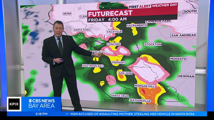
st. helena down south into vallejo.eing patchy conditions throughout the peninsula this morning. i will say this, into the next couple hours it is not liting up just yet. i will show you futurecast in a second. you can see what i mean. it's hit or miss all day long. here is the winter weather advisory. for higher elevated areas from 2,000 feet and above we can see three to 12. 12 will not happen by the way. three inches roughly this afternoon into the evening hours. tonight this advisory will expire at 4:00. we don't have a lot of high elevated areas that will see the crazy downpour of snow. light flurries are expected. close to mount hamilton they're expecting about an inch. we have left over energy from the major system sweeping through. taking a look at temperatures, i want to dive into this. notice it doesn't really warm up into the afternoon hours just on futurecast. what i am saying with this is it's a chilly day. bundle up. we are 10 to 15 degrees below average throughout the area into this afternoon. here is fut
st. helena down south into vallejo.eing patchy conditions throughout the peninsula this morning. i will say this, into the next couple hours it is not liting up just yet. i will show you futurecast in a second. you can see what i mean. it's hit or miss all day long. here is the winter weather advisory. for higher elevated areas from 2,000 feet and above we can see three to 12. 12 will not happen by the way. three inches roughly this afternoon into the evening hours. tonight this advisory will...
61
61
Feb 28, 2023
02/23
by
KGO
tv
eye 61
favorite 0
quote 0
st. helena, we have snow in the mid to high elevations, an area of rain that is fairly steady right now, view, sunnyvale, and over in the east bay come along 580, we have got some downpours. it is windy out there, 25 to nearly 35 miles an hour across the bay area. most of the day, this has been a level 2 less intense, it is going to be a level one storm. we are talking pocket the showers, brief downpours, windy conditions at times, low elevations, and an isolated thunder and hail. starting at 5:00 p.m., notice not a lot of activity between 5:00 and 8:00. later tonight, we get more widespread snow developing in the high elevations with pockets of rain moving on shore just before midnight. 6:00 a.m. tomorrow, as the morning commute is really getting underway, that is when our next wave of stormy weather, pretty energetic storm, moves in. we have a winter storm affecting the sierra until 4:00 a.m. wednesday. lowe's tonight, mid to upper 30's in, about 40 and the shoreline. l -- 30's inland come about 40 in the shoreline. dan: it is amazing. a student doing something his school has never see
st. helena, we have snow in the mid to high elevations, an area of rain that is fairly steady right now, view, sunnyvale, and over in the east bay come along 580, we have got some downpours. it is windy out there, 25 to nearly 35 miles an hour across the bay area. most of the day, this has been a level 2 less intense, it is going to be a level one storm. we are talking pocket the showers, brief downpours, windy conditions at times, low elevations, and an isolated thunder and hail. starting at...
51
51
Feb 11, 2023
02/23
by
KGO
tv
eye 51
favorite 0
quote 0
st. helena, the sierra nevada, two to three inches, maybe four around kirkwood and the high surf advisory0, 13 to 14 foot waves right now. pretty dangerous. looking at our highs for sunday, warmer, mid-60's to near 70 p look what happens monday, still 60's in the east bay but getting cooler and windier by the coast and then by tuesday, look at high temperatures, struggling to make it to around 50. highs mid-50's was showers ending this morning but further breezy afternoon winds, the warmer day sunday and the day of transition monday. by tuesday and wednesday, we get really chilly, overnight lows dropping back into the 30's, maybe colder than that. friday, the next chance of rain but looks weak. we have a nice warm day tomorrow and then back. >> so we will have to savor tomorrow as best as we can. thank you so much. a reminder, you can watch the newscasts live and on-demand through the abc seven bay area connected tv app available for apple tv, google tv, amazon fire tv, and roku sewed download the tv, and roku sewed download the app now in s i'm jayson. i'm living with hiv and i'm on cabe
st. helena, the sierra nevada, two to three inches, maybe four around kirkwood and the high surf advisory0, 13 to 14 foot waves right now. pretty dangerous. looking at our highs for sunday, warmer, mid-60's to near 70 p look what happens monday, still 60's in the east bay but getting cooler and windier by the coast and then by tuesday, look at high temperatures, struggling to make it to around 50. highs mid-50's was showers ending this morning but further breezy afternoon winds, the warmer day...
75
75
Feb 22, 2023
02/23
by
KNTV
tv
eye 75
favorite 0
quote 0
st. helena. it's very spotty today. i do expect the activity to start to ramp up tomorrow afternoon.when much more of the bay area is going to see rain and wintery weather in the mix as well. where you see the white and the pink, that's wintery mix and snow and green shows the rain that starts to taper off on saturday. overall we're looking at several storm systems coming in over the next few days. more widespread rain between thursday night and friday. then it tapers off briefly on saturday before another storm system comes in on sunday, another one right behind that on monday. you can see the picture here. it's going to be cold and wet through at least next week and we have a possibility of getting about 2 to 3 inches of rainfall for those areas in purple that really spreads out as we go toward the middle of next week. so our temperatures, no warm-up here. upper 40s, low 50s. mornings starting out in the 30s. the thing that will be changing, almost rapidly throughout the day, is going to be sunshine, then we go to rain, then snow, then there will be some hail. it's going to be all
st. helena. it's very spotty today. i do expect the activity to start to ramp up tomorrow afternoon.when much more of the bay area is going to see rain and wintery weather in the mix as well. where you see the white and the pink, that's wintery mix and snow and green shows the rain that starts to taper off on saturday. overall we're looking at several storm systems coming in over the next few days. more widespread rain between thursday night and friday. then it tapers off briefly on saturday...
89
89
Feb 22, 2023
02/23
by
KNTV
tv
eye 89
favorite 0
quote 0
st. helena up to 7 or 8 inches of snow.will cause difficult travel, as well as possibly more downed trees and power outages. and then going into the weekend we start to see this first storm sinking to the south, another one coming in on sunday. and then there's going to be another storm right behind that on monday. so lots to watch out for here. and we could see all kinds of precipitation here from rain to snow, as well as hail and also maybe even some gropple. our temperatures reach into the upper 40s and low 50s. mornings starting out near freezing and we see more of this cold and wet weather at least through the beginning of next week. >>> vianey, any issues popping up for the early morning commute? >> we're getting closer to the 6:00 a.m. hour and the thing i'm noticing is building traffic. we've got a smooth commute, but the bay bridge toll plaza, the metering lights are definitely on. so you can expect to see those delays start to stretch beyond the toll span through berkeley as well and the oakland interchange along
st. helena up to 7 or 8 inches of snow.will cause difficult travel, as well as possibly more downed trees and power outages. and then going into the weekend we start to see this first storm sinking to the south, another one coming in on sunday. and then there's going to be another storm right behind that on monday. so lots to watch out for here. and we could see all kinds of precipitation here from rain to snow, as well as hail and also maybe even some gropple. our temperatures reach into the...
88
88
Feb 25, 2023
02/23
by
KNTV
tv
eye 88
favorite 0
quote 0
st. helena said employees couldn't make it down the mountain safely. >> talked to jason, one of our winemakers. i think he had 8 inches of snow, no power, trees down everywhere. >> reporter: as for the vines up there, the buds haven't broken. vineyards tell me they think they'll survive, but -- >> our olive trees took a big hit. we have 140-year-old olive trees, and they're tall, 30, 35 feet tall, and they're just a wreck. >> reporter: a wreck that will need a little more tlc as they wait for this winter wonderland to melt. >> it's a nice diversion, you know, and then in a couple days, it's back to the grind. >> reporter: gia vang, "today in the bay." >>> the snow is not just in the bay area. look at this. there is plenty of snow in southern california. this was in wrightwood in san bernardino county. you can see those green signs saying "chains required." people put on their chains there. the elevation is 6,000 feet there. for the first time since 1989, a blizzard warning is in effect for the mountains in ventura and l.a. counties. that's through the day today. coming up in 30 minutes from no
st. helena said employees couldn't make it down the mountain safely. >> talked to jason, one of our winemakers. i think he had 8 inches of snow, no power, trees down everywhere. >> reporter: as for the vines up there, the buds haven't broken. vineyards tell me they think they'll survive, but -- >> our olive trees took a big hit. we have 140-year-old olive trees, and they're tall, 30, 35 feet tall, and they're just a wreck. >> reporter: a wreck that will need a little...
105
105
Feb 27, 2023
02/23
by
KNTV
tv
eye 105
favorite 0
quote 0
st. helena, we are seeing some snow coming down in some of those areas. this will be a storm where the snow is up a lot higher and we'll have a chance of thunderstorms as the system quickly sweeps through, through late morning into the afternoon a chance of thunderstorms that could bring some hail, as well as gusty winds that could top about 50 miles per hour for the coastline, and then scattered showers as we go into today, with another coating of snow. but mostly up above 2,000 feet, as well as some elevations that are higher compared to what we had last week. we are also going to see more rain in the forecast tomorrow, with another wave of heavy rain. i'm tracking that, as well as the impacts, and we'll also talk about when we get a little bit of a break in just a few minutes. >> we're going to need those when we can get them. the next storm soon to arrive, the morning commute may get dicey in parts of the bay area. >> "today in the bay's" bob redell is live in livermore. kari was just talking about the wintery condition we're seeing may once again bri
st. helena, we are seeing some snow coming down in some of those areas. this will be a storm where the snow is up a lot higher and we'll have a chance of thunderstorms as the system quickly sweeps through, through late morning into the afternoon a chance of thunderstorms that could bring some hail, as well as gusty winds that could top about 50 miles per hour for the coastline, and then scattered showers as we go into today, with another coating of snow. but mostly up above 2,000 feet, as well...
36
36
Feb 21, 2023
02/23
by
KTVU
tv
eye 36
favorite 0
quote 0
moon bay reporting a wind gust of 41 in our hills just as bad we have mount diablo reporting 38 not st helena reporting 29 big rock in the north bay reporting winds. 2 51 so the wind advisory moves into place at one o'clock. it's not even in place right now. but you can see it's very gusty and blustery already out there for today, and this wind advisory doesn't expire until tomorrow at one o'clock, and we do expect those wins again to be reaching 50 to 55 mph, which could create the power outages perhaps bring down trees, things like that, so that's pretty much what we're dealing with for today. cool and very windy conditions tomorrow a winter storm watch for the santa cruz mountains because snow levels has some point. are expected to drop down about 1000 ft and a freeze watch for parts of the bay area on thursday, so very cold air continuing to filter into the bay area over the next few days. meanwhile the winter storm warning for the sierra is already in place, and it doesn't expire until saturday . so a lot going on in the sierra as well. a winter weather advisory for the lake tahoe area f
moon bay reporting a wind gust of 41 in our hills just as bad we have mount diablo reporting 38 not st helena reporting 29 big rock in the north bay reporting winds. 2 51 so the wind advisory moves into place at one o'clock. it's not even in place right now. but you can see it's very gusty and blustery already out there for today, and this wind advisory doesn't expire until tomorrow at one o'clock, and we do expect those wins again to be reaching 50 to 55 mph, which could create the power...
69
69
Feb 10, 2023
02/23
by
KTVU
tv
eye 69
favorite 0
quote 0
our winds are generally light where a little breezy in our hills as we check in over areas mount st helena reporting 90 mph reporting 23 big rock as well as middle peak reporting 20 mph here in the north bay hills, no wind advisory associated with this system and we're not expecting a whole lot of rain. i do think we're going to be cooler, though for tomorrow afternoon. here's a view of storm tracker to where it's still fairly quiet out there again, perhaps just a little bit of drizzle. following right below the radar beam, and as i stretch back just a little bit, we can see. still the front is to the north into the west, so this is going to be dropping in the system is going to kind of slide right down the coastline, and so we'll have an opportunity at a few scattered showers this evening. but right now, it looks like saturday morning will be the best opportunity for all of us to see a little bit more wet weather and i'll show you this with the future cast in about four o'clock or so notice. it's over the north bay now what starts to happen is it moves through the central and south bay in
our winds are generally light where a little breezy in our hills as we check in over areas mount st helena reporting 90 mph reporting 23 big rock as well as middle peak reporting 20 mph here in the north bay hills, no wind advisory associated with this system and we're not expecting a whole lot of rain. i do think we're going to be cooler, though for tomorrow afternoon. here's a view of storm tracker to where it's still fairly quiet out there again, perhaps just a little bit of drizzle....
110
110
Feb 25, 2023
02/23
by
KGO
tv
eye 110
favorite 0
quote 0
but in the north bay around st helena highway, 12 some rain snow mix and there's rain from american canyonlong the coast here, inverness looking at some wet weather level one system slippery roads , scattered showers with that rain snow mix and look at mount tam. yes, still looking very wintery 41 downtown 42 in santa clara. it's in the upper thirties for half moon bay and look at sfo a little bit of sun there so not everyone seeing the rain 38 santa rosa 39 in livermore. so this all winds down within the 9 10 o'clock hour. we're left with mostly cloudy skies if you sunny breaks and a break until today. morrow. then we're going to see another level one system. this will be bringing a rainy sunday, maybe a third of an inch and more rain for monday list. lisa thank you . the news continues with good morning america and we'll see you in a half hour for another news update. have a more paper being crumpled music: “i wish” by skee-lo boom! sound of paper balls landing in bins office workers cheering music stops why do we shoot baskets with paper balls? for the same reason we play scratchers fro
but in the north bay around st helena highway, 12 some rain snow mix and there's rain from american canyonlong the coast here, inverness looking at some wet weather level one system slippery roads , scattered showers with that rain snow mix and look at mount tam. yes, still looking very wintery 41 downtown 42 in santa clara. it's in the upper thirties for half moon bay and look at sfo a little bit of sun there so not everyone seeing the rain 38 santa rosa 39 in livermore. so this all winds down...
83
83
Feb 23, 2023
02/23
by
KTVU
tv
eye 83
favorite 0
quote 0
mount st helena, you're getting snow flurries. hambleton, if you get a cloud over it you know, the freezing level is down around 3000 ft, so we're definitely seeing low low snow levels and the snow level is going to go lower than that. their main event for us is going to be thursday night into friday. you know that time we're going to see certainly snow levels down to around 1000 ft, or 800 ft, maybe as low as 500, ft and again, will we get a lot of snow? yeah you know, 1976. we had a big event where we got 3 to 5 inches of snow up on twin peaks up in marin county an inch out in the avenues that's hard to do with a very cold weather system like this, because again, the moisture air the moisture is really not available. it's super dry. so this is the forecast for tomorrow and i'll take you through it. so tomorrow looks a lot like today, doesn't it until you get to the evening hours here we are about 56. how it sort of organizes right there and it brings you look at the moisture it pulls in from the south. south. so that is our best
mount st helena, you're getting snow flurries. hambleton, if you get a cloud over it you know, the freezing level is down around 3000 ft, so we're definitely seeing low low snow levels and the snow level is going to go lower than that. their main event for us is going to be thursday night into friday. you know that time we're going to see certainly snow levels down to around 1000 ft, or 800 ft, maybe as low as 500, ft and again, will we get a lot of snow? yeah you know, 1976. we had a big event...
166
166
Feb 25, 2023
02/23
by
KTVU
tv
eye 166
favorite 0
quote 0
quite a few roads in the higher elevations were closed highway 29 over mount st helena was closed not only due to snow, but a number of fallen trees that completely blocked the road on my phone tells me that we're at 1400 ft, which is the very bottom of the snow line all around napa belly. there are plenty of places that are much, much higher. and they're covered in snow as well. in other places , the snow was much lower well under 1000 ft. since snow like this, it's probably been since about early two thousands more weather coming over the weekend . this is not over because a lot of the snow is sticking nonetheless, the valley floor where there is no snow is open for your business. tom baker, ktvu fox two news. quick reminder you can always get the latest weather conditions and forecast with our ktvu weather app. it includes a live interactive radar, the app is free to download for your phone. six, the san francisco police department looking for a missing person considered at risk, jeffrey vandergrift was last seen at his home on king street, san francisco last night around 10. pm he
quite a few roads in the higher elevations were closed highway 29 over mount st helena was closed not only due to snow, but a number of fallen trees that completely blocked the road on my phone tells me that we're at 1400 ft, which is the very bottom of the snow line all around napa belly. there are plenty of places that are much, much higher. and they're covered in snow as well. in other places , the snow was much lower well under 1000 ft. since snow like this, it's probably been since about...
99
99
Feb 28, 2023
02/23
by
KTVU
tv
eye 99
favorite 0
quote 0
on monday, a light dusting of wet snow was falling along the summit of mount st helena. in fact, a series of storm cells moved through the bay area monday morning into the afternoon, some of them resulting in short but intense downpours. pg and e is temporary staging point on mount sina halina was mostly empty because crews were busy dealing with numerous mostly smaller outages . the hardest hit area in the bay area has been the north bank where we have 4000 customers about power. so that's about half of the outages and all of the bay area quite a bit of the snell that fell on northern napa county mountains at the end of last week, still remains with more expected down to 2500 ft highway 29 between calistoga and lake county was finally opened. it had been closed for a long time due to icy road conditions and the fact that trees had fallen down on power lines causing pg need to affect repairs up here, but that is over. just for now. so we're looking at this as a series of three storms. the first storm was last week. the second storm started this morning and his lasting th
on monday, a light dusting of wet snow was falling along the summit of mount st helena. in fact, a series of storm cells moved through the bay area monday morning into the afternoon, some of them resulting in short but intense downpours. pg and e is temporary staging point on mount sina halina was mostly empty because crews were busy dealing with numerous mostly smaller outages . the hardest hit area in the bay area has been the north bank where we have 4000 customers about power. so that's...
 Live Music Archive
 Librivox Free Audio
 Metropolitan Museum
 Cleveland Museum of Art
 Internet Arcade
 Console Living Room
 Open Library
 American Libraries
 TV News
 Understanding 9/11