176
176
Jan 24, 2013
01/13
by
WRC
tv
eye 176
favorite 0
quote 0
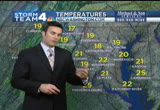
good morning, i'm storm team 4 meteorologist tom kierein. most of the snow is scattered in northern virginia, the district, into maryland. these are heading to the south and east. they've left in their wake many locations that have picked up an inch mainly south and east of washington. even a couple of inches parts of st. mary's county. this is going to be changing over it some clearing skies here over the next couple of hours. sunshine with a blustery wind. highs only near 30 degrees by mid-afternoon. could get more snow tomorrow. latest in ten minutes. danella with a look at traffic now. >>> good morning. an update on early morning accidents westbound 66 at the dulles toll road. crash here is blocking the left lane and the center lane. over to i-95 at cardinal drive, you'll see off to the right lane here, there is an accident. please use extra caution as you travel along i-95. the other accident, this one at dumfries road. still the box truck is disabled blocking the right lane, as well. i'm back in ten. over to you. >> thank you. >>> we h
good morning, i'm storm team 4 meteorologist tom kierein. most of the snow is scattered in northern virginia, the district, into maryland. these are heading to the south and east. they've left in their wake many locations that have picked up an inch mainly south and east of washington. even a couple of inches parts of st. mary's county. this is going to be changing over it some clearing skies here over the next couple of hours. sunshine with a blustery wind. highs only near 30 degrees by...
141
141
Jan 28, 2013
01/13
by
WRC
tv
eye 141
favorite 0
quote 0
look at storm team 4 radar. we're getting precipitation reaching the ground to our west and north. but not right in the district or south and east. the areas in bright white getting a combination of sleet and freezing rain across loudoun county. across the potomac into montgomery county, the areas in bright white, from poolsville, gaithersburg, clarksburg, all getting sleet and light icing. farther south and east of there, just a few light sprinkles and temperatures are a little bit above freezing around the beltway and inside the beltway. just north and west, we have it right near the freezing mark. hour by hour through the morning hours, hovering near freezing. sleet and icing, 5:00, 6:00 a.m. by 7:00, some light icing on untreated surfaces, elevated surfaces. that's the same for 8:00 and 9:00 a.m. may have a few isolated slick spots on roads. a look at traffic now with danella. >> good morning. checking the roadways in your first 4 traffic report. looking for construction, looks pretty clear. we'll talk about
look at storm team 4 radar. we're getting precipitation reaching the ground to our west and north. but not right in the district or south and east. the areas in bright white getting a combination of sleet and freezing rain across loudoun county. across the potomac into montgomery county, the areas in bright white, from poolsville, gaithersburg, clarksburg, all getting sleet and light icing. farther south and east of there, just a few light sprinkles and temperatures are a little bit above...
208
208
Jan 28, 2013
01/13
by
WRC
tv
eye 208
favorite 0
quote 0
storm team 4 meteorologist tom kierein now here. tom? >> it's mostly icing now. my twitter followers and facebook friends are posting reports of patio furniture coated with ice, decks getting coated, tree limbs, shrubbery, power lines and icicles. those areas in pink is where we're getting the freezing rain. it's liquid rain that falls and then freezes on elevated surfaces. and it will continue for several hours. the areas in white, that's where there's a little bit of snow and sleet in eastern prince george's county and anne arundel. the rest of western howard, frederick county in maryland, much of loudoun county, most of those regions, we have temperatures at the freezing mark or below depending on the elevation where you live. that's where the rain is icing up on elevated surfaces on tree limbs and power lines and schaubry. farther south, it's in the form of rain. generally in the district, the areas in green, the rain is not sticking to anything. it's continuing to fall. southern maryland, northern neck, down 95. toward fredericksburg. but west of 95 there ar
storm team 4 meteorologist tom kierein now here. tom? >> it's mostly icing now. my twitter followers and facebook friends are posting reports of patio furniture coated with ice, decks getting coated, tree limbs, shrubbery, power lines and icicles. those areas in pink is where we're getting the freezing rain. it's liquid rain that falls and then freezes on elevated surfaces. and it will continue for several hours. the areas in white, that's where there's a little bit of snow and sleet in...
153
153
Jan 24, 2013
01/13
by
WRC
tv
eye 153
favorite 0
quote 0
here's the storm team 4 four-day forecast. we'll have sunshine breaking out here later this morning. winds increasing, gusting to 30 miles per hour. that will blow the snow around. we'll be in the upper 20s by later this afternoon. and then clear, cold tonight, teens by dawn tomorrow. and thickening clouds tomorrow. then does look like during the afternoon and evening, more snow. maybe a couple more inches or so. and ending midnight friday night. sun back on saturday and sunday. still cold. a warming trend as we get into next week. maybe rain on wednesday. i'm back in ten minutes. danella with first 4 traffic. good morning. >>> good morning. have an update on the earlier accident we were talking about. southbound i-270 south of fingerboard road. that accident involved four vehicles. it's out of the roadway. making your way southbound heading toward montgomery county, it is pretty slippery along i-270. let's take a look now as you're making the commute. this time around the beltway, not bad at all in montgomery county as well,
here's the storm team 4 four-day forecast. we'll have sunshine breaking out here later this morning. winds increasing, gusting to 30 miles per hour. that will blow the snow around. we'll be in the upper 20s by later this afternoon. and then clear, cold tonight, teens by dawn tomorrow. and thickening clouds tomorrow. then does look like during the afternoon and evening, more snow. maybe a couple more inches or so. and ending midnight friday night. sun back on saturday and sunday. still cold. a...
185
185
Jan 30, 2013
01/13
by
WRC
tv
eye 185
favorite 0
quote 0
storm team 4 has been tracking it for days, our team coverage begins with meteorologist veronica johnson. what's the time line? >> the next six to seven more hours. we have quite a ways to go. you can see on radar, there's the storms down south, part of the same weather system headed even. we're on the leading edge of some of those heavy rains and the high winds too. you can see around columbia, gaithersburg, through montgomery county, even leesburg, blue mount areas. and even some gusty conditions, too. headed towards gaithersburg, in the next 20 minutes, so all against eastbound for us, from in and out until 11:00 p.m. we have the possibility of seeing not only heavy rain, but also very high winds throughout the area. those heavy rains could be delivers ponding on area roads. we could get quite a bit of rain in a short period of time. let's go to chief meteorologist doug kammerer standing by with more on our potential for flooding and wind damage. >> yeah, veronica, the national weather service just issued the wind advisories for the entire area. earlier today it was out towards portio
storm team 4 has been tracking it for days, our team coverage begins with meteorologist veronica johnson. what's the time line? >> the next six to seven more hours. we have quite a ways to go. you can see on radar, there's the storms down south, part of the same weather system headed even. we're on the leading edge of some of those heavy rains and the high winds too. you can see around columbia, gaithersburg, through montgomery county, even leesburg, blue mount areas. and even some gusty...
172
172
Jan 25, 2013
01/13
by
WRC
tv
eye 172
favorite 0
quote 0
you can see what i'm talking about on storm team 4 radar.ng to move out of the area right there in northwestern areas of virginia, around winchester ending soon, the snow, this is a system that's just racing eastward. it didn't last very long. but the fact is for anyone going out on area roads, it may be slick in some spots. for buie, right along i-95, bigger flakes of snow. same thing leesburg, loudon county, and prince william county around 66, you're still getting the snow, as well. you can see it showing up, little bit better on the composite. that brighter white, around 15, and just around reston too, reston, virginia, snow coming down pretty good, as well. lower visibilities there. and also, 301. look at this from colonial beach, this will be headed toward leonardtown, montrose area in a couple of minutes. reduced visibility. only till about 7:00 or 8:00 p.m. slick for tonight, keep that in mind if you're going out tonight or out early tomorrow. and, you know, this has been a very cold week for us, the last three days our high temperat
you can see what i'm talking about on storm team 4 radar.ng to move out of the area right there in northwestern areas of virginia, around winchester ending soon, the snow, this is a system that's just racing eastward. it didn't last very long. but the fact is for anyone going out on area roads, it may be slick in some spots. for buie, right along i-95, bigger flakes of snow. same thing leesburg, loudon county, and prince william county around 66, you're still getting the snow, as well. you can...
189
189
Jan 25, 2013
01/13
by
WRC
tv
eye 189
favorite 0
quote 0
storm team meteorologist tom kieran. folks are getting ready for the storm coming this way. >>> just enough to put down a coating but will stick immediately once it starts falling. showing the mountains. the bright white areas is where it's reaching the ground. where you see the darker gray, it's all pretty much drying up before it reaches the ground. we don't have -- it shows on radar snow right over northern virginia, the district, and maryland, don't have any reports of any of that reaching the ground. when you look at the sky, you kind of see there's a little bit of fuzzy look to the clouds. that is actually the snow falling out of the clouds, but then it dries right up. it reaches the surface. it's going to take a while before the snow does saturate and begins to reach the ground. right now at the surface, still very cold. right now only in the low 20s. in the nearby suburbs, montgomery, prince george's, arlington, and fairfax. right at reagan national now at 24 degrees. and it is extremely dry. that's why a lot of t
storm team meteorologist tom kieran. folks are getting ready for the storm coming this way. >>> just enough to put down a coating but will stick immediately once it starts falling. showing the mountains. the bright white areas is where it's reaching the ground. where you see the darker gray, it's all pretty much drying up before it reaches the ground. we don't have -- it shows on radar snow right over northern virginia, the district, and maryland, don't have any reports of any of that...
143
143
Jan 25, 2013
01/13
by
WRC
tv
eye 143
favorite 0
quote 0
taking you hour by hour, storm team 4 keeping you ahead of the storm the entire time. now we look toward the weekend. we'll talk about what's coming up next. a lot to talk about in the weather. we've got ups and downs, snow, freezing rain, we've got, well, i'll show it to you all coming up. >> thank you, doug. >>> we have live team coverage across the area. julie carey's in northern virginia, adam tuss in montgomery county. tracee wilkins in montgomery county. hi, julie. >> reporter: well, here in western fairfax county, seems the snowfall has tapered off. even seen much for the last 30 minutes. in fact, look up behind me in the sky. the moon is glowing through the clouds and just a while ago, as the sun was going down, we saw the sun coming through, even the snow falling, strange weather sights out here today. take a look down on the sidewalk here. you get a pretty good idea of the little bit of powdery snow out here in fairfax county. but, vdot still took this seriously. and they wanted to stay ahead of this snow that came down this afternoon. take a look at these tr
taking you hour by hour, storm team 4 keeping you ahead of the storm the entire time. now we look toward the weekend. we'll talk about what's coming up next. a lot to talk about in the weather. we've got ups and downs, snow, freezing rain, we've got, well, i'll show it to you all coming up. >> thank you, doug. >>> we have live team coverage across the area. julie carey's in northern virginia, adam tuss in montgomery county. tracee wilkins in montgomery county. hi, julie. >>...
122
122
Jan 28, 2013
01/13
by
WRC
tv
eye 122
favorite 0
quote 0
storm team 4 radar showing this precipitation but moving in the last six hours. but it's suspended aloft. much of it is drying up before reaches the ground. to our west, some is beginning to reach the ground. these areas in the darker pinks in loudoun county, montgomery county, as well as -- frederick county west virginia. panhandle there. leesburg they're getting sleet and freezing rain beginning. all points east, it's generally just a little bit above freezing. any rain that falls is going to generally just be wet initially. but just to our west, you look here and montgomery county it's at the freezing mark, so is much of fairfax county, points west into loudoun county and along the blue ridge, prince william into fauquier, near freezing. isolated spots in calvert, anne arundel near the freezing mark. hour by hour, 6:00 we'll probably have sleet and icing. temperatures should be below freezing then. we are going to be staying near 30 degrees at 7:00 a.m., 8:00 a.m., 9:00 a.m. could have isolated slick spots on the untreated surfaces by 8:00. just a trace of ici
storm team 4 radar showing this precipitation but moving in the last six hours. but it's suspended aloft. much of it is drying up before reaches the ground. to our west, some is beginning to reach the ground. these areas in the darker pinks in loudoun county, montgomery county, as well as -- frederick county west virginia. panhandle there. leesburg they're getting sleet and freezing rain beginning. all points east, it's generally just a little bit above freezing. any rain that falls is going to...
138
138
Jan 24, 2013
01/13
by
WRC
tv
eye 138
favorite 0
quote 0
. >> let's check in with storm team 4 meteorologist tom kierein. tom? >> it's a dry snow, coming down since before 11:00 last night. a lot of it now tapering off. you see a little of the moon showing through. "atlanti there's lingering snow in the area. white areas, it's coming down harder in far southern parts of the eastern shore. now the darker gray areas, very light snow in montgomery and howard, prince george's, arlington and fairfax. across northern virginia, there's a couple of spots where it will be coming down harder, prince william, northern fauquier, the panhandle of west virginia. this is all rapidly moving to the east. it did leave up to an inch of snow in some locations. generally around the metro area and points north and west. there was only about a half inch to less than that, maybe a quarter inch. some places here, pendleton county, west virginia, had a couple of inches. a winter weather advisory in effect until 9:00. it's probably going to be expiring here shortly as the snow's going to taper off and end over the next couple of hours.
. >> let's check in with storm team 4 meteorologist tom kierein. tom? >> it's a dry snow, coming down since before 11:00 last night. a lot of it now tapering off. you see a little of the moon showing through. "atlanti there's lingering snow in the area. white areas, it's coming down harder in far southern parts of the eastern shore. now the darker gray areas, very light snow in montgomery and howard, prince george's, arlington and fairfax. across northern virginia, there's a...
155
155
Jan 24, 2013
01/13
by
WRC
tv
eye 155
favorite 0
quote 0
we have the winter weather special coming on, all of us on storm team 4 a part of this.have a forecast for the rest of the wind. so tune in. >>> virginia driver will have to keep paying a monthly fees to use their e-zpass transponders. a bill eliminating the monthly charge has been sent to the house committee for further study. that means the issue is dead for this session. since july vdot that is charged a $1 a month for flex transponders. official say the money goes to the cost. >>> a 9-year-old actress guess critical acclaim, also making some history. she's forced to deal with the real devastate when a storm wipes out her louisiana home. nbc's ann curry sat down with wallis and her co-star. >> boy, it's a long way from being a baker to become an academy award nominated movie. >> yes, it is. yes, sitting with mice little hush puppy. >> daddy. >> she's going to win, no doubt about it. no doubt about itivities you can't be so selfish. >> i know, but something is telling me you're going to win. you have to. >> just keep in mind you can't be selfish. >> all right. >> she i
we have the winter weather special coming on, all of us on storm team 4 a part of this.have a forecast for the rest of the wind. so tune in. >>> virginia driver will have to keep paying a monthly fees to use their e-zpass transponders. a bill eliminating the monthly charge has been sent to the house committee for further study. that means the issue is dead for this session. since july vdot that is charged a $1 a month for flex transponders. official say the money goes to the cost....
117
117
Jan 25, 2013
01/13
by
WRC
tv
eye 117
favorite 0
quote 0
. >>> more now on the storm team 4 coverage. we continue to monitor the conditions live in northwest d.c. >>> and take a look at the storm team 4 continuing to watch this storm making its way through the area. the snow continues out towards the capitol. one thing you can see, though, you can see the dome of the capitol building here. that means the snow not too heavy right now. reporting areas of light to moderate snow. and that continues throughout the region. and will continue for about the next one to two hours across the region. so if you wait until about 8:00 or 9:00, you should be fine. as far as the falling snow is concerned, what we are going to see is that snow accumulated on the roadways. you see where we are right now and notice that snow still coming through the washington, d.c. metro area. but also notice back towards the west, out towards winchester. this area right in here. this is the last area to make its way through the d.c. metro area. that will most likely move in about the next hour to two hours. once again,
. >>> more now on the storm team 4 coverage. we continue to monitor the conditions live in northwest d.c. >>> and take a look at the storm team 4 continuing to watch this storm making its way through the area. the snow continues out towards the capitol. one thing you can see, though, you can see the dome of the capitol building here. that means the snow not too heavy right now. reporting areas of light to moderate snow. and that continues throughout the region. and will...
185
185
Jan 11, 2013
01/13
by
WRC
tv
eye 185
favorite 0
quote 0
storm team 4 meteorologist tom kierein is taking a look outside. tom?ing turns. that's great. we all immediate to take a lesson. >> i like that, tom. >> there's the jefferson memorial and the washington monument under a mostly cloudy sky on this friday morning. good morning, happy friday. right now, the cloud cover extends across most of virginia, maryland and into west virginia. and there are a few thin breaks in the cloud cover over northern virginia now, parts of maryland and we're cold under this cloud cover. temperatures are down near or below freezing. much of northern virginia and southern maryland as well as just to the north. montgomery county near freezing, so is prince george's county and arlington and fairfax. it's a bit milder, though, in the shenandoah valley and out in the mountains. in the upper 30s to near 40 degrees. some of that mild air coming in on a southerly and southwesterly breeze. they have a week disturbance passing over us later today. as it does, it will likely trigger needed rain. we have been abnormally dry the last few we
storm team 4 meteorologist tom kierein is taking a look outside. tom?ing turns. that's great. we all immediate to take a lesson. >> i like that, tom. >> there's the jefferson memorial and the washington monument under a mostly cloudy sky on this friday morning. good morning, happy friday. right now, the cloud cover extends across most of virginia, maryland and into west virginia. and there are a few thin breaks in the cloud cover over northern virginia now, parts of maryland and...
144
144
Jan 28, 2013
01/13
by
WRC
tv
eye 144
favorite 0
quote 0
as we take a look at storm team 4 radar, look at your screen. areas in the pink and the white, that's where we're getting that combination of some sleet and snow and freezing rain. now, the combination of the snow and the sleet is piled up a little bit. only a light amount in montgomery county and howard county. northern prince george's and farther south and east of there. but farther west, now, it's changing over just to all rain south of washington and in the district of columbia. it's a combination of sleet and some rain. it's rain that's falling into air that's below freezing. when that rain hits elevated surfaces like tree limbs and power lines, those can then begin to get a light glaze of ice on them. that's what's going to be happening here for the next several hours through the rest of much of the morning hours. that includes northern virginia, the district, nearby counties in maryland. we're right at or a little below the freezing mark. the difference between the sleet and freezing rain. sleet are the tiny balls of ice that fall down an
as we take a look at storm team 4 radar, look at your screen. areas in the pink and the white, that's where we're getting that combination of some sleet and snow and freezing rain. now, the combination of the snow and the sleet is piled up a little bit. only a light amount in montgomery county and howard county. northern prince george's and farther south and east of there. but farther west, now, it's changing over just to all rain south of washington and in the district of columbia. it's a...
274
274
Jan 25, 2013
01/13
by
WRC
tv
eye 274
favorite 0
quote 0
storm team 4 radar, look at that. nothing to show right now. i don't think it's going to be until we get till about noontime. this next system will start to move in. this will be the dominant system. all moving east, both producing some snowfall and even some wintry conditions down to our south. it's snow for us starting at 2:00. it's cold enough, unlike all of the other systems we had the early part of the winter. much like this last storm system, it will come through quickly. i do not think we're going to have any locations that pick up four or five inches of snowfall as was the case down towards the area of southern maryland this morning. we pick up around one, maybe two inches of snowfall in some locations. then it's cold, but we get the sunshine back over the weekend. and when we do, i do think that the actual afternoon high may get above freezing. so let's talk about those snowfall totals then throughout the area. gaithersburg, montgomery county, leesbu leesburg, one to two inches of snowfall. and then some slightly higher amounts around
storm team 4 radar, look at that. nothing to show right now. i don't think it's going to be until we get till about noontime. this next system will start to move in. this will be the dominant system. all moving east, both producing some snowfall and even some wintry conditions down to our south. it's snow for us starting at 2:00. it's cold enough, unlike all of the other systems we had the early part of the winter. much like this last storm system, it will come through quickly. i do not think...
195
195
Jan 30, 2013
01/13
by
WRC
tv
eye 195
favorite 0
quote 1
storm team 4 has you covered as always. and stay ahead of the storm, downlocal the weather app. search "nbc washington in the app. story or in google play. >>> there's a new twist in the trial of that former culpepper police officer. today jersey were asked to testify about alleged misconduct during deliberations. reporter david culver explains how it unfolded today in court. >> reporter: an unexpected shake-up. suddenly it was the jurors being questioned, the judge and attorneys wanting to know how two additionnaries and one they sauers may have influenced the verdict. the defense they're receiving, they've already filed motion for a mistrial. daniel harmon wright walking back into jail today, a little more composed, a very different harmon wright from 24 hours earlier. that's when a jury convicted him of voluntary manslaughter. perhaps now harmon wright is more hopeful. there's a chance he could get a new trial. inside the courtroom, drama focused on the jurors after tuesday's deliberations, a clerk found two dictionaries and a th thesaurus. bail lives escorted each juror insi
storm team 4 has you covered as always. and stay ahead of the storm, downlocal the weather app. search "nbc washington in the app. story or in google play. >>> there's a new twist in the trial of that former culpepper police officer. today jersey were asked to testify about alleged misconduct during deliberations. reporter david culver explains how it unfolded today in court. >> reporter: an unexpected shake-up. suddenly it was the jurors being questioned, the judge and...
153
153
tv
eye 153
favorite 0
quote 0
now, here's the storm team 4 seven-day outlook into the weekend.tart and cloudy on sunday. good weather for the 'skins game. ought to be in the low to mid upper 40s in the afternoon and then more of the same on monday. but some sun returning. i'll return in ten minutes now with a look at your traffic alexis davies in for danella. good morning. >> good morning, tom. breaking news on the roadways. very serious accident with multiple vehicles. mississippi avenue southeast and hailey terrace southeast. that intersection is closed. your best alternate is fourth street southeast. elsewhere on the roadways, the accident on the ramp to northbound 95 at fairfax county parkway has been cleared and that ramp has been reopened. traveling and look around the roadways, the 95 corridor and the bw parkway corridor, southbound travelers on the parkway, looks like you're up to speed. no issues to report. 49 miles per hour as you head into the district. live look now at 95 in maryland at route 216. things are looking good there as well. all travel lanes are open. you
now, here's the storm team 4 seven-day outlook into the weekend.tart and cloudy on sunday. good weather for the 'skins game. ought to be in the low to mid upper 40s in the afternoon and then more of the same on monday. but some sun returning. i'll return in ten minutes now with a look at your traffic alexis davies in for danella. good morning. >> good morning, tom. breaking news on the roadways. very serious accident with multiple vehicles. mississippi avenue southeast and hailey terrace...
145
145
tv
eye 145
favorite 0
quote 0
here's the storm team 4 seven-day outlook., another dry pattern setting up. we'll have sunshine monday, tuesday, and wednesday. highs in the 40s. and morning lows, 20s to near 30. i'm back in ten minutes with another update, a look at your first 4 traffic with alexis davies. good morning. >> reporter: good morning, tom. good morning, everyone. still looking at a very smooth ride as you travel the beltway this morning in virginia and maryland. no delays being reported. dealing with a water main break in bethesda. two southbound lanes of route 355 are closed between cumberland avenue and dorsett avenue. elsewhere on the roadways, 270 is looking good. no delays being reported in either direction. here's a live look. the southbound lanes are the taillights heading away from the screen as you travel into the district. elsewhere, the beltway in virginia. traveling on the inner loop, this is a live look at the robinson terminal. inner loop is on the right. you've got a seven-minute ride as you travel from the woodrow wilson bridge to
here's the storm team 4 seven-day outlook., another dry pattern setting up. we'll have sunshine monday, tuesday, and wednesday. highs in the 40s. and morning lows, 20s to near 30. i'm back in ten minutes with another update, a look at your first 4 traffic with alexis davies. good morning. >> reporter: good morning, tom. good morning, everyone. still looking at a very smooth ride as you travel the beltway this morning in virginia and maryland. no delays being reported. dealing with a water...
418
418
Jan 25, 2013
01/13
by
WRC
tv
eye 418
favorite 0
quote 0
storm team 4 meteorologist tom kierein is here with the forecast. >> good morning, storm team 4 radarumulating snow not arriving until later this afternoon. that's when it is going to pile up a little bit. maybe up to an inch or so around the metro area. couple of inches, eastern suburbs. around the bay and eastern shore. and then quickly ending tonight. sun returns over the weekend. but still cold. warming trend into next week. keith? >> there are over 200 varieties of gourmet coffee that have earned the "keurig brewed" seal of approval. the keurig brewed seal is our commitment that the coffee inside will deliver a delicious cup of coffee every time. keurig brewed -- look for the only mark of genuine keurig quality. >>> southbound 270, 109, travel lanes have been reopened. let's take a live look, as you can see, still have a slight bit of a delay. it is clearing up. mechanical problem has all m.a.r.c. penn train lines stopped. very heavy delays there. 5th street northwest closed at nicholas street for police activity. >>> back now with more of "today" on this kickoff to the weekend,
storm team 4 meteorologist tom kierein is here with the forecast. >> good morning, storm team 4 radarumulating snow not arriving until later this afternoon. that's when it is going to pile up a little bit. maybe up to an inch or so around the metro area. couple of inches, eastern suburbs. around the bay and eastern shore. and then quickly ending tonight. sun returns over the weekend. but still cold. warming trend into next week. keith? >> there are over 200 varieties of gourmet...
185
185
Jan 31, 2013
01/13
by
WRC
tv
eye 185
favorite 0
quote 0
. >> storm team 4 stay on top of the weather in your neighborhood. find out when it rolls out of here and what's next. >>> a new ad campaign on metro to change perception about jihad. posters are up at shaw, waterfront, rockville metro stations. they so images of muslims expressing their jihad. council for american islaming relations says the word has become synonymous with terrorism. they say it really means struggling in the way of god. >> a d.c. woman is making sure all her doors are locked after she slept through a burglary. she was napping yesterday when a burglar kicked in her back door in northwest. later an officer spotted the man looking suspicious. and found stolen computers and iphone in his possession. using a photo on that phone, police tracked the stolen stuff back to rossman's house and woke her up to explain what had happened. >> the first shock and -- sort of fright. but -- you know? but then i realized how lucky i was. >> police believe he targeted the house because the security door wasn't closed. >> turn back to our weather now. v
. >> storm team 4 stay on top of the weather in your neighborhood. find out when it rolls out of here and what's next. >>> a new ad campaign on metro to change perception about jihad. posters are up at shaw, waterfront, rockville metro stations. they so images of muslims expressing their jihad. council for american islaming relations says the word has become synonymous with terrorism. they say it really means struggling in the way of god. >> a d.c. woman is making sure all...
159
159
Jan 25, 2013
01/13
by
WRC
tv
eye 159
favorite 0
quote 0
storm team 4 meteorologist tom kierein is here. >> we've had had the clouds increasing. a snow event this afternoon. getting rather cloudy and a little visible through the high cloud cover. it is cold. right now, montgomery county only the low teens. much of prince george's county open only in the mid teens. in much of arlington and fairfax county, the low to mid teens there as well. we'll stay frigid throughout the morning. an advisory all the counties in the purple color. there's a storm system in western maryland beginning later today and continuing into saturday there. we're only going to have a storm system coming in today that's going to be bringing us light snow by early to mid-afternoon initially and pick up in intensity. there could be slick spots by late afternoon and winds gentle. not too bad. these are the snowfall totals i'm expecting from this lilley vent. heavier along the bay. on the bay and on the eastern shore, an inch or less in much of virginia, maryland. the higher amount in the mountains. i'm back in ten minutes. a look at traffic with danella. >> g
storm team 4 meteorologist tom kierein is here. >> we've had had the clouds increasing. a snow event this afternoon. getting rather cloudy and a little visible through the high cloud cover. it is cold. right now, montgomery county only the low teens. much of prince george's county open only in the mid teens. in much of arlington and fairfax county, the low to mid teens there as well. we'll stay frigid throughout the morning. an advisory all the counties in the purple color. there's a...
218
218
Jan 27, 2013
01/13
by
WRC
tv
eye 218
favorite 0
quote 0
so let's get right to storm team 4 meteorologist kim martucci with a look at our forecast. kim, we just can't catch a break with the timing of this weather. >> we can't. the timing just doesn't any worse. it's targeting our morning rush tomorrow, and because of that, that winter weather advisory in effect. here it is, all of this pink stuff is ice, and it is steadily moving into what is going to be cold air trapped at the surface right on top of us. look how big, look how much real estate these advisories take up from new york state right on down into north carolina, westward into the great lakes, all of these advisories mostly for ice and freezing rain, and, of course, we are included, too, all of our viewing area in this for tomorrow morning. so the big question is, what is it? it is a morning rush between 5:00 and 10:00 a.m. nightmare. what is going to be falling? likely freezing rain. a little bit of sleet but mostly freezing rain and how much will we be getting? probably a few hundredths of an inch. it doesn't sound like much. you won't see white snow all over the plac
so let's get right to storm team 4 meteorologist kim martucci with a look at our forecast. kim, we just can't catch a break with the timing of this weather. >> we can't. the timing just doesn't any worse. it's targeting our morning rush tomorrow, and because of that, that winter weather advisory in effect. here it is, all of this pink stuff is ice, and it is steadily moving into what is going to be cold air trapped at the surface right on top of us. look how big, look how much real estate...
243
243
Jan 20, 2013
01/13
by
WRC
tv
eye 243
favorite 0
quote 0
storm team 4 meteorologist chuck bell tracking the inauguration day forecast. we start with chris gordon live on capitol hill. a lot of excitement in the air around d.c. today, chris. >> reporter: good evening. you could see at this hour on the mall people are milling about. it's a beautiful evening and the people are very friendly and excited down here. crowds, traffic growing. tomorrow the focus of the world will be on the u.s. capitol for the inauguration, and today some of the people participating in inaugural activities got a front row view of history. long lines of people waited to get into metropolitan ame, the oldest african methodist episcopal church in washington, d.c., to be with the president and first family. >> i'm very much excited. all the way from africa just to be here and watch it with obama. >> reporter: moments later motorcades arrived thrilling the crowds. >> he leaned forward and waved. i saw him directly and it made me happy. i wanted to wave and say, we support you. >> reporter: the president and mrs. obama heard a sermon that reflected
storm team 4 meteorologist chuck bell tracking the inauguration day forecast. we start with chris gordon live on capitol hill. a lot of excitement in the air around d.c. today, chris. >> reporter: good evening. you could see at this hour on the mall people are milling about. it's a beautiful evening and the people are very friendly and excited down here. crowds, traffic growing. tomorrow the focus of the world will be on the u.s. capitol for the inauguration, and today some of the people...
127
127
Jan 18, 2013
01/13
by
WRC
tv
eye 127
favorite 0
quote 0
storm team 4 meteorologist tom kierein here. >> location, location, location. >> yes. >> good morningstarting off with a clearing sky, a few scat irreconcilable differences flurries north and west of the metro area. stay in the 30s throughout the day. winds gusting occasionally to 30 miles an hour. wear your warmest winter gear. if you're going out tonight, a cold night. down to near 30 by midnight under a clear sky and lighter wind. seven-day outlook is coming up at 4:51. a look at traffic now. here's danella. >> good morning. still checking on construction in our area. the dulles toll road, eastbound at reston parkway, still blocked there. checking local roads along 29, heading to columbia, no issues at 2 at 32. passing bridge cheney ahead -- >> thank you, danella. >>> it's now 4:43. ahead on "news4 today," talk about just dropping in. the unlikely object that came crashing through the roof of this business. >>> why you may want to limit how much water you ♪ ♪ if loving you is wrong, i don't wanna be right ♪ [ abrupt record scratch, music stops ] what!? it's not bad for you. it just
storm team 4 meteorologist tom kierein here. >> location, location, location. >> yes. >> good morningstarting off with a clearing sky, a few scat irreconcilable differences flurries north and west of the metro area. stay in the 30s throughout the day. winds gusting occasionally to 30 miles an hour. wear your warmest winter gear. if you're going out tonight, a cold night. down to near 30 by midnight under a clear sky and lighter wind. seven-day outlook is coming up at 4:51. a...
116
116
Jan 29, 2013
01/13
by
WRC
tv
eye 116
favorite 0
quote 0
let's check in with storm team 4 meteorologist tom keerp about what the fog is about and warmer weather. >> it stayed above freezing overnight. starting off with a little bit of a remnant of moise you are in the air from the rain yesterday. still quite a bit of cloudiness and a few sprinkles showing up out of the mountains and those patches of green. we do have that patchy fog. it's not widespread. the patchy fog, it's now in upper 30s to 40 degrees in montgomery county. much of prince george's county in the 40s. the rest of northern virginia holding steady in the upper 30s right now. a milder morning under way. now, by 6:00 a.m., we're still going to have that patchy fog and a partly cloudy sky. the moon showing there. in the mid-30s to upper 30s. by 8:00 a.m., near 40 degrees. still lingering, patchy fog. by 10:00 in the mid 40s and the sunshine in and out. in the -- i'll be back in ten minutes with another update. danella with a look at our first 4 traffic. good morning. >> pretty quiet around the area. let's talk about emergency construction. if you're traveling 650, new hampshire b
let's check in with storm team 4 meteorologist tom keerp about what the fog is about and warmer weather. >> it stayed above freezing overnight. starting off with a little bit of a remnant of moise you are in the air from the rain yesterday. still quite a bit of cloudiness and a few sprinkles showing up out of the mountains and those patches of green. we do have that patchy fog. it's not widespread. the patchy fog, it's now in upper 30s to 40 degrees in montgomery county. much of prince...
142
142
Jan 26, 2013
01/13
by
WRC
tv
eye 142
favorite 0
quote 0
tomorrow, storm team 4, taking on winter. we've got a special report coming up tomorrow afternoon or tomorrow evening at 7:30. a whole half hour special on what you can expect for the rest of the winter. how much snow do we expect for the rest of the winter? >> how much, doug? >> you'll have to watch as storm team 4 takes on winter. for you snow lovers, you're not out of luck yet. >> i'll have to watch the clock tomorrow to see if the short wind will come above freezing. >> i will call you when the special comes on. >> tweet me. all right, thanks, doug. >>> coming up in sports, the capitals have a devil of a [ male announcer ] now at your neighborhood subway: the big hot pastrami melt. we've perfected the pastrami sandwich -- filled with juicy pastrami, pickles, yellow mustard and melted cheese. all piled-high on freshly baked bread. taste one at your local subway today! subway. eat fresh. >>> carol's here with sports. so, one of the redskins is not going to the pro bowl now? >> so, if you look at the roster, he has that drea
tomorrow, storm team 4, taking on winter. we've got a special report coming up tomorrow afternoon or tomorrow evening at 7:30. a whole half hour special on what you can expect for the rest of the winter. how much snow do we expect for the rest of the winter? >> how much, doug? >> you'll have to watch as storm team 4 takes on winter. for you snow lovers, you're not out of luck yet. >> i'll have to watch the clock tomorrow to see if the short wind will come above freezing....
418
418
Jan 19, 2013
01/13
by
WRC
tv
eye 418
favorite 0
quote 0
i'm storm team 4 meteorologist chuck bell. we're off to a seasonably chilly start outside this morning. temperatures are generally in the low to mid-30s right now. there's a south breeze blowing that has wind chills back down into the low and mid-20s. a real bundle-up factor. a cold start. plenty of sunshine today. that southwesterly breeze will be with us all day long. it will put temperature near 50 today. a little cooler tomorrow with a northwesterly breeze. >> that is your last forecast. lester? >> thanks. >>> president obama's inauguration weekend is kicking off today with a national day of service. and ron mott is right at the center of things at the washington mall. good morning, what's happening this morning? >> reporter: hey, lester. good morning to you. as you mentioned, activities kick off this weekend. this is one of the ones that really is near and dear to the president's heart and the first lady's heart. that's the national day of service that the president called for four years ago. now this tent that we're on i
i'm storm team 4 meteorologist chuck bell. we're off to a seasonably chilly start outside this morning. temperatures are generally in the low to mid-30s right now. there's a south breeze blowing that has wind chills back down into the low and mid-20s. a real bundle-up factor. a cold start. plenty of sunshine today. that southwesterly breeze will be with us all day long. it will put temperature near 50 today. a little cooler tomorrow with a northwesterly breeze. >> that is your last...
129
129
Jan 30, 2013
01/13
by
WRC
tv
eye 129
favorite 0
quote 0
storm team 4 meteorologist tom kierein here to talk about the forecast.orious day yesterday. we want more of the same. >> weather and traffic and as we're starting off this morning, we've got some clouds coming through and balmy temperatures for this time of the year. it's january 30th for crying out loud. temperatures are well above the average. highs right now in prince george's county near 60 degrees. arlington, fairfax counties also in the 50s. hour by hour through the morning hours, climbing into the 60s. wind out of the south at 20 miles per hour. then we'll peak into the low 70s it looks like by 3:00 with gusty wind. then strong storms between 8:00 and 11:00 p.m. some storms could be severe. the latest on that with frequent updates toughout the morning. next update in ten minutes. >> see you soon, thank you, tom. >>> still to come on "news4 today," if you like the weather, get ready for another change. >>> plus the so-called franken you're on timeout leo! some things won't last 25 years. ah! woof! some things will. some things won't last 25 years.
storm team 4 meteorologist tom kierein here to talk about the forecast.orious day yesterday. we want more of the same. >> weather and traffic and as we're starting off this morning, we've got some clouds coming through and balmy temperatures for this time of the year. it's january 30th for crying out loud. temperatures are well above the average. highs right now in prince george's county near 60 degrees. arlington, fairfax counties also in the 50s. hour by hour through the morning hours,...
273
273
Jan 18, 2013
01/13
by
WRC
tv
eye 273
favorite 0
quote 0
meteorologist tom kierein on the storm team 4 weather deck. in the chill with the chilly forecast. >> a blustery wind out of the northwest. it certainly feels like winter now. temperatures are just a few degrees above freezing. it feels like the 20s. the wind has been gusting to around 20, 25 miles an hour over the last couple of hours. in the wake of that winter storm that passed to our south yesterday. let look at the radar. over the last 12 hours, there was that storm. all that area in white was the heavy snow rolled across central, southern virginia. went as far north as salisbury and ocean city after midnight. we've cleared out. as much as 6 inches much of central and southern virginia. up to as much as 14 inches there in southwestern virginia into the western border there of north carolina. it was a close call. the storm just tracked about 50 miles further south than anticipated. over the last several hours, we've had the cloud cover breaking up. drifting over the metro area now. sunshine today but cold temperatures. out of the mountains
meteorologist tom kierein on the storm team 4 weather deck. in the chill with the chilly forecast. >> a blustery wind out of the northwest. it certainly feels like winter now. temperatures are just a few degrees above freezing. it feels like the 20s. the wind has been gusting to around 20, 25 miles an hour over the last couple of hours. in the wake of that winter storm that passed to our south yesterday. let look at the radar. over the last 12 hours, there was that storm. all that area in...
149
149
Jan 11, 2013
01/13
by
WRC
tv
eye 149
favorite 0
quote 0
right now on radar, storm team 4 radar showing rain moving into west virginia out of ohio and indiana and kentucky, also a few sprinkles southwestern virginia. that is going to be getting closer to us by later this afternoon. right now, it is cold. montgomery county near freezing, as well as much of southern maryland, including prince george's county and arlington and fairfax down to the low to mid-30s. just near 30 degrees prince william county and parts of stafford and spotsylvania and culpeper. throughout the day, this is by noontime, some of that rain moving into west virginia and perhaps south of richmond. during the afternoon, between about 3:00 and 7:00 p.m. is when we'll probably get that rain moving on through. after that, we'll have fog, dense fog forming tonight and into tomorrow morning. here's how we're looking. here's the temperature graph. we'll have upper 40s near 50 by noontime. lot of clouds around then. it's probably around 2:00, 3:00 we'll have this rain beginning to move in. that's going to be with us into early this evening. then that dense fog forms later tonigh
right now on radar, storm team 4 radar showing rain moving into west virginia out of ohio and indiana and kentucky, also a few sprinkles southwestern virginia. that is going to be getting closer to us by later this afternoon. right now, it is cold. montgomery county near freezing, as well as much of southern maryland, including prince george's county and arlington and fairfax down to the low to mid-30s. just near 30 degrees prince william county and parts of stafford and spotsylvania and...
221
221
Jan 21, 2013
01/13
by
WRC
tv
eye 221
favorite 0
quote 0
storm team 4 meteorologist tom kierein is here with more. tom, good morning. >> there's only a slight chance of that. there's a greater chance this evening. dress like those people from cincinnati. they were bundled up. it is a cold morning. right now, getting streaks of high cloudiness. maybe a few flurries in northern prince george's county, anne arundel in western maryland. otherwise, no travel problems. it's cold. all these air crass in the darker blue below freezing. into the upper 20s near 30 nearby suburbs and rural areas. in washington, generally around the beltway and the nearby suburbs in the upper 20s. montgomery county near 30. prince george's county, arlington, fairfax county near 30 as well. on the mall, it's a little above freezing. the location for the inauguration today, capitol steps by 8:00 a.m., mid 30s. between 11:00 and noon during the swearing in ceremony in the low 40s. may briefly hit the mid and upper 40s during the parade time. a blustery wind. much colder. look at the snow showers in ten minutes. a look at traffic
storm team 4 meteorologist tom kierein is here with more. tom, good morning. >> there's only a slight chance of that. there's a greater chance this evening. dress like those people from cincinnati. they were bundled up. it is a cold morning. right now, getting streaks of high cloudiness. maybe a few flurries in northern prince george's county, anne arundel in western maryland. otherwise, no travel problems. it's cold. all these air crass in the darker blue below freezing. into the upper...
172
172
Jan 11, 2013
01/13
by
WRC
tv
eye 172
favorite 0
quote 0
and then east of there, across virginia, maryland, the district of columbia and close up few of storm team radar and farther to the north, into northern adirondel county and eastern howard county getting some sprinkles and getting a few sprinkles in the shenandoah valley and western maryland and more somewhat moderate rain south of fredericksburg and that's going to move to southern maryland. right now, charles county is getting a few sprinkles as well. temperatures are chilly all throughout the areas in light blue and it's in the mid 40s around the metro area and probably will warm up about another five degrees or so by later this afternoon but look at the mild air pushing to west virginia and ohio valley near 60 degrees. as the mild air comes in after the rain comes in overnight, that is probably going to create some dense fog. that will be coming in later tonight. we'll talk about that and the big warm joup for the weekend and a look into next week in a few minutes. >> tom, thanks. >>> let's check your mid day traffic with mike cremedas in for danella seabrook. how we look something. >>
and then east of there, across virginia, maryland, the district of columbia and close up few of storm team radar and farther to the north, into northern adirondel county and eastern howard county getting some sprinkles and getting a few sprinkles in the shenandoah valley and western maryland and more somewhat moderate rain south of fredericksburg and that's going to move to southern maryland. right now, charles county is getting a few sprinkles as well. temperatures are chilly all throughout...
208
208
Jan 29, 2013
01/13
by
WRC
tv
eye 208
favorite 0
quote 0
. >>> storm team 4 meteorologist tom kierein is here with a look at how much we'll warm up today. it sure felt nice compared to the subfreezing temperatures last week. >> it really did. >> nice warmup on the way. all the icing yesterday is all melted. panhandle of west virginia for our viewers there, viewers in the northern neck of virginia, eastern shore, temperatures there in the mid and upper 40s. closer to washington, montgomery county, 30s to near 40 degrees. much of prince george's county from the low to mid-30s in the northern part of the county. middle and southern part of prince george's county in the mid-40s. arlington near 40 degrees and much of the rest of fairfax county in the mid-30s to near 40 degrees. we had those sprinkles overnight and the few breaks in the cloud around sunset. since then, a few more sprinkles out of the mountains into the central shenandoah valley. those should stay south of the metro area. still mid-30s to near 40 and that patchy fog. little patchy fog maybe by 8:00 with a partly sunny sky. near 40. by 10:00 the mid-40s. by noontime, upper 40s
. >>> storm team 4 meteorologist tom kierein is here with a look at how much we'll warm up today. it sure felt nice compared to the subfreezing temperatures last week. >> it really did. >> nice warmup on the way. all the icing yesterday is all melted. panhandle of west virginia for our viewers there, viewers in the northern neck of virginia, eastern shore, temperatures there in the mid and upper 40s. closer to washington, montgomery county, 30s to near 40 degrees. much of...
140
140
tv
eye 140
favorite 0
quote 0
here's the storm team 4 four-day forecast.e 30s during the daylight hours and 20s tonight. by dawn, low to mid 20s starting off thursday morning. afternoon high around 40. then on friday, another cold morning, afternoon highs mid 40s. a lot of sun. partly sunny. both mornings cold near 30. afternoon highs saturday mid 40s. sunday near 50. good weather for the 'skins game. dry and cold start the next week. mike cremedas in for danella. good morning, mike. >> good morning, tom. the activity still on the shoulder, same at eastbound 6 -- a live view of the picture. also activity on the westbound side. no major backups there. outer loop of the beltway. montgomery county, in new hampshire avenue. seen the delays more in the camera east of 270. it's about a 14-minute drive on the pelt way from 95 to i-270 at 44 miles an hour. eun? >>> thanks, mike. this morning, metro looking at surveillance video after a woman was stabbed and another beaten. they're looking for four men. the attack happened on a 93 bus heading to congress heights ye
here's the storm team 4 four-day forecast.e 30s during the daylight hours and 20s tonight. by dawn, low to mid 20s starting off thursday morning. afternoon high around 40. then on friday, another cold morning, afternoon highs mid 40s. a lot of sun. partly sunny. both mornings cold near 30. afternoon highs saturday mid 40s. sunday near 50. good weather for the 'skins game. dry and cold start the next week. mike cremedas in for danella. good morning, mike. >> good morning, tom. the activity...
534
534
Jan 28, 2013
01/13
by
WRC
tv
eye 534
favorite 0
quote 0
areas in pink on storm team radar.g this afternoon around 40 degrees and the rain will end. tomorrow, sun back into the 50s. 60s on >> and that's your latest weather. matt? >>> coming up, we'll talk to whitney houston's mom, cissy, about her brand new book. >>> also ahead, a new test that can reveal the gender of a baby about a month earlier than you're used to. >>> and a little later, we're going to show you how to build the perfect nachos for super bowl sunday. but first these messages. ♪ ♪ [ male announcer ] let's take every drop of courage, every ounce of inspiration, every bit of determination, and go where we've never gone before. ♪ introducing the radically new avalon. toyota. let's go places. daisy is 100% pure with nothing else added. meals are simply better with a dollop of daisy. ♪ ♪ do a dollop, do, do a dollop of daisy ♪ ♪ see lioutdoors, or in.ight. transitions® lenses automatically filter just the right amount of light. so you see everything the way it's meant to be seen. maybe even a little better. visi
areas in pink on storm team radar.g this afternoon around 40 degrees and the rain will end. tomorrow, sun back into the 50s. 60s on >> and that's your latest weather. matt? >>> coming up, we'll talk to whitney houston's mom, cissy, about her brand new book. >>> also ahead, a new test that can reveal the gender of a baby about a month earlier than you're used to. >>> and a little later, we're going to show you how to build the perfect nachos for super bowl...
163
163
Jan 24, 2013
01/13
by
WRC
tv
eye 163
favorite 0
quote 0
we'll check in with storm team 4 meteorologist tom kierein in just a minute.we're getting a look at some great pictures from viewers who got varying amounts of snow. want to go to melissa mollet to see those. >>> that's right, ask and you shall receive, right? we asked viewers to send in pictures and they did. thank you very much. let's look at this first one out of st. mary's county. looks beautiful. the snow bending branches. down south they got a good coating. another out of st. mary's, a couple of inches on the mini cooper hiding the car. . and st. mary's and hollywood, the viewer woke up to four inches of snow here. this pretty shot out of cobb island. snow still falling there. this shot pretty, reagan national in the instance. snowy and wet roads this morning. this last shot stacking up on a viewer's deck makes you want to go inside and heat up some coffee this morning, guys. chilly outside. be careful when you driive. >>> and kids ready to go out, make snowballs, snowmen, have fun. >> we'll check in with tom kierein. >> big difference on the amounts and
we'll check in with storm team 4 meteorologist tom kierein in just a minute.we're getting a look at some great pictures from viewers who got varying amounts of snow. want to go to melissa mollet to see those. >>> that's right, ask and you shall receive, right? we asked viewers to send in pictures and they did. thank you very much. let's look at this first one out of st. mary's county. looks beautiful. the snow bending branches. down south they got a good coating. another out of st....
151
151
Jan 24, 2013
01/13
by
WRC
tv
eye 151
favorite 0
quote 0
coming up on "news 4 at 4:00," storm team 4 is all over the winter weather. stay with us for everything you need to know how to navigate the roads this evening. and also ahead at 4:00, sweet success, a chef from prince georges county hits the big time. pat lawson-muse introduces us to the woman whose sweet treats have landed her on the food network. and tonight at 5:00, a consumer warning from liz crenshaw. meet a woman whose credit was ruined by one bill she never received. we'll tell you how to avoid becoming the next victim. >>> and a look, a final look for today for midday, anyway at our weather. >> it's in the mid-20s now. wind gusting around 25 miles an hour, feels like the teens. highs only the upper 20s later today, could get one to three inches of snow friday night. that's the way it looks. >> all right, tom, thank you. you want to look at this. >>> the hit song gangnam style has been imitated hundreds of times, but this may be the cutest. look. ♪ that is 7-month-old dancing it. the video uploaded just six days ago but already has more than 830,000 h
coming up on "news 4 at 4:00," storm team 4 is all over the winter weather. stay with us for everything you need to know how to navigate the roads this evening. and also ahead at 4:00, sweet success, a chef from prince georges county hits the big time. pat lawson-muse introduces us to the woman whose sweet treats have landed her on the food network. and tonight at 5:00, a consumer warning from liz crenshaw. meet a woman whose credit was ruined by one bill she never received. we'll...
153
153
Jan 31, 2013
01/13
by
WRC
tv
eye 153
favorite 0
quote 0
storm team 4 four-day forecast feeling like wintertime.ght, into the 30s. 20s tomorrow morning. friday, flurries in the morning, 30s in the afternoon. it will feel like winter over the weekend, too. could get flurries late on saturday into sunday morning. and remaining cold monday. a bit warmer midweek. i'm back in ten minutes. danella now with a look at traffic. good morning. >>> good morning. flooding slowing down the rails. first we'll start with the vre. 15-minute delay, fredericksburg train numbers 300 as well as 302. that's your delay. over to the marc, flooding as well slowing down. first the brunswick east train 872. delays, 12 minutes. 11-minute delay on camden south train number 843. now over to the roads. we'll talk about flooding along beach drive. closed between connecticut avenue and kensington parkway. aaron and eun, back to you. >> thank you. >>> right now we're hearing from montgomery county fire department. there are two water rescues going on right now in montgomery county. again, another reminder, do not drive through h
storm team 4 four-day forecast feeling like wintertime.ght, into the 30s. 20s tomorrow morning. friday, flurries in the morning, 30s in the afternoon. it will feel like winter over the weekend, too. could get flurries late on saturday into sunday morning. and remaining cold monday. a bit warmer midweek. i'm back in ten minutes. danella now with a look at traffic. good morning. >>> good morning. flooding slowing down the rails. first we'll start with the vre. 15-minute delay,...
1,127
1.1K
tv
eye 1,127
favorite 0
quote 0
i'm storm team 4 meteorologist tom kierein.tellite radar. sprinkles south and east of the metro area. knows continue to off to the east. might get a sprinkle or in yourry later today. cloudy and high near >> and that's the weather. now back to willie g. >> andrea, thank you. time now for a special new year's edition of take three. we'll kick off 2013 with some laughs. joining us this morning, currently on the shaq all-star comedy jam and michelle bowen on "last comic standing." happy new year. >> thank you for joining us. >> how is everybody feeling? >> where is that champagne? >> are you morning people? >> no. >> haven't been to sleep yet. >> is that right? boy, you look good for somebody who hasn't been to sleep yet. >> black don't crack. >> michelle, some things you want to tackle. you look good to me but you want to lose some weight. >> going to the gym, that's a big one i did that last year. i joined a gym. and they just called me and said my membership is going to expire. would i like to renew. i said where are you locate
i'm storm team 4 meteorologist tom kierein.tellite radar. sprinkles south and east of the metro area. knows continue to off to the east. might get a sprinkle or in yourry later today. cloudy and high near >> and that's the weather. now back to willie g. >> andrea, thank you. time now for a special new year's edition of take three. we'll kick off 2013 with some laughs. joining us this morning, currently on the shaq all-star comedy jam and michelle bowen on "last comic...
188
188
Jan 17, 2013
01/13
by
WRC
tv
eye 188
favorite 0
quote 0
on the radar, storm team 4 radar, mainly to the south of our area. in fact, you can see the bubble there? just east of charlottesville, that's luisa, where there have been some records of a bit of snow coming down. we've had reports of a bill of sleet, too, but the bigger radar, you can see an area of low pressure in northeastern georgia. that's what will be moving east-northeastward, so it doesn't move directly over us. it's going to stay to our south. by the time we're doing with the system, the best chance of snowfall before 9:00 p.m., then pretty much it's all east. it does seem to an inch around manass manassas. around areas of louray, la plata maybe an inch of snow. our temperatures a big story not for today, but for tomorrow. we're in the low 40s right now. we'll drop down into the 30s. in a couple minutes, i'll tell you about the possibility of any slick roads for tomorrow morning, and just how low those temperatures will go, something we haven't felt yet this winter. back to you. >> anytime bad weather is in the forecast, one of the biggest
on the radar, storm team 4 radar, mainly to the south of our area. in fact, you can see the bubble there? just east of charlottesville, that's luisa, where there have been some records of a bit of snow coming down. we've had reports of a bill of sleet, too, but the bigger radar, you can see an area of low pressure in northeastern georgia. that's what will be moving east-northeastward, so it doesn't move directly over us. it's going to stay to our south. by the time we're doing with the system,...
166
166
Jan 24, 2013
01/13
by
WRC
tv
eye 166
favorite 0
quote 0
on radar storm team 4, nothing going on. look at this, dry on your goodnight wake-up forecast.focus on the light spots, the light winds that will allow the temperatures to drop down. now one, but two storms that will come very close to us tomorrow. here's d.c., there's your area of low pressure, chicago, nashville, that is where the storms are coming from. fast-moving storms, by friday, 3:00, here we go, there's the snow. watch it push through, get it out of here, around 9:00, 10:00, it's gone. we'll be left with around 1, 2, slightly higher amounts, maybe 2 inches of snow around gaithersburg. sunshine back on saturday, cold during the afternoon. so as far as snowfall goes in your neighborhood, let's look at that snowfall forecast real quick. 1 to 2 inches here. areas around lexington, annapolis, slightly higher amounts. but generally 1 to 2 in, with areas west of the blue ridge getting more. look how cold it is tomorrow morning, fo friday afternoon, 26 to 29, prepare for friday &n- then, 0v0ta$x even@received.náttp:01wo 4l meet ;fñ girlfrhoch >>qj3 worried it'si rue fort she n
on radar storm team 4, nothing going on. look at this, dry on your goodnight wake-up forecast.focus on the light spots, the light winds that will allow the temperatures to drop down. now one, but two storms that will come very close to us tomorrow. here's d.c., there's your area of low pressure, chicago, nashville, that is where the storms are coming from. fast-moving storms, by friday, 3:00, here we go, there's the snow. watch it push through, get it out of here, around 9:00, 10:00, it's gone....
169
169
Jan 30, 2013
01/13
by
WRC
tv
eye 169
favorite 0
quote 0
storm team meteorologist tom kierein with here how the storms could impact us. >> tom, my neighbors are already talking about trying to get generators. is it going to be that bad? >> well, unfortunately, we may have scattered power outages, not as bad as the derecho last summer, but strong gusty winds that likely are coming in later this afternoon. it does look like things are accelerating and looked earlier than this morning. with the timing on that. first of all, let's take a look at the sky. right now over washington, we've got a cloud cover. there's the washington monument. 62 balmy degrees. wind's gusting at 30 miles an hour. we're going to have the blustery winds you there much of the afternoon. college park, 70 degrees. camp springs 67 in prince george's county. arlington and fairfax counties mid to upper 60s. easily in the low 70s in the next couple of hours. then the rain's going to arrive farther west. in the mid-60s in shenandoah valley and petersburg, west virginia, 72. by contrast, only 45 with fog in hagerstown. an amazing difference. wind off the water in annapolis, too,
storm team meteorologist tom kierein with here how the storms could impact us. >> tom, my neighbors are already talking about trying to get generators. is it going to be that bad? >> well, unfortunately, we may have scattered power outages, not as bad as the derecho last summer, but strong gusty winds that likely are coming in later this afternoon. it does look like things are accelerating and looked earlier than this morning. with the timing on that. first of all, let's take a look...
139
139
Jan 29, 2013
01/13
by
WRC
tv
eye 139
favorite 0
quote 0
that is your storm team 4 seven-day outlook. >> tom, thank you.'s get another check on the traffic out there to see how things are moving. >> alexis, what can you tell justice. >> we still have an accident, northbound 95 off route 32. that is shut down. traveling around the beltway, no major delays cause see from the map traveling northbound in virginia looking good. we've got a 13-minute drive as you're heading from prince william parkway to the belt lane. and we still have that water main break. little river turnpike at willow run drive. eastbound lane blocked there. >>> it's 18 minutes after 11:00, still ahead on news4 midday, saved by the door, a s.w.a.t. team's harrowing story of survival. >>> plus, she has received the nation's top honor from the boys and girls club. today, a young lady tells us what she discussed with president obama the state of young people in america. [ male announcer ] when your business is powered by verizon, you can do more business per second. and with more reliable internet, that's more per second. and with a dedica
that is your storm team 4 seven-day outlook. >> tom, thank you.'s get another check on the traffic out there to see how things are moving. >> alexis, what can you tell justice. >> we still have an accident, northbound 95 off route 32. that is shut down. traveling around the beltway, no major delays cause see from the map traveling northbound in virginia looking good. we've got a 13-minute drive as you're heading from prince william parkway to the belt lane. and we still have...
256
256
Jan 29, 2013
01/13
by
WRC
tv
eye 256
favorite 0
quote 0
storm team 4 radar nothing showing up here. but you can see that line of storms producing a lot of severe weather. areas of chicago, rye down towards dallas. there is month way toes cape the front. we are bogey to get something out of it when it moves through here late tomorrow. i hi at the very least moderate to heavy rain as well as high winds. let's talk about your evening clear skies still cold. it is not going to be cold. it will be mild this evening. very mailed important your evening tomorrow morning, too. starting out very mild with temperatures tomorrow morning in the 40s to around 50 degrees throughout the area. it is warmth for us tomorrow. we can have a paw showers coming early. here is the line of storms. by 8:00 p.m. coming into the area, by the time we get to midnight, it is east of us. heading trudel del and winds will start to pick up and could easily get wind gusts out of this storm tomorrow, upwards of 45, even 55 miles per hour at times. let's talk about it. strong winds expected between 8 and 11:00 p.m. mode
storm team 4 radar nothing showing up here. but you can see that line of storms producing a lot of severe weather. areas of chicago, rye down towards dallas. there is month way toes cape the front. we are bogey to get something out of it when it moves through here late tomorrow. i hi at the very least moderate to heavy rain as well as high winds. let's talk about your evening clear skies still cold. it is not going to be cold. it will be mild this evening. very mailed important your evening...
474
474
tv
eye 474
favorite 0
quote 0
i'm storm team 4 meteorologist chuck bell. the sky is clear outside this morning, but temperatures are chilly. in the upper 20s and lower 30s in most locations. windchills, a little on the low side. low to mid-20s today. bundle up on your way out the door. a pleasant day today. plenty of sunshine early on. high clouds coming back later this afternoon. temperatures in the upper 30s and low 40s. dry for the redskins game tomorrow too. >> and that is your latest forecast. erica? >> dylan, thanks. >>> president obama is headed back to washington from his hawaiian vacation today. and given the fights he's about to face in washington, he may be wishing he could stay a little bit longer. our white house correspondent, kristin welker, is traveling with the president. she's in honolulu this morning. good morning. >> reporter: good morning to you, erica. well, the president and congress may have resolved the fight over the fiscal cliff, but there are three more budget battles looming, and analysts say that could sideline part of preside
i'm storm team 4 meteorologist chuck bell. the sky is clear outside this morning, but temperatures are chilly. in the upper 20s and lower 30s in most locations. windchills, a little on the low side. low to mid-20s today. bundle up on your way out the door. a pleasant day today. plenty of sunshine early on. high clouds coming back later this afternoon. temperatures in the upper 30s and low 40s. dry for the redskins game tomorrow too. >> and that is your latest forecast. erica? >>...
266
266
Jan 19, 2013
01/13
by
WRC
tv
eye 266
favorite 0
quote 0
storm team 4 radar, not much going on around our area. a real polar plunge.ome noticeably colder air coming to us in batches. the first batch arrives tomorrow into monday. the second batch, monday night into tuesday. ree re-enforcing shots of cold air coming in our direction. our average high now is in the low 40s. we should be able to do four or five degrees above average today. clear skies tonight. not as much of a breeze during the overnight hours, but that wind will be right back tomorrow. cold front number one racing through here during the day tomorrow. that means today a southwest wind becomes a northwest wind tomorrow and another re-enforcing shot of cold air comes our way as he get into monday and monday afternoon. so all the folks out on the mall, bundle up factor for your monday. today, nothing too serious. sunny and cool, breezy at times. overnight, clear skies and a light breeze. temperatures tonight, chilly to cold with a little bit of a southwesterly breeze. for tomorrow, a nice day. sunny, a bit cooler than today as that first of one of the co
storm team 4 radar, not much going on around our area. a real polar plunge.ome noticeably colder air coming to us in batches. the first batch arrives tomorrow into monday. the second batch, monday night into tuesday. ree re-enforcing shots of cold air coming in our direction. our average high now is in the low 40s. we should be able to do four or five degrees above average today. clear skies tonight. not as much of a breeze during the overnight hours, but that wind will be right back tomorrow....
188
188
Jan 11, 2013
01/13
by
WRC
tv
eye 188
favorite 0
quote 0
storm team 4 meteorologist tom kierein here with your forecast straight ahead.good friday morning. i'm aaron gilchrist. >>> i'm eun yang. welcome to this friday, january 11, 2013. i guess you were happy about the weekend. >> yeah. >> there was a multicounty -- a man who broke out of a locked hospital ward. clayton mol en hov broke down a door in maryland, wednesday night. d.c., montgomery and prince george's county police are on the lookout. he has a history of violence, suffers from paranoia, has been aggressive with police before and this is not the first time he has escaped. >> he has escaped in the past several times. he apparently has a lot of extensive training in martial arts. keeping him restrained has been a bit of a challenge. >> police say if you see this man, stay away from him and call police as soon as possible. >>> new evidence could jeopardize the conviction of the man who killed chandra levy. the evidence could taint the testimony of a key witness from the trial of ingmar guandique. her body was found a year later. prosecutors presented the judg
storm team 4 meteorologist tom kierein here with your forecast straight ahead.good friday morning. i'm aaron gilchrist. >>> i'm eun yang. welcome to this friday, january 11, 2013. i guess you were happy about the weekend. >> yeah. >> there was a multicounty -- a man who broke out of a locked hospital ward. clayton mol en hov broke down a door in maryland, wednesday night. d.c., montgomery and prince george's county police are on the lookout. he has a history of violence,...
123
123
Jan 30, 2013
01/13
by
WRC
tv
eye 123
favorite 0
quote 0
storm team 4 meteorologist tom kierein is now with the impact these storms could have on us. tom. >> wacky warm weather yesterday setting the stage for strong storms to come into the metro area later tonight. here's what to expect. storms moving in between 7:00 and 11:00 p.m. some could be severe with heavy rain and damaging wind, unfortunately, that may cause outages. we've held in some of that warmth from yesterday. right now, temperatures across montgomery, prince george's, arlington, fairfax counties, near 60 in washington. a few clouds drifting through. no precipitation yet. likely we'll see that moving in hour by hour through the morning hours. just a blustery wind in the 50s through 7:00 a.m. by 3:00 to 4:00 p.m., into the low 70s. winds gusting to 30 miles an hour. then between 7:00 p.m. until midnight, we'll get the strong storms coming through. temperatures dropping back counsel to near 60. could pick up an inch of rain. some of the storms could produce damaging winds. i'll be here with frequent updates all morning long. staying on top of this changeable situation.
storm team 4 meteorologist tom kierein is now with the impact these storms could have on us. tom. >> wacky warm weather yesterday setting the stage for strong storms to come into the metro area later tonight. here's what to expect. storms moving in between 7:00 and 11:00 p.m. some could be severe with heavy rain and damaging wind, unfortunately, that may cause outages. we've held in some of that warmth from yesterday. right now, temperatures across montgomery, prince george's, arlington,...
246
246
tv
eye 246
favorite 0
quote 0
nothing showing up on storm team 4 radar for now. that's not going to be the case necessarily all weekend. little chance of moisture well down to our south. it is racing in our direction. it will bring clouds back here tonight and maybe a little passing snowflake or two. your saturday planner, nothing to worry about. sunny and cold today. a little bit of a breeze as well. of course, tomorrow, 4:00 in the afternoon, skies will be clear. the sun will still be out at 4:00, but it will be generally a dark time for the game. clear skies out there, upper 30s, low 40s. we'll talk more about that coming up. >> thanks, chuck. >>> redskins mania is reaching a fever pitch this morning as the team gets ready for their return to the postseason. the battle with seattle is just a little more than 24 hours away. >> and after five years away from the playoffs, players say the excitement of the fans could be the difference for them tomorrow. here's a preview of the game. >> good saturday morning. the skins are 1-0 all time at fedex field in the playof
nothing showing up on storm team 4 radar for now. that's not going to be the case necessarily all weekend. little chance of moisture well down to our south. it is racing in our direction. it will bring clouds back here tonight and maybe a little passing snowflake or two. your saturday planner, nothing to worry about. sunny and cold today. a little bit of a breeze as well. of course, tomorrow, 4:00 in the afternoon, skies will be clear. the sun will still be out at 4:00, but it will be generally...
170
170
tv
eye 170
favorite 0
quote 0
here we go on storm team 4 radar.recipitation, yes, there has been some sprinkles around the area. have you go all the way down to the south. norfolk, areas around new york, towards elizabeth city, that's the weather system that moved lou. allowing that cold air to move in. by the time we get to 11:00 p.m., midnight, temperatures ranging from 35 to 38 in and by morning. and a bigger range in the mercury, 22 to 30 degrees. 30 right inside of the beltway. that's cold. your sun sets at 4:57. tomorrow some areas will be starting out in the 20s. look at this on the national temperatures. currently 24 degrees in chicago, illinois. just 12 degrees in minneapolis, minnesota. so there is some cold air up there. but the cold we get tomorrow, not going to last very long. really cold is the word for tomorrow. clearing taking place. more sun as we get into the latter part of the day. again, definitely cold as that area of low pressure slides down to the south and east and stays away from us. then more sunshine coming our way for t
here we go on storm team 4 radar.recipitation, yes, there has been some sprinkles around the area. have you go all the way down to the south. norfolk, areas around new york, towards elizabeth city, that's the weather system that moved lou. allowing that cold air to move in. by the time we get to 11:00 p.m., midnight, temperatures ranging from 35 to 38 in and by morning. and a bigger range in the mercury, 22 to 30 degrees. 30 right inside of the beltway. that's cold. your sun sets at 4:57....
 Live Music Archive
 Librivox Free Audio
 Metropolitan Museum
 Cleveland Museum of Art
 Internet Arcade
 Console Living Room
 Open Library
 American Libraries
 TV News
 Understanding 9/11