199
199
Mar 21, 2012
03/12
by
KGO
tv
eye 199
favorite 0
quote 0
the ukiah and the cloverdale areas are seeing a few sprinkles.eing more on live doppler 7hd in the near future. the temperatures are in the 50s. it is really mild out there. partly cloudy and mild tomorrow. a few showers on wednesday night and thursday morning. really light. and then more rain is due in for the weekend, and that is going to bring us a good soaking. i will show you the storm in a moment. here is the satellite and the radar. the warm front went through and a nice mild air. tonight's temperatures were in the 60s and even a few 70s showing up. other than pacifica in the upper 50s. here is what is going to happen. we will start to see rainfall approaching as we head and fast-forward into tomorrow night. here is the cold front we are watching at 11:00 p.m. tomorrow night and going to early morning hours. the morning commute thursday, light showers and the showers pretty much diminish. partial clearing for your thursday. so it is going to be a quick moving, quick shot of rain and enough to where you get some damp roadways for the mornin
the ukiah and the cloverdale areas are seeing a few sprinkles.eing more on live doppler 7hd in the near future. the temperatures are in the 50s. it is really mild out there. partly cloudy and mild tomorrow. a few showers on wednesday night and thursday morning. really light. and then more rain is due in for the weekend, and that is going to bring us a good soaking. i will show you the storm in a moment. here is the satellite and the radar. the warm front went through and a nice mild air....
187
187
Mar 20, 2012
03/12
by
KOFY
tv
eye 187
favorite 0
quote 0
tonight those sprinkles in santa rosa and ukiah amounted to nothing measure annual. just sprinkle sprinkles. so temperatures first thing in the morning in the 40's. milder than yesterday and this morning that's for sure and tomorrow afternoon temperatures arising particularly in the east bay. peninsula. south bay. load to mid 60's. most other areas lake the north bay mostly cloudy temperatures in the 50' 50's. 50's along the coast at well and tomorrow afternoon monterey bay numbers range from the low to the mid 60's under partly cloudy skies. so hears look at the accu-weather 7 day forecast. chance of late rain mainly north. showers for your thursday. mostly cloudy friday then notice rain becomes lakely as we hit the weekend and going into sunday at least a chance lingers. >> thanks sandy. >> well where is the first place you go when you need medical advice? >> just ahead why the doctor medical advice? >> just ahead why the doctor might be ♪ beth! hi! looking good. you've lost some weight. thanks. you noticed. these clothes are too big, so i'm donating them. how'd yo
tonight those sprinkles in santa rosa and ukiah amounted to nothing measure annual. just sprinkle sprinkles. so temperatures first thing in the morning in the 40's. milder than yesterday and this morning that's for sure and tomorrow afternoon temperatures arising particularly in the east bay. peninsula. south bay. load to mid 60's. most other areas lake the north bay mostly cloudy temperatures in the 50' 50's. 50's along the coast at well and tomorrow afternoon monterey bay numbers range from...
228
228
Mar 20, 2012
03/12
by
KGO
tv
eye 228
favorite 0
quote 0
tonight those sprinkles in santa rosa and ukiah amounted to nothing measure annual.nkle sprinkles. so temperatures first thing in the morning in the 40's. milder than yesterday and this morning that's for sure and tomorrow afternoon temperatures arising particularly in the east bay. peninsula. south bay. load to mid 60's. most other areas lake the north bay mostly cloudy temperatures in the 50' 50's. 50's along the coast at well and tomorrow afternoon monterey bay numbers range from the low to the mid 60's under partly cloudy skies. so hears look at the accu-weather 7 day forecast. chance of late rain mainly north. showers for your thursday. mostly cloudy friday then notice rain becomes lakely as we hit the weekend and going into sunday at least a chance lingers. >> thanks sandy. >> well where is the first place you go when you need medical advice? >> just ahead why the doctor medical advice? >> just ahead why the doctor might be >> searching the web to try to diagnosis yourself when sick could make you feel even worse. uc irvin scientist a team of researchers who fo
tonight those sprinkles in santa rosa and ukiah amounted to nothing measure annual.nkle sprinkles. so temperatures first thing in the morning in the 40's. milder than yesterday and this morning that's for sure and tomorrow afternoon temperatures arising particularly in the east bay. peninsula. south bay. load to mid 60's. most other areas lake the north bay mostly cloudy temperatures in the 50' 50's. 50's along the coast at well and tomorrow afternoon monterey bay numbers range from the low to...
204
204
Mar 21, 2012
03/12
by
KOFY
tv
eye 204
favorite 0
quote 0
the ukiah and the cloverdale areas are seeing a few sprinkles.ll beeeg more on live doppler 7hd in the near future. the temperatures are in the 50s. it is really mild out there. partly cloudy and mild tomorrow. a few showers on wednesday night and thursday morning. really light. and then more rain is due in for the weekend, and that is going to bring us a good soaking. i will show you the storm in a moment. here is the satellite and the radar. the warm front went through and a nice mild air. tonight's temperatures were in the 60s and even a few 70s showing up. other than pacifica in the upper 50s. here is what is going to happen. we will start to see rainfall approaching as we head and fast-forward into tomorrow night. here is the cold front we are watching at 11:00 p.m. tomorrow night and going to early morning hours. the morning commute thursday, light showers and the showers pretty much diminish. partial clearing for your thursday. so it is going to be a quick moving, quick shot of rain and enough to where you get some damp roadways for the mo
the ukiah and the cloverdale areas are seeing a few sprinkles.ll beeeg more on live doppler 7hd in the near future. the temperatures are in the 50s. it is really mild out there. partly cloudy and mild tomorrow. a few showers on wednesday night and thursday morning. really light. and then more rain is due in for the weekend, and that is going to bring us a good soaking. i will show you the storm in a moment. here is the satellite and the radar. the warm front went through and a nice mild air....
133
133
Mar 24, 2012
03/12
by
KOFY
tv
eye 133
favorite 0
quote 0
we may be having a few light showers developing in ukiah and perhaps some sprinkles around santa rosa. all of this is going to start to become a little more widespread in the next couple hours, so around 1:00 in the morning. you can see the rain line is right there approaching the coast and it continues to move through. saturday morning is soggy. the rest of your saturday is soggy. how about the rest of your weekend? i'll be back with your sunday forecast and a little more detail as far as the rainfall tote will tays. >> thank you. we'll see you shortly. >>> the wife of mercarini is headed back to venezuela. iliana lopez and her son will leave on sunday to visit her sick father. the month long trip was approved by a family court judge according to the court documents filed today. on monday, he pleaded guilty to a misdemeanor count of false imprisonment. he was then officially suspended the next day. the initial charges stem over lopez's desire to take their son to venezuela. but now she is heading there. >>> a quarter of the staff working for the business side of the america's cup rac
we may be having a few light showers developing in ukiah and perhaps some sprinkles around santa rosa. all of this is going to start to become a little more widespread in the next couple hours, so around 1:00 in the morning. you can see the rain line is right there approaching the coast and it continues to move through. saturday morning is soggy. the rest of your saturday is soggy. how about the rest of your weekend? i'll be back with your sunday forecast and a little more detail as far as the...
313
313
Mar 24, 2012
03/12
by
KGO
tv
eye 313
favorite 0
quote 0
we may be having a few light showers developing in ukiah and perhaps some sprinkles around santa rosa. all of this is going to start to become a little more widespread in the next couple hours, so around 1:00 in the morning. you can see the rain line is right there approaching the coast and it continues to move through. saturday morning is soggy. the rest of your saturday is soggy. how about the rest of your weekend? i'll be back with your sunday forecast and a little more detail as far as the rainfall tote will tays. >> thank you. we'll see you shortly. >>> the wife of mercarini is headed back to venezuela. iliana lopez and her son will leave on sunday to visit her sick father. the month long trip was approved by a family court judge according to the court documents filed today. on monday, he pleaded guilty to a misdemeanor count of false imprisonment. he was then officially suspended the next day. the initial charges stem over lopez's desire to take their son to venezuela. but now she is heading there. >>> a quarter of the staff working for the business side of the america's cup rac
we may be having a few light showers developing in ukiah and perhaps some sprinkles around santa rosa. all of this is going to start to become a little more widespread in the next couple hours, so around 1:00 in the morning. you can see the rain line is right there approaching the coast and it continues to move through. saturday morning is soggy. the rest of your saturday is soggy. how about the rest of your weekend? i'll be back with your sunday forecast and a little more detail as far as the...
190
190
Mar 7, 2012
03/12
by
KTVU
tv
eye 190
favorite 0
quote 0
in ukiah temperatures are dropping there as well and the cold air is beginning to work its way to theay as well. sunshine warmer temperatures take us to friday and clouds roll in sunday. >>> look at this, beautiful hawaii, three days of relentless rain causing major problems on the island sending homes into the ocean. one landslide and flooding on a lot of roads. more than 50 people were forced to stay in shelters. they are not going to allow states to make repairs. >>> what one man said about a canon ball that went flying through a trailer home. >>> also for sponsors, the latest fall out from his controversial comments. >>> if you are driving so far so good. we will tell you more about that straight ahead. . >>> all right, steve, good morning to you, here is a look at some of the top stories, police in sunny veil are investigating a deadly shooting. last night police found the bodies of two people near highway 85. so far the police have not made any arrests, it is still not clear if this was a murder/suicide. >>> concord police looking for a man responsible for a violent take over ro
in ukiah temperatures are dropping there as well and the cold air is beginning to work its way to theay as well. sunshine warmer temperatures take us to friday and clouds roll in sunday. >>> look at this, beautiful hawaii, three days of relentless rain causing major problems on the island sending homes into the ocean. one landslide and flooding on a lot of roads. more than 50 people were forced to stay in shelters. they are not going to allow states to make repairs. >>> what...
186
186
Mar 7, 2012
03/12
by
KTVU
tv
eye 186
favorite 0
quote 0
ukiah 21. sonoma is outside the plaza. danville now checking in at 39 and the air mass is dry and starting to drop so it's cold out there so even if you don't have a breeze it will be sunny. cold clear skies, breezy windy morning for some. trends take it to tomorrow and we will level off. it will be a little warmer, winds will decrease and that will help us warming up so bundle up, don't worry about your hair, pass on the hair day. >> are you saying put it in a ponytail? >> that will help. >>> starting to take shape next week, maybe some rain and lots of sunshine and warmer temperatures. >>> our time now 6:11, winds knocked down a huge oak tree in stockton, two cars and a pickup try were damaged by it. a tree knocked down a pickup. one woman recently bought her home in the neighborhood because of the tree. >>> what away area man did that prompted police response. >>> also new video we just got into our newsroom, an early morning fire in san francisco, look at the pictures, why special equipment was needed to battle the fla
ukiah 21. sonoma is outside the plaza. danville now checking in at 39 and the air mass is dry and starting to drop so it's cold out there so even if you don't have a breeze it will be sunny. cold clear skies, breezy windy morning for some. trends take it to tomorrow and we will level off. it will be a little warmer, winds will decrease and that will help us warming up so bundle up, don't worry about your hair, pass on the hair day. >> are you saying put it in a ponytail? >> that...
221
221
Mar 1, 2012
03/12
by
KTVU
tv
eye 221
favorite 0
quote 0
i just heard from william who picked up two thirds of an inch yesterday, ukiah says light rain and back over to napa, napa airport says it is cloudy and not a lot of rain but yesterday's rain totals were pretty good. st. mary's college 1.30, and right above santa cruz 1.2 2, and at the danville library, .93, about a half inch to two inches in the santa cruz mountains. this is the next system but it is also the last one and light rain develops. gusts are about 30, snow levels are about 2800 feet. if any snow does fall 40s on your temperatures and we'll see one more system go through and after that high pressure is coming back which is pretty much the norm. winter storm warning until 4:00, above lake level there has been a couple of feet up there so a cool unsettled pattern today. high pressure will build back in, one more system is much weaker than we had yesterday and that will take us into the weekend. cool breezy, blustery in some of the higher elevations. 54 to 59. i don't think there will be too much difference on the temperatures. sunny and warmer weather will take us to the weeken
i just heard from william who picked up two thirds of an inch yesterday, ukiah says light rain and back over to napa, napa airport says it is cloudy and not a lot of rain but yesterday's rain totals were pretty good. st. mary's college 1.30, and right above santa cruz 1.2 2, and at the danville library, .93, about a half inch to two inches in the santa cruz mountains. this is the next system but it is also the last one and light rain develops. gusts are about 30, snow levels are about 2800...
244
244
Mar 30, 2012
03/12
by
KGO
tv
eye 244
favorite 0
quote 0
ukiah, clear lake and cloverdale mid to upper 50s.mid 60s for the monterey bay warmer inland low to mid 70s more sunshine farther south you go. tonight, morgan hill, santa cruz, clear lake, cloverdale, 48, 49, the rest of us low to mid 50s rain coming down. first, looking at this cold front and the flow running parallel to it. moist flow that's why we've seen a lot of rain north up north right now because it is running parallel not pushing the front towards us that going to happen when this low hooks up with the front later today and tonight it will bring more rain more energy to this front definitely bring us movement let's see how it happens during the evening hours stray shower possible especially north bay and along the coast know that before you head out. as we head towards 7:00 tomorrow morning cold front moving in heavier rain in the form of yellow and orange radar returns moving morning to mid-afternoon then showers fall in behind it, through early sunday morning. by sunday afternoon breezy and much drier. rainfall amounts two
ukiah, clear lake and cloverdale mid to upper 50s.mid 60s for the monterey bay warmer inland low to mid 70s more sunshine farther south you go. tonight, morgan hill, santa cruz, clear lake, cloverdale, 48, 49, the rest of us low to mid 50s rain coming down. first, looking at this cold front and the flow running parallel to it. moist flow that's why we've seen a lot of rain north up north right now because it is running parallel not pushing the front towards us that going to happen when this low...
249
249
tv
eye 249
favorite 0
quote 0
degrees warmer, livermore and napa -- we'll get to 70 in antioch, napa, santa rosa, cloverdale and ukiahe in the mid to upper 60s with a light and variable wind. 66 monterey rest of the bay inland low 70s tonight dry air, clear, calm, cool temperatures in the 30s inland a few 40s around concord possibly antioch san rafael low to mid 60s around the bay shore out to the coast san francisco about 48°. let's see an what is happening three areas of high pressure -- dominating. pushing jet stream up into canada then dropping it into the central u.s. omega block pattern that will keep us high and dry today and tomorrow watch the cooler air with clouds over the ocean get closer by friday evening as that cold front draws near that's why saturday and sunday is going to be cooler than tomorrow. let's take a look eight we jump two to four december?rwÑ tomorrow then we lose eight saturday another eight monday and tuesday best chances of measurable rain across the bay area. spring forward set those clock as head, change batteries in the smoke detectors and carbon monoxide detectors. >>> ufl, we are st
degrees warmer, livermore and napa -- we'll get to 70 in antioch, napa, santa rosa, cloverdale and ukiahe in the mid to upper 60s with a light and variable wind. 66 monterey rest of the bay inland low 70s tonight dry air, clear, calm, cool temperatures in the 30s inland a few 40s around concord possibly antioch san rafael low to mid 60s around the bay shore out to the coast san francisco about 48°. let's see an what is happening three areas of high pressure -- dominating. pushing jet stream up...
715
715
Mar 2, 2012
03/12
by
KPIX
tv
eye 715
favorite 0
quote 0
now it is a getaway friday and if you are going statewide, 63 in ukiah, 40 in the high sierra. and again no rain, no snow, all weekend. just clear sailing. ideal conditions. temperatures in the 60s across the central valley and 58 degrees once the fog lifts in monterey bay. tomorrow, average high 61 in san francisco, going with 60. mid 60 santa rosa. 64 towards the delta. extended forecast, check out your weekend. temperatures in the 70s on saturday, warmer on sunday and chance of rain by tuesday. heading to napa valley, we have, boy, 70 degrees as an afternoon high. race time in the low 40s. that's the pinpoint forecast. eyewitness news continues after this. ,, (car horn) paying with your smartphone instead of cash... (phone rings) that's a step forward. with chase quickpay, you can send money directly to anyone's checking account. i guess he's a kicker... again, again! oh, no you don't! take a step forward and chase what matters. likely departure of running back michael bush. the raiders plac >>> the raiders made a move today to assure the return of branch and departure of bu
now it is a getaway friday and if you are going statewide, 63 in ukiah, 40 in the high sierra. and again no rain, no snow, all weekend. just clear sailing. ideal conditions. temperatures in the 60s across the central valley and 58 degrees once the fog lifts in monterey bay. tomorrow, average high 61 in san francisco, going with 60. mid 60 santa rosa. 64 towards the delta. extended forecast, check out your weekend. temperatures in the 70s on saturday, warmer on sunday and chance of rain by...
107
107
Mar 27, 2012
03/12
by
KTVU
tv
eye 107
favorite 0
quote 0
mendocino counties, ukiah two- thirds, our oberon said steady rain and lake county and they picked up .20, we are getting there on south bay if anything has been really light. north bay is showing us it will stack up with some pretty decent totals and 40s and 50s on the temperatures but the wind is the mild system. we have the light rain here this morning and it looks like a steady day of rain and cooler temperatures in the north bay. until this right there swings in, in to wednesday morning. cloudy, winzy for all, mild temperatures and mid-60s with a strong southeast wind. i would not be surprised if that rain holds off until later and i think it will for them. into wednesday morning, late system friday into saturday and it looks like sunday will be the best day of the weekend, pam, dave? >>> the rising cost of gasoline will likely change vacation plans and if fuel prices continue to rise they could change their plans. 44% say they will take trips if gas prices continue to spiral upward. even if gas prices go up more than a dollar they will not change vacation plans at all. it is an
mendocino counties, ukiah two- thirds, our oberon said steady rain and lake county and they picked up .20, we are getting there on south bay if anything has been really light. north bay is showing us it will stack up with some pretty decent totals and 40s and 50s on the temperatures but the wind is the mild system. we have the light rain here this morning and it looks like a steady day of rain and cooler temperatures in the north bay. until this right there swings in, in to wednesday morning....
188
188
Mar 28, 2012
03/12
by
KTVU
tv
eye 188
favorite 0
quote 0
ukiah, kentfield had 2 inches of rain. our observer .97 and crockett close at .93. you can see the moisture source continues to take aim at us. so a cloudy, mostly cloudy day. 51 santa rosa. but a lot of 54s in here. see the temperatures are really stuck to the cloud cover. the next system has a lot of moisture with it. it's moving toward northern california. it will start to slide south. time line for wednesday, the north coast is going to get hammered 8 to 10 inches. but far lesser amounts. after that, most of this will be on saturday. after saturday's system, the next chance of rain is wednesday. light rain minking it gay to light shower activity later today. a little breezy but nothing like yesterday. a break thursday, clouds roll in friday. rain to the north t will spread south and things look okay on sunday. claudine and dave. >> okay, steve. >>> controversy at a san francisco meeting. some say a member the public goes from being critical to threatening. >>> the as and mariners get a warm welcome. >>> and two people rescued from a water treatment plant. how th
ukiah, kentfield had 2 inches of rain. our observer .97 and crockett close at .93. you can see the moisture source continues to take aim at us. so a cloudy, mostly cloudy day. 51 santa rosa. but a lot of 54s in here. see the temperatures are really stuck to the cloud cover. the next system has a lot of moisture with it. it's moving toward northern california. it will start to slide south. time line for wednesday, the north coast is going to get hammered 8 to 10 inches. but far lesser amounts....
163
163
Mar 28, 2012
03/12
by
KTVU
tv
eye 163
favorite 0
quote 0
ukiah that was a record rain fall for the day. 2.81. i'll have more rainfall totals coming up in ten minutes or so. some of the rain starting to pick up in marin county. there is a few lines out toward the east bay. look at the temps 50s. this is not a cold system at all. very mild system coming in from mid latitude. you can see right there not coming down from the north they are coming in from the west. temperatures will rebound pretty nice. mostly cloudy. scattered showers. a little breeze here and there. 50s and 60s. showers, probably decreasing by this afternoon. they are picking up in the morning. partly sunny a little break on sunday. looks like a break on sunday. >> thank you. 5:53. the california wild fires keep burning. the reason firefighters are having so much trouble putting it out. the new reports on two deaths that may be blamed on that fire. >> is a ride on san francisco's muni worth the money? comparing bay area prices with other cities. q >>> welcome back to the county v channel 2 morning news. i want to take you to col
ukiah that was a record rain fall for the day. 2.81. i'll have more rainfall totals coming up in ten minutes or so. some of the rain starting to pick up in marin county. there is a few lines out toward the east bay. look at the temps 50s. this is not a cold system at all. very mild system coming in from mid latitude. you can see right there not coming down from the north they are coming in from the west. temperatures will rebound pretty nice. mostly cloudy. scattered showers. a little breeze...
234
234
Mar 15, 2012
03/12
by
KGO
tv
eye 234
favorite 0
quote 0
live doppler you can see the showers north cloverdale towards ukiah most of the afternoon. this could clip the north bay i think the north bay still has the best chance of seeing scattered showers today. it is might and mild mid to upper 50s not only here but around the monterey bay showers best across the north bay drizzle this morning hangs around the coast for the better part of the afternoon. stormy tomorrow heavy rain in the evening that's when i think the south bay will get their rain and we could see flooding in other areas friday evening. weekend showers will bring thunder, small hail and snow down to 2500 feet. today, nice mild southerly breeze with the clouds, the drizzle along the coast and scattered showers upper 50s long the coast, san francisco north bay valleys low to mid 60s for the rest of us. monterey bay drizzle along the coast low to mid 60s scattered showers as you move inland and mid 60s. rain picks up in coverage and intensity overnight all of us gets rain there upper 40s to low 50s once again a very mild morning last night while were you sleeping tha
live doppler you can see the showers north cloverdale towards ukiah most of the afternoon. this could clip the north bay i think the north bay still has the best chance of seeing scattered showers today. it is might and mild mid to upper 50s not only here but around the monterey bay showers best across the north bay drizzle this morning hangs around the coast for the better part of the afternoon. stormy tomorrow heavy rain in the evening that's when i think the south bay will get their rain and...
237
237
Mar 21, 2012
03/12
by
KOFY
tv
eye 237
favorite 0
quote 0
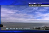
up north we have had some sprinkle hitting the ground up around ukiah.nificant at the moment. just light rain there and this is a time lapse view this afternoon. from high definition east bay camera emeryville to the golden gate cloud overhead but no significant precipitation moving in on us yet. but late tomorrow it might. here's look at conditions state width tomorrow. sunny mild down south. rainy some spots cool up north. in the bay area tomorrow we will see increasing cloudy skies late in the day but partly sunny early. high pressure generally in the 60's up to about 70 morgan hill much cooler up north where the rain will be developing and here's the accu-weather 7 day forecas forecast. few showers overnight tomorrow night into thursday morning then dry remainder of the day thursday. rain develops again on friday night into saturday. through saturday and quite rainy through the weekend drying out again on monday. so active weather ahead especially for the weekend. >> looks like it. thanks very much. >> larry hear with all the sports. 96 million reaso
up north we have had some sprinkle hitting the ground up around ukiah.nificant at the moment. just light rain there and this is a time lapse view this afternoon. from high definition east bay camera emeryville to the golden gate cloud overhead but no significant precipitation moving in on us yet. but late tomorrow it might. here's look at conditions state width tomorrow. sunny mild down south. rainy some spots cool up north. in the bay area tomorrow we will see increasing cloudy skies late in...
228
228
Mar 24, 2012
03/12
by
KOFY
tv
eye 228
favorite 0
quote 0
a little moisture mroching sea ranch and ukiah area. in the form of light showers and sprinkles. this batch of moisture moving in through the bay area in just a couple of hours. so computer animation. you will notice that around 1:00 o'clock steady line of rain l in some parts of our viewing area then the rain line begins to shift in the overnight hours. it's a wet saturday morning i'll let you know if the rain will stick around and spill over in your sunday. >> thanks. see you shortly. >> america's cup race in san francisco has a few less hands on deck after race organizers announced some staff cuts toda today. 28 employees got the bad news this morning. half of the cuts were in san francisco. the other in offices around the world. staff cuts have come as race organizers and the city finalize new agreement that significantly scales down the event which happens in san francisco next year. mean time california unemployment rate has steady last month at 10.9 percent. no change for january. and while the bay area has some of the lowest rates in the state, one city has a chronic prob
a little moisture mroching sea ranch and ukiah area. in the form of light showers and sprinkles. this batch of moisture moving in through the bay area in just a couple of hours. so computer animation. you will notice that around 1:00 o'clock steady line of rain l in some parts of our viewing area then the rain line begins to shift in the overnight hours. it's a wet saturday morning i'll let you know if the rain will stick around and spill over in your sunday. >> thanks. see you shortly....
228
228
Mar 26, 2012
03/12
by
KGO
tv
eye 228
favorite 0
quote 0
tomorrow night when we'll start to see the first bit of rain start to move into the north bay, ukiah. santa rosa, and then all of this will advance over the entire bay area by tuesday morning. temperatures tomorrow, mid-to-upper 60s. east bay. we're not going to see some sunshine tomorrow but the clouds thickening up late in the day. 58 for san francisco, and 61 for santa cruz, hollister, 63. the accuweather seven-day forecast, it's soggy. after tomorrow's brief break, rain likely tuesday, rain and wind on wednesday, few lingering showers on thursday, and then thursday afternoon and friday, temperatures in in the 60s. >> alan: let's talk college basketball with shu. and then there were four. >> mike: the seemingly never-ending neaks tournament. louisville and ohio state reached the final four yesterday. today we tip off with the tar heels facing kansas. north carolina marshall out with a fractured wrist. first half, mcado the steal. 15 points to lead carolina. we're tied at 4 at the half. taylor came up huge for kansas. off the steal. followed by the spike. then again on the break. ta
tomorrow night when we'll start to see the first bit of rain start to move into the north bay, ukiah. santa rosa, and then all of this will advance over the entire bay area by tuesday morning. temperatures tomorrow, mid-to-upper 60s. east bay. we're not going to see some sunshine tomorrow but the clouds thickening up late in the day. 58 for san francisco, and 61 for santa cruz, hollister, 63. the accuweather seven-day forecast, it's soggy. after tomorrow's brief break, rain likely tuesday, rain...
127
127
Mar 1, 2012
03/12
by
KTVU
tv
eye 127
favorite 0
quote 0
. >>> light rain reported to the north, up to ukiah, you can always tweet me and this is a much weaker system, but still it is set to arrive here and it looks like it will be done as high pressure builds back in. all of that rain is starting to snow also in lake county this will continue snow for the sierra which had a really good blasting yesterday. 40s on the temperatures, mountain view, san jose, also fairfield. our system continues to rotate, it is the last piece of energy rotating high pressure is on the way. we have to get one more system that will clip us. i think by noon things will start to calm down, it will be 4 to 8 inches but if you get below, another 5 to 10 is possible. mostly cloudy rain is beginning to move back in and it will be another cool and breezy day. highs today will stay in the 50s but there is going to be a warmup here in a second. we still have a high surf advisory. high tide at 5:45 a.m. it will start to go down and be careful if you are heading to the beaches. clearing out friday, the weekend looks like upper 60s to near 70s. back to you, pam. >>> they hop
. >>> light rain reported to the north, up to ukiah, you can always tweet me and this is a much weaker system, but still it is set to arrive here and it looks like it will be done as high pressure builds back in. all of that rain is starting to snow also in lake county this will continue snow for the sierra which had a really good blasting yesterday. 40s on the temperatures, mountain view, san jose, also fairfield. our system continues to rotate, it is the last piece of energy rotating...
115
115
Mar 21, 2012
03/12
by
KBCW
tv
eye 115
favorite 0
quote 0
rain across the santa clara valley just over attendants in santa rosa and about a third dimension ukiah otherwise well planned out most of what lies in 1980 suspect areas of fog developing along the immediate coast to mall will be cloudy in the north as some sunny spots in the selfsame temperatures will responds nicely otherwise get strong this storm out prepare for and private credit to saturday. tonight into the 40's about 30 degrees pollen count mall be on the high side and you can limit on the tree count members smiled very similar to today 50 and '60s extended forecast calls for that two more powerful system on friday with up to an inch and a half of rain in the wetter is look cases through saturday with gusty winds and blowing snow level will have a sports with dennis franz right after this. third thing summer the state department is also supporting the effort. degrees her legacy resonates today for anyone girls and boys who dreams of the stars. the expedition believe and it was for viper chart time ever recovered artifacts that some believe could along familiar earhart's. >>> the
rain across the santa clara valley just over attendants in santa rosa and about a third dimension ukiah otherwise well planned out most of what lies in 1980 suspect areas of fog developing along the immediate coast to mall will be cloudy in the north as some sunny spots in the selfsame temperatures will responds nicely otherwise get strong this storm out prepare for and private credit to saturday. tonight into the 40's about 30 degrees pollen count mall be on the high side and you can limit on...
126
126
Mar 10, 2012
03/12
by
KOFY
tv
eye 126
favorite 0
quote 0
you get up to ukiah, clearlake, could see a few sprinkles and around the monterey bay, 64 in santa cruzfar cry from the 80s. 67 degrees in gilroy. seven-day forecast, dry tomorrow except for a few sprinkles well to the north. light showers sunday, much cooler weekend. don't forget, spring forward 2:00 a.m. sunday, we go to daylight saving time and then wetter pattern. raindrops every single day. as the week progresses the storms will get stronger and wetter. this will all mean snow coming to the mountains. >> that is good news. >>> come up next, a look at super aspirin. >> they say it shows promise in tackling some types of cancers. >> coming up next on "nightline," flight attendant seems to lose it and latest. plus massive quake, a year after to travel back to japan to see (car horn) paying with your smartphone instead of cash... (phone rings) that's a step forward. with chase quickpay, you can send money directly to anyone's checking account. i guess he's a kicker... again, again! oh, no you don't! take a step forward and chase what matters. >>> london's daily mail is reporting a supe
you get up to ukiah, clearlake, could see a few sprinkles and around the monterey bay, 64 in santa cruzfar cry from the 80s. 67 degrees in gilroy. seven-day forecast, dry tomorrow except for a few sprinkles well to the north. light showers sunday, much cooler weekend. don't forget, spring forward 2:00 a.m. sunday, we go to daylight saving time and then wetter pattern. raindrops every single day. as the week progresses the storms will get stronger and wetter. this will all mean snow coming to...
105
105
Mar 29, 2012
03/12
by
KTVU
tv
eye 105
favorite 0
quote 0
can see some -- you can see some some activity but mainly up toward mendocino county right around ukiah. as far as current temperatures, take a look at these, already in the upper 50s to the lower 60s. san jose right now checking in 62 degreesian ton -- downtown san francisco in the upper 50s. currently 5 reporting mostly cloudy. forecast headlines we have this partly to mostly cloudy skies. we do bling a chance for a few showers. so rainfall becoming likely especially first thing saturday morning. temperatures will be cooling off for the weekend as well. here is the setup for today. you can see all of this cloud cover. the rain confined to the north. we do have a sun/cloud mix. this is close enough that we cannot rule out a shower in the north bay. we have the fronts here. so the warm front is here. that's warm air moving through the area. so some mild air sticks around. in add vance of our next storm and that moves in first thing next thing on saturday morning. a few high clouds into the why afternoon -- a few high clouds. we could have a few high showers. the bigger perspective, as c
can see some -- you can see some some activity but mainly up toward mendocino county right around ukiah. as far as current temperatures, take a look at these, already in the upper 50s to the lower 60s. san jose right now checking in 62 degreesian ton -- downtown san francisco in the upper 50s. currently 5 reporting mostly cloudy. forecast headlines we have this partly to mostly cloudy skies. we do bling a chance for a few showers. so rainfall becoming likely especially first thing saturday...
149
149
Mar 30, 2012
03/12
by
KGO
tv
eye 149
favorite 0
quote 0
here but there is sun well south of us, if you look at live doppler 7 hd we're seeing rain up towards ukiah. there is around santa rosa there are a few sprinkles. and there is temperatures into 50s in the north bay there is san jose did get up close to 70 degrees today so mild down towards south bay. there is windy, rainy conditions developing on saturday. there is a storm system we're seeing sprinkles in the north bay this, continues to remain in far northern end of california and this will keep in possibility of springel goesing into tomorrow. real storm gets here heading into saturday. there is a blustery storm here, wind, rain and thunderstorms. there is wet weather, could see drizzle and there is rain getting here on saturday. you can see it could be briefly heavy. as a cold front goes through, rain continues to spread south and east around 10:00 saturday morning. behind the cold front there is showers and so is what we're looking at. rest of the sunday is looking just fine. there is winter storm watch friday night through late saturday night for sierra. there is heavy and blowing snow
here but there is sun well south of us, if you look at live doppler 7 hd we're seeing rain up towards ukiah. there is around santa rosa there are a few sprinkles. and there is temperatures into 50s in the north bay there is san jose did get up close to 70 degrees today so mild down towards south bay. there is windy, rainy conditions developing on saturday. there is a storm system we're seeing sprinkles in the north bay this, continues to remain in far northern end of california and this will...
197
197
Mar 8, 2012
03/12
by
KOFY
tv
eye 197
favorite 0
quote 0
antioch, napa, santa rosa, cloverdale ukiah low 70s. 70s dominates most of the monterey bay and inlandception monterey in the 60s. very warm with a lot of sun upper 60s through the central valley 50 tahoe 72 big sur mid to upper 70s around l.a. and palm springs. a few 30s inland especially north bay valleys towards livermore everybody else in the low to mid 40s until you get to san francisco at 48. three areas of high pressure dominating. you can see it pushing the next storm to the north as we have this strong ridge that will hold our weather stable today and tomorrow. we'll be two to three degrees warmer tomorrow away from the coast just about everybody in the low to mid 70s cold front extra clouds saturday temperatures drop six to eight degrees another six to eight degrees monday, monday and tuesday the best chances for measurable rain before thursday. thursday maybe be better. next week very active. enjoy the sun and warm weather now. >>> today is international women's day. a day to pay tribute to the achievements of women and examine the issues that hold us back. the these images
antioch, napa, santa rosa, cloverdale ukiah low 70s. 70s dominates most of the monterey bay and inlandception monterey in the 60s. very warm with a lot of sun upper 60s through the central valley 50 tahoe 72 big sur mid to upper 70s around l.a. and palm springs. a few 30s inland especially north bay valleys towards livermore everybody else in the low to mid 40s until you get to san francisco at 48. three areas of high pressure dominating. you can see it pushing the next storm to the north as we...
208
208
Mar 27, 2012
03/12
by
KOFY
tv
eye 208
favorite 0
quote 0
we have very late rain being reported around ukiah. 101 heading down to the clover dale area. sea ranch manchester along highway 1 also getting a little bit of that moisture. but it's very light and just the beginning of what is to come. temperatures rate now in the 50's and here are the highlights. sprinkle late showers in the north bay tonight. rain spreads south tomorrow. we look at the showers diminishing as we head that your wednesday. hears satellite and radar. this is the storm we are watching. it has a lot of moisture to work with. and this one is going to be another drenching for the north way in particular. you see here on the computer animation clouds tonight. few showers in the north bay then at 5:00 a.m. the north bay is the area where you are going to see some wet pavement. so morning commute dicey up there. if it takes you through the area. cold front presses south but moisture doesn't vps rate away. not until the afternoon that the east bay and peninsula and south bay start to get some of the moisture moving into the area heavy rain along the front north bay an
we have very late rain being reported around ukiah. 101 heading down to the clover dale area. sea ranch manchester along highway 1 also getting a little bit of that moisture. but it's very light and just the beginning of what is to come. temperatures rate now in the 50's and here are the highlights. sprinkle late showers in the north bay tonight. rain spreads south tomorrow. we look at the showers diminishing as we head that your wednesday. hears satellite and radar. this is the storm we are...
199
199
Mar 26, 2012
03/12
by
KGO
tv
eye 199
favorite 0
quote 0
ukiah to santa rows sample highs tomorrow with a mixed bag of clouds and sun, mid-to-upper 60s, concord 58, sap -- san francisco. 61, accept cruz -- santa cruz tomorrow. the seven day forecast, a nice break. get things cleaned up in the yard in anticipation of the next storm, rain likely developing on tuesday across the entire bay area. wednesday as well. downpours, turning to showers on friday. flip a coin for saturday because the models don't know what they want to do, but get prepared for wind and rain tuesday and wednesday. >> ama: let's get to shu. tiger wants a win. >> mike: all eyes on tiger's today, and profitly -- appropriately it was [ male announcer ] at green giant we know nature gives us the most nutritious of gifts. but only when they are ready to be given. that's why green giant picks vegetables at their peak. ...and freezes them fast, locking in nutrients ...for you to unwrap. ♪ ho, h ho. green giant those five food groups sound a whole lot better when you put them in a taco shell instead of a pyramid. old el paso. when you gotta have mexican. >> mike: september 2009 was
ukiah to santa rows sample highs tomorrow with a mixed bag of clouds and sun, mid-to-upper 60s, concord 58, sap -- san francisco. 61, accept cruz -- santa cruz tomorrow. the seven day forecast, a nice break. get things cleaned up in the yard in anticipation of the next storm, rain likely developing on tuesday across the entire bay area. wednesday as well. downpours, turning to showers on friday. flip a coin for saturday because the models don't know what they want to do, but get prepared for...
212
212
tv
eye 212
favorite 0
quote 0
antioch, napa, santa rosa, cloverdale ukiah low 70s. 70s dominates most of the monterey bay and inlandception monterey in the 60s. very warm with a lot of sun upper 60s through the central valley 50 tahoe 72 big sur mid to upper 70s around l.a. and palm springs. a few 30s inland especially north bay valleys towards livermore everybody else in the low to mid 40s until you get to san francisco at 48. three areas of high pressure dominating. you can see it pushing the next storm to the north as we have this strong ridge that will hold our weather stable today and tomorrow. we'll be two to three degrees warmer tomorrow away from the coast just about everybody in the low to mid 70s cold front extra clouds saturday temperatures drop six to eight degrees another six to eight degrees monday, monday and tuesday the best chances for measurable rain before thursday. thursday maybe be better. next week very active. enjoy the sun and warm weather now. >>> today is international women's day. a day to pay tribute to the achievements of women and examine the issues that hold us back. the these images
antioch, napa, santa rosa, cloverdale ukiah low 70s. 70s dominates most of the monterey bay and inlandception monterey in the 60s. very warm with a lot of sun upper 60s through the central valley 50 tahoe 72 big sur mid to upper 70s around l.a. and palm springs. a few 30s inland especially north bay valleys towards livermore everybody else in the low to mid 40s until you get to san francisco at 48. three areas of high pressure dominating. you can see it pushing the next storm to the north as we...
389
389
tv
eye 389
favorite 0
quote 0
springlike, 73 cloverdale. 76 in ukiah. san francisco, 68. 69 in concord. antioch. 68 in livermore. 71 in san jose. santa cruz, boardwalk, 75 degrees. here's a look at the satellite, and i'm going to show you, no clouds over us, but this gives you a pretty good sense of the huge ridge of high pressure. storm track well to the north of us, and this is going to stay in that position for one more day. so go ahead and get those outdoor plans ready for tomorrow. here's a look at the current readings. 69 for antioch. 66 in livermore, san francisco, cooled to 61. 71 in redwood city. mountain view 70. clear overnight. the higher elevations, still getting a slight offshore wind flow -- may be a bit on the breezy temperatures and temperatures mail may -- may not be as cold, springlike tomorrow and then things get cooler monday and tuesday. and you will notice that. here's the setup. high pressure, one over the pacific. you can see the ridge stretching well to the north of us. it will stay put for at least one more day. so, look for temperatures once again tomorrow, u
springlike, 73 cloverdale. 76 in ukiah. san francisco, 68. 69 in concord. antioch. 68 in livermore. 71 in san jose. santa cruz, boardwalk, 75 degrees. here's a look at the satellite, and i'm going to show you, no clouds over us, but this gives you a pretty good sense of the huge ridge of high pressure. storm track well to the north of us, and this is going to stay in that position for one more day. so go ahead and get those outdoor plans ready for tomorrow. here's a look at the current...
243
243
Mar 10, 2012
03/12
by
KGO
tv
eye 243
favorite 0
quote 0
you get up to ukiah, clearlake, could see a few sprinkles and around the monterey bay, 64 in santa cruzom the 80s. 67 degrees in gilroy. seven-day forecast, dry tomorrow except for a few sprinkles well to the north. light showers sunday, much cooler weekend. don't forget, spring forward 2:00 a.m. sunday, we go to daylight saving time and then wetter pattern. raindrops every single day. as the week progresses the storms will get stronger and wetter. this will all mean snow coming to the mountains. >> that is good news. >>> come up next, a look at super aspirin. >> they say it shows promise in tackling some types of cancers. >> coming up next on "nightline," flight attendant seems to lose it and latest. plus massive quake, a year after to travel back to japan to see >>> london's daily mail is reporting a super aspirin that tackles 11 forms of karen. it curbs the growth of 11 types of cancer cells without harming normal cells. the report says it shrank human colon cancer by 85% in live animals without adverse effects. in the same results are seen in humans it could be used to shrink tumors
you get up to ukiah, clearlake, could see a few sprinkles and around the monterey bay, 64 in santa cruzom the 80s. 67 degrees in gilroy. seven-day forecast, dry tomorrow except for a few sprinkles well to the north. light showers sunday, much cooler weekend. don't forget, spring forward 2:00 a.m. sunday, we go to daylight saving time and then wetter pattern. raindrops every single day. as the week progresses the storms will get stronger and wetter. this will all mean snow coming to the...
125
125
Mar 30, 2012
03/12
by
KPIX
tv
eye 125
favorite 0
quote 0
i would like to zinsser in so you can see from willets to ukiah, a heavy downpour at this hour. the klamath river is currently at 36 ft. which is flood stage. we have all lot of rain from the system coming this way. right now into the 50s and 60s. wind is on the breeze inside. the bottom line is, another storm is heading this way in time for the weekend. there is a veil of clouds for friday with a couple of raindrops in the far northern portions of sonoma county but the bulk of the storm will come during the overnight hours. a little bit of light rain around santa rosa but the main cold front will come through saturday and to dump a lot of rain in a short amount of time but behind it you will notice some scattered showers for the afternoon hours. a threat of a thunderstorm does exist. it moves out of the area leaving us with mostly sunny skies. this is the low pressure that is causing a couple of raindrops in the north bay but behind it is a more vigorous cold front. friday night overnight through saturday, that is when we anticipate the colder temperatures. easily up to a coupl
i would like to zinsser in so you can see from willets to ukiah, a heavy downpour at this hour. the klamath river is currently at 36 ft. which is flood stage. we have all lot of rain from the system coming this way. right now into the 50s and 60s. wind is on the breeze inside. the bottom line is, another storm is heading this way in time for the weekend. there is a veil of clouds for friday with a couple of raindrops in the far northern portions of sonoma county but the bulk of the storm will...
249
249
Mar 12, 2012
03/12
by
KGO
tv
eye 249
favorite 0
quote 0
today partly sunny mid to upper 50s ukiah, cloverdale, clear lake, 58 san rafael, richmond and san francisco vallejo, half moon bay mid to upper 50s everybody else low to mid 60s. monterey bay increasing clouds and breezes over the water. low to mid 60s as you move inland. today all wet weather near eureka and crescent city quiet time to get to tahoe before the snow tomorrow 46, low to mid 60s chico, sacramento, big sur, l.a. and san diego with palm springs 78 the warm spot. tonight wind coming off the ocean temperatures around 50 in san francisco, oakland, san mateo rest of us mid to upper 40s. break today weak area of high pressure this pair of low will send cold front tuesday another batch will follow that wednesday. it is going to stay arm most of wednesday that's why -- stay around most of wednesday. tonight once the sunsets 7:20 light rain north bay tomorrow's morning commute, tomorrow's evening compute overnight wednesday you can see the rain shield gets smaller -- concentrated on the bay areal of wednesday rainfall amounts up to wednesday three to five inches in our mountains, a coup
today partly sunny mid to upper 50s ukiah, cloverdale, clear lake, 58 san rafael, richmond and san francisco vallejo, half moon bay mid to upper 50s everybody else low to mid 60s. monterey bay increasing clouds and breezes over the water. low to mid 60s as you move inland. today all wet weather near eureka and crescent city quiet time to get to tahoe before the snow tomorrow 46, low to mid 60s chico, sacramento, big sur, l.a. and san diego with palm springs 78 the warm spot. tonight wind coming...
120
120
Mar 14, 2012
03/12
by
KOFY
tv
eye 120
favorite 0
quote 0
ukiah is reporting rain. as we head toward marin county, very light rain.ead august cross the bay bridge and into berkeley and concord and san ramon, still getting wet. santa cruz mountains, it has lightened up quite a bit. i want to show you what it looks like in the sierra nevada. it is snowing across the higher elevations. it is 88 and 4 where we are seeing the chain controls. this is photo and gusty winds in tahoe. it is sent to twitter by les. she said she had a great time. more snow is on the way. and check out this picture. this is absolutely adorable. this was posted to my facebook page. she said her daughter was out enjoying the puddles in livermore. didn't get a lot of rain, but it was enough for her to enjoy. the rain continues through wednesday morning. a break is coming on wednesday night and thursday. another storm is due thursday night into friday. the satellite-radar is showing you a slow moving storm. it is over 4 inches in some spots. this front will continue to progress southward, but it will start to wash out by the early morning hours.
ukiah is reporting rain. as we head toward marin county, very light rain.ead august cross the bay bridge and into berkeley and concord and san ramon, still getting wet. santa cruz mountains, it has lightened up quite a bit. i want to show you what it looks like in the sierra nevada. it is snowing across the higher elevations. it is 88 and 4 where we are seeing the chain controls. this is photo and gusty winds in tahoe. it is sent to twitter by les. she said she had a great time. more snow is on...
188
188
Mar 3, 2012
03/12
by
KOFY
tv
eye 188
favorite 0
quote 0
got up to 66 in santa cruz and mid60s in places like ukiah. a good 5 to 10 degrees warmer and then take a look at this picture. it was a sunset cents to me via twitter. a lovely shot there. you can see how clear the skies were at the time the sun was going down and the skies remain clear tonight. so that means temperatures are going to tumble. already we are seeing numbers in the 40s and 50s except napa has dropped down to 39 degrees. clear and cold overnight, especially the valleys. spring-like days expected, and it is turning cooler on monday, but still nosigns of any major storms coming in. here is a look at the area of high pressure that will provide us with some real warm weekends. it is a strong ridge that is in charge this weekend. it is pushing the jet stream to the north. they are well to the north of us now. any will come over and ride over the top of the ridge. so this ridge will provide us with another down sloping day. offshore flow continues on sunday with the warmest spots on sunday. low to mid70s. a good 5 to 10 degrees above n
got up to 66 in santa cruz and mid60s in places like ukiah. a good 5 to 10 degrees warmer and then take a look at this picture. it was a sunset cents to me via twitter. a lovely shot there. you can see how clear the skies were at the time the sun was going down and the skies remain clear tonight. so that means temperatures are going to tumble. already we are seeing numbers in the 40s and 50s except napa has dropped down to 39 degrees. clear and cold overnight, especially the valleys....
155
155
Mar 12, 2012
03/12
by
KOFY
tv
eye 155
favorite 0
quote 0
mid 50s along the coast upper san mateo, san francisco, richmond ukiah, cloverdale and clear lake everybodyse in the low to mid 60s warmer monterey bay breezier over the ocean 57 monterey everybody else in the low 60s inland low to mid 60s around the state, the rain stays up around eureka 53. 78 palm springs. tonight clouds roll in check out temperatures mid 40s to around 50° mild air mass during the overnight hours. another look at that swirling mass of clouds to our north cold air behind it, floodgates open to alaska where these storms are going to come from. right now nothing during the afternoon. tonight, tomorrow's morning commute along the coast santa cruz mountains mainly north bay wet everyone gets wet, on and off rain throughout the day the front stalls wednesday couple of chunks of energy roll across it squeezes out waves of rain some heavy at times by 7:00, 8:00 it starts to clear out. during the same time 11:00 tonight through 5:00 wednesday morning two to three feet of snow up in the sierra. that is down to about 7,000 feet. it is going to be chain requirements all week in the
mid 50s along the coast upper san mateo, san francisco, richmond ukiah, cloverdale and clear lake everybodyse in the low to mid 60s warmer monterey bay breezier over the ocean 57 monterey everybody else in the low 60s inland low to mid 60s around the state, the rain stays up around eureka 53. 78 palm springs. tonight clouds roll in check out temperatures mid 40s to around 50° mild air mass during the overnight hours. another look at that swirling mass of clouds to our north cold air behind it,...
207
207
Mar 12, 2012
03/12
by
KGO
tv
eye 207
favorite 0
quote 0
mid 50s along the coast upper san mateo, san francisco, richmond ukiah, cloverdale and clear lake everybodyelse in the low to mid 60s warmer monterey bay breezier over the ocean 57 monterey everybody else in the low 60s inland low to mid 60s around the state, the rain stays up around eureka 53. 78 palm springs. tonight clouds roll in check out temperatures mid 40s to around 50° mild air mass during the overnight hours. another look at that swirling mass of clouds to our north cold air behind it, floodgates open to alaska where these storms are going to come from. right now nothing during the afternoon. tonight, tomorrow's morning commute along the coast santa cruz mountains mainly north bay wet everyone gets wet, on and off rain throughout the day the front stalls wednesday couple of chunks of energy roll across it squeezes out waves of rain some heavy at times by 7:00, 8:00 it starts to clear out. during the same time 11:00 tonight through 5:00 wednesday morning two to three feet of snow up in the sierra. that is down to about 7,000 feet. it is going to be chain requirements all week in th
mid 50s along the coast upper san mateo, san francisco, richmond ukiah, cloverdale and clear lake everybodyelse in the low to mid 60s warmer monterey bay breezier over the ocean 57 monterey everybody else in the low 60s inland low to mid 60s around the state, the rain stays up around eureka 53. 78 palm springs. tonight clouds roll in check out temperatures mid 40s to around 50° mild air mass during the overnight hours. another look at that swirling mass of clouds to our north cold air behind...
170
170
Mar 2, 2012
03/12
by
KPIX
tv
eye 170
favorite 0
quote 0
looking good. 62 in sacramento, 63 and sunny in fresno today, about 61 degrees in monterey bay, 68 ukiah. starting to warm up there and also around the bay area as we are going to see temperatures soaring to as high as 66 in san jose today. 60 in half moon bay. 46 degrees in union city. east bay temperatures moving well into the 60s by the afternoon. as high as 67 in pleasanton. and 67 degrees in the napa valley. one of the warmer spots, santa rosa, checking in about 68 degrees and 64 degrees and sunny all day in san francisco. the next couple of days, we are going to watch these temperatures running well above average. 70s in the hotspots. even some mid-60s at the coast. by monday, we start to cool just a little bit. but then we'll see some more extensive cooling back to work as we head on tuesday as we'll see more clouds rolling in and well, maybe some showers by the end of the week. the snow report. they have seen plenty of it this week and it's looking good. a good weekend to ski. >> all the cars will be going there. >> we'll see them racing up there now. >> thank you. >>> coffee, wa
looking good. 62 in sacramento, 63 and sunny in fresno today, about 61 degrees in monterey bay, 68 ukiah. starting to warm up there and also around the bay area as we are going to see temperatures soaring to as high as 66 in san jose today. 60 in half moon bay. 46 degrees in union city. east bay temperatures moving well into the 60s by the afternoon. as high as 67 in pleasanton. and 67 degrees in the napa valley. one of the warmer spots, santa rosa, checking in about 68 degrees and 64 degrees...
221
221
Mar 14, 2012
03/12
by
KGO
tv
eye 221
favorite 0
quote 0
ukiah is reporting rain. as we head toward marin county, very light rain. head august cross the bay bridge and into berkeley and concord and san ramon, still getting wet. santa cruz mountains, it has lightened up quite a bit. i want to show you what it looks like in the sierra nevada. it is snowing across the higher elevations. it is 88 and 4 where we are seeing the chain controls. this is photo and gusty winds in tahoe. it is sent to twitter by les. she said she had a great time. more snow is on the way. and check out this picture. this is absolutely adorable. this was posted to my facebook page. she said her daughter was out enjoying the puddles in livermore. didn't get a lot of rain, but it was enough for her to enjoy. the rain continues through wednesday morning. a break is coming on wednesday night and thursday. another storm is due thursday night into friday. the satellite-radar is showing you a slow moving storm. it is over 4 inches in some spots. this front will continue to progress southward, but it will start to wash out by the early morning hours
ukiah is reporting rain. as we head toward marin county, very light rain. head august cross the bay bridge and into berkeley and concord and san ramon, still getting wet. santa cruz mountains, it has lightened up quite a bit. i want to show you what it looks like in the sierra nevada. it is snowing across the higher elevations. it is 88 and 4 where we are seeing the chain controls. this is photo and gusty winds in tahoe. it is sent to twitter by les. she said she had a great time. more snow is...
150
150
Mar 16, 2012
03/12
by
KOFY
tv
eye 150
favorite 0
quote 0
you can see it here we are getting rain in the north bay between ukiah down to holds burg, santa rosat lawm area taking you down to street leve level, rohnert park, pepper road eli road getting very late showers right now. we are watching the showers also in and around the san jose area,e morgan hill, gilroy few light showers sprinkles check out this photo. this bird here soaking wet. par wrought posted by jennifer to my face book. she said rain or shine the telegraph hill bird comes to her back yard to feed there every single day. what a shot. thanks for sharing that picture. since monday evening here's how much rain we have received. more than a foot of rape here. two kent field and san francisco 2 inches. san jose 7 hundredths inch of rain. rain shadow of the mountains by the time the moisture gets there all dried out not much left. i'll talk about the next system. numbers in the 50's seen here and the highlights drizzle late showers tonight. rain becomes heavy tomorrow particularly in the evening. we lack at chance of thunder and low snow levels as well. here's satellite radar thi
you can see it here we are getting rain in the north bay between ukiah down to holds burg, santa rosat lawm area taking you down to street leve level, rohnert park, pepper road eli road getting very late showers right now. we are watching the showers also in and around the san jose area,e morgan hill, gilroy few light showers sprinkles check out this photo. this bird here soaking wet. par wrought posted by jennifer to my face book. she said rain or shine the telegraph hill bird comes to her...
216
216
Mar 30, 2012
03/12
by
KGO
tv
eye 216
favorite 0
quote 0
north where the clouds are thicker rain around ukiah, mid to upper 50s.most of the north bay valleys -- [ unintelligible ] down to the monterey bay more sun, mid 60s around the bay as you head inland -- [ unintelligible ] low to mid 70s. showers up to the north today eureka 54, chico 64, tahoe 58, 70 yosemite palm springs almost 90° today. back home tonight all the rain and mild temperatures other than clear lake, cloverdale, santa cruz and morgan hill upper 40s, we have a low to mid 50 sandwich between those two areas. front stalled to our north most energy up to the north and taking the bulk of the wet weather with it. nice, moist flow along this front, we need something to push it to our neighborhood many this area of low pressure will hook-up with the front, increase the intensity, also increase the rainfall. scattered showers possible during the evening and overnight be aware of that if you have plans. here's the real deal coming in 7:00 tomorrow morning into the north bay, sweeping through the heart of the bay from about 9:00 through 2 then you see
north where the clouds are thicker rain around ukiah, mid to upper 50s.most of the north bay valleys -- [ unintelligible ] down to the monterey bay more sun, mid 60s around the bay as you head inland -- [ unintelligible ] low to mid 70s. showers up to the north today eureka 54, chico 64, tahoe 58, 70 yosemite palm springs almost 90° today. back home tonight all the rain and mild temperatures other than clear lake, cloverdale, santa cruz and morgan hill upper 40s, we have a low to mid 50...
198
198
tv
eye 198
favorite 0
quote 0
let's get to these numbers for you. 77 today in ukiah. 70 in san francisco. 64, half moon bay.our high today. we had a string of 72s. fairfield, concord, antioch, livermore. the record high, santa cruz, 83 degrees. and san hey -- san jose, 75. temperatures starting to come down. san rafael, 70s there. 72 in redwood city. 70 in fremont. 60 in san francisco. half moon bay, 60. los gatos, 71. we're going to be seeing subtle changes tonight, with a few passing clouds overhead. maybe a little bit of fog near the coast. and then a much cooler day. the wind picks up to more onshore, which is a cool wind direction for us, for monday and tuesday, and there is a system to the north that can possibly bring us a few showers overnight and monday night. this is the closeup satellite. we're clear but check out the last few frames. you'll notice a little bit of fog starting to venture back. that's because the winds are starting to shift. this weekend they were offshore, and brought us the hit. they're starting to shift to onshore, which is a cooler wind direction so definitely things will be c
let's get to these numbers for you. 77 today in ukiah. 70 in san francisco. 64, half moon bay.our high today. we had a string of 72s. fairfield, concord, antioch, livermore. the record high, santa cruz, 83 degrees. and san hey -- san jose, 75. temperatures starting to come down. san rafael, 70s there. 72 in redwood city. 70 in fremont. 60 in san francisco. half moon bay, 60. los gatos, 71. we're going to be seeing subtle changes tonight, with a few passing clouds overhead. maybe a little bit of...
135
135
Mar 24, 2012
03/12
by
KPIX
tv
eye 135
favorite 0
quote 0
over three-quarters of an inch around ukiah to the north.ver a quarter of an inch in san jose. what does this mean for the high sierra? that is it winter weather advisory in effect for some it with a heavy snowfall sunday afternoon for monday morning. wrapping it all up for you, we will have the heaviest rain tomorrow morning. the rains brought to begin with a few breaks and it looks like we will see another system by tuesday into wednes,,,,,,,,,,,,, ,, >> tiger is 36 holes away from heading to us the with the masters undewith a win under his belt. he was not the only one on the prowl. there were no issues, he birdied four straight holes to get within striking distance but he was not done there. after another birdie putt on 17, tiger moves to the top of the leader board. shooting 65 to get to 10 under and is tied for the lead with charlie lea. n.c.a.a. tournament, n.c. point guard out with a wrist injury. ohio down by two, walter ties it but missed the free throw and we go into overtime. tied at 63. reggie belike gets opened and knocks down
over three-quarters of an inch around ukiah to the north.ver a quarter of an inch in san jose. what does this mean for the high sierra? that is it winter weather advisory in effect for some it with a heavy snowfall sunday afternoon for monday morning. wrapping it all up for you, we will have the heaviest rain tomorrow morning. the rains brought to begin with a few breaks and it looks like we will see another system by tuesday into wednes,,,,,,,,,,,,, ,, >> tiger is 36 holes away from...
236
236
Mar 16, 2012
03/12
by
KGO
tv
eye 236
favorite 0
quote 0
sausalito, san rafael, novato, petaluma, all the way up to ukiah, we have rain right now. we'll pull out over the last three hours moving a little south of east which means some of this lighter rain will move farther south in the morning commute wet in a lot of areas it is drier towards the east bay valleys and south bay areas that have been the driest so far out of these storm systems that is going to change into the afternoon. winds fairly light 10 to 15 miles per hour. 8:00 you can see light rain dancing around all of our neighborhoods temperatures in the 50s. towards lunch we'll still have rain hanging around with the heaviest rain starting to move into the north bay, yellows there around santa rosa, temperatures in the mid to upper 50s by 4:00, we have the heaviest of the rain starting to pull into the bay itself, you can see there coming down san rafael, napa, close to san francisco, oakland and concord. primarily an evening event. rain during the day heavy flooding rain will come during the evening hours when you need to be careful for that flooding, debris slides a
sausalito, san rafael, novato, petaluma, all the way up to ukiah, we have rain right now. we'll pull out over the last three hours moving a little south of east which means some of this lighter rain will move farther south in the morning commute wet in a lot of areas it is drier towards the east bay valleys and south bay areas that have been the driest so far out of these storm systems that is going to change into the afternoon. winds fairly light 10 to 15 miles per hour. 8:00 you can see light...
136
136
Mar 30, 2012
03/12
by
KOFY
tv
eye 136
favorite 0
quote 0
ukiah steady rain tonight over quarter inch so far. santa rosa picked autopsy if you sprinkles and still not out of the question later on tonight heading that tomorrow. take a look at the time lapse from high definition east bay hills camera. many dealing with this. we look towards mount diablo. cloud cover out there and cloud with us it pretty much all day long after morning fog and drizzle. we have fog out there right now. half moon bay is reporting really low visibility. temperatures in the 50's but most other areas are reporting quite a bit of cloud cover and numbers being held up because of the clouds so in the 50's at this hour and not expected to fall much. here are the highlights occasional spring el in the north bay. mild conditions for the south by. this is tomorrow forecast. windy and rainy for your saturday and even potential for some thunderstorms. so here's satellite radar this storm is pray mayoral a northern california event but some of this moisture is getting into our area so we are seeing it in the form of clouds alt
ukiah steady rain tonight over quarter inch so far. santa rosa picked autopsy if you sprinkles and still not out of the question later on tonight heading that tomorrow. take a look at the time lapse from high definition east bay hills camera. many dealing with this. we look towards mount diablo. cloud cover out there and cloud with us it pretty much all day long after morning fog and drizzle. we have fog out there right now. half moon bay is reporting really low visibility. temperatures in the...
281
281
tv
eye 281
favorite 0
quote 0
you can see it on live doppler, moving southbound from eureka to ukiah right now.hat is going to move in from mid-morning to mid-afternoon. i would expect an increase if the coverage of showers more than just santa rosa reporting light rain now. mid to upper 40s until you get to mountain view, los gatos and san jose around 40°. monterey bay 40 santa rosa and watsonville, 36 gilroy mid 40s salinas and monterey, one to nine degrees cooler than this time yesterday. showers and breezy again today. clearing, calmer and cooler tonight. frost possible inland. warming trend for the weekend. we have strong surf, high surf advisory until 9 a.m. this morning up to 18 foot swells out of the west-northwest maybe a breaker up to 20 watch out for that if you are heading out early a lot of rip currents. during the afternoon that will start to subside, mostly cloudy, scattered showers moving through temperatures below average mid to upper 50s. the same around the monterey bay as you head inland also as far as lows tonight we'll be in the low to mid 30s north bay valleys mid to uppe
you can see it on live doppler, moving southbound from eureka to ukiah right now.hat is going to move in from mid-morning to mid-afternoon. i would expect an increase if the coverage of showers more than just santa rosa reporting light rain now. mid to upper 40s until you get to mountain view, los gatos and san jose around 40°. monterey bay 40 santa rosa and watsonville, 36 gilroy mid 40s salinas and monterey, one to nine degrees cooler than this time yesterday. showers and breezy again today....
173
173
Mar 8, 2012
03/12
by
KOFY
tv
eye 173
favorite 0
quote 0
low 70s for ukiah cloverdale. and upper 60s concord and livermore. palo alto. and 64 degrees. around the monterey bay and 72 inland in gilroy. here a look at the accu-weather seven-day forecast. a chilly start tomorrow and a nice rebound and low 70s tomorrow. getting up to the mid70s by friday. cools off over the weekend. a chance of rain on sunday. really off and on through wednesday there is a chance of rain. and don't forget to spring forward sunday at 2:00 a.m. we will go to daylight saving time. >>> up next, the new ipad revealed. it is faster, brighter and sharper than your flat screen tv. ♪ ♪ we were skipping stones ♪ and letting go ♪ over the river and down the road ♪ [ female announcer ] at nature valley, we know nature comes together in amazing ways. that's why we bring together natural ingredients, like dark chocolate with toasted oats, or sweet golden honey. perfect combinations of nature's delicious ingredients, from nature valley. ♪ ♪ i was thinking that i hope this never ends ♪ [ female announcer ] nature valley granola bars, nature at its most delicious. no new
low 70s for ukiah cloverdale. and upper 60s concord and livermore. palo alto. and 64 degrees. around the monterey bay and 72 inland in gilroy. here a look at the accu-weather seven-day forecast. a chilly start tomorrow and a nice rebound and low 70s tomorrow. getting up to the mid70s by friday. cools off over the weekend. a chance of rain on sunday. really off and on through wednesday there is a chance of rain. and don't forget to spring forward sunday at 2:00 a.m. we will go to daylight saving...
233
233
Mar 22, 2012
03/12
by
KGO
tv
eye 233
favorite 0
quote 0
and as the sun went down we were tracking some sprinkles, and they are still around the ukiah and cloverdale area. light showers being reported across the region. we are going to see the showers in the overnight hours and then for your morning commute. temperatures right now are quite comfortable in the 50s. the cloud cover is holding the temperatures up. a few showers for the morning commute. breezy and cooler tomorrow afternoon, and we are looking at rain on saturday and showers on sunday. this is the stronger storm we are watching. tomorrow's cooling trend will be quite noticible. thursday's high in napa 61 degrees. we are coming down and they are taking a 12-degree drop going pr 73 to 61 degrees tomorrow afternoon. a cooler day area wide for your thursday. here is what will contribute to the cooling. it was a weak front. it moves through tomorrow morning primarily, but we are already seeing a few sprinkles ahead of it. we will call for those sprinkles and light showers in the overnight hours. as you notice here right around 5:00 a.m., could use some slick roadways as it continues until a
and as the sun went down we were tracking some sprinkles, and they are still around the ukiah and cloverdale area. light showers being reported across the region. we are going to see the showers in the overnight hours and then for your morning commute. temperatures right now are quite comfortable in the 50s. the cloud cover is holding the temperatures up. a few showers for the morning commute. breezy and cooler tomorrow afternoon, and we are looking at rain on saturday and showers on sunday....
 Live Music Archive
 Librivox Free Audio
 Metropolitan Museum
 Cleveland Museum of Art
 Internet Arcade
 Console Living Room
 Open Library
 American Libraries
 TV News
 Understanding 9/11