177
177
Oct 15, 2012
10/12
by
WRC
tv
eye 177
favorite 0
quote 0
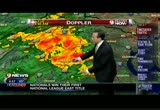
heads-up in warrenton in the next five to ten minutes. you could at least see some of the thunder and heavier downpours coming through your area west of prince william county. we'll continue to see these showers and storms move through through the rest of the evening hours. then we start to clear out. notice the showers back to the west. these are actually induced by cold air. so the cold air trying to filter on in here. we're going to see cooler weather move in over the next 12 hours or so. this evening, clouds and showers ending late. i think most of these will move out of here. temperatures 58 to about 68 degrees. tomorrow morning, waking up to cool numbers, but not too cold. 44 in the coolest suburbs, to about 50 in the city. winds out of the northwest at 10 to 15 miles an hour. they may be on the breezy side, winds up to 15 miles an hour. breezy earlier tomorrow. temperatures 64 to 69 degrees. once again, we will see those breezy conditions lingering throughout the early afternoon. and then it gets really nice. take a look at wednesd
heads-up in warrenton in the next five to ten minutes. you could at least see some of the thunder and heavier downpours coming through your area west of prince william county. we'll continue to see these showers and storms move through through the rest of the evening hours. then we start to clear out. notice the showers back to the west. these are actually induced by cold air. so the cold air trying to filter on in here. we're going to see cooler weather move in over the next 12 hours or so....
226
226
Oct 15, 2012
10/12
by
WUSA
tv
eye 226
favorite 0
quote 0
there's activity west of town headed for fauquier county north of warrenton and another heavier storm moving into howard county. that's about to cross route 32, about to cross 29 and 95 in between d.c. and baltimore. even if you look carefully, this is lightning heading out of near the culpeper area, headed into fauquier county. don't be surprised if you hear the rumble of thunder, pretty heavy storms crossing 66 moving north and east. get ready chantilly, fairfax, anybody driving out 56, slow go, brief heavy rains with it actually. you can season the line of storms and the red indicates rainfall rates of about an inch per hour with pretty good lightning. this will move across 17, across toward haymarket and across 66 of the in next 30 minutes. after that -- 66 in the next 30 minutes. after that we'll talk about drying off and getting cooler coming up. >>> a fire yesterday in upper marlboro, a woman pulled from her burning home yesterday morning on peach leaf court has now died. it's believed the fire started in the basement. investigators think it was an accident. there was a working
there's activity west of town headed for fauquier county north of warrenton and another heavier storm moving into howard county. that's about to cross route 32, about to cross 29 and 95 in between d.c. and baltimore. even if you look carefully, this is lightning heading out of near the culpeper area, headed into fauquier county. don't be surprised if you hear the rumble of thunder, pretty heavy storms crossing 66 moving north and east. get ready chantilly, fairfax, anybody driving out 56, slow...
136
136
Oct 15, 2012
10/12
by
WUSA
tv
eye 136
favorite 0
quote 0
you get farther south and southwest, south of warrenton, then we're just into general showers. sperryville its a little bit heavier. we have light showers now falling across southern maryland, back toward colonial beach and port royal and the northern neck. we'll be dealing with the rain showers on and off, maybe some thunderstorms for the afternoon. if you have outdoor plans, that could be a problem. one good thing today, temperatures are way up. we have low 70s now in town. 60s north and west. itas a mild morning. for the rest the afternoon, these clouds will give way to some showers around at times between now and let's say 6:00, maybe some thunder. winds will turn southwest to even west to northwesterly. by 9:00 tonight, we'll be down to 60. drier air moving in. so it looks a lot better for the the next couple of days. full forecast in a few minutes. jc? >>> we have breaking news now from silver spring, maryland. there is a report of a stabbing that occurred in a high school. it hammed at northwood high school located at the corner of alcoa avenue and university boulevard.
you get farther south and southwest, south of warrenton, then we're just into general showers. sperryville its a little bit heavier. we have light showers now falling across southern maryland, back toward colonial beach and port royal and the northern neck. we'll be dealing with the rain showers on and off, maybe some thunderstorms for the afternoon. if you have outdoor plans, that could be a problem. one good thing today, temperatures are way up. we have low 70s now in town. 60s north and...
133
133
Oct 19, 2012
10/12
by
WUSA
tv
eye 133
favorite 0
quote 0
culpepper, warrenton, moving through parts of the metro area. i think tomorrow morning the big problems will be i-95 and eastward. all right, you see all these? reports of hail. that's why they were severe. but again right now no warnings and there never were any watches out. okay future cast. early early in the morning, 4:45, a couple of light showers. so a lot of the commute will be wet, the roads will be damp. then we'll get into the 7:15 hour, another line tries to develop east of town. southern maryland and also the northern neck, that will roll on through for them, even by 10:00 to 11:00, it will still be wet by the way and annapolis. clears out pretty quickly after that. we'll salvage a very, very nice friday afternoon. and hit the stage for a pretty nice weekend. early showers and storms tomorrow morning. slower commute for you on i-95 and east. you might want to allow 10 extra minutes if you're coming in westbound or use i-95. you still need your shades. warmer on friday with a cooler weekend. but still a pretty nice weekend for you. te
culpepper, warrenton, moving through parts of the metro area. i think tomorrow morning the big problems will be i-95 and eastward. all right, you see all these? reports of hail. that's why they were severe. but again right now no warnings and there never were any watches out. okay future cast. early early in the morning, 4:45, a couple of light showers. so a lot of the commute will be wet, the roads will be damp. then we'll get into the 7:15 hour, another line tries to develop east of town....
181
181
Oct 3, 2012
10/12
by
WTTG
tv
eye 181
favorite 0
quote 0
we also have heavy showers moving into the warrenton area. i'll have your forecast. >> check out the rundown. we're back. >> this is fox 5 news edge at 11:00. [ male announcer ] citibank's app for ipad makes it eaeasy for anne to manage her finances when she's on the go. even when she's not going anywhere. citibank for ipad. easier banking. standard at citibank. in today's economy. too many of those who are working are living paycheck to paycheck trying to make falling incomes meet rising prices for food and gas. more americans are living in poverty than when president obama took office and fifteen million more are on food stamps. president obama and i both care about poor and middle-class families. the difference is my policies will make things better for them. we shouldn't measure compassion by how many people are on welfare. we should measure compassion by how many people are able to get off welfare and get a good paying job. my plan will create twelve million new jobs over the next four years helping lift families out of poverty and stren
we also have heavy showers moving into the warrenton area. i'll have your forecast. >> check out the rundown. we're back. >> this is fox 5 news edge at 11:00. [ male announcer ] citibank's app for ipad makes it eaeasy for anne to manage her finances when she's on the go. even when she's not going anywhere. citibank for ipad. easier banking. standard at citibank. in today's economy. too many of those who are working are living paycheck to paycheck trying to make falling incomes meet...
142
142
Oct 3, 2012
10/12
by
WTTG
tv
eye 142
favorite 0
quote 0
i think this is the second question from warrenton we've had this week., why is the washington, d.c. region not subjected to the amount of natural disasters the rest of the country experiences on a regular basis? and by the way, nathaniel says, tony, you the man. >> you just put that in there. >> i did see tony typing something. >> thank you. may i say a very nicely put question from this 10-year-old boy. not true. we are subject to some natural disasters. we're somewhat fortunate in that we don't encounter some of the extremes that other parts of the country do. the west coast of the united states as we all know is earthquake prone. the midsection of the country is very prone to tornadoes, tornado alley. but we can have earthquakes as we've learned recently. we can have relatively weak tornadoes usually. hushs im-- hurricanes impact us and like. >> i think the difference is, in the washington area, we don't have unpredictable natural disasters. that is my theory. so in parts of the country, we can't predict tornadoes with more than five or 10 minutes, 15
i think this is the second question from warrenton we've had this week., why is the washington, d.c. region not subjected to the amount of natural disasters the rest of the country experiences on a regular basis? and by the way, nathaniel says, tony, you the man. >> you just put that in there. >> i did see tony typing something. >> thank you. may i say a very nicely put question from this 10-year-old boy. not true. we are subject to some natural disasters. we're somewhat...
224
224
Oct 31, 2012
10/12
by
WUSA
tv
eye 224
favorite 0
quote 0
warrenton to culpeper. we'll have light rain or showers around for the morning commute. that's not going to happen. leesburg, manassas all at 39 with 43 annapolis. when you factorn the winds, there are your windchills running in the mid- to upper 30s in most areas. monika samtani, it's pretty chilly inside the studio but she has the traffic report. >> it's freezing in here. >> mind over matter. >> that's right. >>> if you're planning to head outside, one problem is replaced by another. there was a problem on the inner loop near route 450. that was cleared. now there's another accident. i'll get to that in just a minute. first of all public transportation normal service on metro bus and rail. amtrak modified service from basically newark, new jersey to points south. call ahead and know that of course they're going to -- there are going to be delays due to sandy. let's go to another graphic and this time it's just a list, a short list of the road closures including georgetown pike, sligo creek parkway, route
warrenton to culpeper. we'll have light rain or showers around for the morning commute. that's not going to happen. leesburg, manassas all at 39 with 43 annapolis. when you factorn the winds, there are your windchills running in the mid- to upper 30s in most areas. monika samtani, it's pretty chilly inside the studio but she has the traffic report. >> it's freezing in here. >> mind over matter. >> that's right. >>> if you're planning to head outside, one problem is...
159
159
Oct 3, 2012
10/12
by
WJLA
tv
eye 159
favorite 0
quote 0
muggy. 75 in gaithersburg, 77 now in warrenton. average, theabove official temperature at reagan national. a few showers continue to move the east of the carolina coast. some in southwest virginia. there could possibly be a shower, especially a cold front works its way in. muggy. as we get to friday, we will lose the humidity. comfortable. 77 in detroit, 63 in chicago, in minneapolis. , thee rocky mountain area temperatures are really starting tank, and we will feel that later. this is kind of a summertime, muggy combination. 30 degrees in minneapolis. is the cooler, drier air in. will be coming this will blow through tomorrow and by friday, a sunni. -- by friday, sunny. we may see scattered showers the saturday, and then comes right on in. near 60's on sunday, change. 68 degrees early tomorrow fog in with some patchy the air. isolated shower, which may not be widespread, on friday, we dry things out. a better chance of some light rain on sunday. some beautiful autumn weather tuesday, and wednesday. and now, the toyota sports desk,
muggy. 75 in gaithersburg, 77 now in warrenton. average, theabove official temperature at reagan national. a few showers continue to move the east of the carolina coast. some in southwest virginia. there could possibly be a shower, especially a cold front works its way in. muggy. as we get to friday, we will lose the humidity. comfortable. 77 in detroit, 63 in chicago, in minneapolis. , thee rocky mountain area temperatures are really starting tank, and we will feel that later. this is kind of...
189
189
Oct 17, 2012
10/12
by
WJLA
tv
eye 189
favorite 0
quote 0
southbound 95, a work zone between warrenton road and franklin.thbound 95 looking pretty good with no delays. all your travel lanes are open heading into springfield and continuing on 395. earlier accident in maryland on the shoulder prior to 1-0909 and 270. looking good the bethesda and the beltway, no troubles. that's the latest. back to you. >> thank you. in entertainment news, you can say all the single ladies will be watching the super bowl. >> it is because beyonce will be the halftime performer this year. the nfl confirmed the news yesterday after beyonce posted this photograph of herself on our website. you can see she's wearing the eye-black. of course the that's the date the super bowl is in new orleans. we will have to wait to see if maybe your husband will perform or members of her former group destiny's child. let's make it a half times spectacular. fans said goodbye to another celebrity on "dancing with the stars." >> kirstie alley had the lowest score after monday's performance and bristol palin. >> bristol. >> after the announcemen
southbound 95, a work zone between warrenton road and franklin.thbound 95 looking pretty good with no delays. all your travel lanes are open heading into springfield and continuing on 395. earlier accident in maryland on the shoulder prior to 1-0909 and 270. looking good the bethesda and the beltway, no troubles. that's the latest. back to you. >> thank you. in entertainment news, you can say all the single ladies will be watching the super bowl. >> it is because beyonce will be the...
130
130
Oct 19, 2012
10/12
by
WUSA
tv
eye 130
favorite 0
quote 0
same in nassas. 62 in warrenton. only 50 in oakland and the beltway, upper 60s for the most part. 66 in gathisburb. code green for us. beautiful on sunday. a lot of sunshine and a high of 67. the sunshine continuing on monday. as we head back to work and school, temperatures will be rising close to 80 degrees by tuesday, 78 here with a mixture of clouds and sun. same deal on wednesday. there's going to be a storm system approaching from the west that could trigger a shower or storm on friday. it's going to be dry and warm feeling more like june than october and here, people are getting their halloween costumes ready and all that kind of stuff. we're looking at temperatures more appropriate for sunglasses and bathing suits here. >> oh, yes. not going to complain. >> looks good to me. >>> weird news tonight. ♪ i believe i can fly, i believe i can touch the sky ♪ in china, taking the word daredevil to a new level. guys on suits with wings and then jump off. yeah, wee, right? and then open your parachute and you land saf
same in nassas. 62 in warrenton. only 50 in oakland and the beltway, upper 60s for the most part. 66 in gathisburb. code green for us. beautiful on sunday. a lot of sunshine and a high of 67. the sunshine continuing on monday. as we head back to work and school, temperatures will be rising close to 80 degrees by tuesday, 78 here with a mixture of clouds and sun. same deal on wednesday. there's going to be a storm system approaching from the west that could trigger a shower or storm on friday....
156
156
tv
eye 156
favorite 0
quote 0
is advancing rather quickly from the southwest heading northeast, getting some light showers now, warrenton county further west, closer to washington from near leesburg and western loudoun county getting sprinkles further north. might have just a few little tiny sprinkles in the windshields in montgomery, prince george's and
is advancing rather quickly from the southwest heading northeast, getting some light showers now, warrenton county further west, closer to washington from near leesburg and western loudoun county getting sprinkles further north. might have just a few little tiny sprinkles in the windshields in montgomery, prince george's and
263
263
Oct 29, 2012
10/12
by
WJLA
tv
eye 263
favorite 0
quote 0
we have a strong band from hagerstown down toward frederick and warrenton. we can see zero 0.5 inches per rain.f we can seek higher totals in the delmarva peninsula. dover, delaware, over four inches. about 2.5 inches in annapolis. there has been an incredible of wave action. this is a time lapse from ocean city, maryland. look at the end of that pierre. . that is about 100 feet appear that was wiped out. of pier wiped out. we see 35-mile per hour wind gusts. here is a time line -- 30-50 hour gusts are expected then 45-55 6:00 midnight and by tomorrow 50-70g, we will see the per mile power wins. ds. talk about other aspects of sandy coming up in a little bit. you can still find us online wjla.com. you could also use your mobile phone. we will be applied streaming. as you mentioned, the maryland line is really taking a pounding. has beener ocean city by waves. brianne carter has more. we know the waves have been oming in tyrian >> we are starting to see some damage. we are seeing sheets of from these sections along the boardwalk. down here andng debris scatte
we have a strong band from hagerstown down toward frederick and warrenton. we can see zero 0.5 inches per rain.f we can seek higher totals in the delmarva peninsula. dover, delaware, over four inches. about 2.5 inches in annapolis. there has been an incredible of wave action. this is a time lapse from ocean city, maryland. look at the end of that pierre. . that is about 100 feet appear that was wiped out. of pier wiped out. we see 35-mile per hour wind gusts. here is a time line -- 30-50 hour...
112
112
Oct 20, 2012
10/12
by
WUSA
tv
eye 112
favorite 0
quote 0
through the zones we will look at temperatures close to normal. 67 in leesburg and 66 in warrenton and 62 in come ber ton and to the beltway the temperatures in the mid to upper 60s. 68 in andrews air force base and 67 in baltimore. the temperatures won't move very much during the overnight hours and into tomorrow. partly cloudy for the it were's game and playing at nc state, 67 in college park. code green conditions, nice. 67 with lots of sunshine on sunday. 74 on monday. and temperatures get easy warmer from there. 78degrees on tuesday, wednesday and thursday. and that sunshine will continue. we don't have a chance for rain until next friday with approaching storm system. enjoy the warm, dry, almost summer-like weather. maybe a june kind of feel as we head towards halloween. >> the kids will be in shorts. >> it will be bizarre. >>> not a costume. >>> it was a tall order to fill but the tallest man in the country has got shoes and they asked him to sit. a team at reebok spent the last five months making the size 24, jackson, size 24. the last time this minnesota guy fit into a pair of
through the zones we will look at temperatures close to normal. 67 in leesburg and 66 in warrenton and 62 in come ber ton and to the beltway the temperatures in the mid to upper 60s. 68 in andrews air force base and 67 in baltimore. the temperatures won't move very much during the overnight hours and into tomorrow. partly cloudy for the it were's game and playing at nc state, 67 in college park. code green conditions, nice. 67 with lots of sunshine on sunday. 74 on monday. and temperatures get...
206
206
Oct 5, 2012
10/12
by
WUSA
tv
eye 206
favorite 0
quote 0
now during the day tomorrow, 74 degrees in winchester. 76 in leesburg. 75 in warrenton. and 78 in manassas. looks like great weather as we head into the afternoon hours. i'm going to have to hit the hot button once again so we can get to our forecast over the next three days. that chance of a shower on saturday and code yellow on sunday because of pockets of heavy rain in the forecast. on monday, columbus day, it looks good. a stray shower lingering, but 64 degrees for the high. chilliest day is on sunday, 58 degrees there. now as you are heading back to work and school, that's when the weather starts to improve, 70 degrees for your high. lots of sunshine on tuesday and for the most part, it stays dry through the workweek. stick with us, 9news now at 7:00 will continue in a minute. >>> in the mail bag tonight, major league reaction on the w usa9 facebook page. dawn is one of many who just wasn't buying it. perhaps it will be refactorred just after the election to the actual number. don't worry, it won't be page one news, it will be buried behind an expired coupon. when w
now during the day tomorrow, 74 degrees in winchester. 76 in leesburg. 75 in warrenton. and 78 in manassas. looks like great weather as we head into the afternoon hours. i'm going to have to hit the hot button once again so we can get to our forecast over the next three days. that chance of a shower on saturday and code yellow on sunday because of pockets of heavy rain in the forecast. on monday, columbus day, it looks good. a stray shower lingering, but 64 degrees for the high. chilliest day...
189
189
Oct 15, 2012
10/12
by
WUSA
tv
eye 189
favorite 0
quote 0
mountains to the coast, 62 in winchester, maybe 60 in hagerstown, mid-60s, 66 in culpeper, but 64 warrenton, manassas, leesburg, maybe 65 in fairfax. downtown 66, 65 in rockville and also gaithersburg and mid- 60s into southern maryland, just a few parts of the bay andfieldal potomac with a small craft advisory early tuesday. next three days code green, why not? cooler, nice tomorrow, 66, very nice on wednesday, partly cloudy, 71 and then mild on thursday. yes, some clouds come in late, maybe a shower by nightfall, temperatures in the low 70s, pretty good deal. next seven days, friday looks okay right now, partly cloudy, temps around 70, cooler over the weekend at least on saturday, temps back in the mid- 60s but a nice day for terp football. it is homecoming in maryland and also howard, 70, maybe a shower sunday are but don't change your plans and then 75 monday. >> we will look for tweakage as the week goes along. >>> all right. stop what you're doing and check this out. this daredevil stunt nearly ended in tragedy, a base jumper in norway flung off the side of a cliff when the bar he was
mountains to the coast, 62 in winchester, maybe 60 in hagerstown, mid-60s, 66 in culpeper, but 64 warrenton, manassas, leesburg, maybe 65 in fairfax. downtown 66, 65 in rockville and also gaithersburg and mid- 60s into southern maryland, just a few parts of the bay andfieldal potomac with a small craft advisory early tuesday. next three days code green, why not? cooler, nice tomorrow, 66, very nice on wednesday, partly cloudy, 71 and then mild on thursday. yes, some clouds come in late, maybe a...
119
119
Oct 17, 2012
10/12
by
WUSA
tv
eye 119
favorite 0
quote 0
low 70s for culpeper. 70 for warrenton, leesburg, manassas. 70 or 71 for fairfax. downtown, looking at 71. low 70s into charles county, st. mary's county, and 70, rockville and frederick. and because of those southeast winds, there's a small craft advisory for the bay and title potomac. the bulk of the day, nice, 71. 72 on friday. still nice. got to go green, you know, a couple showers possible, but the bulk of the day is fine. cooler on saturday, maryland's homecoming looks great. temperatures in the mid 60s. next seven days, temperatures go up. in fact, we get into monday, temperatures go back up into the 70s. talking mid 70s on monday, upper 70s on tuesday. maybe some showers next wednesday, but temperatures are hanging in there in the low 70s. so sometimes october can be pretty sweet. >> for a little while. >>> lots of folks have tattoos and no big deal, but what if your boss ordered you to cover yours up? that is exactly what they are doing at scotland yard. britain's officers are being told, disclose all your tattoos to your manager or you may be fired. visib
low 70s for culpeper. 70 for warrenton, leesburg, manassas. 70 or 71 for fairfax. downtown, looking at 71. low 70s into charles county, st. mary's county, and 70, rockville and frederick. and because of those southeast winds, there's a small craft advisory for the bay and title potomac. the bulk of the day, nice, 71. 72 on friday. still nice. got to go green, you know, a couple showers possible, but the bulk of the day is fine. cooler on saturday, maryland's homecoming looks great. temperatures...
112
112
Oct 6, 2012
10/12
by
WUSA
tv
eye 112
favorite 0
quote 1
looking at the zone. 74 in winchester. 78 in manassas and 75 in warrenton. annapolis looking good at 77 degrees tomorrow. an isolated storm is possible as we head into the later part of tomorrow. so the next three days, code yellow for sunday. because it will be rainy and chilly. 58 degrees for your high on sunday. monday an improvement here. still a high of 64 degrees. so it's not exactly looking great on columbus day. tabling a look at the seven-day forecast, we dry out just in time for going back to work and back to school. the timing is not very good with the seven-day forecast. sorry about that, guys. but it looks better for the terps than it does for the skins as far as the football weather goes. >> we aren't going to blame you. >> the pros like it messy. >> there you go. not a lot of rain. >> let's talk football. >> rg3, he was at the high school football game. everybody wants his jersey. we are giving away these jerseys right here. here's how you get one. like us on facebook at wusa9. go to wusa9 and like us and tell us why you deserve the free jerse
looking at the zone. 74 in winchester. 78 in manassas and 75 in warrenton. annapolis looking good at 77 degrees tomorrow. an isolated storm is possible as we head into the later part of tomorrow. so the next three days, code yellow for sunday. because it will be rainy and chilly. 58 degrees for your high on sunday. monday an improvement here. still a high of 64 degrees. so it's not exactly looking great on columbus day. tabling a look at the seven-day forecast, we dry out just in time for going...
122
122
Oct 11, 2012
10/12
by
WUSA
tv
eye 122
favorite 0
quote 0
you'll need to stay to the right if you're planning to head southbound toward route 17 warrenton allhe way to route 3. stay to the right to get around that construction zone. let's take a live look outside and show you what it looks like if you're planning to head northbound on i-95. here is what is looks like at route 1 in woodbridge. very light heading towards springfield. this time all the way up 270 coming in from frederick. no issues to report. 355 looks great as well. great seneca highway a little further south in gaithersburg and for the beltway you'll be fine. a quick look at the beltway in college park. here at route 1 everything is fine. eastbound or northbound route 212 at evans trail is blocked because of a utility problem. maybe use 95 instead. i'll be back with more coming up at 4:39. >>> we start with breaking news now. fire crews are on the scene of a deadly fire in northeast baltimore. two-alarm fire started just after 2:00 this morning at a house in the 5000 block of denwood avenue. five people were killed in the fire, four of them children. one person survived by j
you'll need to stay to the right if you're planning to head southbound toward route 17 warrenton allhe way to route 3. stay to the right to get around that construction zone. let's take a live look outside and show you what it looks like if you're planning to head northbound on i-95. here is what is looks like at route 1 in woodbridge. very light heading towards springfield. this time all the way up 270 coming in from frederick. no issues to report. 355 looks great as well. great seneca highway...
142
142
Oct 5, 2012
10/12
by
WUSA
tv
eye 142
favorite 0
quote 0
with just a touch of fog out to warrenton.per 54 and on the bay still 67 in annapolis and la plata 55. this afternoon a beauty. maybe one of the last really great days of the year. high temperature today 83 in town and maybe holding 79 in hagerstown. mike back to you. >>> i'll take it howard. thank you. we begin with a look at the latest from -- is beverly farmer there? >> hey, i-270 yes we're here and ready to roll this friday morning. south on 270 out of frederick. overnight road work not costing you much time. it looks great here into hyattstop and continuing south into the beltway. so that's reopened now. travel virginia 66, you're off to a great start making your way east into markham. heading into manassas getting into fair oaks vienna falls church, no early issues there. the 95 and 395 corridors no incidents. ongoing accident on a stretch of glebe road just south of route 1 near mount vernon avenue. next timesaver traffic sat 4:39. mike, jessica back to you. >>> we start with a look at the latest from the campaign trail
with just a touch of fog out to warrenton.per 54 and on the bay still 67 in annapolis and la plata 55. this afternoon a beauty. maybe one of the last really great days of the year. high temperature today 83 in town and maybe holding 79 in hagerstown. mike back to you. >>> i'll take it howard. thank you. we begin with a look at the latest from -- is beverly farmer there? >> hey, i-270 yes we're here and ready to roll this friday morning. south on 270 out of frederick. overnight...
146
146
Oct 2, 2012
10/12
by
WUSA
tv
eye 146
favorite 0
quote 0
warmest spot, 86 in culpeper. 84 in warrenton, manassas, leesburg, maybe 85 in fairfax. 85 downtown.3 by the water for annapolis. and we're looking at 85 up in gaithersburg. right now, no small craft advisories for the bay or title potomac. that may change tomorrow afternoon. code green, warmer tomorrow, isolated storm possible. 85. 84 on thursday. just great. and fantastic on friday. mostly sunny, temperatures in the low 80s. now the weekend, temperatures go down. still mild on saturday for the terps game. for family weekend at university of maryland. showers possible before the game is over. better chance of showers at night and cooler. we're in the 60s sunday, monday, and tuesday, and some of those showers may bleed into the game. >> yes, they will. >> we lost seven in a row? >> that's weird. >> let's hope they can pick that up. >> let's talk about the weird news, because as topper, you know this. without the world records, there would be less than half of the weird news that we have most of the time. let's go straight to india. how about this choice for weird news. bash your head
warmest spot, 86 in culpeper. 84 in warrenton, manassas, leesburg, maybe 85 in fairfax. 85 downtown.3 by the water for annapolis. and we're looking at 85 up in gaithersburg. right now, no small craft advisories for the bay or title potomac. that may change tomorrow afternoon. code green, warmer tomorrow, isolated storm possible. 85. 84 on thursday. just great. and fantastic on friday. mostly sunny, temperatures in the low 80s. now the weekend, temperatures go down. still mild on saturday for...
194
194
tv
eye 194
favorite 0
quote 0
had allege fog around warrenton and culpeper but those visibilities have come up to five miles.fog advisory west out toward cumberland and south toward the winchester, frederick county, virginia area as well. going up to the high 60s, maybe low 70s with showers late. >>> visibility the issue. some wet pavement and the fog factor. still some woad work went on in the -- road work went on in the overnight hours. eastbound 66 volume is very light here getting to the beltway past gallows road. the last report the left hov accident to join 95 is closed. northbound 95 a little bit after struggle although the pace is better coming out of fredricksburg. the work crew before 17 fall moth blocking all but -- falmouth blocking all but the left lane. if you travel on the 395 corridor, the pace is good. beltway up toward the 14th street bridge and folks that are headed around the maryland beltway inner loop roadway should be pulling out of your way. the beltway at the american legion bridge running freely in east direction. you can see a little bit of haze at the tree top level with the fog.
had allege fog around warrenton and culpeper but those visibilities have come up to five miles.fog advisory west out toward cumberland and south toward the winchester, frederick county, virginia area as well. going up to the high 60s, maybe low 70s with showers late. >>> visibility the issue. some wet pavement and the fog factor. still some woad work went on in the -- road work went on in the overnight hours. eastbound 66 volume is very light here getting to the beltway past gallows...
179
179
Oct 12, 2012
10/12
by
WUSA
tv
eye 179
favorite 0
quote 0
the winner on this map is culpeper, 64, but warrenton, manassas, leesburg, fairfax, 60, 61, downtown 62. get into charles county past la plata, waldorf, probably get to the mid-60s, 64 for annapolis. no small craft advisory tomorrow for the bay or tidal potomac. day planner, 30 to 42 to start and 57 to 62 by noon. so even at noon there will be some 50s and by evening cool, temperatures between 60 and 65 with full sun. next three days all green, 62 tomorrow, 75 on sunday, great for the redskins game. they're home, ravens home, great. maybe a shower on monday, 76, still a pretty nice day. next seven days, we get to tuesday, gets a little cooler behind the frontal boundary but nothing crazy, mid-60s and then 70 on wednesday, then showers may develop thursday late or more likely thursday night into friday. nice thursday, low 70s and back in the mid-60s friday. >> it's hard to grasp watching baseball all bundled up, but that's what the fall season is about. we'll be right back. >>> a brunswick teenager has been charged after attacking a fellow classmate right in front of a tv reporter. th
the winner on this map is culpeper, 64, but warrenton, manassas, leesburg, fairfax, 60, 61, downtown 62. get into charles county past la plata, waldorf, probably get to the mid-60s, 64 for annapolis. no small craft advisory tomorrow for the bay or tidal potomac. day planner, 30 to 42 to start and 57 to 62 by noon. so even at noon there will be some 50s and by evening cool, temperatures between 60 and 65 with full sun. next three days all green, 62 tomorrow, 75 on sunday, great for the redskins...
163
163
Oct 12, 2012
10/12
by
WUSA
tv
eye 163
favorite 0
quote 0
fifty in oakland, 58 in cumberland, 63 in warrenton. looking at 65 downtown, 65 for annapolis. there's a small craft advisory for the bay and to to mac because of the north-northwest winds. next three days are code green. a tad cooler on saturday; but still nice, low 60s, beautiful on sunday, 77. next 7 days, showers possible as we get to monday. just some light showers, and then we stay warm, tuesday, partly cloudy, 72, showers on wednesday, a better chance for showers on thursday and still warm. tive will be back with more baseball highlights after this. stay tuned. >>> mark learner strolls over to me and said, "that was one of the real moments we had in the stadium." most of the game wasn't good. the ending was phenomenal. that's adam la roche. you know the story. he came in struggling until that. he said "i'm taking my talents to the center-field grass. first lead in 18 innings for washington ross ross detweiler came in, and a lot of people questioned whether he should start the day. he was he was sharp. this was the only run he yielded in 6 innings, a sac fly to center. ca
fifty in oakland, 58 in cumberland, 63 in warrenton. looking at 65 downtown, 65 for annapolis. there's a small craft advisory for the bay and to to mac because of the north-northwest winds. next three days are code green. a tad cooler on saturday; but still nice, low 60s, beautiful on sunday, 77. next 7 days, showers possible as we get to monday. just some light showers, and then we stay warm, tuesday, partly cloudy, 72, showers on wednesday, a better chance for showers on thursday and still...
104
104
Oct 16, 2012
10/12
by
WUSA
tv
eye 104
favorite 0
quote 0
warrenton, manassas, leesburg, 64. 66 downtown. 66 in waldorf and 66 in annapolis.ight, next three days, code green has to be. nice tomorrow, sunshine and 66. 71 on wednesday with sunshine. few clouds thursday. maybe a shower thursday night, but the bulk of the day will be beautiful. next seven days, friday looks okay at this point. there's a storm up in the great lakes. it should leave us alone. stay partly cloudy saturday. homecoming at maryland. >> great day on saturday. mid-60s. 70 on sunday. maybe a shower and then 75 on monday. >> you've been delivering here on the weekends. >> i'm trying, yes. >> don't touch it. >> no tweaking. >>> we've got some more football news tonight, and it's not just redskins. >> at the time not just redskins. lots going on here but also up i-95 with the ravens. first we've got to talk about rg3. some said it was like watching a track meet. i know you heard from derek and fans, but even president obama got the attention of president obama. here he had to say plus the greatest olympian >>> all right, the argument is still ongoing. shou
warrenton, manassas, leesburg, 64. 66 downtown. 66 in waldorf and 66 in annapolis.ight, next three days, code green has to be. nice tomorrow, sunshine and 66. 71 on wednesday with sunshine. few clouds thursday. maybe a shower thursday night, but the bulk of the day will be beautiful. next seven days, friday looks okay at this point. there's a storm up in the great lakes. it should leave us alone. stay partly cloudy saturday. homecoming at maryland. >> great day on saturday. mid-60s. 70 on...
157
157
tv
eye 157
favorite 0
quote 0
lane is able to get by to the left getting past 17 falmouth and the ramp to 17 to go north toward warrenton is still blocked in that construction. they should be pulling out of there in the next 20 minutes. here north of the rest area, dumfries, dale city into woodbridge, the pace is good. >> thank you, beverly. >>> it is 4:40. time for the first your money segment of the morning. >> hi, jessica doyle. >> good morning, everybody. wall street is kicking off a new month, new quarter. a lot of economic news out there. expect reports this week on construction spending, manufacturing, and auto sales. main event of course is friday when the government releases the unemployment report for september. the previous reports shows the economy added just 96,000 jobs in august while the unemployment rate fell slightly to 8.1% because more people stopped looking for work. as for stocks it was a weak finish to a strong quarter on wall street. checking the numbers, the dow stands this morning at 13,437, but it fell about 49 points on friday. it rose 4% for the entire quarter. nasdaq lost 20 points on friday
lane is able to get by to the left getting past 17 falmouth and the ramp to 17 to go north toward warrenton is still blocked in that construction. they should be pulling out of there in the next 20 minutes. here north of the rest area, dumfries, dale city into woodbridge, the pace is good. >> thank you, beverly. >>> it is 4:40. time for the first your money segment of the morning. >> hi, jessica doyle. >> good morning, everybody. wall street is kicking off a new...
197
197
Oct 31, 2012
10/12
by
WUSA
tv
eye 197
favorite 0
quote 0
same story showers from strasburg toward warrenton, culpeper. very light. intermittent wiper type intensities is what i'm thinking. temperatures in the upper 30s and low 40s. your windchills currently running in the mid-30s to around 40. winds have been not too strong this morning. michael & son camera, good visibility here. the capitol dome is looking nice all lit up. 43 degrees in town with a south wind at 5 miles an hour and the barometer continues to rise now at 29.51. if you're like me and sensitive to the pressure changes, you've been feeling it the last couple of days. snow will persist in the mountains here through the afternoon with mostly cloudy skies around here. our temperatures on the cool side this halloween, 55. still some high water around. dry the next couple of days with 55 thursday. agent bit more sun but cooler friday, 52. the weekend could be a shower late sunday. don't forget clocks back saturday night. monika? >> does that mean more sleep? >> one hour more. i wish we could do it 24 hours time. >> i'll take the one hour and i'm sure al
same story showers from strasburg toward warrenton, culpeper. very light. intermittent wiper type intensities is what i'm thinking. temperatures in the upper 30s and low 40s. your windchills currently running in the mid-30s to around 40. winds have been not too strong this morning. michael & son camera, good visibility here. the capitol dome is looking nice all lit up. 43 degrees in town with a south wind at 5 miles an hour and the barometer continues to rise now at 29.51. if you're like me...
169
169
Oct 4, 2012
10/12
by
WUSA
tv
eye 169
favorite 0
quote 0
then you go down 17 into central fauquier county toward warrenton. we have a few heavier showers. lighter stuff getting over to almost dale city, quantico, fredricksburg. we have a couple of heavier showers there as well. all of this scattered shower activity moving to the northeast. it will be drifting eastward with the showers moving north on it. that's why we'll be wet here for the morning rush again. nothing like a couple mornings ago but any rain will certainly slow things down. there's our warm stuff south and east. 75 the patuxent river naval air station. 64 in cumberland. that's not bad at all for this time of year. here in town we have a 71- degree reading. looking outside on our weather camera, we're dry, cloudy but good visibility this morning with the 71-degree reading. humidity way up at 90%. at the moment there are no winds to speak of. look at the cold air coming into the country. wow, temperatures this morning 20s and 30s in the northern rockies. snow is flying. there are parts of northwestern minnesota that could see a foot of snow over the next couple of days. th
then you go down 17 into central fauquier county toward warrenton. we have a few heavier showers. lighter stuff getting over to almost dale city, quantico, fredricksburg. we have a couple of heavier showers there as well. all of this scattered shower activity moving to the northeast. it will be drifting eastward with the showers moving north on it. that's why we'll be wet here for the morning rush again. nothing like a couple mornings ago but any rain will certainly slow things down. there's...
170
170
Oct 2, 2012
10/12
by
WUSA
tv
eye 170
favorite 0
quote 0
down toward warrenton and culpeper, the more moderate rain shower.here's more rain behind that. 65 right now for washington with upper 50s in the shenandoah valley. fredricksburg is 64. we've got 67 degrees in prince frederick this morning. easton 64 and pax river naval air station 69 degrees. outside on our michael & son weather camera, cloudy skies, 65. sun rise isn't till 7:05 this morning. look at dew point up to 60. a sign of the mugginess that has come back. as a warm front lifts this way, you can see the showers and storms back into western north carolina, eastern gulf of mexico. this is headed for us for later this morning and toward the middle of the day especially. so today upper 70s to even around 80 with scattered showers and maybe even a rumble or two of thunder. for tonight we've got temperatures dipping into the 60s. tomorrow 84. and then thursday 82. actually it should be green all three days here. by friday, friday is going to be a decent day around 80 and a front saturday may bring us a shower. same story on sunday. it's 4:48. good
down toward warrenton and culpeper, the more moderate rain shower.here's more rain behind that. 65 right now for washington with upper 50s in the shenandoah valley. fredricksburg is 64. we've got 67 degrees in prince frederick this morning. easton 64 and pax river naval air station 69 degrees. outside on our michael & son weather camera, cloudy skies, 65. sun rise isn't till 7:05 this morning. look at dew point up to 60. a sign of the mugginess that has come back. as a warm front lifts this...
116
116
Oct 12, 2012
10/12
by
WUSA
tv
eye 116
favorite 0
quote 0
fifty in oakland, 58 in cumberland, 63 in warrenton. looking at 65 downtown, 65 for annapolis. there's a small craft advisory for the bay and to to mac because of the north-northwest winds. next three days are code green. a tad cooler on saturday; but still nice, low 60s, beautiful on sunday, 77. next 7 days, showers possible as we get to monday. just some light showers, and then we stay warm, tuesday, partly cloudy, 72, showers on wednesday, a better chance for showers on thursday and still warm. tive will be back with more i'm here to prove that mini babybel cheese packs a whole lotta something special inside this little wax package. why go ordinary? try the special zip peel freshness that only comes from mini babybel. nice! yes! hey, girls. want the perfect snack accessory? it's totally natural, 100% delicious cheese! tasty. see? good things really do come in small packages. like rubies! girls like rubies... mini babybel cheese from the laughing cow. have you laughed today? >>> mark learner strolls over to me and said, "that was one of the real moments we had in the stadium.
fifty in oakland, 58 in cumberland, 63 in warrenton. looking at 65 downtown, 65 for annapolis. there's a small craft advisory for the bay and to to mac because of the north-northwest winds. next three days are code green. a tad cooler on saturday; but still nice, low 60s, beautiful on sunday, 77. next 7 days, showers possible as we get to monday. just some light showers, and then we stay warm, tuesday, partly cloudy, 72, showers on wednesday, a better chance for showers on thursday and still...
169
169
Oct 3, 2012
10/12
by
WUSA
tv
eye 169
favorite 0
quote 0
problems in the shenandoah valley from gaithersburg back toward dulles and manassas and warrenton.hree-quarters of a mile down to a mile. half mile now at national and to the east quarter mile visibility in annapolis and baltimore. but the only advisories we have are annapolis up to baltimore and the northern then shenandoah valley. these dense advise -- northern shenandoah valley. those advisories go in effect till 10:00 this morning. cumberland, hagerstown, win chester 63. got damp streets out there, wet on wisconsin avenue. fog. as we said visibility a quarter mile at national with calm winds and humidity very high. 94%. we still have the flow of moisture in from the southwest. right now clouds here. some showers near wilmington, north carolina. they'll track more to the east. look like the rain chances are only on the slight side for the afternoon when we get a little bit of sun to come out. a warm day, 85. isolated shower. tonight we're dipping 65 to 70. so a very mild night. tomorrow low 80s and we might even get to 84. right now i think 82 but we'll watch it. still either wa
problems in the shenandoah valley from gaithersburg back toward dulles and manassas and warrenton.hree-quarters of a mile down to a mile. half mile now at national and to the east quarter mile visibility in annapolis and baltimore. but the only advisories we have are annapolis up to baltimore and the northern then shenandoah valley. these dense advise -- northern shenandoah valley. those advisories go in effect till 10:00 this morning. cumberland, hagerstown, win chester 63. got damp streets...
233
233
Oct 3, 2012
10/12
by
WUSA
tv
eye 233
favorite 0
quote 0
just in the last hour, we see the yellows and the oranges around warrenton.derate rain possible there. it will head towards leesburg and middleburgh. some fog early, no doubt about that p. turning warmer, no doubt about that either. thunderstorm possible tomorrow, but they're going to be kind of far and few between. a little better chance in the mountains, and just great on thursday. next three days, code green, green and green. a slight chance of a storm tomorrow, 85. again, it may take quite awhile to burn the fog and clouds off early. great on thursday, 84. fantastic on friday, mostly sunny. temperatures in the low 80s. next seven days, cold front comes in on the weekend. some showers possible. possibly before the maryland game is over. still mild, not warm, mid-70s. then some showers trying to end before the redskin game begins, but very cool. if you're dale gating or going -- tailgating or going to the game, that's your high. >> we have a fall fest going on. >> yeah, we do. >> take your umbrellas, okay. >> 80s and 70s and 60s. >>> so the nationals will n
just in the last hour, we see the yellows and the oranges around warrenton.derate rain possible there. it will head towards leesburg and middleburgh. some fog early, no doubt about that p. turning warmer, no doubt about that either. thunderstorm possible tomorrow, but they're going to be kind of far and few between. a little better chance in the mountains, and just great on thursday. next three days, code green, green and green. a slight chance of a storm tomorrow, 85. again, it may take quite...
164
164
Oct 9, 2012
10/12
by
WUSA
tv
eye 164
favorite 0
quote 0
you get warrenton west, culpeper west, fairly quiet, even around leesburg. this is ground clutter.ore moderate showers. you're seeing them south and east of town into d.c. a few in southern fairfax county as well and down into western charms and
you get warrenton west, culpeper west, fairly quiet, even around leesburg. this is ground clutter.ore moderate showers. you're seeing them south and east of town into d.c. a few in southern fairfax county as well and down into western charms and
166
166
Oct 17, 2012
10/12
by
WJLA
tv
eye 166
favorite 0
quote 0
chantilly, 37 in huntingtown, 43 warrenton. it is a cold morning. things will warm up nicely through the day. have a few midlevel clouds. afternoonratures this 60's. upper a pleasant day, comfortable, despite a cool start. codeill definitely need a coat this morning. have short sleeves later on today. for the commute. >> thank you very much. good morning on the road. this wednesday morning we have another trouble spot in howard county. a vehicle fires slowing things nearon snowy river parkway maryland 100. get past that, you should be good to go. from howard county, to and from on 95 asdel county as the b-w parkway, moving between both parkways once you reach the capital beltway, find that newou hampshire avenue, moving well over the work zone over the northwest branch, no delays. northbound and5, southbound at king street moving , looks good between the district and the springfield interchange. continuing on 95 southbound, a work zonel between sallisaw and -- falmouth and frederick. before metro 2015 has a cell phone service line.ble on the entire
chantilly, 37 in huntingtown, 43 warrenton. it is a cold morning. things will warm up nicely through the day. have a few midlevel clouds. afternoonratures this 60's. upper a pleasant day, comfortable, despite a cool start. codeill definitely need a coat this morning. have short sleeves later on today. for the commute. >> thank you very much. good morning on the road. this wednesday morning we have another trouble spot in howard county. a vehicle fires slowing things nearon snowy river...
254
254
Oct 4, 2012
10/12
by
WJLA
tv
eye 254
favorite 0
quote 0
lightsseeing brake warrenton headed towards quantico.an 395, no early reported northbound or southbound between the 14th street bridge and the capital either. back to you. >> thank you. we are just shy of 70 degrees morning.hursday >> good news for passengers ofried about the waves airlines.ith american what the carrier now honey, don't use your sleeve. vo: for cold and flu season, there's clorox bleach. on gasoline. i am probably going to the gas station abt once a monthth. last timi was at a g station was about...i would say... two months ago. i very rarely put gas in my chevy volt. i go to the gas station such a small amount that i forget how to put gas in my car. [ male announcer ] and it's not just these owners givi the volt high praise. volt received the j.d. power and associates appeal award two years in a row. ♪ captioned by the national captioning institute --www.ncicap.org-- aup at 6:00, how family discovered a group of teenagers broke into their home, , and then cleaned mess. davey johnson had to leave nationals before the yes
lightsseeing brake warrenton headed towards quantico.an 395, no early reported northbound or southbound between the 14th street bridge and the capital either. back to you. >> thank you. we are just shy of 70 degrees morning.hursday >> good news for passengers ofried about the waves airlines.ith american what the carrier now honey, don't use your sleeve. vo: for cold and flu season, there's clorox bleach. on gasoline. i am probably going to the gas station abt once a monthth. last...
282
282
tv
eye 282
favorite 0
quote 0
we've got 79 gaithersburg. 81 fort belvoir. 84 in warrenton. that's our warm spots. here's what's going on. up to the north we have some sprinkles around damascus and areas north through howard county. still heavy toward baltimore county. there's just a few sprinkles left as we take a look at the wider view. you can see the spin right there. that is what's left of our weather system. an area of low pressure to our west. tomorrow, as that comes through, it's still going to be a little unsettled. we're still start out with morning fog. overnight, sprinkles. mild conditions. we drop to 75 by 11:00 p.m. upper 60s to 71 degrees to start the day. patchy fog. i think the fog is going to burn off a lot faster. here we go. let me take you through the future. clouds, morning showers, from 7:00 a.m. up until about noontime tomorrow. that's that area of low pressure coming through with the whole weather system. partly sunny afternoon. i think warm, too, with a high around 80 degrees. for friday, even more sunshine. because that system will have pushed further off to the east. we
we've got 79 gaithersburg. 81 fort belvoir. 84 in warrenton. that's our warm spots. here's what's going on. up to the north we have some sprinkles around damascus and areas north through howard county. still heavy toward baltimore county. there's just a few sprinkles left as we take a look at the wider view. you can see the spin right there. that is what's left of our weather system. an area of low pressure to our west. tomorrow, as that comes through, it's still going to be a little unsettled....
257
257
tv
eye 257
favorite 0
quote 0
one little lonesome shower around warrenton, about ready to slide over i-66. so that heavy, the moderate rain that we had the first part of our day. that is all gone. and over. and for tomorrow morning, again for the morning rush, it is fog that will be the big deal. 66, our temperature to start out in frederick, maryland and mt. airy. 67 in leesburg. 69 degrees in manassas starting out for tomorrow morning. we look at the numbers. know there will be some humidity in the air even early. on it will be humid, foggy and rather mild, too, to start with an afternoon that will take us into the low to mid 80s. >>> welcome back at 4:30. i'm jim handly. >> i'm pat lawson muse. a document league has plagued the vatican. >> today in an italian courtroom, pope benedict's butler admitted to stealing private documents from the pontiff's offices. >> as claudia reports, the butler says he's innocent. >> reporter: the pope's former butler took the witness stand and confessed being the person that stole and leaked private documents from the papal apartments to an italian journa
one little lonesome shower around warrenton, about ready to slide over i-66. so that heavy, the moderate rain that we had the first part of our day. that is all gone. and over. and for tomorrow morning, again for the morning rush, it is fog that will be the big deal. 66, our temperature to start out in frederick, maryland and mt. airy. 67 in leesburg. 69 degrees in manassas starting out for tomorrow morning. we look at the numbers. know there will be some humidity in the air even early. on it...
220
220
Oct 22, 2012
10/12
by
WRC
tv
eye 220
favorite 0
quote 0
doing a little better than today, getting in the upper 70s to right near 80 degrees down south, warrentonnassas and fredericksburg, too. we'll look at the trend, how long it will continue and the next best chance of rain, all coming up when i meet you outside. >>> apple may have fans clamoring for brand-new gadget for the holidays. a smaller, lighter version of the ipad is rumored to be part of that big reveal. speculation about a 7.8-inch mini has been flying for months now. analysts say that apple is ready to compete with smaller tablets like google's nexus 7 and the amazon kindle fire. it happens tomorrow at 1:00. >>> he's being called a super pedestrian. a man crossing a street managed to stop a car during a high-speed chase in russia. you can see the car start to swerve, as the driver notices a man crossing the street. that man jumps up and lands on the hood, smashing the car's windshield. ouch! he then rolls off and lands on his feet and walks away like nothing ever happened. >> amazing. >> don't try that at home. >>> another look at that incredible sky dive from space. now we get t
doing a little better than today, getting in the upper 70s to right near 80 degrees down south, warrentonnassas and fredericksburg, too. we'll look at the trend, how long it will continue and the next best chance of rain, all coming up when i meet you outside. >>> apple may have fans clamoring for brand-new gadget for the holidays. a smaller, lighter version of the ipad is rumored to be part of that big reveal. speculation about a 7.8-inch mini has been flying for months now. analysts...
143
143
tv
eye 143
favorite 0
quote 0
right now, it's raining in winchester, luray, front royal, warrenton, gainesville and leesburg and now moving into portions of montgomery county, around the clarksburg area, and frederick county. you'll continue to see the light showers. not only will you need the jacket tonight, but most likely you'll need the umbrella, maybe even the rain boats the rest of the evening. this is all part of a storm system driving through the region. that is going to help to create more showers for us. the strongest storms have been down to the south. we've seen a lot of thunder and lightning through the norfolk area and eastern north carolina. the storm continues to move off to the eastern portions of the atlantic. or rather, western portions of the atlantic ocean. 47 in hagerstown. you can see the cold air just sitting on top of us. it is going to stay here overnight tonight. the area of low pressure moves up the coast and gives us cool air tomorrow with a northeasterly flow. that will allow not only for cool conditions, but maybe fog and drizzle tomorrow morning. showers through portions of southern
right now, it's raining in winchester, luray, front royal, warrenton, gainesville and leesburg and now moving into portions of montgomery county, around the clarksburg area, and frederick county. you'll continue to see the light showers. not only will you need the jacket tonight, but most likely you'll need the umbrella, maybe even the rain boats the rest of the evening. this is all part of a storm system driving through the region. that is going to help to create more showers for us. the...
218
218
Oct 4, 2012
10/12
by
WUSA
tv
eye 218
favorite 0
quote 0
even toward warrenton, i don't know if you can see that out there. can see it better in hd. that will be the case the next few hours the showers around but much better this afternoon. 60s and even 70s at this hour with arlington at 71. it is 70 in leesburg. 70 in haymarket. 73 this morning at andrews. bowie 69. we've got good visibility with cloudy skies and 73 degrees. high humidity 87%. it's been muggy around here for the last few days. got a few more days of muggies to go. wouldn't to show you the temperature trend here. some cold air starts to move into the northern part of the country. minnesota could get a foot of snow. this cold shot pushes south and east. tomorrow only going to be in the low 50s in st. louis. detroit in the 50s. we're going to be in the low 80s. then by saturday that colder air knocking on our doorstep. dallas on saturday 55. we'll see a high in new york of 72. but by sunday looks like we're going to struggle to get to 60 with showers around. so today 81, an early shower or two this afternoon looks much better. tonight mid-50s to low 60s for lows. cl
even toward warrenton, i don't know if you can see that out there. can see it better in hd. that will be the case the next few hours the showers around but much better this afternoon. 60s and even 70s at this hour with arlington at 71. it is 70 in leesburg. 70 in haymarket. 73 this morning at andrews. bowie 69. we've got good visibility with cloudy skies and 73 degrees. high humidity 87%. it's been muggy around here for the last few days. got a few more days of muggies to go. wouldn't to show...
262
262
Oct 11, 2012
10/12
by
WUSA
tv
eye 262
favorite 0
quote 0
you a vinward and cellar tour for two and take home cheese from mediterranean cellars winery in warrenton. you can find this deal on groupon. if you have an offer you've seen or you're local merchant with a deal for our viewers, i would love to hear from you on facebook. over to you. >> thank you. >>> let's see who's celebrating a birthday today. it's october 11, 2012. golfer michele wie is 23. one of the producers of the hit show phones is 36, emily deschanel. shaun patrick fanry is 47. act stress jone cuesic is 50. if it's your birthday, have a great day. we'll be right back. >>> welcome back. 5:48. your weather first. a chill in the air. lots of 40s out there with low 50s in town. with a little breeze you might need a pair of gloves. sunrietz not till 7:-- sunrise not till 7:14. we're looking at a nice sunny day. northwest winds at 10. by lunch time probably not one you're going to eat outside with 56 and a northwest wind today. we do see highs getting into the low 60s. 63 for the high. 4:00 61 and by 8:00 54 degrees. going to the game this afternoon, game four, hopefully not the last
you a vinward and cellar tour for two and take home cheese from mediterranean cellars winery in warrenton. you can find this deal on groupon. if you have an offer you've seen or you're local merchant with a deal for our viewers, i would love to hear from you on facebook. over to you. >> thank you. >>> let's see who's celebrating a birthday today. it's october 11, 2012. golfer michele wie is 23. one of the producers of the hit show phones is 36, emily deschanel. shaun patrick...
196
196
Oct 24, 2012
10/12
by
WRC
tv
eye 196
favorite 0
quote 0
plenty warm with some locations just down to the south getting into the low and mid-80s, from warrenton, prince william county, fredericksburg, and culpepper, 81 to 85 degrees. we could easily tie the record high temperature for today. so in the short term, again, we've got areas of clearing skies, high pressure moves in, and don't have to go too far to notice this. again, the outer most edge of what is sandy, as a hurricane right now. the clouds hitting areas around key west and miami. you can see the spin there as it comes right over jamaica. so it's on to areas of cuba, and then the bahamas, with that track as a hurricane, going right to the east of florida. very close to florida. again, a lot of the guidance taking the storm system more and more toward the outer banks of north carolina, toward areas of delaware, and even coastal new jersey. so it could weaken as it makes its way through the bahamas. then it will have chance to strengthen again. this could be a very strong storm wa high impact of wind and rain on sunday for areas through north carolina, southeastern areas of virginia
plenty warm with some locations just down to the south getting into the low and mid-80s, from warrenton, prince william county, fredericksburg, and culpepper, 81 to 85 degrees. we could easily tie the record high temperature for today. so in the short term, again, we've got areas of clearing skies, high pressure moves in, and don't have to go too far to notice this. again, the outer most edge of what is sandy, as a hurricane right now. the clouds hitting areas around key west and miami. you can...
140
140
Oct 2, 2012
10/12
by
WUSA
tv
eye 140
favorite 0
quote 0
it's starting to pick up out toward warrenton and fauquier county. here in d.c. relatively quiet. a lone shower toward benedict and eastern charles county. you go west of route 15 here in loudoun county, up toward i-81, jefferson county west virginia, the rain is picking up. go south toward berryville. gets heavier there from upperville down toward front royal, out toward amissville. back toward culpeper, things get lighter. the first batch of heavier showers will be coming through. there's the break but more showers as well. we start mild. this in the 60s. beverly farmer, good tuesday morning. >>> so far it is a good tuesday morning despite the forecast, howard. checking out the ride for folks that come north out of fredricksburg if through stafford county, early on we see volume delays heading toward quantico but the pace north of joplin road triangle northbound 95 not too bad. heading on up into woodbridge, all lanes are open. 66 travelers good start heading toward manassas, centreville and the beltway. washout for most of the overnight work way. beltway through falls church, l
it's starting to pick up out toward warrenton and fauquier county. here in d.c. relatively quiet. a lone shower toward benedict and eastern charles county. you go west of route 15 here in loudoun county, up toward i-81, jefferson county west virginia, the rain is picking up. go south toward berryville. gets heavier there from upperville down toward front royal, out toward amissville. back toward culpeper, things get lighter. the first batch of heavier showers will be coming through. there's the...
262
262
Oct 3, 2012
10/12
by
WUSA
tv
eye 262
favorite 0
quote 0
national, baltimore, manassas, warrenton half-mile visibility. even frederick now. quarter mile in hagueerstown. watch out for the fog. give yourself extra time. some showers overnight have lifted into pennsylvania and delaware. high later about 85. it will be nice then. let's go to beverly farmer, 6:00 a.m., timesaver traffic. >>> if you're headed north i-95 you have the wet pavement, the fog factor and the volume that's building northbound 95 first to get into quantico from aquia getting up past the prince william parkway. the volume takes you most of the way into woodbridge, across the occoquan and heavy into newingson. 395 not too bad past landmark. there's a crash to go 395 on the ramp the left side is tied up. traveling in on 66 we see delays in manassas and centreville through fair oaks and more volume building. the hov restrictions load up inside or kick in inside falls church in half an hour. so the pace is heavier on the right side of the screen past sycamore street into boston. as you head out of college park to silver spring, maybe a pleasant surprise. t
national, baltimore, manassas, warrenton half-mile visibility. even frederick now. quarter mile in hagueerstown. watch out for the fog. give yourself extra time. some showers overnight have lifted into pennsylvania and delaware. high later about 85. it will be nice then. let's go to beverly farmer, 6:00 a.m., timesaver traffic. >>> if you're headed north i-95 you have the wet pavement, the fog factor and the volume that's building northbound 95 first to get into quantico from aquia...
185
185
Oct 30, 2012
10/12
by
WRC
tv
eye 185
favorite 0
quote 0
as far as the winds are concern, man, warrenton, 58 miles an hour. strasburg at 56.everything else just got blown off the screen. that's what happened with these. woodstock at 4.aeflt we'll continue to see the old air moving in. the windchill, 38 in washington. 39 in winchester. how about the next couple of days? we will get out of this. more clouds tomorrow. more clouds on thursday. maybe a little sun on thursday. the sun really comes out friday, saturday, and sunday. temperatures move back into the mid 50s. this weekend is really looking nice. once again for many of us, that will be a weekend of clean-up. hopefully tomorrow night, halloween, hopefully the kids will get it out. and we'll see if that can happen. >> they'll be through a lot of wet leaves. >> coming up, the impact of hurricane sandy. >>> and new details on the impact from the live desk. >>> several children were carried out of their flooded homes. the sound seeing drama water levels. rescuers using canoes to get to the children. their home surround and up to four feet of water. those kids are on dry la
as far as the winds are concern, man, warrenton, 58 miles an hour. strasburg at 56.everything else just got blown off the screen. that's what happened with these. woodstock at 4.aeflt we'll continue to see the old air moving in. the windchill, 38 in washington. 39 in winchester. how about the next couple of days? we will get out of this. more clouds tomorrow. more clouds on thursday. maybe a little sun on thursday. the sun really comes out friday, saturday, and sunday. temperatures move back...
390
390
Oct 3, 2012
10/12
by
WUSA
tv
eye 390
favorite 0
quote 0
half in warrenton. quarter mile visibility in martinsburg, cumberland and hagerstown. give yourself a little bit of extra time and it will be a much better afternoon. 5:00 a.m. 71 degrees. here comes beverly farmer in for monika with timesaver traffic. >>> what folks need to know as they get up this morning with that weather, the traffic conditions impaired by the slick pavement and poor visibility. outer loop of the beltway good news for you as you head in on 66 as you head in in eastbound. the volume building as you head east from manassas. lanes open as you make your way to the beltway. the ride north on 95 and 395 only volume to report from fredricksburg and the 14th street bridge. outer loop of the beltway between silver spring, the work zone between new hampshire avenue, university boulevard out of your way with a new traffic pattern where the lanes no longer divide. they're all four together and shift over toward the right. your next timesaver traffic at 5:10. mike and andrea, back to you. >>> we were afraid to go to the mall, pump gas or leave our homes. today
half in warrenton. quarter mile visibility in martinsburg, cumberland and hagerstown. give yourself a little bit of extra time and it will be a much better afternoon. 5:00 a.m. 71 degrees. here comes beverly farmer in for monika with timesaver traffic. >>> what folks need to know as they get up this morning with that weather, the traffic conditions impaired by the slick pavement and poor visibility. outer loop of the beltway good news for you as you head in on 66 as you head in in...
 Live Music Archive
 Librivox Free Audio
 Metropolitan Museum
 Cleveland Museum of Art
 Internet Arcade
 Console Living Room
 Open Library
 American Libraries
 TV News
 Understanding 9/11