109
109
Dec 29, 2012
12/12
by
WRC
quote
eye 109
favorite 0
quote 1
as i zoom in on d.c., you can see that we've got it right now around fairfax, around warrenton. the snow will be moving eastward. we have the chance of snow now for the next three, maybe four hours until noontime, but we're not going to get much. after noon, it's rain that takes over and starts eating away at the storm system. this whole event is over with at 3:00, except for the wind and cold. i'll have more on that and what you can expect for the rest of your weekend in a couple minutes. >> thank, veronica. >>> the snow has already started falling in the northern parts of
as i zoom in on d.c., you can see that we've got it right now around fairfax, around warrenton. the snow will be moving eastward. we have the chance of snow now for the next three, maybe four hours until noontime, but we're not going to get much. after noon, it's rain that takes over and starts eating away at the storm system. this whole event is over with at 3:00, except for the wind and cold. i'll have more on that and what you can expect for the rest of your weekend in a couple minutes....
152
152
Dec 18, 2012
12/12
by
WUSA
tv
eye 152
favorite 0
quote 1
warrenton to culpeper a little fog your way. once the winds start to pick up, that will scour it right out of here. we'll 50b degrees by 9:00 -- 50 degrees by 9:00 with a mix of sun and clouds. the winds will start turning northwesterly. down to 52 by 5:00 with winds at times gusting 20, 25 miles an hour. some showers did fall overnight. they've quickly moved up toward new england. you see the rain out in the ohio valley here, even mixing with a little snow in parts of ohio. this is likely the majority of it being wrong out in the mountains. while we could see a sprinkle east of the mountains, i don't think it's going to be that widespread. 50 in college park. laurel 55. in loudoun county, ashburn down to 48. fairfax is 48 as well with 49 from bethesda and rockville and outside on our michael & son weather camera, see the lights off some of the lower clouds. they're not as low as yesterday morning here in tysons corner with an actual temperature of 50 at national with partly cloudy skies. winds south, west at 5 and humidity 89%.
warrenton to culpeper a little fog your way. once the winds start to pick up, that will scour it right out of here. we'll 50b degrees by 9:00 -- 50 degrees by 9:00 with a mix of sun and clouds. the winds will start turning northwesterly. down to 52 by 5:00 with winds at times gusting 20, 25 miles an hour. some showers did fall overnight. they've quickly moved up toward new england. you see the rain out in the ohio valley here, even mixing with a little snow in parts of ohio. this is likely the...
209
209
Dec 18, 2012
12/12
by
WUSA
tv
eye 209
favorite 0
quote 1
a little fog toward warrenton and culpeper and orange as well but they're not under the advisory. some the visibilities can be a quarter mile or less. breezy today. fog will be gone quickly as temperatures go into the mid- to upper 50s and just a slight chance after sprinkle. andrea and mike, over you to. >> thanks, howard. >>> martin score saysy is teaming up with a film about president clinton. >> clinton gives the project his blessings saying leshare his perspective on his years as president and his work in the years since. >>> still ahead, overnight police activity at an apartment complex in adelphi. police barricade there is now over. >> what police are doing to make sure that people get back to their homes safely. we'll have that story for you. 6:25. here's monika with a look at traffic. >> outer loop of the beltway after connecticut avenue, accident activity now on the shoulder but delays. it is jammed from at least new hampshire avenue westbound on 495 right through silver spring. details on that coming up in my next report. you're watching 9news. stay with us. >>> we're b
a little fog toward warrenton and culpeper and orange as well but they're not under the advisory. some the visibilities can be a quarter mile or less. breezy today. fog will be gone quickly as temperatures go into the mid- to upper 50s and just a slight chance after sprinkle. andrea and mike, over you to. >> thanks, howard. >>> martin score saysy is teaming up with a film about president clinton. >> clinton gives the project his blessings saying leshare his perspective on...
105
105
Dec 18, 2012
12/12
by
WUSA
tv
eye 105
favorite 0
quote 0
a quarter mile visibility toward baltimore, half a mile at gaithersburg and toward warrenton. take it easy and use your low beams. so the advisory has been expanded to include essentially the entire metro area for loudoun county down to tread distribution burg across to southern maryland, prince george's county. where it was posted earlier it was expanded at 5:00 this evening. doppler radar, showers and even a few thunderstorms out in the mountains. most of the activity in terms of the heavy showers will go to our north and to our west. don't think we'll see any showers in here until we get into the 10:00, 11:00 hour. that is until you're out in cumberland, leesburg, fairfax, wait until about 11:00 tonight. temperatures still great. 50 in rockville. the running average high for december is 55. it should be 47 degrees. i mean, it's been crazy, crazy warm so far this month. 51 in great falls. 50 in fairfax. 51 in burke. 50 in college park. 53 toward -- fog tonight, use your low beams. wet commute for some, especially with the drizzle. a wet morning commute for some north of town
a quarter mile visibility toward baltimore, half a mile at gaithersburg and toward warrenton. take it easy and use your low beams. so the advisory has been expanded to include essentially the entire metro area for loudoun county down to tread distribution burg across to southern maryland, prince george's county. where it was posted earlier it was expanded at 5:00 this evening. doppler radar, showers and even a few thunderstorms out in the mountains. most of the activity in terms of the heavy...
119
119
Dec 6, 2012
12/12
by
WUSA
tv
eye 119
favorite 0
quote 0
warrenton, h 4. 45 or maybe 46 as we get into fairfax. 46 downtown. 47 in andrews, 45 at gaithersburg. 48 annapolis. the next few days, our 9 weather alerts are green, g. chilly tomorrow. clouds on friday, maybe a showers, 52. milder on saturday. i took that cloud down a little so more sunshine. 63 for a high. next seven days looks like this. i raised the temperatures over the weekend. low to mid-60s on saturday. slight chance of a shower. slight chance of a shower on sunday but temperatures back in the mid six. that's pretty g. rain and showers on monday. colder next week. so the game is right here on channel 9 and it is going to be a big game. right now we're looking at mid- 60s. >> thanks, top. >>> what's going on now? >> nice and warm inside watching the game. some people are out there, though. big game this weekend on wusa 9. it's happened just four times before these two meeting, but this time there's a lot more at stake. both teams have their eyes on the playoff. >>> plus, army-navy weekend. the commander in chief trophy is within reach. sports is next. >>> the baltimore ravens
warrenton, h 4. 45 or maybe 46 as we get into fairfax. 46 downtown. 47 in andrews, 45 at gaithersburg. 48 annapolis. the next few days, our 9 weather alerts are green, g. chilly tomorrow. clouds on friday, maybe a showers, 52. milder on saturday. i took that cloud down a little so more sunshine. 63 for a high. next seven days looks like this. i raised the temperatures over the weekend. low to mid-60s on saturday. slight chance of a shower. slight chance of a shower on sunday but temperatures...
126
126
Dec 19, 2012
12/12
by
WUSA
tv
eye 126
favorite 0
quote 0
culpeper mid-50s easily. 53 warrenton, manassas, leesburg. maybe 54 in fairfax. downtown 54.-50s into southern maryland through waldorf, st. mary's city over to annapolis. small craft advisories expire in the morning but boaters need to be aware of a pretty big chop on the bay throughout the day on wednesday. 54 gaithersburg. rockville 53, over in frederick. green weather alert for tomorrow, breezy and mild, 54. yellow on thursday. we've got rain coming in probably just in time for the evening commute. highs only around 50. yes, your eyes do not deceive you. that is a thunderstorm. we could have a thunderstorm thursday night. early flurries on friday back to green, windy and colder. highs only in the mid-40s. next seven days, mid-40s on saturday. the sounds kind of cold but really this is within two degrees of average. we've been so crazy warm this month. on sunday for the ravens, they're home. upper 40s. we're looking at sunshine up in philly in the mid-40s bright, but brisk. quie >>> the washington wizards have been decimated by injuries this season. first walls and price,
culpeper mid-50s easily. 53 warrenton, manassas, leesburg. maybe 54 in fairfax. downtown 54.-50s into southern maryland through waldorf, st. mary's city over to annapolis. small craft advisories expire in the morning but boaters need to be aware of a pretty big chop on the bay throughout the day on wednesday. 54 gaithersburg. rockville 53, over in frederick. green weather alert for tomorrow, breezy and mild, 54. yellow on thursday. we've got rain coming in probably just in time for the evening...
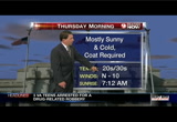
265
265
Dec 29, 2012
12/12
by
WRC
tv
eye 265
favorite 0
quote 1
warrenton, leesburg all getting snowfall right now. same thing around fairfax.6, you have some snow falling out there right now. it's rain down to the south. d.c., waldorf, leonardtown, areas through southern maryland. you have rain. there may be, over the next couple hours, a chance to see some sleet mixing in. same thing around d.c. a mixture of rain and snow. let me take you through the next couple of hours. noontime today, rain, higher temperatures taking over. this whole event blows out of here, moves east by 3:00 and 4:00. we clear out and turn cold. look at the temperatures by tomorrow morning. 29, leesburg. 28, gaithersburg. 30, manassas. strong winds. windchill temperatures tomorrow morning will be starting out in the teens and 20s. sunshine back tomorrow. it'll be a cold and windy day. then our next storm system will be bringing in increasing clouds to the area new year's eve. i know you're wondering what's going to happen by the stroke of midnight. right now, it's looking mainly dry throughout the area. there could be just maybe a few little spritzes
warrenton, leesburg all getting snowfall right now. same thing around fairfax.6, you have some snow falling out there right now. it's rain down to the south. d.c., waldorf, leonardtown, areas through southern maryland. you have rain. there may be, over the next couple hours, a chance to see some sleet mixing in. same thing around d.c. a mixture of rain and snow. let me take you through the next couple of hours. noontime today, rain, higher temperatures taking over. this whole event blows out of...
224
224
Dec 7, 2012
12/12
by
WUSA
tv
eye 224
favorite 0
quote 0
we're already getting that rain moving in in portions of warrenton, frederick and also toward hagerstown. the rest of us we're about to get some as well. it's creeping up toward the beltway. temperatures are on the cool side. 30s and 40s for this morning. that's going to be the case for the next couple of hours but things will improve as the rain tapers off in the afternoon. on satellite and radar, you can see where the moisture is coming from. our winds so far this morning are predominantly south. that's going to turn a little bit toward the southwest as we head toward the afternoon. but still the cloud cover sticks around as well as that moisture. overall, though, the day planner does start off with the overcast skies. those who have dry pavement now will see a little bit of wet pavement later. that's why we're going with a yellow alert for today. as we move out of the 40s, we should hit right around 49 degrees by the 1:00 hour. we'll squeak into the 50s but i think most of us are going to stay in the lower 50s. we could even see some mid- range 50s closer to the city center by that 4:
we're already getting that rain moving in in portions of warrenton, frederick and also toward hagerstown. the rest of us we're about to get some as well. it's creeping up toward the beltway. temperatures are on the cool side. 30s and 40s for this morning. that's going to be the case for the next couple of hours but things will improve as the rain tapers off in the afternoon. on satellite and radar, you can see where the moisture is coming from. our winds so far this morning are predominantly...
229
229
Dec 18, 2012
12/12
by
WRC
tv
eye 229
favorite 0
quote 0
around the metro region, 46 in gaithersbu gaithersburg. 50 in reston. 53 towards warrenton.afternoon. after we saw that front move lou, temperatures normally behind the cold front go down. in this case, they went right back up. high temperature today is 61 degrees. little earlier. we have a mixture of clouds coming across the region. but we will see those clouds give way to mostly clear skies tonight. we will just call it partly cloudy and mostly clear. move on through the might tonight. down to 40 in washington. 32 in frederick. 32 in winchester. little bit after breeze. that will help keep temperatures up a little bit. once again, the average low, about 22 in frederick and 32 in washington. you can see where way above that. tomorrow afternoon right whack into the 50s. once again, a very mild afternoon. partly sunny skies. all day long tomorrow really looking like a nice day. i think that will be the last really nice day we see because over the next couple of days, the big changes come on thursday. clouds move in. rain moves in late thursday. maybe even a few thunderstorms
around the metro region, 46 in gaithersbu gaithersburg. 50 in reston. 53 towards warrenton.afternoon. after we saw that front move lou, temperatures normally behind the cold front go down. in this case, they went right back up. high temperature today is 61 degrees. little earlier. we have a mixture of clouds coming across the region. but we will see those clouds give way to mostly clear skies tonight. we will just call it partly cloudy and mostly clear. move on through the might tonight. down...
306
306
Dec 31, 2012
12/12
by
WRC
tv
eye 306
favorite 0
quote 1
ar warrenton at 21. 30 in d.c. around capital heights.ry conditions right now, we're talking about the possibility of sprinkles that could be around the area around midnight. you can see the system making its way eastward into western kentucky and tennessee now. snow to the north. rain to the south of that system. as far as what we're going to see around here, i think just a sprinkle for today. then we've got a sprinkle or flurry chance for tomorrow. 9:00 a.m. today, it's cold. hit 33 degrees. by noon, more clouds. more high clouds will be moving in. the temperature 42. by 5:00, we'll be at 43 after maxing out the 46 degrees today. a sprinkle chance even around the stroke of midnight. alexis, let's see what's going on on the roads now. >> thank you, veronica. we have more information on this accident northbound 28. one person has been confirmed killed in this accident involving a tractor-trailer. that is northbound 28 at sully road there. three right lanes are blocked. you can get by to the left. here's a live look at the vdot cameras. tr
ar warrenton at 21. 30 in d.c. around capital heights.ry conditions right now, we're talking about the possibility of sprinkles that could be around the area around midnight. you can see the system making its way eastward into western kentucky and tennessee now. snow to the north. rain to the south of that system. as far as what we're going to see around here, i think just a sprinkle for today. then we've got a sprinkle or flurry chance for tomorrow. 9:00 a.m. today, it's cold. hit 33 degrees....
197
197
tv
eye 197
favorite 0
quote 0
we've got 50 degrees in warrenton. 53 right now in d.c., takoma park, into areas around winchester, and martinsburg already at 45 degrees. up to the north, 30s showing up, and here it is, not even 7:00. buffalo, new york, below freezing. chicago, illinois, at 36 degrees. and 34 in pittsburgh, pennsylvania. that's where it is right now. cold. and by later tonight, tomorrow morning, dropping into the 20s. here we'll drop to 34 inside the beltway. other locations, down into the 20s. still not looking at any big, big storms, or cold waves coming into our area. our jet stream right now to the north. we'll go from cool conditions, to cold conditions by tomorrow morning. and then as we get into friday, still a little on the cool side as well. so the next two days, cool, but not this upcoming weekend. we do have something else to deal with this weekend. chilly conditions it is for the evening. coats back on by tomorrow morning. probably all buttoned up, too. we've got high pressure that's going to move in. loads of sunshine. pennsylvania down through virginia tomorrow. so very much like decembe
we've got 50 degrees in warrenton. 53 right now in d.c., takoma park, into areas around winchester, and martinsburg already at 45 degrees. up to the north, 30s showing up, and here it is, not even 7:00. buffalo, new york, below freezing. chicago, illinois, at 36 degrees. and 34 in pittsburgh, pennsylvania. that's where it is right now. cold. and by later tonight, tomorrow morning, dropping into the 20s. here we'll drop to 34 inside the beltway. other locations, down into the 20s. still not...
298
298
Dec 31, 2012
12/12
by
WRC
tv
eye 298
favorite 0
quote 1
warrenton and culpeper, 32 degrees. currently over in green belt. around largo.ill readings, they're running from 5, 6, 7 degrees lower than the actual air temperature. right now, feeling like we're in the low 20s across the area. we will see light winds today and, again, more of this moving in. a big old batch of moisture with rain to the north and -- rain to the south and snow to the north. little bit of snow may skirt south of chicago, illinois today. approach areas of cincinnati with maybe rain and snow mix. for us, not much at all. only about a tenth of an inch of precipitation. mainly the form of sprinkles. can't rule out a flurry for the early part of the day tomorrow. watch it move in on future weather. today, partly sunny to mostly cloudy. here's the sprinkles and flurries. that's the white up north along the maryland/pennsylvania border. even at midnight, the sprinkles could come through. same deal for tomorrow as this weather system continues to push eastward. this morning, cold, 28 to 34. sunrise today at 7:27. your afternoon not too cold. 41 to 46 de
warrenton and culpeper, 32 degrees. currently over in green belt. around largo.ill readings, they're running from 5, 6, 7 degrees lower than the actual air temperature. right now, feeling like we're in the low 20s across the area. we will see light winds today and, again, more of this moving in. a big old batch of moisture with rain to the north and -- rain to the south and snow to the north. little bit of snow may skirt south of chicago, illinois today. approach areas of cincinnati with maybe...
232
232
Dec 18, 2012
12/12
by
WRC
tv
eye 232
favorite 0
quote 0
warrenton, fauquier county, breaks in the clouds. by the lunch-hour, in the low to mid 50s and partly sunny and a slight chance of a sprinkle over the noon hour. later this afternoon, climbing into the upper 50s. the winds will get gusty, too. we could have gusts up to 30 miles per hour. this evening, turning colder. a look at your seven-day outlook in ten minutes. danella with a look at traffic now. good morning. >> good morning. we'll start with the rails. if you're taking metro or vre, mo reported delays. over to the roadways, a situation along eastbound 100. this is at arundel mills boulevard. you'll be forced off to arundel mills boulevard. travel lanes are open at i-66. a live look at the rest area. as you make your way eastbound, nice and clear commute. westbound, virtually any cars on the road at all. as you travel 66 inside the beltway, a live look at glebe. no issues to report. i'm back in ten minutes. aaron and eun, back to you. >> thank you, danella. >> 5:12. 50 degrees. the change made overnight to help you get to work f
warrenton, fauquier county, breaks in the clouds. by the lunch-hour, in the low to mid 50s and partly sunny and a slight chance of a sprinkle over the noon hour. later this afternoon, climbing into the upper 50s. the winds will get gusty, too. we could have gusts up to 30 miles per hour. this evening, turning colder. a look at your seven-day outlook in ten minutes. danella with a look at traffic now. good morning. >> good morning. we'll start with the rails. if you're taking metro or vre,...
452
452
tv
eye 452
favorite 0
quote 0
manassas, warrenton, falls church, too, in the upper 30s right now. take a look at storm team 4 radar. we've got moisture coming in from the northwest and moisture coming up from the south, all helping to produce some moisture around here for tomorrow morning. so we're expecting a few light showers and sprinkles early at 5:00, 6:00, 7:00 a.m. but probably over with at around 11:00 a.m. and then for saturday, looks like we would have rain early saturday with that weather front just to the north of us. right now, it looks as though that front will stay up to the north. so saturday now looking dry. but with clouds around. and some morning fog. maybe even some late day sunshine. then we'll see showers return on sunday. here's a look at the forecast. increasing clouds, cool, 35 to 39 degrees for your evening. tomorrow morning, a few sprinkles. you'll just need the small umbrella for tomorrow morning to get by. not too bad at 30 to 36 degrees. over the maryland line, though, in the high spots of pennsylvania, they're talking about freezing rain. if you're d
manassas, warrenton, falls church, too, in the upper 30s right now. take a look at storm team 4 radar. we've got moisture coming in from the northwest and moisture coming up from the south, all helping to produce some moisture around here for tomorrow morning. so we're expecting a few light showers and sprinkles early at 5:00, 6:00, 7:00 a.m. but probably over with at around 11:00 a.m. and then for saturday, looks like we would have rain early saturday with that weather front just to the north...
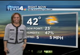
196
196
Dec 12, 2012
12/12
by
CSPAN
tv
eye 196
favorite 0
quote 0
host: helen in warrenton, virginia, independence.ler: i have a question about - i have not heard a lot of people talk about this, what is referred to as the marriage penalty. i'm having a hard time understanding how two people that live together each making $125,000 or $130,000 per year are any more well-to-do than two single people that live together each making the same. although the combined income of a married couple of more than $250,000 suddenly gets pushed up to a higher tax bracket. how much attention has been put on that and if there is any possibility that might be adjusted to today's times? guest: yes, it always comes up and it should be adjusted. there's a huge number of things, including the alternative minimum tax that will also take effect. all this will happen at the end of the session. i believe what will happen is a continuing resolution, because there simply isn't any time. we have been here more than a month and have yet to take up anything while the discussions go want ad nauseam. but you are right. and they shou
host: helen in warrenton, virginia, independence.ler: i have a question about - i have not heard a lot of people talk about this, what is referred to as the marriage penalty. i'm having a hard time understanding how two people that live together each making $125,000 or $130,000 per year are any more well-to-do than two single people that live together each making the same. although the combined income of a married couple of more than $250,000 suddenly gets pushed up to a higher tax bracket. how...
 Live Music Archive
 Librivox Free Audio
 Metropolitan Museum
 Cleveland Museum of Art
 Internet Arcade
 Console Living Room
 Open Library
 American Libraries
 TV News
 Understanding 9/11