218
218
Feb 24, 2012
02/12
by
WRC
tv
eye 218
favorite 0
quote 0
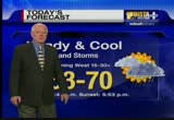
we have some showers and, yes, thunder and lightning in west virginia. that area of orange and yellow. that is some thunder and lightning now coming through western and north central west virginia. now it's advancing to the east. the leading edge of rain coming into the shenandoah valley, panhandle of west virginia, into washington county. moving to the east. so over the next couple of hours, we may get showers coming toward the metro area and quite likely we will. maybe even with thunder and lightning. ahead of that, temperatures now are in the 40s to near 50 degrees. mid 40s in montgomery, arlington, fairfax, prince george's counties. and it's in the low to mid 50s in southern maryland, eastern shore. low 40s farther to our west. later today, strong winds developing later this afternoon. we are going to have wind gusts to 60 miles per hour in that area in pink. and farther to the east, we could have gusts to 50 miles per hour. that will be late this afternoon and this evening. here's the day planner, sunrise will be at 6:48. we'll have -- after the mor
we have some showers and, yes, thunder and lightning in west virginia. that area of orange and yellow. that is some thunder and lightning now coming through western and north central west virginia. now it's advancing to the east. the leading edge of rain coming into the shenandoah valley, panhandle of west virginia, into washington county. moving to the east. so over the next couple of hours, we may get showers coming toward the metro area and quite likely we will. maybe even with thunder and...
324
324
tv
eye 324
favorite 0
quote 0
most of the region down in the mid and low 20s throughout west virginia, virginia and maryland. montgomery, fairfax, arlington, prince george's counties now in the mid-20s. near freezing in washington and by the bay. view from space showing a clear sky. plenty of sunshine today, high pressure over the region, and here's your "day planner." sunrise at 7:10. we'll stay below freezing until 8:00 and mid-to-upper 30s by 9:00 soaring to 50 by noon time. low and mid-50s in the afternoon with lots of sunshine. sunset at 5:35. we'll have a partly cloudy evening, temperatures will be chilly in the 40s. by midnight down to the low 40s. a look at tuesday, wednesday, the rest of the week and weekend in ten minutes. how is traffic? >> still looking good. off to a good start over the work week. traveling along i-95 nothing but green lanes are open heading out of woodbridge connecting to the beltway. light volume traveling northbound and southbound. northbound speeds pretty good. 60 miles per hour. make your way from the occoquan to the beltway, 11 minutes. continuing on to 395 no issues. betw
most of the region down in the mid and low 20s throughout west virginia, virginia and maryland. montgomery, fairfax, arlington, prince george's counties now in the mid-20s. near freezing in washington and by the bay. view from space showing a clear sky. plenty of sunshine today, high pressure over the region, and here's your "day planner." sunrise at 7:10. we'll stay below freezing until 8:00 and mid-to-upper 30s by 9:00 soaring to 50 by noon time. low and mid-50s in the afternoon...
420
420
tv
eye 420
favorite 0
quote 0
, especially some of the higher spots along the blue ridge, massanutten mountain, panhandle of west virginia braddock mountain and points west and north. closer to washington, generally maybe an inch or two in fairfax county to loudoun county and montgomery and northern prince george's county and northwest washington. mainly, again on, grassy areas. and south and east, maybe a little dusting. much farther south and east, looks like mostly rain. tomorrow and friday, the sun returns. highs in the 40s. a cold weekend to follow. could get flurries on saturday morning. danella? >>> we have an update on the breaking news we've think about following in the district. new york avenue has reopened at florida avenue. you are able to travel in both directions. also traveling in annandale, virginia, still have braddock road closed from ravensworth to backlick due to downed wires. use caution in the area. and chopper 4 is live over the dulles toll road, if you're heading eastbound just inside the beltway. have a four-car crash taking up the left side of the road. are you passing single file to the right.
, especially some of the higher spots along the blue ridge, massanutten mountain, panhandle of west virginia braddock mountain and points west and north. closer to washington, generally maybe an inch or two in fairfax county to loudoun county and montgomery and northern prince george's county and northwest washington. mainly, again on, grassy areas. and south and east, maybe a little dusting. much farther south and east, looks like mostly rain. tomorrow and friday, the sun returns. highs in the...
223
223
Feb 29, 2012
02/12
by
KNTV
tv
eye 223
favorite 0
quote 0
i beg to differ. >> you lived in west virginia. tell the poor people watching in west virginia.ow -- i don't know if we get big ratings. i hope we do because i love west virginia! >> okay. i grew up on dogwood avenue in morgantown, west virginia. >> what sounds more picturesque than that? honestly. >> tread lightly. >> i'm not kidding. that sounds beautiful. >> it was a beautiful place. when we moved we cried because we loved west virginia so much. >> you were in sixth grade, right? >> wild, wonderful west virginia stickers all over the place. i take issue with that west virginia. >> so your happiest years were there. >> they were. >> see? we don't agree with any of these so-called -- >> okay. all right. you see, if i was happy looking like that, then you know i was a happy kid. okay? >> that's called bliss. that's blissful. >> on the ball in the control room today. >> dangerous. he got a good night's sleep. you know we complain about everything. i have a broken nail. i can't, i have a pimple. i can't. my alarm clock didn't go o. >> so many people in the world have real problems
i beg to differ. >> you lived in west virginia. tell the poor people watching in west virginia.ow -- i don't know if we get big ratings. i hope we do because i love west virginia! >> okay. i grew up on dogwood avenue in morgantown, west virginia. >> what sounds more picturesque than that? honestly. >> tread lightly. >> i'm not kidding. that sounds beautiful. >> it was a beautiful place. when we moved we cried because we loved west virginia so much. >>...
265
265
tv
eye 265
favorite 0
quote 0
opportunities for accumulations are confined really to northern maryland out to the panhandle west virginian that, it's only going to be an inch at most probably. light rain and snow, maybe an additional inch or so, that's it. most chances of accumulation well north and west of the d.c. metro. low in the low 30s. tomorrow chilly, rain and snow ending long before noontime. little clearing late, not a lot of sunshine and as a result staying chilly with a high of only 43, sunshine back for monday and tuesday, highs near 50. and another chance for rain, maybe some more conversational snowflakes late wednesday night into the predawn hours of thursday. but even that doesn't look like another inch. >> thank you, chuck. >>> coming up in sports, the nfl hands out some hardware. >>> plus, it's a >>> everybody's getting ready. >> everybody but one man. on super bowl eve, the patriots played the role of grinch releasing underwood and signing a rookie defensive end. the move increases the chances that receiver chad ochocinco will be active for the game. it's not all bad news for underwood. he would like
opportunities for accumulations are confined really to northern maryland out to the panhandle west virginian that, it's only going to be an inch at most probably. light rain and snow, maybe an additional inch or so, that's it. most chances of accumulation well north and west of the d.c. metro. low in the low 30s. tomorrow chilly, rain and snow ending long before noontime. little clearing late, not a lot of sunshine and as a result staying chilly with a high of only 43, sunshine back for monday...
217
217
Feb 29, 2012
02/12
by
WJLA
tv
eye 217
favorite 0
quote 0
if ohio and west virginia we do have some rain.l be moving into the metro area by 8:00 a.m. and earlier farther west of town. 41 right now in chevy chase, 37 in la plata. remington, 40, in virginia. 50 this afternoon with three- quarters of an inch of rain overall. moderate to heavy showers in some areas and they could have over an inch in spots. a lot of sunshine tomorrow, warmer, breezy. west winds down sloping off the mountains will warm up the atmosphere into the mid 60's. looking like a beautiful thursday overall. that's the forecast. now to lisa. >> looks pretty good this morning. interstate travel, beltway complicated for metro rail, marc rail drv, normal service. green light, travel times in our favor between richmond and baltimore. jummy olabanji in a moment in bladensburg erred, maryland with a sinkhole that developed on 450 westbound at alternate route 1. an alternate would be route 1 /road island ave. and decatur streets. but it's complicated. plan your drive accordingly. back inside for more details. >> let's go to bla
if ohio and west virginia we do have some rain.l be moving into the metro area by 8:00 a.m. and earlier farther west of town. 41 right now in chevy chase, 37 in la plata. remington, 40, in virginia. 50 this afternoon with three- quarters of an inch of rain overall. moderate to heavy showers in some areas and they could have over an inch in spots. a lot of sunshine tomorrow, warmer, breezy. west winds down sloping off the mountains will warm up the atmosphere into the mid 60's. looking like a...
341
341
tv
eye 341
favorite 0
quote 0
radar showing light snow coming into northern shenandoah valley, panhandle of west virginia into westernd. flurries there, really much of it not quite reaching the ground. there are a few occasions where it is. farther to the west and north is where in southern ohio and far western west virginia it is beginning to reach the ground. starting to accumulate there. closer to washington, we have the clouds thickening up and temperatures are down to near the freezing mark throughout the entire region from the mountains all the way to the bay and the eastern shore. except near the waters and along the tidal potomac, fairfax, montgomery, arlington, prince george's counties near the freezing mark. and later this morning, upper 30s to near 40 degrees. maybe a few flurries this morning. some accumulating snow in the afternoon. north and west of the i-95 corridor, areas will see accumulation on grassy areas. south and east, mostly rain south and east of the i-95 corridor. all the precipitation tapering off and ending by later this evening. i'll show you my snow forecast map. we'll look at the seven-
radar showing light snow coming into northern shenandoah valley, panhandle of west virginia into westernd. flurries there, really much of it not quite reaching the ground. there are a few occasions where it is. farther to the west and north is where in southern ohio and far western west virginia it is beginning to reach the ground. starting to accumulate there. closer to washington, we have the clouds thickening up and temperatures are down to near the freezing mark throughout the entire region...
318
318
tv
eye 318
favorite 0
quote 0
up towards the pennsylvania border and into western maryland and west virginia. andoah valley but near freezing farther to the west and near 40 in washington, low 40s in southern maryland now. lot of the snow will be melting on grassy areas as it comes down. certainly melting on roadways. road temperatures are way above freezing. so i don't think we are going to have any problems on the roads with this. these accumulations amounts here are going to mostly be on grassy areas. maybe just an inch or would around the metro area. by the time it all ends by mid evening this evening. and then tomorrow and friday we get the sun back with highs in the 40s and cold weekend after that. highs only in the 30s saturday and sunday. dry and chilly first part of the week. frequent updates throughout the afternoon. stay tune. >> thank you. >> this is an outtake from season two of "the voice." it is one of the hottest videos on youtube. alicia shot the video of her duet with one of her donkeys. she posted it online for her friends and family. let's just say they weren't the only one
up towards the pennsylvania border and into western maryland and west virginia. andoah valley but near freezing farther to the west and near 40 in washington, low 40s in southern maryland now. lot of the snow will be melting on grassy areas as it comes down. certainly melting on roadways. road temperatures are way above freezing. so i don't think we are going to have any problems on the roads with this. these accumulations amounts here are going to mostly be on grassy areas. maybe just an inch...
236
236
Feb 11, 2012
02/12
by
WRC
tv
eye 236
favorite 0
quote 0
virginia. snow to the north and west. rain down to the south and east and as we move to the next couple days you'll notice a cold day on sunday. 34 with winds of 30 miles an hours. that will put wind chill between 18 and 20 did the and then about 50 degrees the day after valentine's day. ♪ [ male announcer ] no success is overnight. ♪ it's about working harder. ♪ and smarter. ♪ it's the culmination of a million decisions. it's where you see yourself going and how you choose to get there. the all-new 2013 gs. our boldest response ever. there's no going back. ♪ in more ways than ever. and our networks are getting crowded. but if congress frees up more wireless spectrum, we can empower more people to innovate, create jobs, and put momentum behind our economy. and a spectrum auction could raise as much as 30 billion dollars to help fund the payroll tax cut. it's simple. more spectrum means more freedom. for everyone. >>> it is really cool, when a local kid lands at a local school. >> it is. i'm going to let him have all the g
virginia. snow to the north and west. rain down to the south and east and as we move to the next couple days you'll notice a cold day on sunday. 34 with winds of 30 miles an hours. that will put wind chill between 18 and 20 did the and then about 50 degrees the day after valentine's day. ♪ [ male announcer ] no success is overnight. ♪ it's about working harder. ♪ and smarter. ♪ it's the culmination of a million decisions. it's where you see yourself going and how you choose to get...
332
332
Feb 21, 2012
02/12
by
WRC
tv
eye 332
favorite 0
quote 0
in the low 20s across the rest of much of maryland, virginia, and west virginia. the view from space showing a clear sky, but there are clouds closing in from the west. we'll have sunshine this morning. here's your day planner. sunrise at 6:52. and by mid morning, into the upper 30s. then by noontime, mid 40s and cloudy. a blustery wind, too. and we'll be reaching up around the upper 40s to near 50. the evening planner, sunset at 5:52. a cloudy and chilly evening. mid 40s just after sunset. then near 40 by midnight. we'll take a look at a warmup on the way for the rest of the week. we'll look at that and the weekend in ten minutes. danella has traffic. good morning. >>> good morning, traveling the beltway on the outer loop in virginia, have a disabled vehicle but just on the left shoulder lane at telegraph look. we'll look at van dorn, no issues there. if you continue to make your way from van dorn crossing the wilson bridge, nice and smooth trip. 59 miles per hour. only taking seven minutes to get over the wilson bridge. now if you continue on the beltway in prin
in the low 20s across the rest of much of maryland, virginia, and west virginia. the view from space showing a clear sky, but there are clouds closing in from the west. we'll have sunshine this morning. here's your day planner. sunrise at 6:52. and by mid morning, into the upper 30s. then by noontime, mid 40s and cloudy. a blustery wind, too. and we'll be reaching up around the upper 40s to near 50. the evening planner, sunset at 5:52. a cloudy and chilly evening. mid 40s just after sunset....
537
537
tv
eye 537
favorite 0
quote 0
it is frosty cold throughout west virginia, virginia and maryland. the eastern shore.ight now mid-20s in fairfax, montgomery, prince george's counties. near 30 in washington. and elsewhere we have it down in the 20s and we have some fog in the northern shenandoah valley. clear sky today. plenty of sunshine. a highs climbing in the throw mid-50s. quite a warm up from this cold start. overnight tonight sunset 5:35. partly cloudy. near 40 by midnight. >>> we have breaking news if you're traveling on the beltway. the inner loop of the beltway in college park as you make your way to route 1, accident blocking the left side of the roadway. chopper 4 is here now. two of the left lanes is blocked as well as your left shoulder lane. please be aware of that. police and fire department they are all on the scene right now and you are slow on the inner loop of the beltway as you make your way towards this accident. again, this is the inner loop us a make your way to route 1 and i am starting to see some delays, very slow as you approach and make your way past the accident. back to
it is frosty cold throughout west virginia, virginia and maryland. the eastern shore.ight now mid-20s in fairfax, montgomery, prince george's counties. near 30 in washington. and elsewhere we have it down in the 20s and we have some fog in the northern shenandoah valley. clear sky today. plenty of sunshine. a highs climbing in the throw mid-50s. quite a warm up from this cold start. overnight tonight sunset 5:35. partly cloudy. near 40 by midnight. >>> we have breaking news if you're...
620
620
Feb 27, 2012
02/12
by
WRC
tv
eye 620
favorite 0
quote 0
elsewhere, most of west virginia, virginia and maryland, 20s to near 30 degrees. high pressure over us giving thus clear sky now. drifting off the atlantic seaboard later today. shifting our winds into the southwest. and that will warm us quickly. by noontime, ought to be near 60 degrees. might hit the mid 60s by mid-afternoon. a spectacular february day. then clouds coming in by late afternoon and early this evening, public into the 50s by then. clear -- back into the 50s by then. clearing by midnight, then mid 40s. a look at changes on the way. maybe rain, too, later this week. details on that with your seven-day outlook in ten minutes. danella, how's traffic? >>> good morning. taking the outer loop of the beltway, river road. inner loop from seven locks to the american legion bridge, picking up. on i-95 in virginia, hitting the brakes at fairfax county parkway, northbound first set of delays around route 1. stop and go past fairfax county parkway to backlike road. your average -- backlick road. your average speed, 42 miles per hour from occoquan to the beltway.
elsewhere, most of west virginia, virginia and maryland, 20s to near 30 degrees. high pressure over us giving thus clear sky now. drifting off the atlantic seaboard later today. shifting our winds into the southwest. and that will warm us quickly. by noontime, ought to be near 60 degrees. might hit the mid 60s by mid-afternoon. a spectacular february day. then clouds coming in by late afternoon and early this evening, public into the 50s by then. clear -- back into the 50s by then. clearing by...
270
270
Feb 17, 2012
02/12
by
WRC
tv
eye 270
favorite 0
quote 0
in the mid 40s elsewhere across much of west virginia, virginia and maryland. and the densest fog, here's the latest visibilities. down to 1/3 of a mile at reagan national and throughout much of southern maryland, down to a half to 1/3 of a mile. culpeper, visibility, zero. some really thick fog there. west and north, it's really not as bad. the visibilities are around five to ten miles per hour. we still have quite a bit of cloudiness around. there may be a few lingering sprinkles around the panhandle of west virginia. there's the live view from the city camera. reagan national airport is lost there in the fog. you can barely make out the lights of the airport now. by 9:00, a lot of the fog will be dissipating. we still may have poppy fog around. sun -- patchy fog around. sunrise at 6:57. mostly sunny through the rest of the afternoon with mild temperatures for february, mid 50s by mid-afternoon. we'll have the friday evening planner in ten minutes. that's the way it looks right now. eun? >> thank you very much. >>> preparation in prince george's county. two c
in the mid 40s elsewhere across much of west virginia, virginia and maryland. and the densest fog, here's the latest visibilities. down to 1/3 of a mile at reagan national and throughout much of southern maryland, down to a half to 1/3 of a mile. culpeper, visibility, zero. some really thick fog there. west and north, it's really not as bad. the visibilities are around five to ten miles per hour. we still have quite a bit of cloudiness around. there may be a few lingering sprinkles around the...
233
233
Feb 23, 2012
02/12
by
WJLA
tv
eye 233
favorite 0
quote 0
a few areas of light rain in west virginia.s into the shenandoah valley early this morning. otherwise, a few sprinkles here and there this morning northwest of town and this afternoon. a few sprinkles tonight. first half of the day tomorrow, isolated showers. temperatures will be the big headline. we could get a little sunshine as well. 48 in the district right now 45 in frederick. temperatures will climb well into the 60s today. warmer than yesterday. upper 60's locally, low 70's south of the metro. partly cloudy and a little breezy. mostly cloudy tonight, a few isolated showers. mild, near 60 through the nighttime. in the 60's for the first half of the day tomorrow. >> the commute looks pretty good. making plans, you can go to the gym and take your time. nothing major to report if that could change. -- and that could change. metro rail and drv reporting normal service. in good shape on 75there's a tractor-trailer stuck on the guard rail in frederick maryland on 75 south of interstate 70. and a tractor-trailer turned over on 9
a few areas of light rain in west virginia.s into the shenandoah valley early this morning. otherwise, a few sprinkles here and there this morning northwest of town and this afternoon. a few sprinkles tonight. first half of the day tomorrow, isolated showers. temperatures will be the big headline. we could get a little sunshine as well. 48 in the district right now 45 in frederick. temperatures will climb well into the 60s today. warmer than yesterday. upper 60's locally, low 70's south of the...
446
446
Feb 23, 2012
02/12
by
WRC
tv
eye 446
favorite 0
quote 1
down through central west virginia.is drying out so we may get a few clouds mid-morning but a small chance of a small shower. by noontime hiding 70 by mid afternoon. a look at your evening planner, that will be in ten minutes. danella has a look at traffic. good morning. >> if you're traveling northbound at 440, still seeing an accident there. if you're traveling on i-66, getting a bit busy, not seeing any accidents for you. that's good, but your volume is increasing. now is the time to head out of the house. traveling eastbound to the beltway, that trip right now only taking you 11 minutes. if you're crossing over the 14 street bridge getting some volume. again, heading out of the house, hitting the roadways, you're at 59 miles an hour. northbound, that trip's only taking 12 minutes at this time. back over to you. >> danella, thank you. we're less than a way from the primaries in michigan. rick santorum and mitt romney are getting more and more vicious. they squared off last night in the last republican debate before n
down through central west virginia.is drying out so we may get a few clouds mid-morning but a small chance of a small shower. by noontime hiding 70 by mid afternoon. a look at your evening planner, that will be in ten minutes. danella has a look at traffic. good morning. >> if you're traveling northbound at 440, still seeing an accident there. if you're traveling on i-66, getting a bit busy, not seeing any accidents for you. that's good, but your volume is increasing. now is the time to...
163
163
Feb 24, 2012
02/12
by
WBAL
tv
eye 163
favorite 0
quote 0
there's even a tornado watch in effect for south west virginia and parts of west virginia into the westernolinas. here is the cold front to the west of us. everything goes through by 8:00 this evening and the last of the raid should be leaving the eastern shore and we drive out. saturday afternoon, we may see a few clouds popup that maybe even a snow flurries because it will be quite a bit colder over the weekend. we expect to warm up a little bit today. a lot of the area will be in the 60's and maybe thunderstorms or a snow flurries tomorrow and 43 degrees. 47 degrees on sunday -- on sunday with sunny skies and in the 40's all next week with rain chances monday and wednesday. ♪ >> a new study says the bird flu may be less deadly than originally thought for the virus which travels from a paltry two people killed more than half of those infected. researchers at mount sinai school of medicine say those figures only include the most severe cases. new numbers show just 1.2% of those with mild cases of bird flew died between 1997-2009. health experts are recommending all adults be vaccinated ag
there's even a tornado watch in effect for south west virginia and parts of west virginia into the westernolinas. here is the cold front to the west of us. everything goes through by 8:00 this evening and the last of the raid should be leaving the eastern shore and we drive out. saturday afternoon, we may see a few clouds popup that maybe even a snow flurries because it will be quite a bit colder over the weekend. we expect to warm up a little bit today. a lot of the area will be in the 60's...
157
157
Feb 24, 2012
02/12
by
WUSA
tv
eye 157
favorite 0
quote 0
showers pushing across areas in howard, carroll, frederick counties out into the mountains of west virginiaow and all moving off to the east northeast and just want to show you temps big rains here. we have some low 40s just north and west of town. 52 at reagan national and some 60s already down to the tappahannock airport and richmond and again a very warm windy day ahead with highs above the 70-degree mark. i'll be back in a few minutes with look at the weekend for you. right now to monika samtani inside with timesaver traffic. >>> one trouble spot right now it's not close into d.c.. it's coming out of baltimore but it's worth telling you about on the southbound side of 95 at 195. with two lanes block. i know sky 9 is just about to arrive there at the scene. in the meantime just keep that in mind for your travel plans, outside live right now first of all on the beltway north of town again closer in the normal slow stuff here heading the georgia avenue but all lanes are open. 270 and i-70 out of frederick on the north side of town, no problems to report. you can see all this yellow? that's
showers pushing across areas in howard, carroll, frederick counties out into the mountains of west virginiaow and all moving off to the east northeast and just want to show you temps big rains here. we have some low 40s just north and west of town. 52 at reagan national and some 60s already down to the tappahannock airport and richmond and again a very warm windy day ahead with highs above the 70-degree mark. i'll be back in a few minutes with look at the weekend for you. right now to monika...
283
283
Feb 29, 2012
02/12
by
WRC
tv
eye 283
favorite 0
quote 0
a few sprinkles panhandle of west virginia, northern shenandoah valley, winchester toward charlestown and martinsburg, near hagerstown. that area of rain passing far west and north of washington now. but some steadier rain now just coming in to west virginia. that will likely be arriving by late morning. and during the afternoon. there may be a bit of a break from the rain for a time by mid to late afternoon for a brief time. certainly does look like a wet day. temperatures climbing to near 60 by late afternoon. could get thunder and lightning tonight. we'll talk about that with the evening planner. that will be in ten minutes. eun? >> thank you. >>> breaking news in prince george's county. right now a water main break has caused a major sinkhole in bladensburg. right now, no drivers can get by route 450 which is closed at route 1. tracee wilkins is live on the scene with the latest. good morning. >> reporter: good morning. yeah, and it is amazing that it is an actual sinkhole, that you can see that the asphalt is beginning to sink because of this water main break overnight. so here's
a few sprinkles panhandle of west virginia, northern shenandoah valley, winchester toward charlestown and martinsburg, near hagerstown. that area of rain passing far west and north of washington now. but some steadier rain now just coming in to west virginia. that will likely be arriving by late morning. and during the afternoon. there may be a bit of a break from the rain for a time by mid to late afternoon for a brief time. certainly does look like a wet day. temperatures climbing to near 60...
344
344
Feb 24, 2012
02/12
by
WRC
tv
eye 344
favorite 0
quote 0
farther west and north, washington county, panhandle of west virginia, getting more line rain as wellne arundel county. temperatures around the region are generally near 40 west and north, frederick to leesburg to winchester and farther south. in the mid 40s. near washington, forecast, montgomery -- fairfax, montgomery, arlington, upper 40s to mid 40s farther west in western fairfax, northern montgomery, near 50 in washington. prince george's county and southern maryland, all these counties in pink under a high wind warning for later today and into tonight. gusts to 60 miles per hour there. and all the counties in the beige color including washington and the nearby suburbs could have gusts to near 40 to 50 miles per hour later this afternoon. here's your day planner. we'll have a rapid warmup with a little sunshine breaking out by mid to late morning and around noontime. temperatures near 70 degrees. may actually climb into the low to mid 70s early to mid-afternoon. then a strong cold front comes in. that triggering some showers and maybe some thunder, too. that would be between 3:00
farther west and north, washington county, panhandle of west virginia, getting more line rain as wellne arundel county. temperatures around the region are generally near 40 west and north, frederick to leesburg to winchester and farther south. in the mid 40s. near washington, forecast, montgomery -- fairfax, montgomery, arlington, upper 40s to mid 40s farther west in western fairfax, northern montgomery, near 50 in washington. prince george's county and southern maryland, all these counties in...
391
391
Feb 22, 2012
02/12
by
WRC
tv
eye 391
favorite 0
quote 0
west virginia, a few of the high spots near 50 degrees. some mild air is beginning to move in on a southwesterly flow. that will be with us today. this is the latest satellite image, and it's showing a clear sky over us now. we have clouds ahead of a weak disturbance here in the midwest. that will be approaching us tonight. a look, here's the day planner. sunrise, 6:51. that's getting earlier and earlier. we will spring ahead on march 11. 9:00, we'll be in the mid 40s with sunshine. by noon, mid 50s, and some clouds around, breezy this afternoon. temperatures soaring to near 60. this evening, clouds come in, near 50 by midnight. by then, we may have light rain coming through and light rain until dawn on thursday. as we look at the next several days, here's your four-day forecast. thursday we will be climbing to near 70 degrees. tomorrow afternoon, a blustery southwesterly wind, partly cloudy. then on friday, mostly cloudy, maybe a little sun in and out. we'll have gusty winds out of the southwest in the morning. we'll climb into the 60s, m
west virginia, a few of the high spots near 50 degrees. some mild air is beginning to move in on a southwesterly flow. that will be with us today. this is the latest satellite image, and it's showing a clear sky over us now. we have clouds ahead of a weak disturbance here in the midwest. that will be approaching us tonight. a look, here's the day planner. sunrise, 6:51. that's getting earlier and earlier. we will spring ahead on march 11. 9:00, we'll be in the mid 40s with sunshine. by noon,...
241
241
Feb 11, 2012
02/12
by
WUSA
tv
eye 241
favorite 0
quote 0
west virginia turns it over. louisville escapes, 77-74. >>> high drama at west point of navy-army, straight too overtime. brendan is older than 16, he's got his license and he can drive to the bucket! three point lead. when they get their first win? no, max spins and scores. and then in double overtime, lennox again. the kid from fairfax army wins, 69-63. the navy women beat army 57-50. >>> all right. some women's hoops. georgetown coach terry williams has instilled a take no prisoners attitude in the team. it's one of reasons they've risen up the rankings. they also don't fear uconn. they played them tough last year. today it started well, ruby lee wright ain't no vegan. she eats meat! preferably husky. from downtown. then they fell apart, turned it over 20 times. uconn rolling in the second half, 80-36. >>> georgetown men have a tough assignment tomorrow. they've got to get over this shot right here, and this loss to syracuse, getting ready to face st. johns tomorrow. the loss ex cruciating on a lot 6 levels, a
west virginia turns it over. louisville escapes, 77-74. >>> high drama at west point of navy-army, straight too overtime. brendan is older than 16, he's got his license and he can drive to the bucket! three point lead. when they get their first win? no, max spins and scores. and then in double overtime, lennox again. the kid from fairfax army wins, 69-63. the navy women beat army 57-50. >>> all right. some women's hoops. georgetown coach terry williams has instilled a take no...
345
345
Feb 23, 2012
02/12
by
WRC
tv
eye 345
favorite 0
quote 0
there's still rain showers in west virginia. those may make their way in the shenandoah valley in another hour or so, but that may be a passing shower mid morning otherwise. still in the 50s through mid morning and then in the 60s to near 70 degrees during the afternoon. sunrise, 6:50. sunrise, 5:54. the evening planner in ten minutes. danella has a look at our traffic this morning. good morning. >> good morning. so far, so good. if you're taking the beltway, not seeing any issues for you so far. a live look at connecticut avenue traveling the inner loop and outer loop, no accidents at this time. 58 miles per hour on the outer loop, only taking ten minutes to get from i-95 to i-270. taking the beltway from virginia, same story. a look at van dorn. great speed. making your way, you're at 60 miles an hour. this trip taking you only six minutes. now back to you. >>> breaking news right now. at least 35 people are dead from seshlg bombings and shootings in iraq. the worst attack was a car bomb killing nine people andi injurig 26 mor
there's still rain showers in west virginia. those may make their way in the shenandoah valley in another hour or so, but that may be a passing shower mid morning otherwise. still in the 50s through mid morning and then in the 60s to near 70 degrees during the afternoon. sunrise, 6:50. sunrise, 5:54. the evening planner in ten minutes. danella has a look at our traffic this morning. good morning. >> good morning. so far, so good. if you're taking the beltway, not seeing any issues for you...
181
181
Feb 23, 2012
02/12
by
WUSA
tv
eye 181
favorite 0
quote 0
southern west virginia. look into western maryland, a couple of echoes are showing up. not positive all of this is reaching the ground but we're detecting this very light stuff trying to get into frederick county, virginia north of winchester. out 50 toward capon bridge. our temps are coldest in prince william market with hey -- prince william county with haymarket at 40 degrees. sterling 46. to the east college park and upper marlboro at 50 right now along with bwi. rockville is 47. alexandria 47. and looking outside now, pretty nice morning out there. partly cloudy skies. good visibility. 48 degrees with a south, southwesterly wind at 8 miles an hour. slight windchills feeling like it's in the low to mid-30s. comfortable for this time of year. it's all going to change. we have cold air coming into the country sinking south. notice how the greens turn to blues. more heavy snow across parts of the rockies. for us the cold air is going to be arriving tomorrow afternoon. for us that also means we'll have the c
southern west virginia. look into western maryland, a couple of echoes are showing up. not positive all of this is reaching the ground but we're detecting this very light stuff trying to get into frederick county, virginia north of winchester. out 50 toward capon bridge. our temps are coldest in prince william market with hey -- prince william county with haymarket at 40 degrees. sterling 46. to the east college park and upper marlboro at 50 right now along with bwi. rockville is 47. alexandria...
522
522
tv
eye 522
favorite 0
quote 0
elsewhere temperatures are down in the 20s from west virginia all across virginia, maryland to the bay. in montgomery county now the mid-20s. mid-20s in prince george's county. fairfax county, low and mid-20s there. near 30 in arlington and the district. right marnear the bay yaurs a b warmer. if there's no wind on the waters low to mid-20s on the eastern shore northern neck and southern maryland. much of northern shenandoah valley getting a little bit of fog right now so watch out for that. elsewhere we got a year sky. we'll have plenty of sunshine today. here's your "day planner." sunrise at 7:10. we'll be in the mid-30s or so by 9:00 and by noon time, quickly climb to 50 with a southwesterly breeze hitting the low and mid-50s during the afternoon. mostly sunny. on tonight few clouds coming in. otherwise partly cloudy. temperatures down to near 40. nearly full moon rising just after sunset and then by dawn tomorrow we'll have that nearly full moon setting in the western sky, we'll be down near freezing starting off tuesday morning. during the day tomorrow another day up in the low to
elsewhere temperatures are down in the 20s from west virginia all across virginia, maryland to the bay. in montgomery county now the mid-20s. mid-20s in prince george's county. fairfax county, low and mid-20s there. near 30 in arlington and the district. right marnear the bay yaurs a b warmer. if there's no wind on the waters low to mid-20s on the eastern shore northern neck and southern maryland. much of northern shenandoah valley getting a little bit of fog right now so watch out for that....
169
169
Feb 16, 2012
02/12
by
WUSA
tv
eye 169
favorite 0
quote 0
as we look at future cast, here comes that rain. 9:00 into west virginia. maybe the shenandoah valley. still hanging out mainly west of us at 11:00. as we head through mid afternoon rain everywhere. then late this afternoon this starts to pull away to this evening and leaves us in pretty good shape tomorrow and saturday before, a storm system could bring us rain and some snow. the showers more so this afternoon. tonight we're in the 30s to near 40. 54, breezy tomorrow. saturday increasing clouds, 52. sunday rain and snow. better chance of all snow north and west. a mix here in the metro. mostly rain south and east and by president's day partly sunny, back to the 40s. it's 5:17. monika samtani is along with an update on time saver traffic. >>> it's been a busy morning. quite a lot of activity going on if you're planning to head into odenton this morning on the southbound side of route 3 at rydell road. it was a tractor-trailer and a van involved in a fatal crash at about 2:00 this morning and the investigation continues there southbound route 3 is closed at r
as we look at future cast, here comes that rain. 9:00 into west virginia. maybe the shenandoah valley. still hanging out mainly west of us at 11:00. as we head through mid afternoon rain everywhere. then late this afternoon this starts to pull away to this evening and leaves us in pretty good shape tomorrow and saturday before, a storm system could bring us rain and some snow. the showers more so this afternoon. tonight we're in the 30s to near 40. 54, breezy tomorrow. saturday increasing...
150
150
Feb 5, 2012
02/12
by
WTTG
tv
eye 150
favorite 0
quote 0
over 2 inches, la vail, stevensville a half inch and one inch west virginia and barryville an itch -- berryville an inch and a half. >> there is still a few flakes coming from the west it will continue to push its way across the area see the swath of moisture, we are primarily concerned with what is happening to the north of us because from areas of western pennsylvania, that patch is starting to push its way to the southeast. so, we are really keeping an eye on that. periods of snow will start to taper off 9 to 10 this morning, through the east and west virginia panhandle a little steadier, areas north in maryland sox they could see at least another quarter inch or so. yesterday's highs 40s. pretty much everywhere, close to seasonal temperatures into the 30s there are some slick spots out there on the roads do be careful there could be a little ice here and there. a few morning passing rain snow showers then this afternoon we get back to sunshine, fairly nice, 45 degrees it is not all bad and we are talking very light northerly wind out there as well. and so things are going to impro
over 2 inches, la vail, stevensville a half inch and one inch west virginia and barryville an itch -- berryville an inch and a half. >> there is still a few flakes coming from the west it will continue to push its way across the area see the swath of moisture, we are primarily concerned with what is happening to the north of us because from areas of western pennsylvania, that patch is starting to push its way to the southeast. so, we are really keeping an eye on that. periods of snow will...
346
346
Feb 10, 2012
02/12
by
WRC
tv
eye 346
favorite 0
quote 0
and extreme northern west virginia could get two inches or more. ther to the south and west of there is where looks like some of the heavier snow will fall. and all of this ending by tomorrow afternoon. getting much colder saturday night. teens sunday morning. sunday partly cloudy and windy and cold. highs only in the low to mid 30s. then warm up next week as we get into mid week to back to near 50 during the afternoons. that's the way it looks now, barbara. >> thank you, tom. >>> got a problem with the way people parallel park in the district? you may be able to blame the dmv. according to the washington examiner the department of motor vehicles admits it has been letting prospective drivers off the hook for three years when it comes to testing their parallel parking skills. dmv has been making sure they make changes in that coming up in the next few years. road tests are given on site in northeast washington. a site that does not have a large enough to test people's parallel parking. >>> plan ahead if you are going to use metro this weekend. no tr
and extreme northern west virginia could get two inches or more. ther to the south and west of there is where looks like some of the heavier snow will fall. and all of this ending by tomorrow afternoon. getting much colder saturday night. teens sunday morning. sunday partly cloudy and windy and cold. highs only in the low to mid 30s. then warm up next week as we get into mid week to back to near 50 during the afternoons. that's the way it looks now, barbara. >> thank you, tom....
273
273
Feb 25, 2012
02/12
by
WBAL
tv
eye 273
favorite 0
quote 0
still in the 40's. >> there could be accumulations up in west virginia. especially in the mountains. the second smaller circle has drifted off toward the bay. we might see something come out of these clouds. it is not enough to interrupt things. we'll talk about the details of the forecast in a moment. >> there is a change in the state education system. the chancellor of the system announced susan aldridge's leave. 11 news requested more information, but a spokse spokesperson declined to eelaborate, saying it was just a surprise. umuc is one of the largest universities in the country with many people taking classes from overseas. >> many are pointing to problems including the number of cabinet member positions and the institutions failure to give out hundreds of thousands of dollars to people in need. avery was named coppin state president back in 2008. >> harford county has narrowed its search for a new school superintendent. tim tooten has an update. >> the official search to replace retired superintendent dr. sidney ended last year. the school system h
still in the 40's. >> there could be accumulations up in west virginia. especially in the mountains. the second smaller circle has drifted off toward the bay. we might see something come out of these clouds. it is not enough to interrupt things. we'll talk about the details of the forecast in a moment. >> there is a change in the state education system. the chancellor of the system announced susan aldridge's leave. 11 news requested more information, but a spokse spokesperson...
368
368
Feb 16, 2012
02/12
by
WRC
tv
eye 368
favorite 0
quote 0
as we look at the radar, we have steadier rain, a broader krar of rain now into west virginia.his area in the yellow and orange is where it's coming down a little bit harder. that's going to be breaking up as it moves off to the east. closer to washington, we have a few sprinkles around, generally northeastern maryland. northern plains neck of virginia to near fredericksburg, charlottesville. that's advancing north and east. it will be moving toward northeast county and stafford and prince william and loudoun county ore the next hour or so. some of the steadier rain heading toward north washington. right now it's 42 at reagan national. fairfax, arlington, prince george's county. right now temperatures there are in the low 40s. farther west, all above freezing and schehenandoah valley. here's the day planner for this thursday. yes, you'll need an umbrella. few sprinkles this morning and steadier rain with passing showers with highs reaching near 50 degrees. sunset at 5:46. we'll have some showers in the early evening and it may taper off ending by moment. then by dawn on friday
as we look at the radar, we have steadier rain, a broader krar of rain now into west virginia.his area in the yellow and orange is where it's coming down a little bit harder. that's going to be breaking up as it moves off to the east. closer to washington, we have a few sprinkles around, generally northeastern maryland. northern plains neck of virginia to near fredericksburg, charlottesville. that's advancing north and east. it will be moving toward northeast county and stafford and prince...
371
371
Feb 24, 2012
02/12
by
WRC
tv
eye 371
favorite 0
quote 0
much of west virginia. and as the cold air surges in tonight and into is the day morning and it is going to be in place through the day saturday and into saturday night and sunday. we will have a clear sky. for the rest of this afternoon, expect breaks in the clouds and sunshine breaking out. then thunderstorms coming in between 3:00 and 7:00. and between now and about 2:00, 3:00, lit likely climb into the low and mid 70s. rapid warmup this evening we will be getting colder rapidly. down to near 50 by midnight. any storms ending and those winds gusting to 50 to 60 miles an hour tonight and perhaps into saturday morning, the winds settled on saturday afternoon. in the 30s tomorrow morning. 40-degree drop in temperature. highs 40s saturday afternoon. sunny on sunday and monday. sunday should be a cold day. 20s in the morning and 40s in the afternoon. then as we get into first part of next week warming up. wild day. stay tuned to your thunder, get signed and turn on news4. we will let you know. >> okay. we wil
much of west virginia. and as the cold air surges in tonight and into is the day morning and it is going to be in place through the day saturday and into saturday night and sunday. we will have a clear sky. for the rest of this afternoon, expect breaks in the clouds and sunshine breaking out. then thunderstorms coming in between 3:00 and 7:00. and between now and about 2:00, 3:00, lit likely climb into the low and mid 70s. rapid warmup this evening we will be getting colder rapidly. down to...
168
168
Feb 5, 2012
02/12
by
CSPAN3
tv
eye 168
favorite 0
quote 0
. >> kennedy said he was going to test west virginia to see whether -- how they feel against catholics. he made that sort of the key issue in west virginia and that was a state that humphrey needed to carry to stay on the campaign. -- west virginia voted by slates so most of those people were more interested in who was running for sheriff than president. sew signed up sheriffs to be supportive of kennedy and when kennedy carried west virginia he was termed by the national press as the nixon won because of his religious views. it was probably that there were more vsheriffs than anything else. >> was there any concern after dirty fix? >> not from our point of view. perhaps it would be from humfy. i don't know. >> let's move ahead to '68. what kind of opponent was humphrey? >> we had wallace also in that race. humphrey was a very tough campaigner and when we thought we should be moving in more, he hung on. we did a poll which was unusual which was one where we would keep going to the same voters all the time maybe about 500 and go every two and three weeks and ask where they were. it was
. >> kennedy said he was going to test west virginia to see whether -- how they feel against catholics. he made that sort of the key issue in west virginia and that was a state that humphrey needed to carry to stay on the campaign. -- west virginia voted by slates so most of those people were more interested in who was running for sheriff than president. sew signed up sheriffs to be supportive of kennedy and when kennedy carried west virginia he was termed by the national press as the...
140
140
Feb 29, 2012
02/12
by
WUSA
tv
eye 140
favorite 0
quote 0
look at all the thunder now showing up in western west virginia. the lightning detectors are popping big time there over toward charleston, up toward parkersburg, headed toward beckly. eventually this is going to be crossing west virginia. a couple of showers. light stuff getting toward areas south and west of charlottesville down toward roanoke. win chester, luray, you may be seeing some of that rain here in the next hour or so, especially down toward luray. winchester may take a little bit longer. you're 39 right now. 41 in fredericksburg. easton is only 36. as we look outside on our michael & son weather camera, good visibility. we've got the clouds in washington. a light easterly wind at the moment so feels like 39. the dew points have risen back into the lower 30s. big storm on the west coast but it's a storm in the middle of the country producing the snow. the blizzard conditions in parts of the dakotas and then the rain, the showers, the thunderstorms. the heavy tornadic thunderstorms. had ten tornadoes yesterday. even this morning we've got
look at all the thunder now showing up in western west virginia. the lightning detectors are popping big time there over toward charleston, up toward parkersburg, headed toward beckly. eventually this is going to be crossing west virginia. a couple of showers. light stuff getting toward areas south and west of charlottesville down toward roanoke. win chester, luray, you may be seeing some of that rain here in the next hour or so, especially down toward luray. winchester may take a little bit...
151
151
Feb 14, 2012
02/12
by
WBAL
tv
eye 151
favorite 0
quote 0
west virginia becomes the 11th football team in the big 12. part of the changing conferences has to do with the need to ignore obvious things like the conference name. boise state and idaho will join the the east to fill the void left by west virginia. look at black deval patrick -- look at what he bought into insanity with the new york knicks. the unlikely story of jeremy lin continues to unfold. injuries forced him into the starting lineup recently, and he has become the first player ever to score 20 plus -- 20 plus points in his first five nba stars. even lin does not know what to make over the immediate impact of stardom that suddenly looks a lot like a disney movie. >> anytime something likes this happens, a lot of stuff has to be put in place and a lot of it is out of my control. if you look back at my story, it does not matter where you look, but god's fingerprints are all over the place. there are a lot of things that had to happen that i just could not control. there are 20 or 30 things that had to happen at the right time for me to b
west virginia becomes the 11th football team in the big 12. part of the changing conferences has to do with the need to ignore obvious things like the conference name. boise state and idaho will join the the east to fill the void left by west virginia. look at black deval patrick -- look at what he bought into insanity with the new york knicks. the unlikely story of jeremy lin continues to unfold. injuries forced him into the starting lineup recently, and he has become the first player ever to...
137
137
Feb 8, 2012
02/12
by
WUSA
tv
eye 137
favorite 0
quote 0
and the mountains out in western maryland and west virginia. middle of the afternoon snow north and west. but look at these temps. they're still mostly above freezing. after we get toward 4:00, 5:00 north and west, we may see buildup. looks like we'll have snow flying for the evening rush. temperatures still above freezing so roads mainly wet. >> thank you, howard. >>> an injured capital returns to the ice. >> the maryland men win big on the road. kristen berset has those stories in this look at sports. >>> good morning, everybody. since the all-star break, the capitals are just one in four, kind of watching their post- season chances slip away. but last night with brooks laich back on the ice, they had a chance to turn things around. how would red play with first place on the line? the caps taking on the panthers. talk about starting fast. a score 13 seconds in the game. ov goes five to put the caps up 2-0. then ov with another shot gets the wrister to go. great eight first to goal games since december 31. caps win 4-0 with the playoff caliber
and the mountains out in western maryland and west virginia. middle of the afternoon snow north and west. but look at these temps. they're still mostly above freezing. after we get toward 4:00, 5:00 north and west, we may see buildup. looks like we'll have snow flying for the evening rush. temperatures still above freezing so roads mainly wet. >> thank you, howard. >>> an injured capital returns to the ice. >> the maryland men win big on the road. kristen berset has those...
188
188
Feb 25, 2012
02/12
by
WJLA
tv
eye 188
favorite 0
quote 0
there will be since no doubt in the mountains of west virginia. wins earlier today were up to about 60 miles per hour. it will still be a chilly day coming up tomorrow. i will tell you about that. the d.c. the sunrise? i have it for you in time lapse. >> in the meantime let's get to the showdown at about who can marry and maryland it. martin o'malley will sign a bill legalizing same-sex marriages in a formal ceremony. this comes as opponents have already began online efforts to have a referendum on the november ballot. they are collecting 56,000 signatures to pull it off. also, he plans to raise the gasoline tax. two democratic lawmakers admitted that the bill will be tough to pass the general assembly. let's go to the story that the entire entertainment world is all getting excited and worked up about. the countdown to the academy awards. >> we are less than 48 hours away from the big night. we have a first look at what we can expect. >> here we are live from the plastic covered red carpet. >> protecting it. >> but we are here. i will tell you a
there will be since no doubt in the mountains of west virginia. wins earlier today were up to about 60 miles per hour. it will still be a chilly day coming up tomorrow. i will tell you about that. the d.c. the sunrise? i have it for you in time lapse. >> in the meantime let's get to the showdown at about who can marry and maryland it. martin o'malley will sign a bill legalizing same-sex marriages in a formal ceremony. this comes as opponents have already began online efforts to have a...
285
285
Feb 21, 2012
02/12
by
WJLA
tv
eye 285
favorite 0
quote 0
off to the west, a few clouds in west virginia, moving east. you will notice an increase in the clouds over all throughout the day. we will get clipped by upper level energy. tens of an isolated sprinkle later on today. mainly western maryland and west virginia. we have a few raindrops here and there later on today. there could be a brief sprinkle tomorrow as well even in the metro area. if 33 degrees in the district, 23 dulles airport 25 in gaithersburg, 23 in martinsburg. we will warm up nicely. 53 this afternoon, warmer than yesterday. tomorrow, 60 degrees or so. well into the '60s and nearly 70 by thursday. a taste of spring on the horizon. now to lisa. >> we are hearing that in stafford there was a water main break in front of colonial forge high school. portion of courthouse rd. is closed as they do repairs to the water main. that is in stafford county. 95 is open as well as route 1. open for business is traffic elsewhere. let's go to a couple of pictures so we can check out the pace. that's wonderful on 395 on your way to the pentagon. d
off to the west, a few clouds in west virginia, moving east. you will notice an increase in the clouds over all throughout the day. we will get clipped by upper level energy. tens of an isolated sprinkle later on today. mainly western maryland and west virginia. we have a few raindrops here and there later on today. there could be a brief sprinkle tomorrow as well even in the metro area. if 33 degrees in the district, 23 dulles airport 25 in gaithersburg, 23 in martinsburg. we will warm up...
350
350
tv
eye 350
favorite 0
quote 0
the panhandle of west virginia, light snow.hese are mostly rain drops, but there's probably a few snowflakes mixed in across central and southern fairfax county, through the heart of the district and into prince george's county. this is light rain now, southern prince george's, right around the anne arundel and calvert county line, down towards huntingtown. so be on the lookout for wet roads and maybe a couple slippery spots first thing this morning. but the back end of the precipitation is already moving through pittsburgh, so i think the drier air is clearly going to win the day. how long it takes to turn off the rain and this snow is a little uncertain. maybe 9:00 or 10:00 this morning, might be as late as lunchtime. but eventually, the dry air wins out, high pressure settles in and we end up with sunshine back here for monday and for tuesday. on the future weather, starting at 6:00 this morning, mostly snow out here to our north and west. and notice how as we get towards 9:00, 10:00, the whole area shrinks away and by noont
the panhandle of west virginia, light snow.hese are mostly rain drops, but there's probably a few snowflakes mixed in across central and southern fairfax county, through the heart of the district and into prince george's county. this is light rain now, southern prince george's, right around the anne arundel and calvert county line, down towards huntingtown. so be on the lookout for wet roads and maybe a couple slippery spots first thing this morning. but the back end of the precipitation is...
106
106
Feb 29, 2012
02/12
by
CSPAN2
tv
eye 106
favorite 0
quote 0
mildred mitchell made west virginia her home in 1946 when she was hired as a staff physician at west virginia's lake and state hospital which at the time was a hospital for mentally ill patients who were african-american. there she met and married her husband, william l.bateman, a therapist at lincoln and native west virginian. throughout her 89 years, mildred mitchell bateman remained committed to serving those without a voice in our community. after leaving to practice medicine privately, mildred returned to the hospital as the clinical director and three years later was promoted as superintendent. in 1962, mildred was named as the director of the state's department of mental health, becoming the first african-american woman to lead a west virginia state agency. mildred's vision for psychiatric care extended beyond west virginia, earning her national recognition and requests for service. in 1973, she became the first black woman to serve as vice president of the american psychiatric association, a short time later she was appointed to the president's commission on mental health, whe
mildred mitchell made west virginia her home in 1946 when she was hired as a staff physician at west virginia's lake and state hospital which at the time was a hospital for mentally ill patients who were african-american. there she met and married her husband, william l.bateman, a therapist at lincoln and native west virginian. throughout her 89 years, mildred mitchell bateman remained committed to serving those without a voice in our community. after leaving to practice medicine privately,...
156
156
Feb 29, 2012
02/12
by
WTTG
tv
eye 156
favorite 0
quote 0
you can see the rain developing out in west virginia and eastern portions of kentucky. we'll get a bit of a break as sarah mentioned as you can see west of kentucky there and before st. louis. and out towards st. louis, we have a cold front. so a worm front and then a cold front comes through and the bottom line is it will be cloudy today for most of the day with showers, unlike monday and tuesday which feature bright sunshine. 40 right now in washington. it is chilly. humidity, 73%. wind are out of the south and east at three miles per hour. highs today in the upper 40s to about 50. even cooler than yesterday with a lot of cloud cover and periods of rain. 52 in fredericksburg. 57 in winchester. things get better tomorrow. details on that in just a minute. >>> we have a traffic alert to pass along for you this morning for drivers in prince george's county. there is a massive sinkhole on westbound or inbound 450. the westbound lanes are blocked at baltimore avenue. there was apparently a water main break at the same location about two weeks ago that flooded that area. the
you can see the rain developing out in west virginia and eastern portions of kentucky. we'll get a bit of a break as sarah mentioned as you can see west of kentucky there and before st. louis. and out towards st. louis, we have a cold front. so a worm front and then a cold front comes through and the bottom line is it will be cloudy today for most of the day with showers, unlike monday and tuesday which feature bright sunshine. 40 right now in washington. it is chilly. humidity, 73%. wind are...
297
297
Feb 29, 2012
02/12
by
WRC
tv
eye 297
favorite 0
quote 0
a few other sprinkles in the highlands of west virginia and panhandle. dier rain is way off to the west and southwest. that will be arriving by late morning. it will be here pie noontime. and during -- by noontime. and during the afternoon, moderates -- expect perhaps even a few passing downpours during the afternoon hours. and temperatures in the 50s to near 60 by late afternoon. this evening, we could have thunder and lightning accompanying some of those downpours as they come on through. through the evening, in the 50s. then all ending after midnight tonight. sun back tomorrow. we'll be near 70 with a blustery northwest wind. lots of sun. and then chillier weather moves in for friday with increasing clouds, highs in the 50s. friday evening, you might have sprinkles. more than likely the rain is going to be arriving on saturday. maybe some thunder and lightning saturday afternoon. ending saturday night. partly sunny sunday, near 50. chilly, and it's going to stay chilly first part of next week with sunshine. danella? >>> good morning. we're still follow
a few other sprinkles in the highlands of west virginia and panhandle. dier rain is way off to the west and southwest. that will be arriving by late morning. it will be here pie noontime. and during -- by noontime. and during the afternoon, moderates -- expect perhaps even a few passing downpours during the afternoon hours. and temperatures in the 50s to near 60 by late afternoon. this evening, we could have thunder and lightning accompanying some of those downpours as they come on through....
410
410
Feb 10, 2012
02/12
by
WRC
tv
eye 410
favorite 0
quote 0
we're below freezing through most of west virginia, virginia, maryland, and the district. near the waters, mid 30s. winds are gusting to around 30 miles per hour. windchills around 20. clouds on the increase coming from the west. here's the day planner. sunrise at 7:06. increasing clouds. highs in the 40s to near 50 this afternoon. here's your evening planner. sunset at 5:39. could get light rain early evening, then likely light rain through the evening, down to near 40 by midnight. cold air surges in tomorrow and into sunday. we'll talk about the weekend, chances for snow, too, that will be in ten minutes. how's traffic, danella? >>> really good. if you're taking the beltway, volume not bad at this point of the morning. not seeing any accidents for you. outer loop is clear at university boulevard, as well as the inner loop. no accidents to report at this time. travel speed, outer loop good at 59 miles per hour. the beltway, taking it in virginia at old dominion drive, no issues. inner loop and outer loop getting by just fine. travel speed if you're continuing on the outer
we're below freezing through most of west virginia, virginia, maryland, and the district. near the waters, mid 30s. winds are gusting to around 30 miles per hour. windchills around 20. clouds on the increase coming from the west. here's the day planner. sunrise at 7:06. increasing clouds. highs in the 40s to near 50 this afternoon. here's your evening planner. sunset at 5:39. could get light rain early evening, then likely light rain through the evening, down to near 40 by midnight. cold air...
485
485
Feb 27, 2012
02/12
by
WRC
tv
eye 485
favorite 0
quote 0
most of west virginia, virginia, and maryland, and prince george's county it's in the low 30s.s near 30 in arlington, fairfax, and montgomery counties. right near the chesapeake bay, in the upper 30s, as well as along the tidal president obama. and farther west, shenandoah valley, into the mountains, we're just in the 20s in most locations. we've got a clear sky. high pressure to thanks for that. this high will be drifting off the coast. our winds will be shifting into the south. and that will bring in some warmer air for the day. sunrise at 6:44. it will be coming up with a clear sky. plenty of sun this morning. mid 40s by 9:00. by noontime, near 60 degrees. we'll be special the mid 60s by -- into the mid 60s by mid-afternoon this monday. a mild afternoon. then clouds closing in late afternoon. it will be around perhaps into early evening. clearing after that. here's the evening planner. sunset, that's at 5:58. by midnight, mid 40s. near 30 by dawn tomorrow. upper 50s tomorrow with increasing clouds. rain is likely on wednesday. and chilly, then sun back on thursday and friday
most of west virginia, virginia, and maryland, and prince george's county it's in the low 30s.s near 30 in arlington, fairfax, and montgomery counties. right near the chesapeake bay, in the upper 30s, as well as along the tidal president obama. and farther west, shenandoah valley, into the mountains, we're just in the 20s in most locations. we've got a clear sky. high pressure to thanks for that. this high will be drifting off the coast. our winds will be shifting into the south. and that will...
271
271
Feb 17, 2012
02/12
by
WBAL
tv
eye 271
favorite 0
quote 0
the gulf coast. -- the moisture is coming up from the gulf coast, especially right here on the west virginia- virginia line. that is over 12 inches forecast late in the evening sun. into monday morning. late sunday night into monday morning, from eastern kentucky into southwestern virginia may have over a foot of snow. the darker blue area as the three-6 inch range. that is what we are thinking. north into southern pennsylvania, an inch or two. south of d.c., more and the 6 inch range. light to moderate snow fall expected for us. this has been all over the maps. some of the computer models to this all the way into virginia, some shift further to the north. still not set in stone, but looks like a moderate snow fall beginning midday sunday. morning sunshine tomorrow, sunny and mild. partly cloudy in the afternoon, high of 49-54, southwest breeze. as the storm approaches, cold air comes in saturday night. sunday morning temperatures freezing, the clouds thickened. at midday sunday, 60% chance of snow developing in the afternoon. the ground and the road is warm, so a lot of that will melt on co
the gulf coast. -- the moisture is coming up from the gulf coast, especially right here on the west virginia- virginia line. that is over 12 inches forecast late in the evening sun. into monday morning. late sunday night into monday morning, from eastern kentucky into southwestern virginia may have over a foot of snow. the darker blue area as the three-6 inch range. that is what we are thinking. north into southern pennsylvania, an inch or two. south of d.c., more and the 6 inch range. light to...
322
322
Feb 18, 2012
02/12
by
WRC
tv
eye 322
favorite 0
quote 0
illegally since 1999 had done a test explosion with agents at a quarry in west virginia. he even had a goal for his suicide bombing. he told the undercover agents he would be happy killing 30 people. the fbi says he's been under surveillance since december. they do believe he was acting alone. jim, back to you. >> thank you, jackie. >> within minutes of that arrest on capitol hill. federal agents raided the apartment in alexandria tonight. we spoke with some of the neighbors in the community and we spoke with his former landlord in arlington. shemarry stone is just off king street tonight. >> reporter: his neighbors that live behind me are surprised he's now a terror suspectp. >> pretty much shock and fear. >> they describe how they fear ed he lived so close. >> other neighbors told me he kept to himself. >> it was a pretty inactive apartment. i didn't see a lot of activity. >> now we're bringing to you another apartment building where his former landlord said he lived inside this apartment. >> what he was engaged in suspicious activity. >> frank was his former landlord i
illegally since 1999 had done a test explosion with agents at a quarry in west virginia. he even had a goal for his suicide bombing. he told the undercover agents he would be happy killing 30 people. the fbi says he's been under surveillance since december. they do believe he was acting alone. jim, back to you. >> thank you, jackie. >> within minutes of that arrest on capitol hill. federal agents raided the apartment in alexandria tonight. we spoke with some of the neighbors in the...
158
158
Feb 29, 2012
02/12
by
WUSA
tv
eye 158
favorite 0
quote 0
you can see them really picking up across west virginia now. seeing a couple of light showers down toward roanoke, maybe up toward i-64 and this morning grab a jacket that's going to keep you warm. we still have 30s and low 40s out there. let's go to monika now. she has a look on the your time saver traffic. a list of incidents is growing. >>> just a little bit. the big story this morning has been a big sinkhole in bladensburg on the westbound side of route 450. it's blocked off at route 1. repairs will happen after the morning rush hour so you're going to be dwempted through that -- deserted through that area -- diverted through that area or choose bw parkway as your alternate route. that's still moving well into comeferly and northeast -- cheverly and northeast d.c. let's take a look at the beltway on the north side of town. no problems to report as you head on the beltway. on 395 what they were doing was zooming into an accident on the northbound side of 395 at king street. it was sitting on the shoulder. if you saw the flashing lights there
you can see them really picking up across west virginia now. seeing a couple of light showers down toward roanoke, maybe up toward i-64 and this morning grab a jacket that's going to keep you warm. we still have 30s and low 40s out there. let's go to monika now. she has a look on the your time saver traffic. a list of incidents is growing. >>> just a little bit. the big story this morning has been a big sinkhole in bladensburg on the westbound side of route 450. it's blocked off at...
338
338
Feb 6, 2012
02/12
by
WJLA
tv
eye 338
favorite 0
quote 0
western maryland, allegany county, eastern garrett county, mineral, hampshire and party counties of west virginiauntil 9:00 a.m. with reduced visibilities especially in the valleys out west. defrost still developing outside on services -- surfaces. give yourself an extra couple minutes this morning. 31 degrees in the district, 23 dulles airport, 25 in frederick and gaithersburg. a warming nicely this afternoon. clear skies overhead. a beautiful night tonight and a great day today with total sunshine. high-pressure and giving us sunshine. over the four corners, colorado we disturbance -- a weak disturbance will move hereby wednesday. not much moisture in atmosphere to work with. but we could have a little light rain or a brief wintry mix with no accumulation on wednesday. 53 today and sunday. upper 50's tomorrow in spots. on wednesday there is a chance of a light mix. otherwise, sunny and pleasant. >> meandering out of the neighborhood looks good. no problems to report from the trail, marc rail, or vre. normal service systemwide. normal travel times along 95. back to you. >> thank you. 5:20 33 deg
western maryland, allegany county, eastern garrett county, mineral, hampshire and party counties of west virginiauntil 9:00 a.m. with reduced visibilities especially in the valleys out west. defrost still developing outside on services -- surfaces. give yourself an extra couple minutes this morning. 31 degrees in the district, 23 dulles airport, 25 in frederick and gaithersburg. a warming nicely this afternoon. clear skies overhead. a beautiful night tonight and a great day today with total...
306
306
tv
eye 306
favorite 0
quote 0
on the radar now, it is beginning to move in to western west virginia. rain ahead of that. farther to the west, this white area is snow that stretches into kentucky, tennessee, illinois, and indiana. and temperatures out ahead of that now are below freezing to near freezing. mountains, shenandoah valley, blue ridge east to the bay. right near the waters, mid 30s, upper 30s near the tidal president obama. near 30 now in fairfax, arlington, montgomery, prince george's counties. here's the day planner. sunrise at 7:08. a cloudy morning. we'll have the clouds thickening up. late morning and around noon, maybe light snow. temperatures above freezing. most of it melting on roads. then during the afternoon, temperatures dropping. it may accumulate on grassy areas mainly. and that's going to continue into this evening and taper off and end by midnight with flurries by late evening. temperatures hovering around freezing. here's my snow. forecast map. area in dark blue could get higher amounts. mainly on grassy areas, two to four inches. shenandoah valley, panhandle of west virginia,
on the radar now, it is beginning to move in to western west virginia. rain ahead of that. farther to the west, this white area is snow that stretches into kentucky, tennessee, illinois, and indiana. and temperatures out ahead of that now are below freezing to near freezing. mountains, shenandoah valley, blue ridge east to the bay. right near the waters, mid 30s, upper 30s near the tidal president obama. near 30 now in fairfax, arlington, montgomery, prince george's counties. here's the day...
296
296
Feb 18, 2012
02/12
by
WBAL
tv
eye 296
favorite 0
quote 0
the mountains of virginia, west virginia, southwest virginia, and that begins on sunday. not in effect today. our insta-weather futurecast, we leave the -- we leap ahead to 8:00 this evening and we begin to pick up cloudiness out ahead of the storm this evening. as we get to sunday morning, we are cloudy, but all the moisture is to the south of us. this particular computer model brings moisture as far north as the pennsylvania line mostly in the form of baltimore. a rain-snow mix to our south by the evening hours. other computer models have this a little farther south. some of them don't give us anything by tomorrow morning. we dry out. president's day looks nice. most snow will be to the north of baltimore. an inch or so of snow. baltimore still comes up dry. the chances we get no snow 10%. 1 to 3 inches, that's the highest chance for around baltimore. when you get those over 4 inches or so, the odds get small that baltimore would see anything that significant. the seven-day forecast, 51 today. only in the 30's. the snow comes in. mostly snow. to our south there will be
the mountains of virginia, west virginia, southwest virginia, and that begins on sunday. not in effect today. our insta-weather futurecast, we leave the -- we leap ahead to 8:00 this evening and we begin to pick up cloudiness out ahead of the storm this evening. as we get to sunday morning, we are cloudy, but all the moisture is to the south of us. this particular computer model brings moisture as far north as the pennsylvania line mostly in the form of baltimore. a rain-snow mix to our south...
 Live Music Archive
 Librivox Free Audio
 Metropolitan Museum
 Cleveland Museum of Art
 Internet Arcade
 Console Living Room
 Open Library
 American Libraries
 TV News
 Understanding 9/11