317
317
Jul 26, 2011
07/11
by
KSTS
tv
eye 317
favorite 0
quote 0
winchester mystery house de san jose. que esta mansion esta embrujada por que supuestamente la rondan espiritus que habrian muerto por armas "winchester". quien vivia aqui, fue precisamente la esposa del fabricante de estas. cuenta la legenda que sara winchester contruyo esta casa como un laberinto por dentro precisamente para perderse de los espiritus y confundirlos para que no la encontraran. la mansion tiene nada menos que 160 recamaras, pero se sabe que en algun momento se contruyeron entre 500 y 600 cuartos, asi que entre tanta contruccion, remodelacion y demolision, quedaron entonces muchas escaleras que no llegan a ningun lado, o puertas que abren a paredes y decenas de chimeneas que no tienen escape. para pintar esta casa por fuera, se requieren de 20 mil galones de pintura y para cuando los pintores terminan, hay que volver a empezar. la bodega de vinos, que se cuenta existe en la propiedad nunca se a podido encontrar. los muebles originales de esta casa fueron subastados por un familiar despues de la muerte de s
winchester mystery house de san jose. que esta mansion esta embrujada por que supuestamente la rondan espiritus que habrian muerto por armas "winchester". quien vivia aqui, fue precisamente la esposa del fabricante de estas. cuenta la legenda que sara winchester contruyo esta casa como un laberinto por dentro precisamente para perderse de los espiritus y confundirlos para que no la encontraran. la mansion tiene nada menos que 160 recamaras, pero se sabe que en algun momento se...
199
199
Jul 8, 2011
07/11
by
WUSA
tv
eye 199
favorite 0
quote 0
winchester more than an inch and a half of rain. so, that could cause a lot of problems potentially. highs today, 86 degrees in downtown. 82 in winchester. lower 80s in hagerstown. a lot of us will be below the average high. overnight lows, still mild. lower 70s for downtown. 68 in martinsburg and fredericksburg, you're down to 69 degrees. here's your seven-day outlook. the critical time is 4:00 p.m. to 9:00 p.m. tomorrow, lower 90s, up to near 90s. maybe a morning shower or so. mostly sunny conditions. on sunday, we're dry and 91 degrees. get ready for the heat on monday and tuesday with more showers possible. be back with andrea cooking in the kitchen. >>> welcome back to 9news now. we're in the 9news kitchen where local creative and innovative, those are some of the key ingredients in the grill and seafood restaurant on pennsylvania avenue in northwest. we welcome executive chef back to our kitchen, rodney scruggs. good to have you here with us. >> thank you. >> what are you preparing today? >> we'll do a little tara chip crusted
winchester more than an inch and a half of rain. so, that could cause a lot of problems potentially. highs today, 86 degrees in downtown. 82 in winchester. lower 80s in hagerstown. a lot of us will be below the average high. overnight lows, still mild. lower 70s for downtown. 68 in martinsburg and fredericksburg, you're down to 69 degrees. here's your seven-day outlook. the critical time is 4:00 p.m. to 9:00 p.m. tomorrow, lower 90s, up to near 90s. maybe a morning shower or so. mostly sunny...
171
171
Jul 4, 2011
07/11
by
WUSA
tv
eye 171
favorite 0
quote 0
winchester could be looking at stronger storms toward 6:00 p.m. go toward 7:30 and winchester toward culpepper a better chance than here, but won't take much to get those showers and storms toward us. good news as we head toward 9:00 key firework time, seeing a lot less activity showing up. perhaps down toward culpepper. but right now i think most of us should be okay, at least by 9:00 but your afternoon grilling may be interrupted by a passing shower or storm. i will see you in a few minutes and we will talk about the rest of the week and the seven-day forecast and more storms. >>> today marked america's 235th birthday and with the threat of shower thousands will pack the national mall for a day full of festivities. armando joins us live with the preview. hi. >>> the good news right now for those thousands of folks you spoke about is at its overcast and that means they won't turn into baked potatoes at least any time soon. if you want to take a look, it's not that crowded out here on the national mall sa. few folks have staked out their prime rea
winchester could be looking at stronger storms toward 6:00 p.m. go toward 7:30 and winchester toward culpepper a better chance than here, but won't take much to get those showers and storms toward us. good news as we head toward 9:00 key firework time, seeing a lot less activity showing up. perhaps down toward culpepper. but right now i think most of us should be okay, at least by 9:00 but your afternoon grilling may be interrupted by a passing shower or storm. i will see you in a few minutes...
271
271
Jul 1, 2011
07/11
by
WUSA
tv
eye 271
favorite 0
quote 0
winchester 88, annapolis 84 degrees. and the dew points are in the mid-40s downtown. and in the 50s in gaugeberg so this is low. but that will start to change tomorrow. tonight get outside if you can and get that evening walk and run in. it will be clear and cool again. the overnight lows in the upper 50s and in the upper 60s around downtown and the winds will be light. and a look at your timesaver traffic, here's monica. >> if you're headed to the beach this afternoon, things are not looking too bad. we'll take you out eastbound side of route 50. it now slows for less than three miles and then you're good to go. and we'll take you to another side of town. if you're heading to the beltway, the inner loop slows to university boulevard. and thing look fine there. and now we'll take you out bw parkway on the northbound side where it is heavy from the beltway to route 32 and 95 looks okay. and if you're heading north to new york, it looks okay. it looks okay to duke street. but duke stress slows off and on -- street slows off and on to the triangle. >>> to the deadly figh
winchester 88, annapolis 84 degrees. and the dew points are in the mid-40s downtown. and in the 50s in gaugeberg so this is low. but that will start to change tomorrow. tonight get outside if you can and get that evening walk and run in. it will be clear and cool again. the overnight lows in the upper 50s and in the upper 60s around downtown and the winds will be light. and a look at your timesaver traffic, here's monica. >> if you're headed to the beach this afternoon, things are not...
254
254
tv
eye 254
favorite 0
quote 1
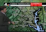
upper 80s for martinsburg and winchest winchester, a high of 90.ow about the chesapeake bay weather forecast. this afternoon not bad. 86 degrees. 87 for your weather forecast tomorrow. but there is a 50% chance of thunderstorms and then on july 4th, i think the thunderstorms will be for the south part of the bay and a high of 87. if you're keeping an eye on the weather, from the weather, that's where our next batch will be approaching. this is the front that will scoop up this hot and humid air by tomorrow. and that's when our best chances for thunderstorms will be out and about. now, watch this front on july 4th, it goes south of us. but lingers some clouds as far north as d.c. and it's d.c. points south that we have a chance for a few isolated thunderstorms. points north, i think it will be dry. i am going with a dry fireworks forecast for d.c. points north. little iffy. touch and go with a few thunderstorms possible for activities south of town. northern neck of virginia, southern maryland, the beaches and down towards fredericksburg. let's put
upper 80s for martinsburg and winchest winchester, a high of 90.ow about the chesapeake bay weather forecast. this afternoon not bad. 86 degrees. 87 for your weather forecast tomorrow. but there is a 50% chance of thunderstorms and then on july 4th, i think the thunderstorms will be for the south part of the bay and a high of 87. if you're keeping an eye on the weather, from the weather, that's where our next batch will be approaching. this is the front that will scoop up this hot and humid air...
139
139
Jul 1, 2011
07/11
by
WUSA
tv
eye 139
favorite 0
quote 0
it's still warm, but it's not that bad, 88 in downtown, 86 in winchester. already 84 in culpepper, and the reason it's not that bad, look at the dew points, in the 40s downtown. 50s in a lot of locations so, when we start to see 60s, that's when it starts to feel uncomfortable, so tomorrow, the humidity is on the rise. we are an under high pressure, so we're seeing clear side through tonight and through tomorrow, and we dry. the heat moves in, cool again tonight, open the windows, grab the sunglasses for the morning and the sunscreen. saturday, slightly sticky, and even hotter and more humid on sunday. so for tonight, great night to be outside and have dinner, clear and cool again, open the windows, low 58 to 68. overnight around downtown, upper 60s, 64 for andrews air force base, fredericksburg, 61 in the morning, nice start, mostly sunny and pleasant, get outside, get jogging, do some gardening. temperatures in the 60s and 70s, and in the afternoon, yeah, mostly sunny and hot, and 60s again, but air quality is code orange which is unhealthy for sensitive
it's still warm, but it's not that bad, 88 in downtown, 86 in winchester. already 84 in culpepper, and the reason it's not that bad, look at the dew points, in the 40s downtown. 50s in a lot of locations so, when we start to see 60s, that's when it starts to feel uncomfortable, so tomorrow, the humidity is on the rise. we are an under high pressure, so we're seeing clear side through tonight and through tomorrow, and we dry. the heat moves in, cool again tonight, open the windows, grab the...
161
161
Jul 7, 2011
07/11
by
WUSA
tv
eye 161
favorite 0
quote 0
winchester 72 degrees. dew points today still not a break from the humidity because dew points in the lower 70s at this hour. 73 for culpepper. fredericksburg, 72. so, it is still sticky out there. warm and muggy morning for today. and hot again this afternoon. some thunderstorms are possible. impact the evening commute in some locations. it will not be widespread. i think some of the storms today could be strong and severe. friday even more storms and the severe threat is larger tomorrow compared to today. here is a look at the future cast. you can see here where some of the storms i think will start out to the north of us. around the mason-dixon line because the front eventually heads down and then it will stall in our area through tomorrow. but the storm chances really will start around late this afternoon and in the evening. you can see it is going to be kind of scattered in nature and again, some of the storms could produce damaging wind gusts and some isolated hail. tomorrow, showers, storms, are like
winchester 72 degrees. dew points today still not a break from the humidity because dew points in the lower 70s at this hour. 73 for culpepper. fredericksburg, 72. so, it is still sticky out there. warm and muggy morning for today. and hot again this afternoon. some thunderstorms are possible. impact the evening commute in some locations. it will not be widespread. i think some of the storms today could be strong and severe. friday even more storms and the severe threat is larger tomorrow...
204
204
Jul 2, 2011
07/11
by
WUSA
tv
eye 204
favorite 0
quote 0
into the 60s for manassas and winchester, annapolis cooling down to just 74 degrees.omorrow morning partly to mostly cloudy. a milder start. grab the umbrella. you'll need the umbrella because by the afternoon, while it's warm and humid, we have scattered showers and thunderstorms. highs will be 89 to 94 degrees and winds out of the west at 10 miles per hour. highs tomorrow generally low 90s. depending on the cloud cover by the afternoon and how much sun we get inbetween those storms, may get into the mid 90s in some spots. winchester 90. culpeper 92 degrees. autism speaks 5k does kick off on july 4 at 7:30. in pennsylvania toe mac, maryland, intersection of river and falls road benefiting autism speaks and also topper will be out there to help kick things off. here's your next three days. the 90s tomorrow and we have scattered showers and thunderstorms. the fourth looking a lot better. not as wet, only isolated storms. here's your seven-day outlook. 90s on the fourth. in the upper 80s, maybe scattered showers and storms on tuesday. wednesday at this point does look d
into the 60s for manassas and winchester, annapolis cooling down to just 74 degrees.omorrow morning partly to mostly cloudy. a milder start. grab the umbrella. you'll need the umbrella because by the afternoon, while it's warm and humid, we have scattered showers and thunderstorms. highs will be 89 to 94 degrees and winds out of the west at 10 miles per hour. highs tomorrow generally low 90s. depending on the cloud cover by the afternoon and how much sun we get inbetween those storms, may get...
177
177
Jul 4, 2011
07/11
by
WUSA
tv
eye 177
favorite 0
quote 0
right now temperatures in the upper 80s in downtown. 282 in manassas. 79 degrees in winchester. so still unsettled tonight. severe thunderstorm watch in effect until 10:00 p.m. for our southern counties. damaging wind is the major threat and the biggest concern from these storms. lightning also a possibility and locally heavy downpours. tuesday, as you are heading back to work, it is hot again. here's your future cast. one model could be happening. mostly showers and storms are scattered. 11:00 looks like manassas, culpeper, you could be getting showers and storms as well. overnight, most of it is to the south of dc and we may see clouds start to clear out by tomorrow midday. for tonight, a lot of folks are going to be outside. mostly cloudy and mild. showers and thunderstorms are possible. some could be severe. around downtown, pretty mild. near mid 70s. now for tomorrow morning as you are heading back to work, it's going to be much more pleasant. mostly cloudy and mild. temperatures 60s and 70s. a lot more sunshine tomorrow as well. partly to mostly sunny and still hot. a stra
right now temperatures in the upper 80s in downtown. 282 in manassas. 79 degrees in winchester. so still unsettled tonight. severe thunderstorm watch in effect until 10:00 p.m. for our southern counties. damaging wind is the major threat and the biggest concern from these storms. lightning also a possibility and locally heavy downpours. tuesday, as you are heading back to work, it is hot again. here's your future cast. one model could be happening. mostly showers and storms are scattered. 11:00...
192
192
Jul 6, 2011
07/11
by
WUSA
tv
eye 192
favorite 0
quote 0
mid-70s around downtown. 70 in manassas. 68 degrees for winchester. it still will feel humid. the next three days, tomorrow, very similar. a little better chance of some scattered showers and thunderstorms. i'll call it around 50% then friday, 50% to 60% chance. that's the best chance for scattered showers and thunderstorms. temperaturewise, still in the upper 80s through the weekend. on sunday, we're looking storm- free. 91 degrees. monday and tuesday, we get a burst of heat coming this way. mid to upper 90s by tuesday. that's your forecast. thanks for joining us. we'll be right back. >>> welcome back to 9news now. just a few days ago, 9news now anchor mike hydeck sampled cupcakes delivered here with a message. help fight breast cancer. our guest was dr. alex, representing pink jams. >> so, how would you like to experience a real, new york fashion show, cat walk and all and raise money for a good cause at the same time? well, you can right here in washington, d.c. coming up. this is dr. alex. she's here representing what's the name of it again? >> pink jams. pinkjams.org. thi
mid-70s around downtown. 70 in manassas. 68 degrees for winchester. it still will feel humid. the next three days, tomorrow, very similar. a little better chance of some scattered showers and thunderstorms. i'll call it around 50% then friday, 50% to 60% chance. that's the best chance for scattered showers and thunderstorms. temperaturewise, still in the upper 80s through the weekend. on sunday, we're looking storm- free. 91 degrees. monday and tuesday, we get a burst of heat coming this way....
232
232
Jul 3, 2011
07/11
by
WUSA
tv
eye 232
favorite 0
quote 0
into that mid-60s right now but 70s in gaithersburg, 70 in winchester.couple days ago they were in the 40s and 50s. so a stormy sunday today. severe thunderstorm watch until midnight. downpours leading to dangerous flash flooding threats. damaging wind and hail. july 4th chance for isolated thunderstorm. what this model thinks will happen. 8 p.m. still some showers going through. some thunderstorms as well. by 11 p.m. a lot of it should be done so i think by then it will be much quieter. tomorrow morning, mostly cloudy conditions to start the day. i think for the most part not as stormy though. the threat here to the south of us may be some showers. again, chance for some isolated storms tomorrow afternoon and evening but they will be isolated in nature and so i think for the fireworks for the most part things are looking pretty good but a slight chance you may see a bit of wet weather. showers and thunderstorm. some heavy or severe. lows tonight around downtown near mid-70s. a warm night for some folks out there. okay. so let's take a look at our foreca
into that mid-60s right now but 70s in gaithersburg, 70 in winchester.couple days ago they were in the 40s and 50s. so a stormy sunday today. severe thunderstorm watch until midnight. downpours leading to dangerous flash flooding threats. damaging wind and hail. july 4th chance for isolated thunderstorm. what this model thinks will happen. 8 p.m. still some showers going through. some thunderstorms as well. by 11 p.m. a lot of it should be done so i think by then it will be much quieter....
171
171
Jul 7, 2011
07/11
by
WUSA
tv
eye 171
favorite 0
quote 0
leesburg, 95. 92 in winchester, annapolis warming into 90 degrees. overnight, very mild if not warm overnight. temperatures around mid-70s for downtown. annapolis only 77. that's their low for tomorrow morning. and leesburg, 72. winchester in the far northwestern suburbs, you may get down into the upper 60s. here is your next three days. so, today, hot and muggy. 94. afternoon, evening scattered showers and storms. some could be severe and strong. damaging wind gusts, maybe some hail and locally heavy downpours at times. tomorrow, not as hot. 85 degrees. more numerous showers and storms. a bigger risk for severe storms as well tomorrow. tomorrow can be a tough day and it can be dangerous. saturday, still hot. 90 degrees. sunday, partly cloudy conditions. and the heat is on for monday. 95 degrees. we're looking to be storm-free that day and then we get back down to more seasonable conditions toward wednesday around upper 80s. all right, it is thursday. it is time for pet line 9. with us is b.j. from the montgomery county humane society. you've got luc
leesburg, 95. 92 in winchester, annapolis warming into 90 degrees. overnight, very mild if not warm overnight. temperatures around mid-70s for downtown. annapolis only 77. that's their low for tomorrow morning. and leesburg, 72. winchester in the far northwestern suburbs, you may get down into the upper 60s. here is your next three days. so, today, hot and muggy. 94. afternoon, evening scattered showers and storms. some could be severe and strong. damaging wind gusts, maybe some hail and...
212
212
Jul 7, 2011
07/11
by
WMAR
tv
eye 212
favorite 0
quote 0
also in winchester. charlottesville and virginia, 84. they had rain across the area.rain cooled temperatures prevailed. lows this morning came in around 70 degrees into baltimore. 72 in dulles and more of the same into winchester. low 70s in hagerstown. york coming in right around 66. so speaking of 66, that moisture content is once again high. york dealing with patchy fog when you have all that humidity out there on the dew points the same as the temperatures, you are deeing with saturated air -- dealing with saturated air. if your travels take you that way, make sure to have the low beams on. 69 in baltimore for a dew point temperature and 70 in washington and culpepper around 7 3. so once again, we are dealing with that very sultry balmy air. the air quality, yes, we have a code orange in effect once again everywhere except for theeastern shore. that -- you should limit your outdoor activity if you have asthma or lung disease. we are dealing with mainly clear skies. the cloud will move in more as we go into the afternoon. and also the chance for showers and thunder
also in winchester. charlottesville and virginia, 84. they had rain across the area.rain cooled temperatures prevailed. lows this morning came in around 70 degrees into baltimore. 72 in dulles and more of the same into winchester. low 70s in hagerstown. york coming in right around 66. so speaking of 66, that moisture content is once again high. york dealing with patchy fog when you have all that humidity out there on the dew points the same as the temperatures, you are deeing with saturated air...
157
157
Jul 6, 2011
07/11
by
WMAR
tv
eye 157
favorite 0
quote 0
yesterday, we were above that and we came in around 93 into baltimore. 91 in easton and 90 in winchesterd not so bad in oakland around 77 and 89 in york and more of the same in hagerstown. lows this morning, 72. so we are starting out on the warm side starting out on the muggy side as well. dew points are coming up. 69 degrees this morning into dulles and 70 in winchester. 72 in charlottesville. here are the dew points i want to show you because they are high. 71 degrees in dc. 70 in culpepper. upper 60s into baltimore and frederick and check out easton right around 7 3. so when you talk about the 70s, upper 60s oppressive outside. we have a code orange so we are definitely looking at some very stale air out there. we are not getting any type of momentum or movement out in the atmosphere and that's why we have the code orange. so if you do have asthma, lung disease, limit your outdoor activities today. satellite and radar not picking up on a lot as of now. but we will have a picks turf sun and clouds as we go throughout the day. and i believe as we go into the afternoon, we will see more
yesterday, we were above that and we came in around 93 into baltimore. 91 in easton and 90 in winchesterd not so bad in oakland around 77 and 89 in york and more of the same in hagerstown. lows this morning, 72. so we are starting out on the warm side starting out on the muggy side as well. dew points are coming up. 69 degrees this morning into dulles and 70 in winchester. 72 in charlottesville. here are the dew points i want to show you because they are high. 71 degrees in dc. 70 in culpepper....
248
248
Jul 5, 2011
07/11
by
WTTG
tv
eye 248
favorite 0
quote 0
winchester, 64. we have fog developing west of the mountains. be ready for that. the possibility that fog could be dense in spots, down to about a quarter mile. some light shower activity moving on through during the overnight hours. most of it well south an east of the city into southern maryland and lower eastern shore. high pressure out to the west out in indiana and ohio trying to build in but it is not really going to be successful as the frontal system that we've had wavering around here for the last couple of days is still in the neighborhood. we've got kind of a battleground at the moment but as we get into the moment, we should see a return to plenty of sunshine. mostly sunny skies. warm, humid out there. 90 your daytime high. code orange air quality, another day with moderate air quality. later today, partly cloudy and warm. 74 your overnight low. plenty of humidity when you get up. there are your showers and thunderstorms. they're back by wednesday and thursday afternoon. we hope to get it out of here. setting up for a nice weekend in july. effect is go
winchester, 64. we have fog developing west of the mountains. be ready for that. the possibility that fog could be dense in spots, down to about a quarter mile. some light shower activity moving on through during the overnight hours. most of it well south an east of the city into southern maryland and lower eastern shore. high pressure out to the west out in indiana and ohio trying to build in but it is not really going to be successful as the frontal system that we've had wavering around here...
213
213
tv
eye 213
favorite 0
quote 0
wjz is live in winchester, virginia. mike hellgren has their story. >> uh-huh. denise, this is a family truly shaken by senseless violence. they said their loved one is a tourist. and they heard the mayor talk about cracking down on this senseless vile. they say they hope those aren't just words, that there's action involved. >> reporter: joe calo's family is reeling from his murder. police say this man stabbed him to death with a broken bottle. in an interview with wjz, his loved ones pleaded with the public to catch his killer. >> i was there when his mother found out. and... my little girl is not going to have a dad. [ crying ] she had him for a year. that's not long enough. >> reporter: callow had just visited his 1-year-old daughter, in winchester, virginia, before he headed to baltimore. >> it's going to be hard. >> i drove 1,000 miles to get here to where i could help. >> i was the first person that they told that he didn't even make it to the hospital. >> reporter: callow's family wants to bring his body home. they want justice and closure for a life nee
wjz is live in winchester, virginia. mike hellgren has their story. >> uh-huh. denise, this is a family truly shaken by senseless violence. they said their loved one is a tourist. and they heard the mayor talk about cracking down on this senseless vile. they say they hope those aren't just words, that there's action involved. >> reporter: joe calo's family is reeling from his murder. police say this man stabbed him to death with a broken bottle. in an interview with wjz, his loved...
157
157
Jul 4, 2011
07/11
by
WMAR
tv
eye 157
favorite 0
quote 0
more of the same into winchester, 95 in charlotsville and 90 in york and 91 in hagerstown and i am forecastingo the temperatures for today. right now, the temperature into baltimore coming in at around 71. 72 in easton and 71 at patuxent river. 70 in dulles and more into winchester. moisture is a big factor this time of the year. so, dew points the measure the moisture in the air and over 65, you are feeling it. feeling nasty outside. 72 degrees now for the dew point temperature into easton. satellite and radar not picking up on a lot. that's good news. the showers and thunderstorms that we got yesterday and this morning starting to fizzle out a little bit. but they will fire back up possibly as we go into the afternoon. reason why, we have a cold front back towards the west. and it's going to sag more to the south and as it does it will stall out around virginia and that's the focal point as we start to get more showers and thunderstorms going into the afternoon and future radar. picking up on that, as we go into the afternoon time frame, we will have scattered showers and thunderstorms, but
more of the same into winchester, 95 in charlotsville and 90 in york and 91 in hagerstown and i am forecastingo the temperatures for today. right now, the temperature into baltimore coming in at around 71. 72 in easton and 71 at patuxent river. 70 in dulles and more into winchester. moisture is a big factor this time of the year. so, dew points the measure the moisture in the air and over 65, you are feeling it. feeling nasty outside. 72 degrees now for the dew point temperature into easton....
178
178
Jul 6, 2011
07/11
by
WMAR
tv
eye 178
favorite 0
quote 0
dulles at 71. 65 in york and 70 in hagerstown and 72 in winchester. 73 in charlotsville. satellite and radar not picking up on a lot. we will get a sun cloud mix going throughout the day today. thinking we have have a chance for showers and thunderstorms as we go into the afternoon as well. the reason why is always because we have the stationer'sy front flickering -- stationer'sy frontflick -- stationary front flyingering back and forth. -- flickering back and forth. lots of moisture in the forecast for us i talked about the showers and thunderstorms. the storm prediction center does us in a slight risk for severe weather. if we get it, it will be in the form of damaging winds and hail. but check out where this is in southern maryland. so, all in all, we pretty much will be out of the woods a bit to get. again, it's a slight risk but it will be in southern maryland. weep keep you update on storm activity. future radar picking up on what's going on. showers and thunderstorms possible going into the afternoon. today, tomorrow, and even into friday, you are going to need the
dulles at 71. 65 in york and 70 in hagerstown and 72 in winchester. 73 in charlotsville. satellite and radar not picking up on a lot. we will get a sun cloud mix going throughout the day today. thinking we have have a chance for showers and thunderstorms as we go into the afternoon as well. the reason why is always because we have the stationer'sy front flickering -- stationer'sy frontflick -- stationary front flyingering back and forth. -- flickering back and forth. lots of moisture in the...
153
153
Jul 7, 2011
07/11
by
WUSA
tv
eye 153
favorite 0
quote 0
winchester in the lower 90s. here is your next three days. hot and muggy today.afternoon showers and storms possible. tomorrow's temperature around mid-80s. not as hot. still warm. then showers and storms are likely. severe threat, just stick with us. it goes up tomorrow. saturday, lower 90s then on sunday, we're looking dry and storm-free with high pressure back in control. monday, it is going to be hot! mid-90s. here's angie with your traffic. >> things are heating up out there. thank you, anny. hello, everybody. we're creeping closer to the 7:00 hour. the yellow light stays on. we've still got problems out in the hyattsville, maryland area. what we have is maryland 202, landover road at firehouse road, still have all northbound lanes blocked as investigators continue to investigate that crash scene involving the person who died and the pedestrian. this is an accident that happened more than an hour ago. they're still telling us they don't know when they'll be able to open up the northbound lanes. southbound travelers, you're doing ok. let's move it out to the
winchester in the lower 90s. here is your next three days. hot and muggy today.afternoon showers and storms possible. tomorrow's temperature around mid-80s. not as hot. still warm. then showers and storms are likely. severe threat, just stick with us. it goes up tomorrow. saturday, lower 90s then on sunday, we're looking dry and storm-free with high pressure back in control. monday, it is going to be hot! mid-90s. here's angie with your traffic. >> things are heating up out there. thank...
249
249
tv
eye 249
favorite 0
quote 0
but look at hagerstown, martinsburg and winchester. that's where the sun has been out, temperatures there running above 90 degrees. back down to the south, though, fredericksburg, leonardtown, both in the upper 70s, as those are the areas that have seen rain throughout the afternoon. live digital doppler showing rain well to the south and east of the fredericksburg area, but still down towards southern portions of st. mary's county, there may be a couple showers throughout the evening, but all in all, things clearing out. and by tomorrow morning, mostly cloudy skies, very warm, humid again with temperatures in the 70s. rain chances only going to increase over the next couple days. i'll show you when i think we could see the most rain coming up in my full forecast. >> see you in a bit. thank you, doug. >>> a wife thought she came up with the perfect plan to sneak her husband out of jail. >>> also ahead this afternoon, sign this horse up for the kentucky derby. an eight-mile chase along a highway is caught on tape. >>> plus, she is nickn
but look at hagerstown, martinsburg and winchester. that's where the sun has been out, temperatures there running above 90 degrees. back down to the south, though, fredericksburg, leonardtown, both in the upper 70s, as those are the areas that have seen rain throughout the afternoon. live digital doppler showing rain well to the south and east of the fredericksburg area, but still down towards southern portions of st. mary's county, there may be a couple showers throughout the evening, but all...
210
210
Jul 8, 2011
07/11
by
WUSA
tv
eye 210
favorite 0
quote 0
winchester, a little cooler at 68 degrees. yes, it is still muggy out there.storms are more numerous today compared to yesterday. the flash flood watch goes through all this afternoon and tonight. heavy, severe thunderstorms are possible. the heaviest, again being between 4:00 p.m. and 9:00 p.m. impacting the evening commute for some folks. now, the severe weather outlook does include the entire d.c. area and the mid-atlantic. main threats being damaging wind gusts also a possibility. power outages not out of the question. of course, the heavy rain. we had the flash flood watch in effect starting at noon today going through late tonight. the entire d.c. metro area. so, if you do come across flooding, here's what you should not do. never cross a flooded street by car or by foot. make sure you have flashlights and batteries also in case we're dealing with power outages once again today. here is a look at the future cast. throughout most of the day, may see some scattered showers and storms. cloudy out there. now, late this afternoon and into the evening, gets a
winchester, a little cooler at 68 degrees. yes, it is still muggy out there.storms are more numerous today compared to yesterday. the flash flood watch goes through all this afternoon and tonight. heavy, severe thunderstorms are possible. the heaviest, again being between 4:00 p.m. and 9:00 p.m. impacting the evening commute for some folks. now, the severe weather outlook does include the entire d.c. area and the mid-atlantic. main threats being damaging wind gusts also a possibility. power...
195
195
Jul 3, 2011
07/11
by
WTTG
tv
eye 195
favorite 0
quote 0
west into central pennsylvania and some are creeping into maryland and virginia and i will put winchester to cumberland and hagerstown. they could creep closer to the washington area overnight. i think generally, we will wake up with a mix of sun and clouds. tomorrow afternoon, the cold front, which brought good thunderstorm activities will come keyser and to the showers and thunderstorms around here. a descent chance. 50, 60% chance of some scattered showers and thunderstorms during the afternoon and if you have plans, don't cancel them. be ready for a possibility of some afternoon showers and thunderstorms. the high temperatures tomorrow, 93 in washington; 93, leopardtown; 89, annapolis and in front royal. drier than sunday with highs about 92. tuesday and wednesday, nice and dry with the highs in the low 90s and may be another thunderstorm by the middle and that end of the week. that is the forecast. enjoy the rest of the holiday weekend. will, back to you. >> thank you. >>> we're taking the edge off with some form fun. a lot of phones loaned the streets and this is the start of the fu
west into central pennsylvania and some are creeping into maryland and virginia and i will put winchester to cumberland and hagerstown. they could creep closer to the washington area overnight. i think generally, we will wake up with a mix of sun and clouds. tomorrow afternoon, the cold front, which brought good thunderstorm activities will come keyser and to the showers and thunderstorms around here. a descent chance. 50, 60% chance of some scattered showers and thunderstorms during the...
411
411
Jul 10, 2011
07/11
by
CSPAN2
tv
eye 411
favorite 0
quote 0
that star of the oed is actually an american reject because simon winchester in his book, and winchester's is a breed. the brits have written history about that and my point is the americans were damn good in the 19th century and we shouldn't forget it. that winchester didn't realize that w.c. minor worked on webster's 1864 addition again i look at the correspondents, and he was the one weak link. ever says this is a fantastic dictionary. minor was supposed to do a natural history definition and they were really lousy. so the future star of the oed couldn't cut it as an american lexicographer, and i just want to highlight just how impressive that dictionary is and that we should be very proud of our tradition of the american lexicography. all right, i will stop there and take questions. [inaudible] >> all right. when we you appear on c-span? >> i'm not sure when it's going to air. [inaudible] >> will that be on the q&a program? >> i think it's going to be telecast on the lecture. >> i know people in those days knew a lot more languages than we know now. how many languages did not webster c
that star of the oed is actually an american reject because simon winchester in his book, and winchester's is a breed. the brits have written history about that and my point is the americans were damn good in the 19th century and we shouldn't forget it. that winchester didn't realize that w.c. minor worked on webster's 1864 addition again i look at the correspondents, and he was the one weak link. ever says this is a fantastic dictionary. minor was supposed to do a natural history definition...
164
164
Jul 1, 2011
07/11
by
WUSA
tv
eye 164
favorite 0
quote 0
so around downtown, upper 60s annapolis, frederick 61, winchester 63. and tomorrow morning, really nice and pleasant. the temperatures in the 60s and the 70s, the winds light. in the afternoon it will start to heat up. mostly sunny and hot and you'll start to feel it sticky. the air quality till be and orange. so generally low 90s downtown, 89 in winchester, and annapolis it will be 87 agrees. here's how the day -- 87 degrees. here's how the daybreaks down tomorrow. a little warmer tomorrow compared to today. and here's how your next 7 days are shaping up. sunday is 94 degrees, mid- 90stor the fourth and chance for some isolated storms as well. we'll have to watch that possibility. and the temperature there near 91 degrees and a better chance for scattered showers and storms on tuesday. so lots of water and sunscreen, everything. >> up next, prince william and princess kate steal the show north of the border. check out that hat. >>> it will be a shorter holiday weekend for the senate. the planned recess for next week is canceled. lawmakers will be back
so around downtown, upper 60s annapolis, frederick 61, winchester 63. and tomorrow morning, really nice and pleasant. the temperatures in the 60s and the 70s, the winds light. in the afternoon it will start to heat up. mostly sunny and hot and you'll start to feel it sticky. the air quality till be and orange. so generally low 90s downtown, 89 in winchester, and annapolis it will be 87 agrees. here's how the day -- 87 degrees. here's how the daybreaks down tomorrow. a little warmer tomorrow...
213
213
Jul 4, 2011
07/11
by
WJLA
tv
eye 213
favorite 0
quote 0
the other area in south of winchester. around the mall, is fine there. anything that really gets going will be well to the south of washington. partly cloudy. captioned by the national captioning institute [ male announcer ] we are americans. we know right from wrong. and we know the ads blaming president obama for the economy are politics at its worst. the republicans have opposed economic reforms at every turn. and now they have a plan that would essentially end medicare for future retirees... slash education... while giving huge tax breaks to big oil and the wealthy. we can't rebuild america if they tear down the middle class. priorities usa action is responsible for the content of this advertising.
the other area in south of winchester. around the mall, is fine there. anything that really gets going will be well to the south of washington. partly cloudy. captioned by the national captioning institute [ male announcer ] we are americans. we know right from wrong. and we know the ads blaming president obama for the economy are politics at its worst. the republicans have opposed economic reforms at every turn. and now they have a plan that would essentially end medicare for future...
302
302
Jul 26, 2011
07/11
by
KSTS
tv
eye 302
favorite 0
quote 0
stop open roll open cu ---regresamos nuevamente con blanca hasta la casa winchester en san jose.anarnos , los dejo con el noticiero nacional de telemundo con jose diaz balart
stop open roll open cu ---regresamos nuevamente con blanca hasta la casa winchester en san jose.anarnos , los dejo con el noticiero nacional de telemundo con jose diaz balart
216
216
Jul 5, 2011
07/11
by
WTTG
tv
eye 216
favorite 0
quote 0
visibility in places like martins burg and winchester less than a quarter mile with that fog. temperatures 76 regan national, 70 dulles, 72 dwi marshall, our forecast today, a good one. hot, highs 90 or so nothing we can't handle typical this time of year highs upper 80s low 90s shower and thunderstorm risk not high today, return tomorrow. >>> a little day of rest. >> give them a break. >>> we will check in to see how the traffic is everyone heading back to work this morning lauren. >> somewhat. lighter volume than usual for a tuesday morning that is good we do have of course more cars on the road than yesterday. george avenue, seminary place, an accident blocking the left lane just cleared out of the way route 28, park mills road watch for the wreck near the montgomery county, frederick county line a live look at 95, as you head southbound, out of laurel no real problems to report. to the left of your screen every thing wide open as it continues to college park on the belt way, you are going to find delays from college park into silver spring and bethesda once you get towards
visibility in places like martins burg and winchester less than a quarter mile with that fog. temperatures 76 regan national, 70 dulles, 72 dwi marshall, our forecast today, a good one. hot, highs 90 or so nothing we can't handle typical this time of year highs upper 80s low 90s shower and thunderstorm risk not high today, return tomorrow. >>> a little day of rest. >> give them a break. >>> we will check in to see how the traffic is everyone heading back to work this...
195
195
Jul 4, 2011
07/11
by
WUSA
tv
eye 195
favorite 0
quote 0
and 87 degrees in winchester. here's your seven-day outlook.perature wise, we aren't heating up a whole lot. cooling down into the mid 80s by friday. but this frontal system, we have a lot of fronts flirting with us the next several days, keeping with us a chance of scattered showers and thunderstorms. the next several days. tomorrow though, again we are thinking isolated and to the south of us. so keep your eyes to the sky tonight as you are waiting for those fireworks and bring an umbrella just in case. >> let's hope it is more calm than last night. >> absolutely. >> we should get the fireworks in. >> i think so. maybe some delays in some cities. we'll have to watch for that. >>> coming up next on 9news now. >> it's a fourth of july tradition and coney island, brooklyn. the annual hot dog eating contest. i'm randall pinkston, i'll have that story. >>> we didn't notice anything that was suspicious. >> rigged card readers. crooks at the top of their game. >> our account was at zero. >> 9news now reveals the tell tail science of super skimming.
and 87 degrees in winchester. here's your seven-day outlook.perature wise, we aren't heating up a whole lot. cooling down into the mid 80s by friday. but this frontal system, we have a lot of fronts flirting with us the next several days, keeping with us a chance of scattered showers and thunderstorms. the next several days. tomorrow though, again we are thinking isolated and to the south of us. so keep your eyes to the sky tonight as you are waiting for those fireworks and bring an umbrella...
512
512
Jul 8, 2011
07/11
by
WJLA
tv
eye 512
favorite 0
quote 0
primarily around the baltimore area, there are more storms are around the winchester area. these are all drifting more to the north. as we get into tomorrow, some of these heavier storms may be in our own backyard. this was a key maryland science center. over an inch of rain in downtown baltimore. it was flooding in dundalk,. there could be of one two, 3 inches of rain. >> now back to our breaking story from the belt way where a deadly the chain reaction crash led to a traffic nightmare and put the lives of two children in jeopardy. ben is live on the scene with late developments. >> that began with a tire change and it ended with two little girls in the hospital and a man dead. >> police say around 6:00 command in this white cadillac hold over to change a flat. a good samaritan pulled over to help them. a third car veered out of its lane and pummel them from behind. it burst into flames. newschopper 7 captured some of the first pictures of the scene. the cascade of the events took the life of the men in the cadillac and sent the girls to the hospital. the 1000's of drivers
primarily around the baltimore area, there are more storms are around the winchester area. these are all drifting more to the north. as we get into tomorrow, some of these heavier storms may be in our own backyard. this was a key maryland science center. over an inch of rain in downtown baltimore. it was flooding in dundalk,. there could be of one two, 3 inches of rain. >> now back to our breaking story from the belt way where a deadly the chain reaction crash led to a traffic nightmare...
197
197
Jul 6, 2011
07/11
by
WJLA
tv
eye 197
favorite 0
quote 0
funeral is set for tomorrow afternoon in winchester. the accused for a good shooter faces the death penalty. -- ft. hood shooter faces the death penalty. the army psychiatrist is expected to appear in the port hood court room. he could enter a plea on 13 charges of murder and 32 charges fromder the november 2009 rampage. >>> coming up at noon, the from the sky. hear what happened in the cockpit when a six-foot hole ripped open on a southwest flight. a spiritual leader takes the rise in center by storm. thousands come out to see the dolly llama. incredible images as a massive desk cloud pours into the next. all that went out of returns forecast. will severe >> seven american tourists are missing and one is then after an accident in the gulf of california. took a fishing trip but their boat capsized sunday morning. 19 passengers and all 16 crew members survived. authorities are now investigating the bohol sports fishing company in charge of the boat. -- the baja sports fishing company in charge of the boat. >>> we're hearing the d forthat
funeral is set for tomorrow afternoon in winchester. the accused for a good shooter faces the death penalty. -- ft. hood shooter faces the death penalty. the army psychiatrist is expected to appear in the port hood court room. he could enter a plea on 13 charges of murder and 32 charges fromder the november 2009 rampage. >>> coming up at noon, the from the sky. hear what happened in the cockpit when a six-foot hole ripped open on a southwest flight. a spiritual leader takes the rise in...
385
385
Jul 4, 2011
07/11
by
WBAL
tv
eye 385
favorite 0
quote 0
most of the thunderstorm activity is west of winchester at this time. this one may be more prone to affect the baltimore area. we do have a slight risk for rain today. the bigger storms are to the south. it is just north of ocean city right now. how warm did get today? not quite as warm as yesterday. 89 at the airport. inner harbor, 94. right now, just about everybody is at mid 80's. 89 at ocean city. 86, a frederick. the clouds are a little heavier. satellite pictures showed a bigger storms are in virginia. they are headed toward southern maryland and the lower eastern shore. that line of storms, that stuff is drifting in this direction. here is baltimore. it could be kind of close. a cold front is just south of us right now. there really dry air is in pennsylvania. it will take a while for that's less humid air to move in. no big storms less -- was of that. thing should quiet down for a day or so. overnight tonight, mostly cloudy skies. thunderstorms mostly to the south. here in baltimore, it could be a close call this evening. if you are going to be
most of the thunderstorm activity is west of winchester at this time. this one may be more prone to affect the baltimore area. we do have a slight risk for rain today. the bigger storms are to the south. it is just north of ocean city right now. how warm did get today? not quite as warm as yesterday. 89 at the airport. inner harbor, 94. right now, just about everybody is at mid 80's. 89 at ocean city. 86, a frederick. the clouds are a little heavier. satellite pictures showed a bigger storms...
296
296
Jul 3, 2011
07/11
by
WJLA
tv
eye 296
favorite 0
quote 0
tyler, his mother, father, and killed when a suspected drunk driver slammed into their jeep in winchester. today they paid tribute to the young boy. >> loved flowers, loved trees. we're having a party today for him. >> funeral services for the place thursday. suspect in the deadly crash remains jailed without bond. >>> four members of the p.g. ty council are calling for ignation of leslie johnson. councilwoman johnson pled guilty thursday to conspiracy to commit evidence and what is tampering. the washington post reports people are all calling for johnson to step down. the account executive has also d for her to resign, but under maryland law, johnson keeper seat until a sentencing in october. plans to continue doing work, she says. >>> no one has stepped forward aim the winning make a icket.ns t but if you live in herndon, va., be nice to your neighbors. somebody bought the winning ticket at a giant grocery store. ackpot is worth $107 milligan, or $68 million in a lump sum. the grocery still will get a bonus of $50,000. >>> prosecutors have called for charges on dominique strauss-kahn. p
tyler, his mother, father, and killed when a suspected drunk driver slammed into their jeep in winchester. today they paid tribute to the young boy. >> loved flowers, loved trees. we're having a party today for him. >> funeral services for the place thursday. suspect in the deadly crash remains jailed without bond. >>> four members of the p.g. ty council are calling for ignation of leslie johnson. councilwoman johnson pled guilty thursday to conspiracy to commit evidence...
195
195
tv
eye 195
favorite 0
quote 0
reporting live in winchester, virginia, mike hellgren, wjz eyewitness news. >> mike, thank you. >>> if you know anything about either of these incidents, you're asked to contact city police. you can remain anonymous. >>> a plane flipped over at martin state. but thankfully, nobody is hurt. police say a student pilot landed and lost control of his plane. sky eye chopper 13 flew over the airport, shortly after it happened. the runway was closed for about an hour. the student was taken from middle river flight services. >>> new information tonight about the man charged with secretly videotaping women in their anne arundel county home. denise is in the newsroom to explain what happened in 40 today. >> a crofton man had just pleaded guilty to 10 charges after he was caught with videotapes of naked women. police arrested 35-year-old charles novak in december, when a weapon caught him sitting inside a car in her garage. officers searched the area and found him with a video camera, and several videos showed him changing clothes. novak was sentenced to the maximum of 47 years, with all but 10 y
reporting live in winchester, virginia, mike hellgren, wjz eyewitness news. >> mike, thank you. >>> if you know anything about either of these incidents, you're asked to contact city police. you can remain anonymous. >>> a plane flipped over at martin state. but thankfully, nobody is hurt. police say a student pilot landed and lost control of his plane. sky eye chopper 13 flew over the airport, shortly after it happened. the runway was closed for about an hour. the...
194
194
Jul 4, 2011
07/11
by
WUSA
tv
eye 194
favorite 0
quote 0
winchester cooling down to 68 degrees. so still unsettled for tonight. the severe thunderstorm watch in effect until 10:00 p.m. mainly to the south once again. damaging wind, now that's the biggest concern, just like yesterday. lightning also the possibility. tuesday as you are heading back to work, it will be hot again. here's your future cast. this is what one model things could be happening. at 9:00 when the fireworks are going off and the good news here with this model is dry for the dc area, to the north and south, we could see some storms going through. maybe some severe storms down to the south of us. and then overnight, maybe some light showers in the south once again in the southern maryland area, charles county, then tomorrow afternoon, some spotty showers and some stray storms possible once again to the south of dc. so tonight, mostly cloudy and mild showers and storms possible. heavy and severe. mainly to the south. lows 66 to 74 degrees. around downtown, fairly mild night. near mid 70s in dc. and then for tomorrow, as you're heading back to
winchester cooling down to 68 degrees. so still unsettled for tonight. the severe thunderstorm watch in effect until 10:00 p.m. mainly to the south once again. damaging wind, now that's the biggest concern, just like yesterday. lightning also the possibility. tuesday as you are heading back to work, it will be hot again. here's your future cast. this is what one model things could be happening. at 9:00 when the fireworks are going off and the good news here with this model is dry for the dc...
187
187
Jul 5, 2011
07/11
by
WJLA
tv
eye 187
favorite 0
quote 0
notice we have them against parts of blue ridge and winchester. if we will see a thunderstorm to it, it will be right along here. this is where we have the best bet, but a marginal chance to see a lake daystar into this afternoon and early evening. the radar does not show anything right now. about 20 minutes ago we had one little echo right there in northern madison county. it was in conjunction with some of the clouds. we have a little shower reigning itself out there. -- shower raining itself out there. this is very muggy where we are getting a bit of a break from the humanity today. but you will not notice much of a change out there. just north of haiti and the dominican republic there are storms developing out on the ocean. one model hints that that could move northward into mexico, not really developing into anything, but be a disturbance that can affect our weather on friday and into saturday. it is a probability not a possibility. there is a storm possible today south of the metro. we also have a chance of a thunderstorm late in the day tom
notice we have them against parts of blue ridge and winchester. if we will see a thunderstorm to it, it will be right along here. this is where we have the best bet, but a marginal chance to see a lake daystar into this afternoon and early evening. the radar does not show anything right now. about 20 minutes ago we had one little echo right there in northern madison county. it was in conjunction with some of the clouds. we have a little shower reigning itself out there. -- shower raining itself...
263
263
Jul 1, 2011
07/11
by
WJLA
tv
eye 263
favorite 0
quote 0
it is not his because we don't have the thick humidity in the air. 85 and the district and 82 in winchester and 79 in cumberland we are on our way to about 90 this afternoon, warm but not too humid and that will change tomorrow and it will get warmer. i'll tell you how warm coming up. >>> a four-year old child is recovering from a gunshot wound after police say he was shot by another child. this happened on a playground yesterday afternoon outside an apartment complex in temple hills. parents want to know how the boy ended up with a gun. jummy olabanji has more. >> automatically, people look around and say how could it happen here. >> this is where prince george's county police say little boy was shot yesterday afternoon. police got the call after 4:00 to this apartment complex of 23rd parkway in temple hills. officials at a 5-year-old boy had a gun on the playground and it went off hitting a 4-year-old boy in the back. a neighbor rushed in to help. >> i rushed in and took him out and tried to get the metal pieces out. the ambulance came. >> neighbors say the playground is filled with child
it is not his because we don't have the thick humidity in the air. 85 and the district and 82 in winchester and 79 in cumberland we are on our way to about 90 this afternoon, warm but not too humid and that will change tomorrow and it will get warmer. i'll tell you how warm coming up. >>> a four-year old child is recovering from a gunshot wound after police say he was shot by another child. this happened on a playground yesterday afternoon outside an apartment complex in temple hills....
355
355
Jul 11, 2011
07/11
by
KPIX
tv
eye 355
favorite 0
quote 0
there are schedule changes on the green line, between the mountain view and winchester stations. there are also some schedule adjustments on "commuter express" trains and some bus lines. it's 6: star power, may not be enough for a hall of famer's big stadium pitch. why joe montana is already hitting a roadblock in santa clara. plus.. a special delivery for one of the world's most beautiful couples. the unusual name, for the new baby beckham. plastic bags and polystyrene (pah-lee-sty-reen) food containers are on the agenda,,,, san carlos city hall. the city council will hold a study session on whether to ban them. several local cities have already jumped on the bandwagon... forbidding businesses from giving those types of bags and containers to customers. proponents say those materials are bad for the environment. four-time super bowl champ joe montana is hoping to score big in santa clara. tomorrow he'll lobby the city council to build an entertainment complex in front of the proposed 49-ers stadium. the city usually requests outside proposals before making a decision-- but monta
there are schedule changes on the green line, between the mountain view and winchester stations. there are also some schedule adjustments on "commuter express" trains and some bus lines. it's 6: star power, may not be enough for a hall of famer's big stadium pitch. why joe montana is already hitting a roadblock in santa clara. plus.. a special delivery for one of the world's most beautiful couples. the unusual name, for the new baby beckham. plastic bags and polystyrene...
171
171
Jul 6, 2011
07/11
by
WMAR
tv
eye 171
favorite 0
quote 0
a shower rolling into the south of winchester and off towards the west of washington. all in all, things are dry this morning. and as we go into the afternoon that's going to change. the temperature right now into perry hall middle school coming in at 70 degrees. humidity 92%. you don't have to look at that and you can stick your toe out the door and feel the hugh implied -- humidity out there. we will feel it. churchville more of the same around 7 3. humidity at 92%. the dew point the measure of the moisture in the air coming in at 70. so we are feeling oppressive this morning. here's the air quality alert code orange once again. the only places that are relieved of this is basically the eastern shore as we go throughout the day. but once again, if you have asthma or lung disease, limit your outdoor activities. let's go over to tonya. good morning. >> reporter: traffic is doing okay. we are doing fine 97 northbound out of crofton no problems to report. the sun is coming up. more people are getting out on the road. let's look at the beltway on the southwest side, 695 a
a shower rolling into the south of winchester and off towards the west of washington. all in all, things are dry this morning. and as we go into the afternoon that's going to change. the temperature right now into perry hall middle school coming in at 70 degrees. humidity 92%. you don't have to look at that and you can stick your toe out the door and feel the hugh implied -- humidity out there. we will feel it. churchville more of the same around 7 3. humidity at 92%. the dew point the measure...
300
300
Jul 4, 2011
07/11
by
WTTG
tv
eye 300
favorite 0
quote 0
didn't mean to say it publicly. >>> shower activity, cloud cover, moving on, breaks here out to winchester martins burg, breaks now, clearing here before long and a little sunshine work in the picture, partly sunny day but with a cold front, responsible for igniting those thunderstorms last night that caused all the problems with that frontal system not having enough umph the possibility of more showers and thunderstorms firing up along that front later today. we are not done with it yet, most of today should be dry but be ready for it between 3 and 6 tonight possibility of more showers and thunderstorms, best chance south and southeast of the city later this afternoon. >> warming up 76 regan national, 76 annapolis and 73 winchester your forecast today code orange air quality moderate, take it easy partly sunny skies, hot 92 degrees possibility of a few more afternoon and or evening thunderstorms wind out of the north and west, 5 to 10 miles per hour, later tonight, humid overnight cloudy, could be an early storm generally out of here 7, 8:00 p.m. at night fireworks 9, 9:30 p.m., should be
didn't mean to say it publicly. >>> shower activity, cloud cover, moving on, breaks here out to winchester martins burg, breaks now, clearing here before long and a little sunshine work in the picture, partly sunny day but with a cold front, responsible for igniting those thunderstorms last night that caused all the problems with that frontal system not having enough umph the possibility of more showers and thunderstorms firing up along that front later today. we are not done with it...
174
174
Jul 5, 2011
07/11
by
WUSA
tv
eye 174
favorite 0
quote 0
parts of winchester, martinsburg. as we head into thursday, as that front from the midwest, the one with the storms, look what happens thursday afternoon. scattered showers and storms and i think we'll see about the same for friday as well before drying out by the weekend. that means temperatures will start to arrive. today around 91. lots of sunshine. spotty storm or two at worse. tomorrow, scattered showers and storms with a better chance south of town, 89. on thursday, scattered showers and storms more widespread again in the upper 80s. about the same on friday. saturday, here's your weekend. got a chance of a storm dropping though 91. here comes more heat and drier air. sunday and monday, low to mid- 90s. we've got some is good chocolate stuff in the kitchen! i've been sampling it. 9news now will return. >> we have some wicked treats in our 9news now kitchen to celebrate the return of the tony award winning musical, wicked. we welcome the chef from the kennedy center cafe and roof terrace restaurant. we also have
parts of winchester, martinsburg. as we head into thursday, as that front from the midwest, the one with the storms, look what happens thursday afternoon. scattered showers and storms and i think we'll see about the same for friday as well before drying out by the weekend. that means temperatures will start to arrive. today around 91. lots of sunshine. spotty storm or two at worse. tomorrow, scattered showers and storms with a better chance south of town, 89. on thursday, scattered showers and...
256
256
tv
eye 256
favorite 0
quote 0
down to 64 in frederick, 60 in winchester, 64 in manassas. some areas about 15 degrees cooler than the district. you step outside and you notice that little chill in the air. chill relatively speaking. of course, we're talking about summer happening outside right now, too. plenty of clear skies. those clear skies are going to continue through the day tomorrow until we see some partly cloudy skies. out to the west, big-time thunderstorms in chicago. they saw some very large hail. i think we'll be seeing some pictures of that. we'll most likely have those tomorrow morning during our newscast starting at 4:30. nice weather. as far as our weather is concerned, one more day tomorrow and high pressure will be dominating the region. that nice weather is not going to last because it will get quite hot. the hot weather moves in on saturday, and really on sunday as that heat index could get up to 95 and maybe over 100 degrees dur during the day on sunday. wind out of the north about 5 to 10 miles per hour. warmer, still nice, 85 to 90. some areas may b
down to 64 in frederick, 60 in winchester, 64 in manassas. some areas about 15 degrees cooler than the district. you step outside and you notice that little chill in the air. chill relatively speaking. of course, we're talking about summer happening outside right now, too. plenty of clear skies. those clear skies are going to continue through the day tomorrow until we see some partly cloudy skies. out to the west, big-time thunderstorms in chicago. they saw some very large hail. i think we'll...
196
196
Jul 7, 2011
07/11
by
WUSA
tv
eye 196
favorite 0
quote 0
that is back in the mountains and that storm also will produce some heavy rains headed towards winchesterat this hour. now in the next hour where will they go? this is going to move essentially down 270, approaching frederick. this will move across the bay. monster storm. it will become a marine warning for the northern bay. hail and heavy rain. the storm is back at the northwest. diminishing a little bit in intensity. 94 right now downtown. 90 in manassas. 93 in leesburg. plenty hot. should stay dry for the nats game. cold front sinks south. muggy with storms tonight. more storms tomorrow. flash flood watch goes into effect tomorrow. hot and less humid over the weekend. so for tonight mostly cloudy and muggy. showers and thunderstorms. lows 68 to about 74. now, the next seven days. cooler tomorrow because of cloud cover. maybe a left over shower on saturday but not a bad day. 89. 90 on sunday. more showers and thunderstorms. some of those could be rather hefty as well. but at least we will actually exchange air masses for a change. >> speaking of exchange. somebody wants albert hayneswor
that is back in the mountains and that storm also will produce some heavy rains headed towards winchesterat this hour. now in the next hour where will they go? this is going to move essentially down 270, approaching frederick. this will move across the bay. monster storm. it will become a marine warning for the northern bay. hail and heavy rain. the storm is back at the northwest. diminishing a little bit in intensity. 94 right now downtown. 90 in manassas. 93 in leesburg. plenty hot. should...
166
166
Jul 4, 2011
07/11
by
WTTG
tv
eye 166
favorite 0
quote 0
there are a couple of showers trying to fire up and these are between charlestown winchester along 81 and that is coming out of west virginia and let's go to it. the fireworks forecast later on and temperatures should be around 80 degrees or sore and that is not -- this is not just for the mall but the surrounding area. everyone has a chance of a shower or thunderstorm and otherwise, warm, muggy, 80 to 83 degrees and not hot and that hasn't been altogether that hot and go to the website and get all of your latest live information on the radar and that is going to goad you. check out the complete list of fireworks in the area and look at the live radar and on that mall and download the www.myfoxdc.com app. senate cleanup continues from a violent storm that swept through yesterday. in arlington, trees came crashing down on the cars and homes and thousands left without power. the national weather service estimates that the winds topped 60 to set miles per hour and many of you who thought it was a tornado but the national weather service said it was a macrobust, a downward burst of violen
there are a couple of showers trying to fire up and these are between charlestown winchester along 81 and that is coming out of west virginia and let's go to it. the fireworks forecast later on and temperatures should be around 80 degrees or sore and that is not -- this is not just for the mall but the surrounding area. everyone has a chance of a shower or thunderstorm and otherwise, warm, muggy, 80 to 83 degrees and not hot and that hasn't been altogether that hot and go to the website and get...
216
216
Jul 8, 2011
07/11
by
WTTG
tv
eye 216
favorite 0
quote 0
winchester another strong thunderstorm kind of to the west and northwest of your vicinity. we can tighten these up a little so you can get a better view. everything is moving off to the east and northeast, very heavy rain here. frederick, virginia, you under a flash flood warning. that's going until 1 a.m. hampshire, virginia, that's going to go until 1:30 a.m. for the flash flood warning. for tomorrow in anticipation of more heavy rain and thunderstorms flash flood watch has already been issued for tomorrow afternoon into tomorrow night. expect the potential maybe as much as 2 to some localized areas 3 inches of rain before this is all said and done early saturday morning. full forecast coming up. >> we do need the rain, thanks. >>> potential jurors from the roger clemens perjury trial facing intense questions today. for a second day the judge and lawyers for both side turned away nearly half of the jury poll, many dismissed after criticizing congress. clemens faces six felony counts charged with lying to congress when he testified he never used steroids or human growth ho
winchester another strong thunderstorm kind of to the west and northwest of your vicinity. we can tighten these up a little so you can get a better view. everything is moving off to the east and northeast, very heavy rain here. frederick, virginia, you under a flash flood warning. that's going until 1 a.m. hampshire, virginia, that's going to go until 1:30 a.m. for the flash flood warning. for tomorrow in anticipation of more heavy rain and thunderstorms flash flood watch has already been...
231
231
Jul 7, 2011
07/11
by
WMAR
tv
eye 231
favorite 0
quote 0
dulles at 72 and also winchester more of the same in hagerstown. 66 right now in york, pennsylvania andthat's the dew point temperature in pennsylvania as well. so if you are driving up that way, you will run into patchy fog across the area. so 69 degrees right now for a dew point in baltimore. 70 in washington. culpepper around 73 as well. and we have patchy fog across the area. and satellite and radar not picking up on a whole lot right now. again, we are mainly clear but what happens is we will have a cold front that's trying to push closer to us. but what's going to happen is once again is it's going to stall out a lot of stationary fronts and with that, that's the focal point. as we go through afternoon today and also tomorrow, behind that front, though, yes, we are getting drier air in here. just in time for the weekend. and future radar showing you what's happening asway go through the afternoon. you can see the chance for showers and thunderstorms to pop around us once again. and then tomorrow, it's going to be the better chance for the showers and thunderstorms. we could start
dulles at 72 and also winchester more of the same in hagerstown. 66 right now in york, pennsylvania andthat's the dew point temperature in pennsylvania as well. so if you are driving up that way, you will run into patchy fog across the area. so 69 degrees right now for a dew point in baltimore. 70 in washington. culpepper around 73 as well. and we have patchy fog across the area. and satellite and radar not picking up on a whole lot right now. again, we are mainly clear but what happens is we...
212
212
Jul 2, 2011
07/11
by
WTTG
tv
eye 212
favorite 0
quote 0
town, gaithersburg 66, manassas the same and a little cooler back out there for martinsburg and winchester, too. how about that 4th of july forecast? what we can expect this weekend, we know things will get a little warmer the next couple days. tomorrow we're up into the lower 90s. it looks like on sunday we'll be a little bit more humid, temperatures in the middle 90s. it will feel like it's in the upper 90s for a brief time on sunday afternoon before these thunderstorms and showers start moving on across and it looks like the chance of storms for the 4th is real slight now. it looks like it wants to be pushed down to the south. so things are looking better for us on the 4th. comfortable temperatures overnight, lower 60s out in the suburbs. i think the temperature here in town will be right around 70 degrees but just great tomorrow morning, loads of sunshine, a few clouds at noon. we're already hot, though, 87 degrees. an isolated thunderstorm is possible at 5:00 and real quickly here's that 4th of july forecast. not a scorcher, temperatures lower 90s the way it looks now. technically sti
town, gaithersburg 66, manassas the same and a little cooler back out there for martinsburg and winchester, too. how about that 4th of july forecast? what we can expect this weekend, we know things will get a little warmer the next couple days. tomorrow we're up into the lower 90s. it looks like on sunday we'll be a little bit more humid, temperatures in the middle 90s. it will feel like it's in the upper 90s for a brief time on sunday afternoon before these thunderstorms and showers start...
198
198
Jul 3, 2011
07/11
by
WUSA
tv
eye 198
favorite 0
quote 0
lower 80s in downtown. 80 annapolis. 75 in fredericksburg and 79 in winchester. not a whole lot of cooling overnight. partly to mostly cloudy and mild. a few showers possible. lows will be 67 to 72 degrees and winds are going to be south and they'll be light. here's your wakeup weather as you are heading out the door. errands to run and get ready for the fourth of july barbecue. temperatures in the 70s and lower 80s by 9:00. mostly cloudy through most of the morning. we'll talk more about that shower threat and thunderstorm threat and your fourth of july forecast. details a little later. >> all right annie, thanks. four families in dc's neighborhood are trying to recover after a devastating fire made their homes unlivable. flames engulfed several houses yesterday forcing the residents to find temporary shelter. for one large family, losing their house isn't the worst part. brittany manufacture morehouse has their story. >> i lost everything. my clothes, underwear, shoes. the only thing i have right now is my shorts and shirt on and these boots. >> 16-year-old kev
lower 80s in downtown. 80 annapolis. 75 in fredericksburg and 79 in winchester. not a whole lot of cooling overnight. partly to mostly cloudy and mild. a few showers possible. lows will be 67 to 72 degrees and winds are going to be south and they'll be light. here's your wakeup weather as you are heading out the door. errands to run and get ready for the fourth of july barbecue. temperatures in the 70s and lower 80s by 9:00. mostly cloudy through most of the morning. we'll talk more about that...
238
238
Jul 8, 2011
07/11
by
WMAR
tv
eye 238
favorite 0
quote 0
the roof caved in because that's what gave way to thunderstorms across the area. 93 degrees in winchestercharlotsville around 91. easton at 95 degrees. now our lows right around 71 in to baltimore. dulles around 71. easton at 73. patuxent river at 76. so not too low. the moisture content once again very high. 68 for the dew point into baltimore. 72 in dc. and easton, coming in right around 75. so a lot of moisture is in the air. and we will squeeze all of it out and so be it. we have a flash flood watch as we go through the rest of tonight. that's basically through our entire viewing area. so we have the potential for some flooding as we go through the remainder of today. the satellite and radar is not picking up on a whole lot. we had showers and thunderstorms earlier this morning that scooted out and we are dry as of now. but changes definitely on the way. we will see another day like yesterday. it could be a little bit worse because we will have more ran across the area. because of all the moisture that we are seeing. so a along the stationary front, we will get the showers and thunder
the roof caved in because that's what gave way to thunderstorms across the area. 93 degrees in winchestercharlotsville around 91. easton at 95 degrees. now our lows right around 71 in to baltimore. dulles around 71. easton at 73. patuxent river at 76. so not too low. the moisture content once again very high. 68 for the dew point into baltimore. 72 in dc. and easton, coming in right around 75. so a lot of moisture is in the air. and we will squeeze all of it out and so be it. we have a flash...
215
215
Jul 5, 2011
07/11
by
WUSA
tv
eye 215
favorite 0
quote 0
winchester 88 degrees. hagerstown 87 degrees. now this unsettled summer-like pattern does continue. dry and mild tonight. wednesday increasing humidity. late afternoon showers, thunderstorms are possible. thursday looks very similar. now future cast shows us late tonight, maybe a light scattered showers to the south of us that will continue overnight into tomorrow as well. wednesday morning, well mostly cloudy to partly cloudy conditions, and the river picking up a little light shower or so and then looks like we have a chance for some scattered showers and thunderstorms tomorrow late afternoon and during the evening hours for the entire area. so we'll have to keep our eyes to the sky. the good news is, they aren't expected to be severe. tonight, partly cloudy and mild. low 67 to 75 degrees. winds are going to be light. now tomorrow morning as you're leaving for work, partly to mostly cloudy and mild. slight chance of showers mainly to the south. pack an umbrella just in case. temperatures 60s and 70s. tomorrow afternoon, better chance for some scattered showers and thunderstorms la
winchester 88 degrees. hagerstown 87 degrees. now this unsettled summer-like pattern does continue. dry and mild tonight. wednesday increasing humidity. late afternoon showers, thunderstorms are possible. thursday looks very similar. now future cast shows us late tonight, maybe a light scattered showers to the south of us that will continue overnight into tomorrow as well. wednesday morning, well mostly cloudy to partly cloudy conditions, and the river picking up a little light shower or so and...
205
205
Jul 7, 2011
07/11
by
WMAR
tv
eye 205
favorite 0
quote 0
low 70s in hagerstown and winchester and charlotsville. york at 69 degrees. so, we are looking at moisture content and it's high once again. 69 in baltimore. and that's the dew point so you know when you get over to 65, we are feeling it. we felt it yesterday and the day before and we will continue to do so. 70 in dc and culpepper around 73. the satellite and radar is not picking up on a lot as of now. under mainly clear skies so we will get sunshine. the clouds will start to build in going throughout the day. and that's going to be setting us up for showers and thunderstorms scattered in nature into the afternoon. we have the cold front back towards the west that will drift off toward the south and east and then it will stall out going into the afternoon. that will linger into tomorrow. and that is going tonight focal point for the showers and storms. but there is dry air behind the cold front that's going to move through. and it has perfect timing because as we go into the weekend, things will start to be much better. now future radar showing you what's goi
low 70s in hagerstown and winchester and charlotsville. york at 69 degrees. so, we are looking at moisture content and it's high once again. 69 in baltimore. and that's the dew point so you know when you get over to 65, we are feeling it. we felt it yesterday and the day before and we will continue to do so. 70 in dc and culpepper around 73. the satellite and radar is not picking up on a lot as of now. under mainly clear skies so we will get sunshine. the clouds will start to build in going...
 Live Music Archive
 Librivox Free Audio
 Metropolitan Museum
 Cleveland Museum of Art
 Internet Arcade
 Console Living Room
 Open Library
 American Libraries
 TV News
 Understanding 9/11