152
152
Sep 16, 2010
09/10
by
WMAR
tv
eye 152
favorite 0
quote 0
take a look, you can see that storm that blew through alston, kent county south into chester town, but no active warnings at the moment. let's take a little different perspective on maryland's most powerful radar, more wet weather pushing in out of the west. in fact right now we're talking some pretty heavy downpours back across i270 from frederick down to rockville. that line of heavier rain also headed toward baltimore here in the next hour or is. more rain behind that. we've got a little bit of a soaker going on this evening, that's a good thing. those warnings clearing out, it's just showers and we'll call them garden variety thunderstorms, 70s, wet and again this is good, we have had an enhanced fire risk, it's been so dry we'll take the rain tonight. weekend forecast is coming up. joce. >> thanks wyatt. our other top stories, a baltimore county couple is locked up after police say they severely assaulted a woman and locked her in the bathroom of their reisterstown home for a year. police say the 22-year-old woman was repeatedly beaten and burned with cigarettes when she tried to
take a look, you can see that storm that blew through alston, kent county south into chester town, but no active warnings at the moment. let's take a little different perspective on maryland's most powerful radar, more wet weather pushing in out of the west. in fact right now we're talking some pretty heavy downpours back across i270 from frederick down to rockville. that line of heavier rain also headed toward baltimore here in the next hour or is. more rain behind that. we've got a little bit...
211
211
Sep 16, 2010
09/10
by
WMAR
tv
eye 211
favorite 0
quote 0
back from elston southward especially back towards kalena, tracking into delaware, just north to chester towna pretty heavy downpour, as well those current warnings 5:30 through cecil county down through kent county, we'll see if that gets extended or not here, in just about 11 minutes from the national weather service. all right. let's say you're downtown right now, a little slick at the moment, not a huge view weather wise at the moment downtown but there's some rain out there. slick roads too, when it hasn't rained in a while the oils come up, makes it slick to drive. 72, temperature-wise northwest winds at 8, as we take a lack at some of our weather net cameras across the straight you see those skies darken and heavy downpours roll in out of the west there downtown. similar scenario there as the skies are sort of dark engineer in, the whole storm system dropping, temperatures at one point today, surged close to 90. just south and west of the inner harbor west of d.c. but out near hagerstown never above 67 so that's that boundary across the state right now. along that boundary things a lit
back from elston southward especially back towards kalena, tracking into delaware, just north to chester towna pretty heavy downpour, as well those current warnings 5:30 through cecil county down through kent county, we'll see if that gets extended or not here, in just about 11 minutes from the national weather service. all right. let's say you're downtown right now, a little slick at the moment, not a huge view weather wise at the moment downtown but there's some rain out there. slick roads...
255
255
Sep 16, 2010
09/10
by
WBFF
tv
eye 255
favorite 0
quote 0
zooming across the bay here and nice line of showers and lightning and few grumble of thunder to chester townenter field got ddcent rainfalllso not done into it and putting into motion and showing theeline f thunderstorms stretching through part of new jersey into delaware and then eastern can see back west of us stille more activity workinn its way -úalong i 70. that will continue to come in play throughhthe next couple hours. now we still have some activity working and aasociated with the cold frontt% that is moving to the west of us. look at the thunderstorms firinggup along the frontal boondary. those are very strong thunderstorms making their way through youngstown, youngstown, ohio, akron down to mansville and columbus they had a tornado warning just south of coluubus ohio so wash it very closely through thee% next several hours.i'll have closer look at the changes come for the wean in just a bit. >>> i'm joy live outside johns hopkins hot. come up on fox 45 n >>>. >> we continue following a delevoping story out of east baltimore where a johns hopkins doctor has been shot. >> he killed
zooming across the bay here and nice line of showers and lightning and few grumble of thunder to chester townenter field got ddcent rainfalllso not done into it and putting into motion and showing theeline f thunderstorms stretching through part of new jersey into delaware and then eastern can see back west of us stille more activity workinn its way -úalong i 70. that will continue to come in play throughhthe next couple hours. now we still have some activity working and aasociated with the...
164
164
Sep 15, 2010
09/10
by
WMAR
tv
eye 164
favorite 0
quote 0
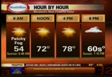
looking at temperatures ranging from 56 degrees right now. 58 there. 54 on the eastern shore in chester town. mostly sunny sky. the high reaches 78 this afternoon. our traffic update now with kim brown. >> thanks justin. this morning we have traffic jammed across the interloop span on the key bridge and only one lane getting by at this time. expect a delay there. a struck pedestrian at ritchie highway and 9th avenue. no delays or problems there. that is a five minute trip. about a 3 men it right there. no issues on the top side. you're going to see traffic moving pretty well here. no issues on the harriersburg expressway on warren road. traffic looks pretty good. megan and jamie back to you. >> if you went to bed and you didn't know who won the race for top prosecutor, things look good for burnstein but we still don't know who won. linda. >> reporter: even though it looks like burnstein has won, an cen tee ballots have not been counted and they will be the deciding factor in this race. both camps say they will regroup this morning to look over the results. burnstein has 49% of the vote. 1400
looking at temperatures ranging from 56 degrees right now. 58 there. 54 on the eastern shore in chester town. mostly sunny sky. the high reaches 78 this afternoon. our traffic update now with kim brown. >> thanks justin. this morning we have traffic jammed across the interloop span on the key bridge and only one lane getting by at this time. expect a delay there. a struck pedestrian at ritchie highway and 9th avenue. no delays or problems there. that is a five minute trip. about a 3 men...
180
180
Sep 25, 2010
09/10
by
WMAR
tv
eye 180
favorite 0
quote 0
chester town to 92. and millersville to 96. these are hot, hot numbers. over to dover where the big race is coming up 97 there. hot day on the track. 98 toward virginia. even tonight still warm balming and muggy out there. and we will not see this change a lot until the winds begin to shift northwest. that won't happen until we get into the day tomorrow. from a timing standpoint it will take awhile. warm air mass over the east coast. here is the leading edge of cooler air that will help us out as we go into the afternoon tomorrow and certainly into sunday. much cooler air will arrive around this boundary we see draped across the western pa and western virginia. another warm muggy night you have to run the ac. and back to the north and west cooler air on the marsh. you really will notice it tomorrow night into sunday. it's going to be a little delayed effect. that front coming through to the day tomorrow. a dry day. partly cloudy skies. into the day on sunday i think partly to mostly cloudy. a slight chance of a shower sneaking in as we go into sunday nigh
chester town to 92. and millersville to 96. these are hot, hot numbers. over to dover where the big race is coming up 97 there. hot day on the track. 98 toward virginia. even tonight still warm balming and muggy out there. and we will not see this change a lot until the winds begin to shift northwest. that won't happen until we get into the day tomorrow. from a timing standpoint it will take awhile. warm air mass over the east coast. here is the leading edge of cooler air that will help us out...
190
190
Sep 16, 2010
09/10
by
WMAR
tv
eye 190
favorite 0
quote 0
about a fifth of an inch to close to half an inch from harbor grey to chester town and back through. all right. let's show you the highs today. man what a difference, out west, 68, 67, on the eastern shore close to the mid-80s, southern maryland up to 90 today including d.c. right now we have cooled off dramatically with the showers, the rains and the storms. we take you out to the entire region, you can see this particular cluster of showers and storms, this little area of low pressure sliding northeastward. the whole ball of wax will push out of here into the day tomorrow. stay a little murky overnight. could be a little murky in the morning as well. the chance for a hit or miss shower, i think we'll dry out by tomorrow midday, sunshine around, that sun is going to last into saturday and especially on into sunday. again this whole system pulling out rapidly into the northeast as we go through the next 24 hours here. then out to hurricane alley we go, you can see hurricane igor, still a powerhouse hurricane packing winds to 125 miles per hour, expected to go right up very close to b
about a fifth of an inch to close to half an inch from harbor grey to chester town and back through. all right. let's show you the highs today. man what a difference, out west, 68, 67, on the eastern shore close to the mid-80s, southern maryland up to 90 today including d.c. right now we have cooled off dramatically with the showers, the rains and the storms. we take you out to the entire region, you can see this particular cluster of showers and storms, this little area of low pressure sliding...
172
172
Sep 22, 2010
09/10
by
WMAR
tv
eye 172
favorite 0
quote 0
where we ended up only into the upper 70s so a very seasonable day, bel air to 79, clayburg to 77, chester town to 76. state-wide today, a little warmer to our south and west, down here in northern virginia there were some 80s, most of us hanging out in the 70s. tomorrow mid-to upper 80s, sun plus a lot of sunshine going to help that happen. we're cool but not as cool as this hour last night. yesterday we were close to 40 degrees, buy wind tonight have quieted down, and they are going to be out of the south tonight. south breeze helping to keep us a little warmer. south wind kicking in stronger tomorrow, clear skies tomorrow and into the day, a lot of sunshine, the bottom line is we do have some back to weather, back across chicago moving the to detroit. but high pressure, keeping the dry air around, keeping us clear, that southerly wind flow will keep us up tomorrow as the high moves east. that disturbance kicks south, it will bring us a chance for showers into tomorrow night. it's going to take a while to happen. our forecast model showing you we'll that have chance for a line of showers to d
where we ended up only into the upper 70s so a very seasonable day, bel air to 79, clayburg to 77, chester town to 76. state-wide today, a little warmer to our south and west, down here in northern virginia there were some 80s, most of us hanging out in the 70s. tomorrow mid-to upper 80s, sun plus a lot of sunshine going to help that happen. we're cool but not as cool as this hour last night. yesterday we were close to 40 degrees, buy wind tonight have quieted down, and they are going to be out...
210
210
Sep 24, 2010
09/10
by
WMAR
tv
eye 210
favorite 0
quote 0
chester town, it 0, just hot hot numbers. and throughout the state today we saw very hot temperatures easton 91, we had to go through deep creek lake to find much cooler air than that. still in those mid-70s, probably don't cool down much before 70, start off close to 70, get a 25-degree warm up or so that's going to get you in the mid-90s, kind of high. a little bit of a humidity bloom coming from the south. actually two different cool fronts, our trend is so clear tonight, yet a warm night too, and into the day tomorrow we're looking for a rapid warm up, mostly sunny skies, our storm track right now is out then across the great lakes well north of us. we're sitting clear here in maryland back down toward the carolinas. that is going to have high pressure off the carolinas, warm air wrapping around this thing, that's going to continue another day. this boundary stalled out and will probably actually shift northward tomorrow a as a warm front before the back front slides in as a cold front tomorrow evening. but as we look at
chester town, it 0, just hot hot numbers. and throughout the state today we saw very hot temperatures easton 91, we had to go through deep creek lake to find much cooler air than that. still in those mid-70s, probably don't cool down much before 70, start off close to 70, get a 25-degree warm up or so that's going to get you in the mid-90s, kind of high. a little bit of a humidity bloom coming from the south. actually two different cool fronts, our trend is so clear tonight, yet a warm night...
106
106
Sep 30, 2010
09/10
by
WMAR
tv
eye 106
favorite 0
quote 0
chester town and centreville. so as we go through time you're definitely going to see things winding back up t flood warnings are in effect still and they'll continue to do so because we just have it for everywhere. what we're really concerned with is the fact that we do have high tide coming in here. so as we check that out in the fell's point that comes in at 12:53 in the morning and annapolis at 11:14 this evening, with that southerly know, oh yes, we're going to definitely get that push of moisture of water coming across the area. even more water. so here is a look at your satellite radar, you can see some of the rain starting to come in, testify research rain, this is what we're getting right now, this first rain here, then this next wave. i don't even want to say the first wave because we have had waves all morning long. areas of low pressure, little disturbances riding along an old frontal boundary, you're going to couple in the remnants of nicole so we have lots of moisture coming in here and we had this n
chester town and centreville. so as we go through time you're definitely going to see things winding back up t flood warnings are in effect still and they'll continue to do so because we just have it for everywhere. what we're really concerned with is the fact that we do have high tide coming in here. so as we check that out in the fell's point that comes in at 12:53 in the morning and annapolis at 11:14 this evening, with that southerly know, oh yes, we're going to definitely get that push of...
193
193
Sep 17, 2010
09/10
by
WMAR
tv
eye 193
favorite 0
quote 0
over toward chester town there. highs today, what a range it was, 57 for a high in hagerstown, inner 6, it was also about 90. right now temperatures into the mid-and upper 6 '0s with the clouds around holding tough and also again on second round of rain, the main round through. one more cluster of showers and these storms are weakening a bit. breaking up. a little more over night, behind that line, not much out there, drier and milder conditions out there. i should continue to eject out to the north and east as we run through the overnight hours. tomorrow during the day these showers clear, tomorrow during the day we maybe have a drizzle in the morning, patchy fog, then we dry it outright tomorrow night right through the weekend. fantastic looking weather. the only big weather concern through the weekend is going to be out here in the tropics not from julia, small hurricane now, hurricane igor still a category 3 tracking right toward bermuda as we work into the second half of the weekend so we're going to watch that
over toward chester town there. highs today, what a range it was, 57 for a high in hagerstown, inner 6, it was also about 90. right now temperatures into the mid-and upper 6 '0s with the clouds around holding tough and also again on second round of rain, the main round through. one more cluster of showers and these storms are weakening a bit. breaking up. a little more over night, behind that line, not much out there, drier and milder conditions out there. i should continue to eject out to the...
164
164
Sep 23, 2010
09/10
by
WMAR
tv
eye 164
favorite 0
quote 0
, high 91 out at el cut city, the hot side, spots 90 plus, 90 chester town, pushed '09 up toward elktongaithersburg you sure got into the mid-90s today. temperature-wise fallen off some, mid-80s, bottom line temperature-wise, warm warm evening out there, going to stay in the 80s for another couple hours, warm out to the west. back through hagerstown. temperatures not cooling off dra hatically, dulles still at 90, humidity high but getting higher as we get into the day tomorrow, hotter and even a little muggier. all right. he index values feeling like 95 in in richmond, 59 norfolk. hot, that's the theme. keep that goin' one more day tomorrow. finally temperatures begin to head down saturday especially sunday into monday. in the meantime we've got this hot air mass in place and it really not going to shift very quickly. you can actually see the jet stream riding north of that giant area of high pressure which is centered right over the carolinas and really just off the north carolina actually and as this thing just sits there the boundary with the cooler air bottled up to the north is goi
, high 91 out at el cut city, the hot side, spots 90 plus, 90 chester town, pushed '09 up toward elktongaithersburg you sure got into the mid-90s today. temperature-wise fallen off some, mid-80s, bottom line temperature-wise, warm warm evening out there, going to stay in the 80s for another couple hours, warm out to the west. back through hagerstown. temperatures not cooling off dra hatically, dulles still at 90, humidity high but getting higher as we get into the day tomorrow, hotter and even...
318
318
Sep 25, 2010
09/10
by
WBAL
tv
eye 318
favorite 0
quote 0
chester town is at 73. it is 70 in colombia. it is down to 59 in pittsburgh. chicago is at 53.inneapolis is that 46 -- 46. the front will move further south. as it does that, it will swing the wings are around. the front will go down to near norfolk. we will not get into the really chilly air. each of those waves that, it will throw some moisture our way. that is not in today's forecast. today, we will see a lot of sunshine. on unseasonably warm weather will continue. 83 degrees to 87 degrees is the high. lisa, you have a hurricane named after you. it is way out in the atlantic. that is hurricane lisa. it will stay out over the atlantic ocean. what is left of matthew is over central america. it will be causing problems there. it looks like another storm will be headed for the gulf of mexico later into the week and next weekend. right now, we're looking at brain chances of coming in on sunday. the best chance for rain will be on monday and tuesday. there could be some pretty good rain. our forecast is 85 today, 71 tomorrow. monday and tuesday, we have a rain chance. the chances
chester town is at 73. it is 70 in colombia. it is down to 59 in pittsburgh. chicago is at 53.inneapolis is that 46 -- 46. the front will move further south. as it does that, it will swing the wings are around. the front will go down to near norfolk. we will not get into the really chilly air. each of those waves that, it will throw some moisture our way. that is not in today's forecast. today, we will see a lot of sunshine. on unseasonably warm weather will continue. 83 degrees to 87 degrees...
213
213
Sep 19, 2010
09/10
by
WBAL
tv
eye 213
favorite 0
quote 0
starting out in the mid-50's this morning, 65 in chester town. if we show you the satellite picture even see the high, thin cloud of was referring to. there were some sprinkles a couple of hours ago in the mountains, but they have dissipated. there is a cold front coming out of the great lakes right now that will the through later tonight and if this front comes through we will have a chance for showers to pass by. as this front comes through some of those offering showers will likely pull together in eastern maryland. high pressure blocking all of this from coming in right now, we should windup with a quiet day as we get into the evening. first, a quick update on hurricane igor. still a category one storm, sustained winds of 88 miles per hour. it looks like the guy is going to make a direct hit on the island. since it is a category one storm, we are not expecting catastrophic damage. if it had made landfall a couple of days ago it would have been a huge problem, but they will get a huge storm surge. ocean city, there could be some big waves and
starting out in the mid-50's this morning, 65 in chester town. if we show you the satellite picture even see the high, thin cloud of was referring to. there were some sprinkles a couple of hours ago in the mountains, but they have dissipated. there is a cold front coming out of the great lakes right now that will the through later tonight and if this front comes through we will have a chance for showers to pass by. as this front comes through some of those offering showers will likely pull...
128
128
Sep 23, 2010
09/10
by
WMAR
tv
eye 128
favorite 0
quote 0
down toward our south in arnold in eastern shore, chester town, 76 degrees. 74 in baltimore. one of the warmest reading across the mid-atlantic you will notice again a fair amount of sunshine. clouds seem to be dispersing this morning. this is a distinct line that appeared to be along skyline drive, in virginia. much like yesterday, when we were following some of these storms, the typical idea is they stay to the west or the better shot would be to the west. a few people had been saying how they were watching those rain bands. a company of -- a couple of showers coming out of there, damage reports with two storms yesterday. another cluster developed around dc, and there may be a repeat that have. the atmosphere does like to repeat itself, sometimes. there is a chance as we head into this afternoon, and tomorrow afternoon as well, we are pushing the upper 80s to lower 90s. not as much computer model support. there will be a cold front that will swing in and bump heat out of the air. the will diminish the heat and really settle things out for a decent weekend. next week could b
down toward our south in arnold in eastern shore, chester town, 76 degrees. 74 in baltimore. one of the warmest reading across the mid-atlantic you will notice again a fair amount of sunshine. clouds seem to be dispersing this morning. this is a distinct line that appeared to be along skyline drive, in virginia. much like yesterday, when we were following some of these storms, the typical idea is they stay to the west or the better shot would be to the west. a few people had been saying how...
193
193
Sep 21, 2010
09/10
by
WBAL
tv
eye 193
favorite 0
quote 0
chester town is at a very nice 74 degrees. western maryland is starting to warm up.number is way out of white, probably eight of the thermometer. warmer air is coming in from the west in the mntains are just as warm as we are. is a good sign we will heat up tomorrow. but mostly clear skies tonight, a lice -- a nice southerly breeze will keep it down. the wind will be the key tomorrow. and will bring in more humidity. the wins will be coming about the gulf coast region. it will feel like summer time even though tomorrow evening is the official start of fall. this front will also be inching in. you can see those bright clouds on the front. some of those thunderstorms may develop tomorrow afternoon. the friend then dissipates in the heat and humidity returns into thursday and friday. a couple of days of the feeling like summer trying to continue. 84-89 degrees tomorrow with a 30% chance of a thunderstorm. winds will be testing out of the south at about 20 knots in the afternoon on the day. there is a small craft advisory. a thunderstorm is likely on deer creek tomorrow.
chester town is at a very nice 74 degrees. western maryland is starting to warm up.number is way out of white, probably eight of the thermometer. warmer air is coming in from the west in the mntains are just as warm as we are. is a good sign we will heat up tomorrow. but mostly clear skies tonight, a lice -- a nice southerly breeze will keep it down. the wind will be the key tomorrow. and will bring in more humidity. the wins will be coming about the gulf coast region. it will feel like summer...
210
210
Sep 23, 2010
09/10
by
WTTG
tv
eye 210
favorite 0
quote 0
the lightning, and you can see the last of the shores crossing not too far from the bay bridge, chester town to dover, everything moving east rapidly. and you can see it on true view as we put it into motion here. nothing behind it, but check out the temperatures today, because 95 degrees was our high temperature, it was very hot and humid, in fact we tied a record in dulles, 94 was also set in 1980. i wish i could tell you these storms were bringing in cooler air for the first full day of fall. the front that triggered them won't move through tonight. i'll let you know if we have storms to chase tomorrow too, shawn and brian . >>> another big story we're following tonight, a navy seal from our area killed in afghanistan. brendon loony grew up in montgomery county. he was a star athlete in high school, went to the naval academy and then to war. bob barnard is here with the story, bob. >> reporter: central to the story of brendan loony, for his large silver spring family, love of country has now taken a terrible toll. >> 10-hut. >> get back, get back. >> reporter: at their practice field in r
the lightning, and you can see the last of the shores crossing not too far from the bay bridge, chester town to dover, everything moving east rapidly. and you can see it on true view as we put it into motion here. nothing behind it, but check out the temperatures today, because 95 degrees was our high temperature, it was very hot and humid, in fact we tied a record in dulles, 94 was also set in 1980. i wish i could tell you these storms were bringing in cooler air for the first full day of...
281
281
Sep 23, 2010
09/10
by
WMAR
tv
eye 281
favorite 0
quote 0
, at least compared to the 40s and the chill we had earlier in the weak. 70 in aberdeen. 73 in chester townance of afternoon thunderstorms once again, probably after 4:00 or 5:00 until 8:00 or 9:00 tonight. if you see rain, good chance you'll see fog at daybreak. we won't break the heat pattern, we'll talk more about that on "good morning maryland" at 9:00. >>> thanks, justin. 70 eastbound is a slow right from the columbia pike as you approach the beltway. however the west side of the beltway slow on both loops this morning. slow from 95 up to security and then further on from security to risers town road. the outer lanes looking better. as we look at our maps though, we have a couple of incidents working northbound on the gw parkway. a crash is blocking the right lane and shoulder. also beaver dam road continues to be closed in both directions between warren. and in monkton, blue mount road and wesley chapel road. expect some delays. >>> "good morning maryland" is next at 9:00 a.m. [ music throughout ] [ male announcer ] looking for a complete picture of your money? meet pnc virtual wallet
, at least compared to the 40s and the chill we had earlier in the weak. 70 in aberdeen. 73 in chester townance of afternoon thunderstorms once again, probably after 4:00 or 5:00 until 8:00 or 9:00 tonight. if you see rain, good chance you'll see fog at daybreak. we won't break the heat pattern, we'll talk more about that on "good morning maryland" at 9:00. >>> thanks, justin. 70 eastbound is a slow right from the columbia pike as you approach the beltway. however the west...
677
677
Sep 30, 2010
09/10
by
WRC
tv
eye 677
favorite 0
quote 0
this is the storm here over western kent county on the chesapeake bay and it's west of chester town heading rain from time to time in the afternoon hours and then taper off and dry for the weekend. >>> coming up next, melissa and jeremy g married live here on the plaza. first, this is "today" on nbc. right here in this neighborhood, i grew up learning strong familieand hard work means opportunity. and that starts with good schools. it's a tradition here in maryland-- and why these tough times i've put education first. we've made record invements in our classrooms... doubled the number of charter schools... and we've frozen college tuition for four years in a row. and it's working. experts sawe nowave the number one schools in the nation. when it comes to expanding opportunity in eve neighborhood, i know that we must do even better. ♪ the turn will make you think. ♪ make you re-exame your approach. change your line. innovate. and create one of the world's fastest-reacting suspensions, reading the road 1,000 timeper second. it's the turn that leads you somewhere new. introducing the new 11 ct
this is the storm here over western kent county on the chesapeake bay and it's west of chester town heading rain from time to time in the afternoon hours and then taper off and dry for the weekend. >>> coming up next, melissa and jeremy g married live here on the plaza. first, this is "today" on nbc. right here in this neighborhood, i grew up learning strong familieand hard work means opportunity. and that starts with good schools. it's a tradition here in maryland-- and why...
265
265
Sep 15, 2010
09/10
by
WMAR
tv
eye 265
favorite 0
quote 0
chester town 54 degrees. basically clear skies. maybe a few high clouds in the afternoon.r system holds off until thursday and friday. enjoy today with a pleasant 78. >> i don't think the traffic is pleasant. >> we have heavy volume and slow going around the beltway on the west side at liberty road. it is moving around the loop but a stop and go situation. >> a major accident in pasadena has that closed. police are on the scene there. we're working a crash and an accident downtown at utah and lombard streets. here is megan. >> good morning. if you went to bed last night and you didn't know who won the race for the top prosecutor things look good for burnstein. he was leading by 1400 votes but we don't know who won due to absentee ballots. another close race, going to be kevin, however neither side has declared victory nor conceded. go to abc 2.com. have a great morning. diabetes testing? it's all the same. nothing changes. [ man ] then try this. new and improved freestyle lite® blood glucose test strip. sure, but it's not gonna -- [ beep ] wow. [ man ] yeah, that's the pat
chester town 54 degrees. basically clear skies. maybe a few high clouds in the afternoon.r system holds off until thursday and friday. enjoy today with a pleasant 78. >> i don't think the traffic is pleasant. >> we have heavy volume and slow going around the beltway on the west side at liberty road. it is moving around the loop but a stop and go situation. >> a major accident in pasadena has that closed. police are on the scene there. we're working a crash and an accident...
245
245
Sep 22, 2010
09/10
by
WMAR
tv
eye 245
favorite 0
quote 0
pushing 70 in chester town. overall, clear skies.orms and showers along a cold front across the great lakes. that'll slowly build in our direction. building in true heat. temperatures in the 90s across the deep south yesterday. we'll probably aim for about 87 this afternoon. we'll increase the clouds, small chance for an isolated thunderstorm. especially towards carroll frederick and southern pennsylvania. >> traffic is going to be moving slow, pretty much everywhere this morning as you approach the beltway coming eastbound on i-70. those delays begin to jam well before columbia pike. looking at the beltway, outer loop lanes, extremely slow going, about a 3-minute delay from bel air road towards york road this morning. we still have that accident, 70 uh, westbound as you approach woodvine road. route 94. overturned tractor-trailer continues to block the two right lanes. in baltimore city, we're working an accident at north broadway and lafayette. crash at green spring avenue and valley road. 12 minutes on the top side. keep that in m
pushing 70 in chester town. overall, clear skies.orms and showers along a cold front across the great lakes. that'll slowly build in our direction. building in true heat. temperatures in the 90s across the deep south yesterday. we'll probably aim for about 87 this afternoon. we'll increase the clouds, small chance for an isolated thunderstorm. especially towards carroll frederick and southern pennsylvania. >> traffic is going to be moving slow, pretty much everywhere this morning as you...
185
185
Sep 14, 2010
09/10
by
WUSA
tv
eye 185
favorite 0
quote 0
town. an win chester right now our warm spot at 69 we could have some gusts over 20 miles an hour briefly.at. 2984 is closed between florence and old annapolis. it will be like this until 9:00 a.m. going both directions not going to access that route. 270 northbound, watch for roadwork at falls road. southbound all clear to the split. and finally the peltway in virginia, more construction to look out for the the inner loop near the braddock road exit and route 7 and the dulles toll road. back to andrea. >> thank you, angie. >>> the muslim leader behind a plan to build a islamic center at the world trade center site say he has a solution to the controversy but hasn't made public what he plans to do. randall pinkston has the latest from lower manhattan. >> reporter: there could be a compromise over the islamic culture center near block of ground zero. >> we are exploring all options as we speak right now. we are working through what will be a solution. >> reporter: imam says his solution will diffuse the crisis but did not offer details. critics say the center would be too close to the site
town. an win chester right now our warm spot at 69 we could have some gusts over 20 miles an hour briefly.at. 2984 is closed between florence and old annapolis. it will be like this until 9:00 a.m. going both directions not going to access that route. 270 northbound, watch for roadwork at falls road. southbound all clear to the split. and finally the peltway in virginia, more construction to look out for the the inner loop near the braddock road exit and route 7 and the dulles toll road. back...
 Live Music Archive
 Librivox Free Audio
 Metropolitan Museum
 Cleveland Museum of Art
 Internet Arcade
 Console Living Room
 Open Library
 American Libraries
 TV News
 Understanding 9/11