166
166
May 10, 2011
05/11
by
KTVU
tv
eye 166
favorite 0
quote 0
little patchy fog down towards monterey peninsula and maybe santa cruz but in the monterey bay. beautiful monterey peninsula. everything is clear. 40s napa airport was down to 37. but the wind picked up. now they're 42. we have livermore sleeping in. they missed their alarm. 48 concord. 47 fairfield. 49 san jose. clear skies just looking at the web camera from the meteorology department there san jose state looking at san jose proper. clear. had a lot of low clouds. yesterday's system moving into the north. fog won't play into the forecast until tomorrow. we had the cool low drop into nevada yesterday. the wrap around gave snow up in the sierra. showers clipped sacramento valley and a little bit of eastern contra costa county solano county. warm weather today and tomorrow could move in although fog could be sneaky. patchy fog mainly towards santa cruz and monterey. a little breezy. good friend of mine. little breeze. 70s inland. 60s by the coast. upper 60s mid-70s but you know we may top out today because that fog could play into the forecast tomorrow. the big news though contin
little patchy fog down towards monterey peninsula and maybe santa cruz but in the monterey bay. beautiful monterey peninsula. everything is clear. 40s napa airport was down to 37. but the wind picked up. now they're 42. we have livermore sleeping in. they missed their alarm. 48 concord. 47 fairfield. 49 san jose. clear skies just looking at the web camera from the meteorology department there san jose state looking at san jose proper. clear. had a lot of low clouds. yesterday's system moving...
202
202
May 12, 2011
05/11
by
KGO
tv
eye 202
favorite 0
quote 0
monterey bay, santa cruz, 57. monterey cool spot is 50. as you head inland, low to mid-70s. seven-day forecast, one more day of warming temperatures and then the cold front comes through and brings us the chance of showers saturday night. thunderstorms sunday and more chances of rain monday, tuesday and wednesday with temperatures well below average away from the coast. good morning, frances. >> so we have eastbound 4 completely shut down in antioch from leverage out to sommersville. there are detours in place. it's only 20 minutes. westbound direction great as you make your way towards concord. here is a live shot of the san mateo bridge, no trouble across the span. 880 is looking all along the east bay as well as 101 on the peninsula. check out the south bay for you. that is northbound 280. i'm not sure if we see highway 17 across the screen. in the north bay, it's looking great for the drive on 101 through san rafael. traffic is southbound moving well out of novato. >> america's credit card is about to run out of money. why time is running out for congress. >> and answers
monterey bay, santa cruz, 57. monterey cool spot is 50. as you head inland, low to mid-70s. seven-day forecast, one more day of warming temperatures and then the cold front comes through and brings us the chance of showers saturday night. thunderstorms sunday and more chances of rain monday, tuesday and wednesday with temperatures well below average away from the coast. good morning, frances. >> so we have eastbound 4 completely shut down in antioch from leverage out to sommersville....
249
249
May 24, 2011
05/11
by
KGO
tv
eye 249
favorite 0
quote 0
around the monterey bay, breezy and 61 in monterey. then we hit the mid-60s in salinas. 70 at santa cruz. heading farther inland, low to mid-70s for hollister, morgan hill. accuweather seven-day forecast -- this time tomorrow we'll be watching rain on the live doppler 7 h.d. moving in the north bay. most of lus get light rain in the morning and afternoon hours. once that passes, it's dry. cooler than average all the way through the end of the holiday weekend. good morning, frances. >> all right. we'll expect a wet ride tomorrow possibly. and also, you will need to find alternative means if you normally take the alameda harbor bay ferry. this is the second day that service has been canceled due to damage to the barge or the dock. they hope to have it fixed by tomorrow. but in the meantime, you need to consider the alameda-oakland ferry as possible alternate or bart. so far, bart and other mass transit systems report nothing delays. we still have major roadwork going on once again eastbound 4 closed loveridge to summersville. until 5:30
around the monterey bay, breezy and 61 in monterey. then we hit the mid-60s in salinas. 70 at santa cruz. heading farther inland, low to mid-70s for hollister, morgan hill. accuweather seven-day forecast -- this time tomorrow we'll be watching rain on the live doppler 7 h.d. moving in the north bay. most of lus get light rain in the morning and afternoon hours. once that passes, it's dry. cooler than average all the way through the end of the holiday weekend. good morning, frances. >> all...
271
271
tv
eye 271
favorite 0
quote 0
monterey bay, 50 in monterey bay and mid and upper 70s inland.nts game, first pitch, cool and breezy 58 dropping down to 55 degrees. clouds around the coast. some of those could spill into the bay. most of our temperatures to near 50 degrees. temperatures will drop another 4-10 degrees. it will be windy and slightly warmer and calmer with temperatures closer to average tuesday wednesday, and thursday. happy mother's day. >> happy mother's day, love you. still a major delay with "h" trains this morning. they are not saying how long but there is equipment problem, "h" train number three, major delays it is free, free day for "h" train for rider appreciation but not showing much appreciation with that delay. earlier muni delays clearing up an accident. still westbound 4 out of antioch an earlier accident clear. slow through the livermore area. a stall cleared at bagsco. and road hazard at the golden gate bridge, southbound past the toll plaza, apparently there is a sledge hammer in the center lane there. traffic isn't affected by it too much. slow t
monterey bay, 50 in monterey bay and mid and upper 70s inland.nts game, first pitch, cool and breezy 58 dropping down to 55 degrees. clouds around the coast. some of those could spill into the bay. most of our temperatures to near 50 degrees. temperatures will drop another 4-10 degrees. it will be windy and slightly warmer and calmer with temperatures closer to average tuesday wednesday, and thursday. happy mother's day. >> happy mother's day, love you. still a major delay with...
242
242
May 5, 2011
05/11
by
KOFY
tv
eye 242
favorite 0
quote 0
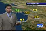
monterey bay, 56 in monterey. 72 in santa cruz and look at 80 degree temperatures gilroy and salinas.ler at the coast and the bay today.. cooling will hit everywhere tomorrow and culminate right on mother's day the coolest day in this forecast. stray shower, that is change in the forecast and yesterday it's possible but nothing to change plans on. compared to yesterday, we are slightly cooler, inland, one cord, 1 degree cooler, fremont 3 and closer you get to the golden gate bridge where the colder air is going to funnel through, the cooler you are compared to yesterday. oakland 90, and san francisco 10. these temperatures are still running well above average. mid to upper 80s in most of east bay valleys. to 80 in castro valley and fremont. low to mid-80s in south bay with san jose around 84 degrees. mid to upper 70s on the peninsula to low 80s as hid southbound into the south bay. low to mid 60s along the coast today. near 70 downtown south fran and sausalito. mid 60s here. we'll have upper 70s to low 80s and we could hit mid-80s around santa rosa. gilroy, upper 80s but cooler as you
monterey bay, 56 in monterey. 72 in santa cruz and look at 80 degree temperatures gilroy and salinas.ler at the coast and the bay today.. cooling will hit everywhere tomorrow and culminate right on mother's day the coolest day in this forecast. stray shower, that is change in the forecast and yesterday it's possible but nothing to change plans on. compared to yesterday, we are slightly cooler, inland, one cord, 1 degree cooler, fremont 3 and closer you get to the golden gate bridge where the...
231
231
tv
eye 231
favorite 0
quote 0
monterey bay, 56 in monterey. 72 in santa cruz and look at 80 degree temperatures gilroy and salinas.ler at the coast and the bay today. still warm inland. cooling will hit everywhere tomorrow and culminate right on mother's day the coolest day in this forecast. stray shower, that is change in the forecast and yesterday it's possible but nothing to change plans on. compared to yesterday, we are slightly cooler, inland, one cord, 1 degree cooler, fremont 3 and closer you get to the golden gate bridge where the colder air is going to funnel through, the cooler you are compared to yesterday. oakland 90, and san francisco 10. these temperatures are still running well above average. mid to upper 80s in most of east bay valleys. to 80 in castro valley and fremont. low to mid-80s in south bay with san jose around 84 degrees. mid to upper 70s on the peninsula to low 80s as hid southbound into the south bay. low to mid 60s along the coast today. near 70 downtown south fran and sausalito. mid 60s here. we'll have upper 70s to low 80s and we could hit mid-80s around santa rosa. gilroy, upper 80s
monterey bay, 56 in monterey. 72 in santa cruz and look at 80 degree temperatures gilroy and salinas.ler at the coast and the bay today. still warm inland. cooling will hit everywhere tomorrow and culminate right on mother's day the coolest day in this forecast. stray shower, that is change in the forecast and yesterday it's possible but nothing to change plans on. compared to yesterday, we are slightly cooler, inland, one cord, 1 degree cooler, fremont 3 and closer you get to the golden gate...
283
283
May 27, 2011
05/11
by
KGO
tv
eye 283
favorite 0
quote 1
around monterey bay, we have monterey and inland to salinas. low 50s.y else in mid-to-upper 40s. as far as the highlights, we have fading showers and clouds. we'll see sunshine. late this afternoon. ought to be a real nice friday night sunset. all right. cool breezes. we have those all weekend. even once those stop, the extented forecast still shows no sign of summer. we are supposed to kick off summer this weekend. just not going to happen. at least as far as the weather is concerned. all right. we have upper 60s to near 70 in south bay. partly cloudy sky. cupertino 68 degrees. on the peninsula, few clouds lingering around millbrae and san mateo. a lot of sunshine elsewhere. low to mid-60s for you. at the coast, we have mid-to-upper 50s. near 60 degrees downtown, south san francisco, saucelito. then we will drop down to mid-to-upper 50s on your beaches in the north bay. over to the valley, though, we have for the most part mid-to-upper 60s. east bay shore, low to mid-60s. some of the cooler weather here. as you head to east bay, san ramon valley. and o
around monterey bay, we have monterey and inland to salinas. low 50s.y else in mid-to-upper 40s. as far as the highlights, we have fading showers and clouds. we'll see sunshine. late this afternoon. ought to be a real nice friday night sunset. all right. cool breezes. we have those all weekend. even once those stop, the extented forecast still shows no sign of summer. we are supposed to kick off summer this weekend. just not going to happen. at least as far as the weather is concerned. all...
251
251
tv
eye 251
favorite 0
quote 0
monterey bay, temperatures 49 in santa cruz, watsonville. extreme, 41 in gilroy to monterey's 50. highlights, not quite as warm today but still temperatures pretty close to average. a few more clouds along the coast. pockets of sunshine but some clouds will linger. warmest afternoon, wednesday and thursday and then we warm this weekend, complete opposite this coming weekend. cool trend will start to roll around but it will remain dry throughout the weekend. mid to upper 70s for the rest of neighbors in the east bay valleys. richmond, 67 and rest of the east bay shore low to mid 70s. doun south bay, 78 in los gatos. mid to upper 70s around the peninsula. mid 60ss and low to mid 60s in soun set. to about 71 in south san francisco. throw mid-70s in the north bay valleys. low to mid 60s and kind of breezy along your beaches. breezes around monterey, of you. low to mid-70s in santa cruz. check out the temperature in tahoe, 60 degrees at lake level. warm spot, l.a. at 88 then san diego, 87 and then palm springs at 86. quite warm down in southern california. low to mid 40s up in the nort
monterey bay, temperatures 49 in santa cruz, watsonville. extreme, 41 in gilroy to monterey's 50. highlights, not quite as warm today but still temperatures pretty close to average. a few more clouds along the coast. pockets of sunshine but some clouds will linger. warmest afternoon, wednesday and thursday and then we warm this weekend, complete opposite this coming weekend. cool trend will start to roll around but it will remain dry throughout the weekend. mid to upper 70s for the rest of...
239
239
May 20, 2011
05/11
by
KGO
tv
eye 239
favorite 0
quote 0
monterey bay, carmel to monterey, 60. if you go further inland and you can see -- farther. you can see the mid-to-upper 70s. this is at&t park. bay bridge series. a's coming across to at&t park. 7:15 the first pitch. 58 and dropping to 55. tonight clouds will be around again. not as thick as this morning. the upper 40s in north bay. low 50s for the rest of us. high pressure is still holding on to the weather it across the west coast. mild day. trough of low pressure and cooler weather. that will roll in for the weekend. let's see how much we're going to drop. two to four degrees tomorrow. again on sunday. sunday and monday. the two coolest days in the two days that will feel coolest when you factor in breezes. the breezes taper and the temperatures rise tuesday, wednesday, thursday. have a great weekend. >> accident-free. construction across the dumbarton bridge eastbound. the right lane is blocked until 6:00. enjoy the live shot of the san mateo bridge. traffic is light everywhere we go. the giants and a's game tonight, you know traffic will be really busy in and out of sa
monterey bay, carmel to monterey, 60. if you go further inland and you can see -- farther. you can see the mid-to-upper 70s. this is at&t park. bay bridge series. a's coming across to at&t park. 7:15 the first pitch. 58 and dropping to 55. tonight clouds will be around again. not as thick as this morning. the upper 40s in north bay. low 50s for the rest of us. high pressure is still holding on to the weather it across the west coast. mild day. trough of low pressure and cooler weather....
283
283
tv
eye 283
favorite 0
quote 0
monterey bay, 49 in santa cruz. gilroy the cool spot, 41. monterey at 50.o it's not going to be quite as warm today. we are so far above average, even if we cooled, it will cool back to average. clouds to the coast make it cooler in your neighborhoods but you will see from time to time. warmest afternoons right in the middle of the week. cooling and clouds will hit during the weekend. mid to upper 70s in the south bay today. san jose, 76 degrees. sunny conditions on the peninsula and real breezy through the san bruno gap. few clouds lingering around half moon bay keeping you in the mid-50s. low to mid-50s daly city and sunset district. low to mid-70s through the north bay valleys including loverdale. low to mid-50s in the north bay beaches. richmond, 57 the only area not in the mid-70s in the east bay shore. 80 as you head deeper to the east and brentwood and fairfield and around the monterey bay, breezy 62 at carmel and 66 at monterey. low to mid-70s for santa cruz and watsonville. upper 70s to 82 in gilroy. game three, 1-1 right now the team is in town. s
monterey bay, 49 in santa cruz. gilroy the cool spot, 41. monterey at 50.o it's not going to be quite as warm today. we are so far above average, even if we cooled, it will cool back to average. clouds to the coast make it cooler in your neighborhoods but you will see from time to time. warmest afternoons right in the middle of the week. cooling and clouds will hit during the weekend. mid to upper 70s in the south bay today. san jose, 76 degrees. sunny conditions on the peninsula and real...
218
218
May 18, 2011
05/11
by
KGO
tv
eye 218
favorite 0
quote 0
around the monterey bay, monterey and carmel upper 50s and stray shower around sincerely and hollister this afternoon. stray showers are possible from chico and sacramento and still have snow but the winter storm warning will expire this morning. it's interesting how much weather is going to fall around tahoe and rain around l.a. and 58. tonight, with the clearing out there, fog will form and temperatures will drop into the mid and upper 40s. we're watching this area of low pressure and extension of energy with it that is bringing us those showers and pushing them down to the south and east. all is pretty quiet. you can see the sunshine developing by noon and showers developing across the north bay, once the sun sets, here comes the warmer weather for thursday and friday and then the breezes will bring us cooler conditions saturday and sunday. have a great day. >> bay bridge toll plaza, delay free but wind advisories for benicia bridge. also looking good through berkeley. headlights moving westbound. no trouble for the north bay, commuters heading toward the golden gate bridge and anot
around the monterey bay, monterey and carmel upper 50s and stray shower around sincerely and hollister this afternoon. stray showers are possible from chico and sacramento and still have snow but the winter storm warning will expire this morning. it's interesting how much weather is going to fall around tahoe and rain around l.a. and 58. tonight, with the clearing out there, fog will form and temperatures will drop into the mid and upper 40s. we're watching this area of low pressure and...
199
199
tv
eye 199
favorite 0
quote 0
half moon bay, oakland, fremont and antioch around the monterey bay, monterey 50. 53 at salinas and mido upper 40s for watsonville a, gilroy and santa cruz. so cool and breezy today. stray shower especially across the north bay. warmest afternoon tomorrow and wednesday. another cool weekend with more rain possible. we still get some rain during the month. mid to upper 50s in the south bay. san jose, 74 degrees is average they are only 66. heading up the peninsula, dropping down to low 60s by millbrae. breezy mid to upper 50s around the coast. downtown san francisco low 50s. north bay valleys, mid to upper 50s with a stray shower sets in. 70 possible in santa rosa. upper 50s at your beaches and low to mid-50s along the east bay shore. see a few clouds develop in the north bay blow in the east bay valleys but the rain should hold off the carquinez straits. same thing with gilroy upper 50s. monterey bay, low to mid-50s. clouds will clear out. mid to upper 40s and low 40s around livermore and some of the north bay valleys. area of low pressure pulling away taking most of the cold weather wi
half moon bay, oakland, fremont and antioch around the monterey bay, monterey 50. 53 at salinas and mido upper 40s for watsonville a, gilroy and santa cruz. so cool and breezy today. stray shower especially across the north bay. warmest afternoon tomorrow and wednesday. another cool weekend with more rain possible. we still get some rain during the month. mid to upper 50s in the south bay. san jose, 74 degrees is average they are only 66. heading up the peninsula, dropping down to low 60s by...
259
259
May 12, 2011
05/11
by
KGO
tv
eye 259
favorite 0
quote 0
monterey bay, few lingering clouds around monterey, near 60 for you. inland to salinas check out morgan hill and hollister. mid-70s. pretty comfortable in most areas. speaking of comfort, at at&t park, 12:45 first pitch, sunny and breezy, 56 degrees and jump up to a game ending 60 degrees. if you are traveling around the state today you can see the sunshine breaking out all up and down the coast. we have mid-70s around sacramento and chico a sunny 64 in tahoe. to 93 in palm springs, we'll have afternoon sunshine near 70 in san diego and upper 70s in l.a. back home tonight. low to mid 40s in the valleys and mid to upper 40s for the rest of us. notice the lack of clouds as the drier cleaner air mass. that will bring us warmer weather for friday. just a tease because look what happens saturday, most of us drop ten degrees and then the showers roll in saturday night, become scattered thunderstorms for sunday and lingering chance for wet weather and cool conditions for monday, tuesday and wednesday. we could use some rain. find out if anything is unusual in
monterey bay, few lingering clouds around monterey, near 60 for you. inland to salinas check out morgan hill and hollister. mid-70s. pretty comfortable in most areas. speaking of comfort, at at&t park, 12:45 first pitch, sunny and breezy, 56 degrees and jump up to a game ending 60 degrees. if you are traveling around the state today you can see the sunshine breaking out all up and down the coast. we have mid-70s around sacramento and chico a sunny 64 in tahoe. to 93 in palm springs, we'll...
294
294
May 30, 2011
05/11
by
KGO
tv
eye 294
favorite 0
quote 0
if you are around monterey bay today, monterey around 60. breezy around the bay with mid-60 for rest of the bay and salinas. take a look at your accuweather seven-day forecast -- tomorrow is the last day of may. we have a pretty good chance of scattered showers. the chance will linger to wednesday which is june 1. it will be much less and mainly over the north bay. once we get past that, temperatures still cooler than average in the afternoon through this weekend. good morning, frances. >> good morning, mike. there is still a wind advisory for the san mateo bridge. be careful driving across the span. there are quite a few cars out on the road. but not necessarily people going to work. it seems like they were still out to the night before. the new crash has been reported in palo alto. southbound 101 at university, where a car drove right in a pole. so they are sending an bla ambulance there. the traffic is so light they're getting by without problems. holiday no, service on ace train today. a.c. transit. bart. caltrain. muni operating on a su
if you are around monterey bay today, monterey around 60. breezy around the bay with mid-60 for rest of the bay and salinas. take a look at your accuweather seven-day forecast -- tomorrow is the last day of may. we have a pretty good chance of scattered showers. the chance will linger to wednesday which is june 1. it will be much less and mainly over the north bay. once we get past that, temperatures still cooler than average in the afternoon through this weekend. good morning, frances....
206
206
May 30, 2011
05/11
by
KGO
tv
eye 206
favorite 0
quote 0
around the monterey bay. we have a stretch of 60 at monterey to 66 at watsonville. what a great day to be out at the ballpark. coliseum today, the sun shine and few clouds. 60 at 1:05 to 64 when the game ends with the yankees. almost guaranteed a good crowd out for that game. look at the rain coming down tonight with the mid-to-upper 40s in north bay valleys. rest of us in upper 40s to near 50. 7:00 in the morning. they disappeared. the high clouds in the afternoon. by 7:00, we are watching scattered showers developing around the mendocino county coast. some moving to normal part of sonoma county. better chance for overnight hours to tomorrow's commute to see scattered showers, closer to the ocean and the bay. then they will wane a little bit in the afternoon hours on tuesday. overnight, it looks quiet. other than a random shower here and there. as we head to wednesday afternoon, you can see the best chance will be up across the north bay. and by the evening hours the two fall apart. once they get past that, we see a small and i really emphasize small warming trend.
around the monterey bay. we have a stretch of 60 at monterey to 66 at watsonville. what a great day to be out at the ballpark. coliseum today, the sun shine and few clouds. 60 at 1:05 to 64 when the game ends with the yankees. almost guaranteed a good crowd out for that game. look at the rain coming down tonight with the mid-to-upper 40s in north bay valleys. rest of us in upper 40s to near 50. 7:00 in the morning. they disappeared. the high clouds in the afternoon. by 7:00, we are watching...
225
225
May 12, 2011
05/11
by
KGO
tv
eye 225
favorite 0
quote 0
near 60 in monterey and rest of the monterey bay, mid to upper 50s.gilroy and hollister. 12:45, first pitch, sunny today and breezy with 56 degrees that first pitch to about 50 pie the end. low to mid 40s up in the north bay. much cooler and mid to upper 40s for the rest of us. take a look what is going to happen. starting 8:00 this morning but here we go into saturday evening. you see the wall of water starting to move in. it tapers by sunday morning, but scattered showers for sunday afternoon with thunderstorms. summon looking a little drier than all the other days because tuesday, another system rolls in. you see the light rain developing tuesday and hang around all the way through wednesday. what an unusual pattern for may. temperatures by then will be about 10 degrees cooler than today and tomorrow except the coast where we'll be stuck if the 50s. >>> check out a live shot of bay bridge toll plaza, no delay at all. just half way through the parking lot. yesterday we had a lot of problems and accidents but right now, it looks really good. check ou
near 60 in monterey and rest of the monterey bay, mid to upper 50s.gilroy and hollister. 12:45, first pitch, sunny today and breezy with 56 degrees that first pitch to about 50 pie the end. low to mid 40s up in the north bay. much cooler and mid to upper 40s for the rest of us. take a look what is going to happen. starting 8:00 this morning but here we go into saturday evening. you see the wall of water starting to move in. it tapers by sunday morning, but scattered showers for sunday afternoon...
219
219
May 10, 2011
05/11
by
KGO
tv
eye 219
favorite 0
quote 0
monterey bay, quite a spread around monterey and carmel to 70 in santa cruz.iamondbacks in town, 58 dropping down to 55. for tonight the clouds you can see the temperatures are in the mid to upper 40s in the north bay valleys. some patchy drizzle along the coast in the east bay hills. this low is pulling out. we have an area of high pressure that is moving in today and lesser extent wednesday and thursday. by friday a cool front rolls through rather quietly but look what it does to the temperatures 10-15 degrees warmer today with showers and thunderstorms most likely sunday. very busy this morning. >> a lot of accidents. the drive time for two slow spots where there is an accident in each direction, westbound 4, lone tree way 242, 21 minutes and westbound 580 you have the accident in north livermore, 205 to 680. 26 minutes, not horrible but if you want to take mass transit, no delays. take a look outside and show you what the ride, 680 in walnut creek looking good. heading to 24 no problems in san ramon valley. san mateo bridge also looking good. drive time 14
monterey bay, quite a spread around monterey and carmel to 70 in santa cruz.iamondbacks in town, 58 dropping down to 55. for tonight the clouds you can see the temperatures are in the mid to upper 40s in the north bay valleys. some patchy drizzle along the coast in the east bay hills. this low is pulling out. we have an area of high pressure that is moving in today and lesser extent wednesday and thursday. by friday a cool front rolls through rather quietly but look what it does to the...
232
232
tv
eye 232
favorite 0
quote 0
best chance for rain is up here. 60 in monterey, mid to upper 60s in monterey bay.fairly clear and cooler than average with low to mid 40s in the north bay valleys. >> the low responsible for the breezy weekend is moving away. jetstream will move away also. in the next couple of days we will be relatively calm with high pressure and warming trend. just when we get our temperatures back to average, another cold front slams the door on that and brings us the cool weather that could see temperatures 10-12 degrees cooler and snow possible around 4,000 feet. here a frances. >> if you are heading out the vacaville area, just reported at midway, apparently a big rig is blocking a couple of left lanes. speed sensors showing only 6 miles an hour right at the scene. it's slow through the bay area approaching san pablo dam road. a concrete block was reported in the eastbound direction but i'm starting to think it's westbound because of slowing around richmond. metering lights are on. san mateo bridge is fine. no trouble across the span. looks good westbound out of hayward into
best chance for rain is up here. 60 in monterey, mid to upper 60s in monterey bay.fairly clear and cooler than average with low to mid 40s in the north bay valleys. >> the low responsible for the breezy weekend is moving away. jetstream will move away also. in the next couple of days we will be relatively calm with high pressure and warming trend. just when we get our temperatures back to average, another cold front slams the door on that and brings us the cool weather that could see...
227
227
May 26, 2011
05/11
by
KGO
tv
eye 227
favorite 0
quote 0
down around the monterey bay, 62 here. monterey. upper 60s elsewhere. low 70s as you move inland. the accuweather seven-day forecast -- a few scattered showers tomorrow morning as one more chunk of energy rolls through the atmosphere. once it passes, a breezy weekend on tap. it will be dry and temperatures will be cooler than average. getting cooler early next week. good morning, frances. >> good morning, mike, good morning, everyone. a couple of areas you need to know about where there is major roadwork going on now. one of them in the north bay on highway 37. we have both directions closed between 121 and highway 29. that is for the next 20 minutes. it should be reopened by 5:00. so if you have to head through the area, just hold off a little bit. you should be okay. because the detour is probably going to take you as long. also, eastbound 4, once again, full freeway closure. from loveridge to summersville, with a pretty easy detour in place. that is scheduled until 5:30. pick it up early. great news for the alameda harbor bay ferry riders. service is supposed to resume today af
down around the monterey bay, 62 here. monterey. upper 60s elsewhere. low 70s as you move inland. the accuweather seven-day forecast -- a few scattered showers tomorrow morning as one more chunk of energy rolls through the atmosphere. once it passes, a breezy weekend on tap. it will be dry and temperatures will be cooler than average. getting cooler early next week. good morning, frances. >> good morning, mike, good morning, everyone. a couple of areas you need to know about where there...
530
530
May 23, 2011
05/11
by
KOFY
tv
eye 530
favorite 0
quote 0
monterey bay, gilroy, watsonville, low to mid-50s. mid to upper 50s for salinas and monterey. you are about to see sunshine and warmer weather also on the satellite right there. it's going to be breezy, cooler than average. wet weather and coolest temperatures come with it on wednesday. ght now the extended looks dry. cold front for the weekend, right now most of the rain passes to the north. highs compared to average, oakland 1 degree cooler. napa, 6, san jose, 8, livermore, 9 degrees cooler than average. east bay valleys, upper 60s to low 70s for you. on the east bay shore, mid to upper 60s. looks like. around oakland and fremont is going to be as warm as it gets. los gatos possibly getting to 70. even with the sunshine at the coast, breezy mid-50s. mid 50s downtown, san rafael upper 50s through low 70s through the valleys. clouds hanging around monterey, in the 50s. mid to upper 50s for salinas. as you head deemer in hollister, upper 50s to low 60s. it will be cooler and the winds calming, mid to upper 40s to low 50s elsewhere. here is the low creating the winds, high press
monterey bay, gilroy, watsonville, low to mid-50s. mid to upper 50s for salinas and monterey. you are about to see sunshine and warmer weather also on the satellite right there. it's going to be breezy, cooler than average. wet weather and coolest temperatures come with it on wednesday. ght now the extended looks dry. cold front for the weekend, right now most of the rain passes to the north. highs compared to average, oakland 1 degree cooler. napa, 6, san jose, 8, livermore, 9 degrees cooler...
268
268
May 27, 2011
05/11
by
KGO
tv
eye 268
favorite 0
quote 0
down around the monterey bay, mixture of sunshine and clouds. 60 at monterey. upper 60s to rest of the bay. 65 in salinas. inland neighborhoods, morgan hill, gilroy and hollister, low to mid-70s. the accuweather seven-day forecast -- there is a chance of a shower. i mean it's so small. i hate to even mention it. since it's a holiday weekend, we'll put it in there, especially if you are going to be north of bay area. or in the north bay. sunday, breezy. cooler than average. then, it will be cooler than average monday, tuesday, wednesday, thursday. no rain after that. good morning, frances. you have an update? >> yeah, mike. there is a serious accident reported on the bay bridge, where they said overturned, all lanes blocked. turned out the be a spin-out. they cleared it. c.h.p. at the scene. everything is off to the city streets in san francisco. so westbound as you make your way out of oakland, no problems at all. and that means we're not going to expect much of a backup at the bay bridge toll plaza. which, of course, is really light right now. i think we'll ha
down around the monterey bay, mixture of sunshine and clouds. 60 at monterey. upper 60s to rest of the bay. 65 in salinas. inland neighborhoods, morgan hill, gilroy and hollister, low to mid-70s. the accuweather seven-day forecast -- there is a chance of a shower. i mean it's so small. i hate to even mention it. since it's a holiday weekend, we'll put it in there, especially if you are going to be north of bay area. or in the north bay. sunday, breezy. cooler than average. then, it will be...
255
255
May 16, 2011
05/11
by
KGO
tv
eye 255
favorite 0
quote 0
-- 58 in monterey. and i'm not sure they'll get the game in it will be raining on the first pitch, 56 degrees. tonight's temperature mid to upper 40s inland. upper 40s to to near 50 for the rest of us and note how the rain is more scattered in nature tonight. right now, warm front means a long duration, gradual seeking rain. cold front behind it is when we'll get more showers. here we are with the rain moving in around 5:00 and then 10:00. heaviest of the rain has still fallen. overnight it becomes more showery in nature and then tomorrow afternoon we'll see scattered showers. better push of organized weather into wednesday morning as the cold front moves through. once that passes becomes more scattered showers wednesday afternoon. temperatures will finally warm on thursday and friday back to the levels they should be. another cold front will come through this one, this one quietly and drop our temperatures saturday and sunday and won't bring us any rain, tonight through tomorrow, possibly two-thirds of
-- 58 in monterey. and i'm not sure they'll get the game in it will be raining on the first pitch, 56 degrees. tonight's temperature mid to upper 40s inland. upper 40s to to near 50 for the rest of us and note how the rain is more scattered in nature tonight. right now, warm front means a long duration, gradual seeking rain. cold front behind it is when we'll get more showers. here we are with the rain moving in around 5:00 and then 10:00. heaviest of the rain has still fallen. overnight it...
273
273
May 16, 2011
05/11
by
KOFY
tv
eye 273
favorite 0
quote 0
-- 58 in monterey. and i'm not sure tll get the game in it will be raining on the first pitch, 56 degrees. tonight's temperature mid to upper 40s inland. upper 40s to to near 50 for the rest of us and note how the rain is more scattered in nature tonight. right now, warm front means a long duration, gradual seeking rain. cold front behind it is when we'll get more showers. here we are with the rain moving in around 5:00 and then 10:00. heaviest of the rain has still fallen. overnight it becomes more showery in nature and then tomorrow afternoon we'll see scattered showers. better push of organized weather into wednesday morning as the cold front moves through. once that passes becomes more scattered showers wednesday afternoon. temperatures will finally warm on thursday and friday back to the levels they should be. another cold front will come through this one, this one quietly and drop our temperatures saturday and sunday and won't bring us any rain, tonight through tomorrow, possibly two-thirds of an
-- 58 in monterey. and i'm not sure tll get the game in it will be raining on the first pitch, 56 degrees. tonight's temperature mid to upper 40s inland. upper 40s to to near 50 for the rest of us and note how the rain is more scattered in nature tonight. right now, warm front means a long duration, gradual seeking rain. cold front behind it is when we'll get more showers. here we are with the rain moving in around 5:00 and then 10:00. heaviest of the rain has still fallen. overnight it becomes...
148
148
May 31, 2011
05/11
by
KOFY
tv
eye 148
favorite 0
quote 0
haven't seen any rain around monterey bay. everybody else around the bay and inland in the low to mid-50s 50s's. it will be dry two days, thursday and friday. looks like the big change in the forecast is going to be chilly and wet this weekend, definitely not going to feel like june. temperatures in the south bay mid to upper 60s in the afternoon hours. low to mid-50s over on the peninsula with mid to upper 50s at the coast. downtown south san francisco, right around 60 degrees. we'll be in the mid to upper 50s along the north bay beaches into sausalito with low to mid-50s in north bay valleys. this is one of the areas we'll see the stronger showers. low to mid-50s along the east bay shore with mid to 50s around the east bay valleys and monterey valley, mid-50s. for the state tonight, we'll see most of the rain will fall north of i-80. if you want heated, to go palm springs where it will be 93. for the game, mostly cloudy and 7:05 first pitch dropping down to 53. it will be cooler than this morning. we'll have mid to upper 40s
haven't seen any rain around monterey bay. everybody else around the bay and inland in the low to mid-50s 50s's. it will be dry two days, thursday and friday. looks like the big change in the forecast is going to be chilly and wet this weekend, definitely not going to feel like june. temperatures in the south bay mid to upper 60s in the afternoon hours. low to mid-50s over on the peninsula with mid to upper 50s at the coast. downtown south san francisco, right around 60 degrees. we'll be in the...
265
265
May 23, 2011
05/11
by
KGO
tv
eye 265
favorite 0
quote 0
monterey bay, gilroy, watsonville, low to mid-50s. mid to upper 50s for salinas and monterey. are about to see sunshine and warmer weather also on the satellite right there. it's going to be breezy, cooler than average. wet weather and coolest temperatures come with it on wednesday. right now the extended looks dry. cold front for the weekend, right now most of the rain passes to the north. highs compared to average, oakland 1 degree cooler. napa, 6, san jose, 8, livermore, 9 degrees cooler than average. east bay valleys, upper 60s to low 70s for you. on the east bay shore, mid to upper 60s. looks like. around oakland and fremont is going to be as warm as it gets. los gatos possibly getting to 70. even with the sunshine at the coast, breezy mid-50s. mid 50s downtown, san rafael upper 50s through low 70s through the valleys. clouds hanging around monterey, in the 50s. mid to upper 50s for salinas. as you head deemer in hollister, upper 50s to low 60s. it will be cooler and the winds calming, mid to upper 40s to low 50s elsewhere. here is the low creating the winds, high pressur
monterey bay, gilroy, watsonville, low to mid-50s. mid to upper 50s for salinas and monterey. are about to see sunshine and warmer weather also on the satellite right there. it's going to be breezy, cooler than average. wet weather and coolest temperatures come with it on wednesday. right now the extended looks dry. cold front for the weekend, right now most of the rain passes to the north. highs compared to average, oakland 1 degree cooler. napa, 6, san jose, 8, livermore, 9 degrees cooler...
227
227
May 31, 2011
05/11
by
KGO
tv
eye 227
favorite 0
quote 0
haven't seen any rain around monterey bay. everybody else around the bay and inland in the low to mid-50s 50s's. it will be dry two days, thursday and friday. looks like the big change in the forecast is going to be chilly and wet this weekend, definitely not going to feel like june. temperatures in the south bay mid to upper 60s in the afternoon hours. low to mid-50s over on the peninsula with mid to upper 50s at the coast. downtown south san francisco, right around 60 degrees. we'll be in the mid to upper 50s along the north bay beaches into sausalito with low to mid-50s in north bay valleys. this is one of the areas we'll see the stronger showers. low to mid-50s along the east bay shore with mid to 50s around the east bay valleys and monterey valley, mid-50s. for the state tonight, we'll see most of the rain will fall north of i-80. if you want heated, to go palm springs where it will be 93. for the game, mostly cloudy and 7:05 first pitch dropping down to 53. it will be cooler than this morning. we'll have mid to upper 40s
haven't seen any rain around monterey bay. everybody else around the bay and inland in the low to mid-50s 50s's. it will be dry two days, thursday and friday. looks like the big change in the forecast is going to be chilly and wet this weekend, definitely not going to feel like june. temperatures in the south bay mid to upper 60s in the afternoon hours. low to mid-50s over on the peninsula with mid to upper 50s at the coast. downtown south san francisco, right around 60 degrees. we'll be in the...
200
200
May 19, 2011
05/11
by
KGO
tv
eye 200
favorite 0
quote 0
monterey bay, we have watsonville, salinas and monterey. and the low to mid-50s. inland, gilroy, 40. santa cruz, 44 degrees. our highlights, sunshine, the warmer temperatures this afternoon. breezes to windy conditions this weekend. that will make it not as warm as today. especially saturday, sunday and monday. no mention of rain. still a slight chance of sprinkle along the coast. this is minimal, taken it out of the forecast. 24-hour temperature change. san jose, fremont and concord, four to six degrees warmer. santa rosa sees the biggest jump thanks to the 14 hours and 19 minutes of sunshine. a ten-degree increase in the afternoon temperatures today. low to mid-70s in the south bay. sunnyvale and santa clara. 71 degrees. we have the same temperatures in los altos and mountain view. northbound on the peninsula, drop to 64 on millbrae. upper 50s to near 60 along the coast with clouds and breezy conditions. we will see more sunshine around downtown south san francisco and saucelito. low to mid-60s. san rafael at 69. low to mid-70s the farther north you head. in the
monterey bay, we have watsonville, salinas and monterey. and the low to mid-50s. inland, gilroy, 40. santa cruz, 44 degrees. our highlights, sunshine, the warmer temperatures this afternoon. breezes to windy conditions this weekend. that will make it not as warm as today. especially saturday, sunday and monday. no mention of rain. still a slight chance of sprinkle along the coast. this is minimal, taken it out of the forecast. 24-hour temperature change. san jose, fremont and concord, four to...
293
293
May 24, 2011
05/11
by
KGO
tv
eye 293
favorite 0
quote 0
monterey, 61 in monterey.santa cruz and low to mid-70s for morgan hill, gilroy and hollister. the accuweather seven-day forecast -- cooler tomorrow with the rain. it's dry thursday through the holiday weekend. >> it's not bad living every day to the fullest. but you need the find a different way to get to work if you take alameda harbor ferry. the service is canceled again today due to landing on the loading barge. alameda-oakland ferry is running. that's an alternate or bart for you this morning. quite a surprise here. southbound 101 approaching vermont. the lanes have been block and trying to find out why they might be roadwork near cesar chavez. the traffic is heavy on southbound 101 near the central freeway connection. north 880 approaching thornton, an accident is partially blocking the left lane. not causing delay at this point. >> thank you. >>> 5:39 is our time. >> still ahead, social networking for your car. a new way to meet the driver next to you. "7 on your side's" michael finney shows us how it wo
monterey, 61 in monterey.santa cruz and low to mid-70s for morgan hill, gilroy and hollister. the accuweather seven-day forecast -- cooler tomorrow with the rain. it's dry thursday through the holiday weekend. >> it's not bad living every day to the fullest. but you need the find a different way to get to work if you take alameda harbor ferry. the service is canceled again today due to landing on the loading barge. alameda-oakland ferry is running. that's an alternate or bart for you this...
236
236
tv
eye 236
favorite 0
quote 1
low 50s around monterey and carmel.id-70s for the rest of the bay and upper 70s to near 80s inland. indians in town to take along the a's and indians with the best record in baseball, mid to upper 40s -- land breeze develops tomorrow that will mean high pollen count and record high temperatures. you'll notice the cooling and temperatures will drop 14-18 degrees over the weekend. >> we're checking out a live shot from the bay bridge toll plaza looking at the incline section and stall reported, third stall this morning so it's a little slow as you make your way toward the base of the incline. backed up to the overcross egg. check out the rest of the bay area, 680 still looking good. so far in contra costa county, no problems here, southbound, normal slowing out of antioch and through the altamont pass. heading back to san jose. southbound 101, tulley on-ramp, eastbound will be closed from 9:00 this morning until 2:00 this afternoon. detours are in place. use the capital expressway and northbound looking good toward santa
low 50s around monterey and carmel.id-70s for the rest of the bay and upper 70s to near 80s inland. indians in town to take along the a's and indians with the best record in baseball, mid to upper 40s -- land breeze develops tomorrow that will mean high pollen count and record high temperatures. you'll notice the cooling and temperatures will drop 14-18 degrees over the weekend. >> we're checking out a live shot from the bay bridge toll plaza looking at the incline section and stall...
219
219
tv
eye 219
favorite 0
quote 0
mid-70s for the rest of the monterey bay. look how the temperatures jump around gilroy and hollister. wrapping up a three-game series with indians, topping out about 76 when the game ends. yosemite and fresno, 93. palm springs, 99. heading to san diego, cooler at 71 and upper 80s around sacramento and chico. back home tonight, mid to upper 40s in the area. it will move inland bie and 12 degree drop and drop a couple degrees on sunday. by sunday i would say 20-22 degrees cooler than we were today and yesterday. looking like we have another incident. >> it's been a busy morning. concord, we have a stall eastbound highway 4. it's blocking the left lane. also eastbound between leverage and somersville. road work has the road closed for construction eastbound until about 5:30 this morning. detour is posted. to san leandro an accident that has been cleared. public transit is all working on time. golden gate bridge is moving well, southbound into san francisco, no problems. 80 through berkeley, looking good, toll plaza, light no pro
mid-70s for the rest of the monterey bay. look how the temperatures jump around gilroy and hollister. wrapping up a three-game series with indians, topping out about 76 when the game ends. yosemite and fresno, 93. palm springs, 99. heading to san diego, cooler at 71 and upper 80s around sacramento and chico. back home tonight, mid to upper 40s in the area. it will move inland bie and 12 degree drop and drop a couple degrees on sunday. by sunday i would say 20-22 degrees cooler than we were...
255
255
May 26, 2011
05/11
by
KGO
tv
eye 255
favorite 0
quote 0
we'll see the same kind of conditions dominate the monterey bay. monterey is 62. mid-to-upper 70s elsewhere. the accuweather seven-day forecast -- remains cooler than average and breezy throughout the weekend. holiday monday. temperatures are cooler tuesday and wednesday. good morning, frances. somehow the traffic? >> all right, mike. it's looking good. that is good news. especially for people normally taking the golden gate bridge which was a mess yesterday morning when they shut down all southbound lanes for ten minutes. right now, we see traffic is flowing well southbound. they have the usual four-lane southbound configuration now. everything looks like it's aum back to normal. we'll check out interstate 80 in berkeley. the headlights move westbound. 18 minutes as the drive-time from the carquinez bridge. no trouble right now out of vallejo. that highway 37 should be reopened now between vallejo and highway 121. it was shut down in both directions for overnight roadwork. it's also a good ride across the san mateo bridge. westbound traffic is on the right. eastb
we'll see the same kind of conditions dominate the monterey bay. monterey is 62. mid-to-upper 70s elsewhere. the accuweather seven-day forecast -- remains cooler than average and breezy throughout the weekend. holiday monday. temperatures are cooler tuesday and wednesday. good morning, frances. somehow the traffic? >> all right, mike. it's looking good. that is good news. especially for people normally taking the golden gate bridge which was a mess yesterday morning when they shut down...
190
190
May 11, 2011
05/11
by
KGO
tv
eye 190
favorite 0
quote 0
we'll see quite a bit of cooling monterey, 58. low to mid-50s elsewhere. more sunshine inland and low 70s. accu-weather seven-day forecast, temperatures hold steady the next couple of days within a couple of degrees. another cold front cools us saturday, saturday night into sunday, let the showers begin with chances of rain monday and tuesday. how often do we get three to four days of rain in may. there it is. >>> hopefully not. here is a live shot of san mateo bridge. you can see that traffic is flowing well. there is a high wind advisory. mike was talking about the onshore flow and breezy conditions out there. both hands on the wheel as you drive across the span. there is major road work going on in antioch. eastbound 34 completely closed. reverse commute directions from leverage to summersville and detours are posted around the closure. >>> it's now 4:40. >> still ahead turning up the pressure on pg&e. tests they may need to do. >> and berkeley man demands an investigation after his wife dies in thailand. >>> good morning, 4:42. live look at high defini
we'll see quite a bit of cooling monterey, 58. low to mid-50s elsewhere. more sunshine inland and low 70s. accu-weather seven-day forecast, temperatures hold steady the next couple of days within a couple of degrees. another cold front cools us saturday, saturday night into sunday, let the showers begin with chances of rain monday and tuesday. how often do we get three to four days of rain in may. there it is. >>> hopefully not. here is a live shot of san mateo bridge. you can see that...
281
281
May 19, 2011
05/11
by
KGO
tv
eye 281
favorite 0
quote 0
we have 60 at monterey. breezy, a few clouds there. mid-to-upper 60s for the rest of the bay salinas and low to mid-70s inland. look at the accuweather seven-day forecast. update for the weekend, breezy and cooler. it looks like most of the rain will as we talk about move to our north. it's taking it out of the forecast. once the wind subside look for the warmer weather tuesday and wednesday. all right. bring frances in to find out about the commute. good morning. >> good morning mike. we head to hayward where there is roadwork blocking lanes on northbound 880 from tennyson to highway 92. that is scheduled until 6:00 this morning. they usually clear it earlier. the roadwork on eastbound 82 has been completely cleared off the san mateo bridge. we have a live shot from the san mateo bridge toll plaza. eastbound traffic is fine out of san mateo. westbound also looking great out of hayward at this point. and we'll also head to the bay bridge for you. no delays at the toll plaza. amy hollyfield is out there covering the final piece of the c
we have 60 at monterey. breezy, a few clouds there. mid-to-upper 60s for the rest of the bay salinas and low to mid-70s inland. look at the accuweather seven-day forecast. update for the weekend, breezy and cooler. it looks like most of the rain will as we talk about move to our north. it's taking it out of the forecast. once the wind subside look for the warmer weather tuesday and wednesday. all right. bring frances in to find out about the commute. good morning. >> good morning mike. we...
290
290
tv
eye 290
favorite 0
quote 0
down the monterey bay we have 50s, santa cruz and monterey outside in the upper 40s gilroy and salinas the north bay valleys. 90 in ukiah record high in oakland as we head into the east bay valleys concord brentwood pleasanton lead the charge 90 degrees there. 90 in gilroy closer you get to monterey bay 85 in santa cruz about ten degrees cooler and monterey at 76. heading to the game tonight great time for baseball 7:05. indians to take on the a's. 81 dropping down to 68. we'll keep dropping down to low to 50s's and warmer than this morning, it will provide some comfortable from the heat we'll deal with today. an then high pressure will bring us that nice sea breeze winds will blow from land to ocean and keep the cool air away us from. temperatures will start cooling at the coast. coolest weather on sunday i would say 18-20 degrees cooler than today. have a great day. here is sue with updates. >> macarthur station we have a ten minute delay. if you are head to the pittsburg richmond and daly city direction expect minor delays there. accident in san jose clearly on the center divide tha
down the monterey bay we have 50s, santa cruz and monterey outside in the upper 40s gilroy and salinas the north bay valleys. 90 in ukiah record high in oakland as we head into the east bay valleys concord brentwood pleasanton lead the charge 90 degrees there. 90 in gilroy closer you get to monterey bay 85 in santa cruz about ten degrees cooler and monterey at 76. heading to the game tonight great time for baseball 7:05. indians to take on the a's. 81 dropping down to 68. we'll keep dropping...
253
253
May 18, 2011
05/11
by
KGO
tv
eye 253
favorite 0
quote 0
monterey bay and inland, 51 to 52 degrees.le today but sunny spots and warmer weather will take over more of the forecast. warmer afternoons will continue tomorrow and friday. random shower, cold front passes us to the north. it will bring more of us cooler weather than it will be a chance of shower. mid to upper 50s. east bay we could have a stray shower this afternoon. best chance will be in the north bay but with the prevailing northwesterly winds one or two may slip over but it will very light. same scenario there to a lesser extent, i think if anything develops it will slide into the valleys. mid to upper 60s with a partly cloudy sky down in the south bay. partly cloudy on the peninsula and low to mid-50s for you. mid to upper 50s and breezy along the beaches. north bay beaches, breezy, mid to upper 50s but ten degrees mid to upper 50s around the valleys and monterey bay inland, most of us in the mid to upper 60s. mid to upper 50s for you. heading to the coliseum 7:05 first pitch with cool conditions and breezy conditions
monterey bay and inland, 51 to 52 degrees.le today but sunny spots and warmer weather will take over more of the forecast. warmer afternoons will continue tomorrow and friday. random shower, cold front passes us to the north. it will bring more of us cooler weather than it will be a chance of shower. mid to upper 50s. east bay we could have a stray shower this afternoon. best chance will be in the north bay but with the prevailing northwesterly winds one or two may slip over but it will very...
496
496
May 18, 2011
05/11
by
KGO
tv
eye 496
favorite 0
quote 0
monterey bay will see mid-to upper 60s for the most part.ning showers tomorrow and afternoon clearing and mainly sunny and milder on thursday and friday. inland highs in the low to midcents. it is cloudy and breezy and cold over the weekend and chance of rain on sunday. >> thank you, spencer >> the future appears secure for a san francisco cherished piece of area. it is a memorandum of sending. it was created in 1940 and placed in city college. mexico consule general said it is a step in the right direction. >> this is how we have the with san francisco . to be in the process in which we want to show the cultural heritage of rivera here in san francisco for the benefit of the whole community. >> the agreement calls for the cultural institutions of both countries to work together to conserve the mural and encourages cultural and academic activities between united states and mexico. >> messy accident thratook place in the toururururururururr >> tonight on coffee tv 20. benefits of coffee for men. >> social media frenzy that is about to hit wal
monterey bay will see mid-to upper 60s for the most part.ning showers tomorrow and afternoon clearing and mainly sunny and milder on thursday and friday. inland highs in the low to midcents. it is cloudy and breezy and cold over the weekend and chance of rain on sunday. >> thank you, spencer >> the future appears secure for a san francisco cherished piece of area. it is a memorandum of sending. it was created in 1940 and placed in city college. mexico consule general said it is a...
237
237
May 1, 2011
05/11
by
KPIX
tv
eye 237
favorite 0
quote 0
then people in monterey our stone church dates 1794 i have to remind them 1791 someone needs to change the bull on the. they are three years younger. >> it is a wonderful place and you have the grave yard. >> cemetery, that vertigo was shot in, over 6,000 indians buried, 5,000 other people that came from the gold rush but i can walk a person through that cemetery, go to some of the grave markers that are still there and it is a virtual whose who of san francisco over 10 dissertations written on people buried the first one starts with the indians. >> tell us about that. you come from native american stock. >> yes, my ancestors are buried there. >> you like the word indian. >> i prefer the word indian i didn't hear native american until i start d high school. one of my professors pulled me aside and said andy don't do that. i didn't understand the big words indian is a term my grandmother used she self- identified as an indian, berkeley politically correct like to use native american. where were you born? >> door by pennsylvania. >> you are born in america. i tell people you are born in
then people in monterey our stone church dates 1794 i have to remind them 1791 someone needs to change the bull on the. they are three years younger. >> it is a wonderful place and you have the grave yard. >> cemetery, that vertigo was shot in, over 6,000 indians buried, 5,000 other people that came from the gold rush but i can walk a person through that cemetery, go to some of the grave markers that are still there and it is a virtual whose who of san francisco over 10...
180
180
May 23, 2011
05/11
by
KGO
tv
eye 180
favorite 0
quote 0
monterey bay, clouds lingering around monterey. 60. mid-to-upper 60s for the rest of the bay. upper 60s to low 70s inland. the accuweather seven-day forecast -- once we get past the wind, all eyes turn to wednesday's chance of rain. cooler than average weather just about every day this week. good morning, frances. >> morning, mike. you know about the wind advisories already for drive in to work. i want to show how it looks like in the rest of the bay area. we start the winds at 680 in walnut creek through contra costa county. no trouble at all as you continue southbound toward highway 24 and through the san ramon valley and sunol grade. also, check out another live shot for you. this is the north bay commute. the drive is at the limit. actually above the speed limit. this time in the morning. from santa rosa through san rafael down to san francisco. and on the peninsula, it's also pretty good if you are heading toward s.f.o.. this does look windy here as well. headlights make their way northbound to san francisco. no trouble at all in san jose. with the live shot of the 280 an
monterey bay, clouds lingering around monterey. 60. mid-to-upper 60s for the rest of the bay. upper 60s to low 70s inland. the accuweather seven-day forecast -- once we get past the wind, all eyes turn to wednesday's chance of rain. cooler than average weather just about every day this week. good morning, frances. >> morning, mike. you know about the wind advisories already for drive in to work. i want to show how it looks like in the rest of the bay area. we start the winds at 680 in...
245
245
May 18, 2011
05/11
by
KGO
tv
eye 245
favorite 0
quote 0
breezy around monterey and carmel. for the rest of the bay and mid to upper 60s as you head inland and stray shower is possible in your neighborhood also. twins are in town cool and breezy 58 degrees jumping down to 53 at the coliseum. cooler tonight mid to upper 40s in the valleys and out to the coast where we may have a lingering cloud or two. the clearing trend by 4:00 some of the showers develop in the north bay and also down around the monitored lay bay. very isolated very light just a sprinkle that will come out of those. here is the clearing trend for tomorrow morning. here is the reason we'll wake up to cooler conditions and tomorrow afternoon look at the sunshine. see what it does for the temperatures on the seven-day forecast 2-6 degrees warmer and some of the warmest days in the forecast. cooler weather for saturday and random shower on saturday and monday and tuesday will be dry and slightly warmer. >>> highway 101 and devil's slide there may be a lane blocked. traffic is still flowing well on 280 and 101 a
breezy around monterey and carmel. for the rest of the bay and mid to upper 60s as you head inland and stray shower is possible in your neighborhood also. twins are in town cool and breezy 58 degrees jumping down to 53 at the coliseum. cooler tonight mid to upper 40s in the valleys and out to the coast where we may have a lingering cloud or two. the clearing trend by 4:00 some of the showers develop in the north bay and also down around the monitored lay bay. very isolated very light just a...
209
209
May 19, 2011
05/11
by
KGO
tv
eye 209
favorite 0
quote 0
around the monterey bay and inland, low to mid-50s from monterey and salinas. cooler, gilroy at 42.50s for you. monterey and carmel near 60. we have low to mid-70s for hollister, gilroy and morgan hill. around the state today temperatures about 10 degrees warmer in the central valley. mid-to-upper 70s. fresno, sacramento. chico is 82. ten degrees warmer at tahoe. 53. 73 in yosemite. morning clouds give way to afternoon sunshine. dangerous rip currents around san diego and l.a. mid-to-upper 60s for those destinations. all right. back home tonight. you can see the clouds along the coast. some of the spilling in the bay. again, temperatures around the bay. upper 40s to low 50s. same with the coast. mid-to-upper 40s in the inland neighborhood. here is what is happening outside. look at the pull-away. almost off the screen by the time we get to what is happening right now. high pressure. you can see the ridge and the storm track heading well north. that's why that cold front is just going to sideswipe us with breezy conditions. sea breeze that will drop the temperatures back below averag
around the monterey bay and inland, low to mid-50s from monterey and salinas. cooler, gilroy at 42.50s for you. monterey and carmel near 60. we have low to mid-70s for hollister, gilroy and morgan hill. around the state today temperatures about 10 degrees warmer in the central valley. mid-to-upper 70s. fresno, sacramento. chico is 82. ten degrees warmer at tahoe. 53. 73 in yosemite. morning clouds give way to afternoon sunshine. dangerous rip currents around san diego and l.a. mid-to-upper 60s...
334
334
May 31, 2011
05/11
by
KGO
tv
eye 334
favorite 0
quote 0
we have upper 40 to low 50s around the monterey bay. upper 40s heading inland to gilroy and salinas. the showers today. thunderstorms are possible tomorrow. we'll get a break. it will be dry and still cooler than average thursday and friday. check this out for the weekend. record rain. it's possible. it will be cooler this weekend. probably than it will be today. today is one of the coolest days in the forecast. low to mid-60s. we'll jump up to the mid-to-upper 60s in the south bay this atch. as we head to the peninsula, we have the low to mid-60s here. mid-to-upper 50s along the coast. low 60s downtown in south san francisco. mostly cloudy, the best chance of showers lingering all day in the north bay. low to mid-60s for you. mid-to-upper 50s at the beaches to saucelito. mostly cloudy along the east bay shore to low to mid-60s. we have the mid-to-upper 60s east bay and around monterey bay. we have the low to mid-60s here. mid-to-upper 60s inland. going to the game tonight. should be mostly cloudy and dry by 7:05. the yankees won last n
we have upper 40 to low 50s around the monterey bay. upper 40s heading inland to gilroy and salinas. the showers today. thunderstorms are possible tomorrow. we'll get a break. it will be dry and still cooler than average thursday and friday. check this out for the weekend. record rain. it's possible. it will be cooler this weekend. probably than it will be today. today is one of the coolest days in the forecast. low to mid-60s. we'll jump up to the mid-to-upper 60s in the south bay this atch....
279
279
May 20, 2011
05/11
by
KGO
tv
eye 279
favorite 0
quote 1
warm clouds around monterey bay to keep you in low to upper 60s. today, temperatures drop two to five degrees. drop more tomorrow and sunday. watch out for breezes sunday and monday. once the taper, look for warmer weather early next week. good morning, frances. how is the commute? >> good. i can't find any problems anywhere. starlt off with 101 and raffsan rafael. delay free to golden gate bridge. check out freeway for headlight move westbound. i takes 35 minutes from berkeley to bay bridge toll plaza. fast ride. we head to south bay. check out 101 and 880 interchange. the headlights move above the speed limit for morgan hill up the peninsula. traffic is slowing on 880 across the screen. >> thanks a lot. >>> 5:09. >> still ahead -- while right now might be the perfect time to sell your car. america's money report is next. >>> also, unabomber makes headlines again. while federal authorities look at him for tylenol poisoning of 30 years ago. >> the second grader doodle making him famous ♪it's the way you bring out the sun♪ my mom makes any day sunny
warm clouds around monterey bay to keep you in low to upper 60s. today, temperatures drop two to five degrees. drop more tomorrow and sunday. watch out for breezes sunday and monday. once the taper, look for warmer weather early next week. good morning, frances. how is the commute? >> good. i can't find any problems anywhere. starlt off with 101 and raffsan rafael. delay free to golden gate bridge. check out freeway for headlight move westbound. i takes 35 minutes from berkeley to bay...
235
235
May 30, 2011
05/11
by
KGO
tv
eye 235
favorite 0
quote 0
around the monterey bay, low to mid-50s for monterey, inland and salinas. the cool spot, farther inland. 42 at gilroy. start in the east bay. we talk about 70 in brentwood. that's as warm as it gets anywhere today. upper 60s for everybody else. over on the east bay shore, we have the low to mid-60s here. with san leandro and fremont. some of the warmer spots at 66. in the south bay, we have mid-to-upper 60s like 67 in san jose and saratoga. again, the temperatures are running five to ten degrees cooler than average. low to mid-60s through most of the peninsula. palo alto and the upper 60s. breezy with upper 50s along the coast, until daly city. 56 degrees today. downtown, south san francisco and saucelito. low to mid-60s. mid-to-upper 60s through the north bay valley. upper 50s at your beaches. around the monterey bay, heading to carmel and pacific grove, upper 60s. mid-50s for the rest of the bay. upper 60s to near 70 inland. is that my coffee you just brought in? thank you! thank you! all right. 60, today. yankees in town. remember it will sell out and co
around the monterey bay, low to mid-50s for monterey, inland and salinas. the cool spot, farther inland. 42 at gilroy. start in the east bay. we talk about 70 in brentwood. that's as warm as it gets anywhere today. upper 60s for everybody else. over on the east bay shore, we have the low to mid-60s here. with san leandro and fremont. some of the warmer spots at 66. in the south bay, we have mid-to-upper 60s like 67 in san jose and saratoga. again, the temperatures are running five to ten...
243
243
tv
eye 243
favorite 0
quote 0
monterey at 68, heading inland, gilroy around 90 degrees.s day to be outside the coliseum, 70 warming to 76 by the time the game is over with the indians. the clouds are banking along the coast. mid to upper 40s. here is what we're watching. this trough of low pressure, a wind shift line. you have a land breeze coming in from the east. this trough moves out over the ocean why is everybody was warmer and trough will retreat back to the east. it opens the door for the cooling sea breeze and that is why our highs will drop around the bay today. inland to the tomorrow and won't stop dropping until they lose about 20 degrees by sunday. again that slight chance of a shower monday sn and monday and dry weather tuesday and wednesday. >> so far, on the roads, very light out there. no major stalls or hot spots. we thought we would take you outside. san mateo bridge, both directions. commute is light 280 at highway 17. no delays here. just a few cars on the road. bay bridge, very minor delays, you can see a little bit of a back-up but metering lights r
monterey at 68, heading inland, gilroy around 90 degrees.s day to be outside the coliseum, 70 warming to 76 by the time the game is over with the indians. the clouds are banking along the coast. mid to upper 40s. here is what we're watching. this trough of low pressure, a wind shift line. you have a land breeze coming in from the east. this trough moves out over the ocean why is everybody was warmer and trough will retreat back to the east. it opens the door for the cooling sea breeze and that...
276
276
tv
eye 276
favorite 0
quote 0
around the monterey bay, 50 in santa cruz and watsonville. 49 in monterey. 43 in gilroy.far as the highlights, sunny and calm today with near record high temperatures. in fact in oakland, forecasting 83 degrees which would be a record for downtown. clear at some point, lows back in the 50s. compared to average, 12 degrees warmer and livermore and san francisco 14. that 83 in oakland, that is higher than 68 by 15 degrees. sl degree jump over what you should be used to today. start in the east bay valleys, some of the warmest weather, brentwood reaching 90. east bay shore, low to mid-80s. asterisk next to oakland means a record high temperature. heading into the peninsula, mid 58 owes a's dropping down to 80 in millbrae. low to mid-70s along coast, to downtown san francisco to sausalito in the upper 70s. low to mid-70s on the on north bay coast. as you head into the north bay valleys, mid to upper 80s to on the in ukiah. gilroy and morgan hill and hollister mid-80s. ally in santa cruz, that would be a record high. if playing the indians tonight, first pitch, 81 down to 68 d
around the monterey bay, 50 in santa cruz and watsonville. 49 in monterey. 43 in gilroy.far as the highlights, sunny and calm today with near record high temperatures. in fact in oakland, forecasting 83 degrees which would be a record for downtown. clear at some point, lows back in the 50s. compared to average, 12 degrees warmer and livermore and san francisco 14. that 83 in oakland, that is higher than 68 by 15 degrees. sl degree jump over what you should be used to today. start in the east...
347
347
May 31, 2011
05/11
by
KGO
tv
eye 347
favorite 0
quote 0
low to mid-60s in monterey bay and upper 60s inland.ower is possible. but mostly dry and mostly cloudy. yankees and a's. 53 degrees. chilly ward the end. tonight the temperatures are cooler. clouds will open up every once in a while. also, i should say break apart every once in a while. then open up for scattered shower. mid-you were toer 40s north bay and upper 40s for the rest of us. cold front working toward the bay area. it will scatter best chance of showers in the morning bay area wide. in the afternoon, north bay. overnight, a little lull with a stray light shower for the morning commute. bulk of the wet weather will fall again in the north bay tomorrow. few stray showers in east bay. the accuweather seven-day forecast -- it's going to be cool tomorrow with the thunderstorms. possibility of small hail. not much of a warming trend thursday and friday. though it's dry. the coolest weather with the record-setting rain saturday. and those will spill in to sunday. then it will finally be dry on monday. but, since we have the rain, why
low to mid-60s in monterey bay and upper 60s inland.ower is possible. but mostly dry and mostly cloudy. yankees and a's. 53 degrees. chilly ward the end. tonight the temperatures are cooler. clouds will open up every once in a while. also, i should say break apart every once in a while. then open up for scattered shower. mid-you were toer 40s north bay and upper 40s for the rest of us. cold front working toward the bay area. it will scatter best chance of showers in the morning bay area wide....
299
299
May 17, 2011
05/11
by
KGO
tv
eye 299
favorite 0
quote 0
around the monterey bay, 59 and low 50s for rest of the bay. for tonight, upper 40s to near 50 degrees in most neighborhoods. slight cooler up in the north bay valleys with the mid to upper 40s there. here is a look what is going on. you definitely see the swirl, counterclockwise swirl of low pressure that is sitting offshore. as long as does, it's going to steer this moisture into our neighborhood. you see the series of fronts not only today but again for tonight and tomorrow morning riding on this jetstream that will push through. once we get passed that here is the area on the left side of screen of high pressure that will bring us the brief rest pitted from the rain. behind that on the extreme left side of screen you, see the next storm system already developing. here is what we're looking at, last night through this morning. rain will taper to showers and we'll see the showers pick up especially from 5:00 on through the overnight hours. it's going to be wet again for the morning commute and watch the drying trend as we head into friday aft
around the monterey bay, 59 and low 50s for rest of the bay. for tonight, upper 40s to near 50 degrees in most neighborhoods. slight cooler up in the north bay valleys with the mid to upper 40s there. here is a look what is going on. you definitely see the swirl, counterclockwise swirl of low pressure that is sitting offshore. as long as does, it's going to steer this moisture into our neighborhood. you see the series of fronts not only today but again for tonight and tomorrow morning riding on...
202
202
May 17, 2011
05/11
by
KGO
tv
eye 202
favorite 0
quote 0
around the monterey bay, low to mid-50s. 49 at gilroy and 50 at salinas.es of showers through tonight. it will be cool and also tomorrow afternoon, threaten record cold-high temperatures once again. we get a break, wednesday afternoon, thursday and friday and cooler this weekend with more chances of rain. let's talk about is temperatures today. mid-50s and richmond and san francisco, half moon bay and you can see clearlake for the cool spot. monterey bay, inland, around the bay, upper 50s to low 60s and showers will also increase in coverage and intensity this afternoon. especially this evening. we got the game in last night. a little harder tonight with showers bringing down heavier rain. angels and a's, 57 down to 54. keep dropping down to the mid 40s in the north bay valleys. noticed the showers do taper a little bit by tomorrow morning. same thing we saw last night through this morning. series of fronts that will roll through here, those are the lifting mechanism, any time you have the cold, damp air you need something to lift it to create the showers.
around the monterey bay, low to mid-50s. 49 at gilroy and 50 at salinas.es of showers through tonight. it will be cool and also tomorrow afternoon, threaten record cold-high temperatures once again. we get a break, wednesday afternoon, thursday and friday and cooler this weekend with more chances of rain. let's talk about is temperatures today. mid-50s and richmond and san francisco, half moon bay and you can see clearlake for the cool spot. monterey bay, inland, around the bay, upper 50s to...
188
188
May 23, 2011
05/11
by
KGO
tv
eye 188
favorite 0
quote 0
in monterey bay, we have 48 in watsonville. to low 50s in santa cruz. and monterey. up toer -- to mid-50s in salinas. cool spot, gilroy, 42 degrees. the winds, yeah, they are down a little bit. we're down to 20 to 30 miles per hour gusts. most neighborhoods. so it's going to be breezy today. those breezes coming off the ocean. mean cooler than average afternoon temperatures. the wet weather, i know it's may. we can still get some rain in may. it will happen probably wednesday. it will be the coolest day in the forecast. the extented right now, looks dry. but there is another storm system that is going to clip to us the north like we had over the weekend. it's going to keep us cooler than average. mainly dry. something we'll keep an eye on. if it dips 100 miles to the south, we could talk rain again for the weekend. for today, breezy down in the south bay. about everybody in the mid-to-upper 60s. los gatos around 70 degrees. mid-to-upper 60s on the peninsula today. redwood city around 67. it will be windy at the coast with temperatures in the mid-to-upper 50s. the win
in monterey bay, we have 48 in watsonville. to low 50s in santa cruz. and monterey. up toer -- to mid-50s in salinas. cool spot, gilroy, 42 degrees. the winds, yeah, they are down a little bit. we're down to 20 to 30 miles per hour gusts. most neighborhoods. so it's going to be breezy today. those breezes coming off the ocean. mean cooler than average afternoon temperatures. the wet weather, i know it's may. we can still get some rain in may. it will happen probably wednesday. it will be the...
424
424
May 19, 2011
05/11
by
KGO
tv
eye 424
favorite 0
quote 0
the amgen continues on monterey bay. along the race route in san jose. louie abc news. >> blue sky and sun? >> that is may-like. >> it certainly is. especially this time of year . i heard you use the term ideal weather conditions. that's exactly my weather headline. high definition camera looking down on the bay. we sunny skies . a mild evening in the bay area. this image on live doppler 7 hd shows no precipitation. sunny skies have begun. we are looking on temperature readings on the mild side. it is low to mid-60s and upper 50s right on the bay and coastline. >> these are the highlights. sunny and warmer than today . dry weather through the weekend. >> this afternoon, we had a mix of clouds and sun . the sun became the dominant feature by the end of the day . we saw a few clouds left and lots of sunny light. >> high pressure is building in now and becoming the controlling factor for the next several days. we'll have a dry pattern not only in the weekend but next week as well. there is a few clouds and low temperatures in the mid-to upper 40s and low to
the amgen continues on monterey bay. along the race route in san jose. louie abc news. >> blue sky and sun? >> that is may-like. >> it certainly is. especially this time of year . i heard you use the term ideal weather conditions. that's exactly my weather headline. high definition camera looking down on the bay. we sunny skies . a mild evening in the bay area. this image on live doppler 7 hd shows no precipitation. sunny skies have begun. we are looking on temperature...

 Live Music Archive
 Librivox Free Audio
 Metropolitan Museum
 Cleveland Museum of Art
 Internet Arcade
 Console Living Room
 Open Library
 American Libraries
 TV News
 Understanding 9/11