268
268
Sep 3, 2012
09/12
by
WBAL
tv
eye 268
favorite 0
quote 0
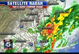
produced upwards of a half-inch of rain. now the latest on a new area of rain and out around reisterstown and even in the city itself. this is a new area that is cropping up right over the city. there you see from woodlawn back toward the inner harbor and westward toward the southeast corner of the city, a new area a shower activity moving to the northeast as well. folks concentrated in that area are getting some rain. these are the rain totals that have occurred over the area so far. we won't show you those right now, but i can tell you that upwards of an inch of rain fell in a brief time in northern baltimore county and down toward baltimore city. that is where the flood warning is in effect until 7:45 this evening. i will have more in the forecast coming up in just of the minutes. >> we are following a developing story on the chesapeake bay. >> rescue workers are scouring the waters looking for missing and boulder. officials say a 27-year-old crew member had been on board the sailing vessel called the links with the female
produced upwards of a half-inch of rain. now the latest on a new area of rain and out around reisterstown and even in the city itself. this is a new area that is cropping up right over the city. there you see from woodlawn back toward the inner harbor and westward toward the southeast corner of the city, a new area a shower activity moving to the northeast as well. folks concentrated in that area are getting some rain. these are the rain totals that have occurred over the area so far. we won't...
171
171
Sep 6, 2012
09/12
by
WUSA
tv
eye 171
favorite 0
quote 0
they got as much as six inches of rain. the country's biggest corn producer, iowa, missed out on the much needed precipitation. >> as we've got some of it here. >> yeah. >> and you know in eastern iowa, the whole state. >> that's a shame that they really need it. >> i know. sometimes you need to get the tropical storm that could be good or bad depending on their situation right now. it actually occurred here, which just devastated them in upper marlboro, eight inches of rain. in fact, some of them had not reopened yet. they needed to close it out. and one business, well, all the office supplies, they need to shut it down as they could not take a loan to pay a loan. he is going to need to shut it down. some businesses, they made it, but it has been a struggle for them in upper marlboro since the flood of last year. i mean again, eight inches of rain fell. that is about 20% of your annual rainfall in a day. that's not good. >> let's talk about it outside. this is our live weather cam. as it is very nice. especially temperature
they got as much as six inches of rain. the country's biggest corn producer, iowa, missed out on the much needed precipitation. >> as we've got some of it here. >> yeah. >> and you know in eastern iowa, the whole state. >> that's a shame that they really need it. >> i know. sometimes you need to get the tropical storm that could be good or bad depending on their situation right now. it actually occurred here, which just devastated them in upper marlboro, eight...
202
202
Sep 6, 2012
09/12
by
WBAL
tv
eye 202
favorite 0
quote 0
rain. we are -- 4/100 of an inch of rain. the grass pollens are in the moderate range. temperature wise, the rain has had an effect of that, too. they are down to 61. 78 in edgewood. 79 in westminster. in western maryland, temperatures are in the mid- 70's. here is satellite imagery showing this area of rain over our area. we are over the northwest aids in baltimore. the clouds are beginning to break up. -- we are over the northwest edge in baltimore. we could have some more storms this afternoon. a low pressure area offshore. that is helping to stir things up right now. there is another cold front out to the west. it will be coming in. between that in the heat of the afternoon, it will trigger some more thunderstorm activity. in the gulf of mexico, it is a little piece of what is left of isaac. one part of it went up into new england and another part headed down to the gulf of mexico. forecasters are watching that to see if it develops into an additional tropical feature. a lot of thunderstorms and activities south of louisiana. we also have leslie. eventually, leslie w
rain. we are -- 4/100 of an inch of rain. the grass pollens are in the moderate range. temperature wise, the rain has had an effect of that, too. they are down to 61. 78 in edgewood. 79 in westminster. in western maryland, temperatures are in the mid- 70's. here is satellite imagery showing this area of rain over our area. we are over the northwest aids in baltimore. the clouds are beginning to break up. -- we are over the northwest edge in baltimore. we could have some more storms this...
139
139
Sep 7, 2012
09/12
by
WJLA
tv
eye 139
favorite 0
quote 0
earlier today, out notion city, two inches of rain. , our entry -- alexandra, quarter of an inch of rain. that is the one that is really a hurricane. .two hurricane if you are heading out for the of that may be showing up in the north carolina and outer banks and to ocean city in the next couple of days. the dew points, that helped -- tells the story. is the indianapolis critics minneapolis -- minneapolis. tomorrow morning, when you get out, temperatures will be in the '80s. -- a.p.'s. into saturday afternoon, -- 80's. saturday on to afternoon, much more .omfortable patchy fog tomorrow as you go out and had to school. -- head to school. temperatures to mar will be close to 90 degrees. after that, temperatures dropped into the 70's. at least and monday, we can breed. a decrease in humidity. that.are excited about you. >> the orioles and yankees go to war. a brawl at national park. you think it was crowded on that at thesen floor, look president clinton: this election to me is about which... candidate is more likely to return us to full e
earlier today, out notion city, two inches of rain. , our entry -- alexandra, quarter of an inch of rain. that is the one that is really a hurricane. .two hurricane if you are heading out for the of that may be showing up in the north carolina and outer banks and to ocean city in the next couple of days. the dew points, that helped -- tells the story. is the indianapolis critics minneapolis -- minneapolis. tomorrow morning, when you get out, temperatures will be in the '80s. -- a.p.'s. into...
165
165
Sep 3, 2012
09/12
by
WUSA
tv
eye 165
favorite 0
quote 1
most of the storms north of baltimore and in the delmarva, up to 4 inches of rain there. so we are now kind of at a respite. let's start with the live look outside on our live weather cam brought to you by michael and son. it's on top of our roof here broadcast house in north west d.c. we're looking west. there's some sun, breaks in the clouds. we'll keep the chance of a shower or storm tonight, but right now we are in pretty good shape. temperature 83, that's okay. the problem is the dew points are in the 70s. that's pretty much uncomfortable. winds south, southeast at 6 and pressure 30.01 inches of mercury. satellite picture radar combined, a lot of showers and thunderstorms in the southeast, ohio valley, parts of the mid- atlantic and yes, in part that is what's left of isaac and also what's left of a frontal boundary moving north of us. that's what triggered these showers and storms. these were monsters. they were in the delmarva. now they're pushing into southern sections of new jersey. big thunderstorms back in the west virginia area, but i think they'll stay west an
most of the storms north of baltimore and in the delmarva, up to 4 inches of rain there. so we are now kind of at a respite. let's start with the live look outside on our live weather cam brought to you by michael and son. it's on top of our roof here broadcast house in north west d.c. we're looking west. there's some sun, breaks in the clouds. we'll keep the chance of a shower or storm tonight, but right now we are in pretty good shape. temperature 83, that's okay. the problem is the dew...
311
311
Sep 2, 2012
09/12
by
WJLA
tv
eye 311
favorite 0
quote 0
about print 7 inches of rain in alexandria. woodstock, are around 0.25 inches of rain. quieter conditions for the next hours or so. the bad news is showers and expected tos are overnight hours. temperatures will fall into the '60s it to middle seventies. for the bigexpect day holiday and the amount? full details coming in just a few minutes. >> thank you. it the founder of the church and owner of "washington times" has away in south korea. sun myung moon passed away due to complications of pneumonia. for his anti- stance. unification church has followers the world and gained many after decades ago holding mass weddings for people at a time. the waorf man charged in the death of a activist has struck a peace deal. -- struck a plea deal. the man's body was found in the washington, after missing a year ago. deal,hange for the plea dropped first three murder and kidnapping charges. a man now accused of a crime is same man that came at some notoriety credited for saving a life. we have that story you will only on 7. neighbors are adamant that not sound like a man they know s
about print 7 inches of rain in alexandria. woodstock, are around 0.25 inches of rain. quieter conditions for the next hours or so. the bad news is showers and expected tos are overnight hours. temperatures will fall into the '60s it to middle seventies. for the bigexpect day holiday and the amount? full details coming in just a few minutes. >> thank you. it the founder of the church and owner of "washington times" has away in south korea. sun myung moon passed away due to...
135
135
Sep 19, 2012
09/12
by
WTTG
tv
eye 135
favorite 0
quote 0
of the southwest. here's current techtures. 62 in petersburg and 61 in winchester. we did see heavy rain today. take a look at the numbers. ballenger freak, 4.22 inches of rain. hills hillsborro, over 4 inches. that rain did lead to some flooding. especially up to rd wast the frederick county area. some of the creeks overflowing their banks. we did see numerous flooded roadways. a lot of those roadways were closed. so we did see some flooding, big-time flooding back to the west. but fortunately, that is all starting to come to an end. here's where we have those showers and these are the gusty showers right here. you can see them heading into the fair fax area right around d.c. right now. and then back to the west, we're looking at the frontal boundary right now. so we'll continue to see some light to moderate rain with these. especially this ban right here down through prince william county. so you'll continue to see some of those showers. cold front sweeps on through and we see clearing skies and clearing skies mean cooler temperatures. the front moves by, hi pressure moves in rapidly tomorrow. tomorrow is going to be a pretty nice day. the sunshine, not that
of the southwest. here's current techtures. 62 in petersburg and 61 in winchester. we did see heavy rain today. take a look at the numbers. ballenger freak, 4.22 inches of rain. hills hillsborro, over 4 inches. that rain did lead to some flooding. especially up to rd wast the frederick county area. some of the creeks overflowing their banks. we did see numerous flooded roadways. a lot of those roadways were closed. so we did see some flooding, big-time flooding back to the west. but...
144
144
Sep 3, 2012
09/12
by
WBAL
tv
eye 144
favorite 0
quote 0
of rain. if you get one of the systems, you could get up to 2 inches of rain.low to mid-70s in the north. 80 in westminster. temperature will not move much today. maybe just another degree or two. down in the tropics, mrs. tropical storm leslie. this is near pr. this is a storm that we have to keep an eye on. this may brush the new england coast as we get through next weekend. showers and thunderstorms possible today. some will produce locally heavy amounts of rain. humid and temperatures in the 80's. same thing tomorrow. everybody goes back to work and school, same forecast. chance for rain goes down to 40% on wednesday. then hoping we get some dry weather at the end of the week. another system coming in right behind that with another chance for rain on saturday and sunday. >> researchers at northwestern university have developed a guide to help parents and doctors determine when a tantrum is just being part of a toddler -- being a toddler or if it is a behavior problem. researchers found most tantrums happen when a child is tired or frustrated. they also foun
of rain. if you get one of the systems, you could get up to 2 inches of rain.low to mid-70s in the north. 80 in westminster. temperature will not move much today. maybe just another degree or two. down in the tropics, mrs. tropical storm leslie. this is near pr. this is a storm that we have to keep an eye on. this may brush the new england coast as we get through next weekend. showers and thunderstorms possible today. some will produce locally heavy amounts of rain. humid and temperatures in...
142
142
Sep 3, 2012
09/12
by
WJLA
tv
eye 142
favorite 0
quote 0
city saw .10 inch of rain and our final stop, children's hospital, the jackpot, nearly 3 1/2 inches of rain since early, early this morning. fallen, more as to come. temperatures slowly falling but is thick. ir it feels soupy outside. 72 at winchester, manassas at 73, annapolis hugging the 83 mark. cooler air north and west. plenty of moisture to the west. this moisture moves its way over the next 24-48 hours and it's all the remnants of what was once hurricane isaac. in the the spin atmosphere right between st. louis and indianapolis. this moves our way. clouds will stick around all day long tomorrow with some embedded heavier showers and thunderstorms. then tuesday afternoon to tuesday night, that's when we're expecting the whole system to move overhead. abc 7, live superdoppler radar, bailey's crossroads, old town alexandria, small cell moving reagan national airport, dumping a little bit of heavier rain and it's not look for ast long but and storms to pop up early tomorrow morning throughout the entire day. temperatures will struggle to 80-degree mark due to the cloud cover and arm
city saw .10 inch of rain and our final stop, children's hospital, the jackpot, nearly 3 1/2 inches of rain since early, early this morning. fallen, more as to come. temperatures slowly falling but is thick. ir it feels soupy outside. 72 at winchester, manassas at 73, annapolis hugging the 83 mark. cooler air north and west. plenty of moisture to the west. this moisture moves its way over the next 24-48 hours and it's all the remnants of what was once hurricane isaac. in the the spin atmosphere...
244
244
tv
eye 244
favorite 0
quote 0
more than two inches of rain falling over the last 48 hours. take a look. just off to the west of hagerstown, maryland, more than six inches of rain. they had flooding there as well. radar, we've been seeing the showers make their way on through. left us with a few light scattered showers. a whole lot of clouds. over the next couple of hours, yeah, more of the same. a lot of humidity. scattered light showers for the first part of the day. 76, our temperature, with southeast wind at six miles per hour. and then as the day unfolds we'll go from patchy fogs to drenching storms for the afternoon again any time until about 2:00 or 3:00. at noontime, top out today and about 83 to 84 degrees during the afternoon. so there's your labor day forecast for you. we will see highs today in the low to mid 80s with humidity, a lot of it, and stormy conditions for the afternoon. let's hit the roads now. >> not too bad on the beltway. travel lanes are open in each directions. let's take a look at the outer loop just after georgetown pike, that accident is cleared out of the w
more than two inches of rain falling over the last 48 hours. take a look. just off to the west of hagerstown, maryland, more than six inches of rain. they had flooding there as well. radar, we've been seeing the showers make their way on through. left us with a few light scattered showers. a whole lot of clouds. over the next couple of hours, yeah, more of the same. a lot of humidity. scattered light showers for the first part of the day. 76, our temperature, with southeast wind at six miles...
257
257
Sep 6, 2012
09/12
by
WJLA
tv
eye 257
favorite 0
quote 1
72 right now -- fifth -- 0.15 inches of rain. 84 and 76, the overnight low was 10 degrees warmer than average. a quarter of an inch of rain and this is a good sign. the record high temperatures in double digits, sat back in 1954 many years before i was on the planet. i will step out while my nose bros. nothing locally, but just to the west, a heavy storm that will diminish. those are terrain-induced thunderstorms. locally, we will see clearing skies the rest of that evening. dropping into the '60s. skies clearing and we will have a nice day tomorrow. afternoon thunderstorms are a possibility. we can show you on the future cast -- clear skies. this is the big cold front. mid to late afternoon behind the front, it's going to turn cooler and less humid. it will be beautiful. check out this image. 90 tomorrow with a chance of showers and on saturday, showers and thunderstorms becoming all likely into the afternoon and evening. beautiful sunshine and low humidity. warming to the lower 80s by the middle of next week. >> that toyota sports desk, brought to you by your local 200 dealers -- mo
72 right now -- fifth -- 0.15 inches of rain. 84 and 76, the overnight low was 10 degrees warmer than average. a quarter of an inch of rain and this is a good sign. the record high temperatures in double digits, sat back in 1954 many years before i was on the planet. i will step out while my nose bros. nothing locally, but just to the west, a heavy storm that will diminish. those are terrain-induced thunderstorms. locally, we will see clearing skies the rest of that evening. dropping into the...
159
159
Sep 6, 2012
09/12
by
WTTG
tv
eye 159
favorite 0
quote 0
most between about two and six inches of rain. delaware was right in there with a bull's eye of more than seven inches of rain. so, very, very rainy day, flooding takes place to the east of us and lingering thunderstorms down through central secs and eastern parts of north carolina. let me zoom in a bit. can you see richmond got pounded with rain. if you were in spotsylvania, fredericksburg, you picked up the rain this morning and this afternoon. the temperature right now has rebounded a little bit with the sunshine and the clearing skies this afternoon. we have come down to 82 now and we were into the mid-80s and that is still dulles, mid-80s, winchester, 86 and somemer sunshine this afternoon. and in cumberland, and to 90. 87 in town and this is for the evening. a spotty and you would call it one or two thunderstorms this evening and that is by nineteen error, 10:00 and some temperatures into the 60s and comfortable conditions overnight. again, laura, some good stuff coming up and that is looks like we're going to salvage most of
most between about two and six inches of rain. delaware was right in there with a bull's eye of more than seven inches of rain. so, very, very rainy day, flooding takes place to the east of us and lingering thunderstorms down through central secs and eastern parts of north carolina. let me zoom in a bit. can you see richmond got pounded with rain. if you were in spotsylvania, fredericksburg, you picked up the rain this morning and this afternoon. the temperature right now has rebounded a little...
194
194
Sep 27, 2012
09/12
by
WBAL
tv
eye 194
favorite 0
quote 0
of rain over the last two to three days. the heavy rain has now moved out but almost two inches of rain. it's just a little dent in the drought. this is what we need, more weather patterns like this. oklahoma city towards tulsa, just a shield of rain here all the way north of mccallister. that's great news there. rain continues in southern pennsylvania. the pennsylvania turnpike is not an enjoyable ride this morning. this rain is heading for philadelphia and new jersey eventually as we go throughout your morning rush hour. as far as the forecast goes today, we're beautiful in the northern portion of the country and it's in the middle that we're dealing with the rainfall today including washington, d.c. that's a look at your national forecast and now here's a look at the weather outside your window. washington, d.c., will not see rain all day long. most of it will stay to the north of you this morning. there will be an additional chance of showers and storms later today. very warm conditions continue. dallas, texas, lorraine field, you have to wait. it doesn't seem like a big deal but two
of rain over the last two to three days. the heavy rain has now moved out but almost two inches of rain. it's just a little dent in the drought. this is what we need, more weather patterns like this. oklahoma city towards tulsa, just a shield of rain here all the way north of mccallister. that's great news there. rain continues in southern pennsylvania. the pennsylvania turnpike is not an enjoyable ride this morning. this rain is heading for philadelphia and new jersey eventually as we go...
74
74
Sep 18, 2012
09/12
by
WJLA
tv
eye 74
favorite 0
quote 1
we have seen as much as an inch of rain there. in the district, only about a 10th of an inch. right now cloudy skies and temperatures at 72 degrees. there is a heavy rain potential -- some urban flooding possible this afternoon and evening. don't drive through it. the storm this afternoon could become severe. damaging winds and isolated tornadoes will be possible. a pretty quick moving system, better weather moving in for your wednesday -- try to say that fast 3 times. but we do see cooler temperatures and the forecast as well. rain and thunderstorms, 73 at 9:00, 76 with a few thunderstorms developing by noon and strong storms by 5:00 and 79 degrees. we will have your seven-day forecast coming up in a minute but first, let's check on the wet roads. >> problems on the maryland the beltway -- just up ahead, around a curve before you get to the excess to 355 just two greens to the right get by. a lot of fire and rescue. the outer loop westbound prior to outerfor 270. it means everyone coming out of college park, please silver spring and bethesda, the early days and they will exten
we have seen as much as an inch of rain there. in the district, only about a 10th of an inch. right now cloudy skies and temperatures at 72 degrees. there is a heavy rain potential -- some urban flooding possible this afternoon and evening. don't drive through it. the storm this afternoon could become severe. damaging winds and isolated tornadoes will be possible. a pretty quick moving system, better weather moving in for your wednesday -- try to say that fast 3 times. but we do see cooler...
148
148
Sep 1, 2012
09/12
by
CNNW
tv
eye 148
favorite 0
quote 0
with it rain and relief for a part of the country in the middle of the worst drought in decades. we are talking several inches of rain from isaac. farmers are desperate for it. it may be too late. it may not be enough. here is susan candiotti with a reality now in the fields. >> reporter: with corn stalks crunching under his feet, richard goes to harvest. thanks to the summer's drought, the field corn is fried to a crisp. in blistering 90 degree heat, not much else to do but climb into the combine and mow down the stalks. >> you put a lot of money and time and effort into it. then you see no return. it's a hard thing to do. >> reporter: hard for every farmer in the midwest whose crops are virtually a total loss. this is so brittle. i mean, what is left in here? what is left in here? >> there's nothing. this one has -- it's basically died right before production. >> reporter: it's like dust. he'll salvage the little he can. maybe five bush shells of grain an acre. >> i'll turn the cows to the field. they can eat leaves and stuff like that. they won't get much. it will keep them alive for a few more days. >> re
with it rain and relief for a part of the country in the middle of the worst drought in decades. we are talking several inches of rain from isaac. farmers are desperate for it. it may be too late. it may not be enough. here is susan candiotti with a reality now in the fields. >> reporter: with corn stalks crunching under his feet, richard goes to harvest. thanks to the summer's drought, the field corn is fried to a crisp. in blistering 90 degree heat, not much else to do but climb into...
195
195
Sep 3, 2012
09/12
by
WJLA
tv
eye 195
favorite 0
quote 0
of 84 degrees. 101 in 1980. look at these rain totals on our weatherbug network. ity, 75 degrees, over 2.25 inches of rain. look at the video we have of earlier this evening and what it looked like just off new york avenue northwest around first and second street. a lot of rain fell over a very short period of time. fortunately, things are improving dramatically. station over ro by howard university. you can see the tracks covered with water. there pumpers out early this evening and had originally eight inches of water on the tracks. now it's down to about two inches according to our report earlier. 75 degrees oking at in ocean city, about .06 of an inch of rain. the jackpot for rain totals today, children's hospital in istrict, almost 3 1/2 inches since earlier this morning. temperatures have now fallen 70's, 74 degrees at dulles, winchester at 72, 73 over in martinsburg. still looking at the rotation left of isaac. you can see the spin in the atmosphere. between st. re louis and indianapolis. towards the off east over the next 48 hours. clouds stick around for the day tomorrow along with imbedded showers
of 84 degrees. 101 in 1980. look at these rain totals on our weatherbug network. ity, 75 degrees, over 2.25 inches of rain. look at the video we have of earlier this evening and what it looked like just off new york avenue northwest around first and second street. a lot of rain fell over a very short period of time. fortunately, things are improving dramatically. station over ro by howard university. you can see the tracks covered with water. there pumpers out early this evening and had...
234
234
Sep 3, 2012
09/12
by
WBAL
tv
eye 234
favorite 0
quote 0
if you happen to get underneath one of them, you could see an inch or two of rain.o stuff outside as early in the day as you can if you want to miss the thunderstorms. this is tropical storm leslie with sustained winds 60 miles per hour. you can see the computer models taken off to the north and east. maybe next weekend, that can come close to the new england shoreline. are we having microphone problems? oh. nobody could hear me talking? that was an excellent broadcast. oh, man. i'm going to start over. they just care about the forecast. variable clouds and a chance for thunderstorms. if you want to do stuff outside, the best time to do it is this morning. maybe an inch or two of rain. high temperature between 80 and 85. scattered showers and thunderstorms again tomorrow. 60% chance for rain tomorrow. 20% on thursday. friday it looks like a dry day. another system moves in on saturday into sunday. temperatures in the low to mid 80's. it will be an active 7 to 10 days here in baltimore. >> thank you. one child is dead after being attacked with a knife in their new je
if you happen to get underneath one of them, you could see an inch or two of rain.o stuff outside as early in the day as you can if you want to miss the thunderstorms. this is tropical storm leslie with sustained winds 60 miles per hour. you can see the computer models taken off to the north and east. maybe next weekend, that can come close to the new england shoreline. are we having microphone problems? oh. nobody could hear me talking? that was an excellent broadcast. oh, man. i'm going to...
607
607
Sep 17, 2012
09/12
by
WFDC
tv
eye 607
favorite 0
quote 0
by tomorrow morning, we could see as much as half an inch of rain around the area. we could pick up another three- quarters of an inch to an inch of rain with some pretty good thunderstorms tomorrow. a slight risk for severe thunderstorm activity all across the mid atlantic region. 78 today. rain chances hold off until sunset. we will pick up clouds. thunderstorms tomorrow, says the high.h79 the >> good morning. some problems coming into us. an accident near 795. no delays on 70. pulaski highway at middle river road, another accident. closures continue in the city sinkhole repair. 45 miles per hour around frederick. 11 minutes on the outer loop north and west side. here's a quick, live look at traffic. outer loop traffic is building near security. we will keep you posted on that. this is pulaski highway where it meets the beltway. watch for an accident wrapping up at pulaski highway and middle river road. that is the latest on traffic pulse 11. >> chicago public school teachers remain on strike this morning. a tentative contract deal had been reached over the weekend
by tomorrow morning, we could see as much as half an inch of rain around the area. we could pick up another three- quarters of an inch to an inch of rain with some pretty good thunderstorms tomorrow. a slight risk for severe thunderstorm activity all across the mid atlantic region. 78 today. rain chances hold off until sunset. we will pick up clouds. thunderstorms tomorrow, says the high.h79 the >> good morning. some problems coming into us. an accident near 795. no delays on 70. pulaski...
209
209
Sep 30, 2012
09/12
by
WJLA
tv
eye 209
favorite 0
quote 0
of year, 91 was a record high set back in 1986. a had some heavier rain from frederick county, md., picking 0.1 inches of rain. st a few sprinkles here and about 0.3 inches of rain hours. fternoon have cooled down dramatically. gaithersburg looking at 55 degrees. our skies will clear as high builds over head. temperatures tonight will fall the 40's and '50's as clouds begin to clear out. some patchy fog will move into their region. t cause any trouble place. be apache and then we will look for sunshine. a little closer on the doppler radar, you can see ready showers are. the showers have moved out of out of thend district. these showers will fizzle away we move to the next hour or so and are skies will begin to clear. there the clearing skies with nighttime lows in the '50s. tomorrow, the clouds will have arrived. mostly cloudy skies at that point. into rain tomorrow night tuesday. to the west may see an inch or two by the time finally clears the area. patchy fog tonight, otherwise . ear skies for tomorrow, increasing clout hours and a few to the to the rest -- west. extended outlook calls for highs near 80. th
of year, 91 was a record high set back in 1986. a had some heavier rain from frederick county, md., picking 0.1 inches of rain. st a few sprinkles here and about 0.3 inches of rain hours. fternoon have cooled down dramatically. gaithersburg looking at 55 degrees. our skies will clear as high builds over head. temperatures tonight will fall the 40's and '50's as clouds begin to clear out. some patchy fog will move into their region. t cause any trouble place. be apache and then we will look for...
194
194
Sep 19, 2012
09/12
by
WJLA
tv
eye 194
favorite 0
quote 0
over 4 inches of rain in myersville. around washington, 1-2 inches of rain. here is what is coming our way. look at the cooler -- chicago 53 degrees. they have a wave coming through. now it has all moved off. through the overnight hours temperatures will continue to tumble. by tomorrow afternoon we will be into a northwesterly wind that will bring in drier air and calmer air also. tomorrow, into the low 70's. a lot of sunshine. that will be with us into thursday. the next chance for anything will not become an until saturday. even that will be weak compared to today. partly cloudy, a breezy day when you get up and head out. temperatures into the 50's 3 + 60's. if there amount of sunrise. an outdoor recess kind of day. a lot of sunshine -- i will call it autumnal. temperatures near 70 degrees. that is the story on thursday to. temperatures get near 80 degrees. keep you posted 247 -- whenever there is big weather, we have lived blogging to keep you posted and prepared, even for tomorrow, which will be a quiet day. >> a busy day for the weather team. make sure w
over 4 inches of rain in myersville. around washington, 1-2 inches of rain. here is what is coming our way. look at the cooler -- chicago 53 degrees. they have a wave coming through. now it has all moved off. through the overnight hours temperatures will continue to tumble. by tomorrow afternoon we will be into a northwesterly wind that will bring in drier air and calmer air also. tomorrow, into the low 70's. a lot of sunshine. that will be with us into thursday. the next chance for anything...
160
160
Sep 2, 2012
09/12
by
WJLA
tv
eye 160
favorite 0
quote 0
there is hardly any rain to speak of today. 77 degrees the current temperature after a high of 80. they had just a touch of rain and about one-quarter of an inchwoodstock. earlier today. the current temperature 81. temperatures across the board will go through the evening hours, 79 with winchester still hanging onto the lower 80's, and this is cooler drier air well to the north and east of us. temperatures are only in the 60's this hour. plenty of warmth out to the west. minneapolis looking at 86 degrees. and cooler temperature in indianapolis. this is associated with isaac and it continues to spin and spin. we have cloud cover. here, you can see this, moving to the east. clouds in our forecast. tomorrow tuesday even into wednesday, and some heavier showers and thunderstorms expected during the day tomorrow, and by tuesday it will start to ease a little bit. for delmore and the beaches down into dewey some showers on the way over the next couple of hours. .the flash flood warning st. mary's county most of the raid has come to end. the futurecast bill will paint a cloudy and what future for the day tomorrow, labor day, with temperatures hoverin
there is hardly any rain to speak of today. 77 degrees the current temperature after a high of 80. they had just a touch of rain and about one-quarter of an inchwoodstock. earlier today. the current temperature 81. temperatures across the board will go through the evening hours, 79 with winchester still hanging onto the lower 80's, and this is cooler drier air well to the north and east of us. temperatures are only in the 60's this hour. plenty of warmth out to the west. minneapolis looking at...
307
307
Sep 9, 2012
09/12
by
WBAL
tv
eye 307
favorite 0
quote 0
blue shade is less than a tenth of an inch of rain. seems like we should have gotten more, the storms moved through so quickly, 30 to 40 miles an hour forward movement and didn't have the chance to drop the amount of rain you thought they would have given the tropical moisture. the cold front has moved through and the clouds are going to disappear. more on the weather for the rest of the weekend and next week coming up. >> all right, john. we will see you in a bit and you can track the storms. try our new apps in full screen. in northwest baltimore, police are investigating a shooting that happened early this morning. officers were called to the 2500 block of edgecomb circle and found an adult male shot multiple times. he is expected to survive. >> before 2:30 a.m. western district officers heard gunshots coming from gold street. officers found two adult males who had been shot. both victims were taken to area hospitals. one of the victims mccoy, died from his injuries. the other victim is expected to survive. firefighters were out in f
blue shade is less than a tenth of an inch of rain. seems like we should have gotten more, the storms moved through so quickly, 30 to 40 miles an hour forward movement and didn't have the chance to drop the amount of rain you thought they would have given the tropical moisture. the cold front has moved through and the clouds are going to disappear. more on the weather for the rest of the weekend and next week coming up. >> all right, john. we will see you in a bit and you can track the...
361
361
Sep 30, 2012
09/12
by
WBAL
tv
eye 361
favorite 0
quote 0
speaking of tropical moisture, a couple years ago, 2010 on this date, record rain at b.w.i. with six inches out of tropical storm nicole and covered in that was a tornado near pasadena. notable date, that's a lot of rain to get in one day. today, 73 was the high. 51 the low early this morning, typical 72 and 52. so just about on target as far as the temperatures are concerned. nowhere near the records, and our temperatures have fallen considerably from us north where the rain fell, 63 at b.w.i. marshall, downtown 64, 67 elkton but 65 at westminister and frederick. that's with the rain. you see the darker green shades. this is where the rain has been falling and is down in the 40's in far western maryland. here's what the map looks like this evening. the little disturbance passing over us right now. a minor thing. it's more of an issue in new england. but here's the gathering storm to the south. all this moisture will be coming up in our direction. and that means we get wet. you see the motion on the satellite radar combination, the one upper air storm spinning over around new england. there
speaking of tropical moisture, a couple years ago, 2010 on this date, record rain at b.w.i. with six inches out of tropical storm nicole and covered in that was a tornado near pasadena. notable date, that's a lot of rain to get in one day. today, 73 was the high. 51 the low early this morning, typical 72 and 52. so just about on target as far as the temperatures are concerned. nowhere near the records, and our temperatures have fallen considerably from us north where the rain fell, 63 at b.w.i....
419
419
tv
eye 419
favorite 0
quote 0
so once again any of the showers will produce heavy rain of 1 to 2 inches per hour. if you get the rain you are going to see it. if you are not count yourself lucky. not everybody's going to be seeing it. areas of rain tomorrow some heavy with fog possible. tomorrow afternoon more clouds with areas of rain, some of it will be heavy. and there will be flooding possible. temperatures 80 to 85 degrees. as we move through the next couple days another good chance for the rain on wednesday with heavy downpours. thursday starting to dry out a little bit but a 30% chance of showers and thunderstorms. high of 91, 88 on friday. a warm and humid atmosphere through the end of the week. and this weekend could be a chance for more heavy rain this weekend. we have been talking all this -- all year about how we have seen a deficit and some areas have been in a drought situation. >> we don't have to make up for it at once. >> college football kicks . >>> strike up the band. this is big. >> the talk of the town. it keeps getting better, this story. it's big time milestone today. the wa
so once again any of the showers will produce heavy rain of 1 to 2 inches per hour. if you get the rain you are going to see it. if you are not count yourself lucky. not everybody's going to be seeing it. areas of rain tomorrow some heavy with fog possible. tomorrow afternoon more clouds with areas of rain, some of it will be heavy. and there will be flooding possible. temperatures 80 to 85 degrees. as we move through the next couple days another good chance for the rain on wednesday with heavy...
190
190
Sep 27, 2012
09/12
by
MSNBC
tv
eye 190
favorite 0
quote 0
almost two inches of rain for you. but as you notice you still have numerous areas of rain in tulsa, oklahoma, three quarters of a inch. significant but not a drought buster. this morning, if you've been driving the pennsylvania turnpike, you needed the wirs, rt tov tdshe philadelphia area. even a little heavy down pour north of baltimore now. so if you're driving from baltimore back up here through wilmington, delaware, you're gog to get wetn the next half hour or so. be prepared for that. as far as rainfall goes, nothing too heavy outther weseperisfrain. that drought situation there just has gotten worse over the last couple months. this was good news last night. >> yeah, much needed reef. all right,bill, thanks so much. >>> coming up, another union deal. student debt climbs and a new meang forhe term canin co yoirlook" at this morning's business headlines is straight ahead. >>> coming up, there's a home run derby in baltimore, a new leader in the al central and strike up the band, the nfl referees are coming back. ja
almost two inches of rain for you. but as you notice you still have numerous areas of rain in tulsa, oklahoma, three quarters of a inch. significant but not a drought buster. this morning, if you've been driving the pennsylvania turnpike, you needed the wirs, rt tov tdshe philadelphia area. even a little heavy down pour north of baltimore now. so if you're driving from baltimore back up here through wilmington, delaware, you're gog to get wetn the next half hour or so. be prepared for that. as...
176
176
Sep 1, 2012
09/12
by
WUSA
tv
eye 176
favorite 0
quote 0
of rain with some spots maybe getting six or seven inches of rain. at said, notice there's showers nashville up to cincinnati and moisture ahead of it and instability. we're fine tonight. i think quite frankly we'll be fine tomorrow. i think we can start to go downhill on sunday and especially on labor day. so saturday the best of the three. keep your tee times. no doubt about that. as we get into the latter part of sunday, i think that's going to be the best chance for showers and storms. and then on monday, labor day, more showers and storms. so not a washout. not going to rain continuously. but certainly saturday will be the better of the three days. that's not going to change. overnight clear skies, breezy and mild. 68-74. winds west, northwest at 10-15. now, we'll get into the morning. and plenty of sunshine tomorrow morning and warm. temperatures in the 70s and 80s. so it's not as hot tomorrow as today but temperatures going back into the low 90s and the winds will be north, northwest at about 10. air quality moderate. 70s and 80s to start. all
of rain with some spots maybe getting six or seven inches of rain. at said, notice there's showers nashville up to cincinnati and moisture ahead of it and instability. we're fine tonight. i think quite frankly we'll be fine tomorrow. i think we can start to go downhill on sunday and especially on labor day. so saturday the best of the three. keep your tee times. no doubt about that. as we get into the latter part of sunday, i think that's going to be the best chance for showers and storms. and...
188
188
Sep 28, 2012
09/12
by
WTTG
tv
eye 188
favorite 0
quote 0
i want to show you how much rain we've seen, most of it has been in through northern virginia but a pocket of about an inch in towards portions of montgomery county, the district only about a quarter of inch. but 2.1 inches in leesburg, 3.7 in northern falkeer county. the flash flood warning, over 5 ifrmzs of rain doppler indicated. so heavy rainfall to the south and west and we're not quite done. we have this line still coming through over the next couple of hours. it will take its time doing this, all because of a stronger storm in towards portion of pennsylvania. so we're not done with the rain just yet. by the time you wake up tomorrow morning, we could still be dealing with showers out there and we will all be dealing with very wet roadways. once again, give yourself some extra time. high temperature today, 85 degrees after a low of 67. temperatures 10 degrees above average. that helped to provide the instability for these storms. the sun went down tonight at 6:56. now, your temperatures into the 60s where we have seen the rain, 64 in leesburg, 64 in winchester and culpeper, fredericksburg at 72, pax
i want to show you how much rain we've seen, most of it has been in through northern virginia but a pocket of about an inch in towards portions of montgomery county, the district only about a quarter of inch. but 2.1 inches in leesburg, 3.7 in northern falkeer county. the flash flood warning, over 5 ifrmzs of rain doppler indicated. so heavy rainfall to the south and west and we're not quite done. we have this line still coming through over the next couple of hours. it will take its time doing...
274
274
Sep 3, 2012
09/12
by
WJLA
tv
eye 274
favorite 0
quote 0
so far today 0.6 inches of rain. no rain to speak of at george washington university. stevens bill, maryland, 0.8 inches of rain -- stevensville. temperatures will cool overnight. 81 is the current temperature in winchester where the clouds have been thicker. now we're looking at some stronger storms just to the north and east of the sea in the baltimore area. what is now left of isaac is the orange area. we will look for this area of low pressure to slowly move our direction as it moves through the next 24-48 hours. with the clouds comes a better chance for heavier downpour into the day tomorrow and we cannot rule out the chance for flash flooding. we will be on the lookout for the next few days. right now, no flash flood warnings across the immediate metro area. doppler radar showing right conditions. just to the north and west of us toward baltimore is where we have the heavier cells. clouds will stick around overnight. we will be in the eight epoxy for the day tomorrow. look for plenty of clouds on wednesday along with showers and scattered thunderstorms. these show
so far today 0.6 inches of rain. no rain to speak of at george washington university. stevens bill, maryland, 0.8 inches of rain -- stevensville. temperatures will cool overnight. 81 is the current temperature in winchester where the clouds have been thicker. now we're looking at some stronger storms just to the north and east of the sea in the baltimore area. what is now left of isaac is the orange area. we will look for this area of low pressure to slowly move our direction as it moves...
173
173
Sep 1, 2012
09/12
by
CNNW
tv
eye 173
favorite 0
quote 0
you had just under two inches of rain since yesterday. enough? >> no, it's not. i mean, it's a good start, but we're going to need more rains to, hopefully, that will look good. >> reporter: if you only end up with like five inches of rain, richard, how is that going to help you? >> it will get the pastures growing again, get some pasture for this fall for the cattle, and quality pasture that way. it will help get the wheat started growing that we sewed yesterday, so it will help. >> reporter: show us where that -- now, just over your shoulder, that's soybean. >> right. >> reporter: that's the green we see, and that's making out okay, right? >> yeah. well, they're not very good, but they're growing yet, so it will help them a little bit. but the field right next to it, i sewed the wheat yesterday, where the corn had been. >> reporter: and that's earlier than you would have done it. >> yes, a good month, and that's so we can get some pasture out of it. >> reporter: this is your wife, karen, as well. karen, you keep the boo books. >> yes, i do. >> reporter: how are
you had just under two inches of rain since yesterday. enough? >> no, it's not. i mean, it's a good start, but we're going to need more rains to, hopefully, that will look good. >> reporter: if you only end up with like five inches of rain, richard, how is that going to help you? >> it will get the pastures growing again, get some pasture for this fall for the cattle, and quality pasture that way. it will help get the wheat started growing that we sewed yesterday, so it will...
177
177
Sep 3, 2012
09/12
by
WJLA
tv
eye 177
favorite 0
quote 0
our computer indicates up to two inches of rain in some areas including howard county montgomery countyderick county, even down into the warrenton area and rappahannock and culpeper counties up to two inches not out of the question through the night. 84 the high today. not an all-day rain but off and on scattered areas and that will be the case again tomorrow. but as we go toward friday we have a chance it dry out. hottest day is thursday, 91 and humid. >> it is 5:55 and 73 degrees. off to a warm start. republican national convention is over but some people are still talking about clint eastwood talking to a chair. how it made history o good morning! wow. want to start the day with something heart healthy and delicious? you're a talking bee... honey nut cheerios has whole grain oats that can help lower cholesterol. and it tastes good? sure does! right... ♪ ♪ wow. delicious, right? ye.. it's the honey it makes it taste so... ♪ ♪ well, would you look at the time... what's the rush? be happy. be healthy. >> according to twitter the most retweeted message in the republican national conventi
our computer indicates up to two inches of rain in some areas including howard county montgomery countyderick county, even down into the warrenton area and rappahannock and culpeper counties up to two inches not out of the question through the night. 84 the high today. not an all-day rain but off and on scattered areas and that will be the case again tomorrow. but as we go toward friday we have a chance it dry out. hottest day is thursday, 91 and humid. >> it is 5:55 and 73 degrees. off...
116
116
Sep 6, 2012
09/12
by
WTTG
tv
eye 116
favorite 0
quote 0
we're talking about six, seven, eight inches of rain in some spots and that two-inch sized hail from roadsville in orange county, virginia. they had large hail as well and this is an estimate of what fell, chording to doctor. two areas of spotlight down here as you look through culpepper county and into spotsylvania county. two 1/2 to three inches of rain. you know where it was worse? to the beaches and through lower southern maryland, the salisburyiary. we had six, seven-inch rain totals, averages and that was excessive. when you add it in, what they had last night, this is a 12- hour estimate, they pushing eight inches in many of the reasons. -- regions. looks like things settled down overnight, isolated storm at 7:00 to the west and 81 degrees and one benefit, at least it was cooler and we'll have some clouds overnight, a patch or two of fog. i have great news coming, brian. we have a humidity best or the weather maps and i will let you know when to expect it in a few minutes. >>> to charlotte where president obama is to take the stage at the democratic national convention. his add
we're talking about six, seven, eight inches of rain in some spots and that two-inch sized hail from roadsville in orange county, virginia. they had large hail as well and this is an estimate of what fell, chording to doctor. two areas of spotlight down here as you look through culpepper county and into spotsylvania county. two 1/2 to three inches of rain. you know where it was worse? to the beaches and through lower southern maryland, the salisburyiary. we had six, seven-inch rain totals,...
203
203
Sep 1, 2012
09/12
by
WTTG
tv
eye 203
favorite 0
quote 0
of rain for them. drought stricken areas. some places could pick up 6, maybe in isolated places up to 9 inches of rain. they'll take it after the devastating drought that they've had over the summer and as we get a little closer here, i think especially sunday and monday we're talking about getting some rainfall up and down this i-95 corridor for maryland and virginia 1 to 2 inches of rain. out towards the beaches it does look a little bit drier. so hope that holds for the holiday weekend if pure out by the shore. 75 -- you're out by the shore. 75 tonight, manassas 73. cooler tomorrow. today's high was 97. we won't be there tomorrow, but we'll be a bit more humid. we'll get up to 91 degrees, a chance of a shower or thunderstorm late in the afternoon, kind of scattered about, not everybody getting wet tomorrow. so don't think that, but we will have the possibility of some of that coming our way. here's the fox 5 accuweather seven-day forecast. once we get through tomorrow, we're kind of stuck in the middle 80s and chance for showers and thunderstorms. does look like next weekend, though, there could be
of rain for them. drought stricken areas. some places could pick up 6, maybe in isolated places up to 9 inches of rain. they'll take it after the devastating drought that they've had over the summer and as we get a little closer here, i think especially sunday and monday we're talking about getting some rainfall up and down this i-95 corridor for maryland and virginia 1 to 2 inches of rain. out towards the beaches it does look a little bit drier. so hope that holds for the holiday weekend if...
211
211
Sep 18, 2012
09/12
by
WTTG
tv
eye 211
favorite 0
quote 0
thurmont, maryland, almost five inches of rachbl and three inches in middletown. the good news is most of the heavy rain is now starting to get out of here. everybody is still seeing some rain but the back edge of this. just off to our west. once this moves through, we are going to clear out dramatically and we'll be waking up to something completely different. my forecast coming up. >>> a look now at the latest outage numbers. pepco is nearly 13,000 customers without power now. most of them in the district. dominion, virginia, has about 4,500 customers in the dark. bge reports nearly 3,000 outages. the majority of those are in anne arundel county. those storms brought down trees and power lines in bethesda. wires fell about 1:30 this afternoon. the neighbors there say they saw the wires on fire after a tree fell. a car was damaged there but nobody was injured. >>> a whole lot of rain fell quickly causing flooding in frederick. roads turned into rivers during the height of the storm. some kids got stuck walking in water up to their knees. some parts of frederick saw between two and four inches of rain.
thurmont, maryland, almost five inches of rachbl and three inches in middletown. the good news is most of the heavy rain is now starting to get out of here. everybody is still seeing some rain but the back edge of this. just off to our west. once this moves through, we are going to clear out dramatically and we'll be waking up to something completely different. my forecast coming up. >>> a look now at the latest outage numbers. pepco is nearly 13,000 customers without power now. most...
209
209
Sep 18, 2012
09/12
by
WJLA
tv
eye 209
favorite 0
quote 0
we did have some rain overnight, about a 10th of an inch in d.c. ok at some of these numbers we have. frostburg, maryland, over an inch of rain. about three-quarters of an inch in hagerstown. about a half-inch in ms word. -- in emmitsburg. the greatest potential of getting severe weather will be damaging wind. that is enough to knock down a branches and outages.ly some power showers and storms today, high of 76-81.e now, jamie. scour out 50, john hanson highway, heading towards the inbound the accident is 50. westbound 50 near route 704. lane is blocked before you get to the beltway. if you are heading south to the wilson bridge, looks good. not solworth avenue a bad. spray in many areas. after urbana and hyattstown, sailing in smooth germantown, rockville, and the beltway. no problems at the chain bridge, had georgetown. 395, any delays forming -- not any delays. good at the 14th street bridge. back to you. >> thank you. thisational zoo tweeted of giant panda bear mei xiang. the white spot that she's cradling under her chin is the cub. there had be
we did have some rain overnight, about a 10th of an inch in d.c. ok at some of these numbers we have. frostburg, maryland, over an inch of rain. about three-quarters of an inch in hagerstown. about a half-inch in ms word. -- in emmitsburg. the greatest potential of getting severe weather will be damaging wind. that is enough to knock down a branches and outages.ly some power showers and storms today, high of 76-81.e now, jamie. scour out 50, john hanson highway, heading towards the inbound the...
319
319
Sep 12, 2012
09/12
by
KPIX
tv
eye 319
favorite 0
quote 0
the city normally gets four inches of rain a year. lawrence for cbs news. >> up next your weather on this wednesday morning and in sports baltimore red sox at-bat as the pennant race heats up. in sports baltimore red sox at-bat as the pennant race heats up. [ sniffs ] ♪ discover nasonex (mometasone furoate monohydrate), the only prescription nasal spray approved to relieve nasal congestion due to seasonal allergies. [ female announcer ] nosebleeds, infections of the nose and throat and slow wound healing may occur. do not use nasonex until your nose has healed from any sore, surgery or injury. eye problems, including glaucoma or cataracts may occur. have regular eye exams. nasonex can increase your risk of getting infections. avoid contact with infections like chicken pox or measles while using nasonex. side effects may include headache, viral infection, sore throat and coughing. [ bee ] why suffer? ask your doctor about nasonex. [ bee ] why suffer? if you think occasional irregulathink twice.ig deal, it may be a sign that your digest
the city normally gets four inches of rain a year. lawrence for cbs news. >> up next your weather on this wednesday morning and in sports baltimore red sox at-bat as the pennant race heats up. in sports baltimore red sox at-bat as the pennant race heats up. [ sniffs ] ♪ discover nasonex (mometasone furoate monohydrate), the only prescription nasal spray approved to relieve nasal congestion due to seasonal allergies. [ female announcer ] nosebleeds, infections of the nose and throat and...
185
185
Sep 1, 2012
09/12
by
WJLA
tv
eye 185
favorite 0
quote 0
almost 1/5 inches of rain. it is the last weekend of summer. like 92 downtown. 90 in fredericksburg. the normal average is 84. we will beat that today. >> it was 97 degrees. was before it is time we above 90 degrees. -- that was the 50th time we above 90 degrees. extending into the washington area. of the tropical systems have, this is a tropical -- rm watch as we go through the day to day. afternoon, some on into showers moving sunday. it is going to seem like summer we havein as temperatures tomorrow in the lower 80's. that way.elief 88-92. possible showers or thunderstorms out there tonight. temperature is right around 70. midpoint of the weekend . degrees i will show you in the seven- is going to day break that pattern. stay rightke we will the pattern into next week. >> thank you. we now know the winner of the jackpot iner ball michigan. it took surveillance footage for oneto finally come forward month after winning. what was he waiting for? in northernes california releasing for this manvideo with this man. not because he did anything wro
almost 1/5 inches of rain. it is the last weekend of summer. like 92 downtown. 90 in fredericksburg. the normal average is 84. we will beat that today. >> it was 97 degrees. was before it is time we above 90 degrees. -- that was the 50th time we above 90 degrees. extending into the washington area. of the tropical systems have, this is a tropical -- rm watch as we go through the day to day. afternoon, some on into showers moving sunday. it is going to seem like summer we havein as...
301
301
tv
eye 301
favorite 0
quote 0
you about, take a look behind me because this is over the weekend where there was more than six inches of rainfell around berkeley springs, vest west virginia. more than two inches. prince william county, areas around loudoun county. there could be more rain, heavy rain right up here today. i think into montgomery county and even around d.c. two inches, more than two inches fell south of d.c. over toward salisbury, maryland. they had more than six inches of rain, too. if you see weather happening tweet me. vjohnsonnbc4. we're talking about this morning, how are you going to spend your labor day. tweet me that and we will talk about it. a lot of folks saying absolutely nothing. there's rain. watching down south. light showers and quantico. south of wood bridge. these have been kind of dying out. making their way off to the east and northeast, waldorf maryland. clinton, if that holds together. light showers occurring right now. but again, showers occasional showers throughout the day. that's what's expected. and then thunderstorms and heavier rain coming our way for the afternoon. there's the sp
you about, take a look behind me because this is over the weekend where there was more than six inches of rainfell around berkeley springs, vest west virginia. more than two inches. prince william county, areas around loudoun county. there could be more rain, heavy rain right up here today. i think into montgomery county and even around d.c. two inches, more than two inches fell south of d.c. over toward salisbury, maryland. they had more than six inches of rain, too. if you see weather...
267
267
tv
eye 267
favorite 0
quote 0
rain setup yesterday was just south. we had some spots south of warrenton that got two inches of rain and in prince george's county, a half inch of rain, but really, we didn't get the big, areawide rains we were planning on. as far as radar now, storm4 radar, we've gothowers around leesburg and frederick, maryland, pushing up to the north and east. notice, too, just north of washington right now, around the northern side of the beltway, some more showers, and those are moving to the north and east. so, for the early-morning hours around 7:00 a.m., 8:00 a.m., there will be some scattered showers, light showers around. we're at 79 degrees. agai it is humid out there right now. temperatures throughout, 72, 79 d.c., 79 around fredericksburg and stafford. high temperature for today going up, again, to 92 degrees with a heat index about 95. a hot one with just a slight chance of a shower. most neighborhoods dry. danella? >>> right now in your "first 4 traffic" report, you're still dealing with some overnight work zones, some in the process of clearing right now. that's good news, but here's what you're still facing. if you're t
rain setup yesterday was just south. we had some spots south of warrenton that got two inches of rain and in prince george's county, a half inch of rain, but really, we didn't get the big, areawide rains we were planning on. as far as radar now, storm4 radar, we've gothowers around leesburg and frederick, maryland, pushing up to the north and east. notice, too, just north of washington right now, around the northern side of the beltway, some more showers, and those are moving to the north and...
215
215
Sep 17, 2012
09/12
by
MSNBC
tv
eye 215
favorite 0
quote 0
some of this heavier rain falling back through western tennessee, about two to three inches of rain possiblen this area. we also have this cold front moving through minneapolis right now. also producing some heavier rain. and it is actually going to drop temperatures significantly. we're looking at much, much colder highs behind this cold front as we go throughout the rest of the week. meantime, high pressure in control all across the northeast for one more day. tomorrow we are going to start to see some of this heavy rain move in. you can also see flashes of lightning move about to move on shore of the coast of louisiana. this is all the activity that's going to spread eastward. and again, we could end up with about two to three inches of rain within the next 48 hours. as it slowly creeps eastward. this has been a slow-moving system. so it is going to take a while to get to the northeast. but the good news is, it's going to move out quickly. even though tuesday looks like a rainy day, we will start to see improvements by the middle of the week. and it looks like sunshine continues into the
some of this heavier rain falling back through western tennessee, about two to three inches of rain possiblen this area. we also have this cold front moving through minneapolis right now. also producing some heavier rain. and it is actually going to drop temperatures significantly. we're looking at much, much colder highs behind this cold front as we go throughout the rest of the week. meantime, high pressure in control all across the northeast for one more day. tomorrow we are going to start...
137
137
Sep 4, 2012
09/12
by
WJLA
tv
eye 137
favorite 0
quote 0
a good just a touch of rain, about a 10th of an inch fell today, and annapolis about three-quarters of of rain, now looking at 80 degrees. temperatures were cool this morning. lexington park maryland is still holding on to 80. what was once hurricane isaac is beginning to break apart. it will interact with a cold front and list northward. that is why we have the potential for some slow-moving thunderstorms and heavy your downpours. some areas may pick up an inch or two from these cells. head to the south and west of us. that is where we have widely scattered showers not expecting to add up to a lot. future cast keeps clouds in our forecast, temperatures in the middle 80 costs. hit or miss showers and thunderstorms. by thursday our skies begin to clear, and friday looks pretty good, ready for the start of the weekend. a little bit of patchy fog. temperatures mid-60s costs and low 70's. tomorrow heavy rain likely. near 85 degrees for the daytime highs. the extended outlook with increased clouds, a chance of showers and thunderstorms. the upcoming weekend does not appear to be a washout,
a good just a touch of rain, about a 10th of an inch fell today, and annapolis about three-quarters of of rain, now looking at 80 degrees. temperatures were cool this morning. lexington park maryland is still holding on to 80. what was once hurricane isaac is beginning to break apart. it will interact with a cold front and list northward. that is why we have the potential for some slow-moving thunderstorms and heavy your downpours. some areas may pick up an inch or two from these cells. head to...
211
211
Sep 16, 2012
09/12
by
WJLA
tv
eye 211
favorite 0
quote 0
about 5 inches of rain, 5 inches below average where we should be for this time of year. clouds will start to increase as we move through the day tomorrow. the big story will be on tuesday, as much as an inch of much-needed rain may fall. temperatures tomorrow by 1:00, 77 degrees. clouds will continue to thicken. we will be on the warmer side of the cold front as it moves by tuesday. heaviest of the rain off to the west. look at the high around 80 degrees. that will make the atmosphere more unstable. tuesday afternoon, tuesday evening is the best guess as to when we're looking at the strongest of the storms across our area. by wednesday morning, things should clear out nicely. partly cloudy and cool. clouds will start to increase. a few late-day showers west of d.c. the extended outlook will call for temperatures in the lower 70's on wednesday. upcoming weekend may look for a huge shower on saturday. if you are planning ahead tuesday night, a big game at national park. it will be wet and messy. >> ok. >> significant rain event. >> telling you to get out. >> rj playing wel
about 5 inches of rain, 5 inches below average where we should be for this time of year. clouds will start to increase as we move through the day tomorrow. the big story will be on tuesday, as much as an inch of much-needed rain may fall. temperatures tomorrow by 1:00, 77 degrees. clouds will continue to thicken. we will be on the warmer side of the cold front as it moves by tuesday. heaviest of the rain off to the west. look at the high around 80 degrees. that will make the atmosphere more...
222
222
Sep 3, 2012
09/12
by
WBAL
tv
eye 222
favorite 0
quote 0
we could see want to two inches of rain. this is tropical storm lesley. it will miss puerto rico. lot of the computer models take it to the north and northwest. this could come fairly close to the new england coast line. we will keep an eye on lesley. variable clouds and a chance for showers and thunderstorms. it will be a muggy day. high temperature between 80 and 85. wave heights near 1 foot if you take the boat out today. same thing tomorrow. this will be a slow-moving system. 60% chance of rain on tuesday. 40% on wednesday. temperatures will stay in the low to mid 80's. another system comes in on saturday night and sunday. >> the democratic convention begins tomorrow. when it comes to convention coverage, and internet giant is setting a new standard. >> google is tracking trends and what people are searching might surprise you. >> we are what we search. google is using we're searching to attract political trends. like the speeches by ann romney and paul ryan. >> that was 42 years ago. we now have five sons and 18 beautiful grandchildren. >> five sons and 18 grandchildren. that
we could see want to two inches of rain. this is tropical storm lesley. it will miss puerto rico. lot of the computer models take it to the north and northwest. this could come fairly close to the new england coast line. we will keep an eye on lesley. variable clouds and a chance for showers and thunderstorms. it will be a muggy day. high temperature between 80 and 85. wave heights near 1 foot if you take the boat out today. same thing tomorrow. this will be a slow-moving system. 60% chance of...
343
343
Sep 18, 2012
09/12
by
WJLA
tv
eye 343
favorite 0
quote 0
we had some heavier amounts of rain across parts of the west three-quarters of an inch if. that's where the rain continues to fall, along interstate 81 corridor and westward. a steady stream of moisture will be moving in throughout the day. a chance of thunderstorms increases at noon. damaging wind will be our primary concern. we cannot rule out an isolated tornado and possible flash flooding with one or two inches of expected. a few severe storms possible today, high temperatures around 80 degrees. first, let's check on the wet roads with jamie. >> currently it's ok at this hour. some wet pavement around the region. 270 is up to speed between frederick and the capital beltway. not seeing anything along the way. 355 out of a gaithersburg and down to the beltway, normal. bethesda through college park and landover and the wilson bridge and american legion bridge checking out fine. no problems. 395 getting into the nation's capital and the 14th street bridge looks good. in stafford and fredericksburg, two separate incidents northbound 95 between route 3 and route 7 team, both o
we had some heavier amounts of rain across parts of the west three-quarters of an inch if. that's where the rain continues to fall, along interstate 81 corridor and westward. a steady stream of moisture will be moving in throughout the day. a chance of thunderstorms increases at noon. damaging wind will be our primary concern. we cannot rule out an isolated tornado and possible flash flooding with one or two inches of expected. a few severe storms possible today, high temperatures around 80...
222
222
Sep 4, 2012
09/12
by
WBAL
tv
eye 222
favorite 0
quote 0
it may produce up to an inch of rain. 73 at the airport. it is very uncomfortable at the present time. oupy airred for the s mass. this is lesley. some of the computer models dressed it close to the east coast of the united states. we'll keep an eye on lesley. variable clouds and humid. a chance for rain showers this morning. scattered rain showers this afternoon. not a lot would change tomorrow. scattered showers and thunderstorms on wednesday with a 586. it will be warm by mostly dry on thursday and friday. another system will be coming on giving us a chance of thunderstorms on saturday and sunday and monday of next week. >> 75 degrees on tv hill. the orioles move even closer to the yankees. keith mills will have highlights. >> here is a look at last night's winning maryland lottery numbers. but it'll become so much more. a new world-class resort casino in maryland. two thousand construction jobs to build it. four thousand permanent, good-paying jobs when it's done. hundreds of millions for maryland schools... real oversight to make sure t
it may produce up to an inch of rain. 73 at the airport. it is very uncomfortable at the present time. oupy airred for the s mass. this is lesley. some of the computer models dressed it close to the east coast of the united states. we'll keep an eye on lesley. variable clouds and humid. a chance for rain showers this morning. scattered rain showers this afternoon. not a lot would change tomorrow. scattered showers and thunderstorms on wednesday with a 586. it will be warm by mostly dry on...
 Live Music Archive
 Librivox Free Audio
 Metropolitan Museum
 Cleveland Museum of Art
 Internet Arcade
 Console Living Room
 Open Library
 American Libraries
 TV News
 Understanding 9/11