289
289
Nov 22, 2012
11/12
by
KGO
tv
eye 289
favorite 0
quote 1
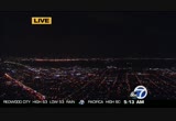
. >>> let's open the weather window and get our first look at the morning, gorgeous from mount sutro back towards the bay, all the way to almost mount hamilton that's how clear the air is, a few clouds, moving away they will be replaced by high clouds into the afternoon hours. live doppler 7 hd, lack of clouds means lack of radar returns, confirming how dry it is. temperatures just updated, still 38 napa and santa rosa, 50 antioch and san francisco else in the 40s. monterey bay mid to upper 40s gilroy 40 salinas 46. mostly sunny, dry today, chilly, foggy, definitely have some of those nights coming especially inland and dry pattern for the entire seven day forecast. temperatures today in the mid 60s for most of us, 63 san francisco, concord 65 san jose 66 santa rosa low to mid 60s coast monterey bay mid to upper 60s upper 60s to 70 around hollister and salinas as you head inland. morgan hill 39 tonight, 39 santa rosa, 37 cloverdale, low to mid 40s other inland valleys, lower to upper 40s bay and coast. those are at the reporting stations your car or home will probably be a couple deg
. >>> let's open the weather window and get our first look at the morning, gorgeous from mount sutro back towards the bay, all the way to almost mount hamilton that's how clear the air is, a few clouds, moving away they will be replaced by high clouds into the afternoon hours. live doppler 7 hd, lack of clouds means lack of radar returns, confirming how dry it is. temperatures just updated, still 38 napa and santa rosa, 50 antioch and san francisco else in the 40s. monterey bay mid to...
211
211
Nov 29, 2012
11/12
by
KGO
tv
eye 211
favorite 0
quote 0
live look from mount sutro towards san francisco, you may run into an isolated shower this morning. the heavier rain will come this afternoon. meteorologist lisa argen is watching live doppler. >>> man in custody near sacramento charged with the murder of an animal control officer in the town halfway between stockton and sacramento the unarmed officer went to the home of a man evicted yesterday who said he had no place to keep his animals. as the officer approached a shotgun blast tore through the door. the gunman is believed to be the evicted man. the house was supposed to have been empty. >>> general petraeus has admitted to a close friend that he screwed up royally in his affair with paula broadwell. he confided in an old army friend retired general shelton, according to him, petraeus told him in a letter resigning from the cia was the right thing to do. he talked to "good morning america" about what he thought about the affair. >> i don't think she wove a web around dave and dragged him in i don't think that at all. i think it was mutual that he wasn't looking for it, it happene
live look from mount sutro towards san francisco, you may run into an isolated shower this morning. the heavier rain will come this afternoon. meteorologist lisa argen is watching live doppler. >>> man in custody near sacramento charged with the murder of an animal control officer in the town halfway between stockton and sacramento the unarmed officer went to the home of a man evicted yesterday who said he had no place to keep his animals. as the officer approached a shotgun blast tore...
193
193
Nov 14, 2012
11/12
by
KGO
tv
eye 193
favorite 0
quote 0
. >>> sutro tower looking down on clear sky high clouds mild temperatures await you 40s and 50s rainn the way for tomorrow may last all weekend. >>> cal football head coach is scheduled to meet with athletic director sunday to talk about his future. the bears are 3 and 8 and finished a dismal season saturday night. he will sit down to talk about the future and whether there is one for him in berkeley after 11 seasons. a lot of cal boosters want a change but it would come at a price the buy-out is nearly seven million dollars. >>> "dancing with the stars" double elimination. the show delivered painful one-two punch last night. >> kirstie and max. >> reporter: they became the 7th all-star team cut. along the way, they sure had a blast. >> if you don't laugh around her, you have zero sense of humor and probably not alive. >> reporter: their scores never got better than one from the bottom their fans kept them here for eight weeks. >> i honestly thought we would be voted off every show our fans are insanely amazing. thank you for staying up night, voting for us every week. >> reporter: s
. >>> sutro tower looking down on clear sky high clouds mild temperatures await you 40s and 50s rainn the way for tomorrow may last all weekend. >>> cal football head coach is scheduled to meet with athletic director sunday to talk about his future. the bears are 3 and 8 and finished a dismal season saturday night. he will sit down to talk about the future and whether there is one for him in berkeley after 11 seasons. a lot of cal boosters want a change but it would come at a...
196
196
Nov 13, 2012
11/12
by
KGO
tv
eye 196
favorite 0
quote 0
we look from mount tamalpais towards mount sutro some of the haze over the bay water.live doppler 7 hd, radar returns are few and far between today, friday's forecast more likely. we are still picking up high clouds that is going to mix with our sun and keep today interesting to go out and maybe look at some of those cloud formations. higher clouds going to be most prevalent from the bay north from the bay southward more sunshine and less high clouds. they are not doing much to dim the heat that the sun provides, still in the 60s everywhere at this hour, 59 oakland, 54 san rafael, 59 fairfield cooler spots around the monterey bay extra sun, everybody in the 60s except santa cruz 59°. let's talk about this cycle. today, mostly sunny and warmer, warmest day tomorrow, then unsettled and cooler towards thursday, friday especially sunday and monday. today, everybody positive, one degree warmer oakland and santa rosa, five degrees in concord and san francisco, six in san jose, nine degree jump in fremont, 69 today mid to upper 60s bay shore inland, low to mid 60s coast some
we look from mount tamalpais towards mount sutro some of the haze over the bay water.live doppler 7 hd, radar returns are few and far between today, friday's forecast more likely. we are still picking up high clouds that is going to mix with our sun and keep today interesting to go out and maybe look at some of those cloud formations. higher clouds going to be most prevalent from the bay north from the bay southward more sunshine and less high clouds. they are not doing much to dim the heat...
248
248
Nov 24, 2012
11/12
by
KGO
tv
eye 248
favorite 0
quote 0
a live picture from sutro cam looking out.sunshine is the thing to think about. it will be nice. upper 60s in san francisco. you can get 70s inland and if you head down towards gilroy, watsonville, down there, around 80 degrees. it will be a beautiful day. rain a few days away. >>> if are out shopping and using smart sma are the phone, thieves are ready to snatch phones out of your hands and install and app to track your phone if it is stolen but does the app really work. michael finney decided to find out. >> police say a tracking app is best chance of getting a phone back from a thief but how likely are you able to find the guy who walked off with it. >> you are walking with your iphone and on a bus you are also risking theft. >> most of our robberies that are occurring in the city involve some sort of a smart phone. >> there were more than 1,000 phone robberies in san francisco from january to august alone. it happened to this man on a muni train. >> he just reached down and grabbed the phone and took off like he was a trac
a live picture from sutro cam looking out.sunshine is the thing to think about. it will be nice. upper 60s in san francisco. you can get 70s inland and if you head down towards gilroy, watsonville, down there, around 80 degrees. it will be a beautiful day. rain a few days away. >>> if are out shopping and using smart sma are the phone, thieves are ready to snatch phones out of your hands and install and app to track your phone if it is stolen but does the app really work. michael...
224
224
Nov 13, 2012
11/12
by
KOFY
tv
eye 224
favorite 0
quote 0
we look from mount tamalpais towards mount sutro some of the haze over the bay water. live doppler 7 hd, radar returns are few and far between today, friday's forecast more likely. we are still picking up high clouds that is going to mix with our sun and keep today interesting to go out and maybe look at some of those cloud formations. higher clouds going to be most prevalent from the bay north from the bay southward more sunshine and less high clouds. they are not doing much to dim the heat that the sun provides, still in the 60s everywhere at this hour, 59 oakland, 54 san rafael, 59 fairfield cooler spots around the monterey bay extra sun, everybody in the 60s except santa cruz 59°. let's talk about this cycle. today, mostly sunny and warmer, warmest day tomorrow, then unsettled and cooler towards thursday, friday especially sunday and monday. today, everybody positive, one degree warmer oakland and santa rosa, five degrees in concord and san francisco, six in san jose, nine degree jump in fremont, 69 today mid to upper 60s bay shore inland, low to mid 60s coast some
we look from mount tamalpais towards mount sutro some of the haze over the bay water. live doppler 7 hd, radar returns are few and far between today, friday's forecast more likely. we are still picking up high clouds that is going to mix with our sun and keep today interesting to go out and maybe look at some of those cloud formations. higher clouds going to be most prevalent from the bay north from the bay southward more sunshine and less high clouds. they are not doing much to dim the heat...
172
172
Nov 16, 2012
11/12
by
KGO
tv
eye 172
favorite 0
quote 0
live doppler 7-hd all water is to west of sutro. out over to toward the ocean, reach over to places like oakland and alameda and berkeley and some it is starting to dip into the south bay. very light rain. just enough to make things slick up to hundredth of inch so far. it is starting to move in mountain view and cupertino and eventually will get down to los gatos and san jose. no flight arrival days but usually the next five for ten minutes they tell us. low to mid 50s to 58 in fremont. very mild this morning. mid-50s around the monterey bay. 61 in salinas. periods of rain through the weekend. high elevation snow in the sierra and another chance of rain next week but nothing like what we're going to deal with the next 48 hours or so. here is a look at that area of low pressure. you can see it rotating it's a way from the southwest to northeast. it's mild and it's moist. it has tapped into some tropical air to a certain extent. that is what is creating the heavier amounts of rain and we'll have waves of water. we'll get tapering aro
live doppler 7-hd all water is to west of sutro. out over to toward the ocean, reach over to places like oakland and alameda and berkeley and some it is starting to dip into the south bay. very light rain. just enough to make things slick up to hundredth of inch so far. it is starting to move in mountain view and cupertino and eventually will get down to los gatos and san jose. no flight arrival days but usually the next five for ten minutes they tell us. low to mid 50s to 58 in fremont. very...
214
214
Nov 28, 2012
11/12
by
KGO
tv
eye 214
favorite 0
quote 0
live look right now from our sutro camera, wind warning along the coast. you can see heaviest cells offshore from the north coast, mendocino, sonoma, marin light rain around the bay continuing to develop. closer look from sea ranch, fort ross, highway 1, bodega bay, wet around windsor over the richmond san rafael bridge, lighter returns the blue here pinole wet weather into the east bay 680 looking at wet weather as well as milpitas and down around the south a from pescadero. wind advisory is going to keep temperatures up, gusty south winds already 57 oakland half moon bay 55 napa, temperatures have come up with the southerly winds gusting to near 40 miles an hour half moon bay, 25 mile an hour gusts in san jose they will continue to increase throughout the morning as the front gets closer warning along the coast, advisory for everyone, stormy commute, rain shifts south tomorrow, the second system heads our way late tomorrow into friday morning. just as soggy. this is a quick mover, it continues to pump up the subtropical moisture we have to get that low i
live look right now from our sutro camera, wind warning along the coast. you can see heaviest cells offshore from the north coast, mendocino, sonoma, marin light rain around the bay continuing to develop. closer look from sea ranch, fort ross, highway 1, bodega bay, wet around windsor over the richmond san rafael bridge, lighter returns the blue here pinole wet weather into the east bay 680 looking at wet weather as well as milpitas and down around the south a from pescadero. wind advisory is...
327
327
tv
eye 327
favorite 0
quote 0
here's a live lookout side from mount sutro, meteorologist mike nicco is in the weather center with more>> not only record heat possibly all-time record highs today and tomorrow, we are living through possibly history not only with the election but with the weather. live doppler 7 hd with satellite superimposed over i, nothing, clear, dry air mass for most areas warmer now -- now than it was 24 hours ago. upper 60s san rafael, oakland everybody else low to mid 70s, 77 in los gatos. in the afternoon, temperatures are going to be 3 to 7° warmer than yesterday. where you see an asterisk is where i'm forecasting record highs. >>> ahead, dramatic new video showing the rescue from a capsized boat off the coast of marin, including several children. >>> how many kids skipped school to go to the giants' world series parade? why it is going to cost the district tens of thousands of dollar >>> seven people rescued from a capsized boat are all recovering. you can see how choppy the waters were and how that boat is pounded. it overturned off dillon beach yesterday, there were children under that boat
here's a live lookout side from mount sutro, meteorologist mike nicco is in the weather center with more>> not only record heat possibly all-time record highs today and tomorrow, we are living through possibly history not only with the election but with the weather. live doppler 7 hd with satellite superimposed over i, nothing, clear, dry air mass for most areas warmer now -- now than it was 24 hours ago. upper 60s san rafael, oakland everybody else low to mid 70s, 77 in los gatos. in the...
253
253
tv
eye 253
favorite 0
quote 0
here is sutro and see how pretty it is out there.sun up later this morning, beautiful day. up sooner tomorrow because we set the clocks back to standard time tonight. live doppler 7 hd showing some higher level cloud cover. this is not all being picked up in your neighborhood. still mount st. helena picking up any moivt. none here in the next several days, we're talking about temperatures well above average, 15-20 degrees above average. that is by monday. still very pleasant over the weekend with numbers above seasonal readings. 52 in fremont. oakland, 56 for you. 40s in los gatos and san jose. even at our sunny coast we are in the cool mid 40s. 47 in monterey. 49 in salinas. high clouds this morning. warming trend getting underway today. taking us through tomorrow. records arrive perhaps on monday into tuesday. a departing weak weather system to the north and east of us. as high pressure builds in, it affects all the incoming systems and allows for our flow to be more of a light offshore component. that is going to allow for these r
here is sutro and see how pretty it is out there.sun up later this morning, beautiful day. up sooner tomorrow because we set the clocks back to standard time tonight. live doppler 7 hd showing some higher level cloud cover. this is not all being picked up in your neighborhood. still mount st. helena picking up any moivt. none here in the next several days, we're talking about temperatures well above average, 15-20 degrees above average. that is by monday. still very pleasant over the weekend...
144
144
Nov 24, 2012
11/12
by
KOFY
tv
eye 144
favorite 0
quote 0
time lapse view from mount sutro this afternoo afternoon. lovely day out over the bay.over the bay area and sunset at 4:53 this afternoon. day lyle light hours getting shorter. state wide lovely sunny mild over most of the state. down right warm down south high of 85 in palm springs and almost 80 in los angeles. here's in the bay area we have mailed weather again with high from mid upper 60's on the coast to low 70's around the bay inland hears accu-weather 7 day forecast. mild weather and dray weather through monday. tuesday clouds thicken cool did you know a bit and rain arrives on wednesday and we have a rainy pattern for wednesday right on into the weekend. >> all right thank you spencer. >> time for sports and jim harbaugh you never know what he is going to say even when he says nothing lick today. it's always enter taping. t to talk about after the game tomorrow night. >> absolutely. >> about harbaugh and crazy things that come out of his mouth. >> gobble gobble. >> that's one of them. we'll get some more in a few minutes. we learned this about harbaugh last few y
time lapse view from mount sutro this afternoo afternoon. lovely day out over the bay.over the bay area and sunset at 4:53 this afternoon. day lyle light hours getting shorter. state wide lovely sunny mild over most of the state. down right warm down south high of 85 in palm springs and almost 80 in los angeles. here's in the bay area we have mailed weather again with high from mid upper 60's on the coast to low 70's around the bay inland hears accu-weather 7 day forecast. mild weather and dray...
299
299
Nov 19, 2012
11/12
by
KGO
tv
eye 299
favorite 0
quote 0
high clouds are going to make today mostly cloudy, we look from mount sutro towards diablo.as we look from mount tamalpais a little breezy, mild winds making it feel warm, kicking up a few clouds, especially across the north bay the best area where we may have a stray shower. as we look at doppler, you can see we are getting the best returns to our north where they are going to stay. hardly any snow, very high elevation snow with this warm core system. different perspective you can see some of the low clouds along the coast mainly the rest of the clouds up to the north where the rain is going to fall even in the sierra, snow levels with in next system that could be around 7,000 feet, monterey bay 55 santa cruz inland 58 gilroy everybody else low 60s. going to be partly cloudy today with a stray shower to the north as storm track moves that way going to be wet for all of us tuesday into wednesday, dry and warmer remainder of the forecast. i think we'll hang out in the low to mid 60s for the most part upper 60 here and there near 60 along the coast monterey bay low to mid 60s,
high clouds are going to make today mostly cloudy, we look from mount sutro towards diablo.as we look from mount tamalpais a little breezy, mild winds making it feel warm, kicking up a few clouds, especially across the north bay the best area where we may have a stray shower. as we look at doppler, you can see we are getting the best returns to our north where they are going to stay. hardly any snow, very high elevation snow with this warm core system. different perspective you can see some of...
528
528
Nov 29, 2012
11/12
by
KGO
tv
eye 528
favorite 0
quote 0
live look from our sutro camera clouds thickening and lowering, main rain is several hours off we are already feeling the affects look at mount tam, windy, rainy conditions some of this rain is a lot of low level moisture, live drop her not picking up all, but you see the blue here reporting light rain darker green is the leading edge of what has to get here, it is going to take through the over might hours heaviest rain timing not good for tomorrow's morning rush. right now picking up rain from highway 101 through american canyon, peninsula and into los altos into the east bay, all very light and should stay light but the winds are really cranking up, up to 35 miles an hour half moon bay, 25 mile an hour gusts through san jose, breezy winds around hayward. with that, subtropical, temperatures in the 60s had to bump a couple up for this afternoon. the numbers will be mild,atyp eeding in from the pacific and this train of moisture goes all the way back to japan. we are talking about the next storm arriving tonight through much of tomorrow by the afternoon showers becoming more scattere
live look from our sutro camera clouds thickening and lowering, main rain is several hours off we are already feeling the affects look at mount tam, windy, rainy conditions some of this rain is a lot of low level moisture, live drop her not picking up all, but you see the blue here reporting light rain darker green is the leading edge of what has to get here, it is going to take through the over might hours heaviest rain timing not good for tomorrow's morning rush. right now picking up rain...
266
266
Nov 27, 2012
11/12
by
KGO
tv
eye 266
favorite 0
quote 0
right now haze and fog around, higher and mid level clouds will be fading that sun from our sutro cameralooking at more filtered sun, enjoy it, this saturday where you should be getting prepared. most of the energy from the first two storms will be in the north bay. all cloud cover here and it is still creating a little bit of a visibility problem in some spots. temperatures in the upper 50s to around 60 in oakland. mid 50s watsonville, 57 monterey. concord and livermore three, four mile visibility. novato has improved. still, a lot of clouds hanging low today making for a grey afternoon. we are looking at the first system headed our way tomorrow. that hasn't changed. it is a fast mover, wind advisory up in the bay area from 4:00 to 11:00 tomorrow among for wind gusts in guess in the higher elevations of 55 miles an hour. by afternoon things taper off. the next system arrives thursday into friday that focus is on the north bay as well. you can see all the cloud cover far off here that's the front and the low developing, a strong one, we could see thunderstorms as well. the first system c
right now haze and fog around, higher and mid level clouds will be fading that sun from our sutro cameralooking at more filtered sun, enjoy it, this saturday where you should be getting prepared. most of the energy from the first two storms will be in the north bay. all cloud cover here and it is still creating a little bit of a visibility problem in some spots. temperatures in the upper 50s to around 60 in oakland. mid 50s watsonville, 57 monterey. concord and livermore three, four mile...
189
189
Nov 15, 2012
11/12
by
KGO
tv
eye 189
favorite 0
quote 0
san jose this morning, still see a few breaks in the cloud cover, one other place you can see from sutro to the east some of the thicker clouds that have roamed through we even had virga out there rainfall from mid level clouds evaporated before it reached the ground going to keep temperatures cooler evaporation and dimming of the sun by the clouds. live doppler, there are no radar returns now, just picking up mainly dry air, you may get a sprinkle or two with the clouds during the afternoon visible satellite you see them coming from the south another key to the forecast the wind is coming from the south mainly upper 50s to lower 60s, upper 50s to mid 60s around the monterey bay and inland this is not one of those cold systems coming from alaska, going to be more likely saturday into sunday, increasing clouds this afternoon, mainly dry, rainy periods off and on rain friday through sunday. even unsettled weather next week best chance now of that rain staying in the north bay. something we'll keep an eye on. here's temperatures today, mid to upper 60s for the bay inland along the coast, ma
san jose this morning, still see a few breaks in the cloud cover, one other place you can see from sutro to the east some of the thicker clouds that have roamed through we even had virga out there rainfall from mid level clouds evaporated before it reached the ground going to keep temperatures cooler evaporation and dimming of the sun by the clouds. live doppler, there are no radar returns now, just picking up mainly dry air, you may get a sprinkle or two with the clouds during the afternoon...
170
170
Nov 12, 2012
11/12
by
KGO
tv
eye 170
favorite 0
quote 0
clear from sutro tower off to the east little frost in some of our valleys rain on the way. all the details coming up. more news. >>> investigators still don't know what caused a blast in an indiana neighborhood that killed two people saturday night. the explosion was so powerful the house at the center of it, is gone as many as 30 other damaged homes may have to be demolished. damage extents for two blocks. last night neighbors held a candlelight vigil for the second grade teacher and her husband who were killed. it does not appear to be a natural gas leak. >>> new york governor cuomo lance to ask the federal government for 30 billion dollars in disaster aid. -- state officials tally the damage at more than 50 billion dollars , making it the nation's second costly yes, sir storm behind hurricane sandy, 60,000 homes are still without electricity, victims -- victims complain they are being kept in the dark. new problem in the disas father -- [ unintelligible ] hurricane sandy number two, number one we'll find out. >>> new study that expectant moms need to hear possible link b
clear from sutro tower off to the east little frost in some of our valleys rain on the way. all the details coming up. more news. >>> investigators still don't know what caused a blast in an indiana neighborhood that killed two people saturday night. the explosion was so powerful the house at the center of it, is gone as many as 30 other damaged homes may have to be demolished. damage extents for two blocks. last night neighbors held a candlelight vigil for the second grade teacher and...
502
502
Nov 28, 2012
11/12
by
KGO
tv
eye 502
favorite 0
quote 0
here's a live look outside this is our sutro camera, you can see the fog, poor visibility from tam still the rain coming down in fact up towards sonoma county we picked up over an inch and a half. winds gusting up to 77 miles an hour from mount -- diablo this morning, 55 mile an hour gusts hills of the east bay. right now you will notice we have breaks in the north bay and on the peninsula heavier from alamo into fremont now. if you are in the east bay from 880 through 68 obey shore freeway, you've got -- 680 bay shore , you've got moderate to heavy rain. san francisco cell pushed east to scattered showers there along the peninsula, looking at page mill road 280 wet weather and east palo alto getting into pretty good rain now south bay lighter rain but very gusty winds, santa cruz mountains looking at the rain getting enhanced there, wind gusts up to 41 miles an hour at sfo, 35 mile an hour guff along the coast here. wind gusts continue through the early afternoon. the warning for the coast high wind warning has been discontinued the wind advisory for the bay area stays up. mid and upper
here's a live look outside this is our sutro camera, you can see the fog, poor visibility from tam still the rain coming down in fact up towards sonoma county we picked up over an inch and a half. winds gusting up to 77 miles an hour from mount -- diablo this morning, 55 mile an hour gusts hills of the east bay. right now you will notice we have breaks in the north bay and on the peninsula heavier from alamo into fremont now. if you are in the east bay from 880 through 68 obey shore freeway,...
204
204
Nov 10, 2012
11/12
by
KGO
tv
eye 204
favorite 0
quote 0
a crist cal clear shot from atop mount sutro looking out. you can see the lights.an francisco, mid-50s max, some breeze to make it feel cooler and more from lisa argen in just ♪ [ female announcer ] at yoplait, we want you to feel even better about your favorite flavors. so when you call, tweet, and post, we listen. that's why yoplait light and yoplait original are now made with no high fructose corn syrup. and why we use only natural colors and natural flavors in yoplait original. so, anything else we can do for you, let us know. but you'll keep it to yogurt, right? 'cause we shouldn't really help with your love life. yoplait. it is so good! >> this is abc7 news. >> bay area combat veterans trying to recover from traumatic injuries and experiences had a unique opportunity yesterday. they had the chance to swim with the doll finance. it's part of a larger program to help vets transition back into civilian lives. we have the story from six flags discovery kingdom in vallejo. >> it's a smile that doesn't come easily for charles quigley, at least not recently, since h
a crist cal clear shot from atop mount sutro looking out. you can see the lights.an francisco, mid-50s max, some breeze to make it feel cooler and more from lisa argen in just ♪ [ female announcer ] at yoplait, we want you to feel even better about your favorite flavors. so when you call, tweet, and post, we listen. that's why yoplait light and yoplait original are now made with no high fructose corn syrup. and why we use only natural colors and natural flavors in yoplait original. so,...
228
228
Nov 16, 2012
11/12
by
KGO
tv
eye 228
favorite 0
quote 0
sutro back towards the east bay hills this morning. let's take a look what is going on as far as live doppler 7 hd. we have doppler radar and they are checking out the wall of water that is about 45 minutes away from the peninsula possibly even an hour. you put it into motion. you see it's heading mainly up to the north and east. it's not coming from north to south. 49 in napa. 47 in concord. those are the cool spots. heading down to monterey bay, mid-50s. 53 in gilroy. pretty mild when you step outside today. periods of rain through the weekend. high elevations snow in the sierra. traveling won't be nearly as bad as it could be in the weekend and chance of rain into next week. here is what is happening, area of high pressure he, this low and trough that isn't as strong as a cold front but enough lift with the warm moist air to create the periods of rain we will have today. it is moving in right now. it's going to continue to move from southwest to northeast throughout the morning hours into the afternoon hours, evening hours will stil
sutro back towards the east bay hills this morning. let's take a look what is going on as far as live doppler 7 hd. we have doppler radar and they are checking out the wall of water that is about 45 minutes away from the peninsula possibly even an hour. you put it into motion. you see it's heading mainly up to the north and east. it's not coming from north to south. 49 in napa. 47 in concord. those are the cool spots. heading down to monterey bay, mid-50s. 53 in gilroy. pretty mild when you...
215
215
Nov 27, 2012
11/12
by
KOFY
tv
eye 215
favorite 0
quote 0
right now haze and fog around, higher and mid level clouds will be fading that sun from our sutro cameraoking at more filtered sun, enjoy it, this saturday where you should be getting prepared. most of the energy from the first two storms will be in the north bay. all cloud cover here and it is still creating a little bit of a visibility problem in some spots. temperatures in the upper 50s to around 60 in oakland. mid 50s watsonville, 57 monterey. concord and livermore three, four mile visibility. novato has improved. still, a lot of clouds hanging low today making for a grey afternoon. we are looking at the first system headed our way tomorrow. that hasn't changed. it is a fast ver, wind advisory up in the bay area from 4:00 to 11:00 tomorrow among for wind gusts in guess in the higher elevations of 55 miles an hour. by afternoon things taper off. the next system arrives thursday into friday that focus is on the north bay as well. you can see all the cloud cover far off here that's the front and the low developing, a strong one, we could see thunderstorms as well. the first system comes
right now haze and fog around, higher and mid level clouds will be fading that sun from our sutro cameraoking at more filtered sun, enjoy it, this saturday where you should be getting prepared. most of the energy from the first two storms will be in the north bay. all cloud cover here and it is still creating a little bit of a visibility problem in some spots. temperatures in the upper 50s to around 60 in oakland. mid 50s watsonville, 57 monterey. concord and livermore three, four mile...
200
200
Nov 29, 2012
11/12
by
KOFY
tv
eye 200
favorite 0
quote 0
live look from our sutro camera clouds thickening and lowering, main rain is several hours off we are already feeling the affects look at mount tam, windy, rainy conditions some of this rain is a lot of low level moisture, live drop her not picking up all, but you see the blue here reporting light rain darker green is the leading edge of what has to get here, it is going to take through the over might hours heaviest rain timing not good for tomorrow's morning rush. right now picking up rain from highway 101 through american canyon, peninsula and into los altos into the east bay, all very light and should stay light but the winds are really cranking up, up to 35 miles an hour half moon bay, 25 mile an hour gusts through san jose, breezy winds around hayward. with that, subtropical, temperatures in the 60s had to bump a couple up for this afternoon. the numbers will be mild,atyp eeding in from the pacific and this train of moisture goes all the way back to japan. we are talking about the next storm arriving tonight through much of tomorrow by the afternoon showers becoming more scattere
live look from our sutro camera clouds thickening and lowering, main rain is several hours off we are already feeling the affects look at mount tam, windy, rainy conditions some of this rain is a lot of low level moisture, live drop her not picking up all, but you see the blue here reporting light rain darker green is the leading edge of what has to get here, it is going to take through the over might hours heaviest rain timing not good for tomorrow's morning rush. right now picking up rain...
165
165
Nov 14, 2012
11/12
by
KGO
tv
eye 165
favorite 0
quote 0
. >> above average today, here's a look outside good morning from sutro tower to the east bay hills,ppler spending waiting for that next storm that is going to come from the west starting tomorrow night. you have today and tomorrow to get out there and get whatever outdoor activities you need done or finished. as far as our temperatures, they are milder this morning. we are in the 40s and 50s almost 60 now at half moon bay. let's check out the monterey bay and the scene high clouds mid to upper 40s, inland 45 gilroy, 55 salinas. today we are looking at day full of high clouds, sunshine and warmest afternoonig%]ç temperatures we are going to have in the next seven days. more clouds tonight, mild the next couple of nights starting thursday night, a wet pattern will hang around through at least monday night. significant rain, temperatures today, cool spot, san rafael 66 along with vallejo, everybody else low 70s, two to eight degrees above average low to mid 70s monterey bay and mid 70s inland. tonight temperatures run in the mid 40s to near 50 inland upper 40s to mid 50s around the bay
. >> above average today, here's a look outside good morning from sutro tower to the east bay hills,ppler spending waiting for that next storm that is going to come from the west starting tomorrow night. you have today and tomorrow to get out there and get whatever outdoor activities you need done or finished. as far as our temperatures, they are milder this morning. we are in the 40s and 50s almost 60 now at half moon bay. let's check out the monterey bay and the scene high clouds mid to...
140
140
Nov 15, 2012
11/12
by
KGO
tv
eye 140
favorite 0
quote 0
. >>> here's a look from sutro tower looking back to the east clear, no need to worry about rain now we have a renegade shower or two possible this afternoon and a lot of wet weather friday, saturday, sunday. more news from kristen. >>> 4:41. the man charged in the colorado movie theater massacre has managed to keep himself out of the courtroom this morning. he was taken to a hospital tuesday. holmes tried to hurt himself by ramming his head repeatedly into the wall of his jail cell. he was released from the hospital taken back to his cell. the judge granted a continue once in the case. holmes is accused of killing 12 people, wounding 58 during a screening of the newest batman film in july. holmes has not yet entered a plea. >>> justice department expected to announce a plea with bp oil. the 2010 explosion of a british oil rig in the gulf coast killed 11 and led to that massive spill. if the plea holds, bp will add night negligence and failures leading up to the spill and pay fines totalling billions it could be a record fine some estimates put it between 5 and 20 billion dollars. >>
. >>> here's a look from sutro tower looking back to the east clear, no need to worry about rain now we have a renegade shower or two possible this afternoon and a lot of wet weather friday, saturday, sunday. more news from kristen. >>> 4:41. the man charged in the colorado movie theater massacre has managed to keep himself out of the courtroom this morning. he was taken to a hospital tuesday. holmes tried to hurt himself by ramming his head repeatedly into the wall of his...
133
133
Nov 15, 2012
11/12
by
KOFY
tv
eye 133
favorite 0
quote 0
san jose this morning, still see a few breaks in the cloud cover, one other place you can see from sutroo the east some of the thicker clouds that have roamed through we even had virga out there rainfall from mid level clouds evaporated before it reached the ground going to keep temperatures cooler evaporation and dimming of the sun by the clouds. live doppler, there are no radar returns now, just picking up mainly dry air, you may get a sprinkle or two with the clouds during the afternoon visible satellite you see them coming from the south another key to the forecast the wind is coming from the south mainly upper 50s to lower 60s, upper 50s to mid 60s around the monterey bay and inland this is not one of those cold systems coming from alaska, going to be more likely saturday into sunday, increasing clouds this afternoon, mainly dry, rainy periods off and on rain friday through sunday. even unsettled weather next week best chance now of that rain staying in the north bay. something we'll keep an eye on. here's temperatures today, mid to upper 60s for the bay inland along the coast, main
san jose this morning, still see a few breaks in the cloud cover, one other place you can see from sutroo the east some of the thicker clouds that have roamed through we even had virga out there rainfall from mid level clouds evaporated before it reached the ground going to keep temperatures cooler evaporation and dimming of the sun by the clouds. live doppler, there are no radar returns now, just picking up mainly dry air, you may get a sprinkle or two with the clouds during the afternoon...
158
158
Nov 19, 2012
11/12
by
KOFY
tv
eye 158
favorite 0
quote 0
high clouds are going to make today mostly cloudy, we look from mount sutro towards diablo. we look from mount tamalpais a little breezy, mild winds making it feel warm, kicking up a few clouds, especially across the north bay the best area where we may have a stray shower. as we look at doppler, you can see we are getting the best returns to our north where they are going to stay. hardly any snow, very high elevation snow with this warm core system. different perspective you can see some of the low clouds along the coast mainly the rest of the clouds up to the north where the rain is going to fall even in the sierra, snow levels with in next system that could be around 7,000 feet, monterey bay 55 santa cruz inland 58 gilroy everybody else low 60s. going to be partly cloudy today with a stray shower to the north as storm track moves that way going to be wet for all of us tuesday into wednesday, dry and warmer remainder of the forecast. i think we'll hang out in the low to mid 60s for the most part upper 60 here and there near 60 along the coast monterey bay low to mid 60s, m
high clouds are going to make today mostly cloudy, we look from mount sutro towards diablo. we look from mount tamalpais a little breezy, mild winds making it feel warm, kicking up a few clouds, especially across the north bay the best area where we may have a stray shower. as we look at doppler, you can see we are getting the best returns to our north where they are going to stay. hardly any snow, very high elevation snow with this warm core system. different perspective you can see some of...
219
219
tv
eye 219
favorite 0
quote 0
beautiful picture from sutro tower looking down on san francisco, clear start record high temperaturesthe way. i'll show you your city in just a minute. >>> the san mateo city council tonight will consider ways to regulate noisey leaf blowers. plans range from complete ban to banning on only those blowers that exceed 65 decibels to stepping up enforcement of the existing ordinance. right now they are banned on sunday and holidays must be used at low speed the rest of the time. reports the complete ban is the most expensive option, requiring the hiring of extra workers to hand rake city parks and private gardeners would likely charge more. >>> a war of words is causing last minute controversy in the race for oakland city attorney. councilwoman and attorney says she will sue over a mailer from current city attorney parker. the mailer claims browner was suspended from practicing law. >> there was a short period when i was running for city council in 1995, i was not practicing law. and i did not -- was not active but i was not suspended. >> people can look it up she was ineligible to pract
beautiful picture from sutro tower looking down on san francisco, clear start record high temperaturesthe way. i'll show you your city in just a minute. >>> the san mateo city council tonight will consider ways to regulate noisey leaf blowers. plans range from complete ban to banning on only those blowers that exceed 65 decibels to stepping up enforcement of the existing ordinance. right now they are banned on sunday and holidays must be used at low speed the rest of the time. reports...
273
273
Nov 28, 2012
11/12
by
KOFY
tv
eye 273
favorite 0
quote 0
here's a live look outside this is our sutro camera, you can see the fog, poor visibility from tam stillhe rain coming down in fact up towards sonoma county we picked up over an inch and a half. winds gusting up to 77 miles an hour from mount -- diablo this morning, 55 mile an hour gusts hills of the east bay. right now you will notice we have breaks in the north bay and on the peninsula heavier from alamo into fremont now. if you are in the east bay from 880 through 68 obey shore freeway, you've got -- 680 bay shore , you've got moderate to heavy rain. san francisco cell pushed east to scattered showers there along the peninsula, looking at page mill road 280 wet weather and east palo alto getting into pretty good rain now south bay lighter rain but very gusty winds, santa cruz mountains looking at the rain getting enhanced there, wind gusts up to 41 miles an hour at sfo, 35 mile an hour guff along the coast here. wind gusts continue through the early afternoon. the warning for the coast high wind warning has been discontinued the wind advisory for the bay area stays up. mid and upper 5
here's a live look outside this is our sutro camera, you can see the fog, poor visibility from tam stillhe rain coming down in fact up towards sonoma county we picked up over an inch and a half. winds gusting up to 77 miles an hour from mount -- diablo this morning, 55 mile an hour gusts hills of the east bay. right now you will notice we have breaks in the north bay and on the peninsula heavier from alamo into fremont now. if you are in the east bay from 880 through 68 obey shore freeway,...
236
236
Nov 5, 2012
11/12
by
KOFY
tv
eye 236
favorite 0
quote 0
here's a live lookout side from mount sutro, meteorologist mike nicco is in the weather center with more>> not only record heat possibly all-time record highs today and tomorrow, we are living through possibly history not only with the election but with the weather. live doppler 7 hd with satellite superimposed over i, nothing, clear, dry air mass for most areas warmer now -- now than it was 24 hours ago. upper 60s san rafael, oakland everybody else low to mid 70s, 77 in los gatos. in the afternoon, temperatures are going to be 3 to 7° warmer than yesterday. where you see an asterisk is where i'm forecasting record highs. >>> ahead, dramatic new video showing the rescue from a capsized boat off the coast of marin, including several children. >>> how many kids skipped school to go to the giants' world series parade? why it is going to cost the [ female announcer ] this is a spspecial message from at&. [ male announcer ] it's no secret that the price of things just keeps going up. [ female announcer ] but we have some good news. it's our bundle price promise. [ male announcer ] a price you
here's a live lookout side from mount sutro, meteorologist mike nicco is in the weather center with more>> not only record heat possibly all-time record highs today and tomorrow, we are living through possibly history not only with the election but with the weather. live doppler 7 hd with satellite superimposed over i, nothing, clear, dry air mass for most areas warmer now -- now than it was 24 hours ago. upper 60s san rafael, oakland everybody else low to mid 70s, 77 in los gatos. in the...
166
166
Nov 22, 2012
11/12
by
KGO
tv
eye 166
favorite 0
quote 0
taking you out from a different perspective, live look from our sutro camera.owards san francisco, you can see clouds out there. rain is done. thanksgiving looking fabulous. i'll show you wait looked like from owe that perspective. we did have storms going through here into this morning and take a look at rainfall totals. look at san jose. two tenths of an inch. san francisco just over an inch. livermore, 2200 of an inch. temperatures falling mid-50s low 60s, bundle up if you're heading out of the door. clear, capitol hilly overnight. this is going to be sunny, mild thanksgiving looking fabulous for plans. there is a cold front went through. high pressure is now calling sho.s you don't have to worry about storms this long holiday weekend. what happens in overnight hours fog forms in central valley. this is monday. when that happens could be dense in pockis chls -- pockets. watch out for fog, temperatures on the chilly sichld you'll need a layer, low 40s around santa rosa, napa and fair feemd. 49 in oakland. 47 degrees in san jose. afternoon looking fabulous, su
taking you out from a different perspective, live look from our sutro camera.owards san francisco, you can see clouds out there. rain is done. thanksgiving looking fabulous. i'll show you wait looked like from owe that perspective. we did have storms going through here into this morning and take a look at rainfall totals. look at san jose. two tenths of an inch. san francisco just over an inch. livermore, 2200 of an inch. temperatures falling mid-50s low 60s, bundle up if you're heading out of...
166
166
Nov 2, 2012
11/12
by
KPIX
tv
eye 166
favorite 0
quote 0
someone stole the statue three years ago from the front of a home in sutro heights. then yesterday police returned it to its owner in pieces in san francisco. >> i knew he would come back. i just knew it. i just felt that, first of all, nobody would say that it's scrap metal. >> well, if sold to recyclers, the thief probably could have gotten $200. it was found during a drug bust friday. they made an arrest. the owner says they plan to weld it back together. a lot of pieces though. >>> a newborn monkey that arrived during the giants post- season run now has a name. it was named after a player. the guy with the orange head right there. the san francisco zoo named the female monkey romo after giants closer sergio romo. the zoo said that was the overwhelming favorite name and fits with the baby monkey's playful personality. he can throw a baseball, too. other popular choices were posey and scutaro but that's a romo. >> he has the hair but does he have the dimples? >> i don't know. but he has the name. that's all that matters. >> sure. >>> was it a hurricane or super sto
someone stole the statue three years ago from the front of a home in sutro heights. then yesterday police returned it to its owner in pieces in san francisco. >> i knew he would come back. i just knew it. i just felt that, first of all, nobody would say that it's scrap metal. >> well, if sold to recyclers, the thief probably could have gotten $200. it was found during a drug bust friday. they made an arrest. the owner says they plan to weld it back together. a lot of pieces though....
301
301
Nov 2, 2012
11/12
by
KOFY
tv
eye 301
favorite 0
quote 0
here is a live view from high definition sutro camera. looking at mainly clear skies, or mostly moony. we do expect clouds to thicken and fog to become dense. here is live doppler 7 hd. you see low clouds around the coastline. some of it as pushed locally from the coast but most areas are looking at clea skies. rainfall totals most recent storm are pretty impressive. over an inch and a half which is mounted st. hlena and inch at santa rosa. third of an inch in santa rosa. third of an in of in oakland. it's all out of here now. right now temperature readings mainly in the 50s. cool 51 in santa rosa and mid to upper 50s in most other locations. these are the forecast features, clouds and fog becoming thicker. partly sunny. tomorrow afternoon the morning will start off as partly cloudy to foggy. sunnier and warmer this weekend. lows under partly foggy and dense fog spots. low 50s, some north bay valley locations will see those drop in the mid to upper 40s. here is satellite image. there is the frontal system that brought us yesterday's storm
here is a live view from high definition sutro camera. looking at mainly clear skies, or mostly moony. we do expect clouds to thicken and fog to become dense. here is live doppler 7 hd. you see low clouds around the coastline. some of it as pushed locally from the coast but most areas are looking at clea skies. rainfall totals most recent storm are pretty impressive. over an inch and a half which is mounted st. hlena and inch at santa rosa. third of an inch in santa rosa. third of an in of in...
303
303
Nov 10, 2012
11/12
by
KGO
tv
eye 303
favorite 0
quote 0
. >> and here is what it looked like now from our mount sutro camera. look at this blue. it's beautiful out there. temperatures are going to drop again another cold night. let's check in with our spencer christian with a look at current companies,. >> current conditions brought to us by coldest air mass. here is a look at live doppler 7. you can see shower activity, scattered just a little bit in the land areas and over into the sierra.im let's focus in on fixed precipitation and snow. there is moisture in the fairfield area. part of the southu out towards los gatos you can see spotty showers. most of the bay area is dry now. in the bigger picture as you can see here, we have cold air mass with pockets of showers wrapped into this cold air mass. snow moving into the sierra.qb?t more showers in our direction. we can have more showers, right now, temperatures into 50s around the bay area. chilly day. tonight getting into evening hours, chilly. temperatures dropping into 40s and below freezing overnight in the north bay valleys. tomorrow afternoon, partly cloudy, mainly sun
. >> and here is what it looked like now from our mount sutro camera. look at this blue. it's beautiful out there. temperatures are going to drop again another cold night. let's check in with our spencer christian with a look at current companies,. >> current conditions brought to us by coldest air mass. here is a look at live doppler 7. you can see shower activity, scattered just a little bit in the land areas and over into the sierra.im let's focus in on fixed precipitation and...
841
841
tv
eye 841
favorite 0
quote 1
here is a live view from our sutro camera. this clear mild to warm evening. let's take a look and you can see absence of clouds near the coastline. it's clear from coast to inland. mild to warm right now. 74 in oakland. notice how most of the work is around the bay right now. temperatures into 70s. forecast features will be warm again tomorrow with possibility of records tomorrow. but warmth will be receding. cooler wednesday. cold showers thursday, lows tonight in mid to upper 50s, possibly a low of only 60 here in san francisco. tomorrow morning sun rise. warmest weather at this point mildest near the coast. will be 66 around the bay. upper 60s inreasoned. mid-70s across the board in regions of the bay area, later into afternoon, cooling near the coast. warm inland and around the bay. upper 70s to 80. the cool down begins with still mild conditions. big cold air mass, cooler wernl by the end of the week. cold over the weekend. tomorrow afternoon, you'll see fog return together coast. that will be beginning a cooling trend continuing into the weekend. in aft
here is a live view from our sutro camera. this clear mild to warm evening. let's take a look and you can see absence of clouds near the coastline. it's clear from coast to inland. mild to warm right now. 74 in oakland. notice how most of the work is around the bay right now. temperatures into 70s. forecast features will be warm again tomorrow with possibility of records tomorrow. but warmth will be receding. cooler wednesday. cold showers thursday, lows tonight in mid to upper 50s, possibly a...
261
261
tv
eye 261
favorite 0
quote 0
good morning, record highs today as we look at the clean air from mount sutro towards mount diablo. clear air everywhere a little fog nestled into the valleys in the north bay watch pout for that 48 santa rosa, 47 fairfield, everybody else in the 50s, 60 fremont, san francisco and half moon bay latest temperatures. 63 santa cruz. record highs possible today and tomorrow. clear and comfortable at night, cooler wednesday, wet thursday possibly showers into friday. everybody three to seven degrees warmer than yesterday, that's where we will have record highs. let's take a trip around the bay, 83 san jose, 84 mountain view, mid to upper 70s along the coast, 81 downtown san francisco record highs. 84 san rafael, 89 santa rosa, east bay shore, richmond 81, oakland 82, hayward record high temperatures, 82 concord, everybody around the monterey bay and inland record high temperatures are possible as you flirt with 90° in so many areas. tonight in the 50s and 60s, it will cool considerably as we head towards the overnight hours. northeast towards wednesday morning, you can see the rain movin
good morning, record highs today as we look at the clean air from mount sutro towards mount diablo. clear air everywhere a little fog nestled into the valleys in the north bay watch pout for that 48 santa rosa, 47 fairfield, everybody else in the 50s, 60 fremont, san francisco and half moon bay latest temperatures. 63 santa cruz. record highs possible today and tomorrow. clear and comfortable at night, cooler wednesday, wet thursday possibly showers into friday. everybody three to seven degrees...
651
651
Nov 29, 2012
11/12
by
KOFY
tv
eye 651
favorite 0
quote 0
live picture from high definition sutro camera.l have clouds around and we did get some rain in the last 24 hours. picked up over an inch in santa rosa and .16 in san jose. peak wind gusts, 55-75 miles an hour. they hope the next one is for real. it looks like it is going to bring quite a bit of rain. live doppler 7-hd, not much happening except for a few showers beginning to redevelop in the north bay right now. you'll see the very light showers around cloverdale, monte rio out to lake port and ukiah. the radar is tracking the storm as it approaches. temperatures right now in the 50s. we do have clouds around. next storm in the north bay thursday by midday, wet and windy for the entire bay area any and saturday. stormy conditions sunday morning with the flood concerns coming up as we head into the weekend. this break, but we do have another storm coming. this will bring heavy rain that will spread south thursday to friday. that is what i'm talking about when i say slow moving storm. the next storm is number three. widespread wind
live picture from high definition sutro camera.l have clouds around and we did get some rain in the last 24 hours. picked up over an inch in santa rosa and .16 in san jose. peak wind gusts, 55-75 miles an hour. they hope the next one is for real. it looks like it is going to bring quite a bit of rain. live doppler 7-hd, not much happening except for a few showers beginning to redevelop in the north bay right now. you'll see the very light showers around cloverdale, monte rio out to lake port...
165
165
Nov 12, 2012
11/12
by
KGO
tv
eye 165
favorite 0
quote 0
looking down from sutro tower all wait over to the east bay hills this morning, high clouds, radar returns on live doppler in the north bay most of the morning now moving into the central valley, no report of anything making it to ground the air is too dry and now the clouds are leaving temperatures are dropping back into the 30s in the north bay again. 38 napa, fairfield 36, clouds are over you now 38 concord, 36 livermore, looks like we are going to have frost in some of our inland east bay valleys. half moon bay 41. most of us in the low to mid 40s, san francisco 48. 34 gilroy, low 40s santa cruz and salinas. chilly this morning, need that heavy coat, warmer by the afternoon, won't need that heavy coat, warmer days on the way today through thursday unsettled weather chance of rain friday, better chance with bigger storm, sunday, monday, tuesday of next week. today out of the 50s into the 60s oakland, san francisco, -- most of us in the low to mid 60s high clouds and sun this afternoon, mid to upper 50s coast. monterey bay low to mid 60s mid 60s inland more sunshine high clouds won't be
looking down from sutro tower all wait over to the east bay hills this morning, high clouds, radar returns on live doppler in the north bay most of the morning now moving into the central valley, no report of anything making it to ground the air is too dry and now the clouds are leaving temperatures are dropping back into the 30s in the north bay again. 38 napa, fairfield 36, clouds are over you now 38 concord, 36 livermore, looks like we are going to have frost in some of our inland east bay...
190
190
Nov 22, 2012
11/12
by
KGO
tv
eye 190
favorite 0
quote 0
here is a live view from our sutro camera looking east across the bay, sunny skies.n this way throughout most of the day. we did have more clouds around, but they've)6j& scattered so te a look at live doppler 7 hd. sunny skies, clouds around, and we have improving sky conditions coming our way. will be clear and chilly overfight. into nornl bay valleys temperatures dropping down to 40 degrees or so. patches of fog in interior valleys will develop. sunny mild conditions tomorrow, satellite shows a frontal system having pushed well to our east now. high pressure building in bringing us a dry pattern lasting into next week. the forecast at 7:00 this evening you can see what will develop overnight in central valley is dense fog spilling through delta and this could provide some fog for us and interior valleys over next few mornings overnight. so tonight, we're looking at a chance of patchy fog. clear skies, low temperatures in 40s, low 40s around napa and santa rosa. coolest region of the bay area will be north bay valleys. tomorrow, sunny, pleasant thanksgiving day. hi
here is a live view from our sutro camera looking east across the bay, sunny skies.n this way throughout most of the day. we did have more clouds around, but they've)6j& scattered so te a look at live doppler 7 hd. sunny skies, clouds around, and we have improving sky conditions coming our way. will be clear and chilly overfight. into nornl bay valleys temperatures dropping down to 40 degrees or so. patches of fog in interior valleys will develop. sunny mild conditions tomorrow, satellite...
314
314
tv
eye 314
favorite 0
quote 0
little an hazy as we look from mount tamalpais all wait cross the marin head lantos ocean beach that's sutro see. live doppler quiet, gathering strength, getting ready for thursday and friday's storms. thunderstorms possible thursday and friday, small hail, lightning, absolutely that's how different the weather is going to be in a couple of days. let's talk about temperatures, all over the place, microclimates galore, 47 fairfield, 48 santa rosa, 50s elsewhere, san francisco and fremont, 60 and 62. 47 gilroy. mid to upper 50s watsonville and santa cruz. by the afternoon, all near record high temperatures today is the last day cold front brings much cooler weather tomorrow, colder air mass on the back side of that with moisture from alaska, brings us a chance of chilly showers thursday and friday, thunderstorm possible with small hail out of those storms. today 11° in napa, 13 in livermore, 81 in san -- if san jose possible record high temperatures. 80 mountain view, 77 millbrae, mid 70s coast south san francisco downtown 77° today. upper 70s to low 80s north bay valleys mid 70s bodega bay ma
little an hazy as we look from mount tamalpais all wait cross the marin head lantos ocean beach that's sutro see. live doppler quiet, gathering strength, getting ready for thursday and friday's storms. thunderstorms possible thursday and friday, small hail, lightning, absolutely that's how different the weather is going to be in a couple of days. let's talk about temperatures, all over the place, microclimates galore, 47 fairfield, 48 santa rosa, 50s elsewhere, san francisco and fremont, 60 and...
182
182
tv
eye 182
favorite 0
quote 0
waiting for the warmer conditions, looking live from mount sutro over the bay, you can see mainly blue and high clouds is around. it's going to increase getting later into the evening hours. we're not looking for significant rainfall. certainly clouds will increase. here is a look at the situation developing on live doppler 7 hd. there is a weak frontal system sweeping into our direction. clouds pushing into the bay area sky now. it's pleasant and mild. clouds continuing to increase during overnight hours and sunnier, warmer weekend and possibly record highs on, by monday. perhaps monday and tuesday. it's going to be a very warm start to the week next week. overnight tonight we'll see again, clouds around and high clouds as well thickening. low temperatures into low 50s, uniform range of lows tonight. here is what's happening in the atmosphere. satellite show as approaching frontal system. it's a weak one. it's going to fall apart as you switch through. moisture staying to our north or out to sea. the front moves through breaking apart, we'll see skies getting sunnier on sunday, and mo
waiting for the warmer conditions, looking live from mount sutro over the bay, you can see mainly blue and high clouds is around. it's going to increase getting later into the evening hours. we're not looking for significant rainfall. certainly clouds will increase. here is a look at the situation developing on live doppler 7 hd. there is a weak frontal system sweeping into our direction. clouds pushing into the bay area sky now. it's pleasant and mild. clouds continuing to increase during...
248
248
Nov 3, 2012
11/12
by
KOFY
tv
eye 248
favorite 0
quote 0
live view from high definition sutro camera. nice view of the moon actually and that is interesting because we had thickening clouds during the late afternoon and early evening hours. despite the presence of cloud cover, we get a nice view of it. clouds not only near the coast but pushing over land, as well. obviously not very widespread extensive cloud cover at the moment. to our north, rainfall around crescent city and eureka. there is the cold front sweeping into the northern is part of the state. we are getting some of the clouds. temperature readings, 48 degrees at half moon ba. 50s everywhere else. 59 in antioch. no 60s on the map. clouds will increase overnight. sunny and warmer over the weekend and we may have record highs on monday and tuesday as it is going to get quite warm. low temperatures will be narrow rage in the low 50s. here is what is happening in the atmosphere, radar composite image, weak cold front in the northern part of the state, its weak front and going to fall apart as it sweeps inland, animation is 7:
live view from high definition sutro camera. nice view of the moon actually and that is interesting because we had thickening clouds during the late afternoon and early evening hours. despite the presence of cloud cover, we get a nice view of it. clouds not only near the coast but pushing over land, as well. obviously not very widespread extensive cloud cover at the moment. to our north, rainfall around crescent city and eureka. there is the cold front sweeping into the northern is part of the...
317
317
Nov 13, 2012
11/12
by
KGO
tv
eye 317
favorite 0
quote 0
just about cloud-free looking from our high definition sutro camera.ll have clouds passing north. at the moment, you can see it's cloud free from ouj to inland. and these are temperatures around or just above 60 degrees in most bay area locations. these are the forecast features. cool overnight condition was clouds gathering overnight. mainly north, warmer tuesday and wednesday.%p7çxqa up in the north bay, mainly mid to upper 60s, 68 in calistoga and napa. 67, santa rosa. east bay highs of 67 in oakland and san leandro. 69 in fremont. inland east bay on the cool side. mainly mid up toer 60s up to about 68 in livermore. and near monterey bay, temperatures in upper 60s to near 70s close to the bay and upper 60s to just above 70s inland. here is the accu-weather forecast. milder weather tomorrow, and wednesday. cooling down slightly thursday, there is a chance of showers f and showers likely friday, then a chance late saturday into sunday. sunday could be a rainy day. we're watching that system. but we're going to call it unsettled approaching the weekend
just about cloud-free looking from our high definition sutro camera.ll have clouds passing north. at the moment, you can see it's cloud free from ouj to inland. and these are temperatures around or just above 60 degrees in most bay area locations. these are the forecast features. cool overnight condition was clouds gathering overnight. mainly north, warmer tuesday and wednesday.%p7çxqa up in the north bay, mainly mid to upper 60s, 68 in calistoga and napa. 67, santa rosa. east bay highs of 67...
215
215
Nov 18, 2012
11/12
by
KGO
tv
eye 215
favorite 0
quote 0
high definition sutro cam showing you a few cloud drift big the bay area.hose of you in the north bay might see a few stray showers, but live doppler 7hd picking up the action toward concord, stockton. you can get a pretty good sense of where this divide line is, right here. and you can see how narrow this cold front it, bow, did it barrel in here on the last two to three hours. right know, oakley getting ready to get hit with moderate rain. you can see it in this trajectory here, back up towards the pittsburg area. we lad moderate rain just move through the castro valley area, union city and fremont. this batch of rain heading off towards the east there it's moving so quickly that each time we go ahead and spin live, you can see -- we sweep live, that is, you can see this live sweep is updating rapidly. son hey say, towards campbell, los gatos, morgan hill, finally starting to see some rain as the front moves into the area. stick around for an hour, hour and a half, and then it will be out of there and you will return to isolated showers overnight. they're
high definition sutro cam showing you a few cloud drift big the bay area.hose of you in the north bay might see a few stray showers, but live doppler 7hd picking up the action toward concord, stockton. you can get a pretty good sense of where this divide line is, right here. and you can see how narrow this cold front it, bow, did it barrel in here on the last two to three hours. right know, oakley getting ready to get hit with moderate rain. you can see it in this trajectory here, back up...
216
216
Nov 14, 2012
11/12
by
KGO
tv
eye 216
favorite 0
quote 0
beautiful colors of the cool morning giving way to warm sunshine, gorgeous shot from sutro you can seee reflection on the bay, capture that one and put that one in frame. live doppler checking out the clouds maybe not as pretty as that picture, definitely working as it sits on top of mount st. helena this morning in anticipation of showers tomorrow evening, friday, saturday, sunday, monday. pattern definitely going to change after today's warm weather. we are going to look at temperatures, dipped into the 30s inland fairfield and napa, 40s elsewhere, 40s along the peninsula, east bay shore, to san francisco out to the coast, mid to upper 50s, 50 watsonville, 55 salinas, low to mid 40s gilroy, monterey and santa cruz. i believe we'll have high clouds today and warmest afternoon more clouds mild at night coming next couple of nights unsettled weather starts tomorrow evening through monday. if you have your sprinkler system on, turn it off. napa two degrees warmer than yesterday, compared to average excuse me san jose four degrees warmer and thafrpblg live more five, redwood city 7, most
beautiful colors of the cool morning giving way to warm sunshine, gorgeous shot from sutro you can seee reflection on the bay, capture that one and put that one in frame. live doppler checking out the clouds maybe not as pretty as that picture, definitely working as it sits on top of mount st. helena this morning in anticipation of showers tomorrow evening, friday, saturday, sunday, monday. pattern definitely going to change after today's warm weather. we are going to look at temperatures,...
266
266
tv
eye 266
favorite 0
quote 0
my question as we look from sutro tower on san francisco to the east bay hills, a little haze, stillisture in the air, we have high clouds starting to roll in. no radar returns, dry morning. fog is the bigger concern as we roll over into the east bay valleys, thicker fog around livermore this morning. hayes been billing around that area and spilling into other parts 3/4 of a mile for you, hasn't made it up towards concord. novato down to 8th of a mile, napa quarter of a mile, santa rosa 3/4 of a mile ha is going to be your biggest hurdle -- chilly, you may have noticed mid 40s to around 50° this morning good 5 to 15° cooler than yesterday. upper 40s santa cruz and gilroy. high clouds and sun straightforward forecast today brighter, warmer this weekend, record highs possible. while were you sleeping cold front washed out to our south high pressure moved in with clockwise flow steering this next system farther north that's why we are getting the blow off in the form of high clouds check out how close the rain gets to us before it fall as part and stars to head too the northwest corner
my question as we look from sutro tower on san francisco to the east bay hills, a little haze, stillisture in the air, we have high clouds starting to roll in. no radar returns, dry morning. fog is the bigger concern as we roll over into the east bay valleys, thicker fog around livermore this morning. hayes been billing around that area and spilling into other parts 3/4 of a mile for you, hasn't made it up towards concord. novato down to 8th of a mile, napa quarter of a mile, santa rosa 3/4 of...
218
218
Nov 11, 2012
11/12
by
KGO
tv
eye 218
favorite 0
quote 0
the high def next sutro cam showing clear sky. i checked the wind and we're pretty much calm and temperatures will start to bottom out by area tomorrow morning. tomorrow -- live doppler 7hd, clear sky, rain towards the east. here's some current temperatures. santa rosa, 37. napa, currently 36. 49 in san francisco. 48 in redwood city. 42, livermore. antioch, 46. san jose, 44. of course, all these numbers will be tumbling down by early topping morning. so clear and cold overnight. warmer for sunday afternoon, and looks like the latter part of the upcoming work week will we bet. here's a look at the highs today. with the cold air mass over much of the bay area, only managing some upper 50s. 59 in san rafael. 56 was all san francisco could do today. 61, oakland airport, and san jose reached a high of 60 degrees. here is a look at the culprit area of low pressure. quite a bit of snow. the past 24 hours, and brought us a few showers and started to kick out towards the east. but still bringing down some very cold air. calm out there. but
the high def next sutro cam showing clear sky. i checked the wind and we're pretty much calm and temperatures will start to bottom out by area tomorrow morning. tomorrow -- live doppler 7hd, clear sky, rain towards the east. here's some current temperatures. santa rosa, 37. napa, currently 36. 49 in san francisco. 48 in redwood city. 42, livermore. antioch, 46. san jose, 44. of course, all these numbers will be tumbling down by early topping morning. so clear and cold overnight. warmer for...
173
173
Nov 13, 2012
11/12
by
KGO
tv
eye 173
favorite 0
quote 0
outbreak world health organization is convinced it works the journal >>> beautiful picture from the sutrotower. high clouds and sun warmer weather on the way. >>> chevron has found a way to get around costly clean air requirements. the plant was damaged in august by a fire that sent a black cloud into the air several thousand sought medical attention. chevron has told the air quality management district it intends to repair not replace the damaged unit that means they will not be required to install new equipment chevron says it will voluntarily reduce its emissions with >>> people looking for a job may find help at a job fair in concord today sponsored by abc 7 and the job journal it will take place at center concord 5298 clayton road from noon until 4:00. public and private sector employers will be on hand. >>> if you are looking to get the most for your toy dollar, dealnews.com retail tracking site says buy two weeks before the holiday, same with christmas decorations closer you get to the big day cheaper the decorations become. as for tv's buy the off brands on black friday great deal
outbreak world health organization is convinced it works the journal >>> beautiful picture from the sutrotower. high clouds and sun warmer weather on the way. >>> chevron has found a way to get around costly clean air requirements. the plant was damaged in august by a fire that sent a black cloud into the air several thousand sought medical attention. chevron has told the air quality management district it intends to repair not replace the damaged unit that means they will not...
267
267
Nov 19, 2012
11/12
by
KGO
tv
eye 267
favorite 0
quote 0
from sutro this morning, clean air there are clouds not obscuring the view cloud cover you can see retreatingng with our storm track thicker clouds heading up to the north, a sprinkle possible, i think we are going to get through today, mainly dry, especially the farther south you are. here's a look at our temperatures, 49 los gatos, everybody else in the low to mid 50s, 55 oakland, san francisco and half moon bay. mid to upper 40s monterey bay temperature continues to drop, your sky is not as -- let's talk about what is going to happen today, cloudy rogue shower possible across the north bay, tuesday and wednesday, storm track comes back down, a chance of rain for all of us, won't be as heavy as it was over the weekend but out there dry once we get past that, dry for rest of the holiday week into the weekend. today cloudy, low to mid 60s bay and inland upper 50s to near 60 at the coast, monterey bay, low to mid 60s, mid to upper 60s inland more sunshine around the monterey bay in your inland valleys. later today, monday night football, candlestick, 5:30 kickoff, 60°, mostly cloudy, dropping
from sutro this morning, clean air there are clouds not obscuring the view cloud cover you can see retreatingng with our storm track thicker clouds heading up to the north, a sprinkle possible, i think we are going to get through today, mainly dry, especially the farther south you are. here's a look at our temperatures, 49 los gatos, everybody else in the low to mid 50s, 55 oakland, san francisco and half moon bay. mid to upper 40s monterey bay temperature continues to drop, your sky is not as...
188
188
Nov 26, 2012
11/12
by
KGO
tv
eye 188
favorite 0
quote 0
here is a look from our sutro cam and you can see clear skies. live doppler 7hd is picking up on clear skies inland as we are going is live. lets me go ahead and show you some of the visibilities for this hour. already less than a quarter of a mile visibility fairfield, novato and a quarter of a mile visibility due to the low clouds and fog in santa rosa. we are seeing some of the fog move around a bit. inland locations and out toward brentwood, 10 miles visibility there. you are all clear right now. here is a look at our current readings. 43 this napa and 52 in san rafael. san francisco is checking in at 54 degrees with light fog and 48 mountain view and 48 san jose. it is 46 right now in livermore. our forecast, low clouds and pockets of dense fog overnight. it will be a dry day and a cooler day for your monday, and then storms will begin to roll in here by the end of our workweek. this will mean the return of rain which could be heavy at times and very gusty winds. you will notice that the fog is carting to shift inland, especially near the co
here is a look from our sutro cam and you can see clear skies. live doppler 7hd is picking up on clear skies inland as we are going is live. lets me go ahead and show you some of the visibilities for this hour. already less than a quarter of a mile visibility fairfield, novato and a quarter of a mile visibility due to the low clouds and fog in santa rosa. we are seeing some of the fog move around a bit. inland locations and out toward brentwood, 10 miles visibility there. you are all clear...
302
302
Nov 11, 2012
11/12
by
KGO
tv
eye 302
favorite 0
quote 0
the high def next sutro cam showing clear sky.cked the wind and we're pretty much calm and temperatures will start to bottom out by area tomorrow morning. tomorrow -- live doppler 7hd, clear sky, rain towards the east. here's some current temperatures. santa rosa, 37. napa, currently 36. 49 in san francisco. 48 in redwood city. 42, livermore. antioch, 46. san jose, 44. of course, all these numbers will be tumbling down by early topping morning. so clear and cold overnight. warmer for sunday afternoon, and looks like the latter part of the upcoming work week will we bet. here's a look at the highs today. with the cold air mass over much of the bay area, only managing some upper 50s. 59 in san rafael. 56 was all san francisco could do today. 61, oakland airport, and san jose reached a high of 60 degrees. here is a look at the culprit area of low pressure. quite a bit of snow. the past 24 hours, and brought us a few showers and started to kick out towards the east. but still bringing down some very cold air. calm out there. but it's
the high def next sutro cam showing clear sky.cked the wind and we're pretty much calm and temperatures will start to bottom out by area tomorrow morning. tomorrow -- live doppler 7hd, clear sky, rain towards the east. here's some current temperatures. santa rosa, 37. napa, currently 36. 49 in san francisco. 48 in redwood city. 42, livermore. antioch, 46. san jose, 44. of course, all these numbers will be tumbling down by early topping morning. so clear and cold overnight. warmer for sunday...
264
264
Nov 18, 2012
11/12
by
KGO
tv
eye 264
favorite 0
quote 0
high definition sutro cam showing you a few cloud drift big the bay area.se of you in the north bay might see a few stray showers, but live doppler 7hd picking up the action toward concord, stockton. you can get a pretty good sense of where this divide line is, right here. and you can see how narrow this cold front it, bow, did it barrel in here on the last two to three hours. right know, oakley getting ready to get hit with moderate rain. you can see it in this trajectory here, back up towards the pittsburg area. we lad moderate rain just move through the castro valley area, union city and fremont. this batch of rain heading off towards the east there it's moving so quickly that each time we go ahead and spin live, you can see -- we sweep live, that is, you can see this live sweep is updating rapidly. son hey say, towards campbell, los gatos, morgan hill, finally starting to see some rain as the front moves into the area. stick around for an hour, hour and a half, and then it will be out of there and you will return to isolated showers overnight. they're p
high definition sutro cam showing you a few cloud drift big the bay area.se of you in the north bay might see a few stray showers, but live doppler 7hd picking up the action toward concord, stockton. you can get a pretty good sense of where this divide line is, right here. and you can see how narrow this cold front it, bow, did it barrel in here on the last two to three hours. right know, oakley getting ready to get hit with moderate rain. you can see it in this trajectory here, back up towards...

 Live Music Archive
 Librivox Free Audio
 Metropolitan Museum
 Cleveland Museum of Art
 Internet Arcade
 Console Living Room
 Open Library
 American Libraries
 TV News
 Understanding 9/11