175
175
Aug 14, 2012
08/12
by
KTVU
tv
eye 175
favorite 0
quote 0
as we can hold that westerly breeze we will be okay. as long as it stays close to the coast it will be okay but all signs point towards that strengthening and we get the tropical clouds and we may see the remains of tropical storm hector and it may filter in by saturday. fog and warm, westerly breeze, 80s for some, 90s now low-to- mid to upper and we will be 89 in fairfield, 95 in morgan hill. 60s on the coast except for santa cruz which will be warmer, fog increases through wednesday cool through friday and we'll see clouds by saturday. >>> and an attack in southern afghanistan nearly 2000 are dead, what we are learning about the latest outbreak of violence as international troops prepare to hand over control. >>> it may have been the motive in two different shootings and we will tell you how a meeting today will help the ongoing problem. >>> traffic is stacking up approaching the bay bridge and we will tell you more about the peak of the morning commute. [ male announcer ] the magic of nature appears every day, within each strand of a
as we can hold that westerly breeze we will be okay. as long as it stays close to the coast it will be okay but all signs point towards that strengthening and we get the tropical clouds and we may see the remains of tropical storm hector and it may filter in by saturday. fog and warm, westerly breeze, 80s for some, 90s now low-to- mid to upper and we will be 89 in fairfield, 95 in morgan hill. 60s on the coast except for santa cruz which will be warmer, fog increases through wednesday cool...
262
262
Aug 14, 2012
08/12
by
KTVU
tv
eye 262
favorite 0
quote 0
the good news, there is a little bit of a westerly breeze and that's a good sign. you don't want it northeast so itings city very eye and a these west at 4:00 no closer to the y, but they beat the north east breeze any time of day. 70 in livermore, they were 103 and i forecasted 104, it was very close. west southwest travis, that is a message and also napa airport, both reporting a south winds at 5:00, this is also a message it will be cooler today. 5060s, still in lake county still vacaville anywhere around antioch will be cooing its grip. cool by the coast and we are starting a cooling trend, i split the difference and for some it will still be hot, 60 for pacifica, after yesterday's 100, san mateo 77, fog is on the increase wednesday thursday friday, take a visit on the weekend, pam. >>> a scarry scene in texas after a major seen near a deadly university. what police say moments after shots rang out. >>> how it could benefit a million undocumented government in the u.s. . >>> good morning, a lot of low clouds, still hot 90s and we topped out yesterday, 60s and 7
the good news, there is a little bit of a westerly breeze and that's a good sign. you don't want it northeast so itings city very eye and a these west at 4:00 no closer to the y, but they beat the north east breeze any time of day. 70 in livermore, they were 103 and i forecasted 104, it was very close. west southwest travis, that is a message and also napa airport, both reporting a south winds at 5:00, this is also a message it will be cooler today. 5060s, still in lake county still vacaville...
259
259
Aug 13, 2012
08/12
by
KGO
tv
eye 259
favorite 0
quote 0
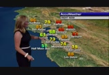
but we will by tomorrow afternoon, we will get into a westerly wind component.o we will look for the cooler winds to return. we will be hot inland tomorrow with high pressures as i mentioned near 100 degrees. in fact, here is a look for yourself as we show you some temperatures. 84 for san jose tomorrow. 85 for campbell. half moon bay, 60 degrees as the winds pick up late in the day. midto upper 70s near the peninsula. san francisco, delightful. 66 degrees, 82 for petaluma and santa rosa 88 degrees. clear lake 101 tomorrow. we will go 74 for oakland and 80 for castro valley. you will be hot inland with brentwood 98 and watsonville 74. santa cruz with afternoon sun and 76 degrees. we will give it one more day with hot temperatures inland, and we will all start to cool down tuesday and wednesday with temperatures inland in the mid to low 90s. i think everyone will like that. mike will be here here tomorrow morning at 4:30. >> thank you, leigh. >>> the giants had a pretty exciting game tonight. >> seems like they always do. the giants roster seems to take turn. tod
but we will by tomorrow afternoon, we will get into a westerly wind component.o we will look for the cooler winds to return. we will be hot inland tomorrow with high pressures as i mentioned near 100 degrees. in fact, here is a look for yourself as we show you some temperatures. 84 for san jose tomorrow. 85 for campbell. half moon bay, 60 degrees as the winds pick up late in the day. midto upper 70s near the peninsula. san francisco, delightful. 66 degrees, 82 for petaluma and santa rosa 88...
199
199
Aug 13, 2012
08/12
by
KGO
tv
eye 199
favorite 0
quote 0
but we will by tomorrow afternoon, we will get into a westerly wind component. so we will look for the cooler winds to return. we will be hot inland tomorrow with high pressures as i mentioned near 100 degrees. in fact, here is a lookself as w yourself as we show you some temperatures. 84 for san jose tomorrow. 85 for campbell. half moon bay, 60 degrees as the winds pick up late in the day. midto upper 70s near the peninsula. san francisco, delightful. 66 degrees, 82 for petaluma and santa rosa 88 degrees. clear lake 101 tomorrow. we will go 74 for oakland and 80 for castro valley. you will be hot inland with brentwood 98 and watsonville 74. santa cruz with afternoon sun and 76 degrees. we will give it one more day with hot temperatures inland, and we will all start to cool down tuesday and wednesday with temperatures inland in the mid to low 90s. i think everyone will like that. mike will be here here tomorrow morning at 4:30. >> thank you, leigh. >>> the giants had a pretty exciting game tonight. >> seems like they always do. the giants roster seems to take tu
but we will by tomorrow afternoon, we will get into a westerly wind component. so we will look for the cooler winds to return. we will be hot inland tomorrow with high pressures as i mentioned near 100 degrees. in fact, here is a lookself as w yourself as we show you some temperatures. 84 for san jose tomorrow. 85 for campbell. half moon bay, 60 degrees as the winds pick up late in the day. midto upper 70s near the peninsula. san francisco, delightful. 66 degrees, 82 for petaluma and santa rosa...
243
243
Aug 1, 2012
08/12
by
KTVU
tv
eye 243
favorite 0
quote 0
here is a little more of a westerly breeze. they will still be warm to hot. for others it will be a cool gray day. not much is changing here. slight bump up i think thursday will be the warmest day. friday we see more fog and that sweeps in for a bigger cool down. >>> 5:27. breaking news coming in from the olympics. eight of the athletes have been told go home. >> only on 2 an exclusive interview with a man charged with storing weapons and six rounds of ammunition. >> volunteers will span out and search for sierra lamar. good morning! wow. want to start the day with something heart healthy and delicious? you're a talking bee... honey nut cheerios has whole grain oats that can help lower cholesterol. and it tastes good? sure does! right... ♪ wow. delicious, right? yeah. it's the honey, it makes it taste so... ♪ well, would you look at the time... what's the rush? be happy. be healthy. >>> good morning, to you. welcome back. this is the ktvu channel 2 morning news the middle of the week now. it's wednesday now the first day of august i'm dave clark. >> and i'm
here is a little more of a westerly breeze. they will still be warm to hot. for others it will be a cool gray day. not much is changing here. slight bump up i think thursday will be the warmest day. friday we see more fog and that sweeps in for a bigger cool down. >>> 5:27. breaking news coming in from the olympics. eight of the athletes have been told go home. >> only on 2 an exclusive interview with a man charged with storing weapons and six rounds of ammunition. >>...
123
123
Aug 16, 2012
08/12
by
WMAR
tv
eye 123
favorite 0
quote 0
it was all about that wind direction, that westerly wind bringing in that dry feel. here's the shot downtown. as we approach the 6:00 hour we're talking temperatures right around 87 degrees. the real story is this humidity level at 37%. dew point below where we have been for the last several months. usually we're talking dew point values around 70. so that's comfortable. westerly wind ushering that dry air. 82347 town. 86 easton. cooler up toward the north. hagerstown around 83. dew point values running between 58, 60. that is comfortable numb brmt visible satellite showing a mixture of stars and few high clouds. 74 around 11. wake up to 68. a little more of that muggy field. high pressure is slowly being eroded as it drifts off to the south and east. let's focus to the west. there are ferocious storms stretched from chicago to st. louis, some big storms. let's switch it over. i put a distance tracker. here we are. you go 17 hours toward the west and you find these watches, warnings close are. terre haute, you can see them going tornadic. they will be strong as they
it was all about that wind direction, that westerly wind bringing in that dry feel. here's the shot downtown. as we approach the 6:00 hour we're talking temperatures right around 87 degrees. the real story is this humidity level at 37%. dew point below where we have been for the last several months. usually we're talking dew point values around 70. so that's comfortable. westerly wind ushering that dry air. 82347 town. 86 easton. cooler up toward the north. hagerstown around 83. dew point...
209
209
Aug 19, 2012
08/12
by
KGO
tv
eye 209
favorite 0
quote 0
bring things down a little bit inland thanks to the westerly winds, 7891 -- 91 antioch.omorrow, patchy sunshine. 55, 80 for san jose, and look for santa cruz tomorrow, coming down a bit, 76. >> the next seven days ahead, get read for a cooling trend. inland, tuesday, wednesday, thursday, inland temperatures in the 80s. 70s around the bay, and even some 60s at the coast. and of course, the -- the ships -- the racing yachts -- >> mike: catamarans. league log thank you very much. >> ama: he is the sports man. >> mike: a little baseball? the a's are celebrating the ten year reunion of money ball. manager art howell here to enjoy the fess stilts although he was happy they we hey was portrayed in the movie. scott hatterberg joining him. they players were elim it indiana by the twins and that's still fresh oregon their minds. >> a great streak. i wish we could have done more. a great team effort. a great run. it was an experience that is hard to explain unless you're in the locker room and it was a bonding thing. >> winning games was awesome. i think if you ask any of the guys
bring things down a little bit inland thanks to the westerly winds, 7891 -- 91 antioch.omorrow, patchy sunshine. 55, 80 for san jose, and look for santa cruz tomorrow, coming down a bit, 76. >> the next seven days ahead, get read for a cooling trend. inland, tuesday, wednesday, thursday, inland temperatures in the 80s. 70s around the bay, and even some 60s at the coast. and of course, the -- the ships -- the racing yachts -- >> mike: catamarans. league log thank you very much....
193
193
Aug 13, 2012
08/12
by
KGO
tv
eye 193
favorite 0
quote 0
it is the westerly wind component that is helping to push a little more of the low cloudiness and foghrough the gap, out towards the bay, and all of this is on the increase the next couple of days. so those in the east bay, temperatures today, still hot, near 100 degrees. wait two days and you're going to be back down into the low 90s. the forecast is coming up. >> ama: a brazen daytime shooting in west oakland this afternoon caused a car crash and left two people wounded. at the intersection of 12th 12th street and mandela parkway. police say someone opened fire on this car white was in motion. the driver was shot several times and crashed into a tree nearby. a passenger in the car was also hit. both are hospitalized but there's no word on their conditions. the gunman has not been found. >> alan: in vacaville a candlelight vigil will begin for a 16-year-old girl killed in hawaii. she was riding a rent jet ski when an australian tourist struck her from behind going 40 miss on his jet ski. the man is being held on $100,000 bail, preventing him from returning to australia. tonight's vig
it is the westerly wind component that is helping to push a little more of the low cloudiness and foghrough the gap, out towards the bay, and all of this is on the increase the next couple of days. so those in the east bay, temperatures today, still hot, near 100 degrees. wait two days and you're going to be back down into the low 90s. the forecast is coming up. >> ama: a brazen daytime shooting in west oakland this afternoon caused a car crash and left two people wounded. at the...
182
182
Aug 14, 2012
08/12
by
KTVU
tv
eye 182
favorite 0
quote 0
we have some higher elevations 80 degrees and they are picking up more of a westerly breeze. we don't want an east or northeast, it is still going to be hot but not as hot as yesterday when it was 107. today 102 but we are going down on temperatures and humidity, although not as hot as yesterday, temperatures topped out, right there it will start increasing the fog so there will be more of a westerly breeze, inland temperatures will take another day or two but temperatures are 101 to 104. 80s closer to the coast and bay. a cooler pattern takes over mid- week and into the middle of the week. >> better than expected and they will provide stimulus to finishish in. checking in on our numbers we do have futures indicating a higher opening this morning. first loss for the s&p 500 and first who is in six days and despite some adverse economic condition. er to sheesh about a about when to turn in the r. the devices based on a new version of microsoft software. toshiba will not introduce it because of delays in the components but they will do it according to windows 8. >>> the great w
we have some higher elevations 80 degrees and they are picking up more of a westerly breeze. we don't want an east or northeast, it is still going to be hot but not as hot as yesterday when it was 107. today 102 but we are going down on temperatures and humidity, although not as hot as yesterday, temperatures topped out, right there it will start increasing the fog so there will be more of a westerly breeze, inland temperatures will take another day or two but temperatures are 101 to 104. 80s...
118
118
Aug 15, 2012
08/12
by
KTVU
tv
eye 118
favorite 0
quote 0
westerly wind i should say. not necessarily a breeze. but it's there. 60s to upper 80s and still a few low 90s. temperatures are on their way down here for a couple days it does look a little warmer on friday. the remains of tropical storm hector looks like they want to pay a visit. >> thank you. >>> new details about a burglary at the late steve jobs palo alto home. he told investigators that he hopped a fence and found a hidden key to the home. he's accused of stealing $60,000 worth of computers and personal items. police say they tracked down mcfarland after someone tried to connecting to the internet with the stolen apple products. >>> expect to pay more for delta airlines tickets. they raised twices between $4- $10. so far no other airline has matched that increase but it's the first fare hike since united airlines boosted fees two weeks ago. >>> the price to rent a home in parts of the bay area is going up. apartmentlist.com released new research that shows rental prices jumped 44% in the last 20 months. in san francisco rent price
westerly wind i should say. not necessarily a breeze. but it's there. 60s to upper 80s and still a few low 90s. temperatures are on their way down here for a couple days it does look a little warmer on friday. the remains of tropical storm hector looks like they want to pay a visit. >> thank you. >>> new details about a burglary at the late steve jobs palo alto home. he told investigators that he hopped a fence and found a hidden key to the home. he's accused of stealing $60,000...
145
145
Aug 29, 2012
08/12
by
KNTV
tv
eye 145
favorite 0
quote 0
but with tonight's westerly flow we're not expecting temperatures to soar inland today into the tripleigits. an area of low pressure sit just to our north. this is ushering in a nice strong onshore flow, so that westerly flow is going to keep temperatures at bay at about 90 degrees in places like livermore, fairfield, and concord where we typically get the hot nest the bay area. tomorrow we will peak. temperatures creeping up by an additional one to two degrees. another great gay dey to hit the beach. pacifica, rare treat to hit 70 degrees there. half moon bay, what a treat for the locals. this is when they start to call it hot. 72 degrees out there, and of course the warmest beach city where you'll get the most sunshine throughout the day today will be santa cruz, about 77 degrees, winds anywhere between 10 to 15 miles per hour sustained throughout this afternoon. san jose, i brought your temperature up to about 85 degrees. that might be your threshold for turning on that air conditioner. what i can tell you is we're going to get that natural a.c. starting on friday. look at that drop
but with tonight's westerly flow we're not expecting temperatures to soar inland today into the tripleigits. an area of low pressure sit just to our north. this is ushering in a nice strong onshore flow, so that westerly flow is going to keep temperatures at bay at about 90 degrees in places like livermore, fairfield, and concord where we typically get the hot nest the bay area. tomorrow we will peak. temperatures creeping up by an additional one to two degrees. another great gay dey to hit the...
262
262
Aug 24, 2012
08/12
by
WBAL
tv
eye 262
favorite 0
quote 0
it is likely to take more of a westerly path. more towards mobile, alabama. it could intensify in the gulf. joyce is been downgraded to a tropical depression. 76 downtown. 65 in ocean city. a lot of cloud cover. the storm system is sitting down to the south. a chance for rain saturday and into sunday. ocean city with a chance for rain tomorrow and some could move been tonight. temperatures in the upper 80's with a partly cloudy skies. we will drop into the 60's tonight. a better chance for rain tomorrow and on sunday. temperatures in the 80's this weekend. >> officials at wegmans said rising food costs will not affect food on their prices. they will freeze prices and more than 60 prices like chickens and frozen vegetables, cereal, and peanut butter. the prices will last through the end of the year. check out this monster of a tv. this is the biggest tv ever made. it comes with that hi-tech remote. it may cost you more than a new car -- $22,000. it is expectedo hit the u.s. in the next month. that brings us to our water cooler question of the day. how much wou
it is likely to take more of a westerly path. more towards mobile, alabama. it could intensify in the gulf. joyce is been downgraded to a tropical depression. 76 downtown. 65 in ocean city. a lot of cloud cover. the storm system is sitting down to the south. a chance for rain saturday and into sunday. ocean city with a chance for rain tomorrow and some could move been tonight. temperatures in the upper 80's with a partly cloudy skies. we will drop into the 60's tonight. a better chance for rain...
412
412
Aug 7, 2012
08/12
by
KOFY
tv
eye 412
favorite 0
quote 0
rising up to 800 feet right now before being carried eastward by the westerly winds that are aloft. it's because of this movement of these, this smoke in this direction. at this altitude that oakland police issued this alert for resident in the northern oakland hill. smoke is moving directly at those residents. now interestingly enough earlier earlier time lps view the smoke was rising higher into the atmosphere because the fire was burning with greater intensity. at that time the smoke was posing a threat because moving at higher level in the atmosphere above the residential area. now though as we go back to the more recent time lapse view you can see rising up only to 800 feet because the fire is burning with less intensity and that is why the smoke now being carried toward residential areas and that's why the police have issued that alert for people in the northern oakland hills. we keep watching this for you and updates as we get more information. >> thank you. check in now with wayne who has been on top of this story since this fire first broke out. and we were hearing reports
rising up to 800 feet right now before being carried eastward by the westerly winds that are aloft. it's because of this movement of these, this smoke in this direction. at this altitude that oakland police issued this alert for resident in the northern oakland hill. smoke is moving directly at those residents. now interestingly enough earlier earlier time lps view the smoke was rising higher into the atmosphere because the fire was burning with greater intensity. at that time the smoke was...
299
299
Aug 7, 2012
08/12
by
KTVU
tv
eye 299
favorite 0
quote 0
there is a little bit more of a westerly breeze, southwest 13, west, northwest 13 at sfo.eeze in place and that system is providing that. 48 sonoma county airport was 46 and apps 49. little chill for some and upper 50s and 60s for others. that system that's all it takes and prevent us from warming up and it may cool down a couple degrees. i might be the only one who notices it. instead of at 82 it might be 80. some locations maybe not change much. tomorrow that little system goes by and the high builds in. sunny and warm. patchy morning fog. if you are through the interior upper 80s to 90s coast and bay, 60s and 70s. very close to yesterday it will be warmer wednesday and thursday and friday look to be the warmest day especially there will be 100s if you go far enough inland. it does look like a cool down sunday and monday. >>> thank you. it's 7:42. what's moving in the markets. why ammay no longer offer youtube apps on mobile devices. >>> scoring big time a sports website starts by four local high school grads hits the jackpot. [ male announcer ] if you think any battery
there is a little bit more of a westerly breeze, southwest 13, west, northwest 13 at sfo.eeze in place and that system is providing that. 48 sonoma county airport was 46 and apps 49. little chill for some and upper 50s and 60s for others. that system that's all it takes and prevent us from warming up and it may cool down a couple degrees. i might be the only one who notices it. instead of at 82 it might be 80. some locations maybe not change much. tomorrow that little system goes by and the...
255
255
Aug 7, 2012
08/12
by
KPIX
tv
eye 255
favorite 0
quote 0
it's likely the winds will pickup later on into the day parade there'll be a it westerly wind. i just checked the air quality management board, so far they are reporting good air quality for the entire area. some low 90s inlands. a lot of '70s around the bay area. as you go toward the coast line, you will see '60s. pass ammocete rich build overhead, the temperatures will near 100 degree mark in land. you will see mid-80s in toward santa rosa with mostly sunny skies. triple digits will be a possibility as we head toward thursday, friday and into the weekend. >>> overall we are not too bad on the roadways. we have photographers threat the bay area to show you the road conditions. you will find some road work near the trimble area of highway 85. also on a 80 as you approach broke caught road. things are looking pretty good heading toward san francisco. pretty big road work project near the macarthur maze. they should be picking it up shortly parade you could also use them palo avenue as an alternate. as you approach the benecia bridge coming out of martinez, a 680 you will find va
it's likely the winds will pickup later on into the day parade there'll be a it westerly wind. i just checked the air quality management board, so far they are reporting good air quality for the entire area. some low 90s inlands. a lot of '70s around the bay area. as you go toward the coast line, you will see '60s. pass ammocete rich build overhead, the temperatures will near 100 degree mark in land. you will see mid-80s in toward santa rosa with mostly sunny skies. triple digits will be a...
183
183
Aug 1, 2012
08/12
by
KTVU
tv
eye 183
favorite 0
quote 0
there is a little bit stronger westerly breeze or on shore west, southwest.ven out to the delta nothing outrageous. there will still be 90s inland. westerly breeze fog near the coast not going anywhere. fog, sun warm for some. hot for others. san rafael at 80 degrees. vallejo 78. 89 walnut creek. brentwood 97. alameda 68. livermore at 93 degrees. 94 morgan hill. gilroy 93. i saw a readingover 88 which i -- reading of 88 which i just didn't believe. 82 about upper 80s upper 70s low 80s by the peninsula. no big changes thursday. friday looks like a little low pressure system moves in and a bigger one moves in for the weekend. >>> time now is 6:41. richmond firefighters get a big surprise. what they found inside a burning home. >> also a college professor accused of plotting to kill the revenge investigators say he was seeking. >> we're live in morgan hill where a search will soon be under way for evidence in the sierra lamar case. we'll tell you what is being done here to kept the momentum going. >> good morning. highway will all of -- highway 4 all of a sudden
there is a little bit stronger westerly breeze or on shore west, southwest.ven out to the delta nothing outrageous. there will still be 90s inland. westerly breeze fog near the coast not going anywhere. fog, sun warm for some. hot for others. san rafael at 80 degrees. vallejo 78. 89 walnut creek. brentwood 97. alameda 68. livermore at 93 degrees. 94 morgan hill. gilroy 93. i saw a readingover 88 which i -- reading of 88 which i just didn't believe. 82 about upper 80s upper 70s low 80s by the...
223
223
Aug 3, 2012
08/12
by
KRON
tv
eye 223
favorite 0
quote 0
. >> reporter: kathleen is talking about new requests from speed freak killer westerly. >> he made it clear to me he has been talking with the police de wants to work with them. >> reporter: she helped put in place a law that allows shermintime to be taken out of security to help find prison remains. a death row inmate that led authorities to remain of five victims and says a nevada woman that went missing in 1996 was killed by herzog and buried in lynn done but questions are swirling around about his credibility. >> a statement from someone from the fbi office says in so many words westerly's information is looking like not credible over time. >> reporter: a reason he is froesing of the police department. >> for anyone to say that he's no longer credible, to me that says that they are forgetting about the fact he's already returned five loved ones home but it's important to him that he be allowed to work with the reno police department because he trusts that they will follow-up on all the information he gives. >> reporter: he says that he was polite in prison and she believes he real
. >> reporter: kathleen is talking about new requests from speed freak killer westerly. >> he made it clear to me he has been talking with the police de wants to work with them. >> reporter: she helped put in place a law that allows shermintime to be taken out of security to help find prison remains. a death row inmate that led authorities to remain of five victims and says a nevada woman that went missing in 1996 was killed by herzog and buried in lynn done but questions are...
259
259
Aug 5, 2012
08/12
by
KPIX
tv
eye 259
favorite 0
quote 0
at sfo monday look for a high of 70 degrees westerlies at 30 mi. per hour and the usual clouds. thunder bumpers at new york and new york 80 degrees forecast thai. sunshine for los angeles denver and chicago. the south bay numbers in the upper seventies some spots '80s morgan hill up to 85 tomorrow. pleasant hill 76. dublin 82. in the north bay numbers in the '70s with 76 at nevada law in this city will look at 65 degrees looking ahead 90s by midweek and by next weekend they stay the same so we get back to normal. it has not been terribly normal this summer. >>> take a look at what happens here, people on the boats that take the sites of a glacier off of greenland parts of that slips away and causes and many tsunami the boat could not get away fast enough and hit by the wave, no one was hurt the propeller and engine and staring on the boat were damaged. and they kept it rolling. youtube will have that shortly. a's fans getting their money's worth. >>> absolutely never a dull moment at oakland coliseum. the a's another extra inning no. today had this one come out? did the a's,,,,,
at sfo monday look for a high of 70 degrees westerlies at 30 mi. per hour and the usual clouds. thunder bumpers at new york and new york 80 degrees forecast thai. sunshine for los angeles denver and chicago. the south bay numbers in the upper seventies some spots '80s morgan hill up to 85 tomorrow. pleasant hill 76. dublin 82. in the north bay numbers in the '70s with 76 at nevada law in this city will look at 65 degrees looking ahead 90s by midweek and by next weekend they stay the same so we...
171
171
Aug 13, 2012
08/12
by
KPIX
tv
eye 171
favorite 0
quote 0
assets fell expects westerlies and i tomorrow at 73. lax '90s. rain in chicago and 70 degrees.new york city looks a ok. 49 in santa rosa and the low. 86 at santa clara 83 at milpitas in east bay 101 brentwood. 96 fairfield. 89 at napa. for san francisco a hive 67. sonoma up to 87. extended forecast rhee cool it down midweek. we might get the in the numbers back below 90 degrees and a warm weekend ahead. >>> it was 90 degrees at 9:00 p.m.. near sacramento. >>> after the break the games are over fare well thoughts from london and 2012 olympics. >>> a fortnight to remember the london olympics are now closed cbs reporter mark phillips looks at the big winners at the 2012 games. >>> the stars came out at the end of the game's britain's distance runner who won the 10,000 m when the 5,000 m as well. his small but signature rivals the bolt the game's biggest are one not trade? jamaica's pusan boat anchors his team in the showdown with the west and the four by 100 relay, nobody can strike like lightning bolt. who are the big winners at this year's cannes the ticket holders who thronged
assets fell expects westerlies and i tomorrow at 73. lax '90s. rain in chicago and 70 degrees.new york city looks a ok. 49 in santa rosa and the low. 86 at santa clara 83 at milpitas in east bay 101 brentwood. 96 fairfield. 89 at napa. for san francisco a hive 67. sonoma up to 87. extended forecast rhee cool it down midweek. we might get the in the numbers back below 90 degrees and a warm weekend ahead. >>> it was 90 degrees at 9:00 p.m.. near sacramento. >>> after the break...
263
263
Aug 23, 2012
08/12
by
WBAL
tv
eye 263
favorite 0
quote 0
this is taking a westerly track, but is likely to steer to the north, keeping it away from the east coast for now. that is good news. isaac is still a real threat. ocean city is pretty quiet, but a 20% chance for storms, which is an 80% chance it will stay dry. not bad beach weather. tonight in baltimore, 60's. mostly clear skies. patchy fog into the night. tomorrow, but-to-upper-80's. that takes us to our seven-day forecast. we thought the weekend was going to be dry, but i throw in a 30% chance of a shower saturday and sunday. something to keep in mind. >> millions of americans take stanton's to lower their cholesterol, and several experienced the most common side effect, muscle pain, and the dose might be directly related to the pain experienced. researchers studied over 1000 problems reported and they found brands with the highest dosage had the highest rate of muscle problems. doctors should inform patients about these risks. medical research can improve patient treatment and start new businesses, but experts say the industry is ailing. we have more and white cutting edge tools are n
this is taking a westerly track, but is likely to steer to the north, keeping it away from the east coast for now. that is good news. isaac is still a real threat. ocean city is pretty quiet, but a 20% chance for storms, which is an 80% chance it will stay dry. not bad beach weather. tonight in baltimore, 60's. mostly clear skies. patchy fog into the night. tomorrow, but-to-upper-80's. that takes us to our seven-day forecast. we thought the weekend was going to be dry, but i throw in a 30%...
195
195
Aug 31, 2012
08/12
by
WMAR
tv
eye 195
favorite 0
quote 0
westerly breeze right now.cross the region, the high humidity levels south of us, cooler numbers, or drier numbers in place across both northern maryland, and really from baltimore north, we don't have the really oppressive humidity. that makes things more comfortable. travel weather looks outstanding across the entire region. not just maryland. few showers beginning to knock on the door to the west. western, west virginia, through ohio, reaching in to t kentucky ask tennessee, spinoff showers from the remnants of isaac, isaac a large mass of rain, a tropical low, and we will continue to bring significan rain, several inches, drought stricken areas in the midwest and this moisture will catch a ride on a frontal boundary, draped over northern michigan right now and up through canada. this is taking a dip. beginning to push the isaac moisture in our direction. stray shower is possible even late tomorrow, late saturday, isolated shower. the chance for showers will come late day sundays, just south of the frontal b
westerly breeze right now.cross the region, the high humidity levels south of us, cooler numbers, or drier numbers in place across both northern maryland, and really from baltimore north, we don't have the really oppressive humidity. that makes things more comfortable. travel weather looks outstanding across the entire region. not just maryland. few showers beginning to knock on the door to the west. western, west virginia, through ohio, reaching in to t kentucky ask tennessee, spinoff showers...
154
154
Aug 3, 2012
08/12
by
KTVU
tv
eye 154
favorite 0
quote 0
westerly breeze at sfo. the fog bank is up there a little higher today. temperature will come down as we get a couple low pressure systems. 50s on the temps. one system carving itself out to the north. there is another little guy right there. a couple of them spinning out here as well. eventually they work their way over to the west coast. so gusty winds about 25. the hottest temps though for monday almost into thursday some inland temps stay rather hot. they will start to drop today and continue that into saturday. lake tahoe not bad. tropical clouds moving in if mostly sunny. but cool perp still toast any fy for so. 65 berkeley. 60s and 70s mainly around the coast and bay. san jose downtown closer to 79. 75 redwood city. 50s and 60s on the coast. combination of low and high clouds for saturday. and then mostly sunny cooler into sunday and a little warmer monday and tuesday. >> thank you, steve. >>> facebook now has 955 million hack vive users but -- million active users. >>> also ambulances rink short of medications. how a national problem is effecting
westerly breeze at sfo. the fog bank is up there a little higher today. temperature will come down as we get a couple low pressure systems. 50s on the temps. one system carving itself out to the north. there is another little guy right there. a couple of them spinning out here as well. eventually they work their way over to the west coast. so gusty winds about 25. the hottest temps though for monday almost into thursday some inland temps stay rather hot. they will start to drop today and...
226
226
Aug 6, 2012
08/12
by
KTVU
tv
eye 226
favorite 0
quote 0
still a westerly breeze. i mean up to 22 is not bad.akland, to livermore, nasa and fairfield to vacaville. after 35, once in a while you're just going to double clutch there. 50s on the temps 57, 58, 59. and you see that tropical cloud cover down there. we get a couple of lead days before it starts o'move in. it will be warmest for those away from the coast, have cavil, antioch, brentwood they seem to warm up the fastest here. by the way, clear lake's low this morning, 44. that's pretty cool there. you start to see that in august sometimes. you get pretty cool lows. 70s, upper 80s, mainly 80s and you get inland and find upper 80s to near 90 degrees for some. san jose right at 80. 77 fremont. 88 morgan hill to gilroy. san mateo 77. warmer but i mean gradually here tuesday, and wednesday those tropical clouds are out of the picture. thursday friday do look to be the hottest days inland. >>> time now is 8:37. san jose police say a 13-year- old boy is one of two people hurt in a gang related shooting. it happened last night on south white r
still a westerly breeze. i mean up to 22 is not bad.akland, to livermore, nasa and fairfield to vacaville. after 35, once in a while you're just going to double clutch there. 50s on the temps 57, 58, 59. and you see that tropical cloud cover down there. we get a couple of lead days before it starts o'move in. it will be warmest for those away from the coast, have cavil, antioch, brentwood they seem to warm up the fastest here. by the way, clear lake's low this morning, 44. that's pretty cool...
185
185
Aug 29, 2012
08/12
by
KICU
tv
eye 185
favorite 0
quote 0
north westerly 8 miles per hour is progression. that is a very slow moving storm. as we move through the evening hours, we wake up it's only progressed about 145 miles. it take until thursday before it leaves louisiana. we will be tracking it throughout. heather? >>> delegates at the republican national convention held a roll call of states this afternoon. officially nominated mitt romney as the gop presidential candidate. reporter kraig is live at the convention where president's wife ann romney is about to speak. >> reporter: very soon right now we're listening to south carolina governor nikki haley. this program is just a few minutes behind this evening on the first full day of the republican national convention. mitt romney earlier after the roll call is taken is now officially the nominee. >> the honorable mitt romney of the state of massachusetts has received 2061 votes. more majority of those votes entitled to be cast. >> reporter: on the first full day of the gop convention, republicans trying to showcase mitt romney has a leader who can fix the nation's ec
north westerly 8 miles per hour is progression. that is a very slow moving storm. as we move through the evening hours, we wake up it's only progressed about 145 miles. it take until thursday before it leaves louisiana. we will be tracking it throughout. heather? >>> delegates at the republican national convention held a roll call of states this afternoon. officially nominated mitt romney as the gop presidential candidate. reporter kraig is live at the convention where president's wife...
181
181
Aug 16, 2012
08/12
by
WMAR
tv
eye 181
favorite 0
quote 0
the westerly wind dragging in the dry air. 86 in town. easton at 86. dpk flirted with -- d.c.lirted with not no dew point 59 to 63. so that is a comfortable feel. just a few clouds. we'll call it a mixture of high clouds. 80 around the 8:00. weak up to a temperature on our way to 80 around the 2:00 hour. you can have the outdoor lunch but things change after the 2:00 hour then strong storms going into this evening. this high pressure that locked in a noise day, that's going to retreat south and east but there are pourful storms right -- powerful storms. here's maryland's most powerful radar. this gives you an idea how close it is. it's close enough that we'll be talking about this in the next 24 to 4 hours -- 24 hours. you saw a nasty storm come through. with the humidity coming into play for tomorrow afternoon we could sew some strong to perhaps severe storms. here's the cold front, marches through tomorrow night and cooler air. northwesterly wind. it will bring in drier and cooler conditions. we'll be talking 80s for your daytime highs for next week. temperatures between 7 t
the westerly wind dragging in the dry air. 86 in town. easton at 86. dpk flirted with -- d.c.lirted with not no dew point 59 to 63. so that is a comfortable feel. just a few clouds. we'll call it a mixture of high clouds. 80 around the 8:00. weak up to a temperature on our way to 80 around the 2:00 hour. you can have the outdoor lunch but things change after the 2:00 hour then strong storms going into this evening. this high pressure that locked in a noise day, that's going to retreat south and...
153
153
Aug 24, 2012
08/12
by
KTVU
tv
eye 153
favorite 0
quote 0
the westerly winds right through that area 20-25 miles an hour. so bring your jacket. meanwhile our inland spots nice and warm once again. 76 for san jose. the peninsula for you this afternoon 75 redwood city. 74 mountain view. 69 for san mateo. the extended forecast numbers fall off into the weekend. mid 80s for some of our warmest areas tomorrow and slightly cooler on sunday. monday into tuesday our temperatures do begin to rebound. just a few changes going on as we progress through the next several days. cloudy and cool at the coast. coming up i'll have a look at your lunchtime numbers. >> thank you. >>> the federal trade commission is suing dish network for making illegal tell marketing calls. the satellite tv provider kept calling people in attempts to sell the service even after being asked to stop calling. the goth says dish made millions of those calls in the last five years. dish denied the charges and said they will fight them. >>> nearly 120,000 pacifiers are being recalled. they feature care bear figures. they were sold at discount dollar stores for about $
the westerly winds right through that area 20-25 miles an hour. so bring your jacket. meanwhile our inland spots nice and warm once again. 76 for san jose. the peninsula for you this afternoon 75 redwood city. 74 mountain view. 69 for san mateo. the extended forecast numbers fall off into the weekend. mid 80s for some of our warmest areas tomorrow and slightly cooler on sunday. monday into tuesday our temperatures do begin to rebound. just a few changes going on as we progress through the next...
341
341
Aug 31, 2012
08/12
by
WRC
tv
eye 341
favorite 0
quote 0
afternoon and peaking in the mid-90s mid-afternoon and back down to near 90 by early evening and westerly breeze around 5 to 15. tonight, sunset 7:39 and the full moon rising just after that, clear, warm, more humid as we get into the latter part of the evening hours, back down to near 80 degrees around midnight and then starting off saturday morning early, should be partly sunny near 70 and partly sunny saturday morning and then clouding up in the afternoon near 90 and rather humid and then as a we get into sunday, monday, labor day, tuesday, each one of those days. that is when we have the chance for some of those passing tropical showers. not continual, just off and on, so, it's not going to totally ruin your picnic and your parade. as we get into wednesday, thursday, may dry out a bit. highs in the 80s over the weekend and into midweek next week. that is the way it looks. >> you might want to squeeze the most fun out of the first half of the holiday weekend. >> a blue moon. >> it's not really blue, though. oh, well, still pretty. >>> let's check on the mid-day traffic with danella sea
afternoon and peaking in the mid-90s mid-afternoon and back down to near 90 by early evening and westerly breeze around 5 to 15. tonight, sunset 7:39 and the full moon rising just after that, clear, warm, more humid as we get into the latter part of the evening hours, back down to near 80 degrees around midnight and then starting off saturday morning early, should be partly sunny near 70 and partly sunny saturday morning and then clouding up in the afternoon near 90 and rather humid and then as...
228
228
Aug 18, 2012
08/12
by
KPIX
tv
eye 228
favorite 0
quote 0
partly cloudy skies with westerlies at 30 m.p.h.. it forecast high of 77 in new york. in the bay area, overnight lows will be in the fifties. no major changes in terms of temperatures. 77 in fremont. 77 in milpitas. the afternoon warmth of the sun can create some towering cumulus clouds and. it is unusual but it can happen. it might late tonight and tomorrow morning. it won't get to the level they have in victorville but there could be a light show for the bay area. if you're tired of the warm weather you get a break by the middle of the week. members will plunge into the '80s on tuesday and remained somewhat on the cool side for the latter half of next week. >> a new trend in the bay area is taking food trucks to a new level. julie says they are evolving from food to fashion. now bringing you designer duds on wheels. >> it looks like a flea market that these mothers are actually buying blue jeans. this is the next generation of home party sales. it is called the blues jean bar and it shows up where you want and when you want. >> i'm looking for something to go out to
partly cloudy skies with westerlies at 30 m.p.h.. it forecast high of 77 in new york. in the bay area, overnight lows will be in the fifties. no major changes in terms of temperatures. 77 in fremont. 77 in milpitas. the afternoon warmth of the sun can create some towering cumulus clouds and. it is unusual but it can happen. it might late tonight and tomorrow morning. it won't get to the level they have in victorville but there could be a light show for the bay area. if you're tired of the warm...
87
87
Aug 24, 2012
08/12
by
KNTV
tv
eye 87
favorite 0
quote 0
however, looks like we're going to see the blanket of clouds hugging the coast all day long, the westerly will bring that natural ac off the pacific into your inland valleys. that's going to keep us a touch below average for today. so 86 degrees in places like livermore and forecasting 78 in san jose. 74 degrees bayside. 63 degrees at the coast. the micro climates are going to come into play when it comes to who is going to get the best weather for the weekend. we'll talk about that in my next report. first let's check your drive. it's friday. good morning, mike. >> good morning, folks. good friday to you. 580 westbound is your commute direction and we can never really deal without any slowing, that wouldn't be appropriate would it for the stretch through this portion, but a smooth drive through livermore and the dublin interchange. 680 and 24 t walnut creek interchange fine as far as speeds go and 24 cleared over at you approach the caldecott tunnel for the road work. those folks can get about their weekend as well. east 80 up toward the carquinez bridge away from richmond, away from the
however, looks like we're going to see the blanket of clouds hugging the coast all day long, the westerly will bring that natural ac off the pacific into your inland valleys. that's going to keep us a touch below average for today. so 86 degrees in places like livermore and forecasting 78 in san jose. 74 degrees bayside. 63 degrees at the coast. the micro climates are going to come into play when it comes to who is going to get the best weather for the weekend. we'll talk about that in my next...
235
235
Aug 12, 2012
08/12
by
KTVU
tv
eye 235
favorite 0
quote 0
take a look at fairfield that west, south westerly breeze 22 miles an hour. if it has been a little too hot for you, this is a good sign. the winds are increasing a little gusting near port chicago. the on shore breeze 30 miles an hour. we are calm in santa rosa. we are calm in san jose. again that delta breeze beginning to trickle in. we need the marine layer to thicken up just a little bit before well inland areas begin to feel the cool down. 56-degrees in fairfield. a cool start santa rosa. napa 52. slightly cooler this morning. 56 in concord. 56 in hayward. 56 in redwood city. low 50s in san francisco. we also have a southerly surge and that will help cool off the north bay. well inland and the east bay not so much. your satellite radar we have that moisture tracking as you can see to the east. we have a little bit moving up through california. we could see a few high clouds near monterey county that should be about it. if you're head together sierra maybe do camping or hiking in the next day or two. it could bring along the possibility of thunderstorms t
take a look at fairfield that west, south westerly breeze 22 miles an hour. if it has been a little too hot for you, this is a good sign. the winds are increasing a little gusting near port chicago. the on shore breeze 30 miles an hour. we are calm in santa rosa. we are calm in san jose. again that delta breeze beginning to trickle in. we need the marine layer to thicken up just a little bit before well inland areas begin to feel the cool down. 56-degrees in fairfield. a cool start santa rosa....
210
210
Aug 29, 2012
08/12
by
KPIX
tv
eye 210
favorite 0
quote 0
we have a spare the air alert to the north but not locally. 88 in vacaville with westerly wind. the seasonal day tomorrow, a blue moon on friday which is the definition of the second full moon of the calendar month. temperatures into the 50s across the board for the overnight lows. low pressure to the north but high-pressure has moved over the four corners and in it will allow a little bit of the cooler air to trickle into the bay area. a gradual cool down on wednesday. much cooler by the end of the weekend. '50s and '60s at the beaches tomorrow. middle and high 80s in morgan hill and gilroy. we swing around the eastern portion of the district, 86 degrees in dublin. seasonal highs across the northern portion of the bay area. we gradually bring down the temperatures that any feel the cool down on friday and we bring them back,,,,,,,,,,,, >> airline passengers may soon have one less thing to complain about. >> a familiar flight ritual may be going away. >> you will still need to take your shoes off when you go through security to the passengers might get too soon read their ipad f
we have a spare the air alert to the north but not locally. 88 in vacaville with westerly wind. the seasonal day tomorrow, a blue moon on friday which is the definition of the second full moon of the calendar month. temperatures into the 50s across the board for the overnight lows. low pressure to the north but high-pressure has moved over the four corners and in it will allow a little bit of the cooler air to trickle into the bay area. a gradual cool down on wednesday. much cooler by the end...
203
203
Aug 27, 2012
08/12
by
KGO
tv
eye 203
favorite 0
quote 0
westerly, gusts to 25.fo, through the gap here, near fairfield, gusts to 35 miles-per-hour, and northwesterlies, 15. san jose, novato, wind right now out of the west at 12 miles-per-hour. very falllike temperatures today. inland, mid-to-low 70s. 75 right now in antioch. 72 in concord. 68 in san rafael. san francisco, 62. half moon bay, low clouds and fog off the coach, managed 63. that's your temperature right now, and it's 69 in san jose. so, we are looking for the clouds near the coast and the bay inland. you should be clear. it will be a nice mild day inland tomorrow, plenty of sunshine, and then get ready for slightly warmer temperatures heading into tuesday and wednesday. lows tonight, generally in the 50s. we me a brake out into a few mid-to up per 40s in extreme north bay communities, a bit a drizzle near the coast, and tomorrow morning, few coastal clouds, cool inland. by lunchtime, low 70s developing in extreme east bay locations, and by 4:00, temperatures in the mid-80s inland and even some 60s at
westerly, gusts to 25.fo, through the gap here, near fairfield, gusts to 35 miles-per-hour, and northwesterlies, 15. san jose, novato, wind right now out of the west at 12 miles-per-hour. very falllike temperatures today. inland, mid-to-low 70s. 75 right now in antioch. 72 in concord. 68 in san rafael. san francisco, 62. half moon bay, low clouds and fog off the coach, managed 63. that's your temperature right now, and it's 69 in san jose. so, we are looking for the clouds near the coast and...
144
144
Aug 22, 2012
08/12
by
WUSA
tv
eye 144
favorite 0
quote 0
all signs point this on the westerly track for the next two days, maybe 2 1/2 days. here's the official track from the national hurricane center. taking it right through haiti, eastern tip of cuba, and yes, going back the northwest into the gulf of mexico on the west side of florida and that were to occur, it would be around the monday, late sunday and monday afternoon time frame. and as a category one, i want to show you something else. each line represents what computer model thinks that will do. a lot of lines on the east sides of florida. we have a pretty good con nuance confluence. all right, live look outside. we have now pushed the camera to north, looking at wisconsin avenue. and we got a good storm up north. we'll show that to you. down to 74 at national, because of the shower. dew point 66. come up a little bit. pressure falling now. all right, look at live radar now. we will zoom in to live doppler 9,000. we have one storm, just north of east, west highway. up toward rockville, gaithersburg, and just to the north of potomac. we'll zoom in and we do find ra
all signs point this on the westerly track for the next two days, maybe 2 1/2 days. here's the official track from the national hurricane center. taking it right through haiti, eastern tip of cuba, and yes, going back the northwest into the gulf of mexico on the west side of florida and that were to occur, it would be around the monday, late sunday and monday afternoon time frame. and as a category one, i want to show you something else. each line represents what computer model thinks that will...
151
151
Aug 12, 2012
08/12
by
KGO
tv
eye 151
favorite 0
quote 0
not going to take much of a westerly wind to push it through the bay. we had 60s at the coast, and as am ma -- amia mentioned, another hot day, 102 in antioch. 101 in livermore. 92 in fremont. concord, 97. you're actually down four from this time yesterday. 62 in san francisco. 93 right now in los gatos. here's a look at the highlights. we'll continue with the fog near the coast. it will move further inland overnight and will be mild and with overnight temperatures remaining in the 60s, it will be another hot day inland. on sunday, cooler at the coast and bay and then look for the cooling to begin, a little heat relief'd, tuesday and win. temperatures tonight mild. 50s coast. the fog, a chance of mist and drizzle. tomorrow, it the mist will be in the north bay. and as we work through the afternoon, it's going to sit nor the coast. once again, pretty good range from 60s coastside to 100 plus degrees again tomorrow inland. the cooling will take place coast and bay. probably going to notice that. the bubble of hot hair is sitting over the bay area. mainly
not going to take much of a westerly wind to push it through the bay. we had 60s at the coast, and as am ma -- amia mentioned, another hot day, 102 in antioch. 101 in livermore. 92 in fremont. concord, 97. you're actually down four from this time yesterday. 62 in san francisco. 93 right now in los gatos. here's a look at the highlights. we'll continue with the fog near the coast. it will move further inland overnight and will be mild and with overnight temperatures remaining in the 60s, it will...
WHUT (Howard University Television)
310
310
Aug 3, 2012
08/12
by
WHUT
tv
eye 310
favorite 0
quote 0
moving in a westerly direction. by sunday expected to come very close to okinawa. to be, strengthening to a typhoon, by monday. now, as you can see it is going to be coming close to taiwan once again. it doesn't look good. could be dealing with a very powerful storm, once again, as we head into next week. and with the potential to be devastating, the same areas that have been hit by this week's storms. very, very busy here. then we go to the atlantic. we have a tropical storm. ernesto. moving west s in-- into the wes caribbean. tropical storm warning for western tilles. 120 millimeters of rain into the next 24 hours. storm surge with us as well. and it is expected to become a hurricane by sunday. let's take a look at what is happening across the u.s. and canada. plenty of well-needed rain across much of eastern and central portions of the u.s. however, storms to the north could get nasty. and to the south, nothing is happening with that dome of heat. 42 degrees in oklahoma city. many of you in the southern plains will deal with the heat wave into the weekend. here
moving in a westerly direction. by sunday expected to come very close to okinawa. to be, strengthening to a typhoon, by monday. now, as you can see it is going to be coming close to taiwan once again. it doesn't look good. could be dealing with a very powerful storm, once again, as we head into next week. and with the potential to be devastating, the same areas that have been hit by this week's storms. very, very busy here. then we go to the atlantic. we have a tropical storm. ernesto. moving...
232
232
Aug 8, 2012
08/12
by
KTVU
tv
eye 232
favorite 0
quote 0
of a westerly breeze. 1 at fairfield, no big deal, southwest 6 at oakland airport. there's a big fight between low pressure in the gulf of alaska and that high pressure system coming back to the four corners in southern california. so the end result is not much change by the coast, yet it's starting to warm up as you get farther away. 90s for some, mid-60s, yet -- 90s, yes -- yet 60s and 70s into the water. a cooling trend kicks in on sunday. >>> new theory about breast cancer, the new possible explanation for the high rate of breast cancer in marin county. >> reporter: live in livermore, where investigators say speeding was to blame for a fatal motorcycle crash. we'll tell you what a witness told the police. >> the casino matrix is officially open. why city leaders say san jose has hit the jackpot. >>> we're finding 99 more about a fatal -- out more about a fatal motorcycle crash. >> reporter: the roadway is open, but if you look behind me, there is a chalky area, and that's where a female police officer
of a westerly breeze. 1 at fairfield, no big deal, southwest 6 at oakland airport. there's a big fight between low pressure in the gulf of alaska and that high pressure system coming back to the four corners in southern california. so the end result is not much change by the coast, yet it's starting to warm up as you get farther away. 90s for some, mid-60s, yet -- 90s, yes -- yet 60s and 70s into the water. a cooling trend kicks in on sunday. >>> new theory about breast cancer, the new...
273
273
Aug 5, 2012
08/12
by
KPIX
tv
eye 273
favorite 0
quote 0
along the shoreline and increasing shoreline along the bay heading out of the bay, as nfl looks for westerlies 30 mi. per hour 84 degrees and new york. 84 chicago and sun. 78 degrees in mountain view tomorrow. in east bay numbers in the mid '80s. napa's 79. the warming trend against marlin spreads to north bay not cool at the coast line 73 at bodega bay. sonoma 77 degrees. look what happens on tuesday wednesday and thursday the numbers recover to the low 90s and land. the shore line stays cool. the typical shoreline spread. that will hold true for rest of next week. we return to whatever normal is. >>> tomorrow marks 50 years since marilyn monroe's death now the blonde bombshell still captures the hearts and imagination of fans. why the monroe missed the still fascinates a half century later. >>> 50 years this week since the death of actress marilyn monroe the fascination of for all of life and career continues. >>> i love everything about the 40's and 50's >>> this family came from miami, florida to see her brentwood home. it is where she was found dead august 5, 1962 at age of 36. timothy gr
along the shoreline and increasing shoreline along the bay heading out of the bay, as nfl looks for westerlies 30 mi. per hour 84 degrees and new york. 84 chicago and sun. 78 degrees in mountain view tomorrow. in east bay numbers in the mid '80s. napa's 79. the warming trend against marlin spreads to north bay not cool at the coast line 73 at bodega bay. sonoma 77 degrees. look what happens on tuesday wednesday and thursday the numbers recover to the low 90s and land. the shore line stays cool....
307
307
Aug 25, 2012
08/12
by
CNNW
tv
eye 307
favorite 0
quote 0
it is now moving in a westerly direction away from tampa. this will be a category 1. this is monday, 2:00. then notice, i'm using the water water here, it will strengthen into a cat 2 with winds of 100 miles per hour. then eventually tracking up to the north. i want to point t this is in the panhandle. this is panama city to give you the idea of it anywhere from the east of new orleans all the way over to the western part of florida. this whole region needs to pay close attention to the system. there is a chance we could see this deviated. right now the warnings and watches are in place. you can see the pink shading. that's our hurricane warning. miami, you are also under a hurricane watch. and i want to know this area in yellow now being extended. you can see where the tropical storm watch is. as we go through the next couple of days, we will still be following a lot of the models and watching how the system does organize. right now 60 miles per hour just off the coast of cuba and it looks like it will be continuing to move in the westerly direction. it will be huggi
it is now moving in a westerly direction away from tampa. this will be a category 1. this is monday, 2:00. then notice, i'm using the water water here, it will strengthen into a cat 2 with winds of 100 miles per hour. then eventually tracking up to the north. i want to point t this is in the panhandle. this is panama city to give you the idea of it anywhere from the east of new orleans all the way over to the western part of florida. this whole region needs to pay close attention to the system....
103
103
Aug 24, 2012
08/12
by
KNTV
tv
eye 103
favorite 0
quote 0
however, we'll continuously get that westerly flow off the pacific as we head throughout the day.cool ocean air will keep us comfortable all day long as the fog hugs the coastline. we get some picturesque conditions. so it works like this. 78 degrees at noon inland, about 86 degrees in the heat of the day, even in the warmest cities across the bay. we're talking mid-80s. low 80s into the weekend. we want to talk about your weekend forecast. it's coming up a couple minutes away. let's check your morning drive. >>good morning. not a lot of major drama, no major reports on chp but they are talking about this t debris or road hazard for 101 right around marsh. you may get a traffic break as chp heads throughout so may be slowing. allow extra minutes but we'll track that so hold on there. next weekend they are closing the dumbarton bridge next friday at 10:00 p.m., until tuesday at 5:00 a.m. that bridge will be chosed. your alternates the san mateo bridge which gets a smooth drive now, here are the headlights off the peninsula side. the bay bridge t east-westç connector, that's showin
however, we'll continuously get that westerly flow off the pacific as we head throughout the day.cool ocean air will keep us comfortable all day long as the fog hugs the coastline. we get some picturesque conditions. so it works like this. 78 degrees at noon inland, about 86 degrees in the heat of the day, even in the warmest cities across the bay. we're talking mid-80s. low 80s into the weekend. we want to talk about your weekend forecast. it's coming up a couple minutes away. let's check your...
170
170
Aug 6, 2012
08/12
by
KTVU
tv
eye 170
favorite 0
quote 0
there's a component of a westerly breeze so again nothing we haven't seen so far this summer. that means areas santa clara valley will warm up. eastern contra costa, up to the north as well. not so bad parts of the peninsula and the north bay. 70s and 80s there but upper 80s to low 90s well inland. looks like a warmer pattern tuesday. possibility of some partly cloudy skies wednesday. looks like thursday and friday will be the hottest day inland and settle in a little cooler as we go into the weekend, pam. >> thank you, steve. >>> filming is expected to get under way this morning for the newest woody allen movie. shooting is expected to start at 6:00 this morning. the exact location is not known at this time. but allen's movie is a romantic comedy about a woman trying to make it on a budget when she moves to san francisco after her upscale new york lifestyle comes crashing down. >>> 4:48 is the time right now. peaceful end to a squarey situation in yuba city. how police were able to save two store clerks who were being held hostage. >>> plus, today marks 67 years since the hir
there's a component of a westerly breeze so again nothing we haven't seen so far this summer. that means areas santa clara valley will warm up. eastern contra costa, up to the north as well. not so bad parts of the peninsula and the north bay. 70s and 80s there but upper 80s to low 90s well inland. looks like a warmer pattern tuesday. possibility of some partly cloudy skies wednesday. looks like thursday and friday will be the hottest day inland and settle in a little cooler as we go into the...
202
202
Aug 14, 2012
08/12
by
WUSA
tv
eye 202
favorite 0
quote 0
winds westerly at 10. next three days, because of those isolated storms, 87. code green on thursday. great day. hot, but not humid. and more storms on friday. especially later in the day, 92 for a high. some of those storms could be hefty. next seven days. that's the second front that rolls through on friday. sets the stage for a nice saturday, but more showers, not so much severe weather, but showers on sunday, low to mid 80s. nice on monday and tuesday. temperatures in the low to mid 80s again. those 60s are downtown. we might peek into the upper 50s monday night. >> looking forward to that. we'll be back. i got the chance to start my own business. i know what it's like to hire people and to make ends meet. from those experiences, i had the chance of running the olympics. the games were in real trouble. there'd been way too much spending. and in massachusetts i found a budget that was badly out of balance. our legislature was 85% democrat. and every one of the four years i was governor, we balanced the budget. i want to use those experiences to help american
winds westerly at 10. next three days, because of those isolated storms, 87. code green on thursday. great day. hot, but not humid. and more storms on friday. especially later in the day, 92 for a high. some of those storms could be hefty. next seven days. that's the second front that rolls through on friday. sets the stage for a nice saturday, but more showers, not so much severe weather, but showers on sunday, low to mid 80s. nice on monday and tuesday. temperatures in the low to mid 80s...
137
137
Aug 25, 2012
08/12
by
KOFY
tv
eye 137
favorite 0
quote 0
it is going to be breezy, westerly winds 15 to would 5 knots. definitely need a sweatshirt or jacket with you. i would hang on to that for the coast. upper 50 there's and low to mid80s so the short sleeves are fine. not that i'm telling you how to dress. minor ups and downs. the breast cancer challenge in oakland. dan will be there with his band, push. >> it is a great day for walking. and a great cause, absolutely. >> >>> coming up, cheryl burke, you know her from "dancing with the when a carpet is clean and fresh, it's irresistible. experience this in your home with resolve deep clean powder. its moist powder penetrates deep, removing three times more dirt than vacuuming alone while also neutralizing odors at their source. it's a clean you can see, smell, and really enjoy. resolve deep clean powder. don't just vacuum clean, resolve clean. "dancing with the stars" cheryl burke hosted a different type of dance contest. dancers from the dance american dance wheels foundation competed at the mountain view studio. it was held with the spinal cord i
it is going to be breezy, westerly winds 15 to would 5 knots. definitely need a sweatshirt or jacket with you. i would hang on to that for the coast. upper 50 there's and low to mid80s so the short sleeves are fine. not that i'm telling you how to dress. minor ups and downs. the breast cancer challenge in oakland. dan will be there with his band, push. >> it is a great day for walking. and a great cause, absolutely. >> >>> coming up, cheryl burke, you know her from...
281
281
Aug 14, 2012
08/12
by
WUSA
tv
eye 281
favorite 0
quote 0
winds westerly at 10. so, we'll break it down for you. 68 to 74 to start. left over clouds. by noon, just warm. 82 to 86. and then by evening, isolated storm, 85 to 89. next three days, we'll keep tomorrow code yellow because of isolated storms. hot, but not humid. 90. hot on friday, late storms. some could be hefty. temperatures back into the low 90s. the weekend, front goes through us, we are in good shape on saturday. back in the mid 80s. on sunday, i had to put showers in. we're still in a good range in terms of temperatures. mid 80s and lows in the 60s. nice on monday and tuesday. some of the cooler air we have seen in a while. got to keep some showers on sunday. >> have to. >> okay, all right. >> it's the dreaded i word. no. >> too early for this. come on. >> you can't avoid it and the redskins have been lucky, but not today. bittersweet day at redskins training camp. let's get to the good news first, camp is officially done. the bad news is the team loses a player for the year after he injures his knee. that's not good. also heat related injuries out there, too, and i
winds westerly at 10. so, we'll break it down for you. 68 to 74 to start. left over clouds. by noon, just warm. 82 to 86. and then by evening, isolated storm, 85 to 89. next three days, we'll keep tomorrow code yellow because of isolated storms. hot, but not humid. 90. hot on friday, late storms. some could be hefty. temperatures back into the low 90s. the weekend, front goes through us, we are in good shape on saturday. back in the mid 80s. on sunday, i had to put showers in. we're still in a...
252
252
Aug 23, 2012
08/12
by
KCSM
tv
eye 252
favorite 0
quote 0
this one is typhoon bolivan, also a strong typhoon moving 15 kilometers an hour in a westerly direction, wind speeds sustained at 144 with gusts of 198 kilometers an hour. and it's heading in towards southern japan as well. it's going to be coming towards okinawa by friday at which point it should be a very strong tie poon. this someone is intensifying and twice the size of tanbin. we have a dangerous situation as we head into the end of the work week and weekend. the added danger with bolevan it might swerve to the northwest and if it does it will impact the korean peninsula. the korean peninsula has been dealing with widespread flooding over the last several weeks with a few different systems coming through, even in the last few days, a heavy band of rain was impacting north korea. it's now down into south korea and the rest of that front is moving up into japan, bringing thunderstorms and heavy rain here as well. so plenty going on here in the western pacific. let's go to our other tropical storm now, this is isaac, which is just passing the leeward islands at the moment, going throu
this one is typhoon bolivan, also a strong typhoon moving 15 kilometers an hour in a westerly direction, wind speeds sustained at 144 with gusts of 198 kilometers an hour. and it's heading in towards southern japan as well. it's going to be coming towards okinawa by friday at which point it should be a very strong tie poon. this someone is intensifying and twice the size of tanbin. we have a dangerous situation as we head into the end of the work week and weekend. the added danger with bolevan...
152
152
Aug 6, 2012
08/12
by
KTVU
tv
eye 152
favorite 0
quote 0
we have a bit of a westerly breeze. went take long for the area to be in upper 80s or 90s and it is all gone now. 70s and 80s. coming up about eight, 10 degrees compared to some and low 90s. 60s. 70s. and san jose. upper 80s and santa cruz is beautifulful they didn't have much fog at all. >> 60s along the coast and cities. very low 80s. doesn't look like it will tip except for maybe tropical clause and see if they develop. warmest day of the week will be thursday and friday. >> hot inland. and raises concern about fire danger. >> thunderstorms can do that. all the time and stay up towards the sierra. and saturday had to being sprinkles around here. it is that time of year. >> you bet. >> lightning strikes at a nascar race and killed one fan and injured nine others. pocono race in pen opinion. it was canceled because of storms and they were asked to take cover. the victim was in or another his car after a parking lieutenant after the race ended when lightning struck the car. one person is in the car in critical condition
we have a bit of a westerly breeze. went take long for the area to be in upper 80s or 90s and it is all gone now. 70s and 80s. coming up about eight, 10 degrees compared to some and low 90s. 60s. 70s. and san jose. upper 80s and santa cruz is beautifulful they didn't have much fog at all. >> 60s along the coast and cities. very low 80s. doesn't look like it will tip except for maybe tropical clause and see if they develop. warmest day of the week will be thursday and friday. >> hot...
225
225
Aug 23, 2012
08/12
by
KCSMMHZ
tv
eye 225
favorite 0
quote 0
typhoon bolovon is a strong typhoon moving quickly, 15 kilometers an hour in a westerly direction. speeds are sustained at 144 with gusts over 198 kilometers an hour, so a very strong system, and it's heading in towards southern japan as well. looks like it's going to be coming towards okinawa by friday, at which point it should be a very strong typhoon, so this one is intensifying, heading in pretty much the same direction and is also about twice the size of the proceeding storm tambian. so we have a very difficult situation through the end of the workweek and weekend. the added danger also with bolovan is it looks like it might swerve up towards the northwest here, if it does so, it will be affecting the korean peninsula. the peninsula has been dealing with widespread flooding with a few different systems coming through. the last days, sagged down to south korea and up into japan, bringing thunderstorms and heavy rain here as well. so plenty going on here in the western pacific. all right, let's go to our other tropical storm now. this is isaac, which is just passing the leeward
typhoon bolovon is a strong typhoon moving quickly, 15 kilometers an hour in a westerly direction. speeds are sustained at 144 with gusts over 198 kilometers an hour, so a very strong system, and it's heading in towards southern japan as well. looks like it's going to be coming towards okinawa by friday, at which point it should be a very strong typhoon, so this one is intensifying, heading in pretty much the same direction and is also about twice the size of the proceeding storm tambian. so we...
158
158
Aug 17, 2012
08/12
by
KTVU
tv
eye 158
favorite 0
quote 0
south westerly wind 18 miles an hour. bringing temperatures down in many spots through the delta and generally through the area. one to three degrees below where we sat. we have fog in the coast. even a little bit of mist and drizzle to deal with. especially closer to the coast. 57-degrees in oakland. 56 in san francisco. upper 50s san jose. mid to upper 50s for rose around san jose. we've got monsoonal moisture heading our way. that will bring the slightest possibility of maybe a shower, maybe a thunderstorm over our foothills as well as our mountains. starting later this evening lasting into saturday. ridge of high pressure still to our east. we have the clock wise motion going on here. we've got low pressure off rt coast. this is going to be migrating north and east as we get into the weekend. it's counterclock wise position dragging in that moisture. we will see the cloud cover increasing later today into the afternoon by this evening. and then for the weekend our temperatures will be falling thanks to this low pressu
south westerly wind 18 miles an hour. bringing temperatures down in many spots through the delta and generally through the area. one to three degrees below where we sat. we have fog in the coast. even a little bit of mist and drizzle to deal with. especially closer to the coast. 57-degrees in oakland. 56 in san francisco. upper 50s san jose. mid to upper 50s for rose around san jose. we've got monsoonal moisture heading our way. that will bring the slightest possibility of maybe a shower, maybe...
259
259
Aug 25, 2012
08/12
by
KGO
tv
eye 259
favorite 0
quote 0
it is going to be breezy, westerly winds 15 to would 5 knots. definitely need a sweatshirt or jacket with you. i would hang on to that for the coast. upper 50 there's and low to mid80s so the short sleeves are fine. not that i'm telling you how to dress. minor ups and downs. the breast cancer challenge in oakland. dan will be there with his band, push. >> it is a great day for walking. and a great cause, absolutely. >> >>> coming up, che >>> the bay area's own "dancing with the stars" cheryl burke hosted a different type of dance contest. dancers from the dance american dance wheels foundation competed at the mountain view studio. it was held with the spinal cord injury center and the palo alto veterans administration. winners got tickets to "dancing with the stars" that will be here on abc7. >> terrific competition. we want to thank some people who have become a part of the abc7 sleep train foster children's dream campaign. our thanks to vc of redwood city, tasha c of hey -- of hayward. you can help as well. like us at facebook.com/abc news and
it is going to be breezy, westerly winds 15 to would 5 knots. definitely need a sweatshirt or jacket with you. i would hang on to that for the coast. upper 50 there's and low to mid80s so the short sleeves are fine. not that i'm telling you how to dress. minor ups and downs. the breast cancer challenge in oakland. dan will be there with his band, push. >> it is a great day for walking. and a great cause, absolutely. >> >>> coming up, che >>> the bay area's own...
 Live Music Archive
 Librivox Free Audio
 Metropolitan Museum
 Cleveland Museum of Art
 Internet Arcade
 Console Living Room
 Open Library
 American Libraries
 TV News
 Understanding 9/11