1,425
1.4K
Nov 26, 2010
11/10
by
WGN
tv
eye 1,425
favorite 0
quote 0
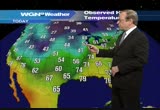
these are windchill equivalent temperatures. zero from marquette, michigan to minnesota and south dakota. double digit temperature declines. but right on the heels of this cooloff are big temperature increases. that's why we're confident that while it's going to be cold tonight and tomorrow and tomorrow night into saturday, it will warm up rather dramatically on sunday. we'll probably get mid-40s in the chicago area. even some thunder possibly rolling. the windchill equivalent temperature is down to 9 in chicago. and the last o the precipitation to effect our part of the country is now south of us. falling last snow flakes in southern illinois and indiana tonight. look at current television and you'll get an idea of how the expanding snow pack -- there's almost 36% of the country covered with snow now. and the cold air is spilling off that snow pack. which is solid from the dakota to the arctic. that's the track on where the arctic express is running and the cool air is filtering into the area. while we were hit by those showers
these are windchill equivalent temperatures. zero from marquette, michigan to minnesota and south dakota. double digit temperature declines. but right on the heels of this cooloff are big temperature increases. that's why we're confident that while it's going to be cold tonight and tomorrow and tomorrow night into saturday, it will warm up rather dramatically on sunday. we'll probably get mid-40s in the chicago area. even some thunder possibly rolling. the windchill equivalent temperature is...
433
433
Nov 26, 2010
11/10
by
WGN
tv
eye 433
favorite 0
quote 0
and it is 27 right now with a gusty wind lowering windchills at o'hare.inds sustained at 17 going up to 26 at times. it is 28 at mid-way. 27. and some other windchills and temperatures around the area. pretty evident right there. these are the wind gusts. they never help when you have temperatures like this. it is the coldest day since february around here. we may not break above 30 degrees and there are some of the average windchills around the area. flags extended. sun is out. although clouds have come in in the last couple hours and there is the air mass, or snowpack off which this cool air is spinning. here is minnesota. look at the snow on the ground there. look at the rain that fell yesterday in down state illinois. over 4 inches came down. so it was damp here but we didn't put up with anything like that. if you look carefully on this visible satellite imagery you can see the edge of the snowpack right here. and go from that area north to the arctic circle and will is no interruption in the area that is covered by snow. so this cold air is just pour
and it is 27 right now with a gusty wind lowering windchills at o'hare.inds sustained at 17 going up to 26 at times. it is 28 at mid-way. 27. and some other windchills and temperatures around the area. pretty evident right there. these are the wind gusts. they never help when you have temperatures like this. it is the coldest day since february around here. we may not break above 30 degrees and there are some of the average windchills around the area. flags extended. sun is out. although clouds...
475
475
Nov 24, 2010
11/10
by
KNTV
tv
eye 475
favorite 0
quote 0
windchill now at 6. one of the coldest pre-thanksgiving we've ever had throughout the west. today will slowly warm things up a little bit. all the bad weather's gone, but temperatures still very, very chill pip that's a look at your the ski areas will be grooming that snow, and it will be picture perfect this weekend. >>> thanksgiving forecast is coming up, lynn. >> all right, bill. thanks so much. >>> also coming up, a bleak job forecast. a bright forecast for online spending, and which beatles song sold the most on itunes? your early morning business headlines are straight ahead. >>> plus, the results are finally in. as far as we know, no one has blown away their tv way shotgun. >>> coming up, a major upset in college hoops. dirk nowitzki shuts down the pistons and coach k gets number 100. you're watching "early today." >>> good morning, and welcome back to "early today." i'm lynn berry. here are some of your top headlines this morning. just three days after senate republicans voted to support a two-year ban on earmarks, the chamber's number two republican appears to have
windchill now at 6. one of the coldest pre-thanksgiving we've ever had throughout the west. today will slowly warm things up a little bit. all the bad weather's gone, but temperatures still very, very chill pip that's a look at your the ski areas will be grooming that snow, and it will be picture perfect this weekend. >>> thanksgiving forecast is coming up, lynn. >> all right, bill. thanks so much. >>> also coming up, a bleak job forecast. a bright forecast for online...
561
561
Nov 24, 2010
11/10
by
WGN
tv
eye 561
favorite 0
quote 0
we have a bit of a windchill.hare where the low may bottom out between 21 and 23. 27 at kankakee. there they are in map forms. the temperatures at the moment. look at the snowstorm out to the west. this is where winter is. it's been really something. salt lake city tonight. and this is a camera from salt lake. under a blizzard warning as snow is coming down on howling winds. windchills under 33 below zero here. our temperatures don't look near as cold compared to that. the cold here has settled down over the snow pack which running something like this. north of that area all the way up to the arctic circle, there's snow on the ground. contrasting with warm air, there were 70s and 80s on the gulf coast today. the result are these succession of storms. one of which is coming into the midwest. the second, this weekend and has 23 states under weather advisories. we think the low will settle south and track along this thermal contrast zone while another center moves to the north. it means that the big snows that occur
we have a bit of a windchill.hare where the low may bottom out between 21 and 23. 27 at kankakee. there they are in map forms. the temperatures at the moment. look at the snowstorm out to the west. this is where winter is. it's been really something. salt lake city tonight. and this is a camera from salt lake. under a blizzard warning as snow is coming down on howling winds. windchills under 33 below zero here. our temperatures don't look near as cold compared to that. the cold here has settled...
409
409
Nov 30, 2010
11/10
by
WGN
tv
eye 409
favorite 0
quote 0
look at the windchills which goes sub zero out west of us.ut get an idea of the air mass coming in. bottom line pull the winter wardrobe out and we will use it for awhile. here the showers and thunderstorms where this cold air makes contact with the warm aiair we were in nor a time yesterday and the clusters of snow showers. these are fairly light. we are getting visibilities of nine miles as flurries fall out here in iowa with howling 30- mile-per-hour winds. so this is not a blizzard out here. just flakes of snow caught up in the wind and that's what will come in here as afternoon wears on. in fact, look at our forecast here. from our rpm model. the sticking snows are where you see the darker blues here and northern wisconsin will get in on that, too. looks like for us won't be sticking until maybe friday night and saturday and that system will warrant or observation and careful monitoring and will be doing that. here is our forecast for the chicago area. cloudy, blustery and colder on this final day of november with temperatures falling in
look at the windchills which goes sub zero out west of us.ut get an idea of the air mass coming in. bottom line pull the winter wardrobe out and we will use it for awhile. here the showers and thunderstorms where this cold air makes contact with the warm aiair we were in nor a time yesterday and the clusters of snow showers. these are fairly light. we are getting visibilities of nine miles as flurries fall out here in iowa with howling 30- mile-per-hour winds. so this is not a blizzard out...
352
352
Nov 23, 2010
11/10
by
WGN
tv
eye 352
favorite 0
quote 0
note the temp and then the windchill. feels like 26 in gary. like 23 in joliet.where they actual thermtser reading is 32. like 16 in south elgin and in the low 20s in schaumburg. this will be the coldest day since march 2. way back last spring. and the coldest day of autumn. with 32 right now at o'hare and a 36 high predicted. 33 at midway airport. 31 at hinsdale and here are the temperatures across the metro area. with some of the lows here. look at the lows this morning in monroe, is with wirs, kenosha, algonquin and windfield. chilly and the same thing tonight. the winds will turn off the lake and will start warming us up. the view from buffalo grove and here is where winter is. livingten, montana. look at the snows coming down there. where the latest snowstorm and storm system to come into that region of the country. that's going to tug more cold air down on us over the weekend and later this week. but for thanksgiving it could mean some rain. it could start as a rain/sleet mixture tomorrow or tomorrow night. at this hour it's 13 below at cut back, montana an
note the temp and then the windchill. feels like 26 in gary. like 23 in joliet.where they actual thermtser reading is 32. like 16 in south elgin and in the low 20s in schaumburg. this will be the coldest day since march 2. way back last spring. and the coldest day of autumn. with 32 right now at o'hare and a 36 high predicted. 33 at midway airport. 31 at hinsdale and here are the temperatures across the metro area. with some of the lows here. look at the lows this morning in monroe, is with...
166
166
Nov 10, 2010
11/10
by
WUSA
tv
eye 166
favorite 0
quote 0
north winds at 8, windchill of 43 in town but again, we have areas down in the 30s and like yesterday, and like monday, this storm still spinning in the atlantic. boston, areas of maine, another wet day at times. showers and cool temperatures for them. for us, what you see is what you get. more sunshine, through midday, through 5:00, 6:00, we're sunny here. the storm sits east. we look to the west, there's nothing headed toward us. few sprinkles in ohio late tonight toward tomorrow morning. even tomorrow, another quiet, sunny day. temperatures in the 50s to around 60. we're in a nice stretch and will continue the nice stretch of weather through the upcoming weekend. 62 today. 60 tomorrow, your veteran's day? thank you veterans, going to be a nice day for you, 60. god day to go and remember those veterans. friday 64 degrees. next week, little cooler. next chance of rain, we pushed it off a day, tuesday with highs in the 50s. it's time for time saver traffic. >> push it out a few more days if you want to. >> great wednesday, good morning. we're going to take a closer look at 270. tracki
north winds at 8, windchill of 43 in town but again, we have areas down in the 30s and like yesterday, and like monday, this storm still spinning in the atlantic. boston, areas of maine, another wet day at times. showers and cool temperatures for them. for us, what you see is what you get. more sunshine, through midday, through 5:00, 6:00, we're sunny here. the storm sits east. we look to the west, there's nothing headed toward us. few sprinkles in ohio late tonight toward tomorrow morning....
183
183
Nov 19, 2010
11/10
by
WRC
tv
eye 183
favorite 0
quote 0
we could be talking about windchills. all day long friday. that is black friday.ill be no place better to be thaa mall. it is going to be cold outside. that leads us into winter. speaking of winter, we've got our win forecast. that's coming up on monday at 11:00. it looks like it will come throh. the earliest portion of winter could be wherewe see the most chances for snow and some of the coldest temperatures. i mentioned the finnish bazaar guys? you cannot do it. m not in the studio. >> come now. right away. >> i'm bringing it. >> we'll se you in a few minutes. >>> coming up, protesters calling for justice for the dog that was shot and killed. >>> d speaking >>> it's been a week since the shocking arrest of jack johnson and his wife leslie. while the county executive has less than three week left in his term in office, his wife is poised to assume a seat on the county council. >> today another incoming councilmember and two state delegates spoke out about whether leslie johnson should or should not assume her council office. derrick ward has our report. >> report
we could be talking about windchills. all day long friday. that is black friday.ill be no place better to be thaa mall. it is going to be cold outside. that leads us into winter. speaking of winter, we've got our win forecast. that's coming up on monday at 11:00. it looks like it will come throh. the earliest portion of winter could be wherewe see the most chances for snow and some of the coldest temperatures. i mentioned the finnish bazaar guys? you cannot do it. m not in the studio. >>...
455
455
Nov 19, 2010
11/10
by
WGN
tv
eye 455
favorite 0
quote 0
they are something and they translate to single digit windchills in minnesota.t is very close and as we put more and more snow down between us and the single digit windchills, that cool air will creep closer and we will start feeling that next week. temperatures in billings, montana, 37 degrees colder than 24 hours ago. but here is why we don't have to worry about cooling right away. see how the jet stream turns southwest over the weekend? that will warm us up and bring a good storm out of the plains to the west of us and that puts us in its warm sector on monday where it might be thunderstorms. but today's south winds give way to tomorrow's northeast winds. cooler wrigley field for the illini and wild cats, big football game there as winds come off the water. then the southerly flow locks in. a warm front that comes north on sunday and by afternoon we could be close to 60 degrees. so there is a real schizophrenic quality to these temperatures. cold one day and then warm the next and moisture as you see in the dew points coming northward. not much now except nea
they are something and they translate to single digit windchills in minnesota.t is very close and as we put more and more snow down between us and the single digit windchills, that cool air will creep closer and we will start feeling that next week. temperatures in billings, montana, 37 degrees colder than 24 hours ago. but here is why we don't have to worry about cooling right away. see how the jet stream turns southwest over the weekend? that will warm us up and bring a good storm out of the...
1,555
1.6K
Nov 22, 2010
11/10
by
WGN
tv
eye 1,555
favorite 0
quote 0
here is a close up look at the windchills which are at eight below at fargo.got spring and winter juxtaposition here put together and we were going into winter. the rest of the thanksgiving week will jump up a little bit on wednesday and early thanksgiving morning before another slug of cold air comes in and it does appear the threat of an ice and snowstorm in chicago has diminished later this week. that will target the upper mid west as we will show you in a moment. humidity is 90%. look at the lightning with this. these storms. these are this morning's storms off to the east of us. here are the new ones and these things are blossoming as we speak approaching the mississippi river. and these are expected to assemble into a squall line that will march eastward and we can kind of time that for you as it snows in the upper mid west. here is our rpm model which shows the state of affairs at 3:30 this afternoon. then you see the line starting to assemble at 5:30 this evening and showers already in parts of the chicago area. by 7:00 it's moved in to the city. by 9:
here is a close up look at the windchills which are at eight below at fargo.got spring and winter juxtaposition here put together and we were going into winter. the rest of the thanksgiving week will jump up a little bit on wednesday and early thanksgiving morning before another slug of cold air comes in and it does appear the threat of an ice and snowstorm in chicago has diminished later this week. that will target the upper mid west as we will show you in a moment. humidity is 90%. look at...
463
463
Nov 26, 2010
11/10
by
KNTV
tv
eye 463
favorite 0
quote 0
. >> reporter: good morning. 6 degrees with the windchill. might think that would keep people from voluntarily standing outside, but it didn't. they were lined up early this morning to be the first into some of these stores. traditionally the day when retailers move into the positive, and they know in these tough economic times, not only do they have to go above and beyond to get shoppers in, but going earlier than in years' past. in chicago, shoppers spent thanksgiving stuffing their carts, the rush for bargains under way before the dishes were even cleared. >> the stores are packed, but trying to get it done early. >> the variety for me, it's christmas. >> reporter: for some, black friday shopping is now as much a tradition as the thanksgiving turkey, and in many places this year it started well before friday. >> you don't have to start your holiday shopping the day after thanksgiving or your online shopping on that cyber monday. >> the idea of cyber monday doesn't really fly anymore with most people not having to wait to return to work for
. >> reporter: good morning. 6 degrees with the windchill. might think that would keep people from voluntarily standing outside, but it didn't. they were lined up early this morning to be the first into some of these stores. traditionally the day when retailers move into the positive, and they know in these tough economic times, not only do they have to go above and beyond to get shoppers in, but going earlier than in years' past. in chicago, shoppers spent thanksgiving stuffing their...
172
172
Nov 19, 2010
11/10
by
WBAL
tv
eye 172
favorite 0
quote 0
not the windchill. it's not going to plunge down through the middle of the country. it's going to linger up here through the dakotas and montana through the upcoming weekend. this is the first real sign that winter is not here yet, but it's very close to it. pretty soon, we'll probably be talking about more snowstorms. not weekend, though. it's a good weekend to get some of that shopping down, maybe a few showers on the coast of florida. not a lot of rainfall expected. it's a very nice looking friday afternoon. highs in the 60s in texas, 50s in the eastern seaboard. that's a look at your friday forecast. now here is a look at the weather outside your window. denver, colorado, you've had beautiful afternoons as of late today, nothing to complain about. more clouds than you'd like, but a high of 59. weekend forecast coming up, lynn. >> thanks, bill. >>> also coming up, gm rules washington street. economic data looks up and a prince of a bet in england. your early morning business headlines are straight ahead. >>> plus, it's here. the latest harry potter flick gets read
not the windchill. it's not going to plunge down through the middle of the country. it's going to linger up here through the dakotas and montana through the upcoming weekend. this is the first real sign that winter is not here yet, but it's very close to it. pretty soon, we'll probably be talking about more snowstorms. not weekend, though. it's a good weekend to get some of that shopping down, maybe a few showers on the coast of florida. not a lot of rainfall expected. it's a very nice looking...
556
556
Nov 18, 2010
11/10
by
WRC
tv
eye 556
favorite 0
quote 0
that would put windchills in the upper 30s. definite with the jackets and coats, maybe the hats and skavsz, the mitten and the bloofz as well. a chilly friday morning. tomorrow afternoon, a cool day. breezy early. 54 degrees. wis out of the west at five to ten. here the next couple days. saturday looking great and then cooler on sunday. a high of 52. 62 on your monday. and then guys, watch this. a chance of showers tuesday, wednesday, and thursday. and right now, watching the potential for a big stm coming up on thanksgiving. >> wow! the feathers are fluttering there. perhaps soggy, too. >> that could be quite ugly. >>> coming up, is your boss to blame for distracted drivers on the road? plus, bed bug found at a local college campus. >>> giving cheaters a second chance. students who are caught breaking the rule. >> i'm liz crenshaw. tricks of the trade f test test. test. test test. test. test test. test test. "access llywood" test. >>> hosting tnksgiving dinner is a big deal and it often come with a lot of ressful. >> here's so
that would put windchills in the upper 30s. definite with the jackets and coats, maybe the hats and skavsz, the mitten and the bloofz as well. a chilly friday morning. tomorrow afternoon, a cool day. breezy early. 54 degrees. wis out of the west at five to ten. here the next couple days. saturday looking great and then cooler on sunday. a high of 52. 62 on your monday. and then guys, watch this. a chance of showers tuesday, wednesday, and thursday. and right now, watching the potential for a...
205
205
Nov 16, 2010
11/10
by
WJZ
tv
eye 205
favorite 0
quote 0
the windchill is not as extensive right now as it was earlier.the north, showing some light rain. a lot of it not reaching the ground because it's so light. and maybe a little fog here or there. all in all, expecting maybe a half an inch reports when it's all said and done, wednesday we will get some rain. temperatures will fall by the end of the week. winds at five to 15 knots. and the advisory beginning tuesday afternoon into the evening hours. bay temp now around 55 degrees, so tonight the rain already into the area. and continued to develop and move up toward pennsylvania line. 44 tomorrow rain and drizzle at times. 57 as we head into the rest of the week. clearing out wednesday afternoon but breezy 62, cooling down 53, 50 and 54, a good deal of sunshine from thursday in through saturday. denise. >> thank you, bob. check in with don scott and marty bass starting at 4:54 a.m. a.m. >>> the ravens get back oh wow, look at that. calm down donkey. it's vacation time! ohhhhh, who says ogres can't surf? nice moves fiona. ha, ha, ha, i love 3d. wooo
the windchill is not as extensive right now as it was earlier.the north, showing some light rain. a lot of it not reaching the ground because it's so light. and maybe a little fog here or there. all in all, expecting maybe a half an inch reports when it's all said and done, wednesday we will get some rain. temperatures will fall by the end of the week. winds at five to 15 knots. and the advisory beginning tuesday afternoon into the evening hours. bay temp now around 55 degrees, so tonight the...
134
134
Nov 10, 2010
11/10
by
WUSA
tv
eye 134
favorite 0
quote 0
windchills down. one thing that isn't down is temperatures in the middle of the country.this. 50s and 60s now extending across the mississippi valley through the southern plains. you see the 20s and 30s in the rockies. they are dealing with plenty of snow in the higher elevations and another storm system coming onshore. while the stormy nes is out west, we have an area of high pressure in the eastern half of the country at the will bring milder temperatures. they are dipping in the west. a dip in the west, ridge in the east. we're looking at nice weather here except for the storm. if it weren't for the storm, we would be back in the upper 60s already. that will happen toward the weekend, looking pretty good, but the future cast showing, the storm and any rain with it offshore clipping southeastern parents of massachusetts midday. we stay sunny, dry. that will be the case again for tonight. that will be the case again tor tomorrow, sunshine, dry weather and cool temperatures. generally look for highs around that 60-degree mark. as we look at what we're expecting for this a
windchills down. one thing that isn't down is temperatures in the middle of the country.this. 50s and 60s now extending across the mississippi valley through the southern plains. you see the 20s and 30s in the rockies. they are dealing with plenty of snow in the higher elevations and another storm system coming onshore. while the stormy nes is out west, we have an area of high pressure in the eastern half of the country at the will bring milder temperatures. they are dipping in the west. a dip...
295
295
Nov 25, 2010
11/10
by
KGO
tv
eye 295
favorite 0
quote 0
that's the windchill factor. it is just what it feels like to your body here. look at the rest of the area. 33 in livermore. redwood city and half moon bay. it is the same story for santa rosa. it is freezing cold with records by, month. sunny and dry by thanksgiving. we are looking at rain with snow in the sierra nevada. if you are doing traveling on saturday, the satellite-radar is showing you the cold air mass has invaded much of the western u.s. many areas of california are under a freeze warning. obviously parts of the bay area are included. this is how cold we are expecting the temperatures to get down to basically by the south bay locations. the low 30s except los gatos 29 and 32 in san jose and sunnyvale, on the peninsula menlo park and lossal toes down to 30 degrees. 30 run in redwood city. below freezing there. mid30s for half moon bay. pacifica. downtown san francisco, there is an asterisk there indicating it is likely to be a record. 39 by morning. 35 for the sunset district. you get up toward the north bay and this is what you -- where you will fin
that's the windchill factor. it is just what it feels like to your body here. look at the rest of the area. 33 in livermore. redwood city and half moon bay. it is the same story for santa rosa. it is freezing cold with records by, month. sunny and dry by thanksgiving. we are looking at rain with snow in the sierra nevada. if you are doing traveling on saturday, the satellite-radar is showing you the cold air mass has invaded much of the western u.s. many areas of california are under a freeze...
198
198
Nov 9, 2010
11/10
by
KTVU
tv
eye 198
favorite 0
quote 0
the windchill will cool down more rapidly than the ambient air. tomorrow morning when you go to work you'll be doing some scraping especially in the north bay valleys. >>> tomorrow, we are seeing this system come in. it will warm things up a little bit. gets in late in the afternoon. all the energy is north. what that means for us is what you see here. drip, drip, drip. not a big deal. san jose you may not see anything. it could put a little glaze on the afternoon commute for tomorrow. tuesday afternoon commute might be a little bit wet. the most recent computer model. there we are. 4:00 p.m. on tuesday. that's the afternoon commute. rain north of santa rosa. sprinkles. then everybody gets light sprinkles tomorrow from 5 to 9. we will watch it and i will change it. i won't change it but this model will change tonight and i'll give you the latest up date. so the forecast, five-day forecast shows showers back in the forecast and a big switch around as we begin to warm up. going to be some cold mornings on wednesday and thursday as it was. then much
the windchill will cool down more rapidly than the ambient air. tomorrow morning when you go to work you'll be doing some scraping especially in the north bay valleys. >>> tomorrow, we are seeing this system come in. it will warm things up a little bit. gets in late in the afternoon. all the energy is north. what that means for us is what you see here. drip, drip, drip. not a big deal. san jose you may not see anything. it could put a little glaze on the afternoon commute for tomorrow....
127
127
Nov 24, 2010
11/10
by
KNTV
tv
eye 127
favorite 0
quote 0
>> reporter: minus 40 no windchill. with windchill, minus 50 when i lived in st. louis. it was a christmas day, very cold one. >> i went skiing once, minus 80 and they closed the slopes. i don't know why i was even out. >> reporter: i ate dirt and walked both ways barefoot to school both directions. >>> because it's cold the san jose shelter is opening 125 beds today trying to help people deal with the freezing temperatures. ehc life builders will make the beds available at 2011 little orchard street. >>> if you drink designated driver, that's the message from chp and everyone else. chp will be out in force this weekend. tonight at 6:00 is the start of the holiday maximum enforcement period. that means more cops out there to keep you safe. there will be dui checkpoints in san rafael and daly city as well as other parts of the bay area. the maximum enforcement period runs all the way through sunday. >>> oakland police want your help in finding two men who sexually assaulted three roommates. it started saturday night as a woman walked home from the west oakland bart statio
>> reporter: minus 40 no windchill. with windchill, minus 50 when i lived in st. louis. it was a christmas day, very cold one. >> i went skiing once, minus 80 and they closed the slopes. i don't know why i was even out. >> reporter: i ate dirt and walked both ways barefoot to school both directions. >>> because it's cold the san jose shelter is opening 125 beds today trying to help people deal with the freezing temperatures. ehc life builders will make the beds...
244
244
Nov 12, 2010
11/10
by
WRC
tv
eye 244
favorite 0
quote 0
otherwise, we would be talking windchill. it's down near or below freezing. northern montgomery county, as well as in southern maryland. look at la play ta. 30 degrees right now. charles, calvert, st. mary's, away from the bay near freezing. prince george's, low to mid-30s. farther to the west, though, it's dippednto the upper 20s. farther south and west and the shenandoah valley, panhandle of west virginia, 20s. and the mountains, bay, eastern shore. temperatures there in the upper 30s. and the view from space with this large ridge of high pressure that is just locked in place. and it's not going to be budging. it's going to be in place today and into the weekend, giving us a clear sky and some mild temperatures during the afteoon. but chilly mornings. sunrise, 6:47. sunset, 4:57. low 60s before perhaps 2:00 or 3:00 p.m. after that, back down into the 50s. good weather for tonight for the high school games. temperatures by dawn. down into the mid-3 saturday morning. saturday, bright and sunny. mid-60s during the afternoon. chilly morning on sunday. clouds su
otherwise, we would be talking windchill. it's down near or below freezing. northern montgomery county, as well as in southern maryland. look at la play ta. 30 degrees right now. charles, calvert, st. mary's, away from the bay near freezing. prince george's, low to mid-30s. farther to the west, though, it's dippednto the upper 20s. farther south and west and the shenandoah valley, panhandle of west virginia, 20s. and the mountains, bay, eastern shore. temperatures there in the upper 30s. and...
640
640
Nov 14, 2010
11/10
by
WGN
tv
eye 640
favorite 0
quote 0
and that's producing windchill temperatures about 10 degrees colder than the air temperatures. headed out tonight, it's colder than you think. this is the ten-day temperature projection. notice that chunk of cold air drifting into the midwest, pulling out and drifting back. that's thursday. daytime highs on thursday in the 30s, but that whitish area, the coldest air yet. that's probably about 10 or 11 days away. we'll continue to keep a close watch of that. the big story in the midwest has been the snow in minneapolis, and the rest of minnesota, as well as northwestern wisconsin. some reports out of that area suggest as much as a foot of snow is falling, and it continues to fall at this hour. skiers, on the other hand, ought to be delighted with this. some snow in parts of the interior mountains of colorado and southwestern wyoming. now, this is our forecast projection. the snow stays to the north as this whole system pushes to the northeast; but some of the clouds do thicken up around here, and we could see some rainshowers in the far north suburbs tomorrow afternoon. here's o
and that's producing windchill temperatures about 10 degrees colder than the air temperatures. headed out tonight, it's colder than you think. this is the ten-day temperature projection. notice that chunk of cold air drifting into the midwest, pulling out and drifting back. that's thursday. daytime highs on thursday in the 30s, but that whitish area, the coldest air yet. that's probably about 10 or 11 days away. we'll continue to keep a close watch of that. the big story in the midwest has been...
227
227
Nov 12, 2010
11/10
by
MSNBC
tv
eye 227
favorite 0
quote 0
right now the windchill is not too bad. it doesn't have much effect.on't expect the wind to be an issue today. there's going to be plenty of sunshine so grab the sunglasses. there's no clouds that are even showing up out there. once the sun gets up there, it will heat us up. temperatures near 60 today. this will feel warm compared to lately, filly to trenton to new york city. not bad, boston to albany, that's where we should be this time of year, in the mid 50s. looking warmer, boston has a chance of getting near 60. by sunday, gets cooler and partly cloudy. we're dry, so it looks like a nice weekend. the problem weather of today, if you're traveling from oklahoma city, possibly dallas, definitely kansas city with thunderstorms later today, maybe even minneapolis or des moines, that's where all the wet weather is in the middle of the nation. on the back side, the storm exits up into canada on the back side of it, looks like a chance of snow in minnesota. some areas could get three to six inches. veronica, overall, much of the country looking okay on th
right now the windchill is not too bad. it doesn't have much effect.on't expect the wind to be an issue today. there's going to be plenty of sunshine so grab the sunglasses. there's no clouds that are even showing up out there. once the sun gets up there, it will heat us up. temperatures near 60 today. this will feel warm compared to lately, filly to trenton to new york city. not bad, boston to albany, that's where we should be this time of year, in the mid 50s. looking warmer, boston has a...
229
229
Nov 10, 2010
11/10
by
MSNBC
tv
eye 229
favorite 0
quote 0
the windchills aren't too bad, though, because temperatures are in the 40s. for today, in boston, cape cod, providence, a chance of showers. the rest of the region we'll call it mostly cloudy. still cool, though, highs only in the 50s. maybe we'll sneak into the 60s d.c. through west virginia, and around pittsburgh. veterans day tomorrow, this looks nice. the storm is gone, still chilly, but should be an ample amount of sunshine for veterans day. so we'll talk more about that, of course, tomorrow. >> all right. thank you very much. >>> robert downey jr. swears he doesn't care about an oscar. >>> plus, a golden honor for america's golden girl. [ male announcer ] in the past, landing an airplane was complicated, with a series of stepped altitude changes. [ air traffic controller ] okay, 245, proceed to your next cleared altitude. [ sighs ] [ male announcer ] today, truecourse flight management systems from ge allow for fuel savings, lower emissions and less noise... ♪ ...making the old way of doing things... [ air traffic controller ] 245, you are cleared to la
the windchills aren't too bad, though, because temperatures are in the 40s. for today, in boston, cape cod, providence, a chance of showers. the rest of the region we'll call it mostly cloudy. still cool, though, highs only in the 50s. maybe we'll sneak into the 60s d.c. through west virginia, and around pittsburgh. veterans day tomorrow, this looks nice. the storm is gone, still chilly, but should be an ample amount of sunshine for veterans day. so we'll talk more about that, of course,...
241
241
Nov 19, 2010
11/10
by
WRC
tv
eye 241
favorite 0
quote 0
breezy tomorrow, 31 to 38 and with winds at 10 to a,15, i thi we could see windchills in the upper 20srnoon. breezy early but winds die down. 49 to 54 on your friday. as we make our way through the weekend, i think right now saturday looks like a great day. plenty of sunshine, high near 60 after a cold start. 52 on sunday as we cool back down. then right back up on monday ahead anoth storm system, this next storm system on tuesday will give us some showers. and then wednesday and thursday and, of course, now we're talking about thanksgiving. that storm will be a game changer. not just for a couple days, but maybe for a couple of weeks. and we'll talk more about that next couple days. >> could be a schedulehanger for some people making travel plans. >> if you have travel plans, you want to watch out for this one >>> still ahead, bartends show off their skills at a competition. >>> sports, the hoyas dialing long distance in charleston. [ male announcer ] washington, d.c. a landmark of libert and opportunity. at bank of america, we live and work here, with thousands of employees and hundr
breezy tomorrow, 31 to 38 and with winds at 10 to a,15, i thi we could see windchills in the upper 20srnoon. breezy early but winds die down. 49 to 54 on your friday. as we make our way through the weekend, i think right now saturday looks like a great day. plenty of sunshine, high near 60 after a cold start. 52 on sunday as we cool back down. then right back up on monday ahead anoth storm system, this next storm system on tuesday will give us some showers. and then wednesday and thursday and,...
275
275
Nov 21, 2010
11/10
by
KGO
tv
eye 275
favorite 0
quote 0
this is about 8,000 feet but tahoe valley airport we have a windchill at 15 and winds gusting at 22 milesour. in spots we have had a little bit of sunshine. high definition emeryville camera but we had a rain shower move on through. warm spot, oakland 50 degrees and elsewhere, light rain showers continuing to press on in the east and south bay. a cell right here from south city to san bruno, down 280 and highway 101, across the bay it's been a little wet. you will continue to see showers into palo alto the south bay, morgan hill. you will be getting wet through the noon hour. we'll see a break throughout the afternoon hours with some sunshine. here is northwest to the southeast, still cold there allowing for unstable atmosphere to make unstable showers throughout the day. 49 in oakland. winds, breezy at the airport and oakland out of west at 18 miles an hour. so we'll continue to be in this cold with the spotty showers that through the day but more rain comes in tonight and right on through tuesday with low snow levels. mixture of rain and snow around mount hamilton. here the setup. an ar
this is about 8,000 feet but tahoe valley airport we have a windchill at 15 and winds gusting at 22 milesour. in spots we have had a little bit of sunshine. high definition emeryville camera but we had a rain shower move on through. warm spot, oakland 50 degrees and elsewhere, light rain showers continuing to press on in the east and south bay. a cell right here from south city to san bruno, down 280 and highway 101, across the bay it's been a little wet. you will continue to see showers into...
250
250
Nov 24, 2010
11/10
by
KGO
tv
eye 250
favorite 0
quote 0
. >>> here is a live look downtown san francisco, you can see a breeze and windchill and frosty cold temperatures. show you where the coldest weather is. >> possible icy conditions on highway 17 but traffic won't slow you down, 280 and 17, an update of an accident in the south bay coming up. >> i'm terry mcsweeney live at sfo. i know it's thanksgiving week, but i still have to tell you, all is calm and all is fine. people have to talk about the pat down protestors. >>> did you see how cold theresa looked, it's pretty chilly. i'm eric thomas. >> and i'm kristen sze. it's been a night of freezing temperatures, we're getting the first of three days of freezing overnight temperatures. meanwhile, in the sierras, the temperatures dropped as low as nine below zero and very icy roads, all needed on 80 and 50. for more on the big chill. let's check in with mike. >> start with current conditions clear sky and ever calming wind and a that is why we're starting to see some of these frosty conditions. you step outside and you are going to see a lot of frost develop on the cars and grass. we have
. >>> here is a live look downtown san francisco, you can see a breeze and windchill and frosty cold temperatures. show you where the coldest weather is. >> possible icy conditions on highway 17 but traffic won't slow you down, 280 and 17, an update of an accident in the south bay coming up. >> i'm terry mcsweeney live at sfo. i know it's thanksgiving week, but i still have to tell you, all is calm and all is fine. people have to talk about the pat down protestors....
1,940
1.9K
Nov 27, 2010
11/10
by
WGN
tv
eye 1,940
favorite 0
quote 0
that produces a windchill. 26 at south elgin. there's a plot of the it was across the area. quite as cold tonight as last night. just updated to 20 at mchenry. 23 at glenview. there are the actual thermometer readings. the third storm in a week moving in out west. this is going to turn our winds south. and they will whistle through this area and warm up us. but they have storm warnings up in the mountains. look at the pacific roaring in there the big waves. this is that system right here. and it takes a system like this to come on shore and turn the winds broadly southerly to warm the continent up and inject cold air like this mass in here now. that's just what happened today. with 20 and 340 degrees temperature increases across the plains states. that storm produced more than 4- 5 inches of rain down state. tonight there are frost and freeze warnings down to houston and brownsville. these are all winter weather advisories in anticipation of the latest snowstorm. what a banner year it's been. the fact so much of the country is covered by snow versus 10% this time last year i
that produces a windchill. 26 at south elgin. there's a plot of the it was across the area. quite as cold tonight as last night. just updated to 20 at mchenry. 23 at glenview. there are the actual thermometer readings. the third storm in a week moving in out west. this is going to turn our winds south. and they will whistle through this area and warm up us. but they have storm warnings up in the mountains. look at the pacific roaring in there the big waves. this is that system right here. and...
303
303
Nov 24, 2010
11/10
by
KGO
tv
eye 303
favorite 0
quote 0
napa has got a breeze so the windchill is about 26 degrees. freezing in livermore and menlo park and getting close in concord and fairfield at 33 degrees. freeze warnings, it's for the north bay and east bay valleys and then again we have the frost advisory for the bay shoreline, santa clara valley and parts of the monterey bay. we'll see repeat performance for the next couple of nights and then the rain for the weekend. i'll have that in the forecast. >>> bart reporting 15 minute delays right now. san francisco from the montgomery station there was earlier police activity heading out to bay point or dublin but it's not reported in the other direction, if you are headed toward sfo you shouldn't encounter any delays. with all the cold weather, bring your hats and gloves and look out for icy conditions on highway 17 and if you are heading up to tahoe, no surprise you'll need chains right now on all the major highways and freeways up there. >> highway 17 is definitely in the spotlight this morning. we are expecting temperatures below freezing in
napa has got a breeze so the windchill is about 26 degrees. freezing in livermore and menlo park and getting close in concord and fairfield at 33 degrees. freeze warnings, it's for the north bay and east bay valleys and then again we have the frost advisory for the bay shoreline, santa clara valley and parts of the monterey bay. we'll see repeat performance for the next couple of nights and then the rain for the weekend. i'll have that in the forecast. >>> bart reporting 15 minute...
238
238
Nov 24, 2010
11/10
by
KTVU
tv
eye 238
favorite 0
quote 0
there have no windchill to speak of. coming up we'll talk to other people what they are doing to stay warm and keep their pets and plants warm as well. reporting live in walnut creek kraig debro. >>> oakland place are searching for a second suspect in a violent home invasion robbery. two people broke into a home around 8:30 last night. we spoke with police overnight. they tell us one victim was injured after being pistol whipped. police tell us they made one arrest and recovered a gun but one bus spect is -- but one suspect is still on the loose. >>> a fishing trip turned deadly for a group of boaters. their crab boat became tangled in a line from a crab pod and capsized after it was hit by a large wave. five people on board were thrown into 51-degree water. no one was wearing a life jacket. they were pulled by the water from friends whop in another -- who were in another boat. >> they were cold and freezing and sopping wet of water. >> 71-year-old sogi of sacramento died. the coast guard says boaters should file a float
there have no windchill to speak of. coming up we'll talk to other people what they are doing to stay warm and keep their pets and plants warm as well. reporting live in walnut creek kraig debro. >>> oakland place are searching for a second suspect in a violent home invasion robbery. two people broke into a home around 8:30 last night. we spoke with police overnight. they tell us one victim was injured after being pistol whipped. police tell us they made one arrest and recovered a gun...
777
777
Nov 24, 2010
11/10
by
KGO
tv
eye 777
favorite 0
quote 0
and this feels colder because there is a windchill factor here. we can expect freezing cold conditions for three nights. record lows are possible. and there is sunny, beautiful. rain coming in saturday. a wet day. and there is a front that brought us a burst of rainfall this morning. and big story is that it's cold air that is spilling into behind the frontal system that is responsible for the three-day chill we're going to experience. taking a look at projected low temperatures for overnight tonight into morning. there is lows dropping into mid-30s for san jose. and there is upper 30s on the coast. and in and around san francisco, lows dropping to 41 downtown and the north bay featuring coldest weather. 27 in cloverdale. near east bay, lows dropping into mid 30s and in oakland, and rich monld, both dropping to 36 degrees or below. and there will be new record lows for tomorrow's date. so there is is 30 in livermore and there is lows mainly just a few degrees above 38 feet. and upper 30s in monterey and carmel. here is a look at freezing cold weat
and this feels colder because there is a windchill factor here. we can expect freezing cold conditions for three nights. record lows are possible. and there is sunny, beautiful. rain coming in saturday. a wet day. and there is a front that brought us a burst of rainfall this morning. and big story is that it's cold air that is spilling into behind the frontal system that is responsible for the three-day chill we're going to experience. taking a look at projected low temperatures for overnight...
172
172
Nov 18, 2010
11/10
by
WRC
tv
eye 172
favorite 0
quote 0
that will put windchills in the upper 20s to lower 30s in all the area. then for tomorrow we'll see the temperature between 49 and 54. so mostly sunny skies. a cool day. a little bit breezy early. very chilly when you step out tomorrow morning. then by about noon, temperatures should warm up. 60 degrees on saturday. 60s looking great for saturday. i think that's about the best day, the next four days. 52 on sunday as we get more cool air. each of those days, temperature into the 30s to startoff. then on monarch little warmer. high temperature, 62 under partly to mostly sunny skies. then thg get very interesting. a chance of showers. maybe ahorl with highs in the mid 60s. mid 60s on wednesday. an afternoon chance of shower activity. and then a big storm moves in. the potential for a major storm moves in late wednesday into thursday. i still think ahead of that storm like our last orm. we'll see the chance for temperature to soar boo the mid to upper 60s on thuray. that is on thanksgiving. by the end of the day, for at turkey, the temperature could be in th
that will put windchills in the upper 20s to lower 30s in all the area. then for tomorrow we'll see the temperature between 49 and 54. so mostly sunny skies. a cool day. a little bit breezy early. very chilly when you step out tomorrow morning. then by about noon, temperatures should warm up. 60 degrees on saturday. 60s looking great for saturday. i think that's about the best day, the next four days. 52 on sunday as we get more cool air. each of those days, temperature into the 30s to...
362
362
tv
eye 362
favorite 0
quote 0
there are the winds blowing across the area and we calculate windchills there in the 20s here in chicago at marquette right now for the coolest around the midway -- mid west and double digit temperature losses compared to yesterday. warm up is underway out to the west and that will come eastward. could be amount to 20-degree temperature increase between today's 42 and the 70 that we may see by monday and 66 expected on sunday before we get there. northwest winds of 17. humidity 43%. there are 14 states with frost and freeze advisories. these include northern florida. you can see the low dew points down there that gives you an idea where the night time temperatures are going to go. and there is the sprawling high pressure that's come out of canada with south winds starting to blow on the plains to warm things up. but the north winds blowing to the east and that is to the eastern u.s. so that warm air is pressing eastward but won't be here for a couple more days in the chicago area. one thing for sure there is not much moisture going on. that continues a trend that we have seen all through
there are the winds blowing across the area and we calculate windchills there in the 20s here in chicago at marquette right now for the coolest around the midway -- mid west and double digit temperature losses compared to yesterday. warm up is underway out to the west and that will come eastward. could be amount to 20-degree temperature increase between today's 42 and the 70 that we may see by monday and 66 expected on sunday before we get there. northwest winds of 17. humidity 43%. there are...
603
603
tv
eye 603
favorite 0
quote 0
the winds are very light so no real windchill.e temperature across the metro area. here are other temperatures. 37 east chicago. hammond 34. beautiful day for a time at frazier magnet school. we had clouds build back in again as the day went on. and in south bend there have been snow showers. here's where the frost and freeze advisories are in effect. they're expecting big snows on the spine of the appalachians right where this jet stream pouring the cold air south on a wind up around 30,000 feet comes in contact with the mountains to get lift and snow to develop. look how the flow flattens and this is the signal of a big warm-up later in the week. 60 on sunday and to 68 on monday. with some areas maybe flirting with 70. same on tuesday. there's the plot of our area temperatures but the highs today show the chinooks were running. and jumped the mountains down sloping winds lead to compressional warmings. so some nice, warm air there. that mild air will march eastward. if we had a mountain range to the west we could get low 70s. we
the winds are very light so no real windchill.e temperature across the metro area. here are other temperatures. 37 east chicago. hammond 34. beautiful day for a time at frazier magnet school. we had clouds build back in again as the day went on. and in south bend there have been snow showers. here's where the frost and freeze advisories are in effect. they're expecting big snows on the spine of the appalachians right where this jet stream pouring the cold air south on a wind up around 30,000...
584
584
Nov 21, 2010
11/10
by
KGO
tv
eye 584
favorite 0
quote 0
windchill about 10 degrees. a south wind at 15 gusting to 23 mph. will continue in the sierra. gonna taper off in the afternoon hours, more snow tomorrow night into tuesday. live doppler 7 hd shows a smattering of showers in the north bay. looking at light rain from the coast there in tiburon. elsewhere into the south bay, 680, milpitas and santa clara just about to san jose right now. so we'll continue to see some scattered showers today. the possibility of a thunderstorm, a cool air mass overhead. sunny breaks but we will see showers continue for the first portion of our work week. i'll have the details on thanksgiving coming up. carolyn? >> thanks, lisa. this weekend's storm created some problems for some residents including power outages, flooding and property damage. in orinda the streets had a significant amount of water. in san francisco, flooding caused street closures. at mandell and sunnyvale, the water was so deep even the muni buses were prohibited from passing through. another trouble spot was the highway 101 on-ramp attal mainny boulev
windchill about 10 degrees. a south wind at 15 gusting to 23 mph. will continue in the sierra. gonna taper off in the afternoon hours, more snow tomorrow night into tuesday. live doppler 7 hd shows a smattering of showers in the north bay. looking at light rain from the coast there in tiburon. elsewhere into the south bay, 680, milpitas and santa clara just about to san jose right now. so we'll continue to see some scattered showers today. the possibility of a thunderstorm, a cool air mass...
261
261
Nov 13, 2010
11/10
by
CNN
tv
eye 261
favorite 0
quote 0
below it the windchill factor, it feels like 22 degrees.s number kind of fluctuating here, this is cool. able to show you the snowfall totals as they're occurring. it's measuring snow from our radar perspective. we have approximately 5 inches on the ground south of the city. it's still snowing. we will see more as we go through the day. it's a tough start to a saturday unless you like the snow, then you're probably happy. rain across the northeast. raining in seattle throughout the morning. more of that. as we head southward along the west coast, tracking strong wind. wind advisories for cities like sacramento for today. the winds will pick up. gusts may get stronger later on today as well as further south into southern california. los angeles, you're not under a wind advisory but to the north and santa clarita, you are, the winds are stronger there. also wind advisories through san bernardino and riverside as well. sun is shining, you'll see nice weather. for those travel, tracking delays. wow, flight explorer is busy. maybe a head start o
below it the windchill factor, it feels like 22 degrees.s number kind of fluctuating here, this is cool. able to show you the snowfall totals as they're occurring. it's measuring snow from our radar perspective. we have approximately 5 inches on the ground south of the city. it's still snowing. we will see more as we go through the day. it's a tough start to a saturday unless you like the snow, then you're probably happy. rain across the northeast. raining in seattle throughout the morning....
264
264
Nov 13, 2010
11/10
by
CNN
tv
eye 264
favorite 0
quote 0
winds gusting 20 miles per hour, taking it down in terms of the windchill factor the way your body interprets temperature into the 20s. now, is it unusual to see snow in minneapolis? of course it isn't but it is early in the season. on average, we see the first snowfall between the 18th and the 21st of november. today, the 13th it is early. cold enough for the snow to stick to so looking at wet, slushy, heavy snow. be careful if you're shoveling because it's heavy. not just minneapolis. seeing snow across northern minnesota, wisconsin and in advance of the system where you have milder temperatures, not warm by any means in the 40 os, heavy rain into the midwest that we're watching. in terms of accumulation, depending on where you are, you could see just below a foot of snow but most will see 5 to 8 inches especially northern minnesota. but this low is deep and strong, and it is going to bring about problems for those 0 that are traveling. a closer look at the region. you can see where we have sleet and ice mixing in where that warmer and colder air are merging together. right now the flight d
winds gusting 20 miles per hour, taking it down in terms of the windchill factor the way your body interprets temperature into the 20s. now, is it unusual to see snow in minneapolis? of course it isn't but it is early in the season. on average, we see the first snowfall between the 18th and the 21st of november. today, the 13th it is early. cold enough for the snow to stick to so looking at wet, slushy, heavy snow. be careful if you're shoveling because it's heavy. not just minneapolis. seeing...
235
235
Nov 22, 2010
11/10
by
WRC
tv
eye 235
favorite 0
quote 0
windchills could bin the 40s all day for a lot of folks. our first taste of win coming friday, saturday and sunday. temperatures in the 30s. not just the 30s. we're talki about the low 30s. our first taste of win. we're talking about our winter forecast. tonight at 11:00, tune in to fined outxactly what we think as far as temperatures know. it shoulbe a-okay. wednesday is looking okay. just chilly. >> any other questions? >> no. that covers it for n. i'll think of something later. >> thanks. >>> coming up, a guilty verdict in the chandra levy murder trial. >>> a series of attack on teenagers in virginia. >>> th pope is supporting the use of condoms. >> reporter: i'm julie carey at reagan national. many are finding out what enhanced security means for the first time whil security officials are holding fir to the procedure amid the furor. >>> brad childress gets his walk papers from minnesota. and the injury bug bites big time out at redskins park. >>> ingmar guaique today was convicted in the murder have chandra levy in rock creek park many
windchills could bin the 40s all day for a lot of folks. our first taste of win coming friday, saturday and sunday. temperatures in the 30s. not just the 30s. we're talki about the low 30s. our first taste of win. we're talking about our winter forecast. tonight at 11:00, tune in to fined outxactly what we think as far as temperatures know. it shoulbe a-okay. wednesday is looking okay. just chilly. >> any other questions? >> no. that covers it for n. i'll think of something later....
481
481
tv
eye 481
favorite 0
quote 0
there are windchills at this hour. that's how much temperatures have dropped.hat has cooled off. winds north at 17 and there is that jet stream i talked about. at the same time it's the snow of the carolinas. it went up to 100 degrees again in southern california. the hottest temperatures they've seen. what's amazing is that the hundred was in san diego today. that's a temperature they rarely see any time of the year. and there was a hundred yesterday at long beach. los angeles hit 96 today. so this is a country of extremes. and we have a hurricane bearing down in haiti soon. more on that in minutes. tonight cloudy periods and cold. low temperature 24 inland, 37 up against the lake in indiana. cloudy spells. windy and cool tomorrow. chilliest weather to date high just 42 and scattered ice pellet and snow flake mixture. but a rain shower or period of ice pellets might develop in northeast illinois and eastern wisconsin tomorrow afternoon. partly cloudy and cold tomorrow night. and partly sunny, still chilly saturday. high of 48. but it's after that, the news get
there are windchills at this hour. that's how much temperatures have dropped.hat has cooled off. winds north at 17 and there is that jet stream i talked about. at the same time it's the snow of the carolinas. it went up to 100 degrees again in southern california. the hottest temperatures they've seen. what's amazing is that the hundred was in san diego today. that's a temperature they rarely see any time of the year. and there was a hundred yesterday at long beach. los angeles hit 96 today. so...
976
976
Nov 18, 2010
11/10
by
WGN
tv
eye 976
favorite 0
quote 1
we'll have a chunk of this low windchill, chilly air coming in tomorrow. then it'll pull back a bit on friday. give way a bit on saturday, turn cooler and a warmer puff of air sunday and monday before the real chill settles in after that. look at the low temperatures. it's interesting to look at these because you get an idea the expanse of the cool air. here it is. this is the really chilly stuff. the sun set today in barrow, alaska. won't see the sun again until january 21. that's going on all across northern north america. that's why the air mass up here grows cold as the snow pack expands and reflects away what little heat is left at this time of the year. for the short-term we expect the winds to go westerly. that chunk will be shot out of the area over the weekend. that's why we could be up flirting with upper 50s by late sunday and monday from the looks of things before the chill comes in. so here is the latest storm to track to the south of us. a ridge of high pressure whose north winds come down the lake set up some lake effect rain sleet or snow s
we'll have a chunk of this low windchill, chilly air coming in tomorrow. then it'll pull back a bit on friday. give way a bit on saturday, turn cooler and a warmer puff of air sunday and monday before the real chill settles in after that. look at the low temperatures. it's interesting to look at these because you get an idea the expanse of the cool air. here it is. this is the really chilly stuff. the sun set today in barrow, alaska. won't see the sun again until january 21. that's going on all...
207
207
Nov 25, 2010
11/10
by
KTVU
tv
eye 207
favorite 0
quote 0
adds a little windchill to the factor. it's a cold morning but it will be sunny, very nice. i really just took yesterday's weather and carrying it over into today. it's dry today and tomorrow. so travel not a problem. if you're heading to the mountains though even though it's dry it's 9 below right now in tahoe and 13 below in truck ee. it's brutally cold. rain returns saturday. this is looking like a better system. this will mean more snow in the mountains. tougher day to travel. clearing, breezy and cool on sunday. signs the middle of next week we could back into a cold rain. until then clear skies today. the cold canadian air settles in from the north and just keeps us on the chilly side. travel weather pacific northwest leading edge of the system getting closer. snow and showers returning to seattle. still cold up there but not as cold as the system comes in. snow in the northern plains or freezing rain. they're close between snow, freezing rain and rain. some of that now moving into the northeast. rain back into, well, cleveland, back into indianapolis and towards oklah
adds a little windchill to the factor. it's a cold morning but it will be sunny, very nice. i really just took yesterday's weather and carrying it over into today. it's dry today and tomorrow. so travel not a problem. if you're heading to the mountains though even though it's dry it's 9 below right now in tahoe and 13 below in truck ee. it's brutally cold. rain returns saturday. this is looking like a better system. this will mean more snow in the mountains. tougher day to travel. clearing,...
210
210
Nov 4, 2010
11/10
by
KNTV
tv
eye 210
favorite 0
quote 0
were this to have been july 3rd instead of november 3rd, it would be 58 degrees right now with a windchillof about minus 20. >> this is perfect chamber of commerce weather. perfect baseball, perfect weather. >> it has been. >> raj, you've been covering this team since day one. a perfect day for the giants as well. >> i've been covering this team since i was a little kid, yes. sometimes i wasn't getting paid to do it. but yes, it's been amazing. what the people have been seeing throughout the play-offs and especially in the world series on the national stage and international stage has been phenomenal. today really a blend of history and culture. history in the sense that the san francisco giants making history with their first world series title and parade. and culture, more than 1 million strong here. we saw black, white, latino, asian, native american and everyone in between. this is our culture. everyone here so excited. it's not a baseball story. it's a community story. with our community comes a very famous singer and song. take a listen. ♪ don't stop believing >> steve perry, who's b
were this to have been july 3rd instead of november 3rd, it would be 58 degrees right now with a windchillof about minus 20. >> this is perfect chamber of commerce weather. perfect baseball, perfect weather. >> it has been. >> raj, you've been covering this team since day one. a perfect day for the giants as well. >> i've been covering this team since i was a little kid, yes. sometimes i wasn't getting paid to do it. but yes, it's been amazing. what the people have been...
413
413
Nov 17, 2010
11/10
by
WGN
tv
eye 413
favorite 0
quote 0
windchill is 41. humidity at 73%. and here is the radar view showing little showers across the lake from us and sprinkles here in parts of northern illinois toward the wisconsin line. these won't amount to much. most substantial precipitation is this system and snowing on its back side in parts of kansas, missouri and oklahoma. this will ride to the south of chicago. but it's northerly winds, winds blown northerly into that system on the back side and those are the winds that lock in here tomorrow and cool things off. this rpm model stays cloudy and sprinkley into morning and then turn the lake-effect on into parts of north central indiana and in michigan but not in chicago. this low, watch how it tracks to the south of us and here is a ridge of high pressure. the winds blowing like this. it will be cool and that's why as that wind comes down the lake there will be lake-effect tomorrow. the winds turn strong and southerly the day after tomorrow. we could have wind gusts here on friday of 35-mile-per-hour from the sout
windchill is 41. humidity at 73%. and here is the radar view showing little showers across the lake from us and sprinkles here in parts of northern illinois toward the wisconsin line. these won't amount to much. most substantial precipitation is this system and snowing on its back side in parts of kansas, missouri and oklahoma. this will ride to the south of chicago. but it's northerly winds, winds blown northerly into that system on the back side and those are the winds that lock in here...
206
206
Nov 25, 2010
11/10
by
KTVU
tv
eye 206
favorite 0
quote 0
depending on the wind if you have a breeze you have a little windchill but also keepinged temperature probably low 30s. if not upper 20s. temperatures today very close to what we had yesterday. low 50s. probably warmer by the coast. it will be a push. 45 san francisco. they need to get to 42 to tie a record. napa 31. hint of a breeze there. that's the only thing holding the temperature up. concord, livermore, 32. livermore dropped to 29. little breeze kicked in. palo alto 29. san jose at 34. 9 below in tahoe. record low yesterday of 8 below. i'll bet that's a record low. eureka 30. that's probably a record as well. and redding 39. they were 27 yesterday. sacramento 29. and 37 monterey to santa maria. that's cold. you see how that canadian air just spills down but the system coming in right here for saturday looking better and better. we'll get some rain out of that but not until saturday. that will give more snow up in the mountains. we stay cool although sunny and breezy. freeze warning until 8:00 a.m. 50s for temperatures today. coast, bay, inland, north bay, east bay, south bay, me
depending on the wind if you have a breeze you have a little windchill but also keepinged temperature probably low 30s. if not upper 20s. temperatures today very close to what we had yesterday. low 50s. probably warmer by the coast. it will be a push. 45 san francisco. they need to get to 42 to tie a record. napa 31. hint of a breeze there. that's the only thing holding the temperature up. concord, livermore, 32. livermore dropped to 29. little breeze kicked in. palo alto 29. san jose at 34. 9...
112
112
Nov 24, 2010
11/10
by
KNTV
tv
eye 112
favorite 0
quote 0
overnight temperatures in truckee tomorrow morning, minus 5 without a windchill.incredibly cold across the high country. around the bay area, cold start to the morning. low 50s for high temperatures today. another chilly, frosty morning tomorrow. the next chance of rain will arrive saturday and clearing by sunday. >>> now checking your morning commute, here's a look at the altamont pass, one of your gateway getaways. we're looking pretty good both west and eastbound. look out for patchy ice this morning out around mechpleasant and livermore. travel times look just fine as you approach sfo, same story approaching oakland airport. travel times looking right on schedule on 880. if those airport temperatures in the mid-30s this morning, may get that rare sight of deicing on some planes. we'll watch that for you. brent, back to you. >>> thanksgiving weekend means several new movies are coming out early. ♪ been holding back for quite some time, and finally the moment's right ♪ >>> in theaters today, the new movie "burlesque." christina aguilera is a small-time girl tryi
overnight temperatures in truckee tomorrow morning, minus 5 without a windchill.incredibly cold across the high country. around the bay area, cold start to the morning. low 50s for high temperatures today. another chilly, frosty morning tomorrow. the next chance of rain will arrive saturday and clearing by sunday. >>> now checking your morning commute, here's a look at the altamont pass, one of your gateway getaways. we're looking pretty good both west and eastbound. look out for...
311
311
Nov 22, 2010
11/10
by
WMAR
tv
eye 311
favorite 0
quote 0
our friend in paul tells us that the windchill is about 8 degrees in bellingham, washington.her was brought to you by kay jewelers. robin. >> let's see, you're 40 years old and you started in 1988 with joanie and all. so what were you, 2? >> just don't do the math. >> be careful giving out the numbers. >>> she has covered 26 countries, four presidents, five olympics, two royal weddings, all from "good morning america." we are excited to have joan lunden back with us this morning. november is national caretaker's month. and joanie has a new series called "taking care with joan lunden." hi, i love it when you're here. >> i love it when i'm here. it's like old home week. every now and then, a project comes to you and you have to work on it. i'm taking care of my mom who's 91 who used to come here to the show all the time whenever she would get a chance. she would go out and meet us on the road. >> look at gladys. >> there she is, yes. there she is with charlie. and now on our set. you know, i don't care how much you love your mom and dad, though, or your spouse who might be debi
our friend in paul tells us that the windchill is about 8 degrees in bellingham, washington.her was brought to you by kay jewelers. robin. >> let's see, you're 40 years old and you started in 1988 with joanie and all. so what were you, 2? >> just don't do the math. >> be careful giving out the numbers. >>> she has covered 26 countries, four presidents, five olympics, two royal weddings, all from "good morning america." we are excited to have joan lunden back...
381
381
Nov 17, 2010
11/10
by
CNN
tv
eye 381
favorite 0
quote 0
right now or d.c., baltimore, it doesn't feel anything like 60 anything because of that almost a windchill factor going on out there. a little snow in parts of kansas that will continue throughout the night. then the biggest chance of snow back out here in the pacific northwest. it has been a stormy couple of days. seattle, you're picking up rain. but if you have go up through the passes you will see snow and there has been some snow, significant snow in the colorado rockies and utah as well. and the skiers are still happy about this. we could have like an easter base for thanks giving. we could have 90 inches of know in some spots. wouldn't that be great for ski sners. >> you mentioned oregon. am i going to have snow in oregon for turkey day? >> where are you going? >> portland. >> no. but you can finds snow with an hour drive. >> a lot of people like this who have already been on tv this week, won't do it again. take a look at this. >>> so it was more invasive than what i was used to. of course what is in my mind from -- >> the head of the tsa john pies o pistole. invasive pat-downs, goi
right now or d.c., baltimore, it doesn't feel anything like 60 anything because of that almost a windchill factor going on out there. a little snow in parts of kansas that will continue throughout the night. then the biggest chance of snow back out here in the pacific northwest. it has been a stormy couple of days. seattle, you're picking up rain. but if you have go up through the passes you will see snow and there has been some snow, significant snow in the colorado rockies and utah as well....
490
490
Nov 1, 2010
11/10
by
KPIX
tv
eye 490
favorite 0
quote 0
with a windchill of 33. ooh. these are easily amused people.all we? we go to the maps. northeast look goods. on the coal side. midwest looks good, too. southern plains watch for rain rolling in. some could are heavy at times. houston, san sn tonio, the likes. and the warm-up in california. high how? temperatures in the mid-90s in some locations. nice time to be in scottsdale. the caribbean. look at tomas. this storm continues to churn. its weakened but is going to pick up speed an strength. we're watching and worrying about haiti for the end of the week. there's the spaghetti models. most lead in that direction. that's a quick look at what's happening not only in the atlantic, in the caribbean, but all across the ,, sglurns this weather report >>> this weather report, rt sponsored by subway restaurants. build your better breakfast, and grab lunch to go, too. >>> and that's your look at your weather picture. i love the color. look goods on you. all right. harry, inside to you. >>> up next, we'll speak exclusively to a hunter and his young daught
with a windchill of 33. ooh. these are easily amused people.all we? we go to the maps. northeast look goods. on the coal side. midwest looks good, too. southern plains watch for rain rolling in. some could are heavy at times. houston, san sn tonio, the likes. and the warm-up in california. high how? temperatures in the mid-90s in some locations. nice time to be in scottsdale. the caribbean. look at tomas. this storm continues to churn. its weakened but is going to pick up speed an strength....
343
343
Nov 11, 2010
11/10
by
MSNBC
tv
eye 343
favorite 0
quote 0
windchill a little cool up in new england, albany and boston, bundle up.where even 60s from philly to baltimore to d.c. veterans day across the middle of the country seeing a little snow in denver. not a big deal. really cold. the middle of the nation the stormy spot over the next couple of days. a lot of heavy rain expected in kansas city northwards to minneapolis. >>> you're watching "morning joe" on veterans day brewed by starbucks. [ woman ] you know, as a mom, i worry about my son playing football. which is why i'm really excited. because toyota developed this software that can simulate head injuries and helps make people safer. then they shared this technology with researchers at wake forest to help reduce head injuries on the football field. so, you know, i can feel a bit better about my son playing football. [ male announcer ] how would you use toyota technology to make a better world? learn how to share your ideas at toyota.com/ideasforgood. [ man ] i thought our family business would always be boots. until one day, my daughter showed me a designe
windchill a little cool up in new england, albany and boston, bundle up.where even 60s from philly to baltimore to d.c. veterans day across the middle of the country seeing a little snow in denver. not a big deal. really cold. the middle of the nation the stormy spot over the next couple of days. a lot of heavy rain expected in kansas city northwards to minneapolis. >>> you're watching "morning joe" on veterans day brewed by starbucks. [ woman ] you know, as a mom, i worry...
 Live Music Archive
 Librivox Free Audio
 Metropolitan Museum
 Cleveland Museum of Art
 Internet Arcade
 Console Living Room
 Open Library
 American Libraries
 TV News
 Understanding 9/11